-
Adventure in the Bayou
Rouge Roubaix My first ride in the bayous of Louisiana was this amazing race in 2010. Before the race, I had dreams of winning. By the end of the race, I was happy just to have finished. My best shot at winning the race came in 2012 where I won the $100 KOM (you physically…
-
Essom Hill Rd
Recap This was my first cold ride of the season – 252 fast and cold miles from Birmingham, Alabama to Cave Spring, Georgia and back. The average temp for the ride was 39 degF, with a low hovering around 25-27 degF for several hours. I woke up at midnight and left the house by 1:15AM.…
-
TNGA 2019
Timer selife at the finish line – second try as I wasn’t quick enough to get back over and sit down the first time. Let’s start at the very end at the Alabama border where the Silver Comet becomes the Chief Ladiga trail if you are heading west, or vice versa if you are heading…
-
Skyway Epic 2019 and 2018
2019 skyway 300 finish 2018 skyway 280 finish I just realized I never finished the draft I had started of my race report from 2018. I’ve included that original draft at the end of this post after the 2019 race recap. Here is my finish line picture above that Brent took from both years. The…
-
Low to high point fat bike fun in Minnesota
Ice beard less than halfway through the ride. Fun adventure in the north woods of Northern Minnesota today. I rode from the lowest point in Minnesota (Lake Superior, 603′) to the highest point in Minnesota (Eagle Mountain, 2301′). It was a tough ride with lots of uncertainty. I had attempted this same ride in 2016,…
-
Adventure Home in the Apps
View of the Great Smoky Mountains from near the top of Cherohala Skyway. “Apps” as in the Appalachian Mountains, not mobile apps or webapps – although both of those were discussed at the ACM Computing Conference I was attending in Gatlinburg, TN. I have been attending this conference in Gatlinburg every year for the past…
-
TNGA 2018
It was a dark and stormy night. Well, no, not really. It was a clear and dry night. I left Hoover, Alabama around midnight Wednesday night so that I could beat the heat on my 200+ mile ride from home to Mulberry Gap. Thankful for a relatively dry night as we have had a ton…
-
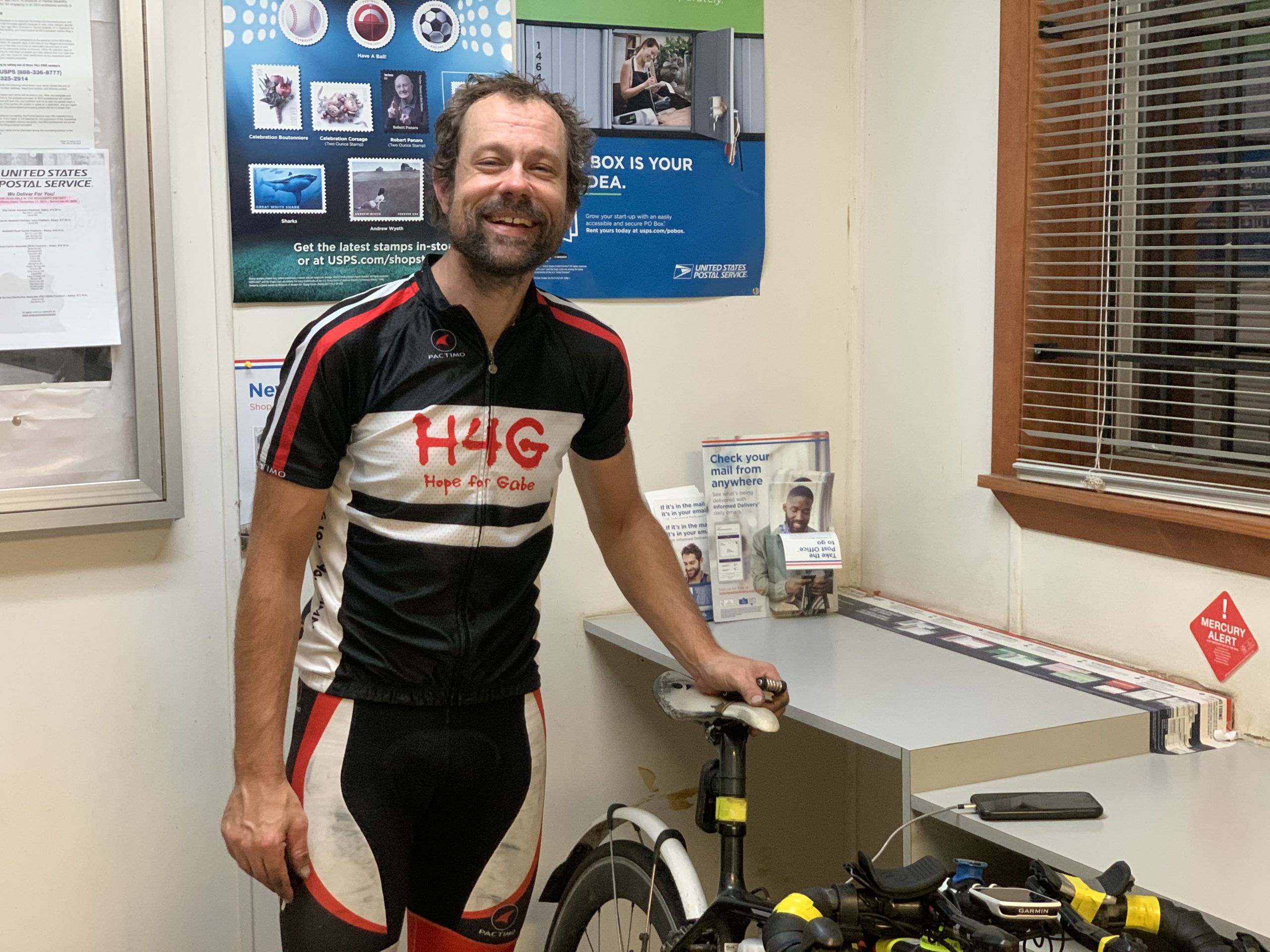
Ride4Gabe 2017
I’m excited to announce that Hope4Gabe is partnering with me to make the Race Across America its kickoff Ride4Gabe event for 2017. It’s only the kickoff, though, because after the race ends, and after we’ve made it back home to Alabama, we’ll also be organizing a ride out of Chelsea on July 1st that you…
-
2017 Skyway Epic 200 Mile Race (Report)
Skyway Epic 2017 – Inaugural 200 Mile Race Podium. Brian Toone (1st), Eddie O’Dea (2nd), Chris Joice (3rd), Justin Shealey (4th), Pete Foret (5th), Josh Lederman (6th) I’ve arranged these pictures from 1st – 6th, but this inaugural edition of the 200 mile version of the Skyway Epic mountain bike race was definitely a race…
-
2016 Season Statistics – All of Alabama
https://www.youtube.com/watch?v=G07XcasQYLA 2016 Season StatisticsBeing able to participate in such a significant life-changing endeavor as the 2016 Ride4Gabe was certainly the highlight of my cycling year, and that led spontaneously to the establishment of a primary goal for 2016 – to ride in every county in Alabama in one year. I set this goal when I…
- June 2026
- May 2026
- March 2026
- January 2026
- December 2025
- November 2025
- August 2025
- July 2025
- June 2025
- January 2025
- December 2024
- October 2024
- July 2024
- April 2024
- March 2024
- December 2023
- October 2023
- July 2023
- June 2023
- October 2022
- September 2022
- August 2022
- July 2022
- May 2022
- April 2022
- January 2022
- December 2021
- September 2021
- August 2021
- May 2021
- April 2021
- March 2021
- December 2020
- November 2020
- October 2020
- September 2020
- August 2020
- July 2020
- June 2020
- February 2020
- January 2020
- November 2019
- September 2019
- April 2019
- December 2018
- November 2018
- August 2018
- May 2017
- April 2017
- February 2017
- December 2016
- August 2016
- May 2016
- April 2016
- March 2016
- February 2016
- January 2016
- December 2015
- November 2015
- October 2015
- September 2015
- July 2015
- February 2015
- January 2015
- December 2014
- November 2014
- September 2014
- August 2014
- July 2014
- June 2014
- May 2014
- April 2014
- March 2014
- February 2014
- January 2014
- December 2013
- November 2013
- August 2013
- July 2013
- June 2013
- May 2013
- April 2013
- March 2013
- February 2013
- January 2013
- December 2012
- November 2012
- October 2012
- September 2012
- August 2012
- July 2012
- June 2012
- May 2012
- April 2012
- March 2012
- February 2012
- January 2012
- December 2011
- November 2011
- October 2011
- September 2011
- August 2011
- July 2011
- June 2011
- May 2011
- April 2011
- March 2011
- February 2011
- January 2011
- December 2010
- November 2010
- October 2010
- September 2010
- August 2010
- July 2010
- June 2010
- May 2010
- April 2010
- March 2010
- February 2010
- January 2010
- December 2009
- November 2009
- October 2009
- September 2009
- August 2009
- July 2009
- June 2009
- May 2009
- April 2009
- March 2009
- February 2009
- January 2009
- December 2008
- November 2008
- October 2008
- September 2008
- August 2008
- July 2008
- June 2008