
It was a dark and stormy night. Well, no, not really. It was a clear and dry night. I left Hoover, Alabama around midnight Wednesday night so that I could beat the heat on my 200+ mile ride from home to Mulberry Gap. Thankful for a relatively dry night as we have had a ton of rain and humidity in the South this summer, I sailed through the night making it to Piedmont and the Georgia border not too long after sunrise. The heat and humidity is not too unusual for Alabama, but usually we get a few more of these low humidity days and/or nights tossed into the mix. Not this summer. This was the first night I can remember not being nearly 100% humidity.
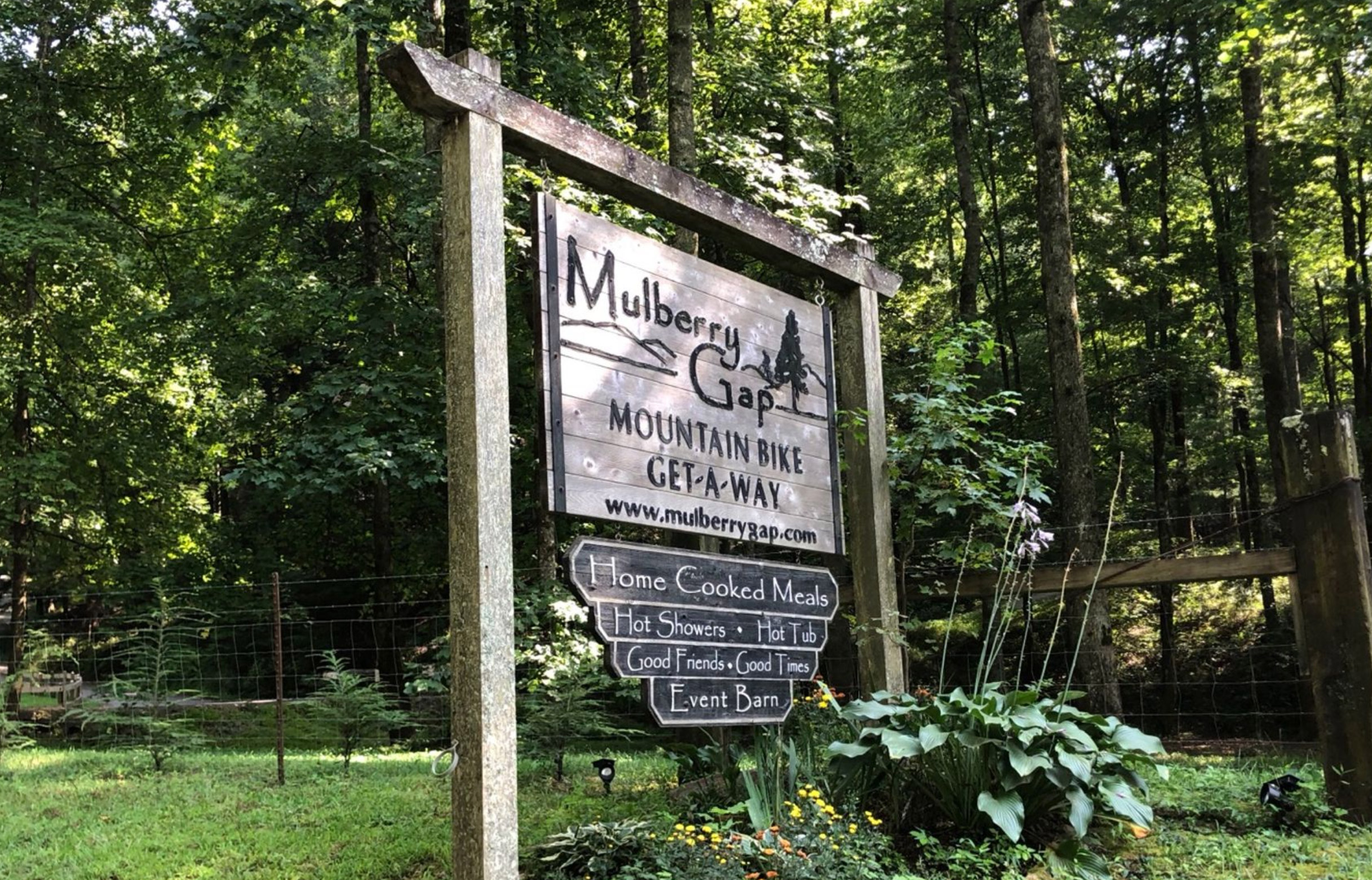
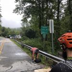
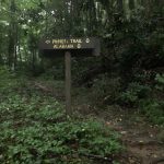
My plan to beat the heat by leaving early was moderately successful, but it was still late in the afternoon by the time I made it to Mulberry. It had started to get hot by the time I made it to the gas station west of Cartersville where the bulletin board below had a sign for “missing 3 goats”. I thought that was funny/interesting enough by itself to take a pic.
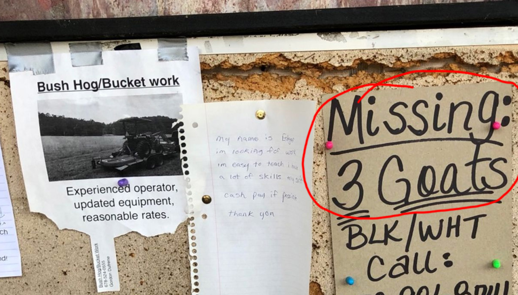
Little did I know that a couple hours later on GA-225 heading towards Chatsworth I would be passed by a pickup truck with not one, not two, but exactly THREE goats in the back of the truck inside a large cage over the entire bed of the truck. Were these the missing three goats? Possibly, but probably not. Either way, just another one of the crazy things you experience while riding.
It was great relaxing at Mulberry, meeting people from all over, Indiana, Ohio, Florida, Wisconsin, Georgia. It was interesting seeing everybody’s stuff at Mulberry thinking I didn’t have enough stuff with me for the race. But on actual race day, seeing everybody’s stuff at the start I thought for sure I had way too much stuff on way too heavy a bike.
I could write a multi-volume book with stories from the area where TNGA is held, but I had ridden surprisingly little of the TNGA course. The only spots I recognized were nearly all of the paved roads we were on or crossed, the Potato Patch climb from the Cohutta 100 mtb race, and a section of the Pinhoti I rode/hiked on my road bike once. Everything else was new, it felt like exploring a different planet.
We pulled out from the Clayton Days Inn at 7AM to head to the start. It was gray and raining a bit, but you could see an orange sunrise sky trying to peak through some breaks in the clouds. Still, I went ahead and put three ziplock bags on top of my iphone, Garmin 1000, and Garmin 1030. I would find out that having two Garmins would be very important in just a few hours as I watched my bike start to float down the river I fell into while trying to ride across.
I started at the front so I could see how fast the fast riders would go and how long I could keep up with them while staying well below threshold effort. I found myself apologizing almost immediately for the loud creaking in my suspension. I could put up with the noise, but I wasn’t sure how everyone else would. I told them we would all be riding by ourselves very soon. Eventual winner Kurt Refsnider from Arizona plus singlespeeder Jason Murrell separated themselves pretty quickly with Dave Chen plus another single speeder Bailey Newbrey just behind. I was next on dirt climb with a guy named Andy gradually falling a little farther behind. The four guys ahead of me continued to push on farther away from me and out of sight.
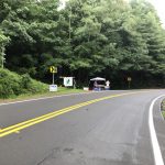
This part of the course was exactly what I was hoping the majority of the course would be like – a couple miles of pavement, followed by a long dirt road climb, followed by a pretty fast dirt descent. But as soon as we turned onto the Darnell singletrack, my suspicions about the challenges ahead were confirmed. Local riders had worked hard to clear a lot of the recent treefall, but I’m pretty sure several trees were intentionally left as challenges for us as all the others trees in a particular pile would be gone but there would be one small to medium one still left across the trail. These were not rideable trees because they would be high enough off the ground that you would have to decide whether to try to heft your bike up and over the tree or try and drag it under. Also, the singletrack eventually merged with a steep stream and became the stream for a while, so lots of slippery rocks and roots.
This was challenging, but still fun and pretty fast so I was somewhat relieved hitting Dillard 25 miles into the race thinking that if that was all that was ahead for the next 325 miles that I would be fine. Lots of pavement through Dillard, and I saw the Cycling Sasquatch and a few others at one of the stop lights cheering on riders. I ate some of my food through here and tried to make up some time on the pavement. The next climb (Patterson Gap) started out paved and transitioned to gravel and eventually dirt. It’s going to be hard for me to remember exactly which climbs were which style, but the general nature of a climb was either well used gravel/dirt, rarely used double track, never used (abandoned) singletrack on old forest road grades, or actual purpose built singletrack.
One of the things that I really like about cycling is how it is a time machine in several different ways. Road biking, you most often see this through abandoned bridges. In mountain biking you get to see it more frequently through abandoned forest roads that have become singletrack. For me, it is fun to imagine people originally traversing the area on foot, horses, early cars, etc…

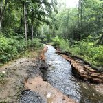
I’m pretty sure the creek crossings started in earnest here. Several were easily rideable, several were not. At one point, a larger creek had been diverted onto the abandoned forest service road so that you either had to ride upstream or pick your way carefully along the side. Another long climb started and I was catching up to Dave close to the top, but he dropped me on the descent until it turned to pavement. I was thankful for a good pavement descent, and drilled it catching and passing Dave just before Hwy 76. I turned left on Hwy 76 out of food and nearly out of water, but knowing that the Top of Georgia Hostel was coming up. They had a nice booth setup with lots of food options for us to purchase. I ended up going with four 20 oz gatorades plus a lot of food, knowing that I had another 45 miles to go (4+ hours) before the next possible place to stop.

I was worried that it was more gatorade than I needed, but I was also really paranoid about getting stuck without liquid as I had never used my water filter before and I wanted to make it as far as possible in the race before I had to start drinking from the creeks. As it turns out, it was probably the perfect amount as I ran out of gatorade right as I made it to the Helen gas station. Dave had decided not to stop at the Top of Georgia booth, so he had gone up ahead and I had passed Bailey on one of the many super steep sections of the climb before that wasn’t rideable on a singlespeed bike.
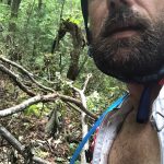
The next section included some hills, flat sections, and a horse trail. It also included the widest river crossing, which I was happy to clear in front of Kate (from Mulberry) and Jason Shearer who were there in lounge chairs in the river cheering people on. Dave had run across it and was remounting his bike when I rode past him. I continued on up the dirt/atv climb and put a little bit of distance into him. Enough distance that he didn’t catch me when I went “swimming” in the river a little bit later. Either that or he had already passed me and left me. It’s hard for me to remember this section well. The one thing I remember really well, though, is trying to cross a faster flowing creek and getting caught up in some rocks and having to stop. As I put my foot down, it was deep and I landed on a rock off angle and tumbled over completely going under for a split second (which was great because it cushioned my back from the rocks in the creek). As I was pulling myself up and assessing whether I had hurt anything bad, I noticed my bike was starting to float away downstream!!! I grabbed it and uprighted it pulling the Garmins out of the water. My backpack was completely submerged too, but thankfully I had waterproof rain cover over it which helped a bit keeping the water out of the backpack. Also, my ziplock had stayed on my iphone so it was ok, but the Garmins were both completely soaked. They were still working, but I was worried they may not charge later. I lost my creek crossing confidence after this and started to walk the next several crossings. Eventually I decided I needed to get my “creek mojo” back and started trying to ride them all again. I cleared a couple, got stuck in a couple, but thankfully didn’t fall into any more. That’s not to say I stopped falling altogether. Especially later into the night, I fell a LOT.
It took what seemed like forever to get up the climb up Tray Mountain, and I felt pretty far spread out from the other riders at this point when the trees decided it was time to bring us all back together. Yes, the trees.

The descent from Tray Mountain was heavily covered in treefall. These were big trees with lots of branches including multiple trunks, etc… It made me think of a third form of navigation that this race required – tree navigation. The first is micro navigation (picking a line). The second is what I called medium navigation – making sure you make all the correct turns. The third form of navigation which was new to me was tree navigation. You had to decide whether to go over, under, through, or around large trees. On the Tray Mountain descent, “around” was never an option as it was an abandoned steep mountain grade that had become really rough singletrack with large drops on the left and super steep incline on the right. Your only choice was to go over, under, through, or some combination of the three. This would be a small challenge if you were just hiking. This would be a slightly larger challenge if you had a lightweight mountain bike to get through. But this was a particularly tough challenge with a dual suspension heavy bike loaded with lots of gear (probably 40 pounds total weight).
All of this tree navigation slowed everyone down enough that we realized how close we were when we came into Helen just under 100 miles into the race. I caught and passed Bailey, who was able to negotiate the trees much quicker than me, on the long road descent into Helen. Dave was just ahead and had stopped at the same gas station that Bailey and I rolled into. Dave mentioned to us as we were chatting getting stuff at the store that Jason and Kurt had just left the gas station so all five of us had essentially come back together because of the trees. The other thing we chatted about was the upcoming Hogpen climb. I mentioned that it was very steep and would probably paperboy parts of it. Bailey asked if it was tougher than the stuff we had just gone through? I said without hesitation – no, absolutely not. And that helped put the climb into perspective for me, thankful that it was pavement to ride on.
Dave pulled out of the gas station first and sprinted away towards Hogpen. I was a bit slower as I wanted to refill my camelbak with all the gatorade I had bought. I went with 80oz powerade this time plus a 33oz tall smart water bottle that I planned on using to filter water as I was pretty sure the next stop would be 110 miles ahead at Mulberry Gap. There were some cool stores (e.g., Iron Bridge) along the Toccoa River supporting river rafters, but I knew they would all be closed as I came through in the middle of the night. Bailey sat down to eat and rest, but I wanted to push on ahead knowing I could eat while I rode. Also, I was particularly nervous about all the sections ahead wanting to try to make it up Duncan Ridge while there was still daylight (I didn’t make it but that turned out ok).
I called Kristine through here since there was cellphone service close to Helen. This was only the second or third time I had cellphone service, and I knew it wouldn’t last long. She had been following the tracking and saw how close we all were so she was super excited. I knew that the Hogpen climb would be steep, and I also knew I needed to stop to plug in my Garmin 1000 as I had forgotten to do that at the gas station stop. I was catching up to Dave when I decided to pull over and plug my Garmin 1000 into my external battery pack. It only took a few seconds, but it was enough to let Dave get out of sight on a few of the corners. Toward the top, there was some guys trying to change a tire on a truck. They asked if I had a knife as I struggled up the climb. I told them “no” and continued on up the climb at a snail’s pace.
Dave had already crossed the top when I made it there and was out of sight. I knew the descent would be fast, and it had dried enough to really rail the descent. My max speed showed 52mph, but it felt much faster on the mountain bike closer to the way 60mph feels on a road bike. I was somewhat cautious though as I approached the turns at the bottom. I knew the first one you could take at full speed and enjoy a slightly higher peak speed at the next straightaway before the really sharp ones – but I wasn’t going to risk it. I braked enough to take the corners comfortably fast. We turned at the first turn to cut over on a gravel climb to Hwy 19 above Vogel state park. It was a tough climb and the light was fading, but it was still light enough to ride without a light. I caught Dave through here.
Making it to highway 19 was great because I knew there would be another paved descent down to Vogel. The challenge with it is the sharp turn to make the left onto the Wolfpen Gap climb. When I was studying the route, I thought that we started on the Wolfpen climb and then turned onto singletrack partway up. But I kept following the route and it kept getting higher and higher on the climb while staying on the pavement. It was completely dark by this point, but wanting to maximize battery life I rode the climb in the dark only turning on my light for the two or three cars coming down the mountain to see me. I was not passed by any cars on the climb (that I can remember). This climb is special to me because I won the Six Gap gran fondo by absolutely crushing this climb a few years ago. So I was getting lots of positive energy the longer I stayed on the climb and didn’t have to turn onto dirt. The turn onto dirt happened at the top of the gap where the paved road continues on down the other side, but there is a dirt road that takes you on up much higher on the mountain. It was an easily rideable dirt road though, which was good because it started to rain pretty oood through here. The descent down the other side was long and fast and not tricky at all.
I went off course at Dial to try and find a water spicket at one of the stores or churches, but I couldn’t find any. I was still holding onto hope that I wouldn’t have to filter water yet. I got back on course and knew that the Iron Bridge was about five miles ahead where I could try again, but I came across the Sandy Bottoms recreation area with a sheltered pit toilet first. I was wanting to get out of my wet clothes, and the rain had stopped so I used the cement floor to change clothes. It felt great to have dry clothes and dry socks again even though I knew it wouldn’t last long. No water spicket (that I could find) so I continued on again and didn’t even bother to look at Iron Bridge. By this point I knew I was going to have to filter water.
I continued onto Wilcot and knew that I was approaching singletrack that I thought might be tricky at night. I made it to the singletrack at the Aska trails. The first two miles were a nice gentle climb on rideable singletrack, followed by a steep turn downhill to cross Long Branch creek on a narrow short bridge. I had been out of water for a while now, and I wasn’t sure when I would see another creek since it was a long climb ahead. So I stopped at the bridge and went to filter water – but my smart water bottle had fallen out! This meant I would have to use my inline camelbak filter instead. As I scooped up the water I noticed that a pine tree had fallen recently and was laying just upstream from where I was filtering. I hoped pine wasn’t poisonous because as I drank the water it definitely had a pine flavor too it. It didn’t matter though as I was really, really thirsty by this point and gobbled down the water as fast as it would come through the filter.
This next climb started what was the hardest part of the race for me (even harder than Snake Creek). The main climb was the Stanley Gap climb which I hadn’t even made it to yet, but this one was steep with many hike-a-bike sections where I couldn’t make it up and over the steep roots. I had practice a lot of hiking with my medical boot on, but it was always dry stuff. The boot was not great for the slippery stuff. The climb really sucked and it went on for maybe a mile or so with a short downhill break that was also very tricky to get over across the road to the real Stanley Gap trail climb. I remembered finding this entrance was tricky, but I thought I was on it and started the climb. I was happy to clear a lot of steep terrain on the dirt road when finally my Garmin said I was off course. I realized I was supposed to be on the trail above and looked for a way to cut up to it. I knew this would be “wrong” but I also didn’t want to go all the way back down to the bottom. Fortunately, I couldn’t find a way up the pretty much sheer cliff and had to go back down so I felt better that I wasn’t cutting the course. And as it turns out that first section of Stanley Gap was really awful so if I had cut the course it would have been a big advantage. I wasn’t thinking much of that at the time, though. I was just thinking “are you kidding me?” as I had to hike nearly constantly. It was several miles of climbing and I probably only road a cumulative quarter mile. The rest was hike-a-bike in the rain/fog/clouds over slippery roots.
I was holding out hope that at the top we would hit a fire road for the descent, but when my Garmin said I made it to the high point, the trail just started back down very steeply with the same root/rocks/dropoffs that were all pretty much unrideable for me. I fell several times on the climb trying to ride stuff that was too steep, coming off on the wrong side of the bike, not having good footing on my bad foot, or even on my good foot and then the weight of the bike pulling me down and over. This never happened on the descent, though, because anything that looked remotely tricky I stopped and walked down it. As awful as this section was, it was such a morale boost to finally be done with it and come out onto either dirt road or pavement. I was so happy to be done with the extensive hike-a-bike-fall-a-bike-throw-a-bike section. I flew down the descent to Cherry Log which definitely turned back to pavement at some point. It was pavement for quite a while, which was good compensation for the nastiness of Stanley Gap.
I kept an eye out for water spickets, but at this point I was confident in my water filter and knew I could filter water out of creek. During this section I came across a working vending machine on the side of the road. I had brought a lot of $1 bills for this specific purpose, so I went ahead and bought two root beers to fill up my water bottle. I was already low on food at this point so I was thankful for the calories from the sugary soda. I was getting a little bit sleepy through here, but nothing debilitating yet. Food was a big concern as at some point I had felt into my backpack and knew that I was down to two gu’s (220 calories total) to make it the next several hours all the way to Mulberry with a big climb up Cohutta.
The climb up Cohutta started out paved so I thought I recognized it from the Cohutta 100 race, but it was a different section of the route than what I was picturing. In fact, I was twisted around thinking I was on the climb back up Cohutta, but it was actually a different approach than the one the race uses down south towards Cohutta. I was confused several times why my route showed me going South when I swore everything in me “felt” like I was heading north given that I was confusing it with a different part of the course. Still, I continued on the steep climb which was long enough for morning daylight to start happening. By the top of the climb it was light enough that I could do the descent down to south fork with no lights. South Fork had a few creek crossings as we reached the “Northern Terminus” of the Pinhoti trail. We hopped on this trail and rode all of it “Pinhoti 1” is what the local mountain bikers call it. This section is a long climb back up to the dirt road we had been on earlier.

I made it to the top and a rather unfortunately timed “lost satellites” happened on my Garmin 1030. I didn’t think to switch over to my Garmin 1000 for navigation thinking that the satellites would come back quickly and that we were just supposed to follow the Pinhoti. Unfortunately, the Pinhoti merged with the Mountaintown Creek trail which dove straight off the side of the mountain. It was a super steep, super fast descent which I was enjoying until I was getting paranoid that I was off course. I switched to the other Garmin and realized I was not supposed to come down this way at all. This was very demoralizing as I knew I wouldn’t be able to ride back up to the top and would have to hike a bunch of it. Plus the bees/yellow jackets were starting to wake up so I started to worry about getting stung by one on a section of the course I wasn’t even supposed to be on! After 20 minutes or so, I made it back up to the top and got on the dirt road descent which we were supposed to take in the first place.
I followed this dirt road descent for a while, and it was a fast descent which led me to miss another turn. Same deal, I was way down the mountain before realizing it, but this time I could at least ride back up the dirt road to make the correct turn. I was really frustrated at this point with the missed turns when I started having satellite problems again at the turn for Pinhoti 2. I thought I was supposed to turn, so I did. I started up the steep climb, but my Garmin had me way off course, so I turned around and went back down the steep descent, but then it had me off course the same way. So this time I switched back to my other Garmin again which had started working by now and I saw that I was in fact supposed to go the way I had first gone!!! So I went back up the steep climb, this time just hiking it instead of riding it because I was tired and demoralized and very very hungry as I had ran out of food a long time ago.
This next section of the Pinhoti had lots of steep ups and downs, but they were all rideable. I really started to get in a good rhythm and was happy with all the steep sections of the trail I was clearing. I would burst out an effort to clear a steep section and then dial it back to barely moving on a still steep climb so that I could recover for the next burst.
Pinhoti 2 eventually popped out on a paved road which I knew took me up and over to Mulberry Gap where I had planned on sleeping for an hour or so. The problem, though, is I was pretty wide awake by this point. I had been out of food forever, though, so I knew I needed to stop and figured I would try to rest since I also knew I couldn’t make it to the finish without some kind of sleep. The guys and gals at Mulberry Gap were awesome, washed my bike, lubed the chain, laundered my clothes, made me an excellent Cuban sandwich, and gave me a robe to wear after I showered and laid down to rest on a cot in the barn. Since I knew I wouldn’t sleep well (or at all), I asked them to wake me up in 30 minutes, which they did. All my clothes were clean and dry, so all I had to do was buy some supplies from the store (more gu’s, fig bars, clif bars, and three 20 oz gatorades). I didn’t want to get too much as I knew there would be a store in about 30 miles or so.
I pulled out of Mulberry Gap at 12:52pm, which meant I had been stopped for 1:52 given that I arrived at exactly 11am. The weather had gone from cool and wet to hot and dry as I started the long climb up Pinhoti 3 up to the Fort Mountain overlook. I had a bad fall near the beginning trying to ride up and over a root on a steep climb and not making it. I landed a bit awkwardly on my back on the downhill side of the trail. I’m lucky whatever I landed on wasn’t too sharp.
Going over the top of the lookout, I knew that we were joining with an ATV trail, but little did I know how rough that would be. It started out fine, just wide and muddy. But as I made it farther down the trail, the rocks and ruts both got quite large. I passed two 4 wheel drive cars struggling very slowly to make it down. I “blew” past them at maybe 10mph on a steep descent. The reward for the ATV trail, though, was turning onto the P5 dropoff trail. This was pretty fast and steep. At the bottom I believe there were a couple roads before rejoining with what for me was personally the most fun section of the Pinhoti. It was a long rolling mostly downhill section through an abandoned road bed that was pretty well overgrown. There was still an occasional tree down, but almost all of them could be ridden over, under, or around. It felt so fast compared to all the trails that I had just covered. Plus, I knew the end of this section was a LOT of pavement on the way over to Dalton, where I had been looking forward to a Starbucks stop.
Unfortunately, I ran out of water on the pavement and decided it was better just to keep plugging away and stop earlier in Dalton. Traffic was not great, and some rednecks in pickup trucks were not nice one of them calling me a “fag” out the window. Dalton has a really good cycling scene, so that doesn’t surprise me that there is “bikelash” from locals who have probably had to wait at some point for a group of cyclists or individual cyclists on the road. It’s really a shame how impatient our society has gotten, and how that impatience has turned cyclists into objects of hate. I assume that’s the source of this, but maybe it’s something else. Who knows? It’s coming to a boiling point soon, though, as more and more people are riding. I see it everywhere I go, but really rural areas are fine, and really urban areas are fine. It’s the in-between suburbia or small cities that are the problematic areas because it’s here where groups of like-minded individuals can get together and hate on cyclists.
The first place I came to was a Subway. I was craving a sandwich, so I stopped here and got a footlong ham sandwich with extra meat, and 3 white chocolate macadamia nut cookies. I didn’t get anything to drink, though, because I had decided to get gatorade and a canned starbucks drink and a couple red bulls and snacks at the next gas station. I wanted to make sure I had enough caffeine to help get me through the next night of riding. I also didn’t want to delay long because I wanted to ride as much of the Snake as possible in daylight.
I saw Dave Chen outside one of the last gas stations on the far side of town on the other side of the road, so I rode on by thinking I would put as much distance as possible between me and him so I could made it as far as possible into the Snake before he caught me. I crawled up the climb up Dug Gap, made the turn onto the gravel tower access road, but missed the turn near the top onto the Pinhoti and ended up under the towers before realizing I had missed the turn. I made it back onto the trail and started on what I knew was a very technical part of the Pinhoti. Thanks to my friend Max Diaz giving me some good advice to ride the West Ridge trail at Oak Mountain, I had a little bit of experience with this type of trail but I still was really bad at it at first. I had two thoughts going through my mind – 1) not hurting myself 2) not blowing out the tire since the Snake is known for shredding tires.
I tried to ride one of the first technical sections, didn’t make it, and walked it instead. This became the pattern, ride for 50 feet, walk the next technical section. I had only made it through a couple sections when Dave came flying by one of the sections I couldn’t ride. He just flew right by me no problem at all. As it turns out, the 28 mile section of trail took me 7.5 hours, but it only took take 5.5 hours – 2 hours faster than me!!! Thankfully after the first few technical sections, the rideable parts got longer. I haven’t mentioned much about my foot, but being in a boot did make this section particularly tricky to dismount, hike-a-bike, remount, and continue. So I knew that unless I wanted to be there for-absolutely-ever, I would need to start riding the technical sections. So I did. It was like a switch clicked. I think I rode nearly ALL of the next 7-10 miles of the trail both uphill and downhill technical sections. I can remember hike-a-biking some of the really steep sections that were just too steep to make it. But everything else I rode. As I cleared more and more technical sections I started to like it. I was still a bit nervous about blowing my tire(s), but I made that part of the challenge.
The topography of the Snake is quite interesting and divides the snake into four or five different sections as you follow a quite jagged ridge that snakes back and forth across the land. The first section we came to was the hardest, so I was happy to make it onto the next ridge. It was still tricky and had a bit more uphill technical sections so it did get tiring making repeated explosive efforts to make it through those sections. I made a bit of a mistake through here as I ran out of gatorade and didn’t filter water at the first valley. I realized partway up the climb that I would need to make it to the top of the next ridge and down into the next valley to find running water. Sure enough, it took a while and when I did find it I had to bushwhack through the edge of the creek to get down to it to fill up my camelbak. I was happy to have lots of water and continued on up the next climb.
The next sections started to get foggy and wet again with intermittent rain. These next sections were also quite overgrown, so I got lost a few times. Also, I fell. A lot. I had my only high speed fall of the race through here as I was heading down a hill shortly after making a turn and checking my Garmin to make sure I was heading the correct way when all of a sudden I was flying through the air. There had been a good 3 foot drop hidden by lots of grass that I didn’t see. So I didn’t have my weight right and endoed over the bars. I was OK though, and the bike was fine. Most of the other falls were on a climb when there would be a rock or rut hidden under the grass and I wouldn’t have enough momentum to clear it. So I would try to step down and if I didn’t land correctly, the weight of the bike would just keep me going until I tumbled down. One wreck I ended up laying on my back next to my bike, which had stabilized itself upside down on the handlebars.

This repeated for what seemed like an eternity until I saw a light up ahead in the woods. It was Dave on the side of the trail nauseous from something in the water. Looking at the Strava fly-by, it had taken me two hours to catch up to him while he was sitting on the trail. I talked to him for a bit and gave him my phone number in case he started feeling himself going downhill. I told him I would turn around and ride back to him if he needed it. He ended up unable to continue because of the nausea.
I continued on and the Pinhoti continued to climb a lot, descend a lot, all in the dark and fog with a lot of foilage covering the trail. I got confused a few more times about which way the trail went, but eventually the sun started to come out. I also recognized part of the trail, having ridden it once on my road bike many years ago. Once I made it to Hwy 27, the Pinhoti started to become much more well-used and beaten in, but not before one last stretch of thorns ripped into my left leg at speed. I was happy to be riding a highly rideable section of the trail on the other side of Hwy 27 with Internet access even. I was going to do a facebook live video, but then I realized I didn’t have facebook installed on my new phone — and I couldn’t download it without wifi. Oh well!!!

I finally dropped down one last steep fast technical section and out onto pavement (GA 100) that I have ridden multiple times. The route I had to follow, though, only stayed on GA 100 for a few hundred feet before turning onto an unfinished rails/trail that lots of thick, sharp gravel. Instead of sailing along on pavement, I was back to crawling at 8-10mph over quite a rough trail. I was out of food and water again, so I was keeping an eye on GA 100 just to my left to see if there were any gas stations. A couple things happened simultaneously – I saw a tall flagpole and a sign and I badly cut the sidewall of my tire. Sealant started spewing out of the hole, so I walked across a bridge thinking I had found a gas station. Unfortunately, it was a craft shop that only had boutiques and keepsakes for sale. The lady who ran it didn’t have any food or drink to sell. I asked if they mind if I changed my tire there, and they said no problem and brought me a coke … trail magic!
It took forever to change the tire (almost exactly 1 hour) because the seal was so incredibly tight between the tire and the rim. I was standing on the side of the tire at one point and couldn’t break the seal. Eventually, I used a flathead screw driver wedged into the tire next to the rim and turned it sideways. This pushed the tire just enough away that I was able to move the screw driver down a few mm and repeat the process before the first section resealed itself. After a few of these moves, I had enough of the tire away from the rim that when I gave it one more push the seal popped so loudly I thought I had broken something.
But nothing was broken. It still took about 15 minutes to finish changing the tire as it was a real bad pain to get the tire back over the rim because the tire was so tight. Also the tire was so tight that part of the tire stayed pinned in the valley of the rim instead of popping out to the side. I knew there were no pinches, but I ultimately could not fix this. So I rode with a very wobbly tire for the last 30 miles from that spot to the end. I even tried at the gas station in Coosa using an adapter I have that turns a presta valve into a schraeder one and the free air compressor at the gas station. I pumped up to what I felt was 50+ psi and it still wouldn’t pop. It was rideable though and if I destroyed the tire, I would be in a lot of trouble. So I left it wobbly for the rest of the race.

With another redbull in me from the gas station and some hot peanuts I took off. I proceeded to make a wrong turn before the Rome bypass. Then once I hit the Rome bypass, my Garmin satellite was off a bit and at one point it had me on a side road instead of the main highway. The course was on the main highway so I misinterpreted it as I was supposed to get off the main highway and onto a side road. I wasted a few minutes trying to figure it all out riding back and forth on the highway. This happened one more time at the entrance to the very last section of the Pinhoti we were riding as the turn was not well marked because the trees had been logged recently at the turn (including the one with the trail marker I guess). Eventually I just bushwhacked over the fallen trees until I found the marker. This section of the trail was awesome once you made it past the fallen trees. It was a really fun way to end the race as I flew through all the singletrack with no problems.
After the singletrack I popped out on Esom Hill Rd is the name of the small community where the finish was. It was still a bit of climbing up to the ridge where the Silver Comet trail runs, but all hard packed dirt or pavement. Once I hit US 278, I knew I was almost there. This was how the Heart of the South 500 mile road race entered back into Alabama, so there was lots of memories for me here. I pushed it hard on the Silver Comet knowing there wasn’t any real reason to try to sprint, but still wanting to push it as fast as possible since the race was almost over. No need to leave anything on the table. My top speed for the silver comet was only 19mph, but to me it felt like I was flying. Kristine and Honcho were there at the finish videoing and I was so happy to see the Welcome to Alabama sign. Sweet Home Alabama!
Below is a couple snapshots of my Strava data from both days of the race. The heartrate flat line at the end of the first day and the heartrate drop at the end of the second day are both from my HRM strap slipping down on my chest and eventually me getting too tired / not caring enough to try to move it back up to get a good reading! Note the max speed of 52mph on Day 1, the max temp of 97 deg at the end of Day 2, and all the averages, etc…
Finally, I overlaid the GPS data from the combined rides onto historical USGS 1:250,000 scale maps used to make the raised relief maps I have mosaiced on our stairwell leading down to the basement. I downloaded the image to my phone and then zoomed in and carefully traced the entire TNGA route over the top of the maps. Here is a video I made narrating the traced route and the mosaic all the way up the stairwell to Maryland.
Leave a Reply