

Rouge Roubaix
My first ride in the bayous of Louisiana was this amazing race in 2010. Before the race, I had dreams of winning. By the end of the race, I was happy just to have finished. My best shot at winning the race came in 2012 where I won the $100 KOM (you physically grab the $100 bill) by being the first up Blockhouse Hill. But two flat tires later, I saw myself sprinting for second place against two teammates from another team. Instead of strategizing for third place, I tried (and failed) to beat them both finishing one spot off the podium in fourth place … somehow both my best AND most disappointing finish.
Let’s go back to Blockhouse Hill and fast forward a couple years to 2014. Even by this point, the lure of the early season race wasn’t just the race itself but also the chance to ride in such a uniquely beautiful and mysterious area. In 2014, I “American Flyered” my ride by finding and racing a barge on the Mississippi River on Cat Island. My pre-ride took longer than planned, so I ended up riding down Blockhouse Hill in almost pitch-black dark without a light.
Finally, let’s look at 2016, the last year that I was able to do the race. That race report has a selfie of me with an alligator (taxidermied at a gas station), and I was wanting to stop at that same gas station on this ride … but I couldn’t remember which one it was, and I ended up picking the wrong gas station. Still, I got to talk to this cool local who was hanging out at the gas station and recounted a story of having to walk from Natchez to Woodville (it’s about 50 miles) and sleeping on the side of the road. I would use this story as motivation later for when I was desperately sleepy outside of Maplesville … more on that later.
Counties
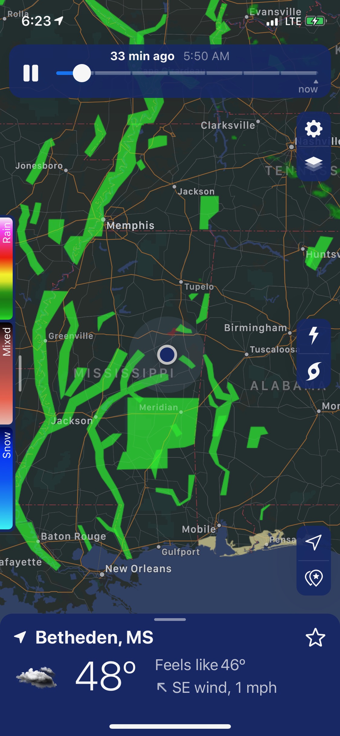
There are about 3,250 counties in the USA and its territories. One day, I’m pretty sure I would like to ride in them all. I’m not sure how realistic that is, but I’ve ridden in over 500 counties already … so maybe? While I still determine the feasibility of the larger task, I’m working on riding all the counties in Alabama, Mississippi, Tennessee, Georgia, and Florida. I noticed a nearby “hole” in Mississippi (see annotated map below) which I could reach on a 350 mile round-trip ride from home in Birmingham, and set out a couple Tuesday’s ago on said ride. Unfortunately, I got a flat tire fairly early in the ride, which I also realized would have me riding into the sunset on the way out AND into the sunrise on the way back in.
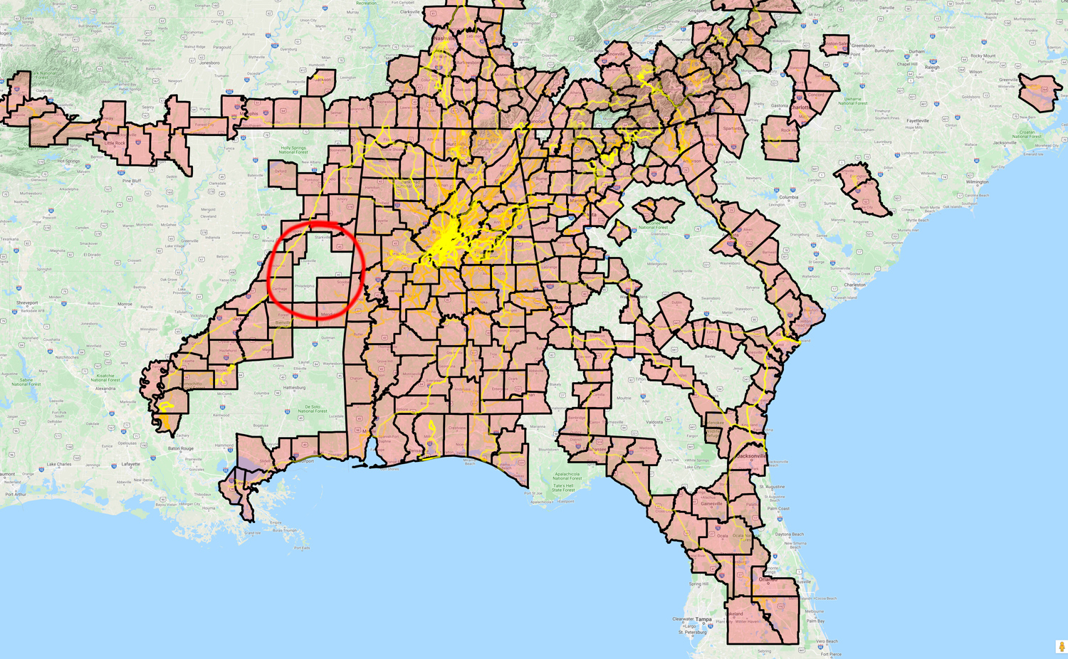
The flat tire was all I needed to cut short the ride and head home. This was a great decision as it led to this 913 mile adventure a couple weeks later that I wouldn’t have otherwise done! I had named the route I was following on the abandoned ride “mscounties”, but as I planned out this more extensive adventure I named the three routes (instead of 1) to “rouge1”, “rouge2”, and “rouge3” – which also indicates the change in motivation for the ride. Instead of just filling in some missing counties, I was now going to fulfill a long predicted dream of riding to St Francisville, the start of Rouge Roubaix. The longer adventure helped with the Mississippi counties, too. Instead of four new counties, I ended up riding in twenty new counties in Mississippi alone, two new counties in Louisiana and zero new counties in Alabama since I’ve already ridden in them all!
It was a dark and stormy night … and day … and another night
We’ve had rather unsettled weather in the South over the past couple weeks with round after round of storms. The most recent was a series of tornados in Louisiana, Mississippi, and Alabama on Saturday. I had a hard time figuring out the timing for this ride because of the storm systems and other obligations, but one of the plans was to leave Saturday night after the storms. That didn’t work out because of a work meeting I had on Tuesday, which I wouldn’t have made it back in time for.
This meant the earliest I could leave was Tuesday because of the meeting, but it was going to be close on the timing with the Bakers Dozen race coming up on Saturday. Also, the problem with Tuesday is that it marked the arrival of the next round of storms. It looked like if I left during the storms on Tuesday night, I could make it to Vicksburg right about the time the next storms arrived there, but I would need to leave early enough on Tuesday evening to make it, which made it tricky with the Birmingham / Tuscaloosa traffic on roads I had been planning to ride much later in the night.
So that’s what I did … left Tuesday night at about 8:30PM in dry weather for the climb up to the top of Vestavia Drive. It was quite foggy at the top, and by the time I made it the half-mile over to Highway 31 it had started to rain pretty hard and continued raining for about 20 miles into Bessemer. Then it stopped and didn’t rain again literally until I got my first flat tire just outside of Durant, Mississippi about 225 miles later, but more on that later. First, we need to talk about parties, chickens, and tornados.
Parties, chickens, and tornados
Leaving earlier than I would like put me on Lakeshore Dr around 9pm in the rain heading down towards Bessemer. I was passed by 29 cars between where I hopped on near the Oxmoor golf course and the end at Hwy 150. Not too bad and most cars got into the other lane to pass.
I made it to AL-216 at about 10:30pm. This was another road that concerned me. It would be fine for sure at 3 in the morning (I’ve ridden it once before at that time), but at 10:15pm on a Wednesday night, I wasn’t sure how many cars would be out there. As it turns out, there wasn’t many (33). By the time I made it to Tuscaloosa, it was just after midnight (3.5 hours!) and I came in through “The Strip” where there were easily 100 or more college students waiting in a line to get into a bar partying at midnight! There was also a lot of people walking around, but not very many people driving (thankfully).
I made my way through downtown Tuscaloosa hitting the main street going the reverse direction from the old Tour de Tuscaloosa criterium, crossing the Black Warrior River on the US-43 bridge, and then turning onto the cobblestone (brick) street through historic Northport, making my way past the airport, and finally onto the next road that was of concern to me – US-82. By this point, it was 12:30AM, and there were very few cars. Highway 82 has a good shoulder with intermittent rumble strips you can “hopskotch” fairly easily. But in the dark, I didn’t want to have to mess with trying to dodge debris with my light on its lowest setting to save battery. Thankfully, I didn’t need to, as there was still a good 2 feet of shoulder to the right of the white line before the start of the rumble strip. This is the absolute best way to do a rumble strip. I was passed by 41 cars and trucks (mostly trucks and county sheriffs) over the 15 mile stretch of US-82 from past the airport to the turn onto AL-86.
A truck had been approaching me as I neared AL-86, but he was far enough back that I could safely get over and make the turn in front of him. But surprisingly, the truck also turned onto AL-86. This was the first of MANY trucks, maybe one about every 5-10 minutes over a span of about 40 miles of AL-86 and MS-388. All of the trucks were chicken trucks. The ones coming towards me were fully loaded with chickens (I think), and the ones passing me were empty. I was wondering if you could get bird flu from the sudden gust of chickens so I started holding my breath right before the chicken wind would hit and for a few seconds after the truck would pass. This went on all the way into US-45 in Mississippi (about 40 miles of chickens). Probably due to the 24-hour truck traffic (this was from 1AM-4AM), AL-86 was not in very good shape with lots of cracks and bumps with several signs that said “rough road”. I passed a few chicken farms, but I never did encounter a truck turning into any of them. It’s possible I just didn’t get the timing right, or maybe there was a massive chicken factory somewhere off US-45 in Mississippi.

While still on the chicken road in Pickens county, I noticed the appearance of broken trees and a broken fence. It took a second to register, but then I realized I was riding through the tornado damage in Pickens County from one of the tornados that had just happened on Saturday – see pic above.
The four counties of Mississippi
Leaving the chickens and tornados behind, I went straight across US-45 and hit my first gravel road following the route I had planned out a few weeks ago that was going to cross through the four counties in the “hole” in the map I included earlier in this post. It was freshly graveled, which was probably good so that it wasn’t ridiculously muddy given how wet it was. The gravel was good gravel, too, meaning you just kinda floated along it instead of bouncing over hard rocks. It was tough riding, though, and my pace slowed down to about 7-8mph for the several miles of gravel … except for a couple short bursts of speed related to the sudden approach of dogs.
I made it through the gravel and turned left onto a very nice road, which ended up being the first cool “find” of the ride – the Noxubee Wildlife Refuge. By this point it was about 5am so still way too dark to see anything but I could tell from the way everything looked within the range of my light that I was riding through a swamp-like area mixed with lakes that seemed like it would be super cool in the day time.
Tires, tubes, and wheels oh my!
I continued on fairly uneventfully, crossing over the Natchez Trace at a section where it was flooded on either side of the trace, until about 227 miles into my ride when I got my first flat shortly after riding through the town of Durant, Mississippi. I didn’t hit anything or hear anything, but suddenly realized my front tire had gone flat at exactly the same time I felt the first big rain drops from skies that had looked threatening all day but had remained dry. I was about half a mile from I-55 where I assumed (correctly) there would be a gas station. So rather than trying to change the flat in the rain, I just walked half a mile to the gas station where I needed to stop anyway for food and drink. I wanted to be VERY thorough and careful in changing the tube since I still had 675 miles left to ride, so I didn’t want to do a hasty tire change in the rain with no shelter.
I am quite adept at changing flat tires now, having ridden close to one quarter of a million miles. But, my awesome Martindale 60mm deep dish wheels present a little bit more of a challenge than your typical wheel. First, you have to make sure you have a valve extender or tube with long enough valve. Second, you have to make sure you have two good tires levers because these wheels have extra wide rims which are phenomenal for preventing pinch flats on gravel as there much more room for the tube to expand when taking a big hit, but mean that the tire has to stretch a little bit farther to get on/off the rim. Lastly, the aluminum braking surface is great for braking but it makes it much harder to push a tire up over the edge than a corresponding slick carbon surface, especially once the aluminum starts to wear down and you get a bit of a lip right at the top edge of where the brake has worn a path into the rim … try riding 50,000 miles on your favorite wheel through mud and rain and all kinds of roads and come back and tell me how that braking surface is doing (oh wait, yeah your wheel probably won’t make it 50,000 miles).
So let’s talk about how I was not really prepared for flats on this ride.
First, I only had one tire lever in my tools ziplock bag. I had changed the rear tire and tube recently at home and apparently forgot to put one of the tire levers back in the bag. THANKFULLY, my multi-tool has a smooth metal tire lever in it that I was careful to use not for the initial prying but just to keep the tire off the rim when inserting my one regular tire lever.
Next, I only had one long stem tube, and it was only 60mm. Also, I had two valve extenders with me but a third already on the front wheel, which had flatted. The problem with two of the valve extenders is that they are the removable core kind. Well, my Walmart tube purchased the last time I had a couple flats on a long trip and which now served as one of my two spare tubes on this ride definitely did not have a long stem. It had a tiny, itty bitty stem.
But with my valve extender it would be fine … except the cheap one I had bought on Amazon was apparently about 1/2 mm too wide and wouldn’t push through the hole opening on the rim. It was close, though, so without it connected to the tube I used my multi-tool to hammer it through hole and then hammer it back out. Then I connected the extender to the tube and was able to push the tube through (with a lot of force) but without the hammering. Normally the tube and valve stem move when the tube is inflated but I knew that this one probably wouldn’t move so I had to make sure the valve stem was pushed through the hole as far as possible before inflating. This makes the tube much more susceptible to pinch flats during pumping because the tube is more likely to get stuck between the edge of the tire and the rim. I checked very carefully and made sure that I didn’t see any tube before I started pumping.
Needless to say, this was quite a long tire change, with the entire stop including getting some food and drink from the gas station taking 49 minutes according to Strava, and that doesn’t include the half mile of walking to get to the gas station. On a more positive note, the gas station clerk who sold me my food and drink came out on a smoke break and had a nice conversation with me and encouraged me that hopefully I had the tire fixed and would make it the rest of the way.
Midnight, Mississippi and Ordinary Epics
I should mention at this point, that for the first 225 miles of the ride I was fighting a wind from the west/southwest. After fixing the flat, I went through a cool town (Lexington) and popped out on a deserted road that probably used to be the state highway at one point. It was nicely paved and practically no traffic in a generally northerly direction, which meant I was finally getting a bit of a tailwind. I knew it wouldn’t last, though, because I knew as soon as I hit the next town I would be turning directly into the wind again.
Little did I know that not only would I be turning straight into the wind, I would also be heading directly into a series of rain showers. Also, I would be riding a very busy highway with a poorly placed rumble strip. All this led up to flat tire #2 and a hasty tire change, in a downpour, in the middle of US-49W (literally, in the median) … one of many showers you could see coming from a mile away where the road would change color in the distance and you knew that was from heavy rain. This flat tire was on my brand new rear tire, which I had not expected to flat at all. I changed the tire in the median of Hwy 49W as a “turnaround” spot for cars. I dug out a very sharp, large rock that had gone straight into the tire like it was butter.
I used my 60mm tube which was just, just, just barely enough to have a couple threads of the valve stem poke through the rim if you push hard from outside the tire. After a little futzing around and a lot of hard pushing hoping that I wasn’t going to push the stem itself out of the tube, I was able to thread my mini-bike pump onto it and then pump it up to what turned out to be about 60psi, which I found out when Jason Shearer came to my rescue a little while later with two 80mm tubes and a floor pump with a gauge … more on that in a minute.
Knowing that I was out of tubes at this point, my first thought was to find a Walmart. But the nearest Walmart was going to be about 20 miles out of my way in Yazoo City, or 75 miles later at my destination for the day in Vicksburg. I still had three patch kits with me (two glueless, and one glue) each with a bunch of patches … but it was also raining and everything was wet so I didn’t want to put all my eggs in the “will the patch hold” basket. Deeming that finishing this ride was more important than sticking strictly to a self-supported philosophy, I put out a call on Facebook to see if anyone was close who could bring me spare tubes, knowing that if this had been a race, it would immediately disqualify me.
Within minutes or seconds of my facebook post, my friend Jason Shearer who runs Ordinary Epics with his wife Wendi had responded that he was in Jackson (about an hour away) and could meet me with tubes. I was trying to find out where I was and it turns out I was riding through Midnight, Mississippi. We picked a spot on my route in the tiny town of Holly Bluff, Mississippi so I could try to stay as close to schedule as possible to make it back to Birmingham before the Bakers Dozen on Saturday.
Jason knew the town of Holly Bluff because one of his races, the Delta Epic, goes through the Delta National Forest right next to the town. I told him I would look for a gas station there, but I think he wisely said that sounded great knowing that there was none in the town so as not to discourage me. I made it to the town and found a church, a post office, and a lot of dogs all mixed up in between. I called him back and told him I was in the post office hiding from the dogs and out of the wet. He replied he knew exactly where it was because he had hunkered down in that same post office waiting out a storm once.
As it turns out, I didn’t flat again the rest of the ride, but I can see why this kind of meet-up even without an exchange of supplies is forbidden in self-supported races. The mental and emotional boost you get from seeing a friend is good to shave hours off your time as well as possibly keep you from abandoning the race altogether. This, of course, was not a race but it was indeed training for future self-supported races so I did feel a bit like a failure in that respect. But man I was so super, super thankful and glad and grateful to see Jason, have a floor pump to get me up to a reasonable tire pressure (which is probably what kept me from flatting again), and having two spare tubes to help see me the rest of the way home to Alabama.
Into Vicksburg
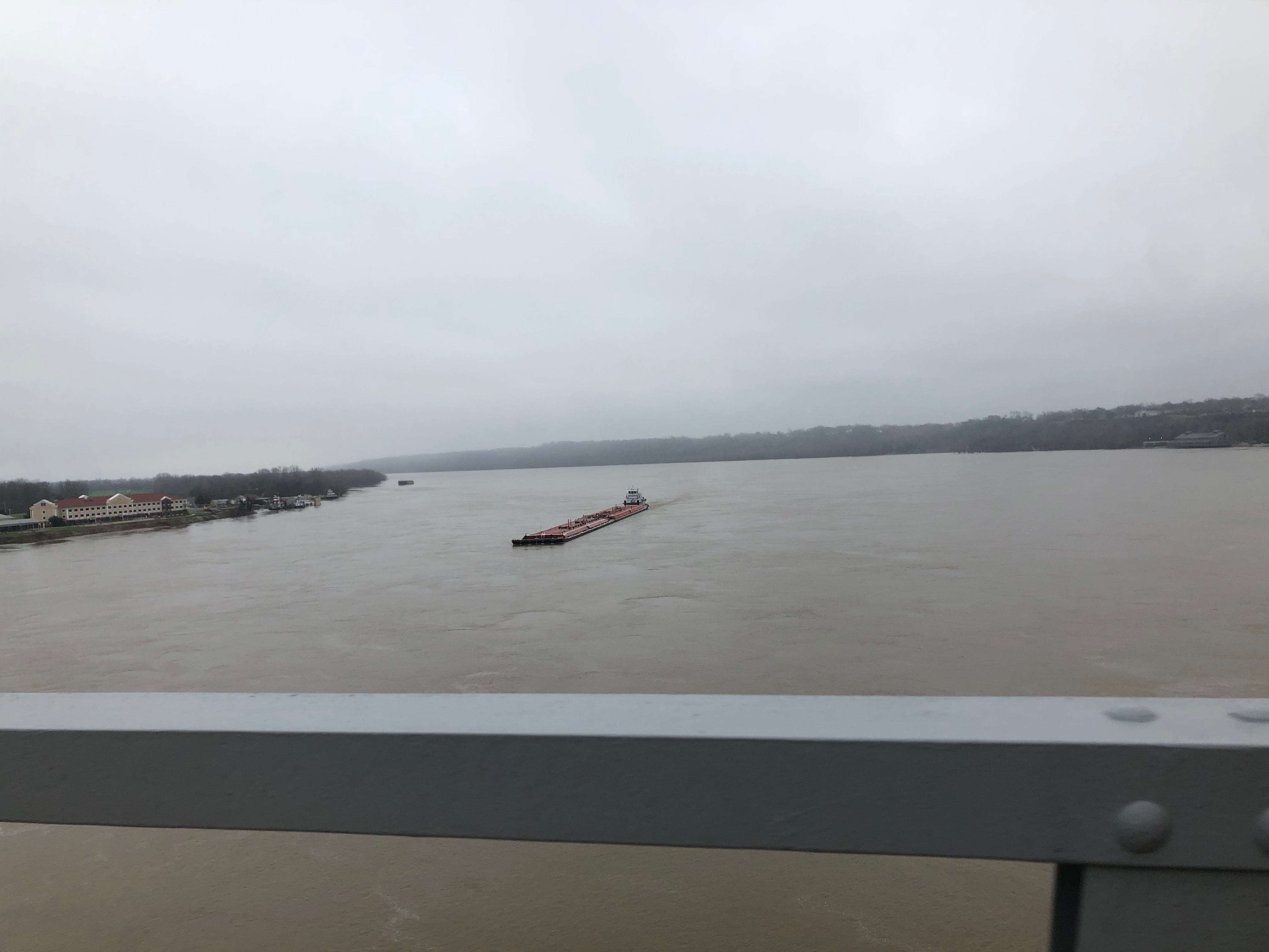
It had stopped raining shortly before Holly Bluff, and it didn’t rain again the rest of the 75 miles into Vicksburg. Or if it did (which it may have), I was too oblivious to even notice or care. I did notice that it got quite a bit cooler as I got closer to the Mississippi River and when I made one last stop at a gas station on the outskirts of Vicksburg, I put on all my cold weather clothes I had hauled but not worn yet. A few more miles and an unexpected 200 ft climb alongside the Mississippi River climbing literally through the town of Vicksburg put me onto the overlook I knew about from previous cross-country drives on I-20.
In fact, the spot where this photo above was taken we called the Donut Lookout because when I was driving out west with the family to race the Cascades Cycling Classic in Bend, Oregon in 2009 with my very young kids, we had stopped here to see the river and climbed the hill from the visitor center up to the lookout with donuts and ate our donuts up there. You’d better believe I was reminiscing the hell out of that having just ridden 353 miles to this spot alongside the Mississippi River through all kinds of rain and awesomeness from my home in Birmingham. And so ended Day 1… well, not quite.
There’s quite a bit more, actually, and not all of it is pleasant so skip the next several paragraphs down to the “The Blues Highway” section if you don’t want to read about it.
I had worked out a non-interstate route to get to my interstate hotel, but by this point it was late enough (almost midnight) that I-20 was pretty much deserted so I just hopped on I-20 and rode two exits back east to the Candlewood Suites I had booked back home (non-refundable … extra motivation).
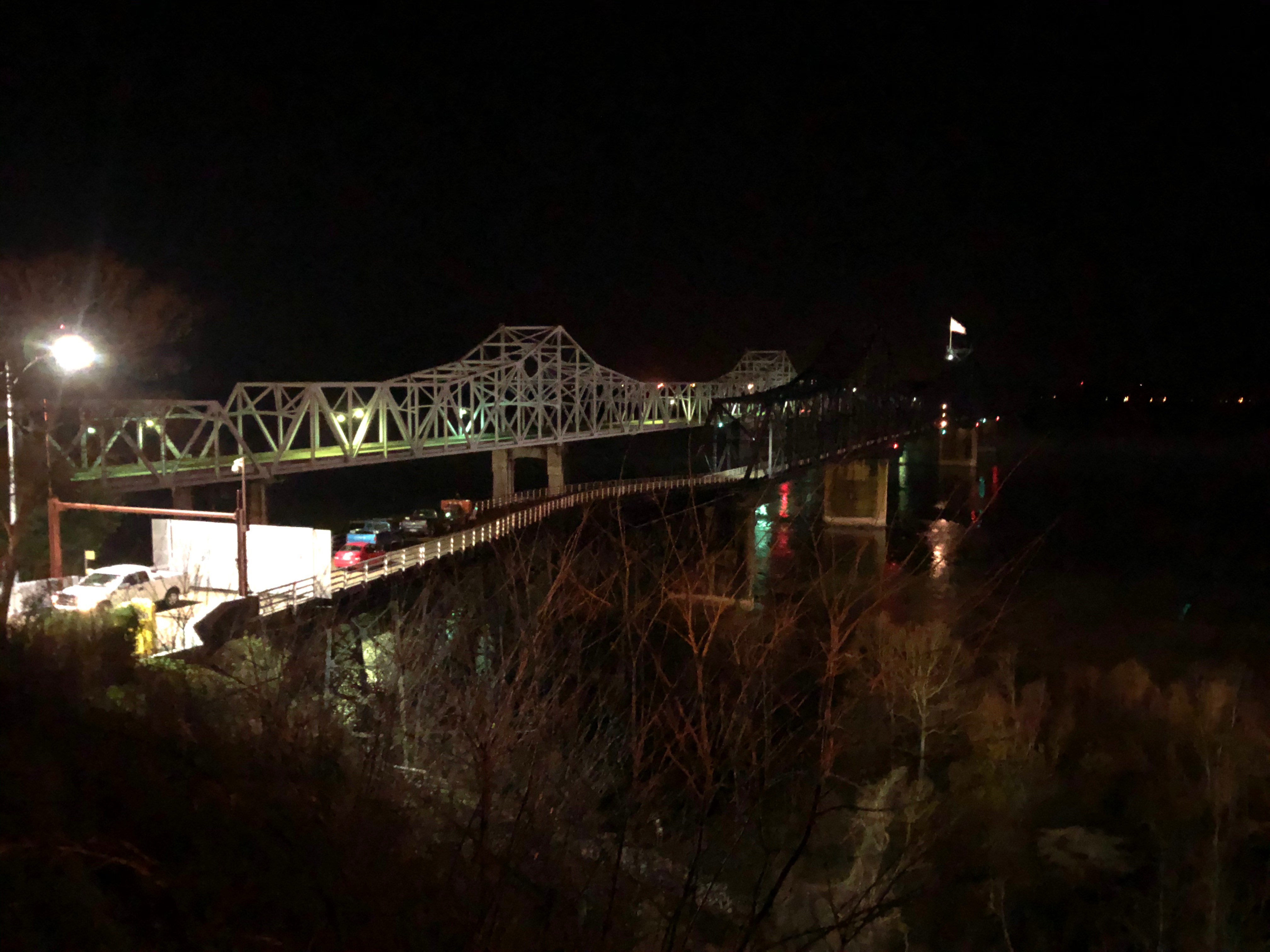
Also, related to I-20 and the picture above. There are two bridges visible. The left bridge is the I-20 bridge crossing into Louisiana. The right bridge is a combined road/train bridge. The train is active, but the road portion of the bridge which carried Highway 80 over the Mississippi River before the I-20 bridge was built is only open to non train workers a few days per year for charity events. There is a well organized movement pushed by both cities on both sides of the river (Vicksburg and Delta) to open the bridge permanently to pedestrians. And it has been in the news that maybe that will happen soon.
Before I get into my critique below, let me first say that I spent a couple hours trying to research this using just the resources available on the Internet including facebook pages and web pages, etc… I did not actually contact or email anyone to find out what the solution is. It makes no sense to me why it wouldn’t be published on the Internet in some way, shape, and form on the Vicksburg transportation pages, facebook pages, etc… But it is entirely possible that there is a “secret” setup in place if anyone wants to cross the bridge. You might just walk up to the guard, knock, and they open the gate to let you across (although I’m not sure how that would work on the unmanned far side .. maybe they drive you across?). So it’s possible that there is a situation in place that doesn’t make it as unreasonable as it appears to be according to an outsider trying to get through the city.
In any case, I wasn’t going to mess with the closed, fortified US-80 bridge and was just going to ride the I-20 bridge. The problems of the day pushing me farther and farther back though meant that I would either have to sacrifice sleep almost entirely after 350 miles or try to cross the bridge in the middle of the morning 8AM commute. I scanned street view leading up to the closed US-80 bridge and there is quite the fortress gate guarding both sides of the bridge. I think it would be possible to walk along the railroad tracks on the service grate clearly visible in street view and the websites I was looking at about the bridge. Then once you make it past the fortress gate, simply climb over the small guard rail onto the US-80 section of the bridge. But I also used streetview to scan the on ramps to the interstate and there is a very distinct lack of “no pedestrian, bicycles, etc…” signs. Probably because the nearest bridge crossing open to pedestrians is US-84 about 60 miles south in Natchez or US-82 a similar distance north crossing into Arkansas.
Still, even though it may (or may not) be legal to cross the I-20 bridge by bike or by walking, there is literally no reasonably safe way for anyone not in a car to get across the bridge to the small town of Delta, Louisiana as the I-20 bridge has a two foot (or less) shoulder with what appears to be drainage grates at regular, frequent intervals. I tried looking up a bus service, and that appears to stay only the Vicksburg side of the river. Google transit directions comes up empty. Walking directions is 359 miles long taking you way, way down to cross the river using a ferry south of Baton Rouge. Bicycling directions is a little more generous at only 155 miles, allowing you to cross on US-84 in Natchez which I did on this trip (doing a quick out/back across the bridge both directions … west bound was insane with no shoulder but at least it was downhill and east bound was fine with a wide, clean shoulder).
This is a sad commentary on the current state of America. I should be able to reasonably reach any public destination I want to by walking or riding a bicycle or at the very least taking public transportation. Here is one concrete example where that is NOT possible unless you want to walk 359 miles to cross a distance of about 7 miles separating the towns when there is a PERFECTLY good bridge ready for and in fact used by pedestrians several times a year. The fact that we are becoming car-centric to the point of making it practically impossible (within reason … 155 miles out of the way for this bridge crossing) for a group of people to cross over a state line strikes at the heart of the “freedom” that this country is supposed to be about.
My willingness to continue riding thousands of miles each year on roads is a testament to a few things – 1) I have faith in people that they can be better people and that the vast majority of people do exhibit some common sense when driving. 2) Without people like me there will be no change, and it will only get worse until cyclists and pedestrians are legally excluded from all roads and highways. 3) There are signs of improvement, many places are organizing to promote alternatives to such a car-centric culture – even in unexpected rural small towns.
The Blues Highway – Day 2
With all the thoughts about how to get across the Mississippi River to resume my intended route down the west bank of the river in Louisiana all the way to Natchez, I ended up not going that way at all because I made a wrong turn onto a road that didn’t connect where I thought it connected. Backtracking would have meant a big climb back up the descent I had just come down. It was raining. I was already way, way behind schedule and the road I was on had a massive tailwind and was taking me under the interstate directly onto US Hwy 61 [aka the Blues Highway, aka the highway we just took up to Wisconsin a few weeks ago], the shortest route to get to the Natchez Trace and then down to Natchez.
The tailwind was too good to even think about turning around, especially after fighting an annoying headwind for the vast majority of the previous 350 miles.
By the time I made it only Hwy 61, it was about 8AM. I was a few miles outside of the main part of Vicksburg heading out of town, so there wasn’t much traffic. I remember there was some good sections of shoulder which I didn’t have to use much. There were periods of rain and periods of dry weather almost to the point of clearing enough to see the sun. But it never did happen, this was the second day in a row that completely passed without me ever seeing the sun.
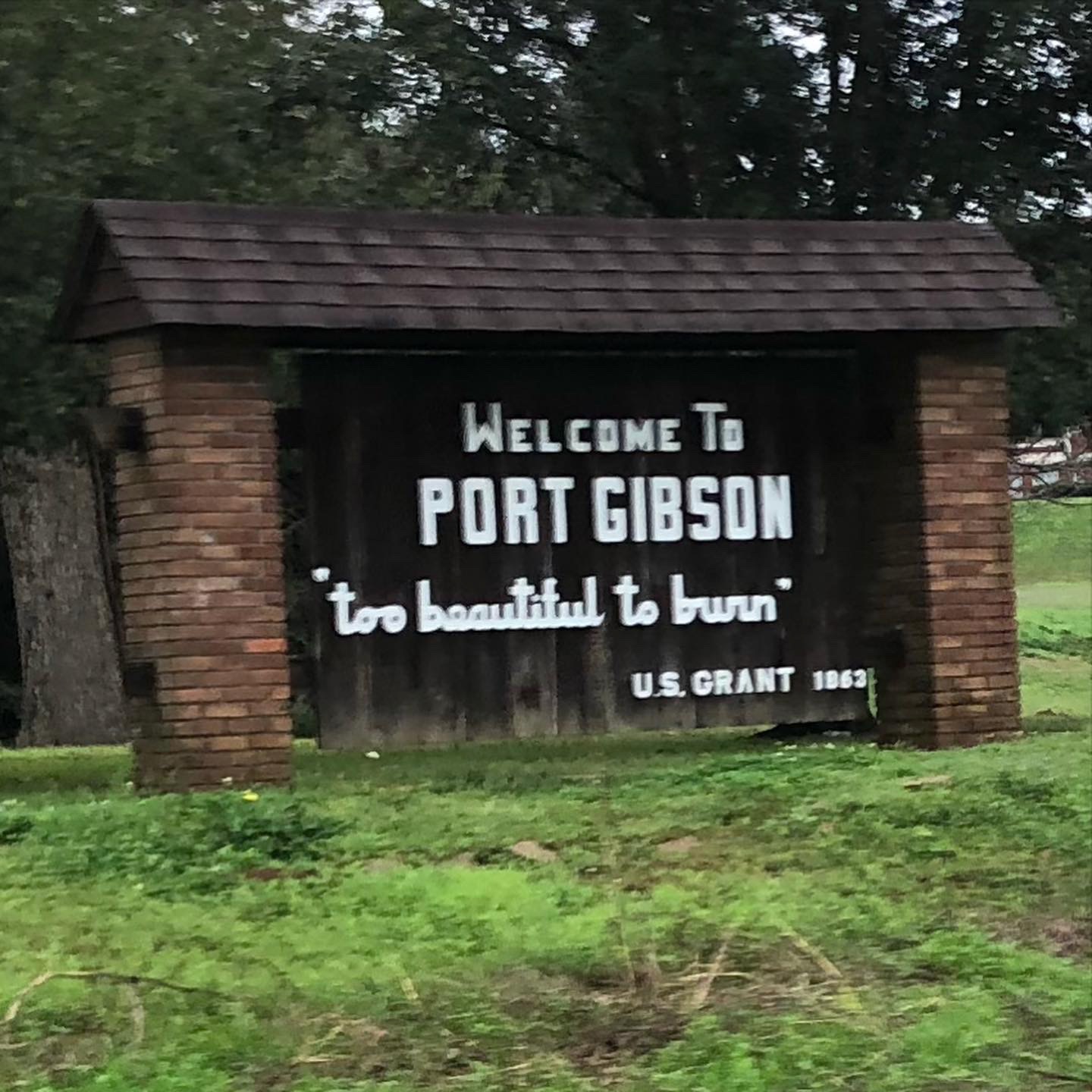
Port Gibson … “too beautiful to burn” … and yes, it was indeed beautiful … I assume this was talking about the Civil War. Lots of traffic especially truck traffic through town with no shoulder and only one lane of traffic each way, it was not good. Thankfully, the far side of town saw me stumble onto the Natchez Trace Parkway, which I had not even thought about as a route option down to Natchez (since I was supposed to be on the other side of the Mississippi River on my original route). It was amazing the difference in cars – 233 cars and trucks between Vicksburg and Port Gibson on Hwy 61 and then only 20 cars between Port Gibson and Natchez about the same distance … with most of those coming in the last few miles of the Natchez Trace where locals use that section of the trace as a shortcut to get over to Natchez. see screenshot below:

I realize this blog has gotten far too long, so I’m just going to leave the rest with a few snippets of things I’ve already typed out and hopefully I will be able to remember the rest of the details for a book some day.
Woodville gas station (looking for alligator) and instead found cool local who encouraged me on my way and related story about having to walk the 50 miles from Natchez and passing out on the side of the road
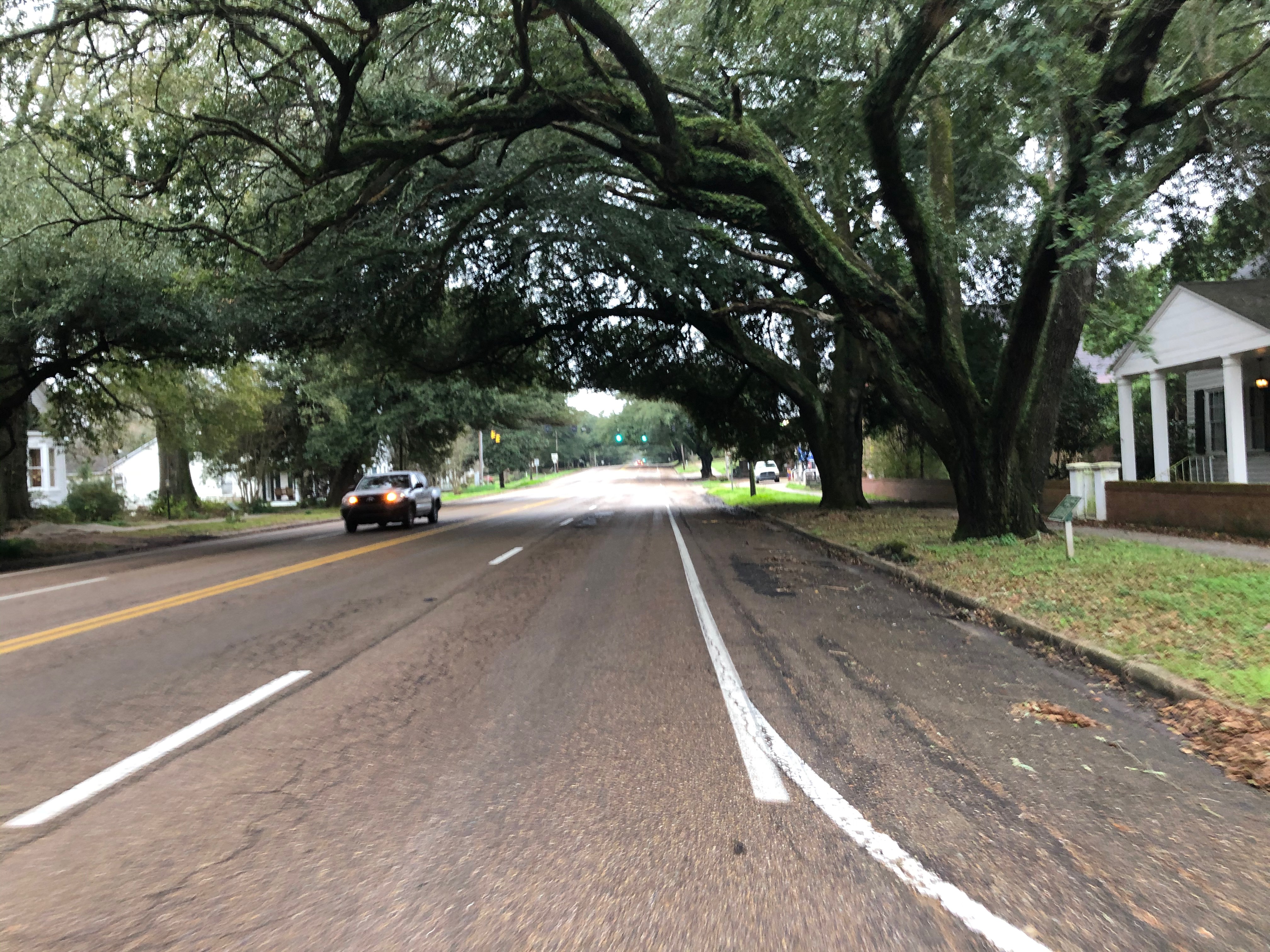
St Francisville and all the rouge roubaix memories … there were a lot … see beginning of this blog post.
Heading East
After a quick stop to take a couple pics, I headed out of St Francisville without even stopping to get food or anything because I still had plenty of food and drink in my backpack from the Woodville gas station. In fact, I was hoping to make it to I-55.
traffic much better than expected as I was on roads I used to take home after rouge roubaix and they seemed fast and busy.
cool little towns i’d driven through many times after the race
NOTHING at I-55 but thankfully a mile or two off the road nice gas station last refueling before columbia
Columbia, Mississippi
cool town, arrived at Walmart at 12:51 AM to find out it was NOT a 24 hour walmart, but rather closing in 9 minutes at 1AM. So I ran inside and got food and supplies I needed and was the very last person to check out as one of the workers closed the self pay machine and turned off the green “open” light as i was leaving.
hwy 98 – surprised that it was that far north (i don’t normally look at road names when making the route)
nice check-in, begged for cheapest room since I was only going to be there couple hours
very nice, moderately cheap room at the magnolia inn
end of day 2, start of day 3
Hattiesburg, Mississippi
after two hours of sleep, i got up and started heading east to hattiesburg at about 5:15AM. traffic picked up quite a bit by the time I made it the 30 or so miles to hattiesburg
hopped on cool bike path and took relatively traffic free roads northwest out of town.
my route was somewhat northwest at first so that i could ride through several new counties in Mississippi before turning farther southeast (directly into another headwind)
closed bridge on ms-167 over the chickamauga creek led to several mile detour and yetis.
Camden, Alabama
very awesome encounter with pick-up truck driver … twice
getting sleepy
Selma, Alabama
home, sweet, home
super sleepy
the problem for me with getting to ultra familiar territory is that the “excitement” of something new and not exactly knowing what I’m going to find wears off which is just fine during the day because there is always something new to see … but at night when you are severely sleep deprived, it becomes exceedingly more difficult to stay awake with each passing mile.
Sleeping on a bench in Maplesville, Alabama.
first hoping for a post office floor, but two little towns prior to maplesville didn’t have a post office that I could see from the main highway
next i passed a high school football stadium with a covered press box (important to get out of the crazy tailwind i was riding) that knew from previous ride was left open. but the thought of ticks or ants crawling around the wooden press box while i was laying down in it kept me moving on.
finally, i came upon the gas station where kristine had bailed me out once before by driving down with a new tire and a floor pump when i sliced open a tire on my way down to montgomery. I was hoping it would be open so I could at least get a red bull, but as it turns out it was closed and had the PERFECT bench for sleeping tucked back behind a large side of the building and out of the wind.

i wedged myself up against the wall and put on both my wind vests and my beanie I had brought all this way in case it got really cold. it was perfect! i fell asleep for about 15 minutes and then woke up with a start when my leg fell off the bench. i had gotten really cold so i decided the best thing i could do was get back on the bike and hammer my way home. i was no longer sleepy and pretty much “flew” the rest of the way home with a very nice tailwind.
Some thoughts and data on cars
I was passed by 4016 cars and trucks over 913 miles of riding for an average of 4.4 cars per mile, or 1.1 cars per minute. Those averages are a little bit misleading, though, because I was passed by many, many cars on some roads at some times of day and would sometimes go hours without seeing a single car on some dirt roads at night. That’s why interactive data with maps like I’ve created on mybiketraffic.com is a little bit more meaningful. There is still a lot of work left though to create a true visualization of what car/truck traffic is really like on a ride like this. Somehow my website doesn’t quite capture the “feel” of traffic on such a long ride as this. Here is a link to interactive data from each of the rides:
- Day 1 – 353 miles – 797 vehicles – https://www.mybiketraffic.com/rides/view/966
- Day 2 – 247 miles – 1259 vehicles – https://www.mybiketraffic.com/rides/view/958
- Day 3 – 313 miles – 1960 vehicles – https://www.mybiketraffic.com/rides/view/959
I had no close calls at all, and 99.9% of all the car drivers were quite courteous, passing me usually in the other lane (I was on a lot of four lane highways and two lane highways with wide shoulders). But 0.1% of 4016 is still 4 cars. And that sounds about right. I had a few cars honk angrily (as a cyclist, you can generally tell when a horn is honked in anger). I had one weird interaction where a guy came up behind me, honked his horn, and kept honking his horn the entire time he passed me, and continued honking after passing me. It was one long continuous honk of maybe 10 seconds. There was nobody coming the other way, and visibility was quite good, so he didn’t even really have to slow down much. It was a weird interaction because it didn’t “feel” openly hostile like a situation like that might normally. It “felt” more like he was just weirdly letting me know he was passing. The road I was on had quite a few rough patches so I couldn’t look over at him as he was passing to see if he was a million years old or something like that. But that would be my guess, that it was an elderly man or woman who just didn’t know what to do to pass a cyclist, or maybe thought that cycling was illegal.
The coolest interaction I had with a driver was on a rural section of AL-10 between Yellow Bluff and Camden just before crossing the Alabama River. Two guys drove up beside me in a huge pickup with oversized wheels, slowed down as if to say something but then sped up because a car was coming the other way. They pulled off at the next dirt road and turned around and waited for me. Then they pulled out again and pulled alongside on a clear stretch of road and we had a friendly conversation for probably close to a minute (with no cars coming the other way and probably 2-3 mile visibility). The passenger asked where I was going and if I needed a ride to Camden. I thanked him, but told him that I was good. He told me I was brave and wished me good luck and took off. I made it to Camden about 30 minutes later and pulled into the first gas station I came to and I saw the pickup truck parked right there! I picked out my stuff and then recognized the guy I had talked to out the passenger window. We continued our conversation in line at the busy gas station and he wished me good luck and told me where he was from and that he had gone to school in Camden and had come back for a Friday night party.
I talked to a few people throughout the day, mostly gas station clerks or people at gas stations. When people asked where I was going or where I was coming from, their response was not only the typical “wow”, “that’s amazing”, and “I couldn’t do that”. Every single one also said something along the lines of “you are very brave”. This is another sad commentary on the state of America right now. I shouldn’t have to be “brave” to ride a bike.
Photo Gallery [in reverse chronological order]

Perfect bench for sleeping 15min 
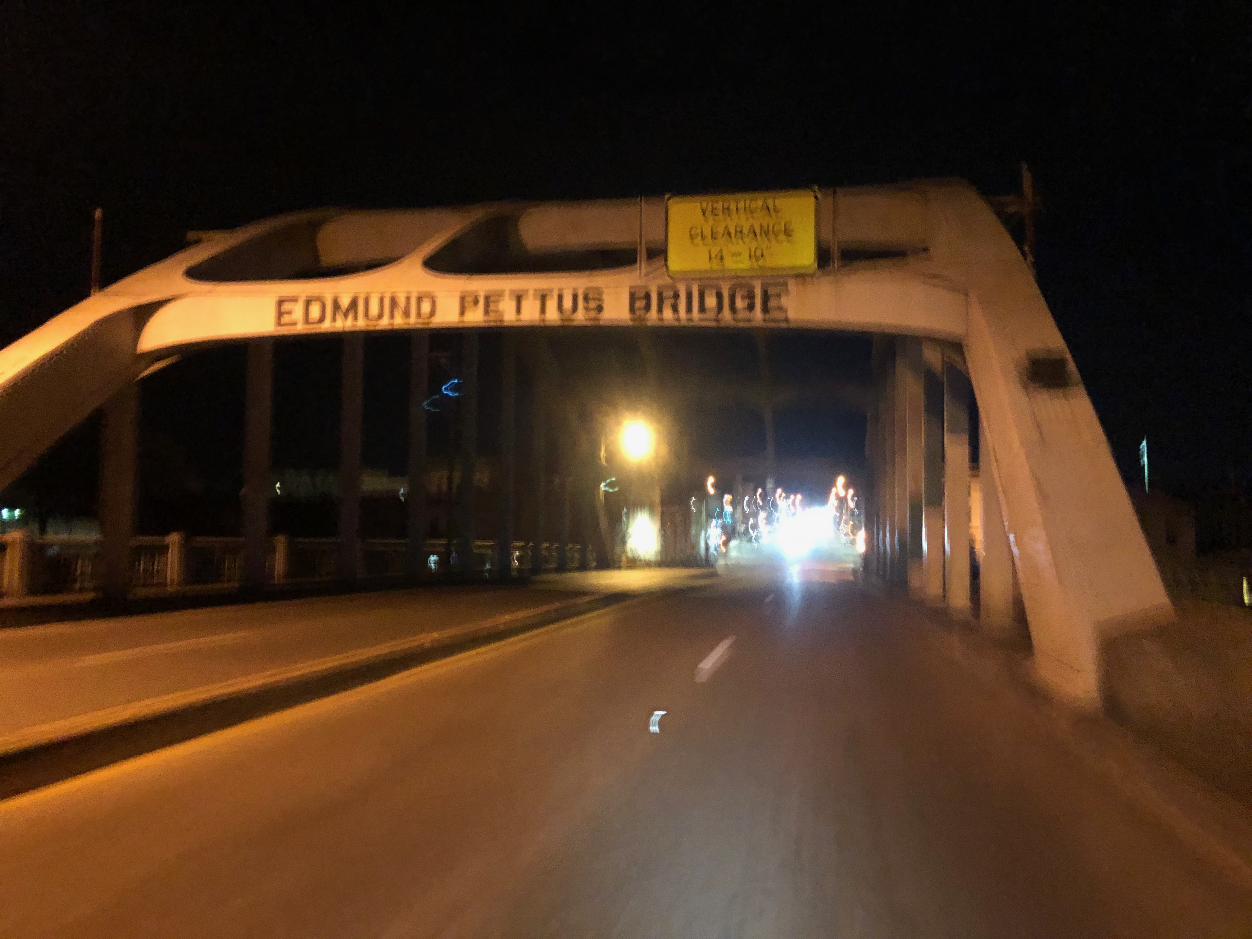
Edmund Pettus Bridge, site of Bloody Sunday 
Selma! 
The bridge was big enough to register as a climb! 
Alligators visible from this bridge when I crossed it in 2016 after the Ride4Gabe. 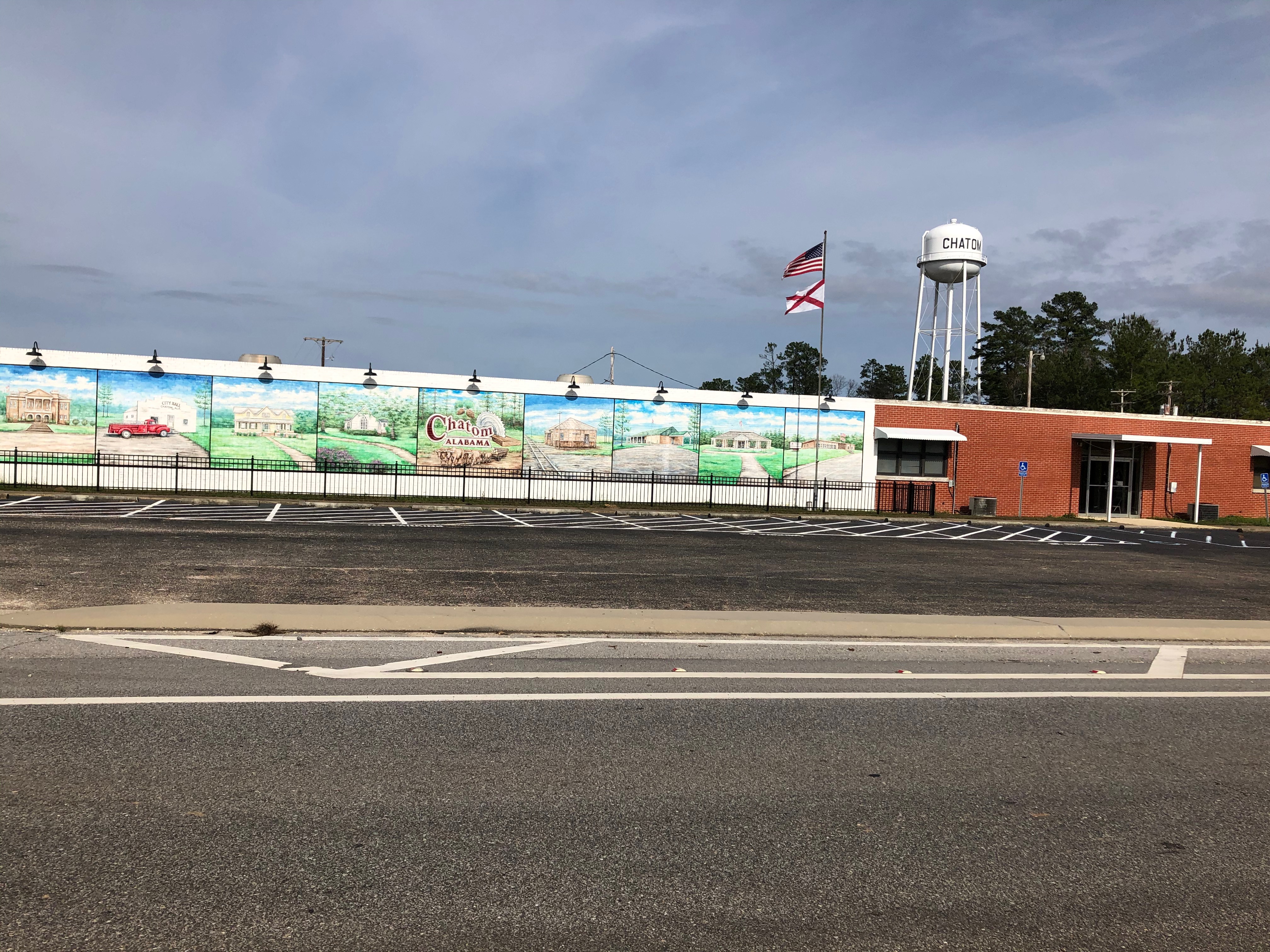
Headwind 
Sweet home Alabama 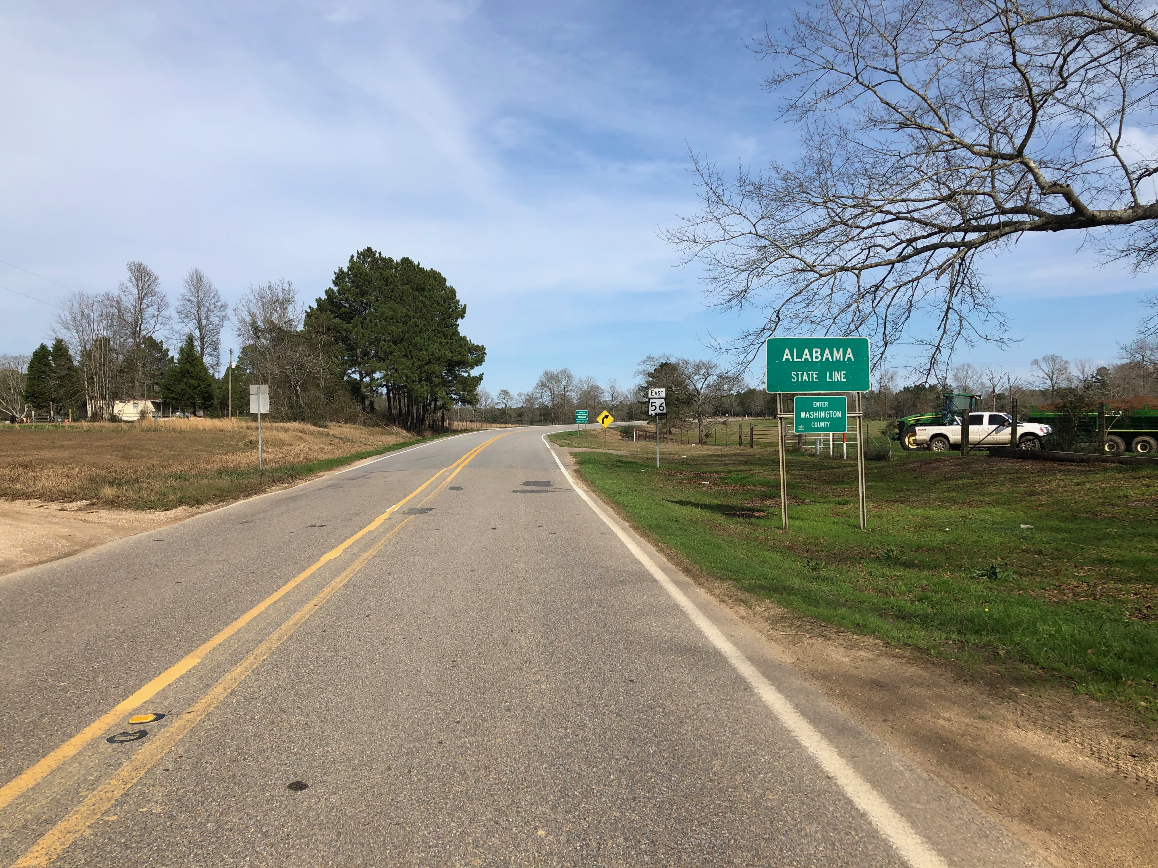
Alabama state line 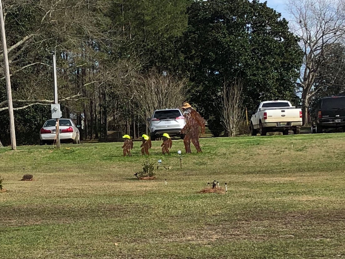
Yetis 
More yetis 
Bridge out over this river led to several mile detour so I could cross it at this bridge 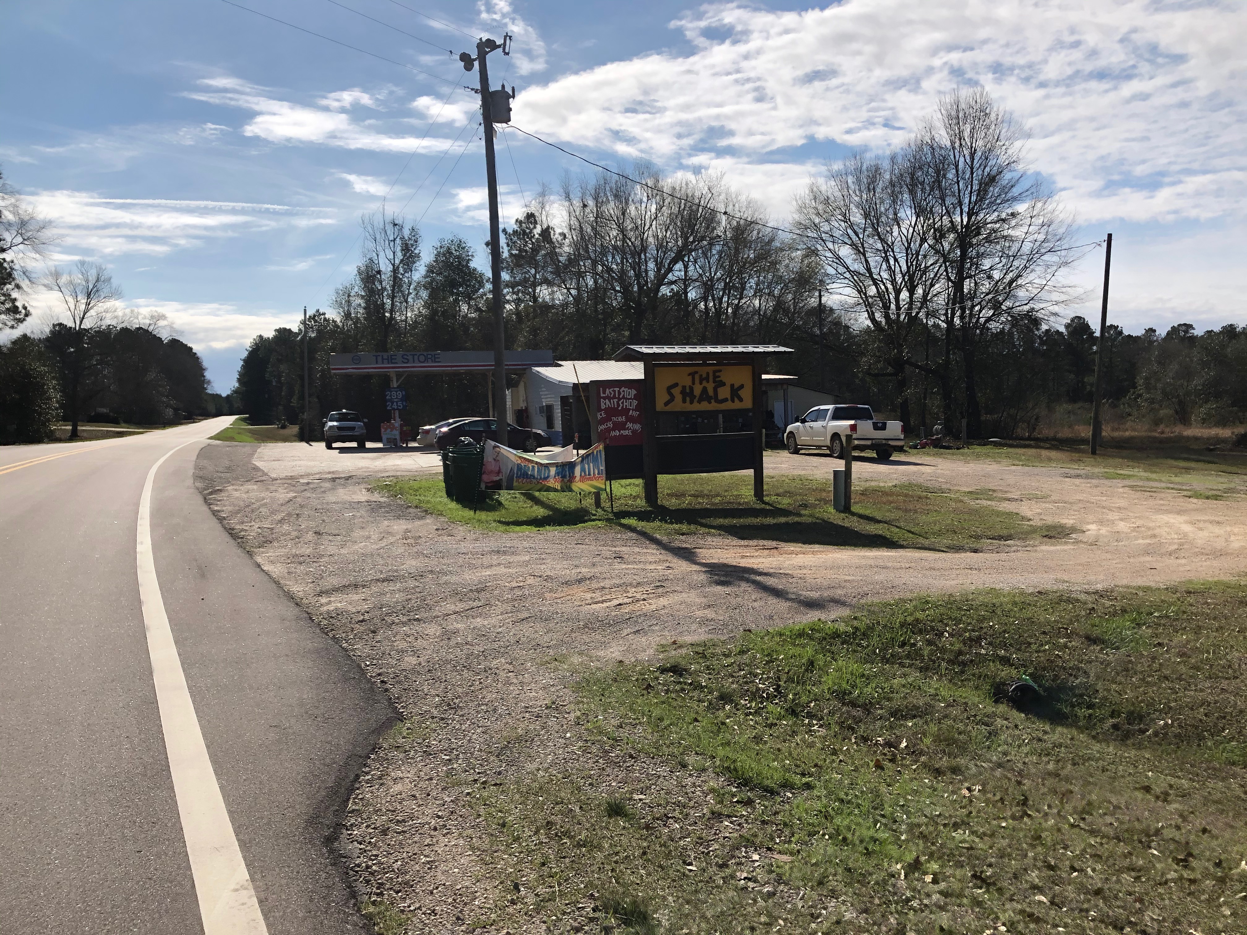


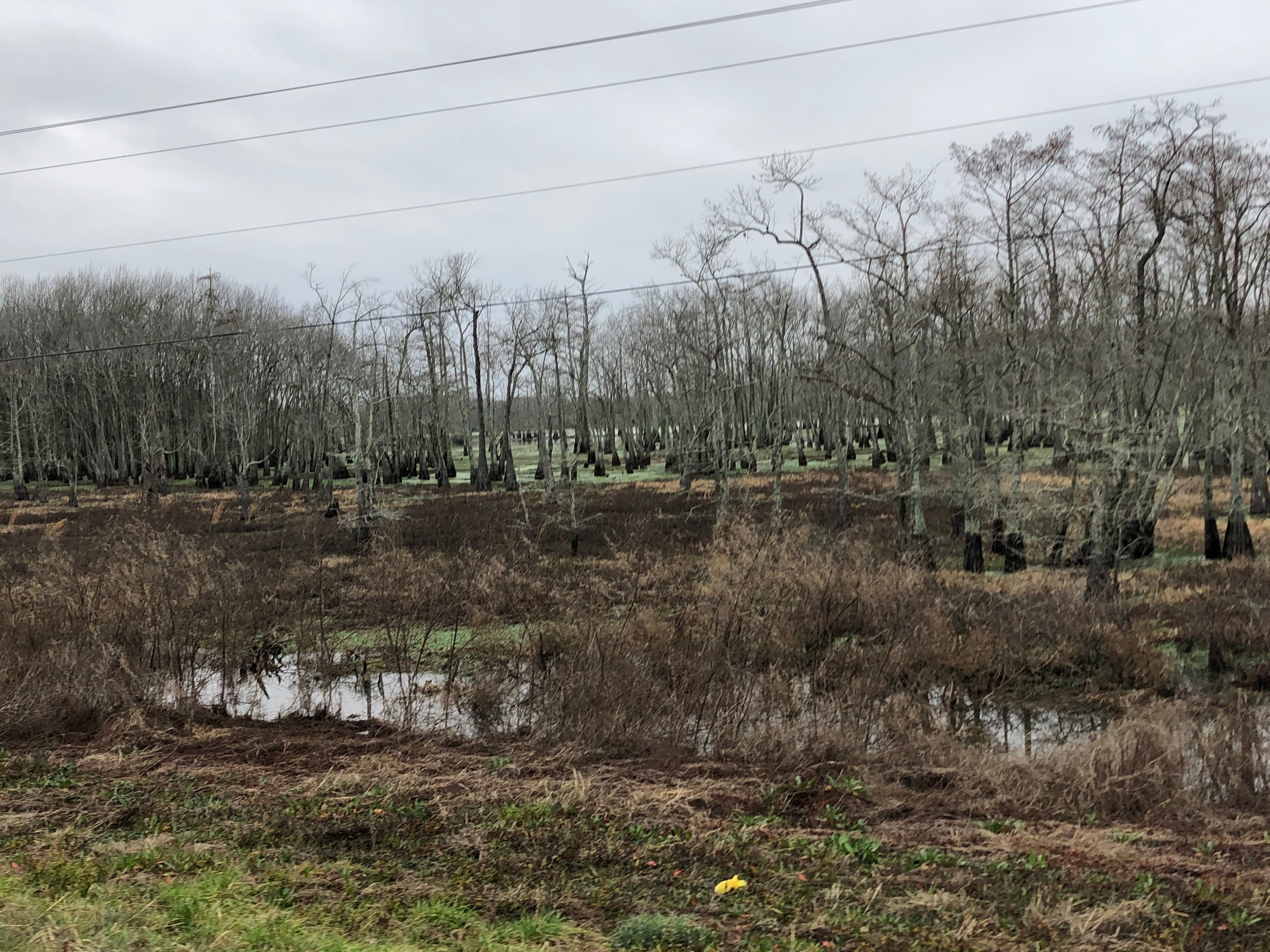


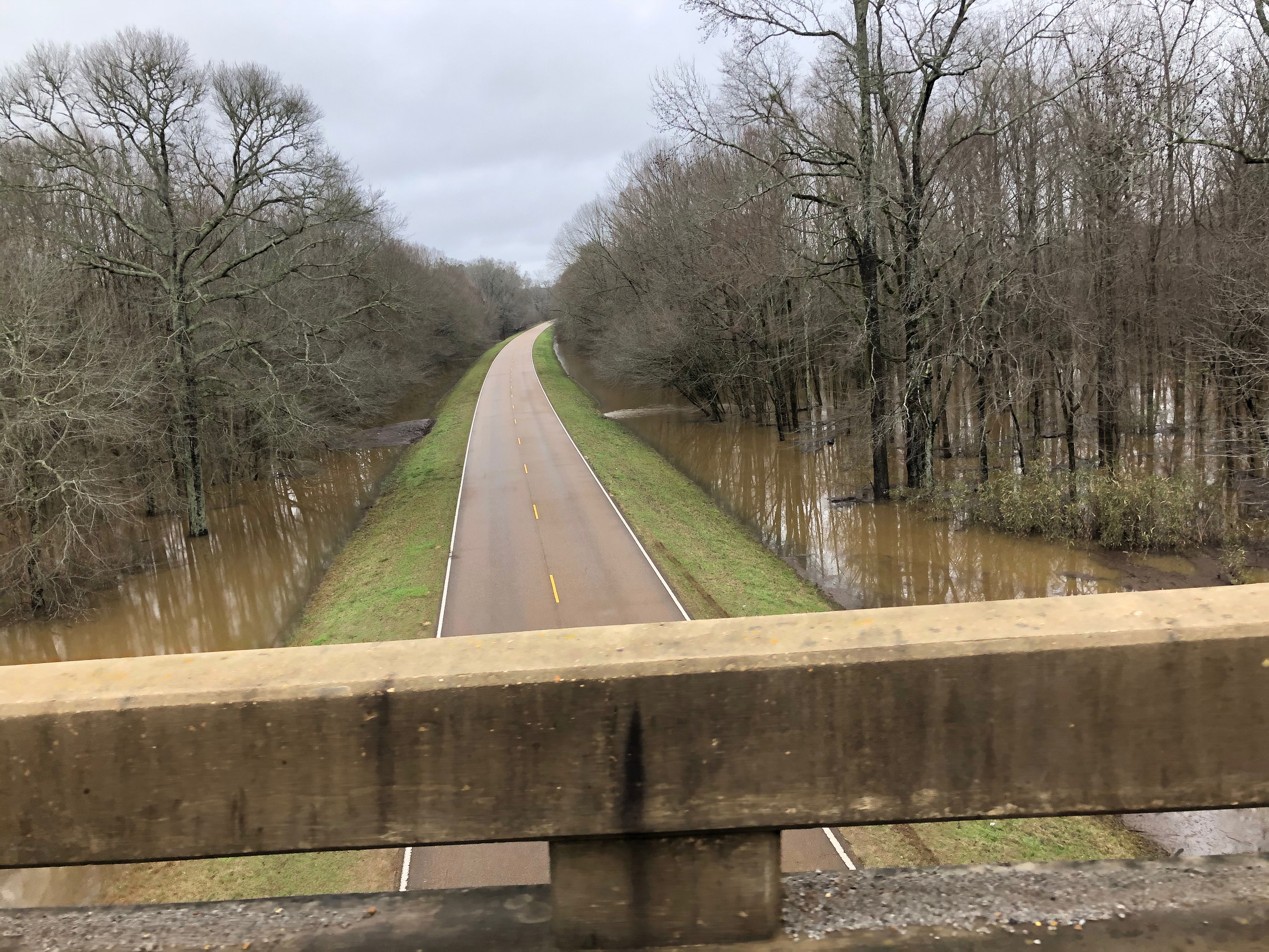


Flood warnings. 


Famous UA landmark 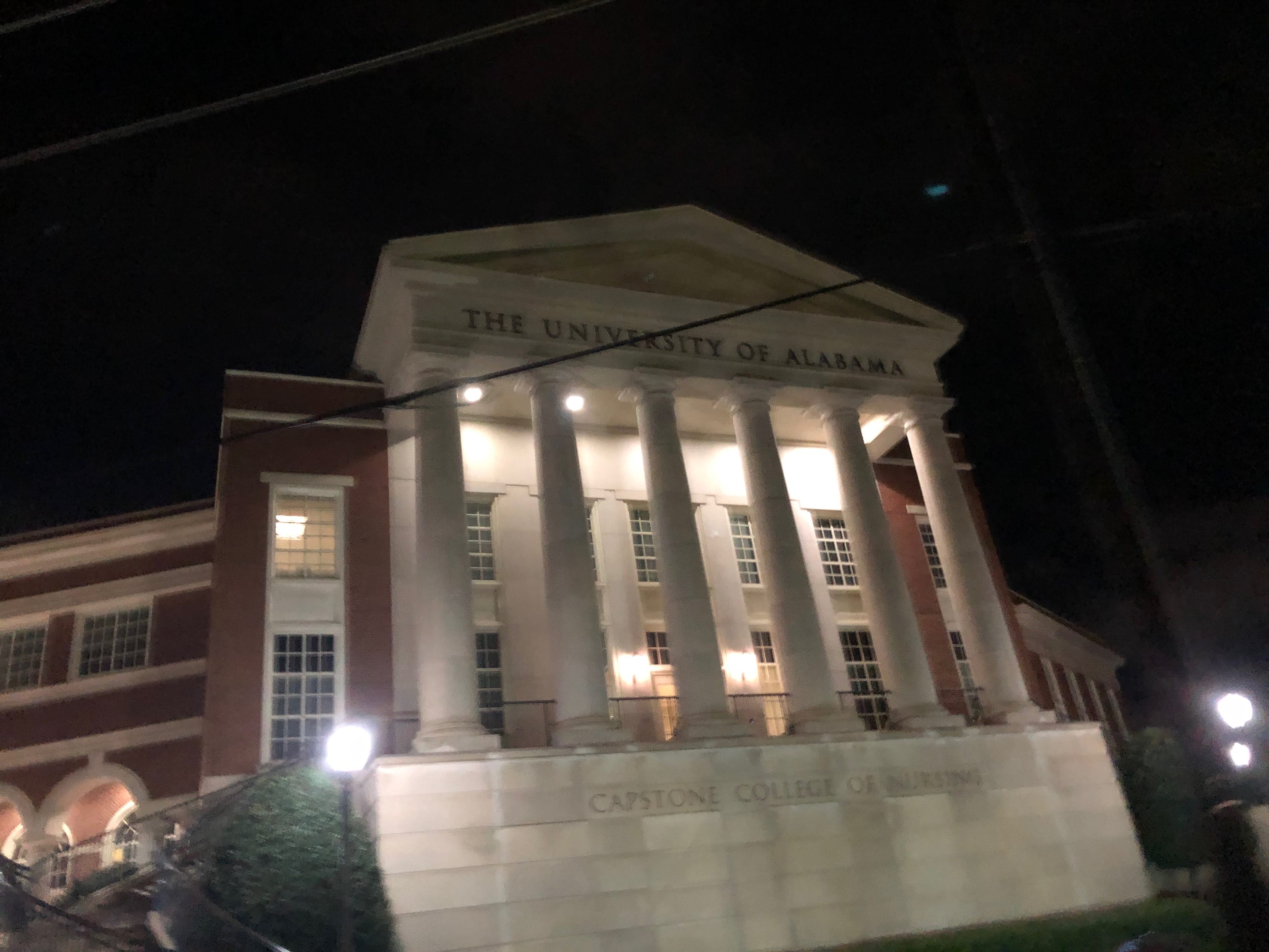
The University of Alabama 
Heavy fog about to become heavy rain in Vestavia
Leave a Reply