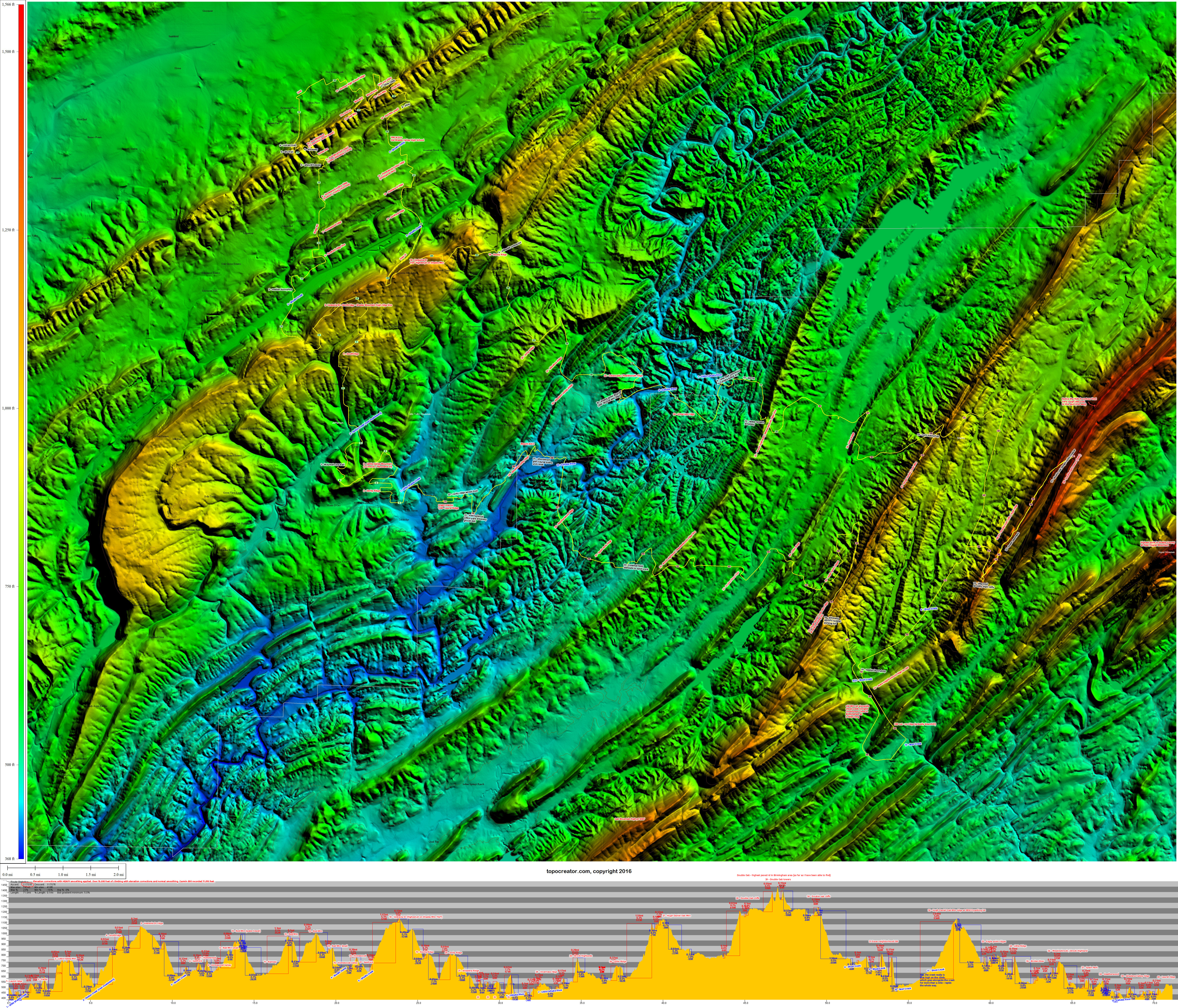
My favorite geological feature in Birmingham is the long ridge lines that run northeast/southwest marking the end of the Appalachian Mountain chain. A long time ago, I hypothesized that if you selected a northwest/southeast route, you would maximize your climbing by crossing all the ridge lines. I discovered over the years, though, that this is incorrect because you also have to cross all the valleys. To maximize your climbing in Birmingham, you have to pick a single ridge and find all the roads that criss-cross it on both sides. Still, those northwest/southeast routes have the most overlooks and the most variety because you are seeing different areas from different heights. Plus, it becomes a challenge to find the route that minimizes the distance across the valley to get to the next hill.
One day as I was riding on Dolly Ridge on my way back from riding out to Double Oak, I realized that there was a spot near the top where you can see all the ridges that you just crossed to get to double oak. It got me thinking about how many different ridges you can cross on one ride in Birmingham. I named that ride the “ridge-to-ridge” ride, and expanded it quickly to include all the ridges from Red Mountain on the southeast side of Birmingham to the Double Oak ridge lines at the edge of the Coosa River valley. The ride can be extended further to hit part of the Signal Mountain ridge line and several other ridges all the way to Flagpole Mountain on the other side of the Coosa River where you could then pick up the Sylacauga ridges and eventually make it to Georgia. That would be a nice 250+ mile round trip ride that I hope to do some day, especially if I could make it all the way over to the long Callaway Gardens / Woodbury ridge line which is such an interesting geological feature so far south in Georgia.
Perhaps what makes a ride like this the most interesting isn’t the 40 ridge crossings (numbered and labeled in red), but rather the 23 spots on the route (numbered and labeled black) that are non-traditional connectors between roads. These make for nice intermediate challenges (can you clear a section of trail without putting a foot down) on a long ride. I’ve also numbered and labeled the major creek and valley crossings in blue as well as a select number of locations around town in purple.
Here’s a gallery of photos selected from the 64 pics I took during the ride yesterday.
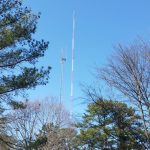
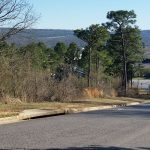
South Cove Dr climb at the beginning. Ridges visible to the southeast include Heatherwood, Inverness, Meadowbrook, Oak Mountain
Red Mountain TV and radio towers from Red Mountain small.
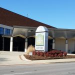
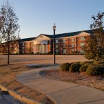
UAB performing arts center.
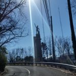
The Vulcan from the Warwick Dr climb.
The US Hwy 31 climb up Shades Mountain with the Vestavia Dr high pt and water tower visible left of center.
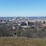
Downtown Birmingham from UAB (far left) to Sloss Furnace (far right) from Crest Rd on top of Red Mountain
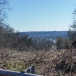
View from Vestavia Dr looking northeast towards the higher parts of Red Mountain extending up to Ruffner Mountain and beyond.
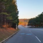
The Lee Branch 280 grade climbing up towards Ebsco / Highland lakes.
Signal mountain – highest point in Shelby County at 1566′
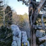
My bike propped at the edge of the double oak cliffs, viewed from between the broken parts of the lightning tree with the Double Oak towers barely visible in the background.
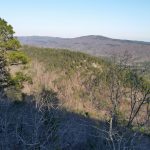
A new view of Signal Mountain just far enough to the right to get a peak at a section of either Bear Creek valley or Coosa Valley towards Pell City
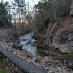
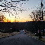
Shoal Creek alongside old 280.
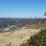
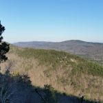
View looking northwest at several ridges – Little Ridge, Meadowbrook, Shades Mountain
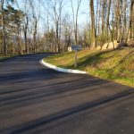
The new EBSCO way parking lot exit.
View from little ridge inside eagle point looking back at EBSCO / Hugh Daniel / Oak Mountain ridge line.
View from the Spain Park ridge looking back at the Meadowbrook ridge. The back entrance descent is next to the water tower.
Berry Middle School with the alpine glow.
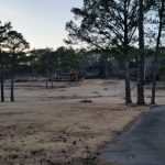
Abandoned AVCC golf course with the 18th and 9th hole climbs back towards the vandalized clubhouse. Super steep nearly 40% section right next to the parking lot.
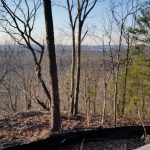
View looking towards Bluff Park with the corner of Little Valley Mountain (S Cove / Panorama) visible.
Finally, just how hilly is a ride like this, check out the iBike data!
 Ridge to ridge to ridge ride plus elevation profile – elevation data annotated, no satellite imagery. Click to enlarge. Depending on your browser, you may have to click a second time on the image to zoom in and see the detail.
 View from Vestavia Dr, the highest pt on Shades Mountain at 1167′. Ridges annotated north towards Birmingham. Click to enlarge.
 View from the Healthsouth Helicopter Hill with annotated ridges to the southeast – too low to see Double Oak beyond the Hugh Daniel ridge line. Click to enlarge.
 View from the double oak cliffs at the turnaround point. Annotated ridges beyond Chelsea. Click to enlarge.
 Ridge to ridge to ridge ride annotated with hires 2015 satellite data (USGS orthoimagery 1ft resolution). Click to enlarge and zoom. Red numbers are ridge crossings. Black numbers are non-car accessible points and trails. Blue numbers are creek and valley crossings. Purple unnumbered labels are other various points of interest. (Click to enlarge, depending on your browser you may have to click the loaded image to zoom)
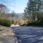

 iBike data for the ridge-to-ridge-to-ridge ride. Click to enlarge.
Leave a Reply