Tag: maps
-
2024 statistics and maps
I used to call this post my “season statistics” or “season summary” in reference to the cycling racing season. I would calculate all my statistics from December 1 of the prior year to November 30th of the current year. This was based on the Eddie Borysewicz cycling training book called “Bicycle Road Racing”, from which…
-
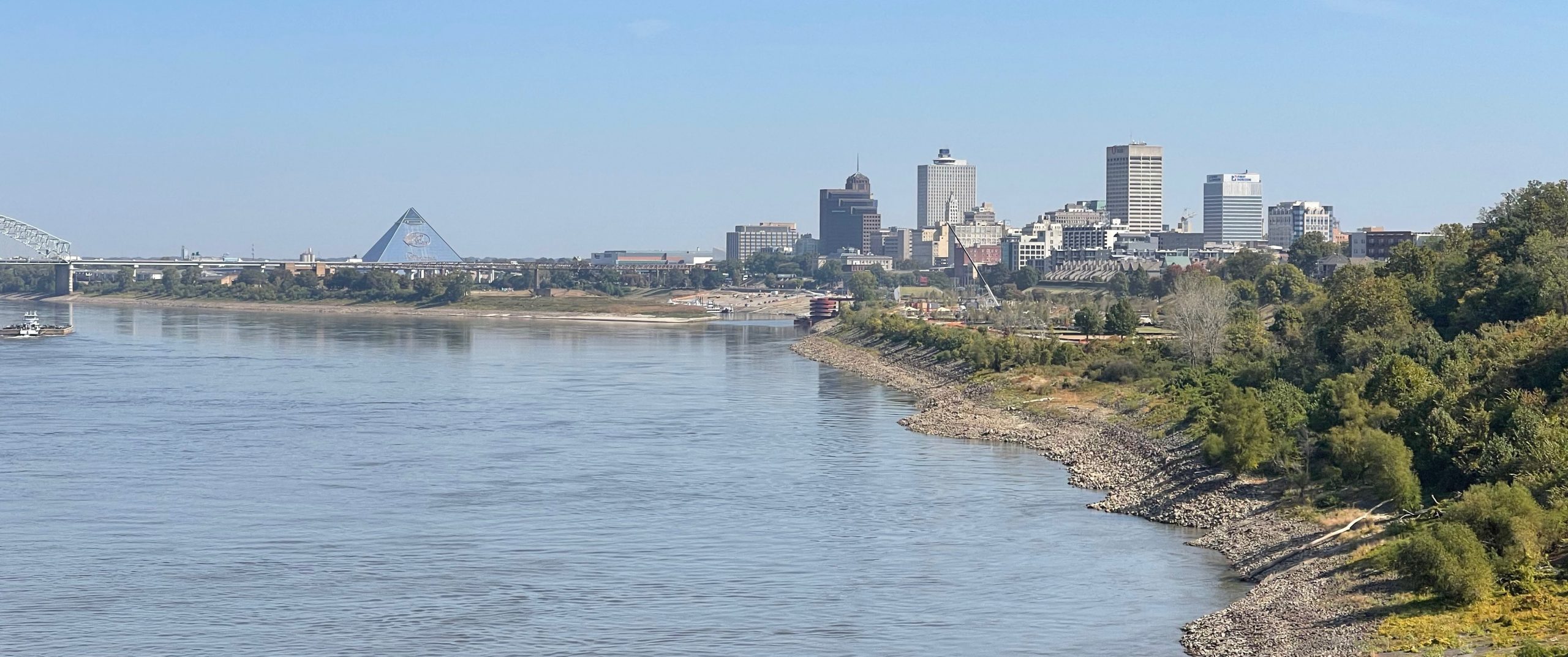
Six State Graceland 600k++
This ride started and ended in the land of the delta blues with a lot of delta blues in the middle, too — but no pouring rain. Instead, it was beautiful dry weather with a wind blowing pretty strong behind me as I headed north. Unfortunately, the wind did not die down much during the…
-
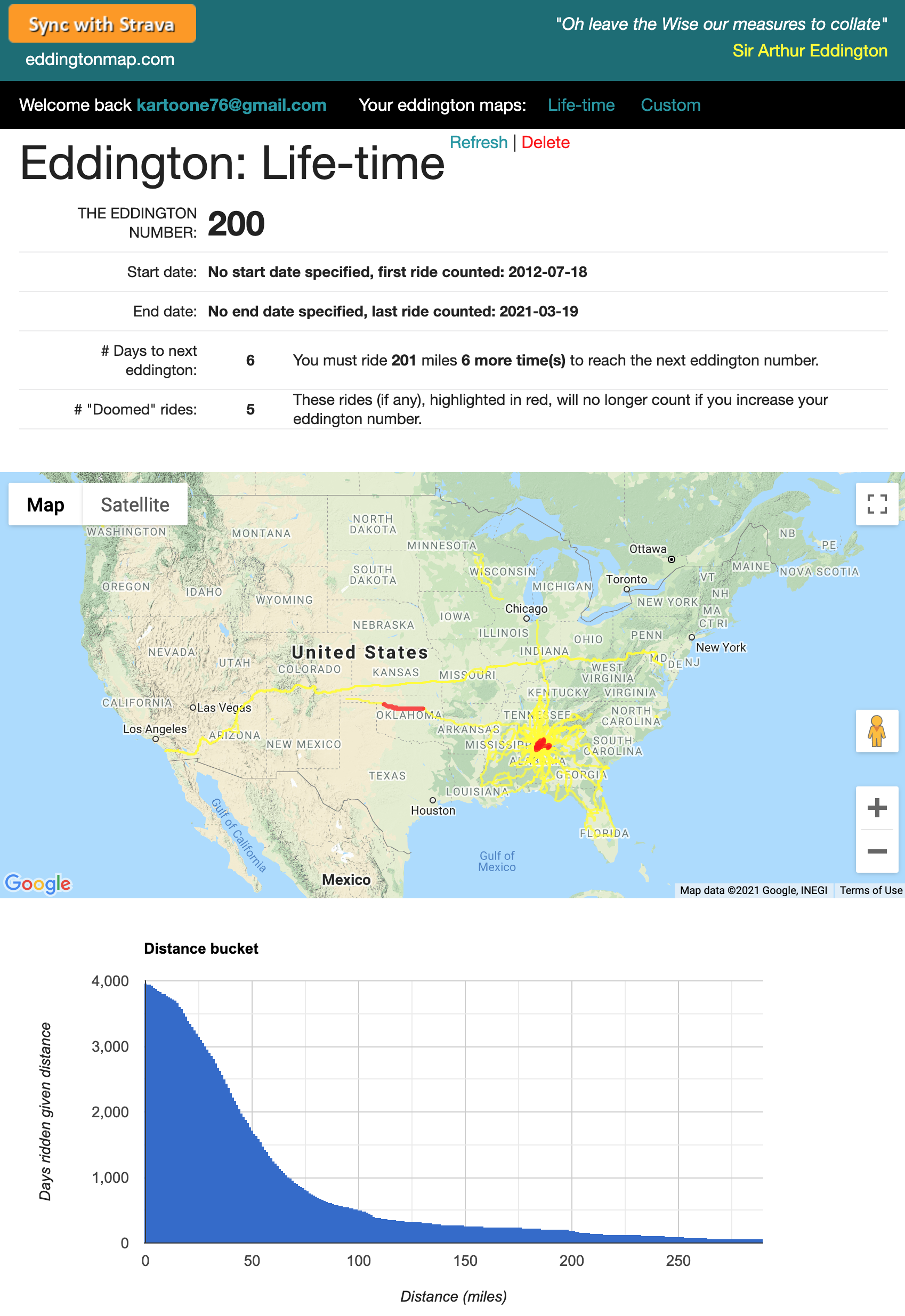
One to go, one to go, one to go!
UPDATE 3/20/21! After I started writing this blog, I hit lifetime eddington 200 today on my ride to the NICA race pre-ride, but when I first started writing the blog a couple weeks ago, I still had “one to go”. One of my most successful racing disciplines was criteriums. I could use strategy and positioning…
-
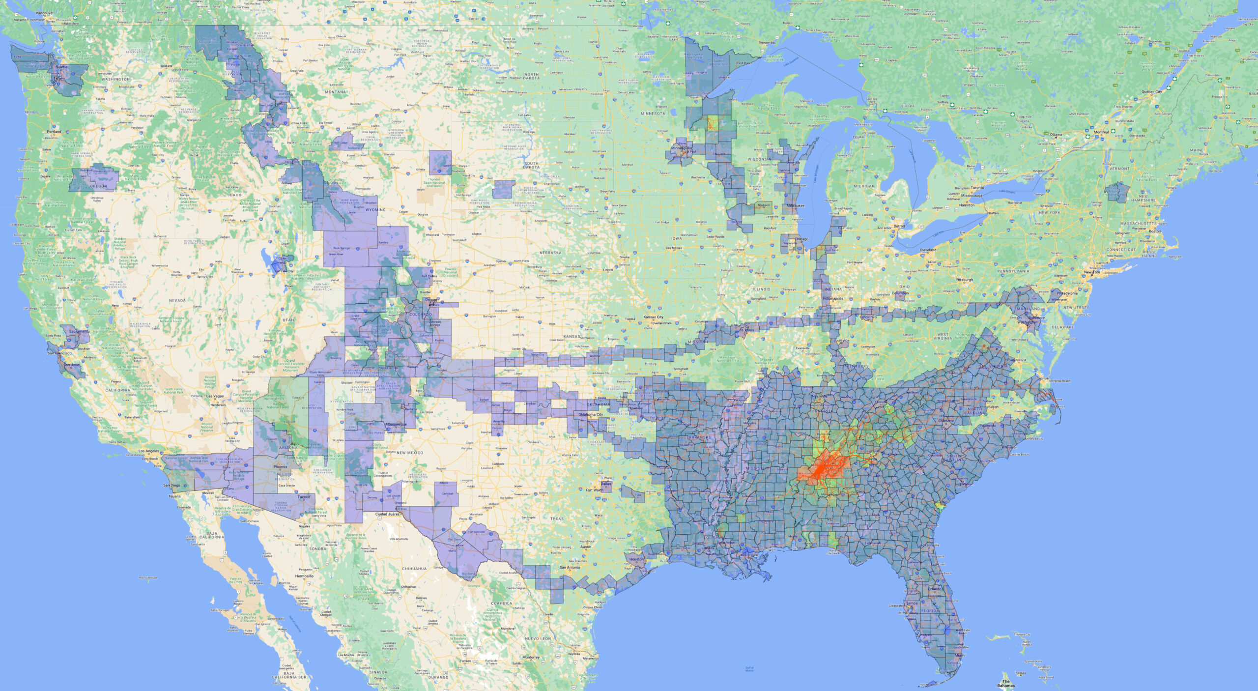
2016 Season Statistics – All of Alabama
https://www.youtube.com/watch?v=G07XcasQYLA 2016 Season StatisticsBeing able to participate in such a significant life-changing endeavor as the 2016 Ride4Gabe was certainly the highlight of my cycling year, and that led spontaneously to the establishment of a primary goal for 2016 – to ride in every county in Alabama in one year. I set this goal when I…
-
topocreator.com sand mountain
View this post on Instagram A post shared by Brian Toone (@kartoone76) View this post on Instagram A post shared by Brian Toone (@kartoone76) If you follow my instagram account, then you know that I’ve posted the picture of “The End of the Appalachians” sign several times. This sign is located in Tannehill State Park.…
-
Northwest Alabama and a tri-state commute home via the highest point in Mississippi
View this post on Instagram A post shared by Brian Toone (@kartoone76) “Ok, google. Where is the highest point in Mississippi?” I asked my phone as I pedaled into a nasty headwind on the Natchez Trace Parkway. I knew the answer was somewhere in Northeast Mississippi, but I wasn’t sure how close it was to…
-
Ridge to Ridge to Ridge
Ridge to ridge to ridge ride plus elevation profile – elevation data annotated, no satellite imagery. Click to enlarge. Depending on your browser, you may have to click a second time on the image to zoom in and see the detail. My favorite geological feature in Birmingham is the long ridge lines that run northeast/southwest…
-
Mountains and valleys in the Alabama snow
Snow showers visible from the top of Blount Mountain near the community of Straight Mountain, Alabama. For those that have done the Tour de Blue, this is the overlook that is used as a rest stop just past Walker Gap. During my Sleeping Giants adventure last week, I rode in shorts and a short sleeve…
-
Cherokee Rock Village
Every fall for the past 10 years, we have traveled to Clemson, South Carolina for fall break. Football game on Saturday (sometimes), long ride for me on either Sunday or Monday (or both), and drive back home on Tuesday usually after visiting local apple orchards in the mountains. My bike rides over fall break have…
-
2013 Season Maps
It’s funny to look at the “referrers” section of my stats as you can trace back to links that people clicked on in various blogs and forums. I will respond simply by saying that it is definitely a balancing act to find as much time as I do to ride, but I look at that…