I had made sure I had 24 hour access to the storage closet because I knew I would be leaving in the middle of the night. It felt a little strange to be tip-toeing through hardwood floors of the historic hotel at 2AM while carrying my bags I had taken off the bike a few hours earlier. Thankfully, both the ballroom area and the closet were indeed unlocked. So I put my bags on, wheeled the bike out the side door, attempted to water-bottle clean the bike to get rid of awful bottom bracket noise and re-lubed the chain. I knew ahead of time that nothing would be open so I had already resupplied at a gas station and grabbed an extra bottle of water specifically for cleaning the bike.

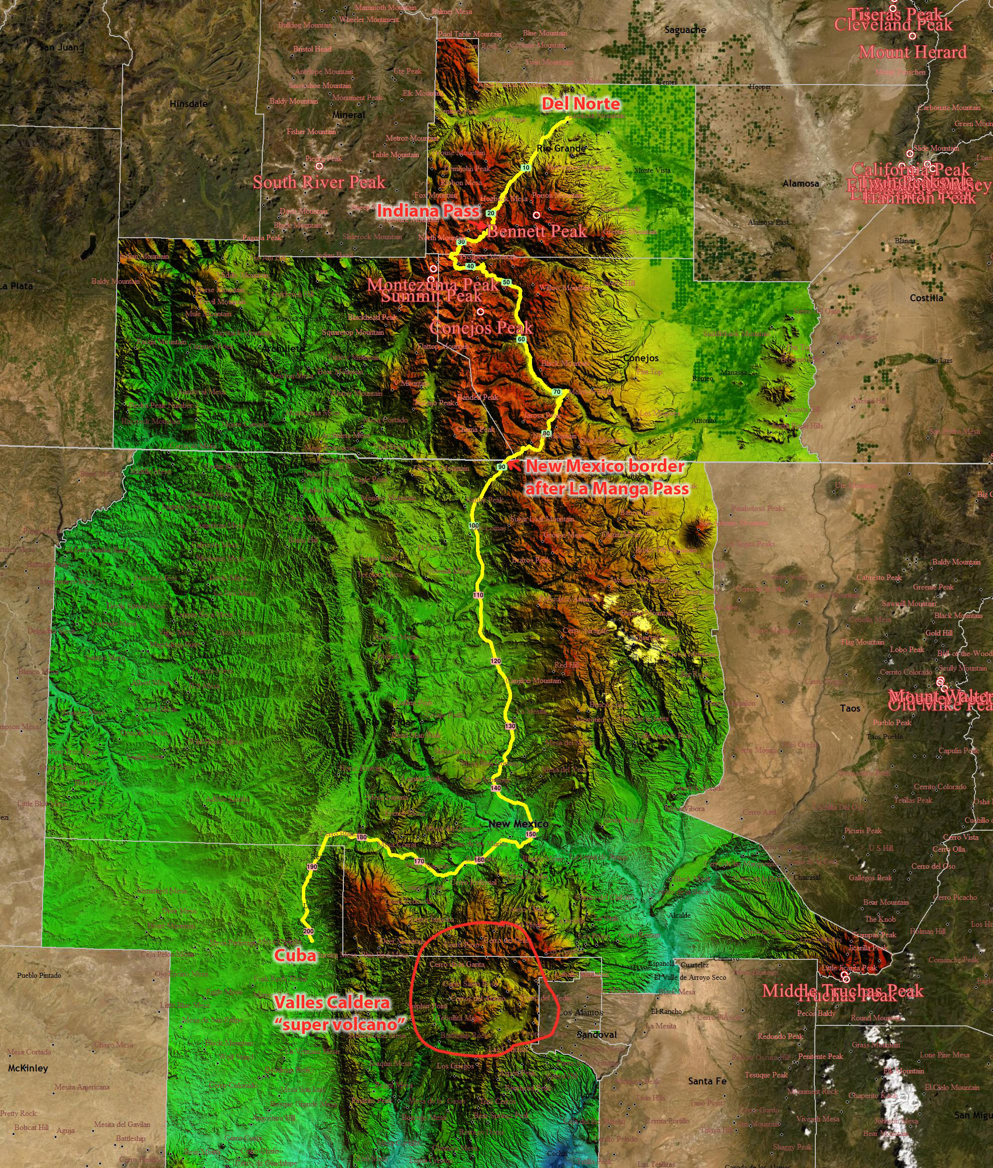
Leaving Del Norte, I started climbing immediately on a paved road that left town and got very dark very quickly. I was picturing a forest with occasional ranches, but looking at the street view pic above, it looks like it was wide open land. It felt so dark, and by the time I got any light at all I had climbed high enough to be back into the forest. So the memory implanted in my brain extrapolated those trees back down the mountain to what I had been riding through. Hilariously wrong.
Before any daylight, though, I had a couple new animal encounters – first was a tiny mouse scurrying across the road, and then shortly after that I heard a loud grunt right beside the gravel climb. I never saw what it was, but my first thought was a wild boar. I immediately turned on my helmet light and looked back in the direction of the sound to see if I needed to get bear spray out, but I didn’t see anything. So I turned my attention back to the steep, deep, washboarded gravel climb that was averaging about 10% with sections even steeper – but kept my helmet light on high setting as a last line of defense to blind any animal that might rush.


I knew that even though I was crawling up the climb, it was steep enough that I was gaining a lot of elevation fairly quickly. Eventually, it did start to get light and became a race to see if I could make it to a good spot to see the sunrise without it being blocked by a mountain off to the east. I did not make it to a good spot because there were several 13ers blocking the view. Plus, even on my climb there would be sections of tree cover also blocking the view.
Speaking of views, I did eventually make it to the top – and the views across the “top” were spectacular. I took a 6 minute video of the final climb to the top where you can see the spectacular “golden hour” lighting that I was enjoying. During the video, I run into the first snow I had seen on that mountain at nearly 12,000 feet and then commentate on the difference in snow levels I had seen as I made my way farther south. Also, towards the end of the video, you see a high mountain off in the distance very briefly – Bennett and Pintada mountains, a 13er and an almost 13er. The nearby peak with the tower is Grayback mountain and tops out at 12,600 feet – so only about 675 feet higher than my current elevation.
As indicated in the video above, the “top” had many large 600′ rollers as it made its way over to the superfund mining site and the abandoned buildings from the Summitville ghost town. The superfund area didn’t bother the elk. There were so many separate herds of elks. I startled a few herds near the road and saw others down in these lush green valleys grazing and looking up at me as I passed by. What I have discovered is that elk have a preset escape path even if it takes them practically on top of you instead of away from you. Thankfully, it was never too close but if I had happened to have my camera out at the exact moment I could have gotten some great close-ups of stampeding elk. Also, I got to witness them scramble up some incredibly steep slopes quite quickly and saw a few baby/young elk, too.


One of my favorite moments was running into a TD northbound dirt biker at the informational sign above. I needed to take some clothes off with it getting later in the day, and while I was stopped to do that he rolled down from the other way. He stopped, too, and we chatted about the route. It was amazing to me that he was literally riding to Canada, and I had just ridden from Canada more than 2,000 miles away from this spot. Also, the view of the iron-ore mountains was cool, too.
After the iron-ore mountains, the descent after one more steep “roller” dropped into the heavily touristed and washboarded Conejos River valley. I saw the Skyline Valley lodge and wondered if it would be worth dropping down into the lodge for quick resupply / coffee (I was sleepy). Yes, it was worth it because of the cool chalk-board “sign-in” for Tour Divide racers, but it was expensive! $3 cup of coffee and $4 clif bar, which I totally didn’t need – but ended up buying any way “just in case” – and paid wi-fi (I was going to upload some photos while I drank the coffee, but nope, not going to pay for wi-fi on top of those crazy prices). Fair enough, they are a long ways up the Conejos Valley which I still had to descend on some busy gravel heavily washboarded roads. Seeing as how it was also a Saturday morning, it was very busy which limited my “washboard navigation” options. It was rough and annoying after the upper part of the descent had been so nice and I had enjoyed many miles of beautiful vistas on good dirt/gravel roads across the “top” of Indiana pass.

I celebrated after finally reaching pavement knowing that the next 300+ miles were all going to be on pavement thanks to a mud re-route I had received a text notification about in the morning before leaving Del Norte. I didn’t realize, however, how busy and hot the roads would be as I lost nearly all shade, starting with a 5 mile STEEP 1600 foot climb up and over La Manga Pass to get to the New Mexico border near the top of the descent down into the town of Chama.


As noted in the captions in the pic above, when I reached Chama I found that they had been without water for TWO WEEKS! Porta-potties were setup at the gas station I resupplied at, and prior to that I had stopped at a Subway that was take-out only because somehow it was unsanitary to eat inside without running water. Still, trying to figure that one out.
After Chama, I tackled the 100 mile detour to Cuba mid-afternoon with temps soaring and a nearly 10 mile long “one way” resurfacing construction zone. I unfortunately had just missed “our turn” to go and ended up waiting 23 minutes in the hot sun not knowing that it was going to be that long and wondering how pissed people would be if I popped out of line into the shade and then came back in when it was our side’s turn to go. I was thinking rationally because of course no one would have cared. It was so hot. In the end, I should have just left and gone while the oncoming traffic was coming because there was a giant shoulder, and it took me so long that I had to fight oncoming traffic any way. I was pissed at myself to have waited so long and then have to ride against traffic any way. 23 minutes stationary in the sun with shade near by. Uggh. I couldn’t have known it was going to be that long, though.


Since this was a re-route, I hadn’t scoped out potential resupply options so spent a bit of time zooming and panning on Google Maps. The only thing I could find was one gas station about 20 miles into the 100 mile detour, but there was also another one a few miles after the one-way repaving construction zone ended. I ended up stopping at that gas station and then at the other one only 10 miles later. I also found a closed visitor center with outdoor water fountain AND hose at the dam across the massive reservoir I had been thinking of filtering water at, so I stopped there too. Also, having traveled so far south, the sun was setting closer to 8:30pm instead of 9:30pm. Temps cooled off quickly, and I made it to Cuba with two full bottles I hadn’t even touched, despite spending a lot of time worrying that I was going to run out of water and not have any place to filter.
Just before midnight, I rolled into Cuba, NM. Cuba is a small town, and I knew that the odds of the hotels having 24 hour check-in was low. So along the re-route I had called ahead and talked to the desk clerk at the Frontier Lodge and explained I wouldn’t be making it there until after midnight. She said that was no problem and could lock me key in a lockbox on the door if I went ahead and pre-paid with a credit card. I also had to explain this to a nice, friendly, chatty worker at the Speedway across the street as I resupplied. He was curious how I had managed to get a place at the lodge since it was after hours. I would end up talking to the same clerk just a few hours later after my very short sleep at the lodge, but more on that tomorrow…
Strava data and maps


Pickuta photo album
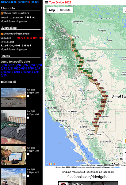
See even more pics from the entire race along with the exact time/location where each was taken on the tracking website I created called pickuta.com. If you are on a phone or small screen web browser, click the “hamburger” triple bar icon in the upper left to slide out the photos and turn on/off the tracking markers: https://pickuta.com/album/258
Leave a Reply