Tag: topocreator
-
Tour Divide 2022 plus home via Uvalde and Santa Fe
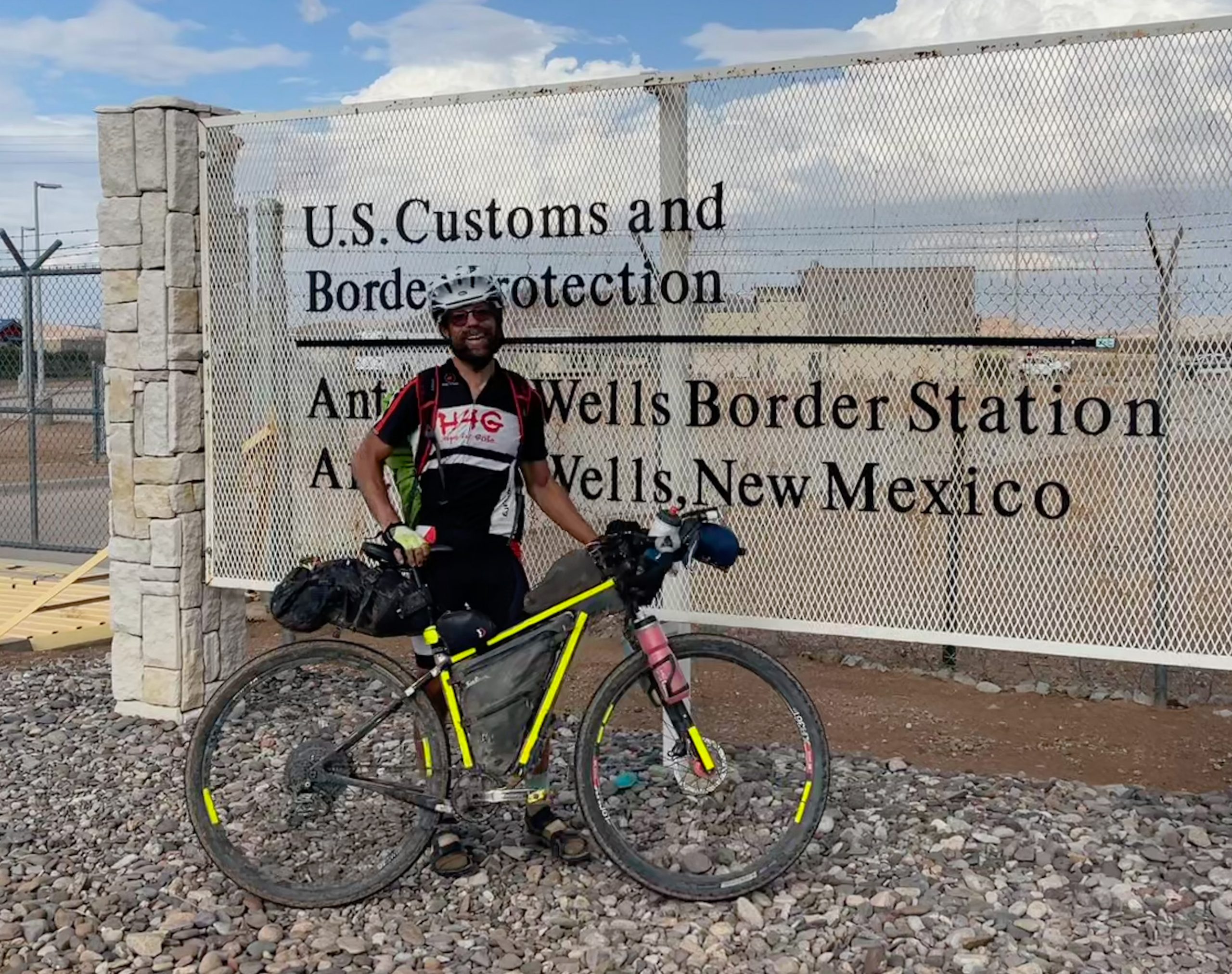
Let’s start out with a quick TLDR – my adventure totaled 4,077 miles with 2,715 miles of that being my 11th place finish (see pic above) in the 2022 Tour Divide southbound grand depart taking 18 days and 11 hours to complete over 16 rides. The remaining 1,362 miles included a 1,044 mile crossing of…
-
Southern-style Paris-Brest-Paris – there and back again
There and back again – topocreator county map showing my outbound route to Clemson in blue and my return route to Birmingham in red. 17 counties traversed on the outbound route, 18 counties traversed on the return route. Click to enlarge and see detail and annotations. I just finished reading the Lord of the Rings…
-
24 hour mountain bike nationals – data and details
My adventure out west to race 24 hour mountain bike nationals led to a 7th place finish and lots of lessons learned for next year’s Race Across America. Here is all my heartrate data and a map annotating the course as well as a general description of the course. The lap times on my heartrate…
-
Birmingham ridges, part ii
My bike at the Cahaba Beach road bridge. You have to hoist your bike over the barricade and carefully ride the planks to make it over to Cahaba Beach road. Watch out for the holes straight through to the river! A post about climbing the ridges in Birmingham wouldn’t be complete without my favorite ridges…
-
Birmingham ridges
After three weeks of traveling out west and enjoying some really amazing riding and sightseeing with the family, I have been enjoying a week of riding back in Birmingham. Today’s ride typifies the type of ridge riding that you can do here in Birmingham. I started out this ride with a loop on the side…
-
Lots of climbing stats
Today was quite a combination of rides — hitting a new personal record of shortest distance to 5,000′ of vertical gain on the way into work and then hitting 5,000′ ft again in less than 30 miles on the way home from work. Both rides were pretty slow with lots of weaving on the steep…
-
Rouge Roubaix heartrate data and topocreator maps
Two more things to add to this year’s Rouge Roubaix race report: annotated heartrate data and topocreator maps (2D and 3D). Check them out below! Heart rate zone summary Annotated heartrate/speed/power curve (click to enlarge) 2D annotated topocreator map of the entire rouge roubaix course (click to enlarge) … or click here to download ultra…
-
Southern Cross hi-res 2D and 3D topo maps
I don’t know why I never thought of making one of these before for the Southern Cross race course, but the topography is really cool and it certainly shows in the maps below … enjoy! Also, I noticed while doing the maps that the course enters 4 different counties. With a slight route change, it…
-
Southern Cross Weekend Wrap-up
Panoramic view from a grassy knoll just below the summit of Brasstown Bald – the highest point in Georgia at just under 4800′ Wrapping up a wonderful weekend of riding, racing, and climbing in the beautiful North Georgia mountains outside of Dahlonega that included the Southern Cross Ultracross race, I headed out for one last…
-
Maps from Cheaha
I forgot to post the maps I made for the weekend of riding … if you are curious about the topography of the entire area, then download the super hires ultra resolution (20MB) map of my Cheaha ride (the last map). Three days, just under 300 miles of riding Read my ride recaps and see…