 There and back again – topocreator county map showing my outbound route to Clemson in blue and my return route to Birmingham in red. 17 counties traversed on the outbound route, 18 counties traversed on the return route. Click to enlarge and see detail and annotations.
I just finished reading the Lord of the Rings trilogy for the umpteenth time [1] as I write this blog. Frodo’s comments on Bilbo’s poem at the beginning of the series pretty much sums up my cycling adventures:
He used often to say there was only one road; that it was like a great river: its springs were at every doorstep, and every path was its tributary. “It’s a dangerous business, Frodo, going out of your door,” he used to say. “You step onto the road, and if you don’t keep your feet, there is no knowing where you might be swept off to.”
Bilbo’s poem itself captures some of the essence of my adventures as well:
The Road goes ever on and on
Down from the door where it began.
Now far ahead the Road has gone,
And I must follow, if I can,
Pursuing it with eager feet,
Until it joins some larger way
Where many paths and errands meet.
And whither then? I cannot say.
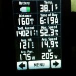
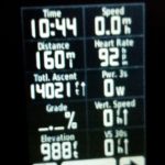
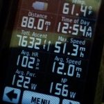
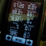
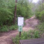
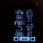
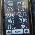
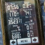
I was close to finishing the series (40 more pages of the Return of the King) before leaving out my door on Friday for a 756 mile adventure to Clemson and back hitting the highest points in Alabama and Georgia on the way there and the highest point in Alabama again on the way back. I arrived back home through the same door just under 71 hours later. That’s over 1200km (the distance of the Paris-Brest-Paris randonneuring event held once every four years in France) in under the time cut-off of 90 hours for PBP. Along the way, I climbed nearly 60,000 feet of my favorite terrain – hills, hills, and more hills.
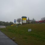
Disney World and Mount Cheaha
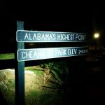
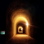
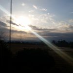
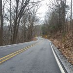
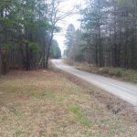
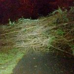
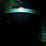
I dropped Kristine and the kids off for their adventure down to Disney World on Friday afternoon after driving down to Alabaster in Friday-before-spring-break rush hour traffic. Two hours later, I made it back home and took off with my friend Michael Staley to ride up and over Cheaha together. We left Birmingham around sunset and made it to Cheaha just past midnight. Michael had brought a portable sleeping hammock so he decided to call it a night at the end of 281. I continued on wanting to hit the Alabama, Georgia, AND South Carolina state high points in a single ride and still make it to Clemson for my hotel reservation Saturday night. I was wide awake and ready to continue but running low on battery for my lights, so I rode without a light at all for many, many miles on beautifully paved Hwy 78 through Heflin and then even after turning onto a county road, the full moon was bright enough to see any obstacles in the road (of which there were very few). I saw two cars the entire time, and both of them came up from behind me so they could see my reflective clothing and blinking taillight. It wasn’t until I crossed over into Georgia, and the pavement went downhill pretty quickly that I turned my front light back on. I had to keep it on for the section of the Silver Comet that I rode from Rockmart to Dallas, which is quite dark and tricky at night. The big tunnel outside of Braswell was cool, although I was hoping for pitch black and spooky – instead it was very well lit.
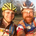
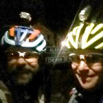
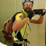
 Michael Staley and I leaving my house in Birmingham and about 5 hours later on top of Mount Cheaha.
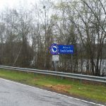
Georgia
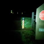
By morning I had made it to the Kennesaw area northwest of Atlanta. Unfortunately, there was a lot of Saturday morning traffic from Kennesaw all the way until I hit 9 to head north to Dawsonville. Traffic died down a bit there, but was still busy. I’m sure there were better routes, but I was trying to find a somewhat direct route and ended up on quite busy roads. I noticed one of the segments on Strava was called “Try not to get hit”. The stretch from Dawsonville to Dahlonega was pretty much deserted, which surprised me as I thought that would be pretty busy, too. And, I was running so far behind and with the weather and rain moving in, the stretch of US-19 and GA-60 from Dahlonega up to the top of Woody’s Gap was quieter than when I rode it after Southern Cross a few weeks ago. I had my first extended stop 254 miles into the ride at the Dahlonega Dunkin Donuts, where I ate a bunch and charged up all my devices using wall chargers. I met Adam Heiser from Atlanta who had driven up with his team to train in the mountains. That’s what so cool about Dahlonega – it is a true cycling destination – people come from all over to train and ride. Although, I’d like to think I’m the first person who has ever ridden there from Birmingham on a single ride!
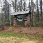
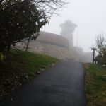
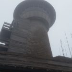
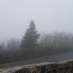
Brasstown Bald – the highest point in Georgia
It was getting dark and quite cool in the high mountain valley between Woody’s Gap and Hogpen Gap so I had to put on my long sleeve rain vest to keep warm. But by the time I made it to the valley at the foot of Brasstown, it had gotten quite warm again and I had to stop and take off all the extra clothes. The temp dropped as I rode up into the clouds and rain so that it was down into the 40s by the top. I made it to the top about 15 minutes too soon, as the park rangers were in the process of leaving. They were still there, though, and they told me I couldn’t ride my bike to the top so I took off hiking up to the top (1k up and 1k back down) in my speedplay cleats. They were gone by the time I made it back down. I’ve ridden to the top of Brasstown many times, but always in weird off hours when the park is deserted and there are no park rangers up there. I understand their concern as it is against the rules, and it is a dangerous climb when the shuttle busses are running because of how steep and sharp that first switchback is, but when everything is deserted and there aren’t any shuttle busses, I don’t see what the problem is all about. Rules are rules, I guess, and some people don’t understand that there is a purpose behind every rule and when conditions invalidate the purpose for the rule, the rule itself should not be enforced. Still, since the park ranger said the park was closed, I was grateful he let me in at all so I could hike to the top. Although I don’t really understand the concept of closing or restricting access to public lands.
Clemson
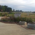
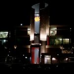
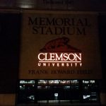
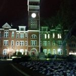
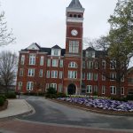
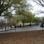
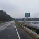
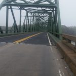
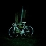
I took the Owl Creek cutoff from the Jack’s Gap descent to make my way over to US-76. Descending down out of the rain, it got warm and eventually sunny as I hit the climbs on US-76 back up to the Appalachian Trail. The sun was setting right about the time I crossed the trail itself, and more clouds were moving in. By the time I made it to Clayton, it was dark and drizzling and 8PM on a Saturday night. I was dreading two things at this point – the super long climb up to Highlands, North Carolina and then close to 50 miles on a very windy, dangerous stretch of US-64 at night in the rain and fog. This was more than enough for me to decide to cut off the northward chunk of the ride that would take me through North Carolina and then back down to the South Carolina high point – Sassafras Mountain. I was disappointed and relieved at the same time. I was happy that I was going to make it into Clemson at a more decent hour and actually get some sleep before having to set out on my return trip. I was also happy to ride some roads I had never ridden before in the Long Creek area. There was one killer climb with a sustained 15% section that was at least half a mile long, straight as an arrow. If I wasn’t so tired and sleepy at that point, I would have for sure turned around and done the descent and hit well over 50mph. As it was, though, I was falling asleep having been up at this point for more than 40 hours from 6:30AM on Friday morning until 11:30PM on Saturday night. I still had 30 miles to ride, but I hit some roads that have tons of memories from when I was a student at Clemson, which helped wake me up as I rolled in around 12:30 and eventually to the hotel by about 1AM after taking pictures around campus. Checking into the hotel was awesome – especially filling out the part with make, model, and license plate of car! 🙂
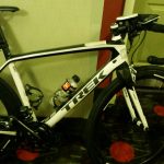
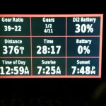
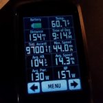
At this point, I was planning on instagramming some of the pics I had been taking and then using the hotel computer to upload my ride to strava. But I fell asleep holding my phone after showering and didn’t wake up for four or five hours later. At which point, I said forget it and just slept for another three hours getting up about 8:30AM eastern time, 7:30 central time (which is the timezone my body stayed on the entire ride). Thankfully, I had plugged in a number of my devices into wall chargers, but I still needed to charge my lights so I did that during breakfast and while I uploaded my ride to strava from the hotel computer. I had brought my Di2 charger with me, knowing that my Di2 battery wouldn’t last the full 750 miles with the D-fly attachment which drains the battery fast. But I hadn’t connected it right and it only charged back up to 50% by the time I left. This barely got me back to Atlanta the next day, where I thought I would have to spend the night but thankfully I got it charged during an extended stop at Starbucks at the Vinings exit on 285.
The return trip home
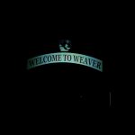
I was expecting rain on the way back, and the weather didn’t disappoint. Fortunately, I made it almost all the way to Gainesville, Georgia (90ish miles into the ride back) before it started to rain. Then it rained pretty much all the way down to Atlanta where it had stopped by the north side of town. The sun came out a bit right as it was sunsetting. Then it was dark and I followed a lot of cool greenways to make it to the Starbucks in Vinings which I had been thinking about for the past 130 miles on the way there. I had two of their new Spicy Chorizo breakfast sandwiches, a venti caramel macchiato, and a venti coffee. I needed to charge both my garmins, my Di2, and my lights. I stayed there for close to an hour and a half getting caught up on instagram pics and waiting for things to charge. Then I took off hitting the Silver Comet and riding it and the Chief Ladiga trail for the next 96 miles to Weaver, Alabama. This was fun, but I would definitely like to experience it again when it isn’t full of huge puddles, debris, and very dark.
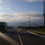
I made it to Weaver by about 5 in the morning about an hour and a half before sunrise when my last light died. So I crossed 431 and headed to the gate and was stopped by a nice soldier, who I told I was trying to make it to the Anniston bypass. He said I needed to head one gate farther down, so I turned around and took 431 south for a mile or so to the next gate which is unmanned and rode through Fort McClellan with no light until I remembered I still had a little bit of charge on one of my battery packs. I plugged it into my light and that gave me about 10 minutes of riding until it died too just as I made it to the Anniston bypass. The new section of the bypass is open now, and it is heavily used even before 5:30 in the morning [2].
 Weaving up cheaha – not ashamed – brings back memories of when we used to do the cheaha challenge with an 11×23 cassette.
Traffic dropped to pretty much zero as soon as I crossed I-20 and hit the friendship road climb up to the parkway. I made it to Cheaha mid-morning and weaved my way up the entire climb (see pic above). I was pretty exhausted by this point but I wasn’t the least bit sleepy. Another issue at this point was saddle sores. Because of all the rain, I had some pretty nasty saddle sores and raw areas even applying lots of the Vitamin A&D ointment at every extended stop. I should have taken one of the men’s adult diapers. I had thought about it, and regretted it for about 12 hours from the middle of Georgia until home. Plus, they don’t sell small versions of those things – you have to buy a 12 pack or larger so I was stubbornly not going to buy any since I only needed one. Oh well, I’m still paying for it several days after the ride.
Both my Garmins were about dead by the time I made it to Talladega, so I ran into the Walmart and bought a FOURTH powerbank that was precharged so I didn’t have to wait for devices to charge before heading back to Birmingham. Still, I ran out of charge on my Garmin 800 by Chelsea after draining the powerbank charging up my phone and Garmin 1000 too much (it charged quickly). So I had to stop AGAIN and charge my Garmin 800 in an electric outlet on the back of a gas station. I would have charged at the Chelsea sonic which has been an oasis for many of an adventure but I couldn’t find any electric outlets at all so I kept on riding until I got to a gas station where I found one.
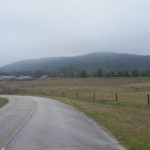
Double Oak
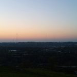
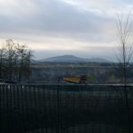
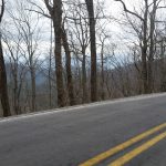
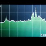
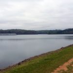
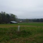
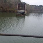
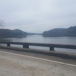
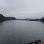
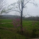
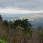
The last big challenge of the ride was convincing myself to do the Double Oak climb. If I had been able to climb Sassafras on the ride on the way to Clemson, there is absolutely no way I would have done the 7 mile detour and 1000 foot climb to the top of double oak from chelsea. I would have ridden as straight home as possible, but given that I missed Sassafras I wanted to at least put double oak on the elevation profile for comparison with the other big climbs on the ride. I was running an 11×32 cassette with a 39 small chainring so I could just spin up the climb and weave up the steeper parts. I was in no hurry as my family was all in Disney World and I just needed to get back eventually so I just took my time. By this time it was quite hot and I was getting sunburned. It was amazing to me that I could experience dry cold, wet cold, wet hot, and dry hot all on the same ride. That puts the scope of the ride into perspective for me. The other thing that puts it into perspective is this view below looking off the double oak cliffs back in the direction from which I had come from Clemson … about 250 miles as the crow flies, 360 miles as the bike rides far, far, far, far beyond the horizon.
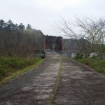
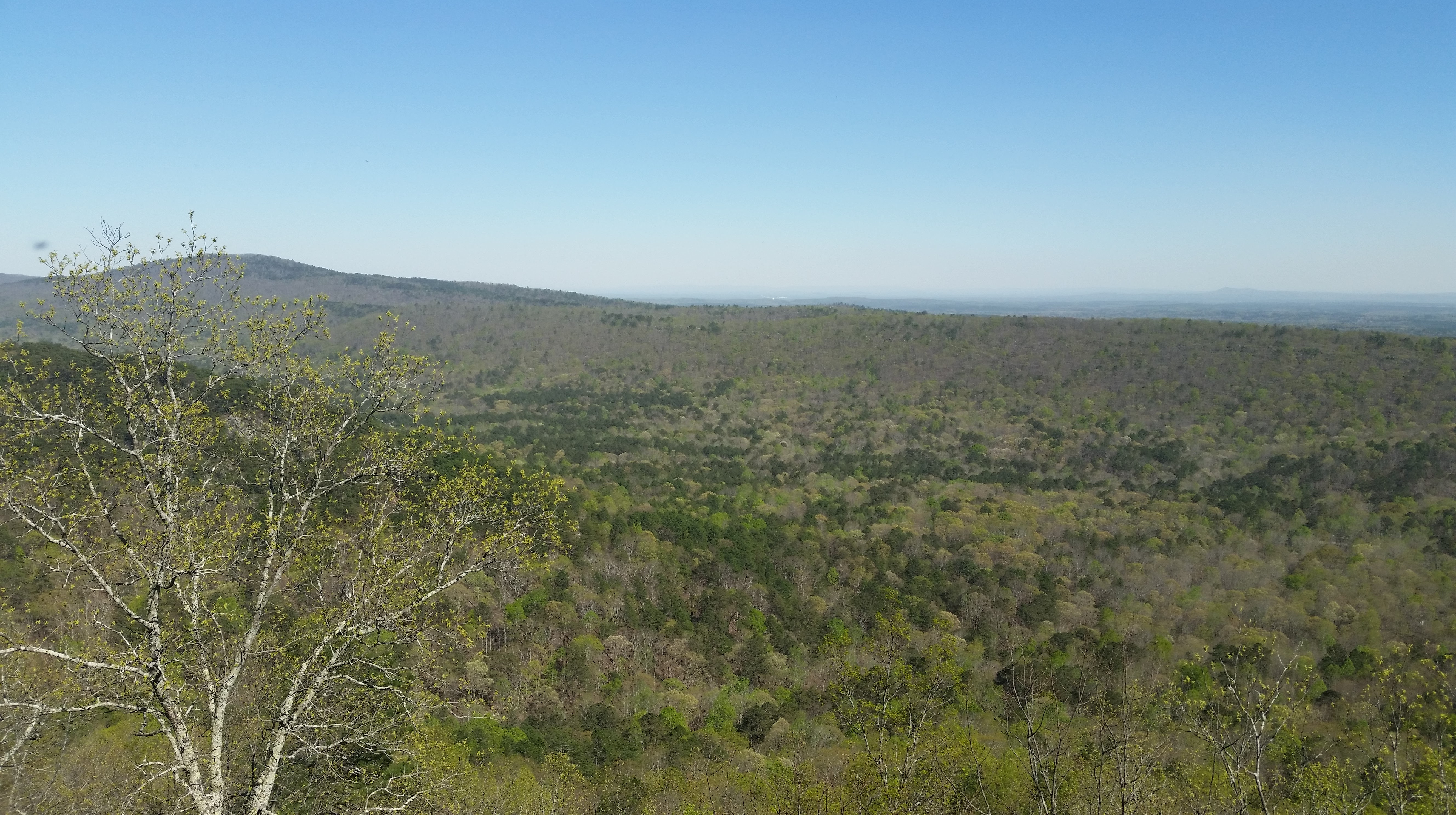 View looking back in the general direction of Clemson beyond Signal Mountain – far beyond the horizon visible in this pic.
I took 285 pictures during the ride, and I’m currently working on a way to display them all on my interactive topocreator maps. In the meantime, check out a selection of the pics separated into two galleries – “there” and “back again”. Also, I have lots of data and analysis to post and lots of comparisons to RAAM that I want to comment on, but I will save that for another post. Thanks for reading!
“There” – Hoover, Alabama to Clemson, South Carolina


“Back again” – Clemson, South Carolina to Hoover, Alabama


[1] The way it works, the only time I read for fun is when we put up the Christmas tree each December. Then I enjoy reading by the light of the Christmas tree at night after every one has gone to bed, or in the morning before everyone else has woken up. But then once I start reading, I can’t stop until I finish the entire series. It’s usually a race to see if I can finish the series before we take down the Christmas tree sometime in February or March. The Christmas tree won this year, as we took it down several weeks ago while I was still in the second book. return
[2] It was ridiculous the number of cars and trucks that passed me, but thankfully there was a wide shoulder where I could pick and choose a path through lots of rocks and debris.return
Leave a Reply