This was my favorite day of the race. It started out cold with the lowest temps of the race with my Garmin bottoming out at 19 degF. But just 12 hours later, my Garmin would top out at 109 degF on the pavement climbing up from the Colorado River while getting swarmed by mosquitoes. In between was all kinds of awesome.
Leaving Brush Lodge
The four of us set out at about the same time at 4am – although I was a few minutes later than everyone else due to my last minute repacking of everything. It was cold, but I was prepared as shown in the pic at the top of the post. FOUR hand warmers wedged between the sandal straps and my thick expedition socks. My feet did not get cold. I also knew that we were starting out climbing so I didn’t overdress. This worked out well as I was able to catch up to Steve pretty quick, and we rode together through the “Hippie Village” – a large collection of all kinds of VW buses and campers and other kinds of cars for long term camping spread out in a few lots. In the first one, there were a few people up already with a large campfire (by this point on the climb it was still before 6am).
After the hippie village we ran across Theo and Zoé, who had stopped for a break and to admire the amazing alpine glow in the valley and hillsides right as the sun was rising. I wanted to keep moving and pressed on with Steve where the double track started climbing quite steeply. There was a steep pitch with a log that I recognized I wouldn’t be able to ride so I got off and hike-a-biked over it. While climbing over the tree, I got some pine mulch or dirt or something down into my sandal. Plus, my hand warmers fell out of my sandals while hiking, so I had to readjust them. I decided right then and there that I was done with hike-a-bike. So from that point to the top, I rode up some pretty ridiculous gradients with lots of logs and rocks to navigate. I kept waiting to mess something up and having to dab, but I am pretty sure I was able to clear the entire rest of the climb.
The descent on the far side was quite rocky. It wasn’t technical, but it was rough. It required some careful navigation down as I was trying to be gentle on the bike and take the smoothest possible lines. I kept thinking that the three others would pass me because of how slow I was going, but they never did. The Captain’s Cove view at the bottom was fantastic, and the course had turned onto nice wide gravel as it continued to descend at a gradual rate down into the Steamboat Springs valley for many miles. I saw two different groups of road riders and it almost looked like one group was part of a race or training race, but it was a Tuesday morning so I thought that was unlikely. Still, it was nice to see so many riders.
Bike paths!
Not too long before Steamboat and after climbing a pretty good hill, the course merged onto a busy road that finished descending straight down into Steamboat. At the first traffic light, I saw a gas station so I went ahead and did my resupply there hoping that the bike shop would be opening at 9am since it was only 830am. The gas station was VERY busy, but they were super efficient at the checkout counter and I was out the door in just a few minutes. I followed the course through town and onto the main bike path that takes you right by the Orange Peel bike shop. I could tell it was closed, but I rode up there anyway to see if they opened at 9am … but unfortunately, they weren’t opening until 10am. There was no way I was going to wait, even though I half wanted to go ahead and replace my chain as preventative maintenance after having gone through so much peanut butter mud and snow and rain over the first week of the race.
I had not eaten any food from my resupply because I was hoping to do that while they worked on my bike at the bike shop. So I decided to go ahead and eat for a few minutes, and during that time Zoé and Steve rode up. Steve mentioned that there was another store on the other side of the building, so I followed him over there and sure enough there was an adventure ski shop that also had some bike supplies. I had been desperately looking for wet lube since the dry lube I had brought wouldn’t last very long in the rain and snow. I knew we were still in for a lot more rain so I was able to buy some wet lube as well as another bottle of dry lube since I was almost out from having to reapply it so often.
After that, I took off on the bike paths heading out of town. I got passed by a few road riders, and our route appeared to follow a very popular road biking route right up to the point where it turned to gravel – at which point it looked like it was a popular hiking/mountain biking trail. It started out as rolling doubletrack climbing up to a reservoir, but turned into singletrack when the route took a left turn across the dam for the reservoir. This singletrack was fast and easy to ride, but it lacked any kind of shade so it got hot very quickly. I stopped at the only shade I could find – a vault toilet at a boat ramp for the reservoir – to take a break and put on suntan lotion.
The singletrack continued on around the reservoir, but our route went up a paved road that eventually turned back into a gravel road with lots of mountain homes scattered around. The gravel road continued climbing for about 25 miles to the top of Lynx Pass. There was one wider water crossing that I stopped to take my socks off to avoid getting them wet. There was a couple logging trucks on the next narrow section that rolled a bit before divebombing down to the Colorado River. Thankfully, the steep section of the descent didn’t have logging trucks … they probably could not have made it up the climb. I felt bad for a few northbounders I saw towards the bottom knowing how long I had been descending, which meant they would be climbing forever in the heat.
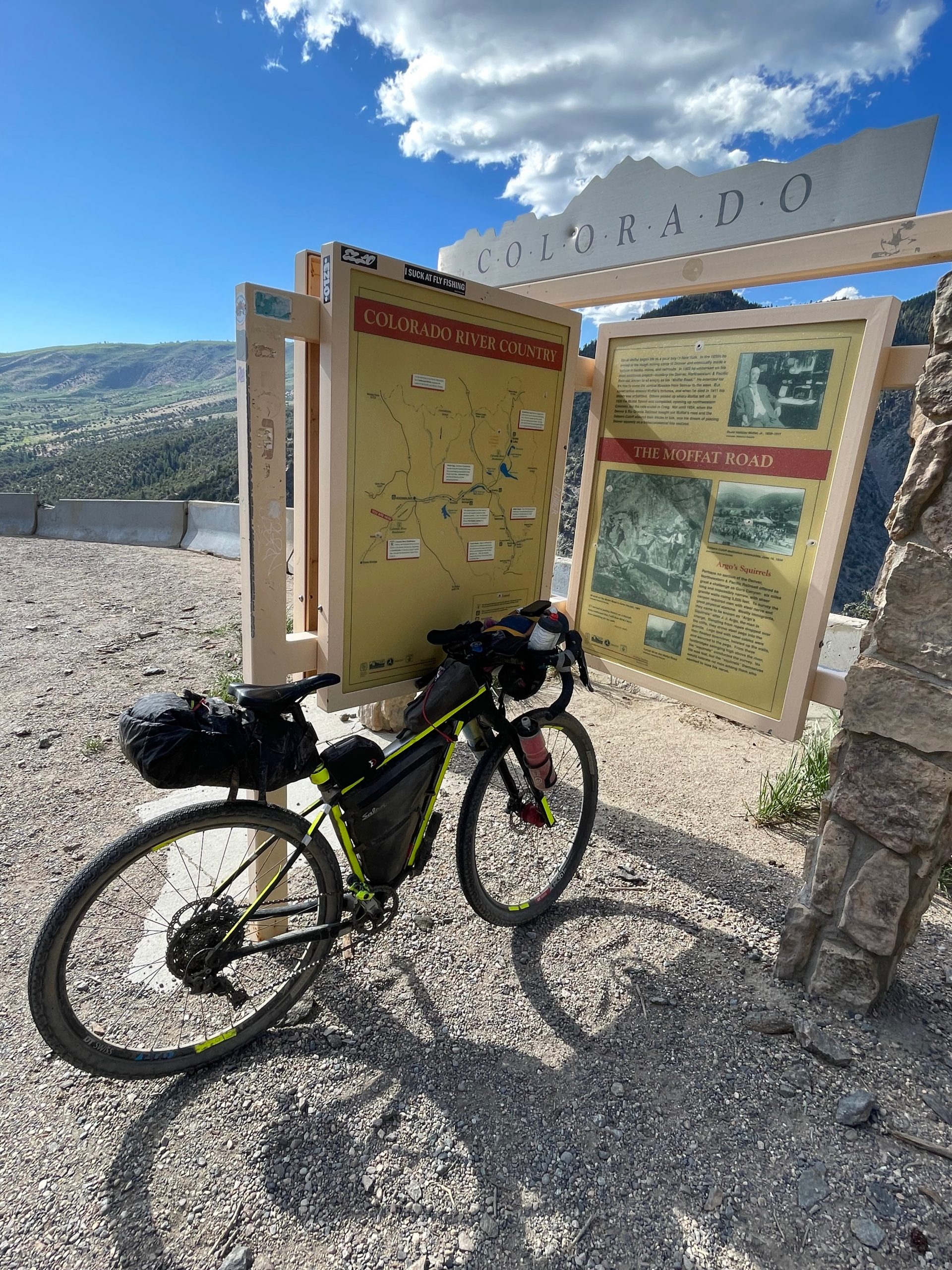
The Colorado River was quite busy with rafting groups. Unfortunately, the place where the rafting busses parked only had a vault toilet and no running water. I found shade alongside the river to drink my own water and try to cool off. I knew from my Garmin that I would be climbing up out of the river soon. What I didn’t know was that after the first 3.5 mile climb and dropping all the way back down to river level, I would then need to do another steeper 4.5 mile climb before dropping down into Kremmling. I also didn’t know that this particular area had mosquitos that could keep up with you if you dropped anywhere below 10mph. Even across the top of some of the climbs I was still getting bit. On the climbs themselves, it was one handed swatting the whole way up.
Route Intersection
Kremmling was significant because I knew I would be crossing my 2,000 mile route riding from Alabama to Durango last summer. Furthermore, I would be stopping at the same gas station I stopped at last summer. The problem with Kremmling, though, is that it’s about 5 miles off course. At the bridge across the Colorado River, which is the turn to go off course to get to Kremmling, there was a CDT hiker resting. I was wondering if they were debating about detouring to get to Kremmling or not. This was the only CDT hiker I saw the entire trip. I offered him some food/water when I got back from my resupply as he was still in the same spot, but he turned me down.
The gas station in Kremmling (and all the roads leading to it) were quite busy. It was a much needed resupply and chance to cool off out of the sun which was starting to get much lower in the sky. I was looking forward to the next stretch as Ridewithgps showed that the next section to Silverthorne was all paved. Unfortunately, that was wrong as I was on dirt roads for quite a while, all the way past the giant reservoir, which I hit just before sunset. The alpine glow on mountains and clouds on the climb after the reservoir was fantastic. The climb continued up for many miles until it got dark. The dirt switched to pavement shortly before reaching the main mining area. There was very little traffic.
Eventually, I did hit the top of the pass, which I assumed would drop me all the way down into Silverthorne, where I had already made a reservation at the Hotel Indigo using my IHG points while riding. I was really looking forward to that hotel, which is probably what made the 10 mile climb after the pass seem that much longer. I had assumed I would just roll into Silverthorne, but it was in fact a gradual 10 mile climb that was on a fairly busy highway until it finally picked up the bike path. The bike path itself, though, continued to climb all the way into town. It was great to play some Pokémon Go with cellphone reception rolling into the hotel shortly before midnight.
And so ended my favorite day of the race … climbing long before sunrise in sub-freezing temps to start the day and finishing by climbing some more on bike paths through town playing Pokémon Go … and every kind of riding imaginable in between – technical singletrack/doubletrack, gravel roads, dirt roads, paved roads, and bike paths – long climbs, short climbs, long descents, short descents, creek crossings and crossing the Colorado River three times (on bridges). The next day would be great, too, but more on that tomorrow!


Maps and data


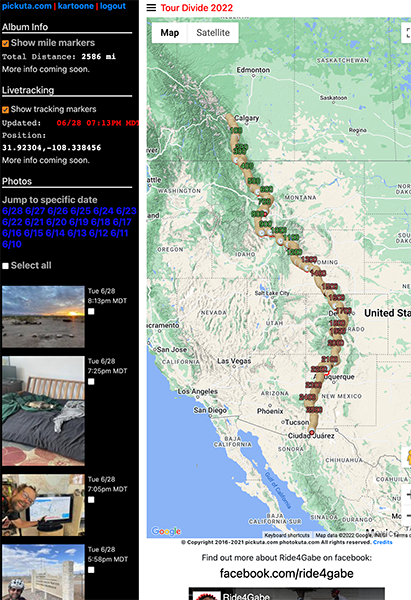
Pickuta photo album
See even more pics from the entire race along with the exact time/location where each was taken on the tracking website I created called pickuta.com. If you are on a phone or small screen web browser, click the “hamburger” triple bar icon in the upper left to slide out the photos and turn on/off the tracking markers: https://pickuta.com/album/258
Leave a Reply