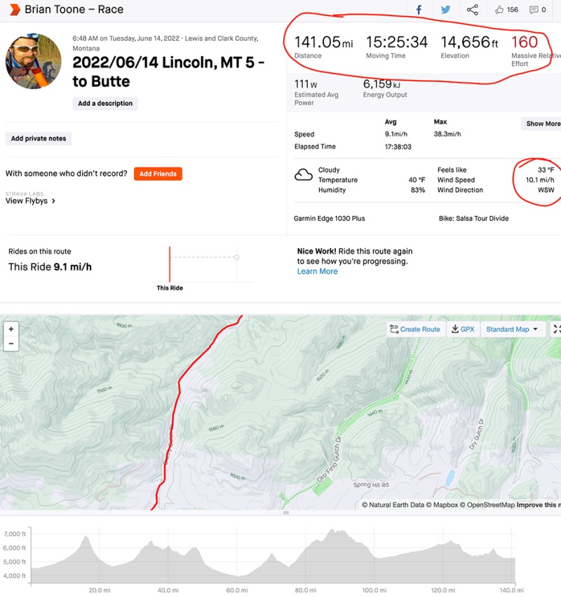
This day had it all – the most climbing per mile of the entire race with three passes and four big climbs, the most technical single-track, the most traffic of the entire race, the strongest winds of the entire race (knocking me off my bike once) and knocking over trees uncomfortably close to me, finishing off with that wind as a headwind into Butte for many washboarded miles along a frontage road next to I-15 followed by a steep technical, confusing, night-time, single-track descent down into Butte.
Leaving Lincoln, it started out cold with rain from the winter storm that was dumping snow in the passes a hundred miles behind me. Pavement turned to gravel by the start of the first climb with the wind picking up, too. Thankfully it was mostly a tailwind blowing up the climb (Stemple Pass), which I realized when I noticed I was getting hot while the temps were heading the wrong way – eventually bottoming out at 34 degF. I had to unzip my jacket and jersey, and I was feeling phenomenal climbing up some pretty steep grades that would have been much harder without that tailwind. Super fun, fast descent on the other side before making a couple turns and starting a more gradual climb up Empire Creek still peppered with steep sections.
At the very top of the climb up Empire Creek, the clouds were dropping a few flurries and there was a light dusting of snow. Also, at the very top, I caught up to Zoé Chauderlot for the first time. This solved the mystery I had been wondering about through all the snow. There were so many footprints left of the tire tracks through the snow, but there were only one or two sets to the right of the tire tracks, including a smaller set of footprints that I kept seeing, which I’m assuming were hers but I kept forgetting to ask her about it. Still, I was super thankful for her footprints (or whomever those belonged to) as I desperately needed footprints that I could step into without having to create new postholes in the snow with my sandals. And I quickly discovered that I am not coordinated enough to push my heavy bike while standing on the left and simply opted to walk through the tire tracks themselves and push the bike through postholes when I couldn’t find a set of footprints to the right. This was quite inefficient, but getting snow in my sandals was NOT an option for miles of hike-a-bike.
It was a short meeting, though, because Zoé dropped me quickly on the descent which was another fast and fun descent, but a bit shorter before climbing up to Priest Pass. After Priest Pass, the route changed direction straight into a massive headwind. I noticed that whenever the route turned slightly back uphill, the wind would follow it. And then as soon as the route turned downhill, it was back into a massive headwind. The video below is after I stopped from being knocked over.
The wind blowing back up Priest Pass as I descended was strong enough to force me into my easiest gear in a couple places and knocked me over once. How that happens: if your wheel is turned even just a little bit to one side, a strong gust will push it even farther to the side, and then if an even bigger gust hits before you correct it, you will now be sideways with so much surface area from the giant frame bag, seat bag, top tube bags, you are going to be stopping or falling over. I opted to stop, stand and then gently lay my bike down instead of fighting the wind… Keep in mind this is the descent that I’m pedaling down in my easiest gear!
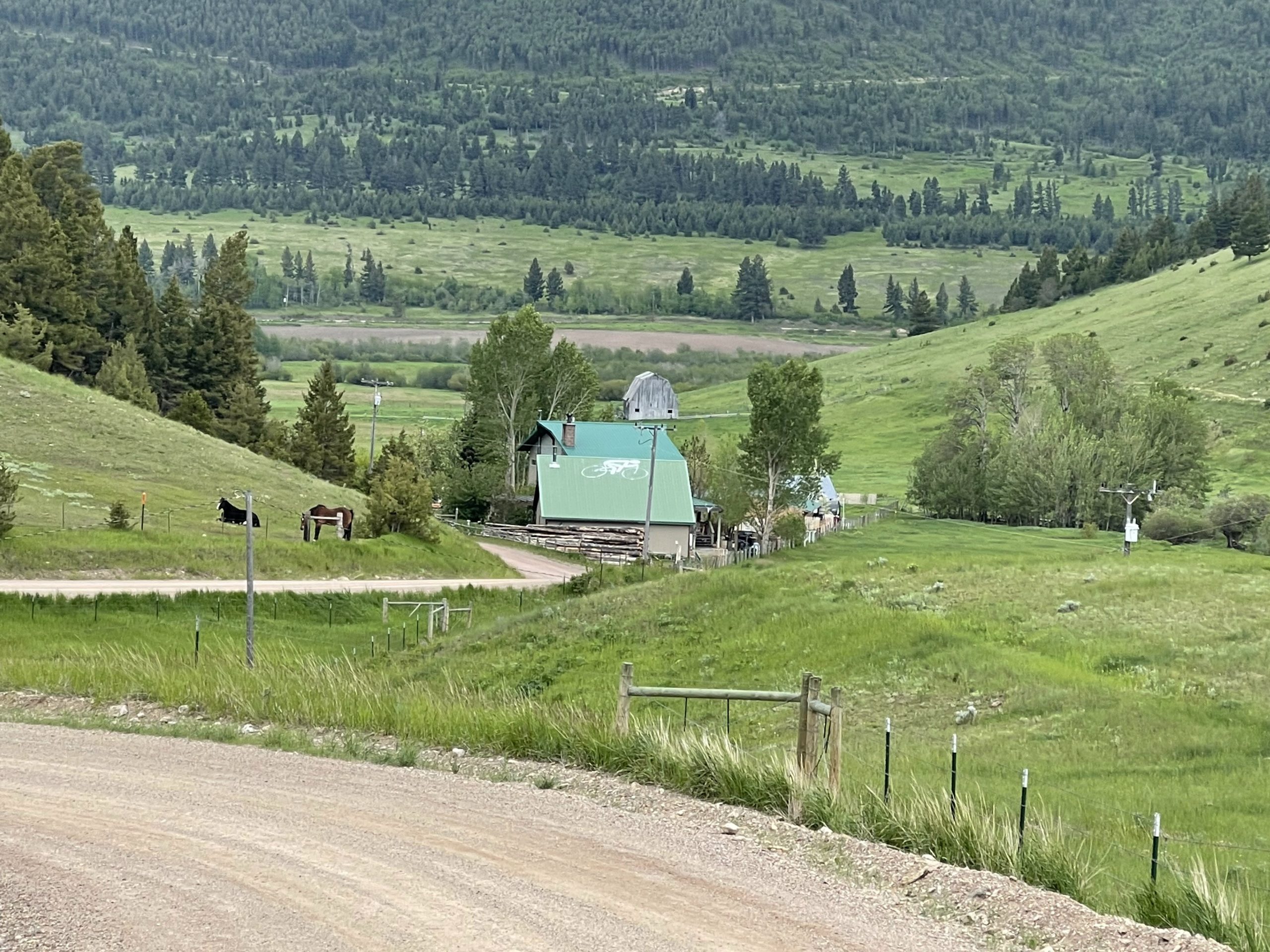
This windy section dropped down past the “llama ranch” which is a bikepacking friendly free hostel that I hit at about 10 in the morning, which seemed to be the time I hit all the free places to stay. Not too long after the llama ranch was a wagon full of free water and cookies for TD racers and a turn onto a very busy US Hwy 287, which is sentimental to me b/c my memories of life are tied up and intertwined with roads and routes and places, and US Hwy 287 was the US highway I drove for many miles through Texas on one of my summer cross country drives from UC Davis in California to Mercy Ships in East Texas.
And the fact that I was hitting US Hwy 287, which I associated with New Mexico (Hwy 87 leaving Raton and eventually merging with Hwy 287) and Texas, meant that I could just keep on going and end up in Texas which makes the entire country feel smaller which was a great mental boost in the race one thousand miles away in Helena, Montana. But by this point in the race, I really had no idea where I was, which probably magnified the effect of seeing a familiar road.
At the moment, though, I knew that the highway just got really, really busy. I wasn’t sure if it was Butte or Helena until I made it farther into the city center. But first, I stopped at a gas station and had to “hide” my bike from the wind next to a picnic table that was sheltered by shrubs planted specifically to block the wind. Otherwise, it was for sure going to get blown over. After resupply at the gas station, I scarfed down something quick because it had gotten cold again in that wind without the effort of moving.
I could see Zoé up ahead at one of the traffic lights and caught up to her right as she turned left off course. I was wondering where she was going and couldn’t hear what she shouted back to me. I kept on going, enjoying a bit of Pokémon go, before very quickly leaving the city center and getting quite rural quite fast in terms of distance, but a slow hour long grind on the bike from downtown you could live fairly high up on a dirt road in the Helena National Forest. I was enjoying this whole section with not much wind, but it got cold on the climb and I had to put clothes back on.
Part of the reason it got cold, is that the route turned back a bit into the wind which seemed to be stronger the higher and higher I got. By the “top” (it rolled quite a bit), the route left the dirt road in favor of some crazy ATV trails that were very much like parts of the TNGA/Pinhoti trail requiring tree navigation, mud avoidance, and some hike-a-bike up particularly steep sections. Each time there would be an intersection, I was hoping it would be to a larger dirt road, but most of the time it was just another single/doubletrack entrance. I was happy to be able to ride some of the more technical bits, which was positive because the wind was starting to get quite bothersome with how loud the trees were groaning and even snapping with one tree sounding like a gunshot when it snapped and me watching another tree fall right next to the trail.
“Top” of the Lava Mountain ATV double track area. There was a lot of technical climbing to get to this point, and a lot of technical descending afterwards. I was able to ride some, but had to hike-a-bike quite a bit. One large tree fell right next to the trail as I was watching, and another tree snapped so loud it sounded like a gunshot. This video gives you an idea of how strong the wind was blowing … I’d say 20-30mph steady with gusts approaching 40-50mph, similar to earlier in the day but much scarier when you are riding narrow double track over newly fallen trees from the wind!
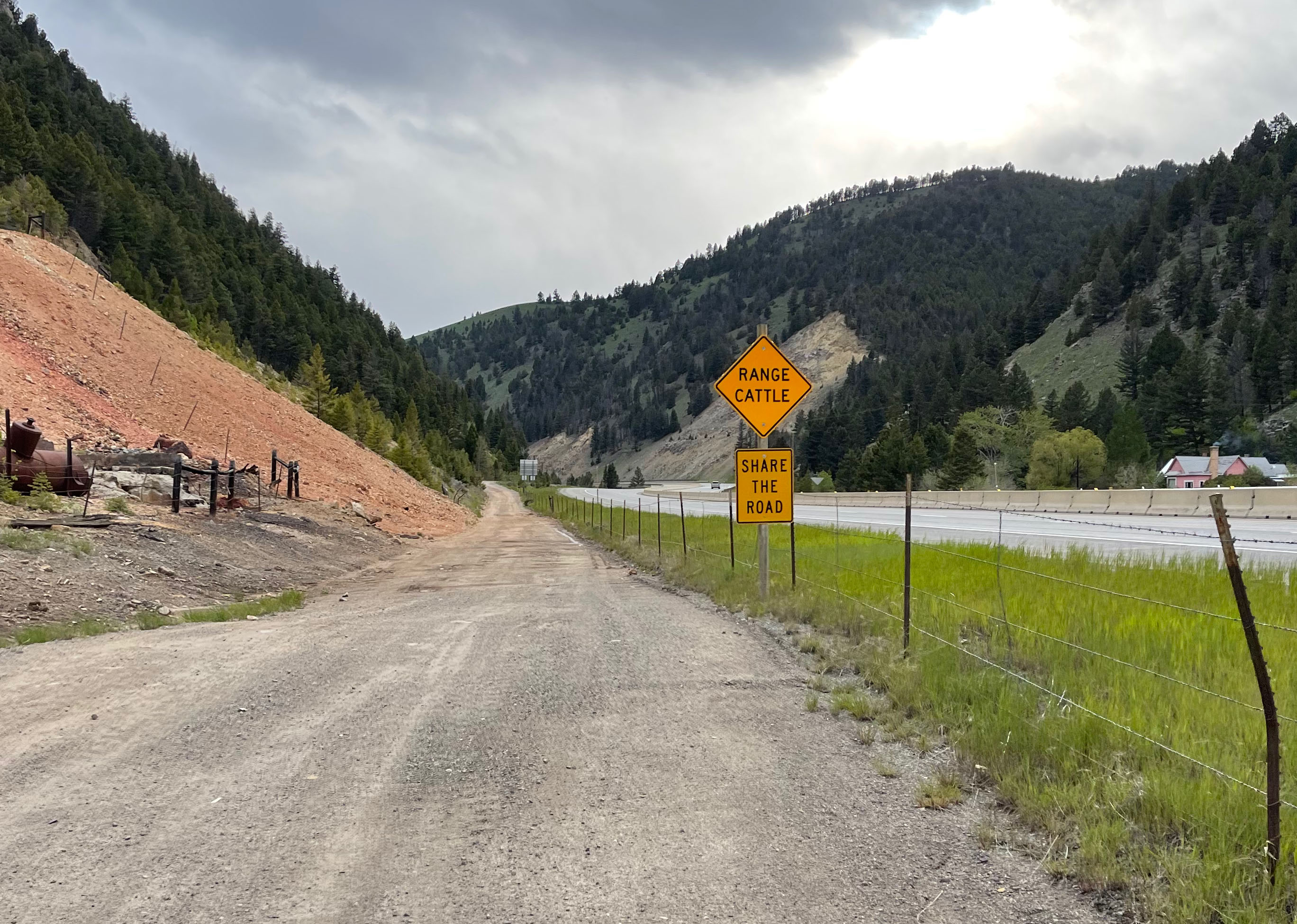
Eventually, I did hit a more established dirt road descent taking me down to and across and then alongside I-15 for many washboarded miles where I saw a “Share the Road” sign for range cattle (not cyclists). I didn’t see any cattle, though, and instead just a lot of washboard straight into the ridiculous headwind funneling through the narrow canyon that also housed I-15 right next to me.
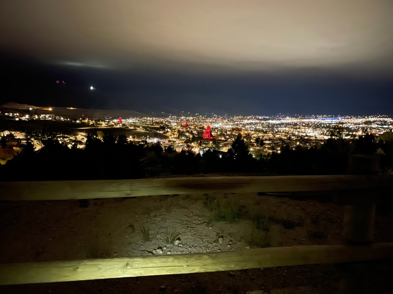
I knew that Butte was coming up next, but the endless headwind and climb (even after leaving the washboard and hitting pavement) made it seem forever. It was almost midnight by the time I made it to the overlook pictured below next to a whole group of cars / teenagers playing loud music and enjoying the evening. I must have been a sight to see. They cheered me on as I left out the back of the parking lot literally off the side of the mountain on some steep switchback singletrack descent. It was a confusing set of trails all the way down exiting through a parking lot and then re-entering trails again hopping a sidewalk. It was hard to navigate and ride at the same time.
Eventually, after a few wrong turns, I made it through all the singletrack down into Butte. I bypassed some city center motels, one of which had their “No Vacancy” sign out. I was hoping to find one near a gas station. What I didn’t realize was how ridiculously expensive those hotels would be next to the interstate! And also, the gas station I stopped at happened to be at shift change during which they closed the checkout counter for 15 minutes. Trying to optimize my time, I thought I would go check in at the hotel. Upon finding out the price, I then thought I would try to find another hotel and gas station or food somewhere. But the taco bell and mcdonald’s drive-thru were both packed, and I ended up back at the same gas station/hotel for the night. It was 12:30am by this point on a Tuesday night, and I just couldn’t get over how busy this whole area was.
It was a frustrating end to what was otherwise a great day.


Maps and data


Pickuta photo album
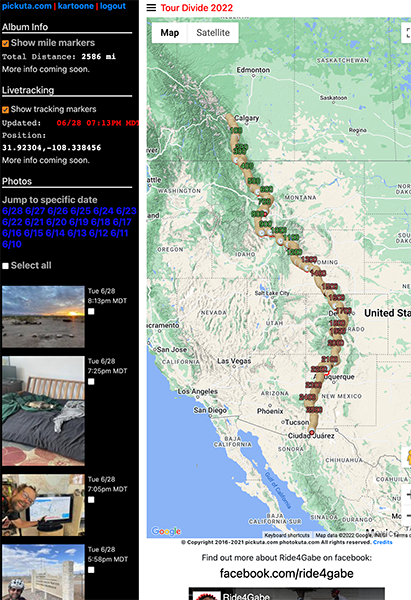
See even more pics from the entire race along with the exact time/location where each was taken on the tracking website I created called pickuta.com. If you are on a phone or small screen web browser, click the “hamburger” triple bar icon in the upper left to slide out the photos and turn on/off the tracking markers: https://pickuta.com/album/258
Leave a Reply