Here is the link if you want to zoom in on the map above. It’s 7500px image (width) so it may take a while to download and open: https://toonecycling.files.wordpress.com/2022/05/annotated-heatmap.jpg
Summary
The Three Rivers Way (Vista 300) race was awesome again this year. I’ve called it the “tree-fall” edition because there was a noticeable increase in the number of trees down throughout the course. This didn’t really detract from the race at all – in fact solving tree navigation puzzles is something I enjoy — how do I get me and my bike around, over, under, or through these trees?!? But the increased number of trees did take a toll on both my equipment and my overall time. I lost my helmet light, presumably ripped off when pushing my way through some of the tree-fall. Also, I lost my bike pump, presumably when dragging my bike under a tree. Sometimes that tug you feel isn’t a pedal stuck on a branch, it might just be your pump being pulled off the frame. All-in-all, though I was happy to set a new slightly faster FKT for the course given how most of the trails and dirt roads were in great condition (except for tree-fall).
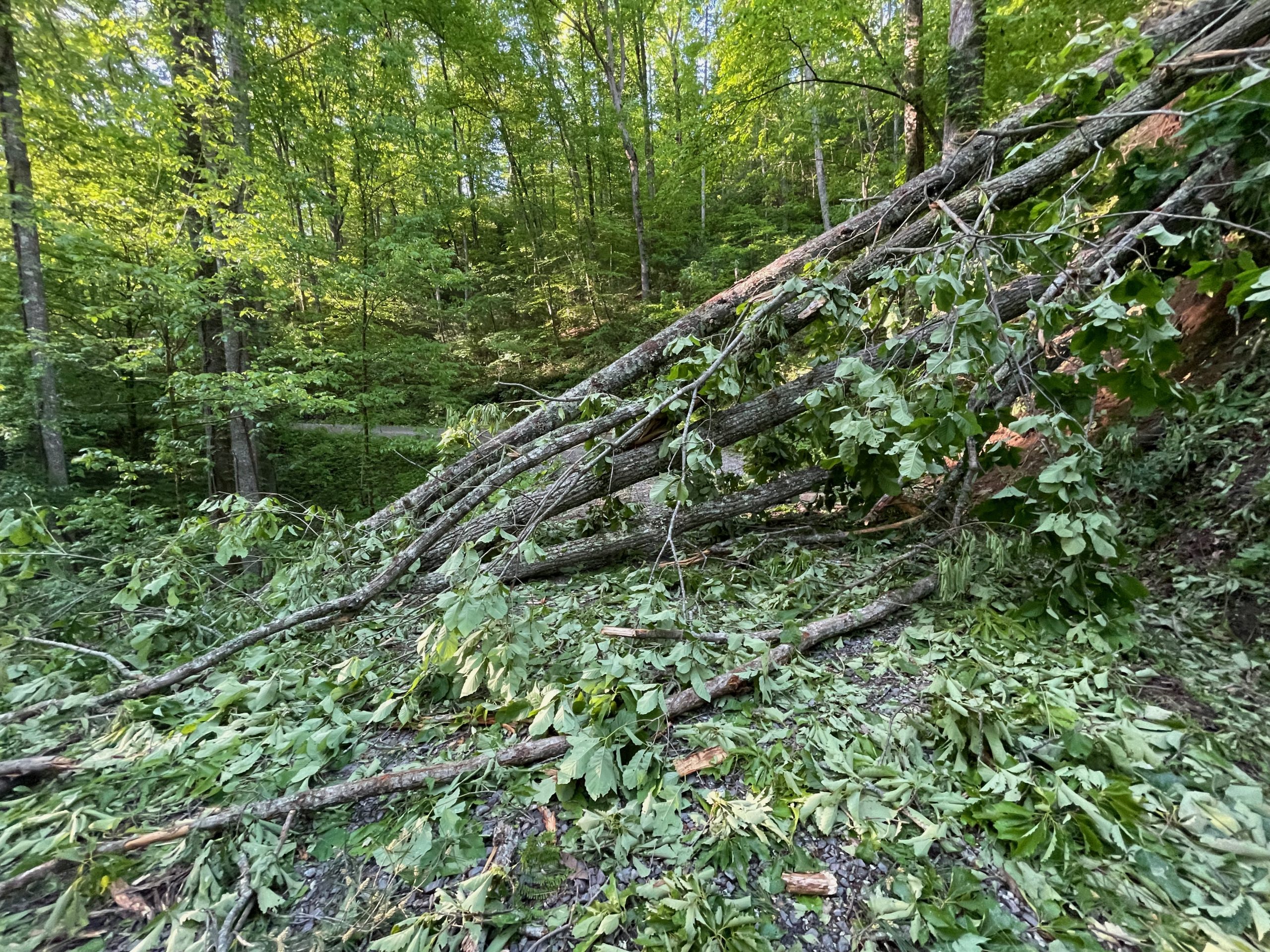
Tree-fall?
Why so many trees down? There has been a large number of storms (including a late winter storm) that have knocked over a bunch of trees. I think at least one or two large trees fell either after I started the race or the night before I started the race. They looked quite fresh when I arrived at them with one of them being on a wide, well-graveled forest road. Also, there was a major fire at the Ocoee Whitewater Center that completely destroyed the historic building that hosted the whitewater events for the 1996 Summer Olympics. Much of the Forest Service resources that would normally be doing spring tree cleaning right now got diverted to the fire investigation and clean-up, which is still ongoing.


The data – how “fast” is a tree (or lack thereof)?
The only way for this to be truly accurate is if I had a better count of how many trees were down last year vs how many were down this year. I would roughly guesstimate about 30% more trees this year. Side by side comparison of various segments noting treefall.
| Segment Name | Length | Elevation | 2021 / 2022 (hh:mm:ss) | Extra Trees |
| Coffee Branch Up | 7.27mi | 1240ft (2.9%) | 1:16:30 / 1:28:06 | About 4-5 |
| Ocoee Brush Creek CW | 6.18mi | 368ft (0.9%) | 53:19 / 1:02:03 | About 1-2 |
| Boyd Gap DH | 0.37mi | -235ft (-11.8%) | 2:51 / 4:53 | About 1-2 |
| Sylco horseback trail | 3.72mi | -530ft (-2.4%) | 49:07 / 1:21:19 | At least 10 |
As far as overall time goes, I was 2 hours 11 minutes faster last year, but I had Garmin problems in last year’s race and had to navigate the course on my phone (somewhat unsuccessfully as I missed a short out/back to the top of Buck Bald). With a 3 hour penalty (very thankful for that instead of a DQ) for missing that section, my net time was 49 minutes faster this year as shown in the table below.
| Year | Raw Time | Penalty | Overall |
| 2021 | 36:36 | 3:00 | 39:36 |
| 2022 | 38:47 | 0:00 | 38:47 |
The Story
Super busy week with a busy weekend with the first of many lasts – my daughter’s last mountain bike race as a high school student (graduating senior) happening over two days at Fort McClellan in Anniston. Each season at the state championship race, NICA recognizes all the awards and brings them up on stage, which is so awesome for people like my daughter who just race for fun. So this is a chance to guarantee that every single NICA rider is on the podium at some point as they individually bring up each senior and recognize how many years they have been racing with NICA.


I drove straight up to the Fireside Outpost after the awards ceremony and got a good night’s sleep with my alarm set for 4 AM. I had tried my best to be as organized as as I could even before leaving the house to go to the NICA race, but still it took me over an hour to get everything ready. I made it across the street to the state park to get a selfie at the start and started rolling by about 5:18 AM with it still quite dark out.
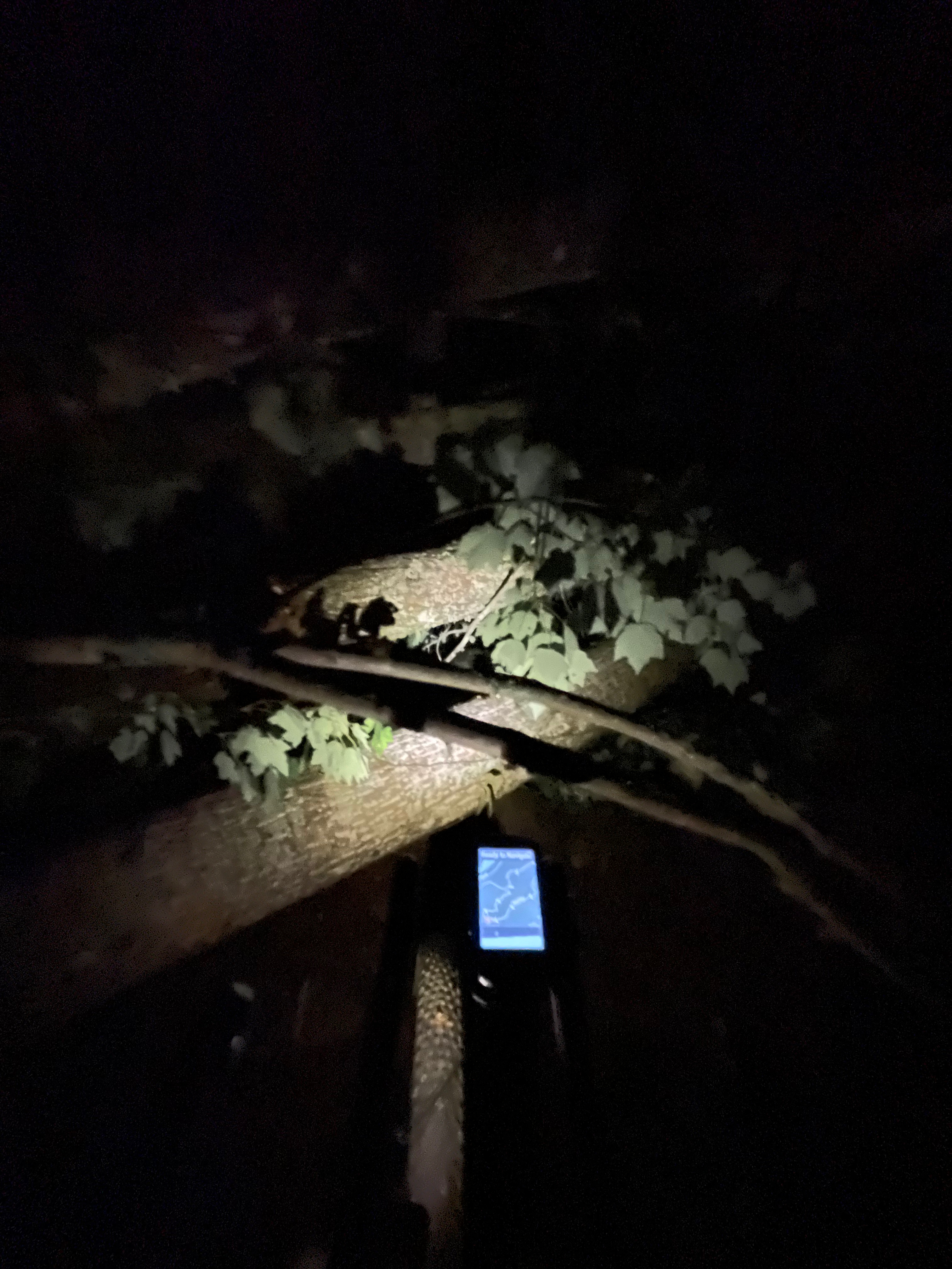
Mistake #1: DON’T RIDE COFFEE BRANCH IN THE DARK.
There is a very good reason why Kim waits until just before sunrise to start the race! You really need the daylight to see all the baby head rocks and navigate around, over, between them. I fell twice on the climb because of bad lines and being unable to unclip once and losing my balance on a different failed section when I put my foot down on the backside of a rock and slipped off it. This kinda set the tone for the day as even though I wanted to put in my best time, I started being way more conservative on the more technical sections.


Absolutely stunning sunrise sky by the top and I started flying on the gravel and paved roads all the way to Tellico Plains – so much so that I was confused about both the timing and distance and started to dread that I had missed part of the course somehow. But it all makes sense now given my start about an hour and 15 minutes earlier. I had stopped there last year but was nowhere near out of water/gatorade this year. Well, as it turns out, there is a good reason to stop at that store as you can make it all the way to Indian Boundary general store with no water filtering if you do stop in Tellico. If you don’t stop in Tellico, you are NOT going to make it to the store without filtering water.
Mistake #2: SKIPPING TELLICO PLAINS STORE AND FILTERING WATER INSTEAD
Last year I timed my stop at the store – 7 minutes. This year I skipped the store thinking that I brought along my water filter and might as well use it! The problem I ran into was that it took longer to filter water than it would have taken to stop at the store. It took me at least 10 minutes to stop and filter water this year. First, water is everywhere on that course until you need it. Then it disappears entirely. It’s like magic. The main cause here is that I waited until I was up on the climb before Indian Boundary. After a mile or two dry (10-15 minutes), one of the switchbacks had a stream running under the road through a drainage pipe. The uphill side was heavily vegitated and the downhill side had a several foot drop to get down to the water. I initially rode on by it thinking I would try the next creek, but then turned around when I realized I might not see another one for a while.
I got everything out and ready. My reservoir still had the regular head on it with the shrink-wrap packaging still on it … so I took that the whole head off to put on the inline sawyer filter). Then I crawled down the embankment, opened the reservoir and shoved it down into the flowing stream (it was several inches deep). Basically, nothing happened and I could see that even though I was holding the reservoir open, the two sides of the reservoir were essentially vacuum sealed together about an inch below my hands. So I shoved my hands down into the reservoir and held that part open, but it was sealed an inch or two below there. I then tried submerging it deep enough to get more pressure, but the water wasn’t deep enough for that. Since there was a good flow of water falling from the drainage pipe, I opted to put it right there hoping that rust in the water wouldn’t cause a problem. Exactly 10 minutes later, I was on my way, flustered at the whole experience and lugging the full 85oz of water with me up the climb, not realizing at the time that I didn’t need THAT much water for only an hour or so more climbing.
In any case I did make it up to the Indian Boundary store earlier than the previous year and this time without running out of water (but already 30 minutes slower since I had started so much earlier this year). The Indian Boundary worker asked me if I was with the race, and he commented about how much better weather I was having then the two racers who had come through a couple days earlier. It was indeed perfect weather, definitely a little bit warmer than the previous year and with me arriving about an hour earlier in the afternoon, the 3000′ climb up Cherohala Skyway was HOT. Before I left the store, though I exchanged a $5 bill for five ones, which was great as I didn’t quite make it to the Green Cove store before closing, but they still have the vending machine out front – and I got a couple cold sprites which even though the temp was starting to drop felt so great to down almost immediately after climbing that climb for so long.
From there, I knew that I was approaching a couple climbs including the one up to Buck Bald that I had missed in my navigation woes from last year. I was so happy I made it there with the sunset glow still in the sky, but by the time I snapped a couple pics and dropped off the top it was pretty dark. No problem, though, because the descent wasn’t too bad or too long (I think – they all start to run together) and you do make it to paved roads fairly quickly afterwards.
It was still a few hours to get all the way to the Circle K from Green Cove. By this point I was getting very sleepy and had been riding very slowly from being so sleepy. I was also sleepy last year, but comparing the long section from after Buck Bald to the Circle K between the two years, it took me 20 minutes longer this year. Eventually, I made it to the Circle K around 2am. After I got all my stuff, I sat down on the floor to drink my coffee and nodded asleep for at least a little bit and woke up with a start, which did more to wake me up than the coffee and send me on my way to next challenge – the Ocoee Center trails.
The Brush Creek and Boyd Gap trails were still open albeit with extra trees down in a couple places, but with the Whitewater Center trails closed for the fire investigation, we had to climb back up to the highway after the Boyd drop, which still meant cutting out a huge chunk of singletrack and, other than the climb up from Boyd, trading it for a long downhill paved descent to rejoin the course at the bottom of Thunderock Express.
It was at this point that I realized that no matter what I did I wasn’t going to beat my unpenalized time from last year and unless something bad happened I was definitely going to beat the penalized time. This helped me relax a bit and try to just enjoy as much of everything as I could. I think those opening two crashes climbing Coffee Branch in the dark, plus all the trees down on it and the other parts of the course, plus not having any other racers chasing me to constantly remind me to pedal my bike fast meant that I was just overall slower despite coming into the race much fresher.
The very last sections of the race told me how cautious I was being with the exposure on some of the sections of Smith Mountain I rode my brakes hard. So while I doubt it was more than a few minutes slower coming down Smith Mountain, it just means that anywhere I could have let loose a little bit, I didn’t – whereas last year, I really didn’t hold back anything. I still had fun on that descent and the whole course but I didn’t take any risks. What is perhaps most interesting to me about this is that my PRE (perceived rate of exertion) on a scale of 1 to 10 would maybe only be half a point lower than last year – but my HR average was higher this year – maybe I am so fresh that I’m actually out of shape? Or maybe it could be the new optical HR monitor I got reading higher than the old one chest strap … or 14 degF colder temps last year leading to lower heartrates last year … or some combination of both?
Still, I did indeed ramp up the pace once I hit the pedestrian bridge across the Hiwassee with 45 minutes left until 8pm and about 10 miles left to ride. 8pm was somewhat significant although the real target was 8:18pm exactly 39 hours so that I could officially break the 39 hour barrier. Since my previous FKT with penalty was 39:36. I was on track to do that and flew past the house with the dogs that always chase you (except not this year!) onto the mud creek trail, almost endo-ed into the drainage culvert (but didn’t) and navigated down to Spring Creek, took a quick pic, shoved the phone back into my pocket and ran across the wide and deep creek. The far side had a lot of new workarounds for some of the bushwhacking I had to do last year so that was quick but you still have a mile or two to ride to get to the final singletrack. I hit that with about 10 minutes and only 1.5 miles on tame singletrack … except within the first minute I came across a tree blocking the entire trail, and then in my rush to get around the tree I got my pedal tangled up and ended up falling over backwards down the slope into the bushes. A minute or so later I got myself and my bike untangled from everything and knew it was unlikely that even if I went warp speed that I would make it in before 8pm. So I took off again fast, but not crazy fast, especially since there were a number of campers hiking and I didn’t want to run anyone over or scare anybody. That being said, there was somebody reading a book and watching the creek in the middle of the singletrack. So I did scare that person as I came around a corner and they were right there blocking the whole trail. But slamming on the brakes and a short skid through the dirt – all was good – and we both laughed about it as she scrambled up out of the chair.
Michael Rasch was there at the finish where the singletrack dumps out into the state park parking lot. It was so great to catch up with Michael and Kim rehashing stories over the years. I did pull off a tick off of me while we were talking that I had picked up along the route (probably from all those workarounds on Smith) … but I also pulled a couple ticks off of me at the gas station stop in Belton so Grand Depart riders for tomorrow – don’t forget to use bug spray and also check yourself at stops! Good luck everyone!!!
Lessons learned for the Tour Divide
- No single points of failure and make sure that everything is so secure on the bike that there isn’t a chance of losing anything.
- NEVER wear the helmet light during the daytime. It’s so stupid to lose a helmet light during the day. Why is it even on your head? Ironically, I’ve already learned this lesson the hard way with my taillight. I have a rule that I will never ride with that taillight unless it is on. If it’s not on, it immediately goes into my top tube bag, which gets zipped up tight. Because if the light is on, you know instantly if it falls off the bike because you get a radar disconnected message. But if the radar is turned off, you may not realize it bounced off until many miles later at the bottom of a technical, rocky long descent – at which point it’s probably going to be impossible to find or could you even pay me $200 (the price of the radar) to climb all the way back up to the top and potentially down the other side and up some other climbs for the chance to maybe find it at some unknown location along the route? If I was guaranteed to find it, then YES. But for just the chance at maybe finding it, then NO. So thankfully that didn’t happen on this ride b/c I have learned my lesson not once, but TWICE, having lost two radars to long mountain descents where the light was on my bike but turned off so I had no warning that it had bounced off until hitting the next road with potential traffic many miles and climbs and descents later and noticing at that point that I no longer had a taillight on the back of my bike. So why this lesson doesn’t just immediately translate to my helmet light for which I have now lost TWO under the exact same circumstances blows my mind. Apparently it takes losing not one, but TWO expensive lights to knock some sense into my brain regarding lights … and that “sense” doesn’t translate between location of lights. So if they ever invent side lights, apparently i will need to lose TWO of them before I make changes to my ways.
A NOTE ABOUT DOGS AND OTHER WILDLIFE
I saw several wild turkeys, several cute brown pigs high up on one of the climbs, one big black snake slithering across the road by the Tellico River, no bears, and about a million dogs (slight exaggeration).
First, the wild brown pigs: one came running out from beside the trail and it was the size of a very large house cat, but much smaller than wild boars I have seen elsewhere. Then I saw another one and it also came running out and both are now running in my same direction dropping me up the climb. Then I ended up seeing a couple more, but all of these were the same size so I kept dreading that if they were in fact young pigs that there might be a mama-sized wild boar about to charge me.
A little while later I stopped for a second for a quick break off the side of the trail and all of a sudden there was some very loud squaking from the bushes immediately in front of me. Some sort of bird trying to scare me away, presumably from a nest. I pretty quickly took off not wanting to bother it, but it made me realize that even if I saw only a small amount of wildlife on the 315+ mile race, that there was a ton of wildlife that saw me. I wouldn’t be surprise if I came within eyesight (or smell) of several bears, several wild cats, maybe hundreds of boars, all kinds of snakes, etc… and yet I only saw the tiniest tip of the iceberg of the wildlife?
Now about the dogs… This course, like any that go by any houses anywhere in the deep south, has dogs on it. I’ve made my peace with dogs and no longer give them much thought. But one of the riders who had started on Friday got a nasty pitbull bite about halfway through the course. I reached that spot at night and the dogs were either asleep or inside. So I didn’t get chased by that one, but I did get tag teamed by a pair of dogs that came out so fast that I couldn’t use my usual trick of pointing and saying no because they were already on me. Thankfully they didn’t seem too interested in biting as I think they were beagles or spaniels or some mix, but if they had been a more aggressive breed, I probably would have gotten bit, too!
It’s interesting, though, that my friend Michael Rasch would say when we were catching up after I finished that when he did the rockstar race up in Virginia last week, there was not a single dog that chased him. I wonder if it’s part of the culture of the rural (and sometime not-so-rural) deep parts of the south to let your dogs roam free at the expense of their lives (getting hit by cars) or the nuisance/hazards that they make for cyclists (because they likely don’t want cyclists on the roads anyway). Now of course that doesn’t apply to everyone in these locations, but what other explanation is there for why I can go ride all over the country and get chased by a tiny fraction of the number of dogs that I get chased by on my rides in The South?
Maps and Pics
Here’s a literal 3D map of the route (see video at top of this post).


Leave a Reply