
An unusual opportunity
Our annual winter vacation visiting family up in Northern Wisconsin/Minnesota got scrapped this year due to covid. This opened up an unusual opportunity for me to tackle the Rapha Festive 500 in one ultra long ride in the “warm weather” down here in the South instead of using every single day of the challenge to rack up the required 500 km (310.7 mi) slogging it out on a fat bike in the snow and extreme cold.
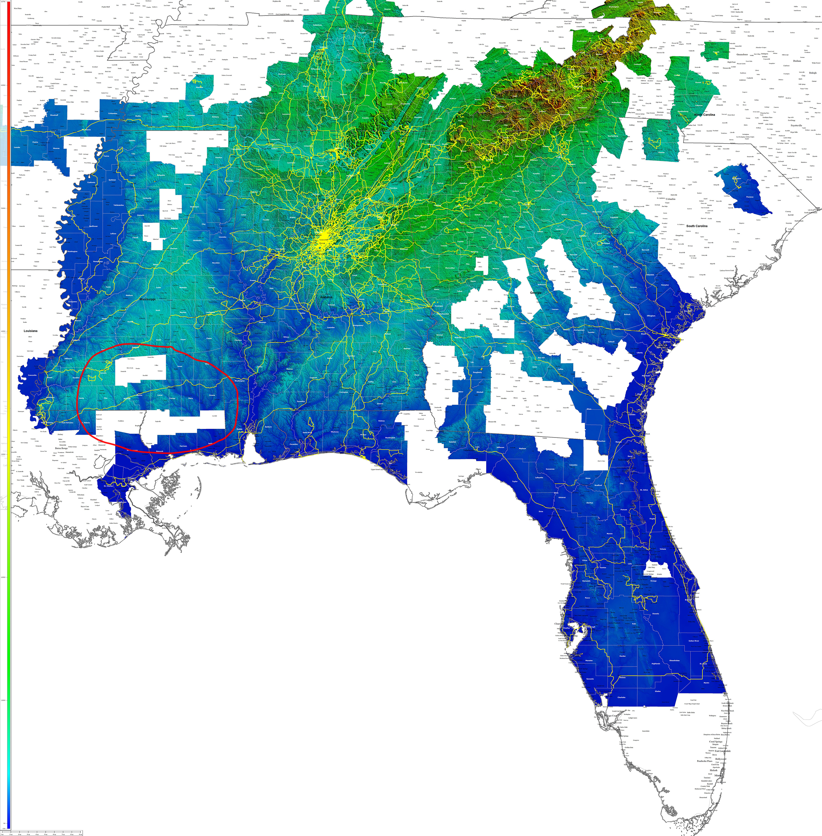
I decided, almost spontaneously, that I should take advantage of this unusual opportunity to knock out the entire Festive 500 in a single ride. Plus, when I checked the counties I am missing in neighboring Mississippi, I realized I could hit all the southern counties in a 310 mile ride if I started from Laurel, Mississippi – which would minimize my driving distance from home (200 miles) while putting me close enough to the missing counties to make it manageable to hit them all in a Festive 500 ride.

Missing counties?
My long term goal is to ride in all the counties in the South starting with my home state of Alabama (completed in just one year – 2016) plus its four immediate neighbors: Mississippi, Florida, Georgia, and Tennessee. After completing those states, I plan to wrap up the rest of the South in roughly this order: South Carolina, Louisiana, Kentucky, and North Carolina. Bonus states might be Wisconsin, Minnesota, Arkansas, and possibly Indiana (I’ve already ridden in more than half the counties there). Also, out west, the counties are so huge it would be relatively easy to add Arizona and New Mexico in a couple days each with a long drive in between the first ride and second ride.
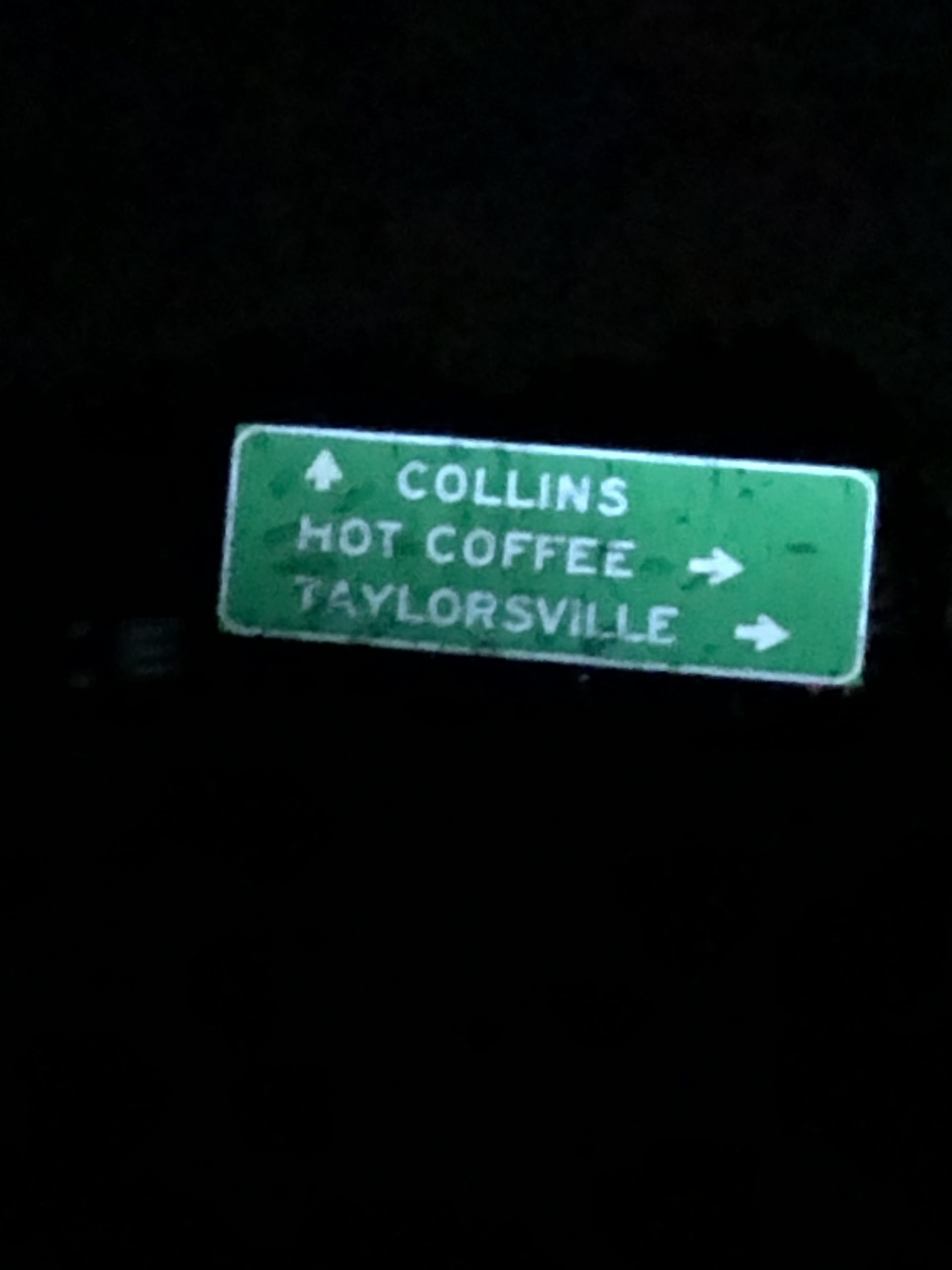
Hot Coffee, Mississippi
I was cold when I stopped for gas on the 200 mile drive from my house in Hoover, Alabama to the place I picked to start in Laurel, Mississippi. I picked Laurel because it was right on the interstate and would minimize my drive time [side note: I dislike driving to ride, but I’ve ridden so much around here that to ride somewhere new, it now takes a really long time to ride to get there]. Because I was cold, I put on most of the clothes I had brought with me. I started out my ride and regretted within a few minutes at having overdressed … especially since I didn’t want to play the “take off / put back on” game with clothing to deal with temps. So I unzipped everything and eventually rode with no gloves at all and no head covering to try and ventilate excess heat every way I could without having to stop and take off layers.
Still, there were cold pockets of air down in the bottoms of all the hills. One of those cold pockets was right after crossing the Leaf River when I noticed the green city directional sign below:

I thought how nice it would be to go get some “Hot Coffee” but knew that nothing would be open at 4am.
Thinking that I would be starting the ride in the middle of the night, I opted for a major US Highway (Hwy 84) for the first 60 miles of the ride heading west straight through three of the “new-to-me” counties. Unfortunately, I was running a little late and didn’t start until a couple hours before sunrise. This pushed me into a bit heavier traffic than I would have liked, but Hwy 84 was a big enough highway that there was a large shoulder on it with plenty of room for me to ride to the right of the rumble strip. I would find out / remember later that Mississippi state highways don’t have this same feature. Instead, you were greeted by a long, continuous rumble strip covering all but a few inches of the already narrow shoulder.
No worries, though, as I turned off Hwy 84 in Monticello after crossing the Pearl River for the first of two times and started heading south towards Louisiana on a couple state highways mixed with a number of immaculate chip/seal roads that Google bicycling directions had given me when I clicked on the edge of Pike County from Monticello. I was laughing as I chuckled at the intricacy of the route and how in the old days you would have needed quite a few notecards with road names and turns or a bunch of county maps on a ride like this. I might have to do a “gps-record-only” adventure soon where I bring along the GPS to record the ride data, but refrain from using it to look at the map or do any kind of navigation at all. I will just set the GPS screen to show distance, current speed, average speed, and timer and obsessively refrain from switching screens even once. I will report back on that adventure sometime soon.

A few county roads later and I would find myself crossing over into Louisiana on a major state highway, but the Bienvenue en Louisiane sign at the border that I had been looking forward to for many miles – ever since turning south – was gone!


So I took these two pics above, which now I’m thankful for, as one highlights the way all state and US highways should be designed, and the other is a really cool Louisiana barn shortly after crossing the border. Kudos to Louisiana, Florida, and Tennessee for getting it right.
I was only on this state highway for a few miles before turning back east to head back towards the Gulf Coast portion of Mississippi. I enjoyed a lot of nice riding but ended up on LA-10 at the very end leaving Bogalusa, LA. This was an extremely busy highway with logging trucks galore as well as processed paper trucks, too, I think. I’m sure they were all bee-lining it to I-59 in Mississippi. Thankfully, there was a nice shoulder … which disappeared exactly at the Mississippi border where the road name changes to MS-26. Cyclists note: avoid this road. Looking back at my route, I can see several parallel roads I could have taken that would have added on a few miles (which I needed to add on at the end anyway). As it turns out, I was on MS-26 through three counties. Yuck. Drivers were courteous and careful though, which surprised me. I think it was the first time they had probably seen a cyclist on that road as all the local cyclists would know to avoid it like the plague I’m sure, and they probably had pity on me trying to negotiate a rumble strip filled tiny shoulder trying to stay out of the way. And who knows, maybe it was just Christmas spirit. In Alabama, multiple drivers would have been laying on their horns and cursing at me and maybe even throwing things at me.
De Soto National Forest
From many cars to zero cars. It was amazing. After dealing with a rumble strip busy road for many miles (60 miles to be exact… 20% of the entire ride), I made a left turn and finally started to head north back towards Laurel after crossing all three of the counties I was missing in the section of Mississippi that juts down into the Gulf of Mexico. This took me straight into the many miles of dirt roads in the De Soto National Forest.
The dirt roads were fast and hard packed for many miles (25 miles) until somehow I managed to route myself onto one particularly nasty mud bog section that reminded me of a tamer version of the Wiregrass Rd fiasco in the Talladega National Forest from earlier this year where it took me nearly 30 minutes to hike-a-bike a half mile section of road that the locals had turned into a complete mudfest – mud from edge to edge of the forest on either side thick enough to strip your shoe off if you stepped in the wrong place. It was so nasty.
This was nowhere near that bad as I was able to ride through all the bogs as there was always one good rut that was slick and mud covered but not deep enough to stop the bike – so you could make it through and then sling the mud off while riding slowly.
The Home Stretch (and Blue Light special?)
After the awesome (even with the mud) stretch of De Soto National Forest with literally zero cars for 25 miles, it was back to an incredibly busy (10pm on a Monday night) small shoulder section of US Hwy 98. This had a slightly wider shoulder (18 inches total with about half of that devoted to the rumble strip instead of 9 inches with only 2 or 3 inches of non-rumble strip) so I was actually able to ride to the right of the rumble strip for long stretches even though it required a LOT of concentration to watch out for any debris.
Still, though, a friendly state trooper pulled me over outside New Augusta because he wanted to warn me that while I was highly visible, the road I was on was extremely dangerous with 65mph speed limit and “no shoulder”. I agreed with him and explained where I was going and that I had “looped down” to the national forest from Laurel which was only about 40 miles away and would be getting off the road at the first available opportunity (which was in New Augusta just a couple miles ahead). Little did he know that my loop was actually 270 miles by this point and veered way over into Louisiana before making it to that spot with only 40 miles to go!
I thanked him, and he told me to “be careful” (just like both checkout clerks at the two gas stations I stopped at and a friendly person in Wiggins outside one of the gas stations and one other person as they drove by somewhere else on the ride that I have now long forgotten). While well meaning and much appreciated, and there are indeed lots of things I can do to be as visible as possible, choose quiet roads (although I was hit at 55 mph on a practically deserted road far out in the country … so does a quiet road really matter either?), I am still 100% at the mercy of people driving while I’m riding. It ultimately doesn’t matter what I do, but yes, I will be careful.
Home, Sweet, Home
I made it back to Laurel, MS shortly before midnight but still had about 5 miles I needed to add onto my route to make it up to 311. I needed to add on miles because I had cut off an out/back to White Sands beach which looked really cool on satellite. But I just wasn’t feeling it at the time and knew that I’d have more fun exploring deserted city streets back in Laurel at midnight.
I was wide awake and pumped after getting back to the car and having accomplished what I had set out to do … but that didn’t last long on the three hour drive home … so I decided that not wanting to be a hypocritical “sleepy driver” I should pull over at the next gas station and sleep … and so that’s what I did. I was only asleep for an hour, but that did the trick and I woke up wide awake to drive the rest of the way home.
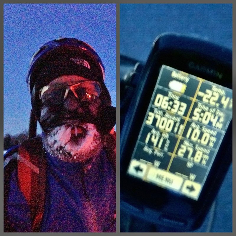
It was getting close to sunrise by the time I made it back home, roughly 28 hours after having left the house at around midnight, including the six hour drive, 21 hour bike ride, and 1 hour gas station nap!
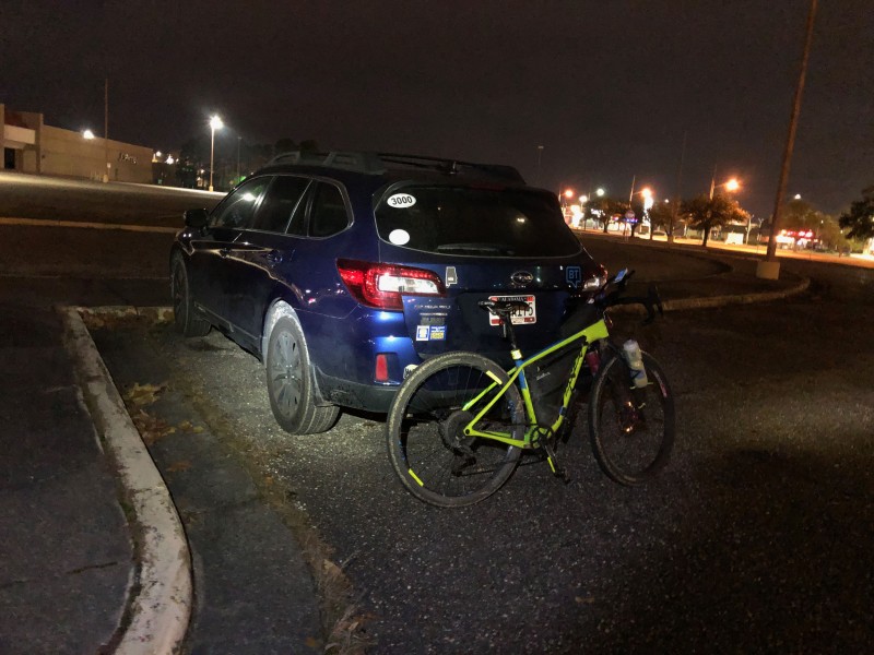
Back at the abandoned mall almost 21 hours later. 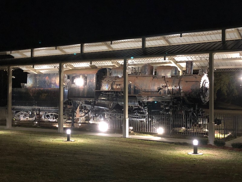
Old steam engine found while wandering around Laurel, MS 
Nice brick roads and lights all over Laurel, MS 
My parents favorite place to eat … and this one was actually open! 
Welcome to Mississippi, please leave your nice shoulder and safety at the border. 
Pearl River, Mississippi 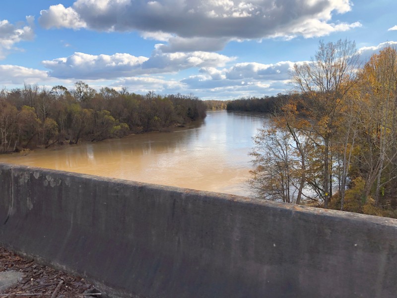
A very full Pearl River 
The halfway point 
Bogue Chitto River was also pretty full, I crossed it on a different county adventure many miles north of here outside of Meridian earlier in the Fall. 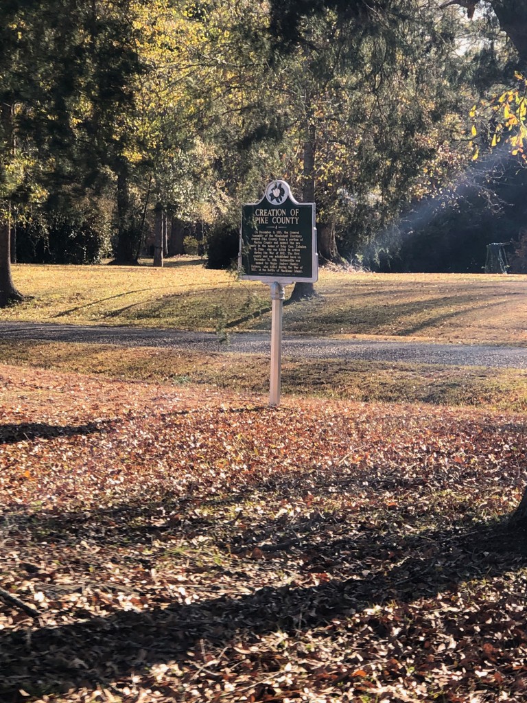
Creation of Pike County. 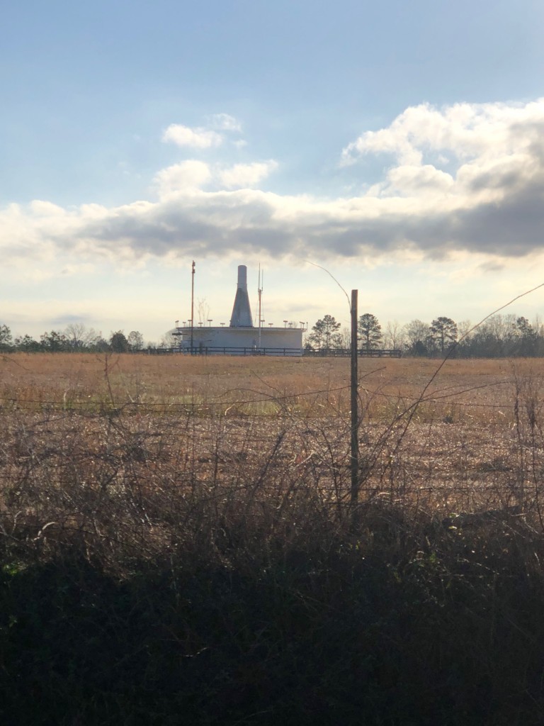
VOR station. 
Hills 
I hopped off US 84 to ride through Prentiss early in the ride. 
Moonlight so bright! 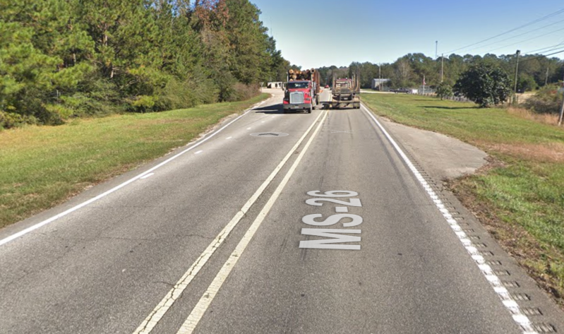
I was on this road for 60 miles.


Leave a Reply