
Quick summary
| Distance: | 546 mi (including 15 mi ride to start), 1007 mi (including 451 mi ride back to start) |
| Climbing: | 8967 ft |
| Time: | 2 days, 11 hours, 46 minutes (Mon, 12/7/20 5:24am to Wed, 12/9/20 5:10pm) |
| Speed: | Overall average (9.1mph), Moving speed (11.0mph), Total stoppage time (10 hours) |
| Sleep: | ZERO – I stopped at several gas stations to warm up but didn’t sleep. |
| Temperature: | Overall average: 47.5 degF, Minimum: 28 degF, Maximum: 73 degF |
| Counties: | 24 |
| Deer: | Hundreds |
| Snakes: | 1, sunning itself right on the trail in front of me |
| Gators: | 0, sadly, although I’m pretty sure I saw one sink out of sight. It was way too cold. |
| Clothing purchased: | Orange hoodie, polyester workout pants, two sets of gloves and lots of hand/foot warmers. The workout pants dried well as they got soaked during one of my swamp crossings and dried significantly faster than the knee warmers I also had on at the same time. |
Map
Here is a high res version of the race (red), plus my ride back to the start (yellow), plus an additional shake-down county ride I did on my drive down from Alabama (green).

The adventure (summary)
It was very cold with a frost advisory during the race, but it was also very fun — too cold for snakes and gators, but not too cold for deer as they were everywhere. I had brought mostly warm enough clothes but not quite enough layers and not enough hand/feet warmers.
I ended up buying a nice bright orange hoodie, polyester workout pants, cotton work gloves, and hand warmers at a Dollar General 377 miles into the race. I put all of that on and then hit a hard-to-ride levee trail (b/c of the thick grass) and had to strip/unzip most of it back off after a few miles. Then I proceeded to turn off the levee too early (b/c I was having issues with my GPS) and fall and roll down the steep embankment into (thankfully) very tall grass stopping just short of the water. Awesome. I couldn’t stop laughing. More on that later.
This was my first time riding in all 24 counties that the race covered, and my understanding is that it was a fairly large spectrum of all the riding you can do in Florida. It certainly felt like it had everything in it.
Paved bike paths – the race hit the Pinellas Trail, a combination of levee/canal, city streets, and rails-to-trails through Pinellas County which includes St. Petersburg, Clearwater, and the smaller towns northwest of the Tampa Bay area on the way up to Homosassa Springs.
Purpose built mountain bike trails – there were a BUNCH of these. I don’t know the exact amount, but I’d guesstimate 50-75 miles total of mountain bike singletrack. Throw in additional isolated extremely rural sections of the Florida Trail (similar to the Pinhotti) and that probably took the total amount of singletrack up over 100 miles. The creativity in using even the smallest of hills to produce flowy jumps and short, steep climbs was quite impressive. I kept thinking how much I wanted to bring my family down to ride these trails.
Highways – we were on US Highway 41 and US Highway 301 as well as a number of state highways and even county roads that all had huge bike lanes. They needed them, though, because there aren’t a lot of roads in central Florida b/c of all the swamps and therefore all the roads were very busy with regular car traffic as well as truck traffic. The only road that felt dangerous to me was on my way back to the start where I ended up on a county highway that alternated between a small shoulder completely filled with a deep rumble strip and no shoulder at all. This was a busy road with lots of traffic, but thankfully I was only that road for a few miles. There was not a single road like this at all on the actual race course.
Dirt roads – almost all the other roads were dirt … and by dirt, I mean sand. Most of the time, the sand was hard packed and fast, but sometimes it was loose and challenging to ride. I loved it though b/c it helped warm you up quite a bit pushing a big gear through the loose sand. Also, it tested your balance, and your faith that the bike would keep moving forward as long as you kept pedaling. One of the racers in front of me had a hard time with it, as I saw numerous slide outs in the sand which I was puzzled by as I just rode straight over top of them. I was wondering if maybe they were running too narrow tires? I had my Sparwood 2.2″ tires on and they worked really well.
The Details, Part 1: Pre-race
I left Birmingham 1am Sunday morning to start the long drive down to St. Petersburg. I knew that I wanted to stop in North Florida to do a good warm-up ride there to calm my nerves and make sure I had everything I needed. It went well … albeit quite cold! I made sure that I picked a route that was at the edge of counties that would be new to me.
I finished the drive down to Tampa in sunny warm weather as I made it below whatever front passed through North Florida. It was in the 70s by the time I arrived at my hotel – the Holiday Inn, St. Petersburg West. This was one of the closest hotels to the state park where the race officially started. I thought about staying in the campground there, but then felt awkward asking if I could leave my car there all week. I didn’t feel as awkward about that at the hotel and they didn’t mind at all.
Even though, the hotel was one of the closer ones, it still meant I had a 15 mile ride to get to the start. I pretty much had everything together before I even finished checking into the hotel, but I also realized I had forgotten my water filter. That meant I would need to do a detailed study of the course before going to sleep to make sure I noted where all the stores are as well as their hours as well as working out the time that I would likely be there to see where I would need to overstock on food and water.
All of that is to say, I didn’t get to bed until almost 8pm, which meant I definitely wasn’t going to get up at midnight or 1am. Initially I set my alarm for 2am, but when I woke up it was pouring down rain. I looked at the radar and saw that the system was getting close to being done with the exception of one smaller wave still off the coast. So I went back to sleep and woke up again at 4am. This time, I was committed to leaving and was out the door by about 430am.
Part 2: from St. Petersburg to the manatees (Homosassa Springs)
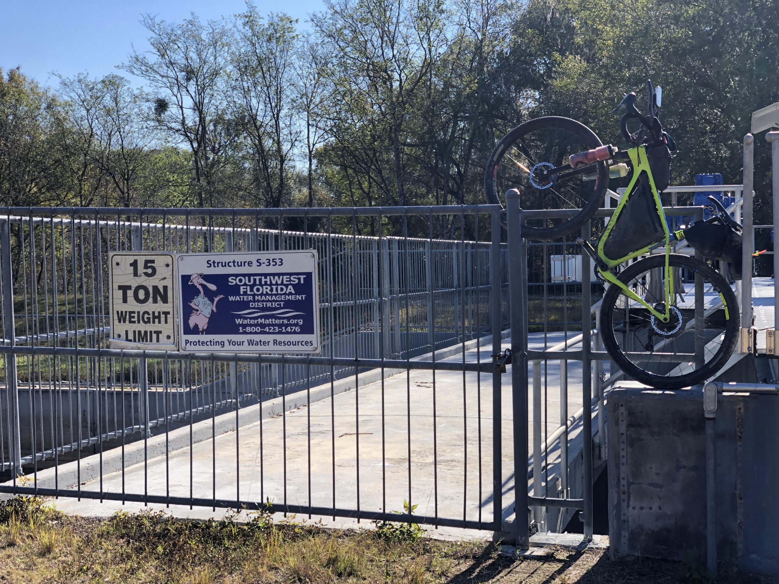
I had routed myself down US Hwy 19 (the same highway that cuts rights through Sandy Springs, Georgia!) to make it as easy and as quick as possible to get to the start. At 4:30am on a Monday, there was very little traffic. I made it to the state park, but the gate to the park was closed since it wasn’t open yet. It wasn’t a very tall gate, though, so I hefted my bike over and then squeezed through the middle of the gate. This would be the first of many fences and gates that you had to cross during the race.
By this point it had started to rain pretty good as the next wave of the system reached the shore. It was mostly south of St. Petersburg so I was hoping I could ride out of it quickly … and indeed that was the case. It had stopped raining by the time I made it back up into St. Petersburg. But before that, I needed to get a selfie and it was VERY dark – no lighting at all at the fort. So I messed around trying to get the selfie flash to work and manage to get two mosquito bites … in the rain!!! These would end up being the only mosquitoes that bit me the entire race b/c it was far too cold for mosquitoes the rest of the race.
It wasn’t a particularly cold rain, so I didn’t even put on my long sleeves. I just took off north in shorts and short sleeves and rode out of the rain within a few miles. Everything was very wet, though, as it had been pouring down rain pretty much the whole night. Most of the early race was following the Pinellas Trail, which was an intricate paved trail system with many bridges over the busy highways.
My first navigation puzzle was after Ridgecrest Park south of Clearwater. I was following the GPS track and it sorta dumped out straight across a busy highway into what I initially mistook as a drop down into scrubs/bushes/swamp. But there was actually a small path beside the guardrail along the highway that led you down to a grassy path that continued alongside a canal. I figured this was prime place to see gators, but they weren’t coming out in the rainy weather.
I followed this until eventually it hopped back onto the official Pinellas Trail again. This time, the route stayed true to the trail for many, many miles all the way to Tarpon Springs where the abandoned railroad trail went right down the middle of the city streets. It was so fascinating to me, that I didn’t see the turn off the trail until I happened to notice “Off Course” a few blocks past where I was supposed to turn. So I turned around and doubled back and followed the course to Craig Park with the route going by a cool mermaid statue right beside the bay. It was starting to rain again by this point.
And it would continue to rain off and on (mostly off) with the sun never making an appearance. It was getting colder, too, and after almost 80 miles I finally broke down and put my knee warmers and long sleeves on because I noticed when I stopped to pee that my hands were really numb. A few miles later, it was on to “fence hopping” number two as the course exited out the back of a park onto a powerline trail connecting up to the first purpose-built mountain bike trail system in the J.B. Starkey Wilderness Park.
Kristine called me through here while I was negotiating the singletrack, and I was remarking to her the irony of me finally putting on warm clothes and then only a few miles later overheating on the singletrack having slowed down from 18-20mph on the paved trails to just 10-12mph and working harder in the dirt. The singletrack didn’t last long though and I exited out the back of that onto a long powerline trail. It was crazy to see the powerlines stretching so far ahead in the distance. The trail was hard packed sand and gravel, though, so it rode almost as fast as a paved trail.
At this point almost 100 miles into the race, I started doing some calculations, which were laughably wrong. I was averaging just under 18mph before entering the singletrack and powerlines and still over 17.5mph afterwards. So I figured 400 more miles of that, I could probably average close to 15mph for the whole race even getting tired. How laughably wrong was that! My overall average speed (including stops) ended up being 9.1mph. So you can imagine that all my calculations were a bit off … how far off … nearly 24 hours off!!!
I was moving pretty good through the powerline trails and the rain had stopped, but then I got a “get out your umbrella” message from my rain app, and sure enough it started to rain again … even though it didn’t even show up on the radar! This was a cold rain straight into a very strong headwind coming out of the north, northwest.
Part 3: riding a tailwind into the wilderness
After the right turn in Homosassa Springs, the wind became a tail-crosswind and eventually a strong tailwind as our route dove southeastward. This was getting late in the day, and the route got quite hilly. Combined without a lot of air movement (due to the tailwind), I got hot again even though the temps stayed in the 50s.
The next 85 mile loop would go through a lot of park and wildlife managements areas. The largest one labeled on the map is Withlacoochee State Forest. This was probably the most rural part of the race, and I did it overnight in the cold. There was a mix of singletrack and included one deep, long swamp road crossing. I initially tried to go around hopping on logs but ended up in deeper swamp water than just trudging right down the middle of the road would have been. That’s what I ended up doing. And my whole plan of taking off socks and doing it barefoot in the sandals to keep my socks dry was foiled when I fell off the first log I was on. So I just trudged the rest of the way with water coming up to my knees and temps down into the lower 40s by this point.
WILD BOAR AND RED BULL
Shortly afterwards, I had my first trailside encounter with a wild boar. I startled it from some bushes immediately beside the trail and it started trotting/bounding away from me in the same direction I was going. Once I realized this, I stopped b/c I didn’t want to keep following it in case it turned around charged. It kept going and turned to the side so I could continue on.
Even after trudging through the swamp, I was all pumped up on adrenaline and working hard and didn’t get cold immediately. I stopped and put on dry socks that I still had. Once I got started again and left the singletrack, I started to get cold. Very cold. By 4am the temp was well down in the 30s with it bottoming out at 34 degF. I was frozen and had no piece of clothing left I could put on. Still thinking I had nearly 30 miles to make it to a 24 hour Circle K, I was seriously thinking about post offices, churches, or anything I could try to get into to lay down for a few minutes and try to warm up somehow. But there was nothing like that. Then I thought of one last thing I could try … I still had an emergency red bull in case I got sleepy (which I was not at all) and a twix candy bar I hadn’t eaten yet. So I stopped in the middle of the dirt road, downed the red bull, and ate the twix … and then took off like a bandit.
I didn’t have to go far, though, before seeing a sight that nearly brought tears to my eyes: a Circle K I had missed on the map! And it was open before 5am! Crowded even… Unfortunately they didn’t have any hand warmers to buy or any clothing at all, but the clerk did have a great idea – she gave me two of the huge trash bags they use as liners for the outside trash cans and told me to poke holes them and wear them like a poncho. It was so perfect.

It worked great to keep me warm as soon as I finally left the Circle K … 1 hour and 30 oz of coffee later! But I did have to take it off within a couple hours as it was a little bit too hot as the temp climbed back up into the 40s. I stopped at the next Circle K (only 30 miles later) to get some more coffee and food this time.
Part 4: Fence puzzle solving, Garmin woes, and swamp swimming below freezing
Let’s start with a nice fence puzzle. There was a nearly 8 foot tall fence at a lock crossing that we had to get across. There was no way (at least for me) to get my bike up and over the main fence (which was relatively easy to climb) but I was able to figure out how to get the bike wedged in place halfway up the fence, climb over myself and then pull it up and over from the other side.
I was so happy to have solved the puzzle, and then I laughed as I realized there was an IDENTICAL 8 foot tall fence on the other side. So I reversed the process, realized my phone was still on my bike, so I climbed back up to get the phone so I could get the pic below to document how the puzzle was solved.
After the 20 minute crossing (that’ll hurt your average speed, no?). I decided it was a perfect time to strip off all my warm clothes … after all, it was a blazing 50 degF … and reset my Garmin. The Garmin had been acting strange and been real slow to update the map page which had led me to miss a couple turns as well as turn too early in a couple other places. It was frustrating, so I figured I would start a new ride and power off the Garmin.
Unfortunately, the Garmin locked up and I had to hard power it off. Then I looked in the ride history and the ride wasn’t listed so I thought for sure I had lost the ride (turns out I hadn’t, but I wouldn’t find that out for another 30 hours). I immediately called Kristine and told her that this was going to make the rest of the ride hard mentally. In fact, if it had been my only GPS I may have considered abandoning. But I knew my Garmin Inreach was also recording the route albeit at a 10 second resolution (instead of 1 second).

This crossing was near the end of Potts Preserve and afterwards was a few miles of chip/seal roads before hitting 35 miles of the Santos trail system. Many, many miles of singletrack mixed in with a few short sections of rails-to-trail. This was some of the most creative singletrack I’ve ever ridden diving down into these tiny hollows and then climbing back out again.
I discovered at the end that apparently there was high bear activity in the area. I didn’t see any … especially since I traversed this whole section during the middle of the day.
The next section afterwards was the Marshall Swamp trail, and it was nowhere near as long as the Santos Trail system, but the Marshall Swamp felt like you were riding on a mountain bike trail built in the middle of a swamp … but this was a rideable trail and the muddy sections weren’t sticky mud. And most of them even had some sort of dead vegetation over top of the mud. It was awesome. It felt like Jurassic park.
After the Marshall Swamp was a required selfie photo on the Okalawaha River bridge crossing. After that was Dollar General. Unfortunately I missed the Dollar General because it wasn’t directly on the route. I had made a note about it and knew it was coming up but as I rode on a levee trail and scoured the route ahead on my GPS, it looked like there was nothing for many miles. So THANKFULLY I double checked and realized I had missed it. I had to backtrack a couple miles, but this was a must-stop-at Dollar General with it about to be night and nothing to be open for many, many miles.
Also, I needed to buy clothes!
I talked to a sometimes homeless hitchhiking man outside the Dollar General and also a young kid tried to get me to buy him cigarettes. Also, I went in and stood through the line three separate times buying clothes or food or hand warmers which I had forgotten. I also spent a lot of time in the bathroom getting ready for a very cold night with a Frost Advisory in effect over night with temps bottoming out in the 20s.
All-in-all I spent an hour and a half at the Dollar General. Plus the 2 mile backtracking meant 4 extra miles total of riding. I got all them warm clothes on, but as soon as I climbed back up on the levee I had to strip a lot of it off – because the levee trail was deep grass and it took a lot of effort to pedal through it.
FALLING OFF A LEVEE
I was on the levee for about 5 miles when I noticed that I was making a hard left to get off the levee. It was an hour past sunset so it was mostly dark but there was still a little bit of light left, too. And as I approached the turn I thought I saw an opening in the woods to the left.
Since it was such an abrupt 90 degree turn off the levee, I assumed we were supposed to ride straight off. I turned too early though and as I went down the steep embankment straight towards a creek, I tried to stop and ended up falling and rolling part of the way down into the tall grass at the edge of the water.
I laughed and saw that I had not only turned too early, there was a freaking exit off the levee that went over top of the creek. So I hike-a-biked back up to the top of the levee rode about a football field farther down and then took the exit off the levee onto a dirt road which turned into a different dirt road that was quite hilly.
The next section was a nice hilly one with a bit of Florida Trail singletrack and a surprise store that was closing in 5 minutes. I stopped here and put on dry socks … my last pair since I had been double socking and so stepping into swamp water meant two pairs of socks (I had six pairs of socks) were getting wet at a time.
It was quite cold and getting colder, but it was dry and hard work in the single track and hills so I was having a great time … until I approached the Ocala Trail. This was one of the few sections that had a bunch of trees down. It was still easier to hop over trees than fences, so not really a big deal, but what followed after the trees completely stumped me. The trail/road I was following headed straight into a large open area that I imagined and looked like a huge, huge lake/swamp. But this was just a trick because of how little I could see with the steam coming off my body and obscuring my head lamp. It was actually just a large pond, but as far as I could tell it extended for quite a while and my only path forward according to the GPS seemed to be straight through it.
Knowing that the temperature was now BELOW FREEZING (30 degF on my Garmin) and that I was out of extra dry socks, I knew that I needed to find a way around the swamp instead of straight through it. The GPS track in actuality veered around the swamp on the left side, but as I tried to do that I couldn’t find my way through the very thick foilage (see pic below). Karlos would later tell me that there was indeed a path around that would have been easy to find in the daytime, but with my GPS probably reading slightly off to the “pond side” it looked like I was supposed to go through the swamp. After 45 minutes of trying somewhat desperately at this point to find my way around, I committed to just going straight through and hoped that the water wouldn’t be above my knees.
Knowing that I was out of dry extra socks and knowing that the temp was below freezing, I took off my socks and put my sandals back on barefoot thinking that if I could just endure the cold for a bit (it didn’t even feel cold at all as the water itself was steaming and well above freezing) that I could put dry socks back on and survive the much, much colder cold to follow after hiking through a swamp. I also rolled up my long workout pants I had bought at Dollar General and my knee warmers up above my knees and set off straight through the water. It wasn’t too bad … above my calves but still below my knees … when I tripped and fell face forward into the water!!! Thankfully my bike was still upright in the weeds and I used it as a prop and only got soaked up to mid-thigh as I fell into a kneeling position in the foot deep water …. in freezing weather with many miles left in the swampy wilderness until shelter. Crap.
I have learned that when I am truly in trouble, I thankfully switch immediately into activator mode. I only panic a bit sometimes on the edge of trouble and make dumb decisions trying to head off trouble. But once trouble hits, there is no panic. There is only what has to be done. This was the case when I fell into a swamp with 30 degF temperature that would bottom out at 28 degF a couple hours later. I immediately got on my bike and started riding … not just riding but riding hard. I was still barefoot. Did I mention it was 30 degF? At the next trees I had to stop and dismount and climb over, I figured my feet were dry enough I could put socks back on. Also, I had unrolled my now soaking wet pants hoping that they would start to dry while I kept up this intense “heat from the inside” mentality.
This is the only thing that really saved me. Immediately after the Ocala trail system, the course hit the St Francis trail system, which is a slow, tricky, cool, fascinating (but flooded) singletrack system. Keep in mind my socks were still dry so I was doing everything I could to keep those socks dry. Also by the time I hit this, my polyester Dollar General pants had dried out considerably. I initially tried to bypass some of the singletrack on logs but soon discovered that even though it looked deep, there was only an inch or two of water over the trail and it made navigation a bit easier … just follow the deepest looking water and that’s where the trail was. I made it all the way through many miles of this with my socks still (mostly) dry by the end!
After taking the required checkpoint selfie at the St Francis trailhead, I knew that warmth awaited at the Deland Circle K. But what I didn’t realize is how cold one can get in just a few miles on tired legs unable to really push the pace that hard but b/c it was pavement still going about 15mph. Needless to say I had to stop at the Circle K to warm up. My plan was to buy hand warmers/feet warmers there but they didn’t have any and nothing was going to be open until at least 7am. I decided by 6am that with the sun coming up soon I could go ahead and head out… especially since I would be hitting trail fairly early.
Part 5: the last 100 miles, a frosty morning, a beautiful afternoon, and the end
Some dirt road and trail riding to start out, followed by a lot of paved roads. In between we crossed some railroad tracks at a secret entrance to a mountain bike trail system. I mistakenly thought this was the section of railroad we needed to follow so I turned right and started riding right down the tracks since it was too steep/rocky/vegetated (all of the above) on either side of the tracks. Then I got an off course message and realized we were just supposed to go straight across the tracks. This was good, because these were busy tracks as several trains passed while I was wandering around in the mountain bike trail system.

The trails at Chuck Lennon Park in De Leon Springs are packed tightly together with many of them one-way trails. I wouldn’t have had a problem making it through except towards the middle I realized that the creaking of my chain was so loud and had gone on for so long that I imagined the chain braking before the end of the race … and here I was in a mountain bike park that might have a bike wash area!
So midway through the trail system, I backtracked to a side exit into the parking lot and followed it back to the bathroom area … no bike wash … but I did find a low mounted faucet with the water still turned on by the tennis courts. I spent the next 30 minutes hunched over cleaning everything taking my wheel off so I could get the cassette under the water. This was tricky with my One-Up multitool b/c it is so small and I had gotten some dirt/water in the axle which made the wheel bolt pretty well locked in place. I ended up freeing it by putting some lube around the side and then standing on the multi-tool to get enough force to loosen the wheel. Thankfully nothing broke, and I was able to get the bike decently cleaned, re-lubed, and most importantly QUIET and smooth again.
Then I had to re-enter the trail system and find the trail I was on … this is exactly what I couldn’t do and ended up re-riding almost the entire first half again until I found the far trail that I needed to be on to complete the singletrack part of the course. From the end of the trail system up to Cody’s Corner, there was quite a bit more traffic but otherwise uneventful.
CODY’S CORNER: HEAVEN ON EARTH
I knew that Cody’s Corner was coming up and I was out of food and quite hungry. Leading up to Cody’s Corner, however, was the longest straightest road you could imagine. When I finally saw it up in the distance, I let out a little sign of relief. And then when I got close enough to see the store itself and the bright sun shining down on a whole row of rocking chairs at the front of the store, I knew this was going to be a good stop.
I wanted to get food as quickly as possible so I could get back out, take off my socks and sandals and just sit there in the sun in a rocking chair and eat. The clerk inside saw me looking around at the food and said they had a $5 lunch special … chicken sandwich, cup of chili, bag of chips and a drink. I said “sold” and also bought some cookies and extra bag of chips to both eat and have enough to make it the last 60 miles from Cody’s Corner to the end. The clerk was very friendly and I thanked her profusely for the food and the rocking chairs and she commented how those chairs were a daily gathering place for the local community (this was really rural in the “middle of nowhere” –her words).
I was only stopped for 51 minutes, but it was plenty long enough to get warm and bask in the sun so I stripped down to just my summer clothing (shorts and jersey) taking off my long pants I had over top of my shorts as well as the sweatshirt I had bought at dollar general. And then as I left I realized that as soon as you left the sun it was still a bit chilly, but I stubbornly finished out the race in that setup … only putting on my long sleeves as I waited at a traffic light on the outskirts of St Augustine.

As I got closer into town I saw what I thought was a pretty tall hill, but I believe it was only a smaller hill combined with tall trees in Matanzas State Forest made to look like a blue ridge by smoky haze from a controlled burn.
As I got closer, I could see the sirens up ahead from the forest service and feel the flames from the burn. Some of the burning had extended onto the road I was riding but as it was a pretty wide dirt road, I wasn’t worried.
It was amazing the difference in how it felt immediately after the burn. Thankfully, though, our route ended up following a deep sand powerline trail up an endless hill which may have also been the ridge I was seeing. It was tricky to ride and it looked like the rider in front of me had struggled a bit with it. And I struggled, too, for sure b/c not only was the sand deep but also it was uphill. So you had to use a lot of energy to make it across.
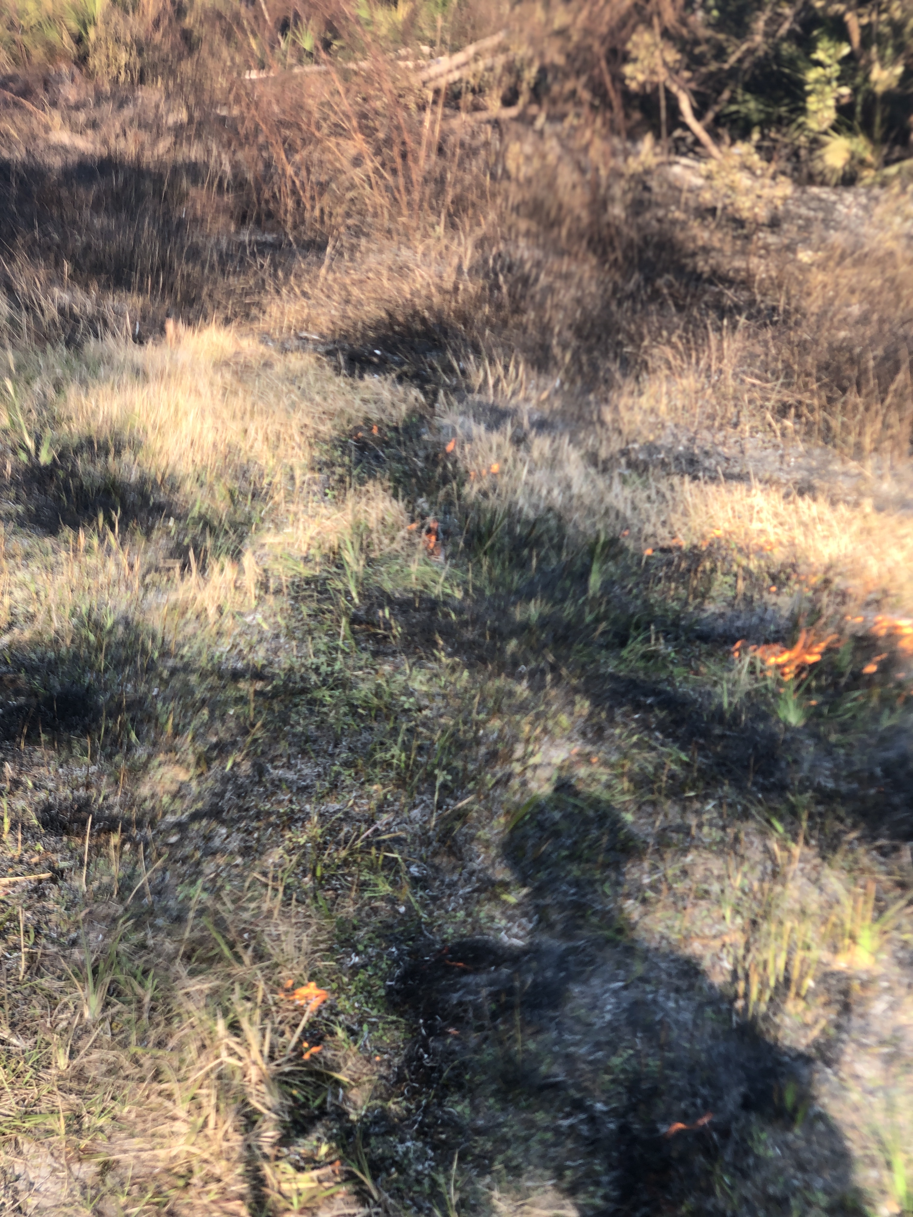
Flames from a controlled burn working their way onto the grassy dirt road through the Mantanzas State Forest. 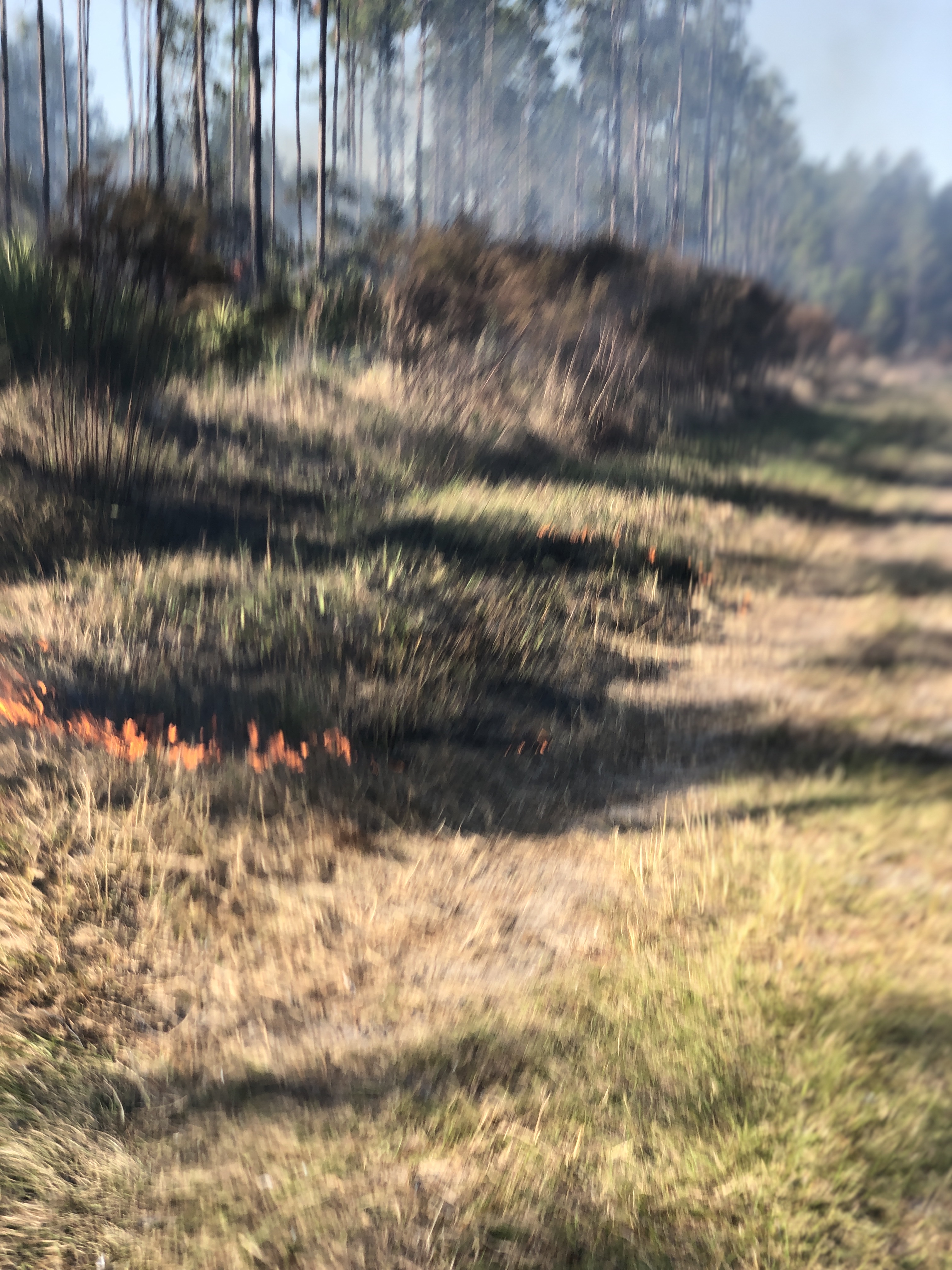
More flames 
Forest service firefighters ahead. 
This was the thickest smoke I had to ride through. Reminded me a little bit of the Talladega National Forest controlled burns that happen frequently in the spring around the time of the Skyway Epic.


This warmed me right up to the railroad tracks which we followed across the Mantanzas River estuary for about 3 miles. Having gotten cut tires on the rocks from railroad tracks before, I was a little bit nervous, but I made it through no problem popping out onto very busy streets given that it was now rush hour and made my way through all the brick roads through the city to the official finish line at Castillo de San Marcos National Monument.
Part 6: The abbreviated 500 mile journey back to the start
Originally I was going to ride as far south as the outskirts of Miami so that I could hit all of the counties in the main part of Florida in a single 1250 mile ride … but the race took about 24 hours longer than anticipated so I need to cut out one of the days of my return trip. This meant that my 267 mile foray dipping down towards Miami before coming back up got scrapped. Not the least bit disappointed though as it just means there is another Florida adventure sometime in my future!
SUPPLIES
- One-up frame pump and multi-tool
- Two 29er spare tubes
- One medium sized bottle of chain lube
- One small insect repellant sunscreen
- One Sawyers bottle of insect repellant
- Hand sanitizer
- Clothing
- One jersey
- Two bib shorts
- One lightweight wind vest
- Long reflective sleeves from a rain jacket
- Six pairs of socks (three purchased during the race)
- Bright orange hoodie (purchased during the race)
- Long polyester workout pants (purchased during the race)
- Knee warmers
- Neck gaiter
- Short finger and two pairs long finger gloves (one pair purchased during race)
- Electronics
- Raspberry Pi 400 computer … yes I took a computer with me during the race!
- Four port wall charger
- Garmin Inreach
- Garmin Edge 1030
- 4,500 mAh Garmin battery extender
- 15,000 mAh battery pack
- Dynamo hub lighting and charging system
- Niterider 550 lumen small helmet mounted light
- One 5-in-1 charging cable, plus two iphone cables, plus two micro usb cables
LAST SET OF MAPS


PHOTOS
All packed up before heading into the hotel. I wanted to make sure I had to do as little as possible after waking up. 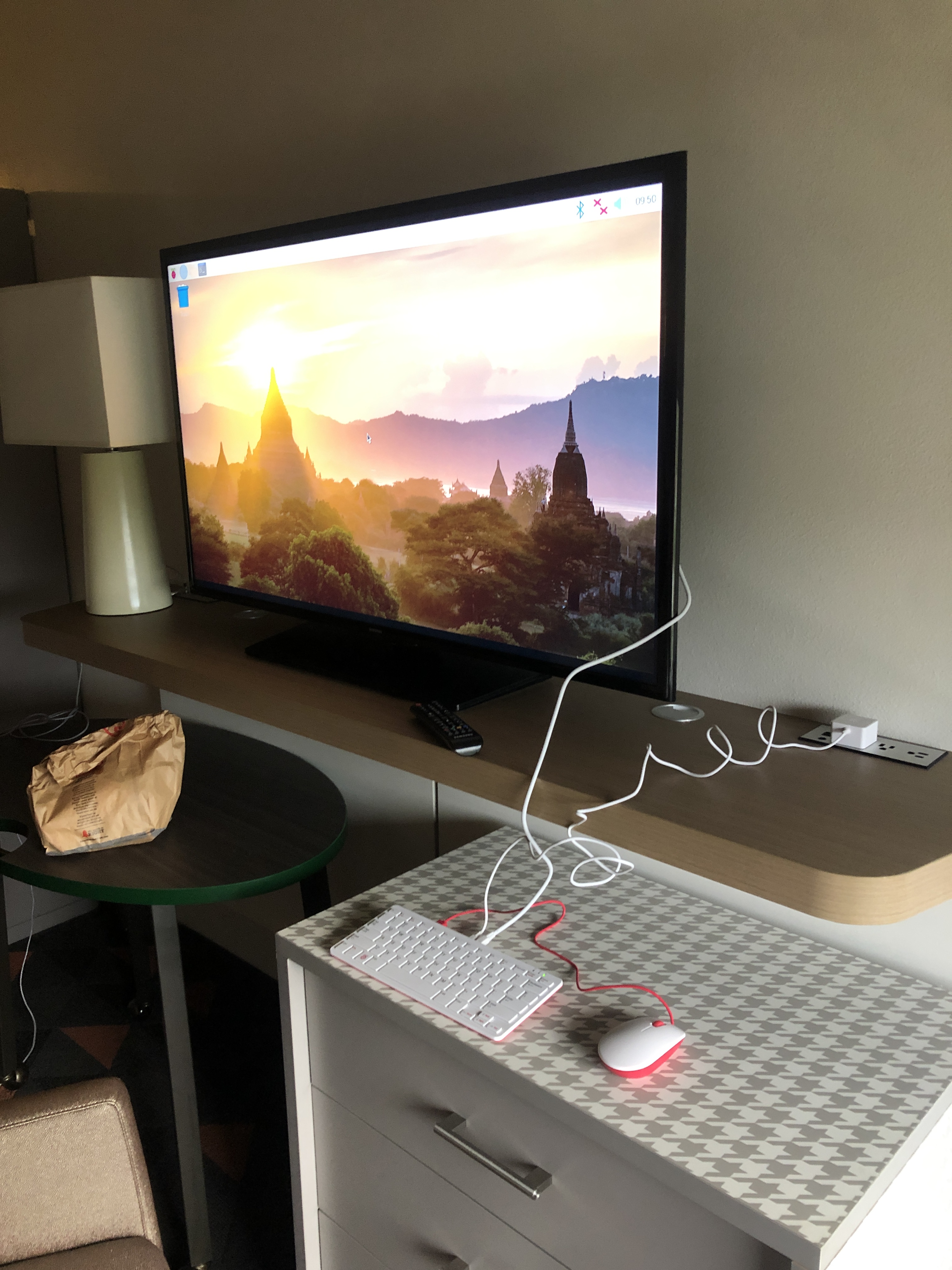
My Raspberry Pi connected to the hotel TV. This worked well and allowed me to do some close route inspection before the start. 
Speaking of route inspection, this was my notes I made on my phone to take with me as I was inspecting closely for stores along the route. 
Pulling out of the hotel on a wet rainy morning to make my way down to the start. 
Discovering the cool Pinellas Trail system during the race. Lots of bridges over busy roads. 
Another bridge on the Pinellas Trail around sunrise. 
Water marks for various strength hurricanes. That’s a LOT of water! 
I remember taking this selfie through a dense section of the forest road I was on. 
An early cool bridge, I would cross over many others (some way cooler) but it was tricky to get my phone out to take pics. 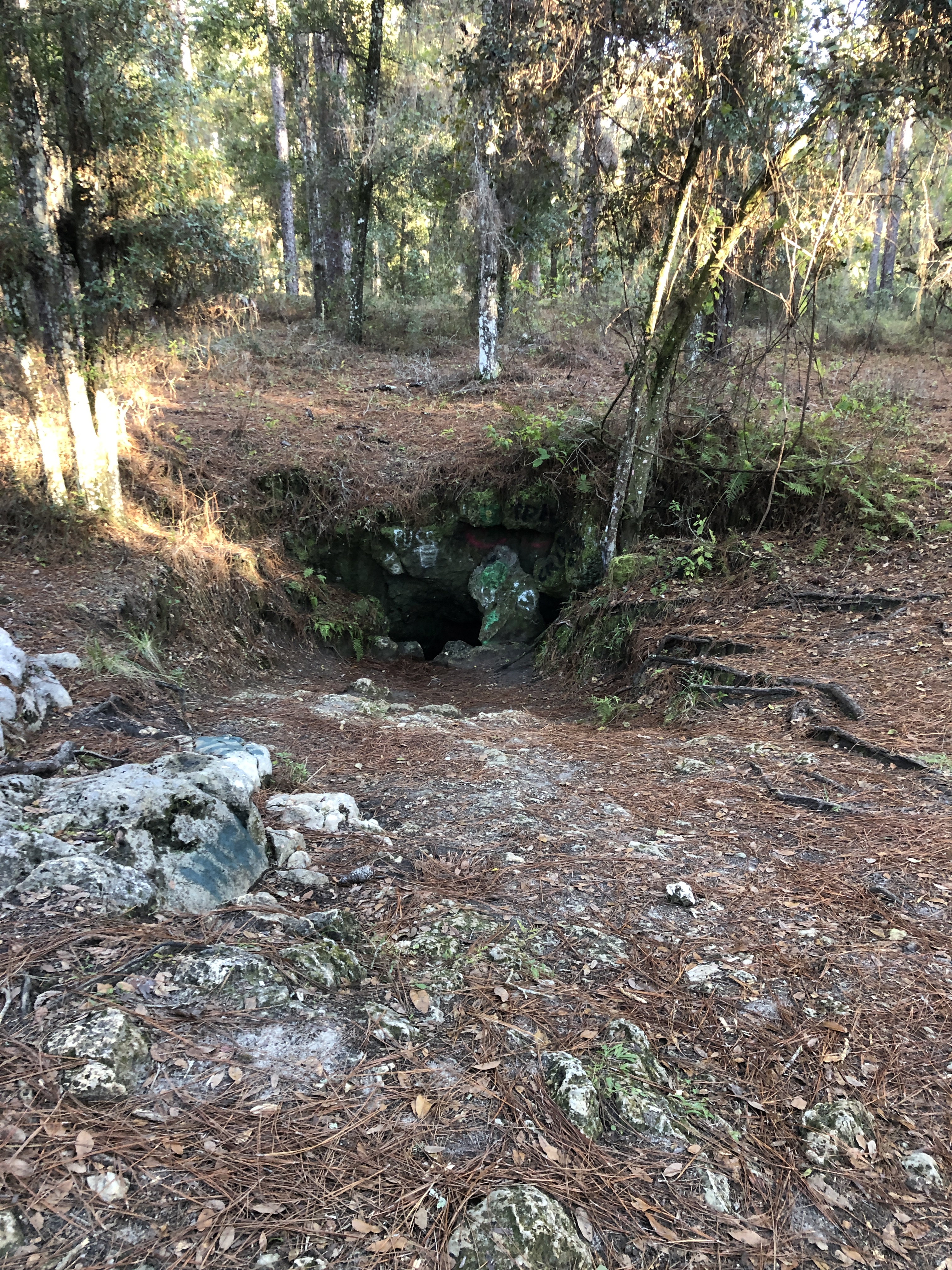
A “cave” in one of the forests. 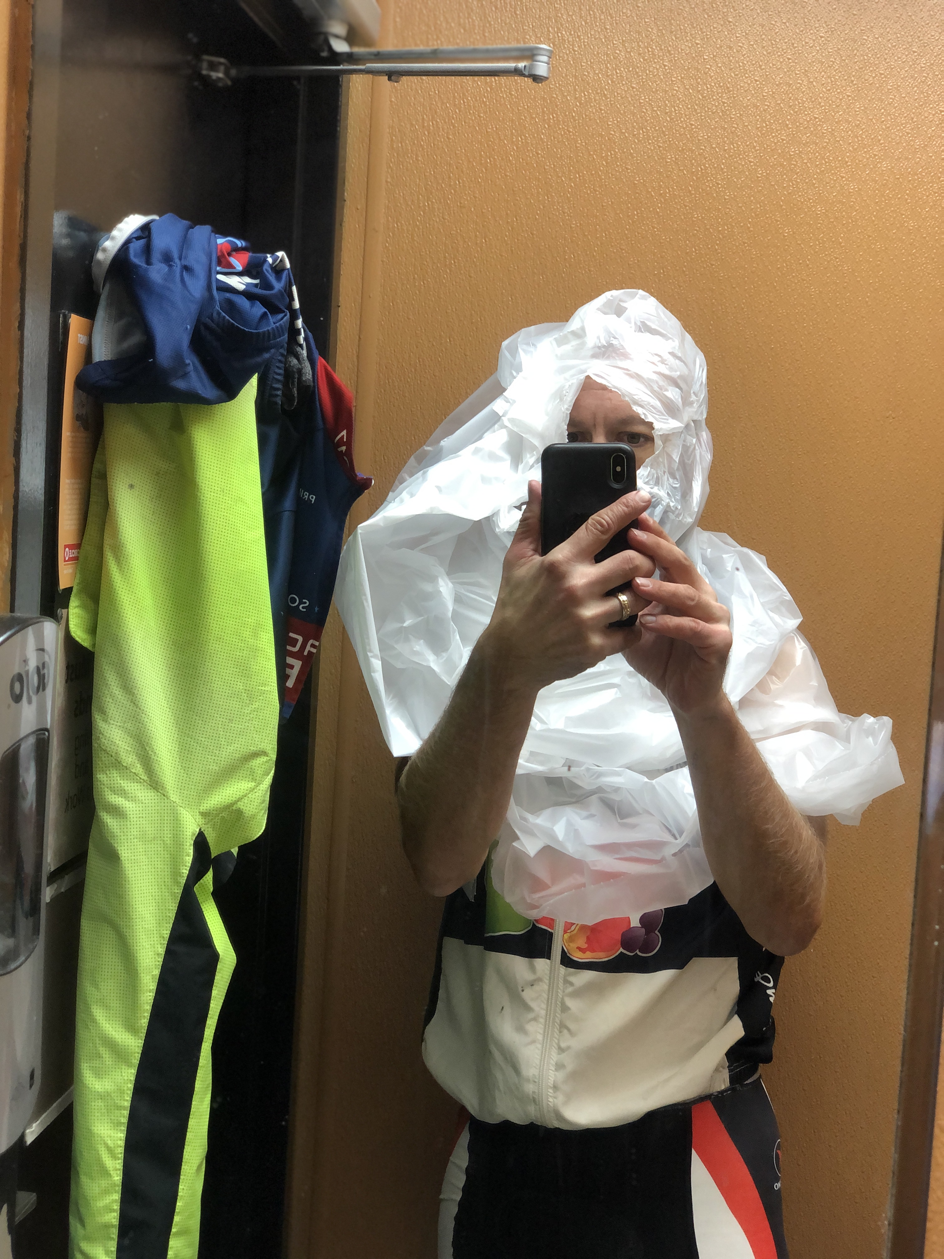
Emergency clothing – Circle K trash can liner. 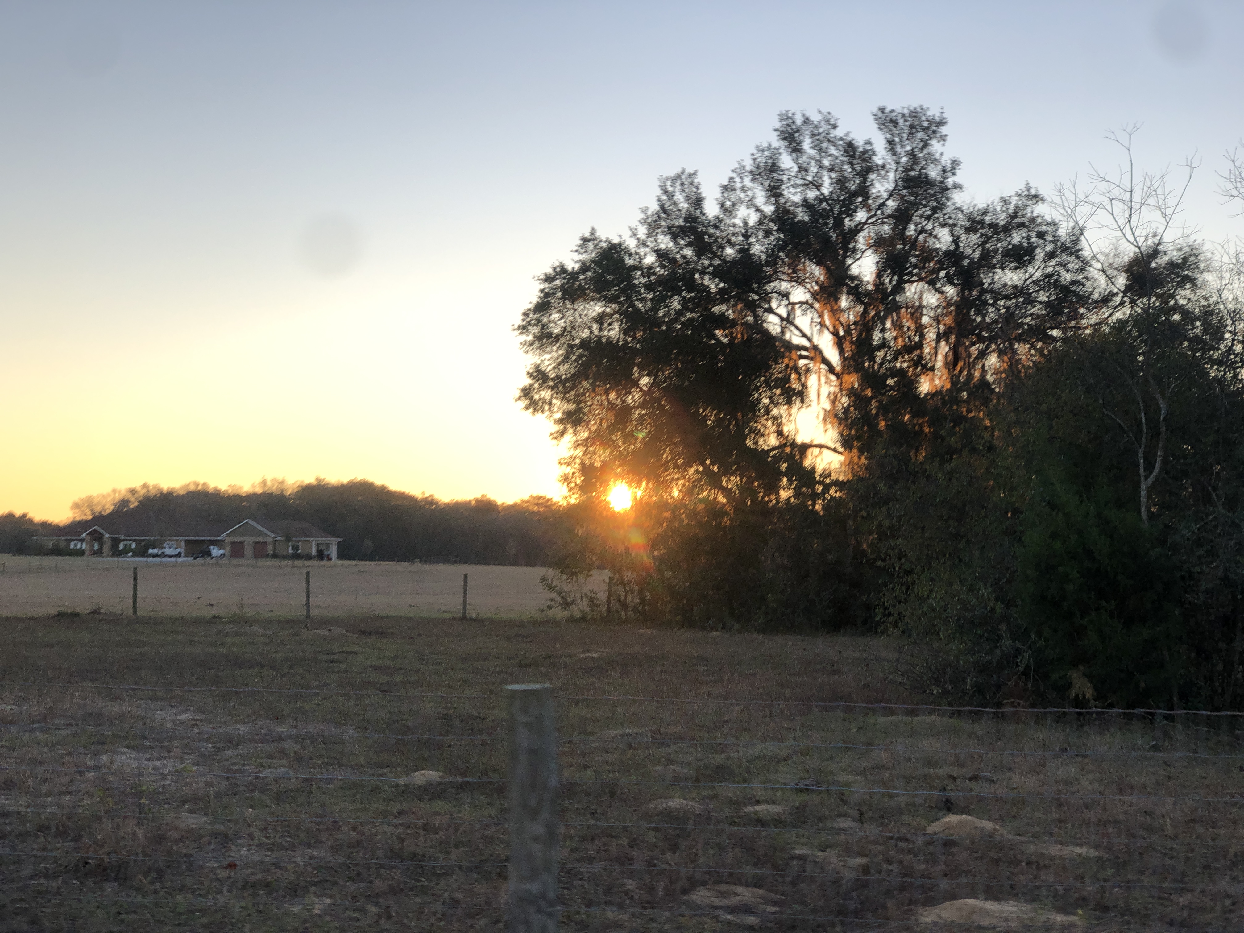
Cold sunrise with Spanish moss. 
Lots of oranges all over Florida. 
The lock gate puzzle. 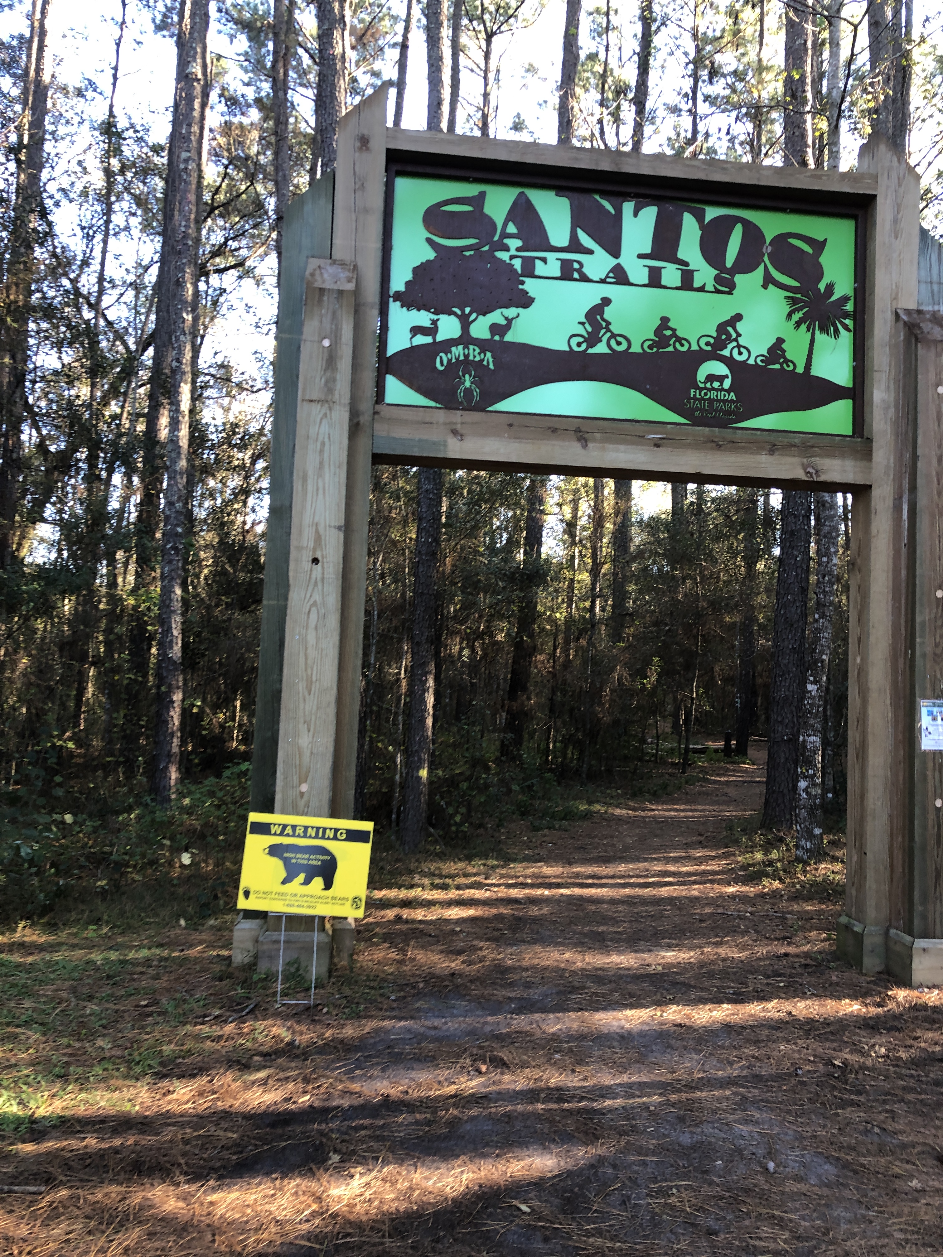
Exiting the Santos trail system. 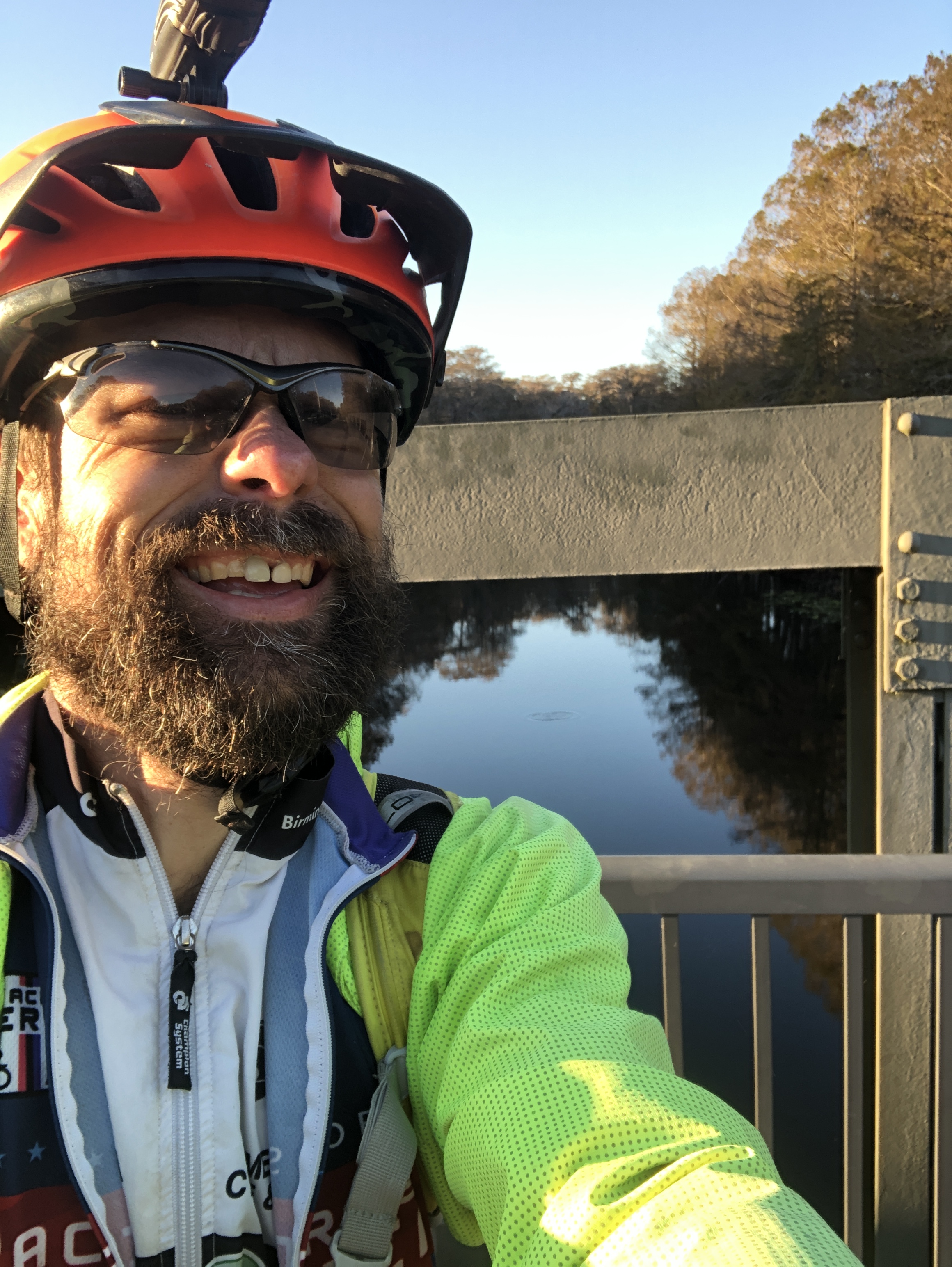
Selfie check point after the Marshall Swamp trail. 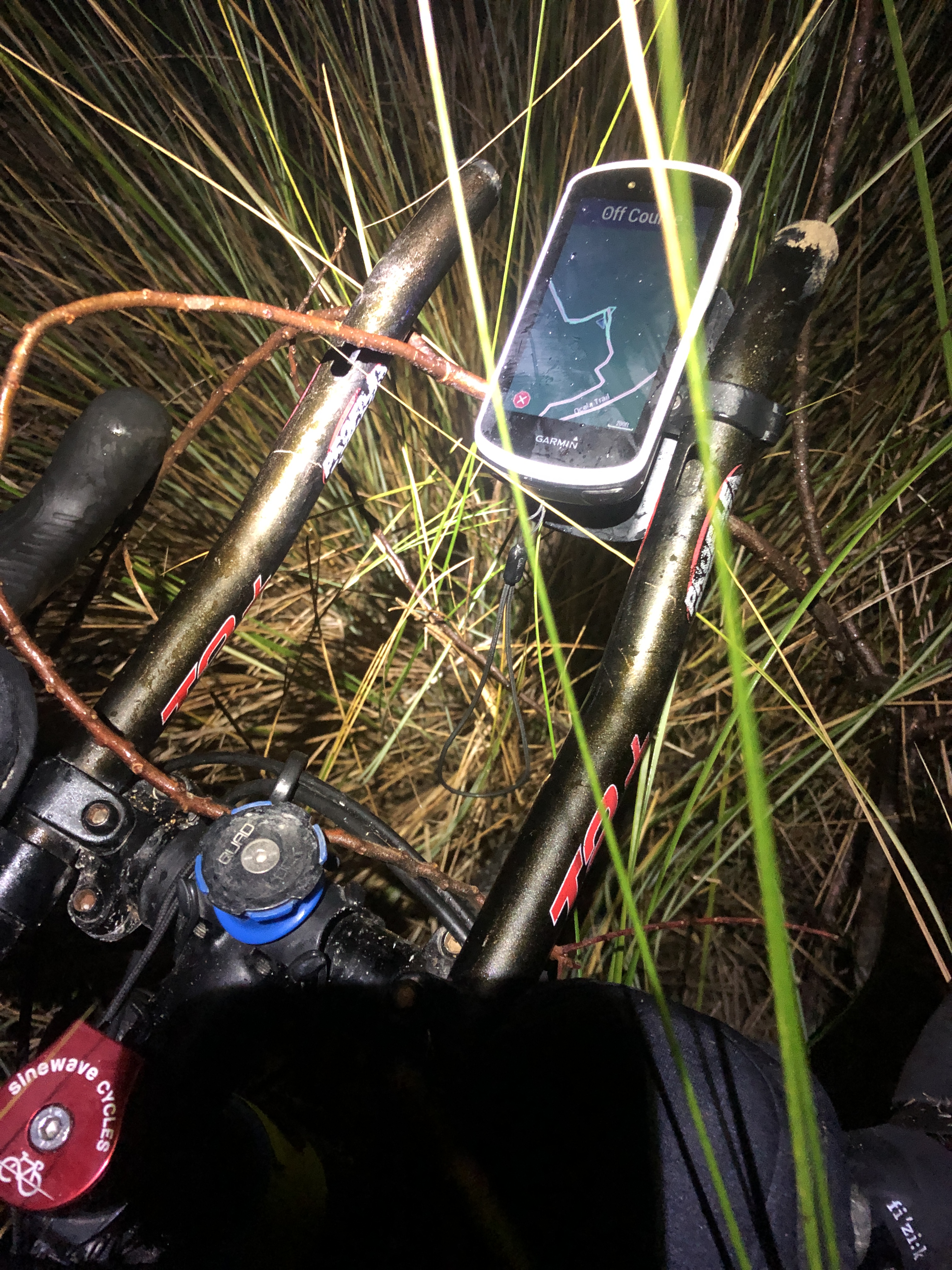
“Off course”. 
One of the cool swamp bridges on the St Francis trail. 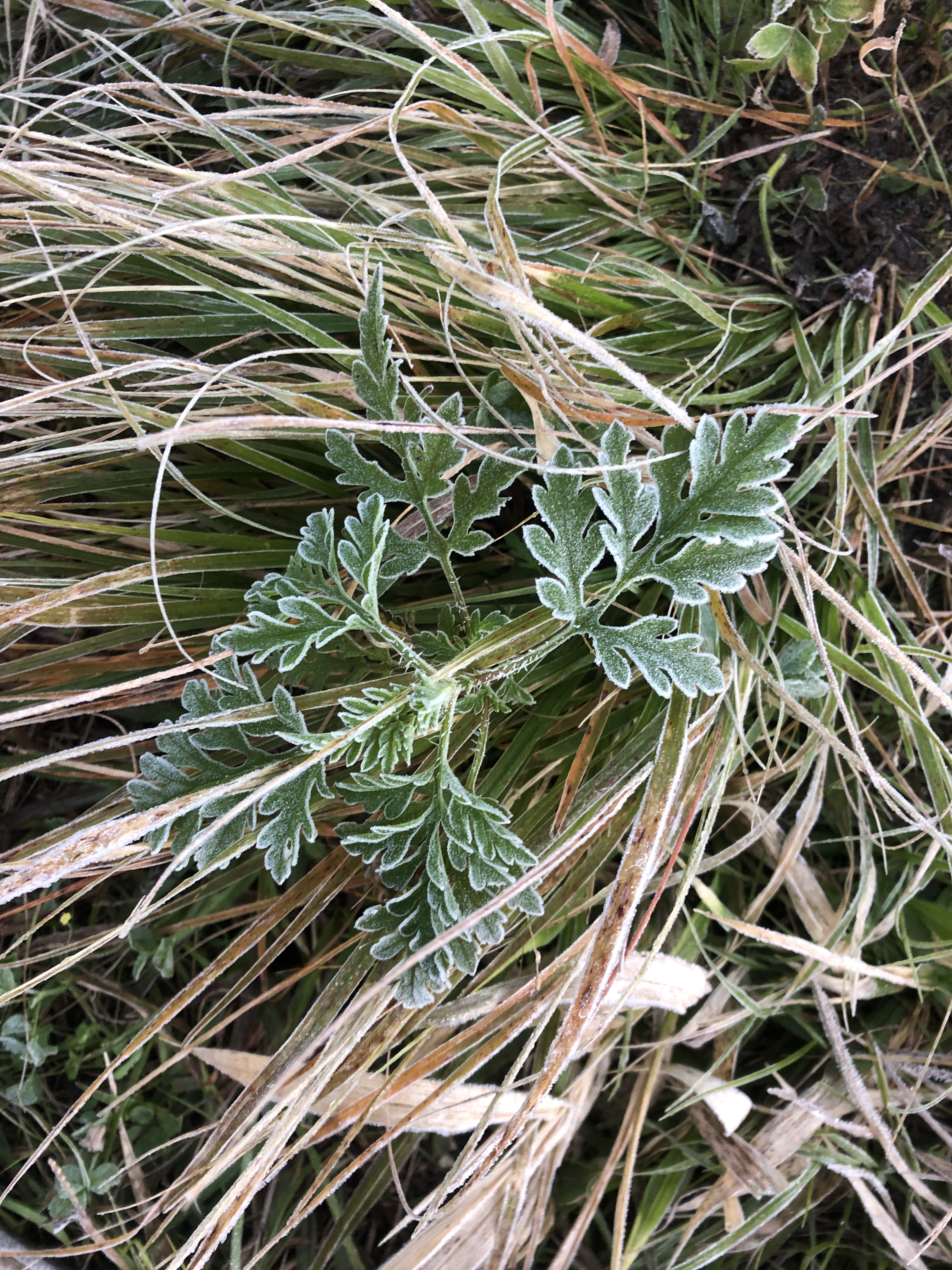
Frost. 
Laying out Dollar General clothes to dry in the blessedly warm sun. 
Riding barefoot in same sun. 
The Old Dixie Highway brick road … 10 miles of this. 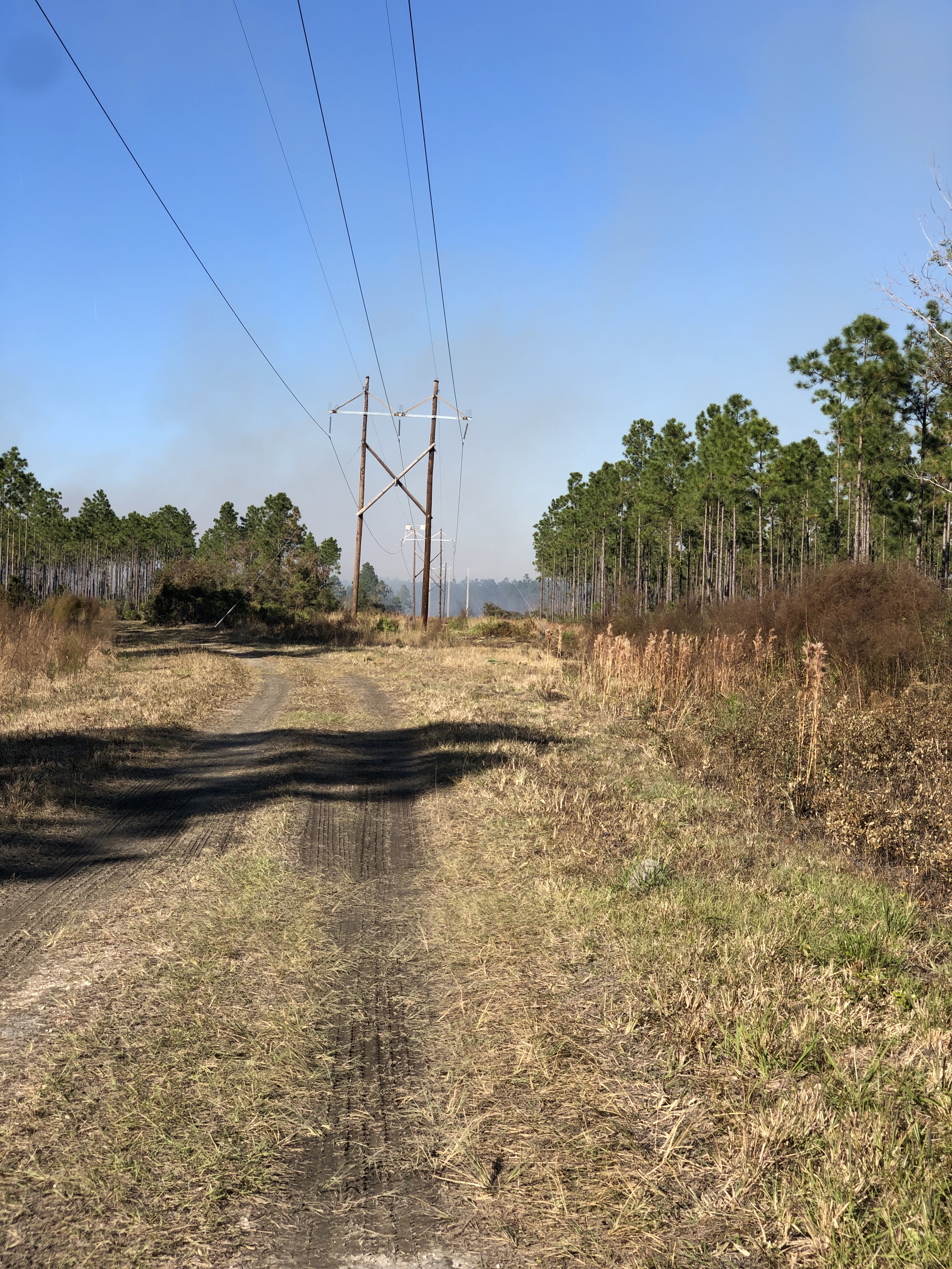
A “mountain” up ahead … turns out it was just a smallish but endless hill made blue by a smoky haze. 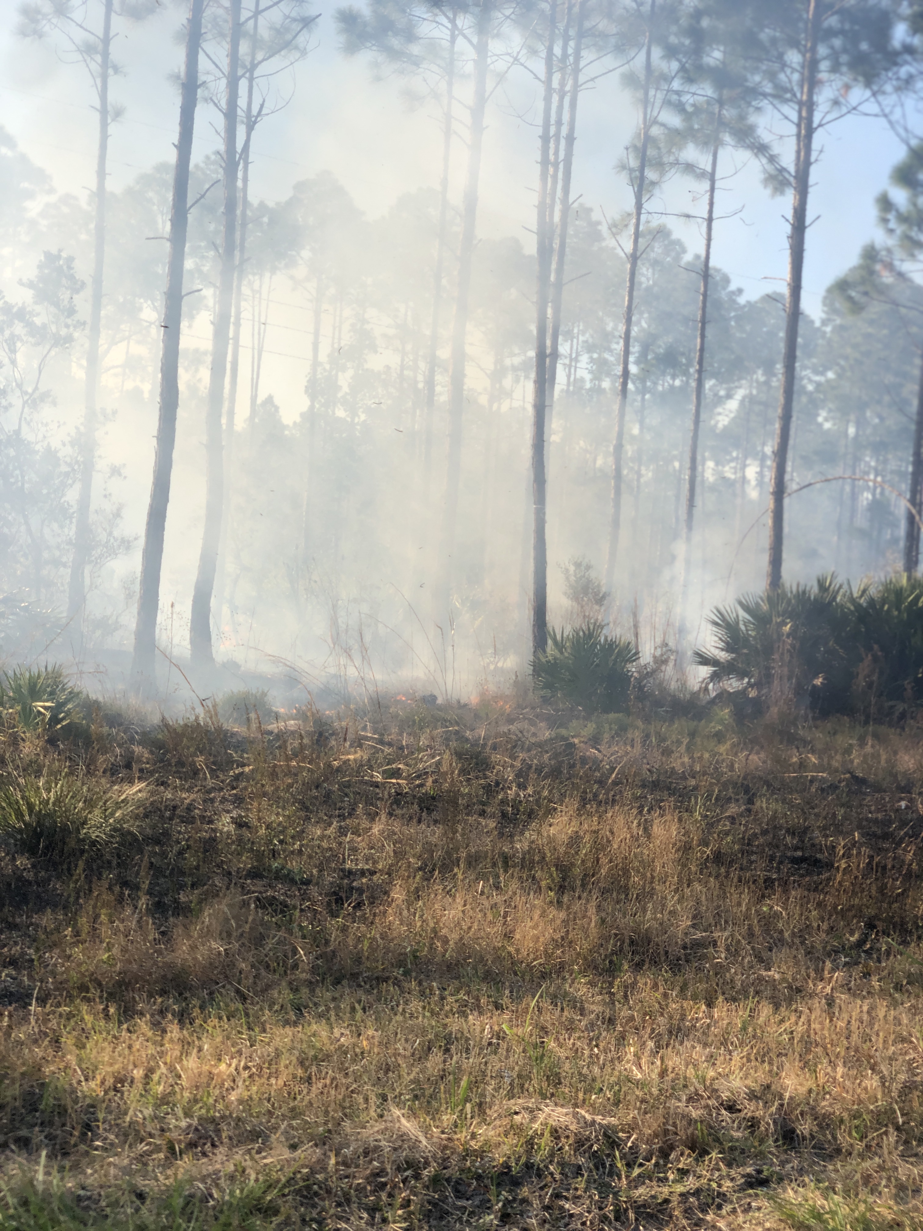
Smoke from a controlled burn. 
There be gators here. 
Old train bridge next to new. 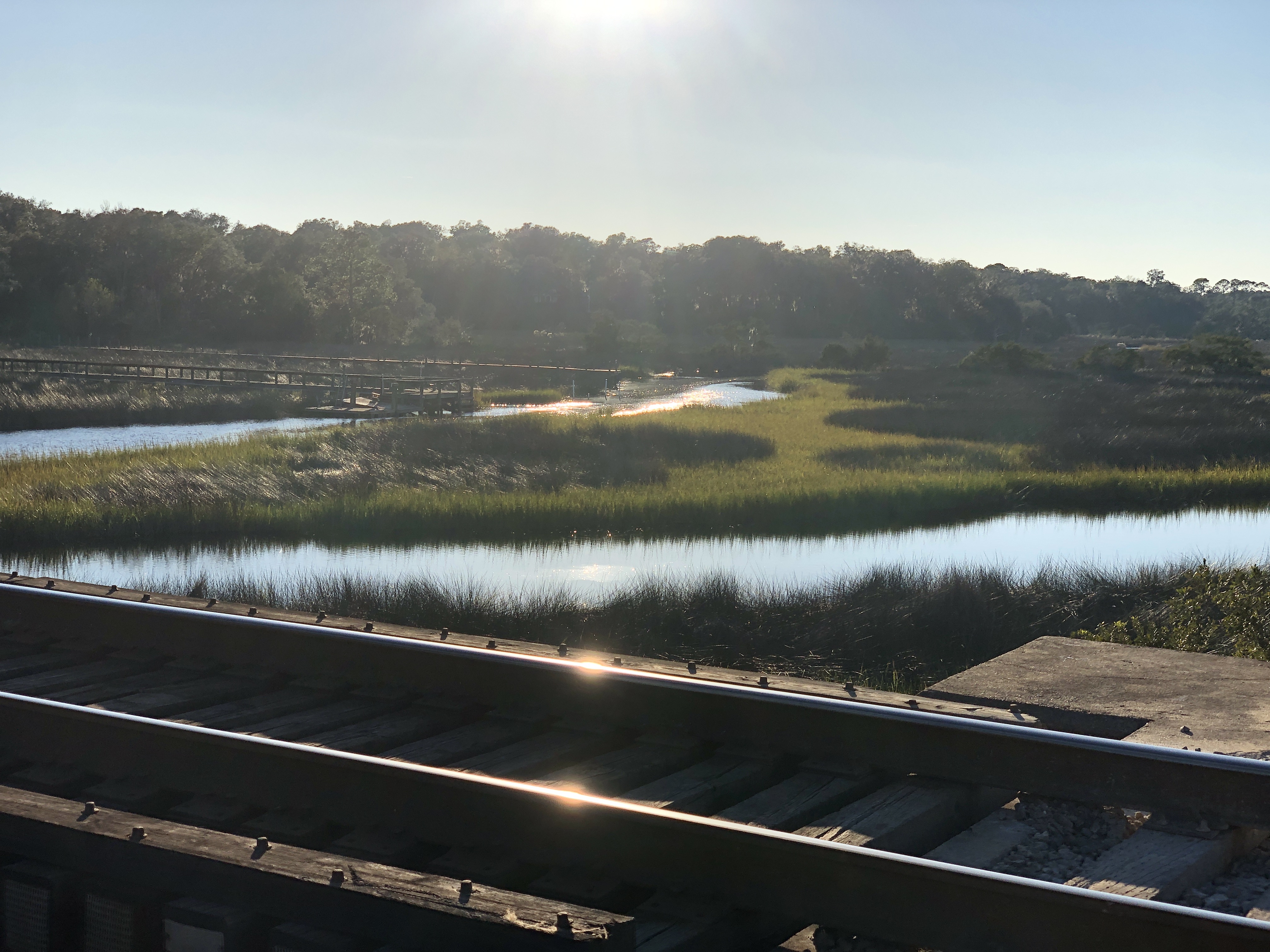
Mantanzas Estuary 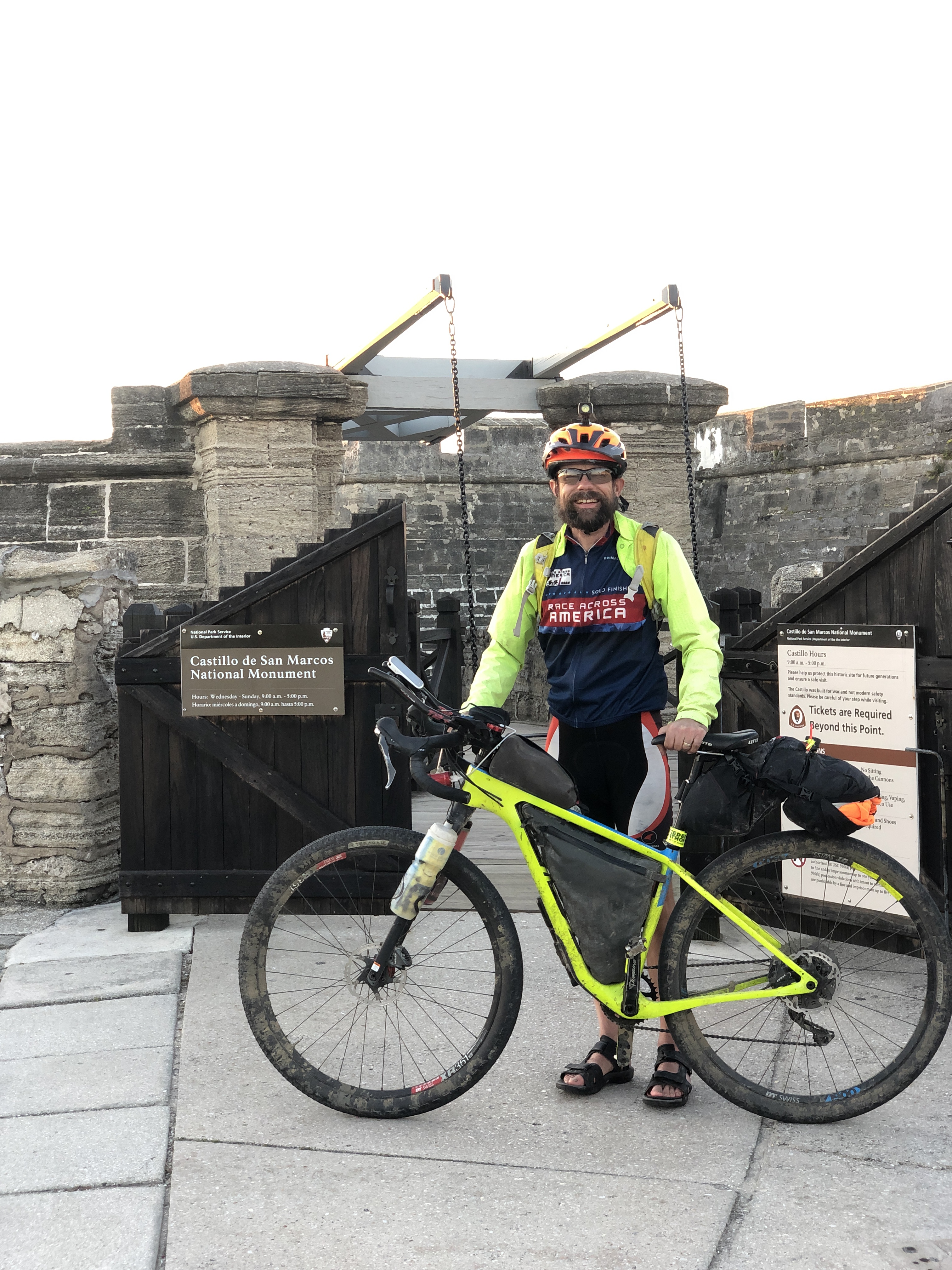
Finished! 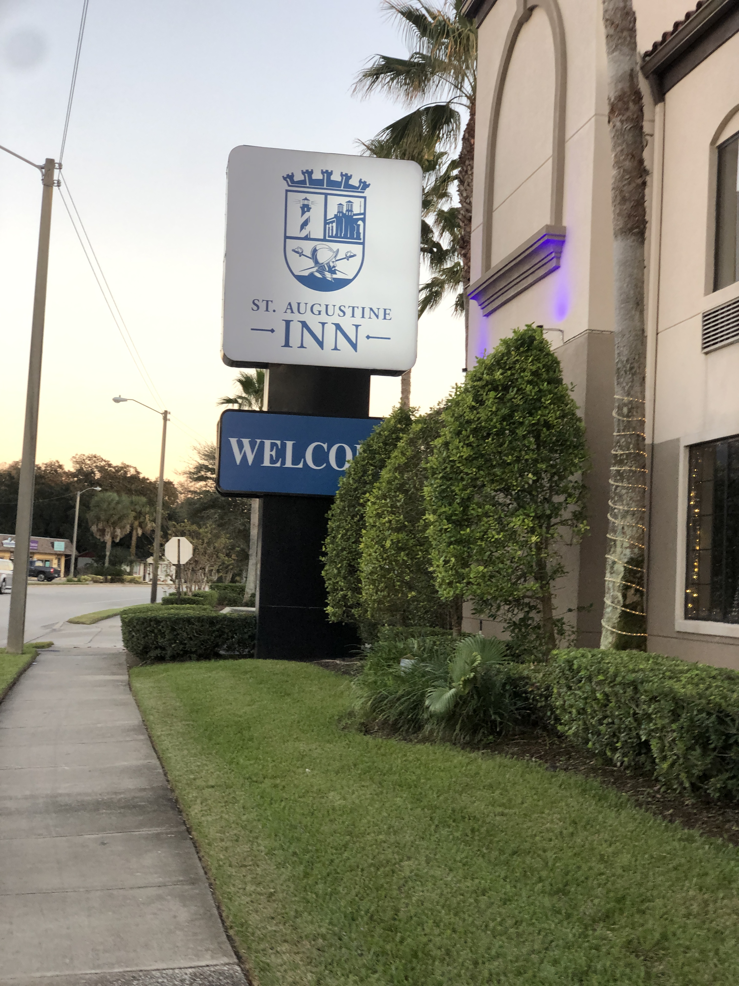
St Augustine Inn 
Historical marker? 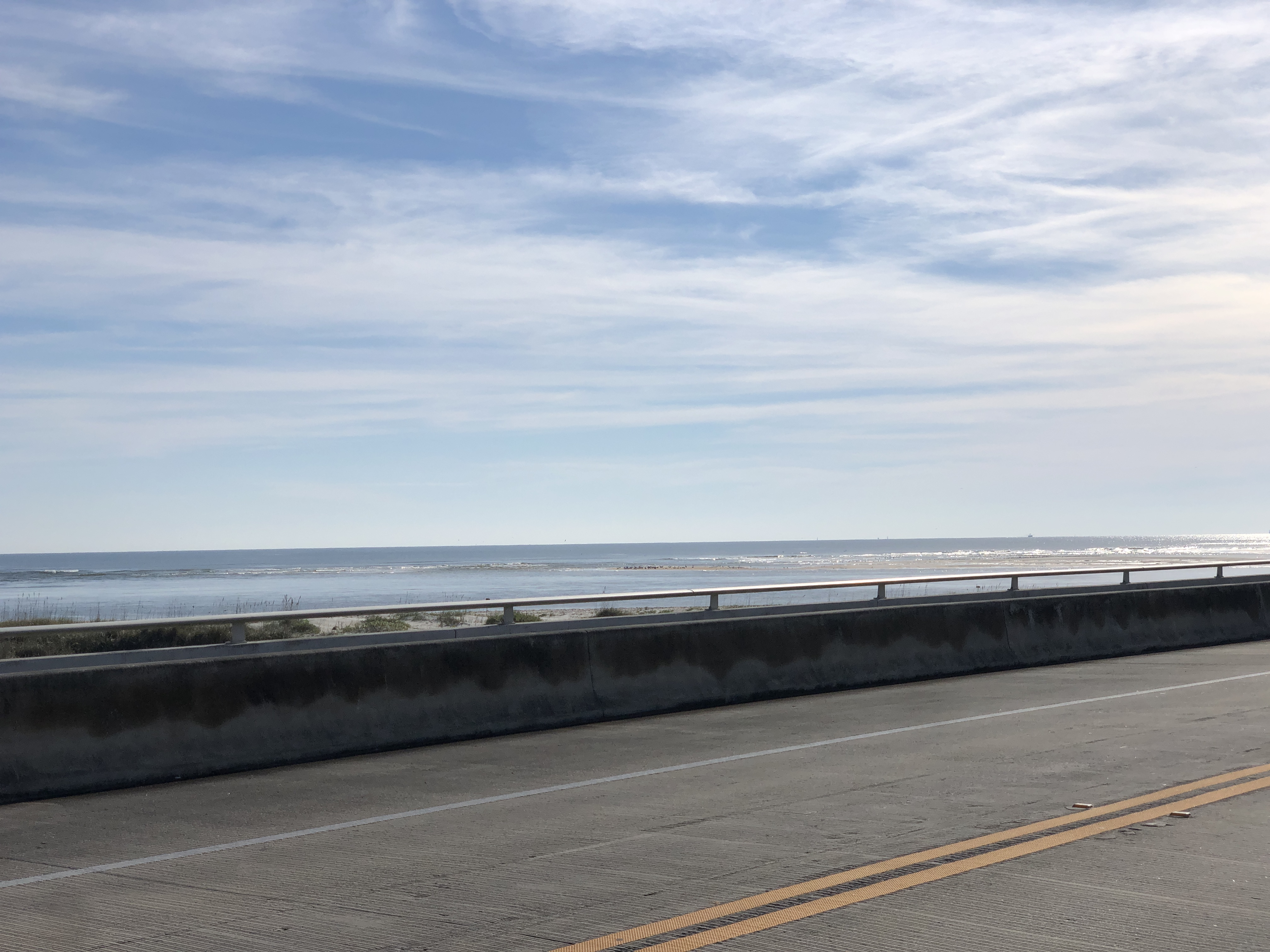
The Atlantic Ocean 
Flagler Beach 
The dock at Flagler Beach 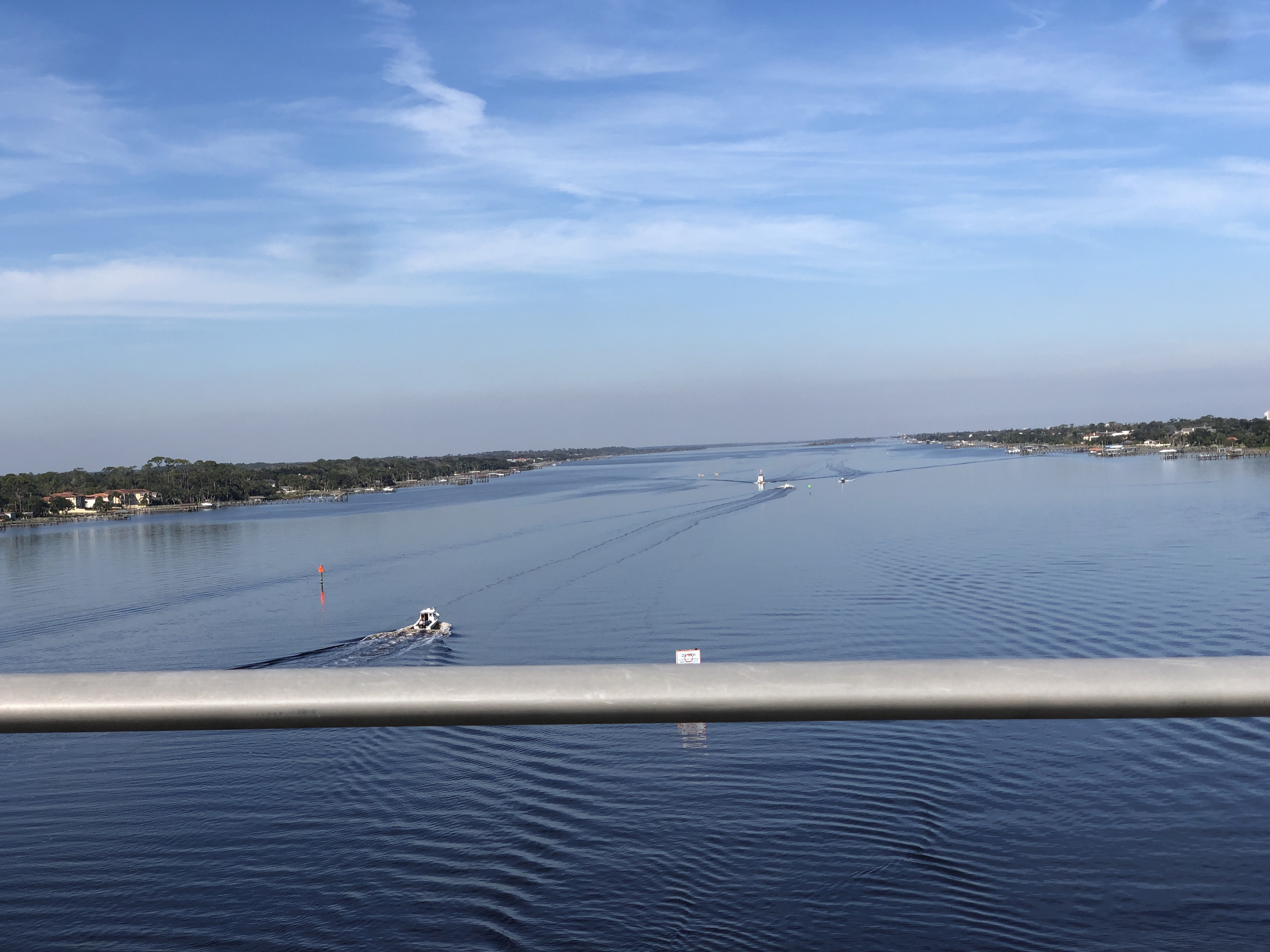
Intercoastal waterway 
A much needed Circle K – this time for food and drink instead of warmth 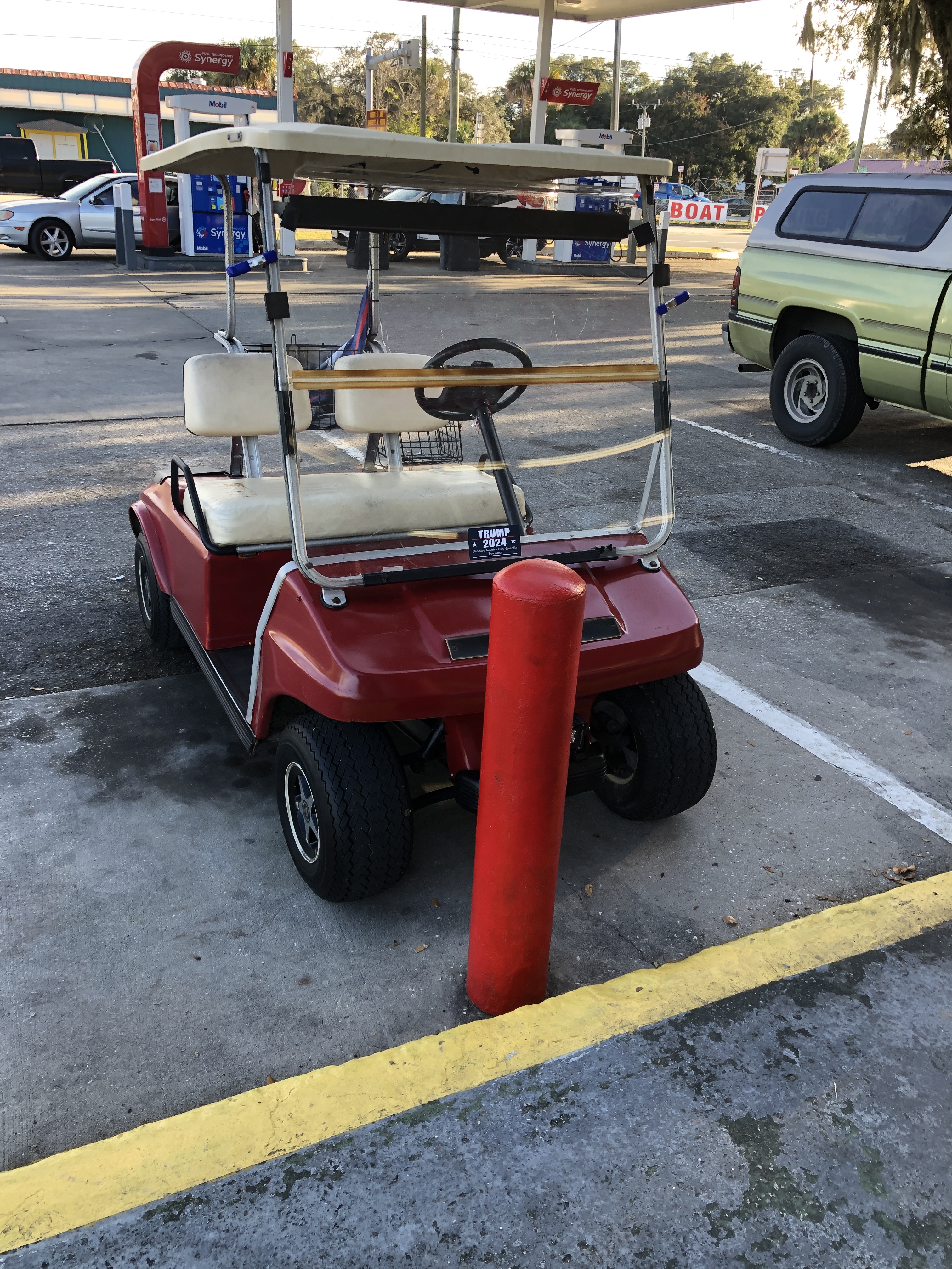
Trump 2024? Won’t he be really old? I’m hoping Biden is only one term as well and turns the reigns over to someone younger. Is that wrong to think they might be a bit too old? I can barely keep my head on at 44 … how are they still functioning at 78??? 
Cocoa Beach 
Election protest for
Donald Trump
I thought this was the trail entrance, I almost rode straight off the end into the canal surrounding Lake Okeechobee 
Lake Okeechobee Trail 
Crossing a lock on the Lake Okeechobee trail. 
Mile marker 53E (east side?) on the Lake Okeechobee trail. I think the entire trail system is 100+ miles around the lake. 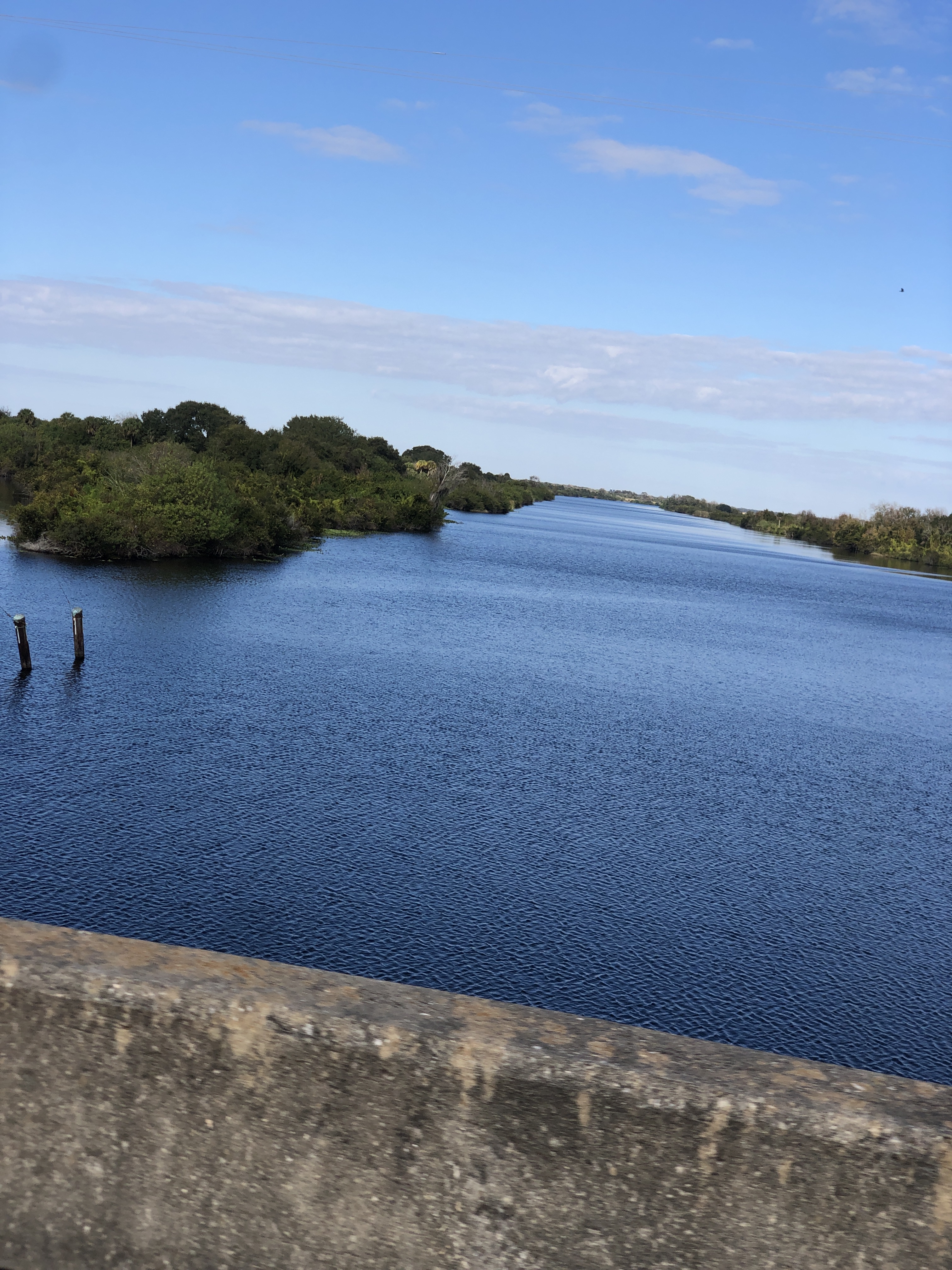
Suwannee River I believe 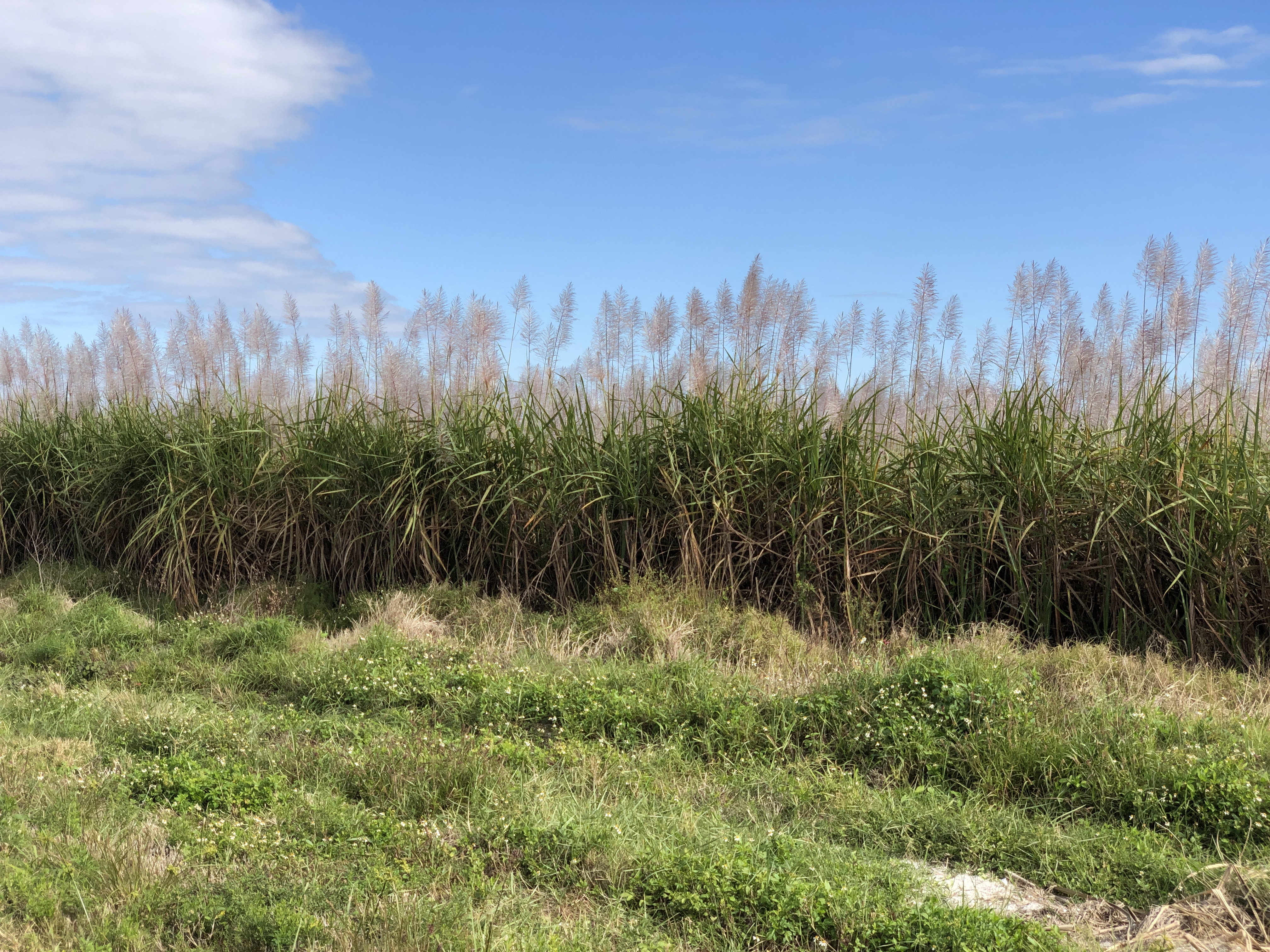
Lots of pompass grass 
Bears and oranges (look between the bushes on the right for the start of an orange grove) 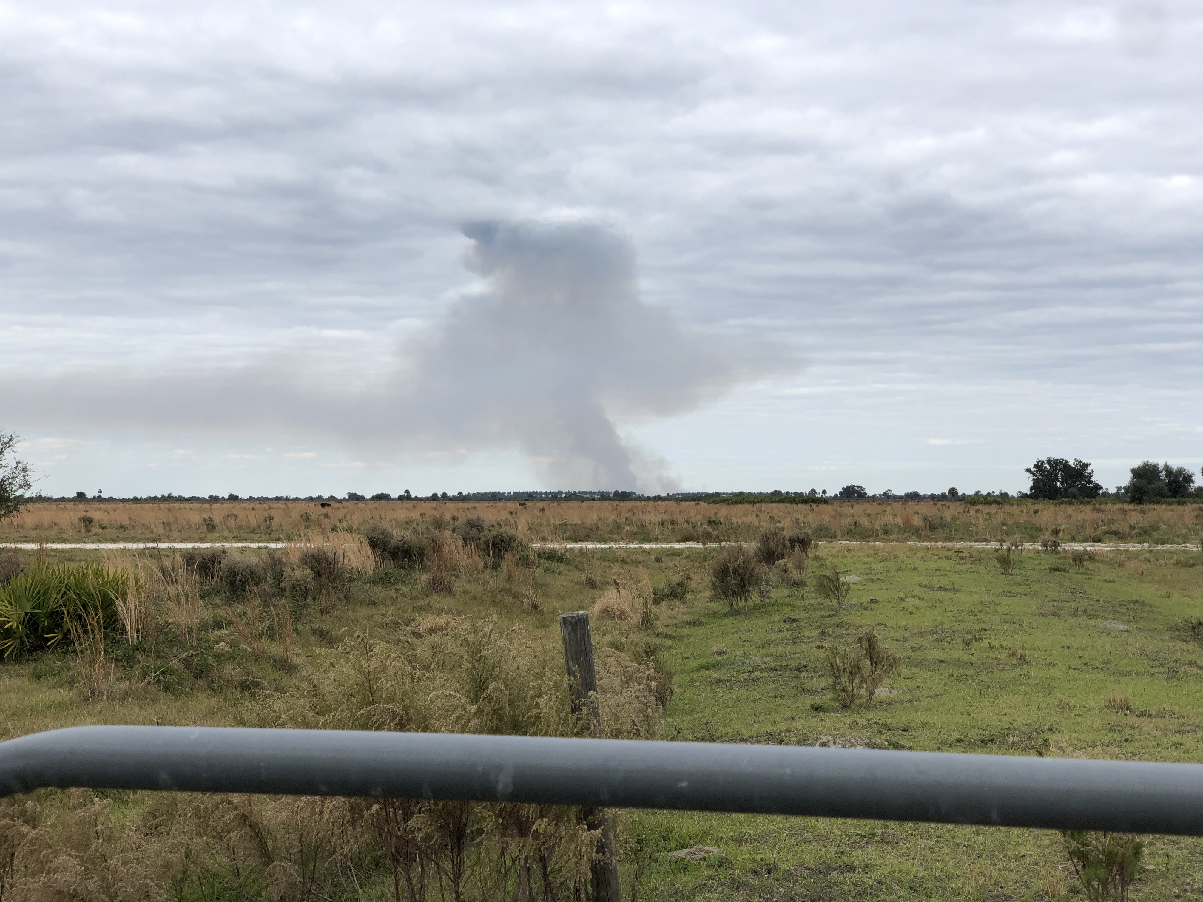
Wildfire in central florida. 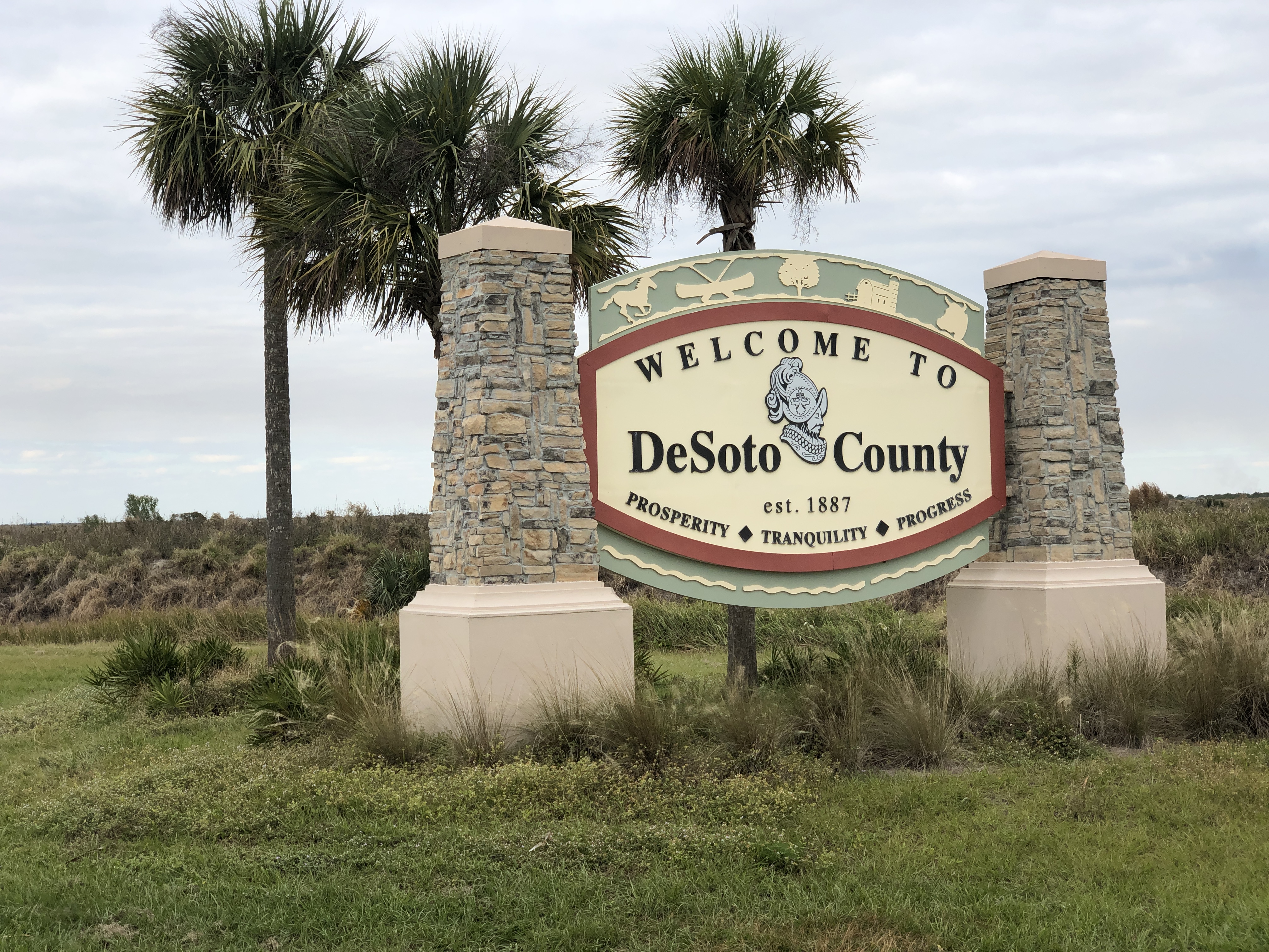
DeSoto county. 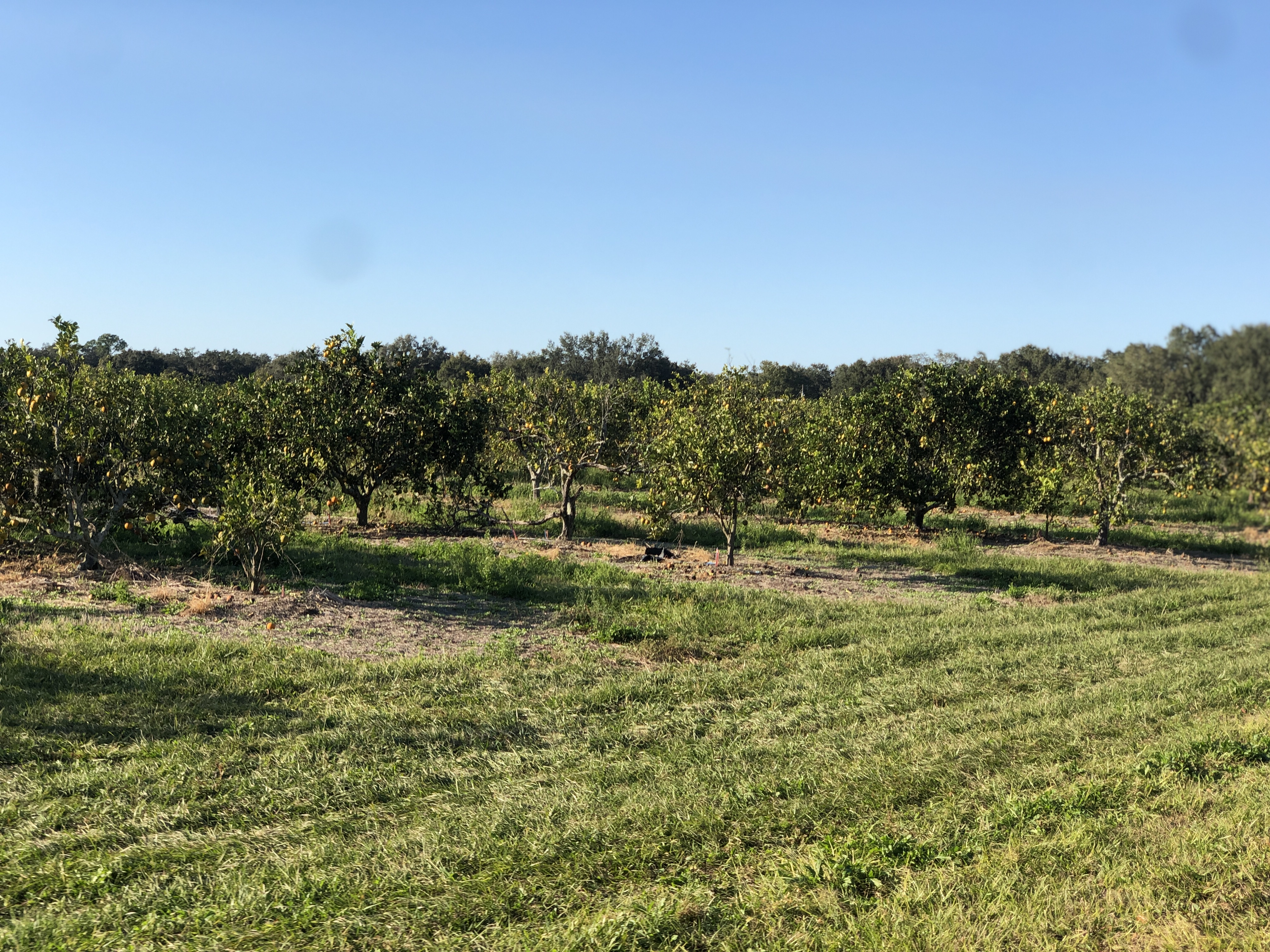
One of many, many, many, many orange groves. 
Spanish moss sunset. 
Orange grove sunset 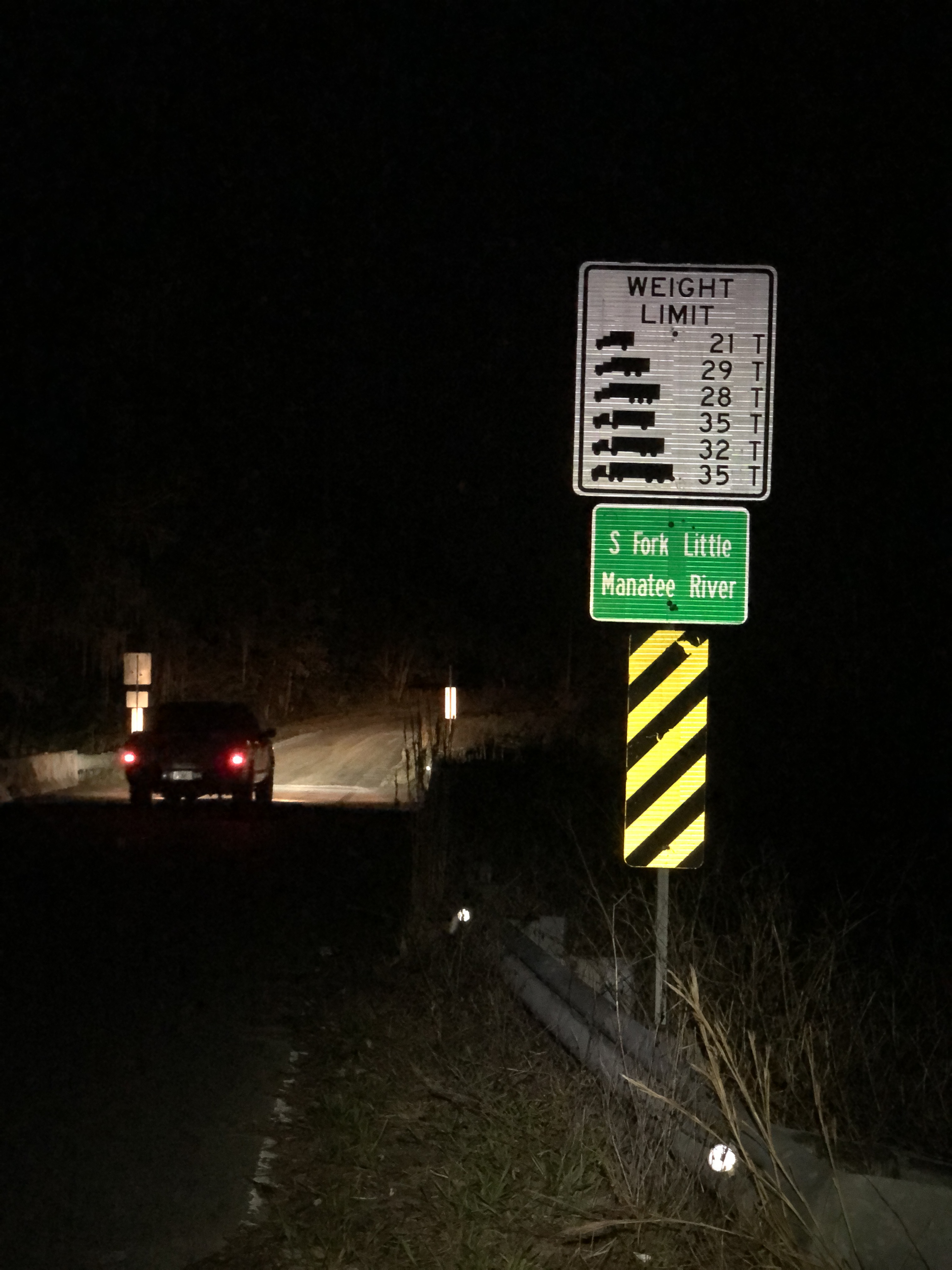
Manatee River 
Tampa river walk multi-use trail 
Tampa river walk multi-use trail 
Tampa river walk multi-use trail 
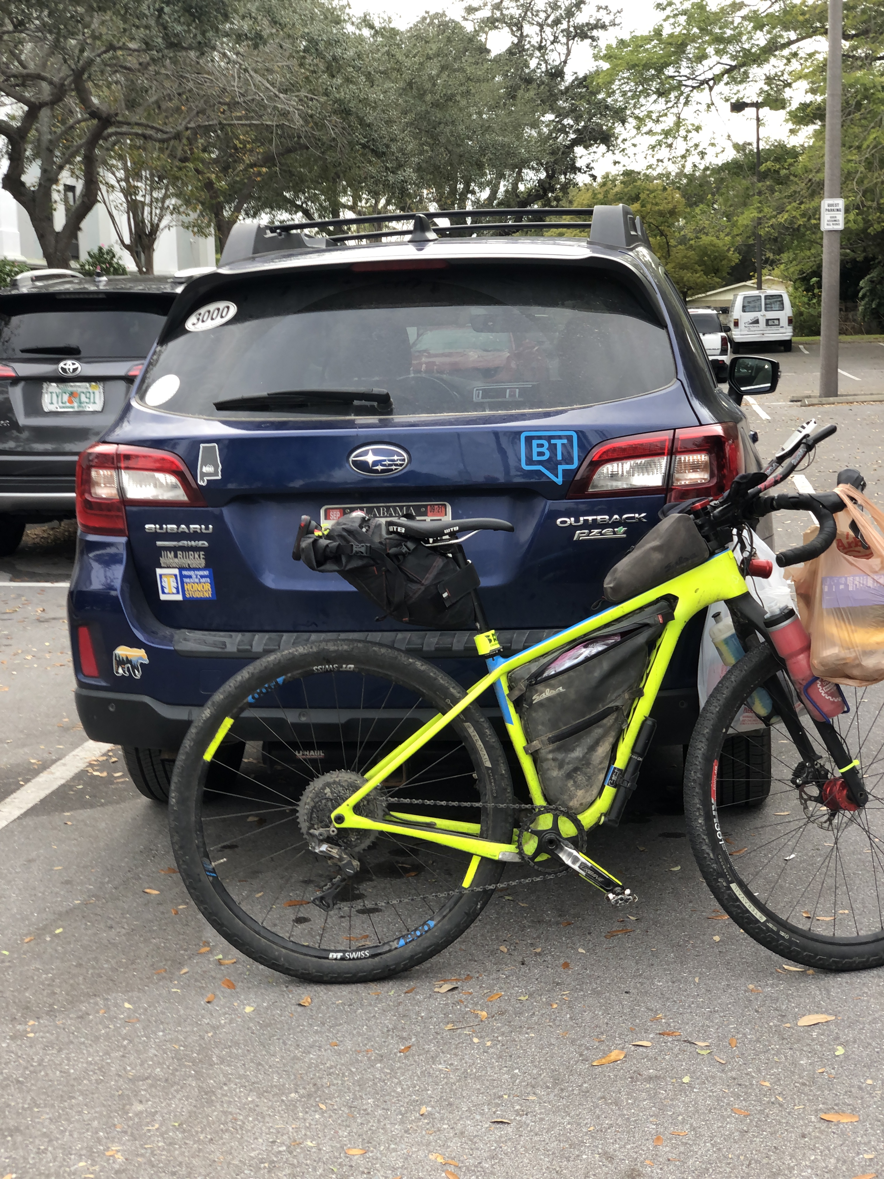
My car where I left it 5 days and 1000 miles ago! 
Taxidermied alligator on my way back to Birmingham.


Leave a Reply