10000 feet of climbing in one ride – the garmin edge 800 cannot display 10,000 feet because it only can display 4 digits in any one column as shown in the red circle! As a side note, the yellow circle indicates what in my opinion is one of the best new features of the Garmin 800 – the ability to display your climbing rate (instantaneous and 30second average).
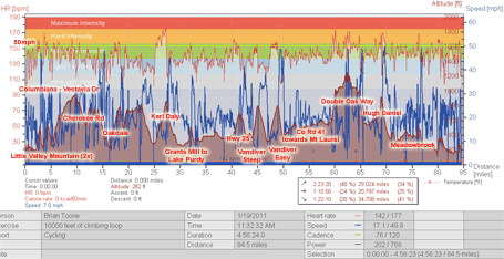
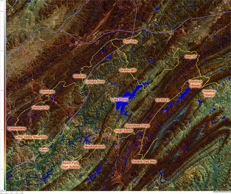
So how does one climb 10,000 feet in Birmingham? Here’s the maps and data!  10,000 feet of climbing in one ride – annotated with climb names and a line indicating all the descents approaching 50mph.
 It’s Birmingham, so what would a ride be without a few greater than 20% gradients per the red iBike slope data above – 21% on Renfroe and Double Oak Way, 24.7% on the climb to Greystone Crest off of Hugh Daniel
 10,000 feet of climbing in one mega-climbing loop! Click the map for the medium version. Or download the huge version to see all the residential road names.
Leave a Reply