Silverthorne and Salida were both important parts of my 2012 Leadville 100 MTB race. My wife and I spent the night in Salida on our drive out to Leadville so that we could pick up my race packet early the next day and then drive to our AirBnB in Silverthorne (you had to book Leadville lodging nearly a year ahead of time to find a place). How funny that I would end up connecting those same two cities in this year’s Tour Divide 10 years later (taking a vastly different route between the two, though).
Bike Paths
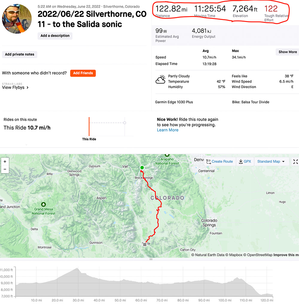
I had checked into the Hotel Indigo in Silverthorne around midnight, and I was out the door and on my way by 5:22AM, and since it normally takes me an hour to get everything back together that means I had set my alarm for about 4:15AM. Tour Divide, “hotel edition”, must be the least efficient way to spend your money imaginable.
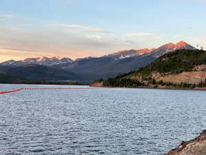
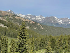
Still, it was a good sleep, and I was happy to be heading out of town on some awesome bike paths as the sky got brighter and see an amazing sunrise with alpine glow over the reservoir and mountains outside of Frisco and Breckenridge (see pic at top of post).
Boreas Pass
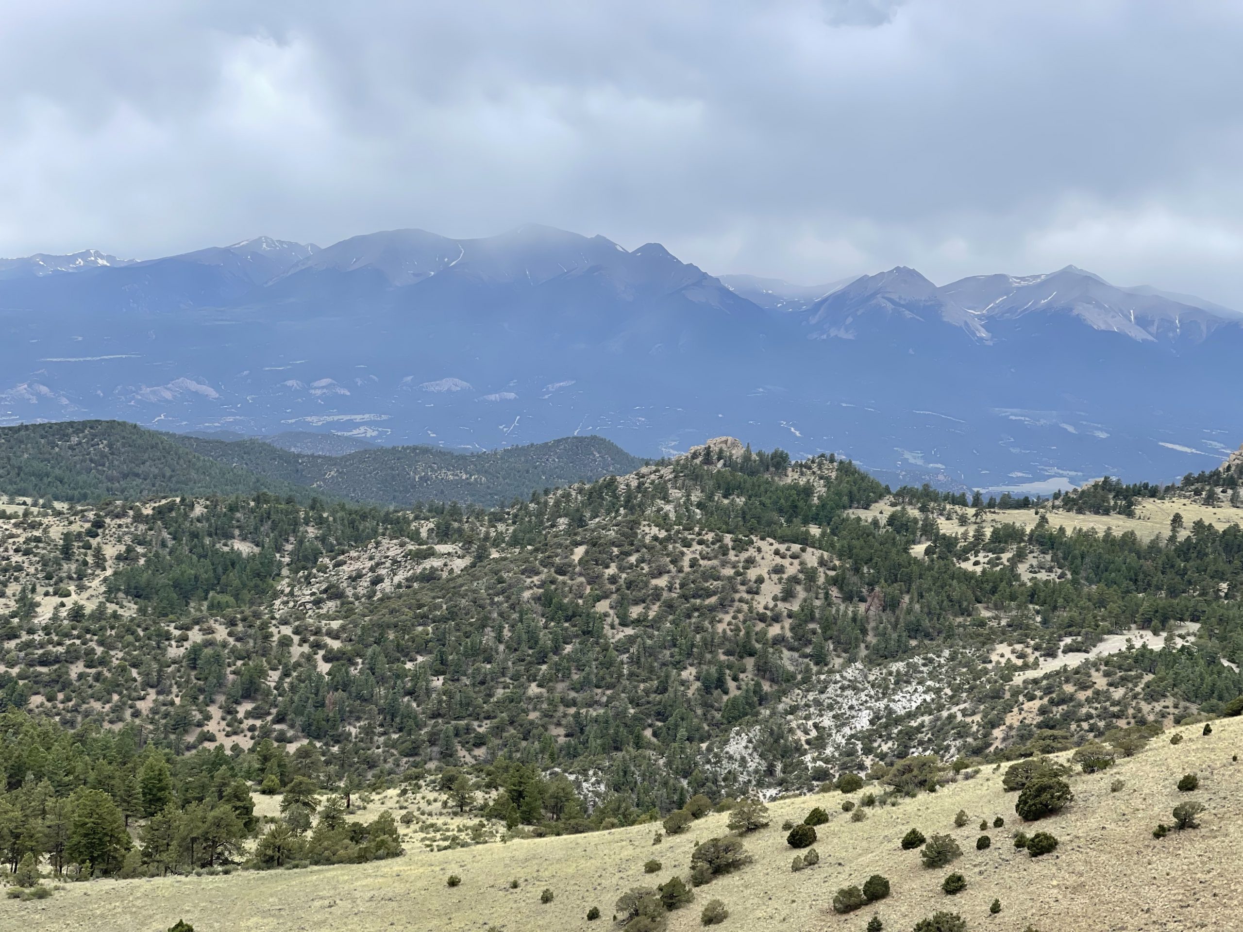
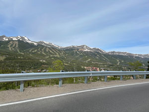
The bike path climbed through Breckenridge until you made it to the paved road taking you up Boreas Pass. Well, at least it started out paved. By the top, it turned back to a somewhat rough gravel/rock. Along the way, there were pullouts already mostly occupied where people had car, campervans, etc… parked. Some were still empty, but I could see how this area would probably get so busy later into summer. The views were fantastic, but still not as amazing as the sharp Rocky Mountains early in the race, but impressive because of the clearly visible tree-lines on most of the mountains indicating the high elevation in the 12k-14k foot range for almost all the peaks. I think the only 14ers visible prior to Boreas would have been Gray’s and Torrey’s peaks looking back across the reservoir but I didn’t know where to look when I was biking through there. Later in the day, Pike’s Peak was about 50 miles to the east with what looks like a clear line of visibility, but perhaps only a mile or two (if that) where you had to look in just the right spot. Also, it was cloudy and raining, so Pike’s was probably not visible.
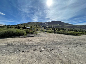
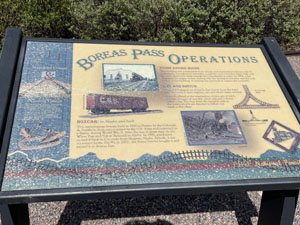
But back to Boreas Pass where it was now late morning – I had been taking my time at the top fascinated by all the railroad signage and trying to imagine trains making it all the way up there when a guy comes charging up to the top on a road bike (I think). He was moving pretty good and went straight over the top at a full sprint. I was thinking, oh he must have been going for a PR or KOM on Strava. He was giving it 100% sprinting across the top. I had spent enough time at the top that I really wanted to get out of there, but right about that time he climbed back up from how far his momentum had taken him down the other side and wanted me to take a picture of him at the sign. I obliged and then headed down the mountain. I couldn’t help but think, man, you just did a hard effort on a single climb and I’ve been doing climb after climb after climb after … well, you get the idea. Also, I was thinking, man I used to be fast. Still, it’s awesome to see all kinds of people with all kinds of goals having fun and pushing themselves to the limit on bikes!
I remembered from all my route planning that there was a note about the singletrack after the top. I kept looking for it and probably went slower than I could have waiting to make it to the entrance, which was a pretty steep drop-off onto the CDT hiking trail itself. This was a steep, mostly rideable/slideable section that eventually turned into a purpose built flow trail that went on forever. It was fun and had all kinds of jumps with a few drops next to tree roots. It did end, eventually down on top of a high plateau.
Dusty, rolling, plateau
This next section of the route started out re-uniting with the Boreas Pass gravel road the route had deviated from in favor of all the CDT and single-track flow trail. It was quite rough for a bit (see left screenshot below), but eventually did merge first with a paved road and then an even rougher and dustier dirt road (see middle screenshot and photo). Also, the middle screenshot doesn’t look like it has nearly as much gravel or dust as what I encountered. That makes me think they had re-graveled that road fairly recently. There was so much washboard in the gravel. The screenshot, though, looks like it was much more susceptible to peanut butter mud without much gravel. So I guess I’m thankful for the washboard gravel because I did have to ride through one bout of rain that would have been bad if it was peanut butter mud.


Looking at my topo map, this “dusty” plateau had so many 14ers to the west, but visibility wasn’t great with a cloudy sky turning into rain off and on for pretty much the entire rest of the day. I ran into a local rider who had done the Tour Divide in the past but was just out riding the course that day and it was encouraging to chat with him for a minute or two, but I cannot remember what we talked about now.
After running into the local rider, I made my way to the gas station and was resupplying there when several loud engine cars with full spare wheels (not just tires) mounted in various places rolled in. I think they were heading for some sort of amateur/regular car drag strip or street racing event as I overheard them talking to each other and they didn’t know each other but were heading to the same place. It was so random.
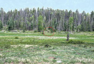
The route did eventually start to climb again out of the dusty, treeless plateau and back up into a national forest. It wasn’t a big climb, but towards the top across from somebody’s ranch I startled the only moose I saw for the entire trip. Other riders had been talking about seeing lots of moose, but I only saw elk until this one lone moose! Shortly after the moose, I started the long descent down into the Salida valley. All the mountains were covered in clouds that looked like they were dropping rain somewhere. It was an ominous view because I knew I had to cross those mountains, and that pretty much sealed the deal that I would be stopping in Salida.
Salida, revisited 10 years after Leadville
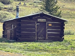
I had researched Salida ahead of time as a potential place to stop, but not well enough. The Salida Hostel is practically on course and would have been cheaper than the hotel I stayed at. I didn’t realize they had private rooms with private bathrooms, which is what I needed since I would be going to bed early and then getting up in the middle of the night to leave. The route immediately veers way west of the main part of town after the hostel. A lot of the development is on the southwest of town. So I decided it would be less backtracking if I followed the course for a few miles west, then veered off-course at a spot where the course dipped south and then backtrack east to find everything. It was good timing because there was a family out riding and they cheered me on and their young son caught up to me and passed me so I cheered him on, too. It was a nice distraction from the mental energy I was currently expending trying to optimize my route with the least amount of backtracking to find the Sonic we had stopped at before, resupply, and lodging.
The Sonic was the first place you came to, so I bought my dinner food there. The Walmart across the street, unfortunately, was not a 24 hour Walmart so I couldn’t hit it on my way back out of town after sleeping – and it looked like it was overrun with people at 5pm, so I decided it would be better to find a gas station to resupply at. Continuing farther off course, I found and checked into a hotel, dropped off my food, and then went back out to find a gas station which was even farther back up into town. It just seemed like a lot of wasted time and effort, but I did get everything and make it back to the hotel, ate, and fell asleep with all the lights on – which was pretty much the case every “night” of the race.


Maps and data


Pickuta photo album
See even more pics from the entire race along with the exact time/location where each was taken on the tracking website I created called pickuta.com. If you are on a phone or small screen web browser, click the “hamburger” triple bar icon in the upper left to slide out the photos and turn on/off the tracking markers: https://pickuta.com/album/258
Leave a Reply