After 22 rides covering 4,347 miles and 173,193 feet of climbing across 130 counties in 10 different states, I have finished riding in all the counties in Arkansas! Just under 2,500 miles of those rides was within the state of Arkansas. Yes, that’s right, I did 22 rides that had at least some small part in the state of Arkansas, but those rides may not have started in Arkansas. One 350 mile ride started from my house in Alabama. Another 400+ mile ride went through six states (MS, TN, AR, MO, IL, and KY).
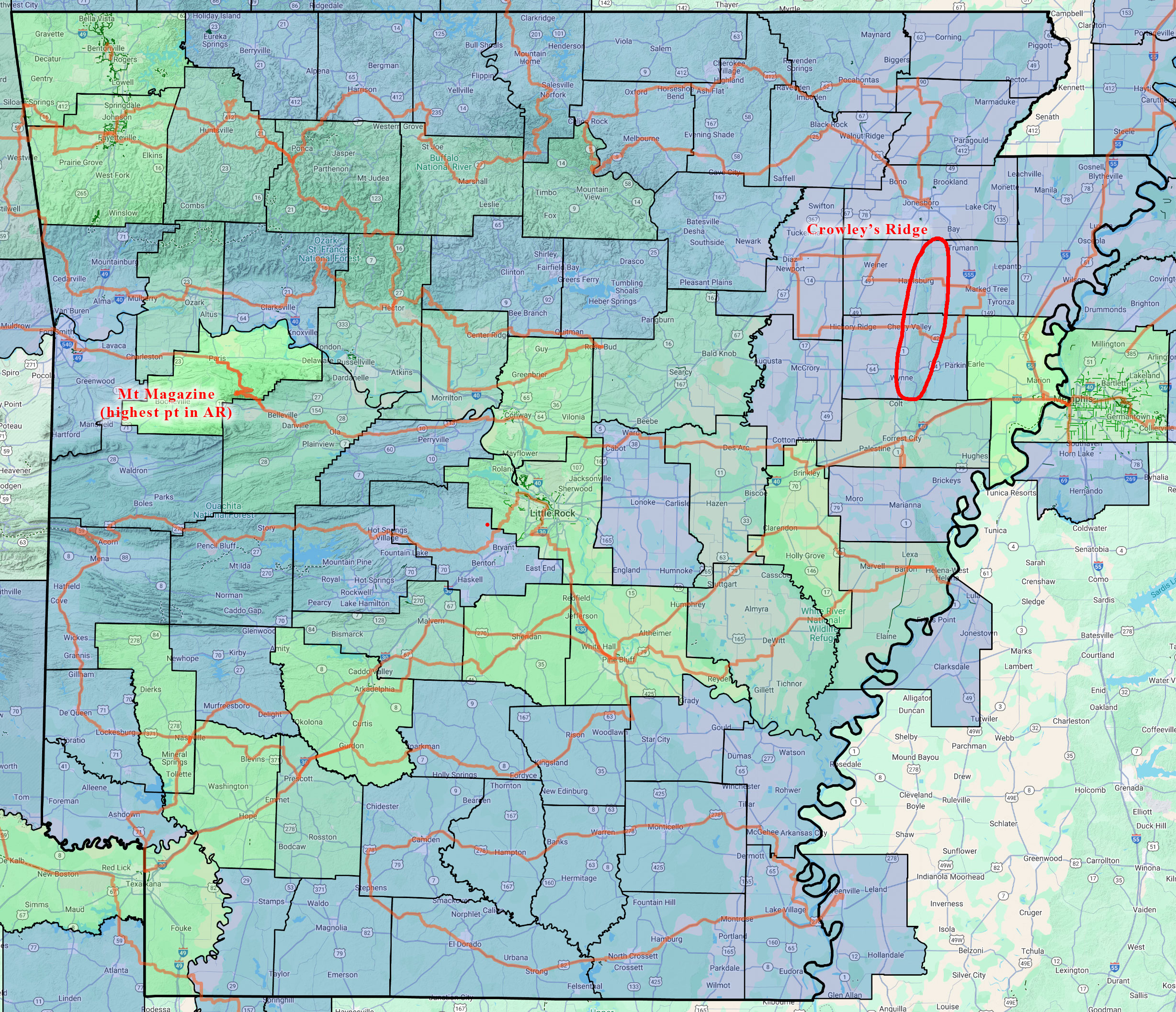
Also, highlighted on the map is a section of Crowley’s Ridge that I crossed twice on what was supposed to be a 275 mile ride earlier this year in January, but cut short to only 140 miles starting from Marked Tree, where I immediately had problems not finding a good place to park. Then I set out into a nasty headwind with the temps hovering just above freezing. I had classes starting the next day so I was on a very tight time schedule to get the ride done. I fell way behind my timing and was just plain miserable in the cold so I decided to cut it short and enjoy what was left of the ride rather than stressing about making it back in time for classes. In the dark well before sunrise, I got a Garmin notice of an upcoming climb, which totally caught me by surprise as I had been riding on table-top flat farmland for several hours. I had made it to Crowley’s Ridge, a long 200-300 foot ridge that runs through east central Arkansas crossing the state from Missouri down to the Mississippi River at St Helena. The climb was a nice break from the cold headwind before dropping back down into more cold headwind in the flatlands on the other side of the ridge.
Fast forward later in the year to the weekend before the Fall semester began in August, I decided to head out to Arkansas on a 550 mile route that would take me through the remaining counties of Northwest Arkansas that I needed to finish my goal of riding in all the counties in the state.
Unfortunately, it rained a lot on the second day, and I decided to cut the ride short to avoid some dirt roads that I thought might have turned to mud. Plus, I was ready to be done with all the rain. So I ended up missing three counties as I deviated from the original path.
This past weekend for my fall break, I charted out a new route that would take me through those three missing counties AND a bunch of counties in Missouri and Oklahoma. Weather would still be a factor with the temperature heading up into the 90s on the first day in the middle of October followed by a dry (no rain) cold front arriving over night with freeze warnings popping up on my Garmin. The temps made it down into the 40s by morning but warmed up nicely into the low 70s during the day before falling quickly down towards freezing by morning. This blog documents that adventure.
TLDR summary
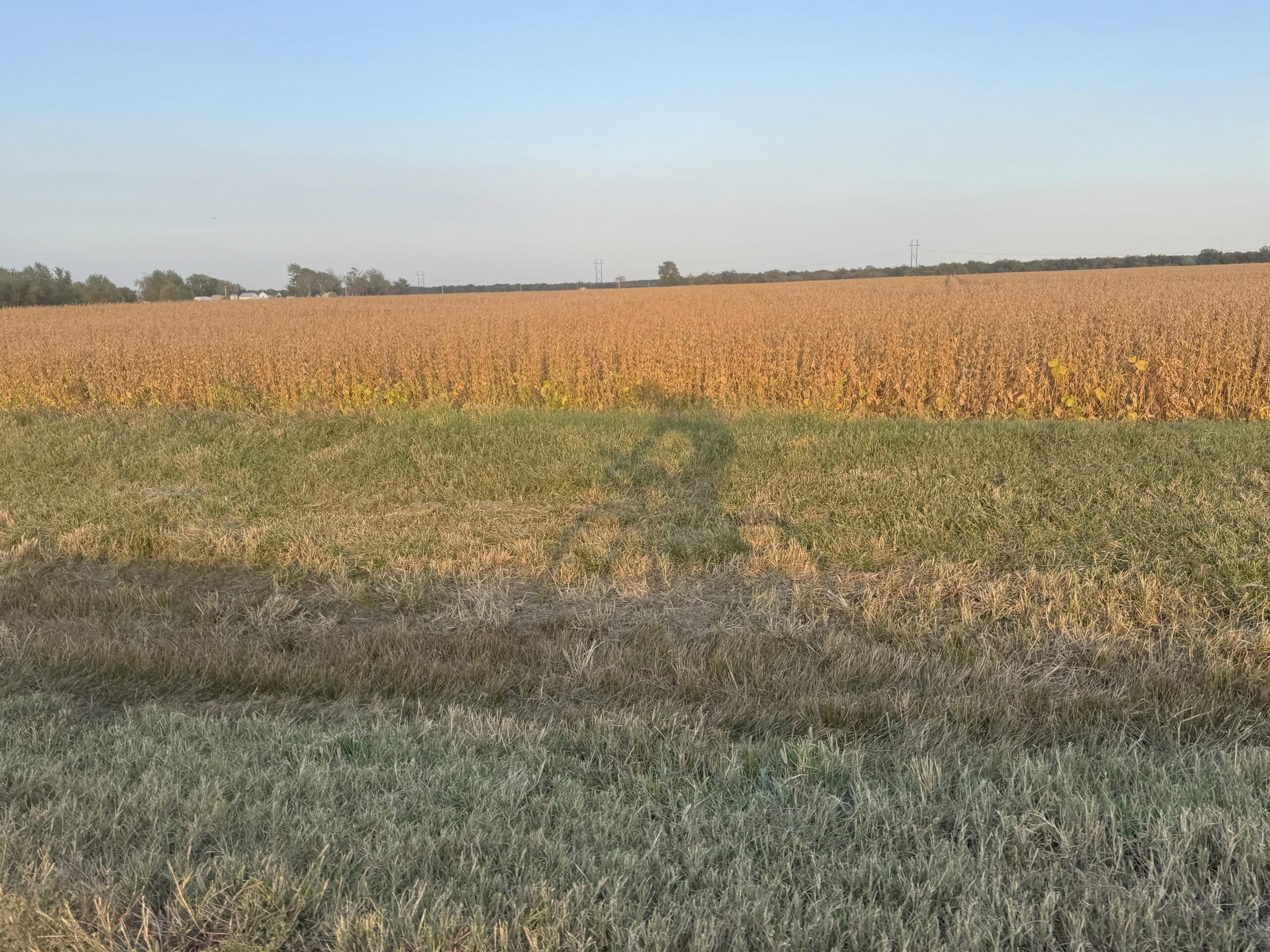
It ended up being an amazing 558 mile ride through the Ozarks towards the beginning of beautiful Fall colors over 48 hours. It was only 36 hours total moving time as I had an extended hotel stop in the middle (sleepy after a long drive with no sleep) and then the normal stops during the course of all-day riding. Still, 558 miles over 36 hours riding is only 15.5 mph, a little bit on the slow slide because there was a TON of climbing … nearly 5000 feet more than ridewithgps estimated! Total climbing was almost exactly 36,000 feet of climbing with nearly 19,000 feet on the first day and over 17,000 feet on the second day. This elevation split between the days was also unexpected because all the big climbs and high elevation through the heart of the Ozarks was on the second day. The first day started in the Ozarks but then went north into the foothills through Missouri, which is where the majority of the climbing happened. It felt like there was not a single flat stretch of road in Missouri.
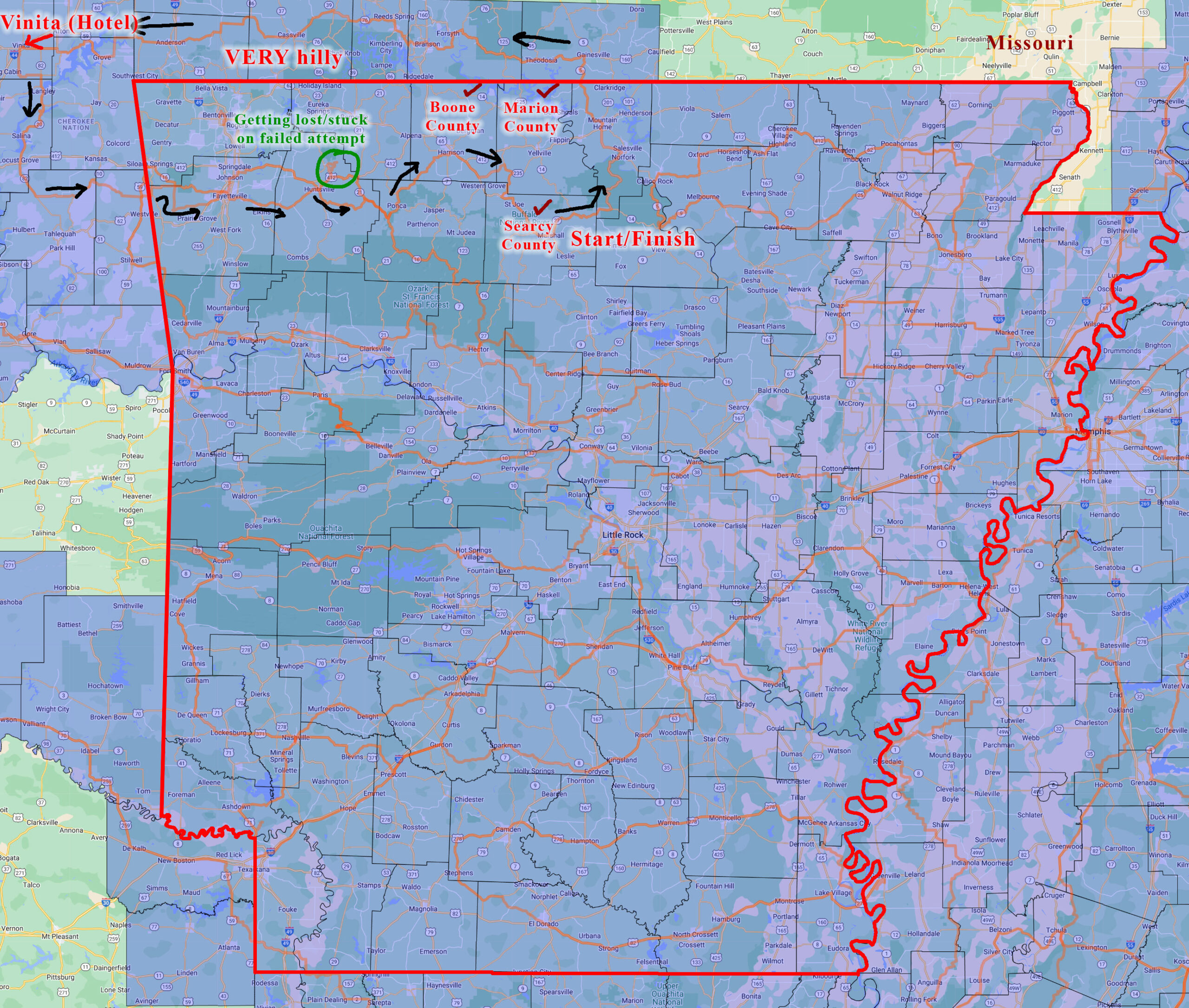
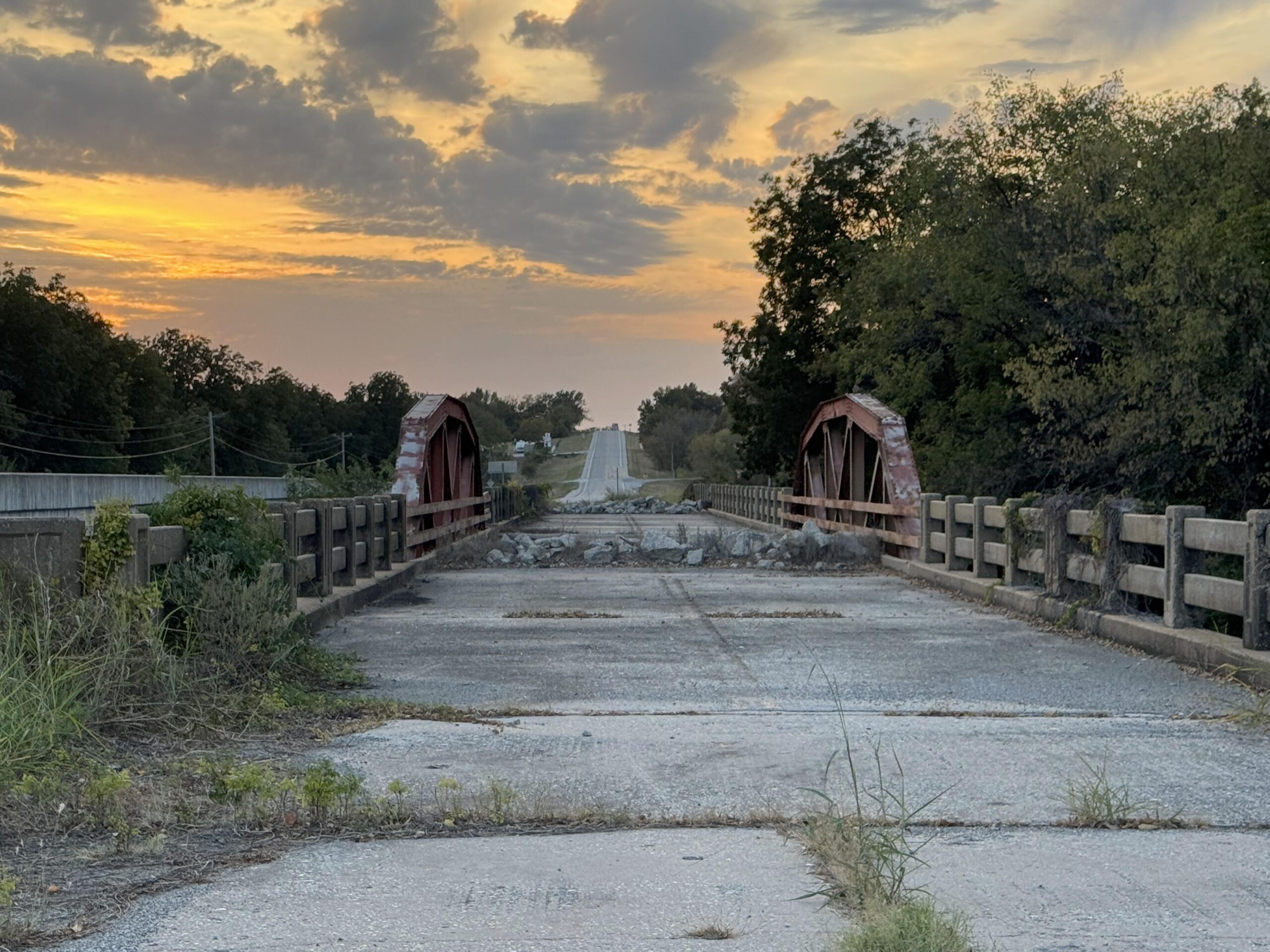
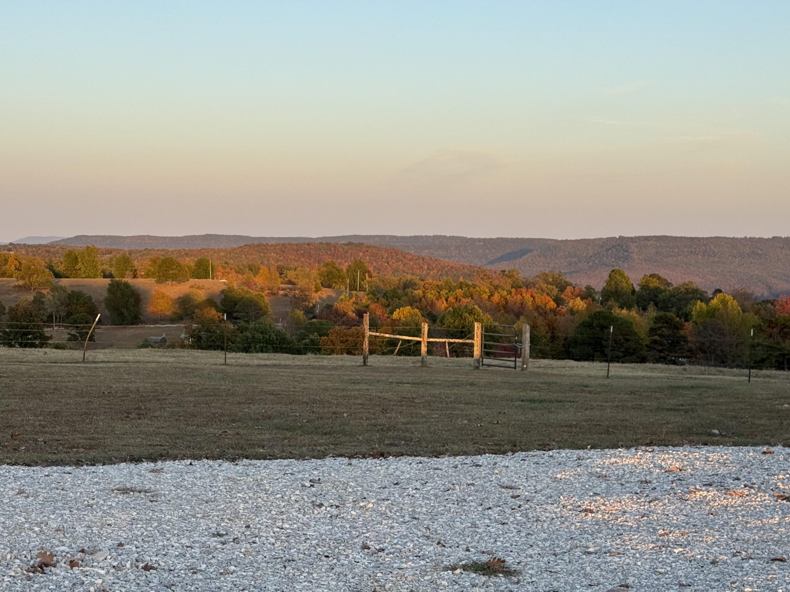
Completing the ride with no deviations from the route I had planned meant that I finished up the final three counties for my goal of riding in all the counties in Arkansas. I started the ride with a new county (Searcy), but did not ride through the last two counties (Boone and Marion) until over 500 miles into the ride on my way back to the start on Day 2. Here is my completed Arkansas map with the final three counties labeled. You can also see on the map my previous failed attempt to finish those counties in the area and how I deviated south on that ride.
Long drive to start this final county adventure in Arkansas
Back to this current adventure: the drive from Birmingham took nearly 10 hours with me having to stop and charge the car three times to cover the nearly 500 mile drive (one way) to Marshall, Arkansas in Searcy County – one of the 75 counties in Arkansas I had never ridden in.
Initially I had planned to park at the high school, but I couldn’t find it. I was also a bit concerned that they might not have Monday off as a holiday, and I didn’t want my car to get towed. So I turned around and parked at the edge of a deserted grocery store parking lot. At the EV charger in Little Rock, I had prepped everything to ride, so it was pretty quick to pull the bike out and start riding just before midnight on Saturday night.
I had thought about napping in the car before starting the 290 mile ride to Vinita, Oklahoma, but I was pretty wired up and ready to go after my drive. So I opted to start about an hour earlier than planned so I could finish earlier and sleep longer at the hotel at the midway point of the ride.
Hot and cold and a drunk
It was still quite warm when I left and I was worried given the timing that I would run out of water with no place open to refill. But I would soon discover that it was quite a bit cooler down in the valleys. Still in the 60s, though, so no need for any of the extra clothing I had brought.
I had routed myself through Mountain Home with several 24 hour gas stations available, but I couldn’t remember whether they were 24 hour and my cue just said “gas” instead of “gas24”, which is what I normally put for 24 hour stations. I was on a highway that would have taken me right to the Syllamo Trailhead where Kristine, Josiah, and I had driven to watch the eclipse earlier in the year. But I turned about 20 miles before that spot and went down a different valley instead of the White River valley to head to new counties.
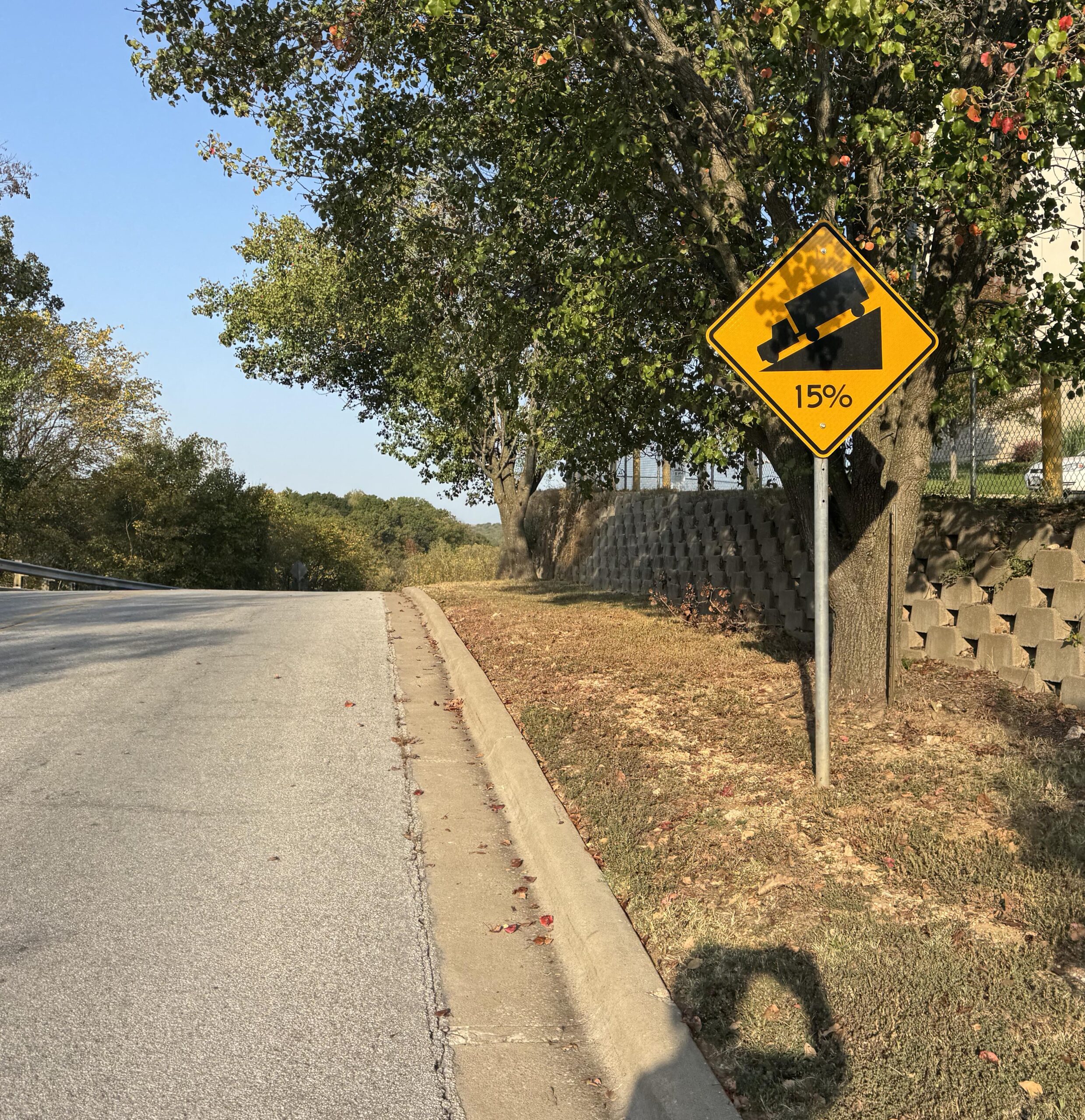
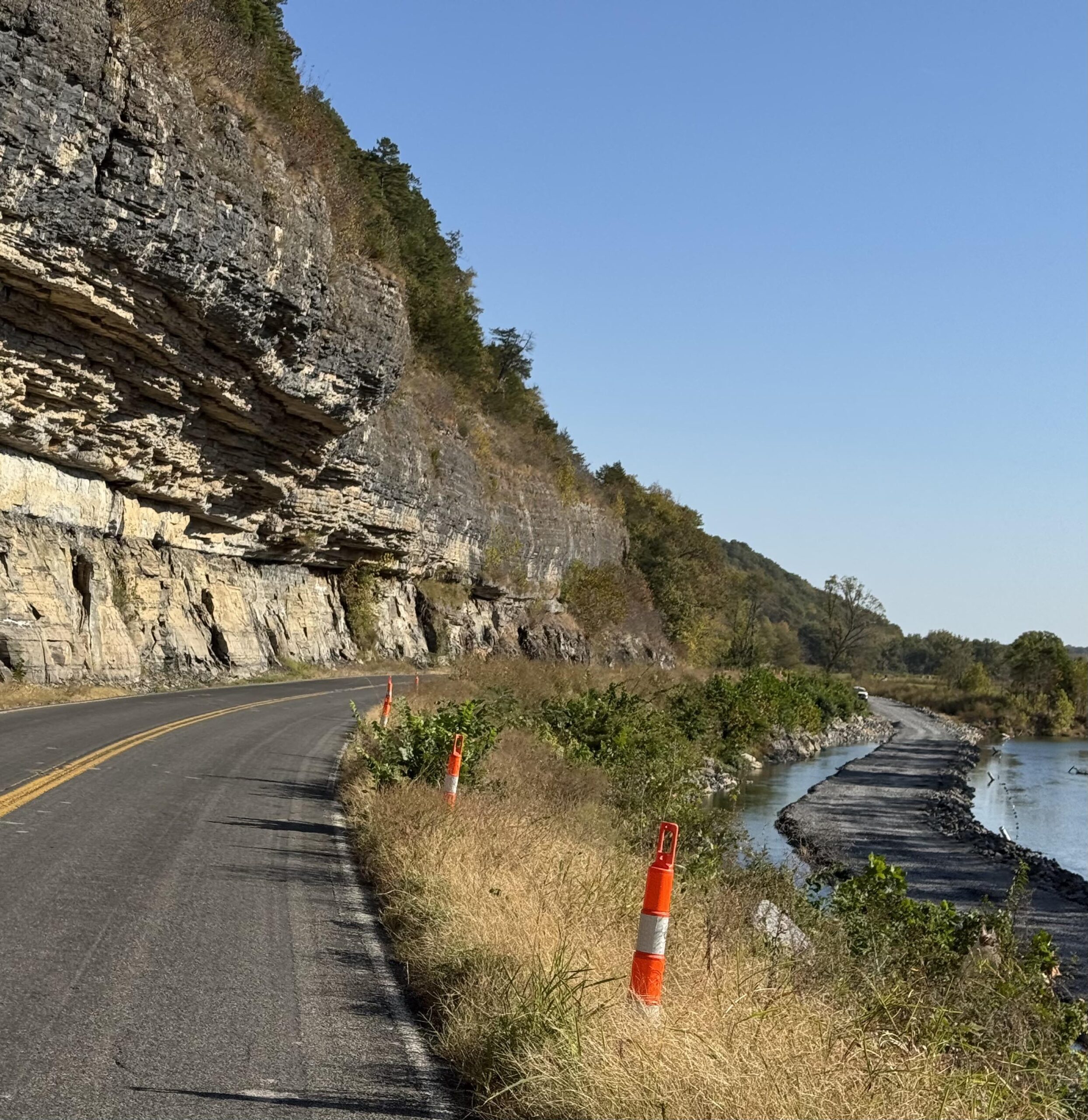
That turn, though, put me on a recently repaved state highway that had been chip-sealed with lots of loose gravel still all over the place. It was quite rough given that cars had not driven in the “chips” yet. I saw the “loose gravel” sign attached to the bottom of the “Mountain Home 30” sign and thought, “this is going to be rough”. And it was, but only about 15 miles or so, before I made it to the older chip seal which was well worn in and not too bad. Still, it wasn’t great, and I was only 50 miles into a 560 mile trip! So I was a bit worried about an early flat given all the sharp gravel and STEEP hills. This was pretty far into the Ozark National Forest and it was constant up and downs. I was hitting mid 40s on all the descents in the dark unable to dodge any kind of rocks at that speed and given how low I keep my headlight to make the battery survive long enough.
When I finally made it to Mountain Home, I stopped at a gas station that did turn out to be 24 hours, at about 3am to use the bathroom and refill water and I heard this loud guy come in who sounded very drunk. The clerk said he couldn’t bring “that” in here (no idea what she was talking about since I was still in the bathroom) and I heard him say I just wanted to show you how bad I had crashed.
She warned me after I came out a couple minutes later that there was a drunk guy on an electric scooter riding around outside and to watch out for him as he had just crashed hard (“ate s$@#!” were her words).
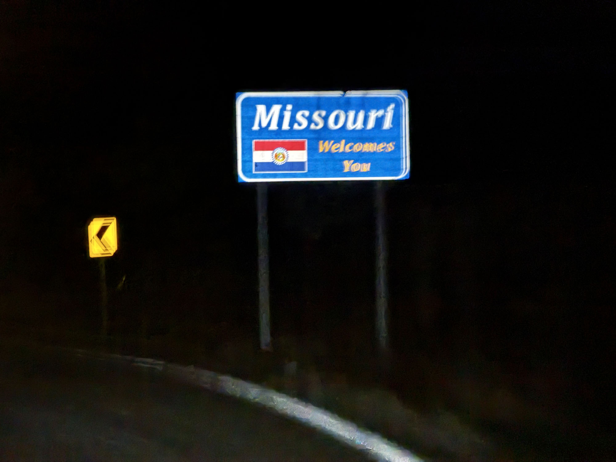
I kept an eye out but saw nobody. Mountain Home is fairly large city for the area and not too long after leaving the sprawl, I had crossed over into Missouri and traffic had started to pick up a bit (given that I hadn’t been passed by anyone in many, many miles).
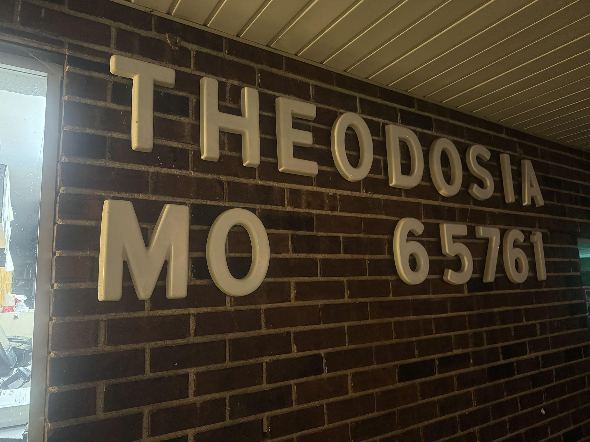
By 5am, I had made it 100 miles to Theodosia, Missouri and the temp had dropped into the lower 50s, which was cold enough given the fatigue and sleepiness and low heartrate that I stopped at a post office to put my arm and knee warmers on. I immediately went down a few steep hills where it was significantly colder, thankful for the warmer clothes, but then proceeded to climb up on a high ridge line where the temp was way back up in the lower 60s. Uggh. I was tired, though, and rather than taking off the clothes I had put on, I just decided to cruise at a bit lower pace and enjoy the spectacular sunrise vistas of the fall colors of the Missouri Ozarks keeping the warmer clothes on until my next stop at a gas station above the White River which had snaked its way back onto my route.
HEAVY Sunday morning traffic
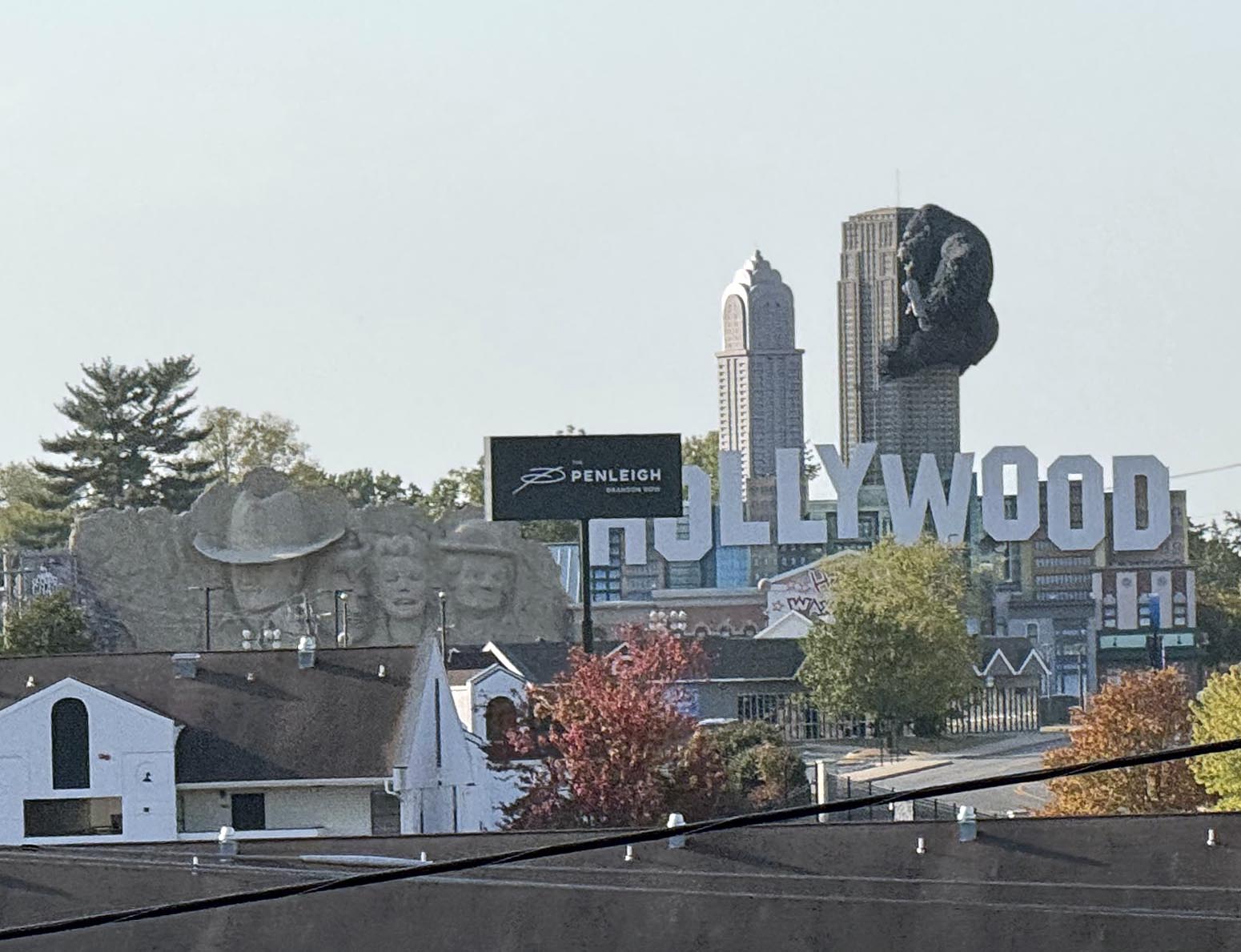
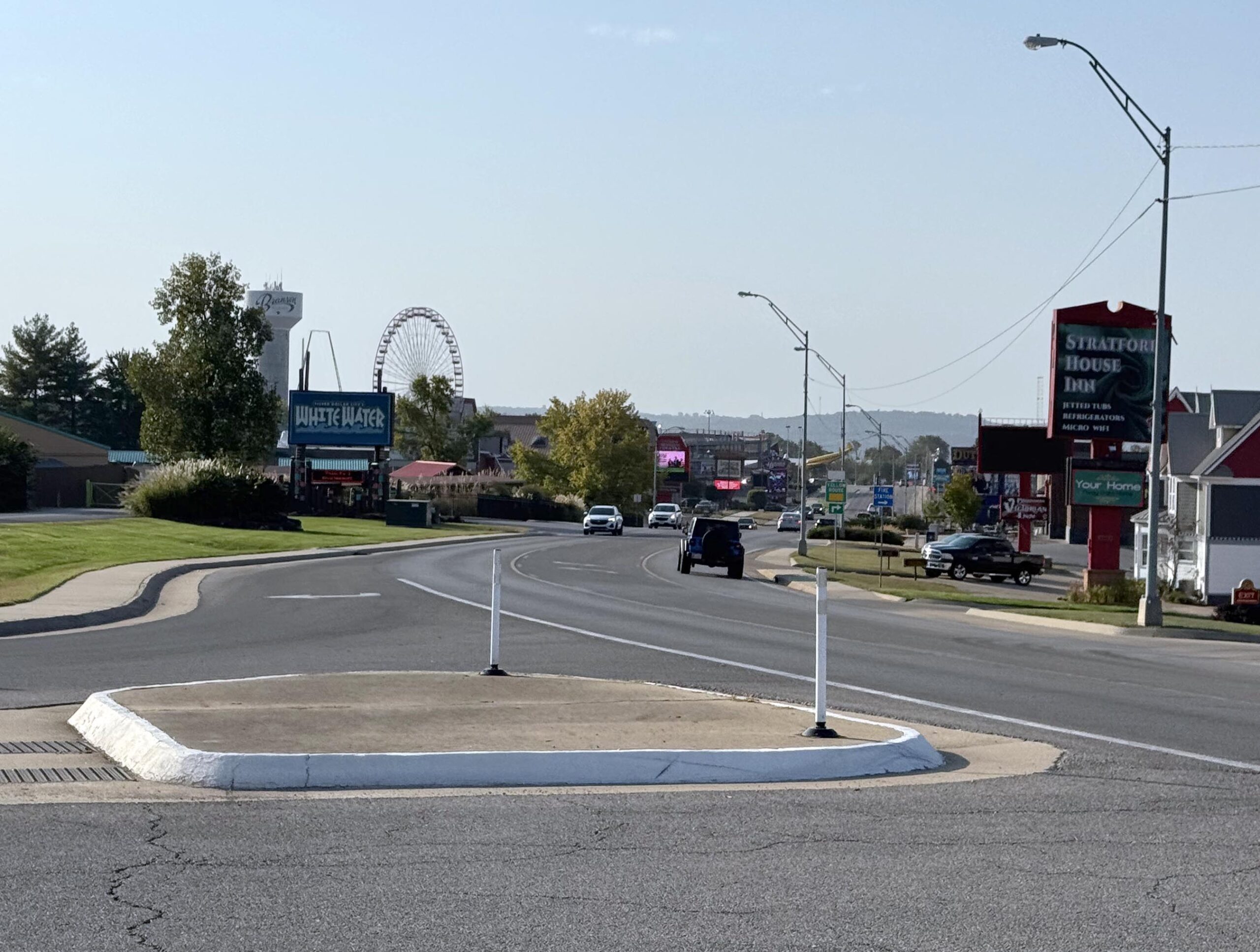
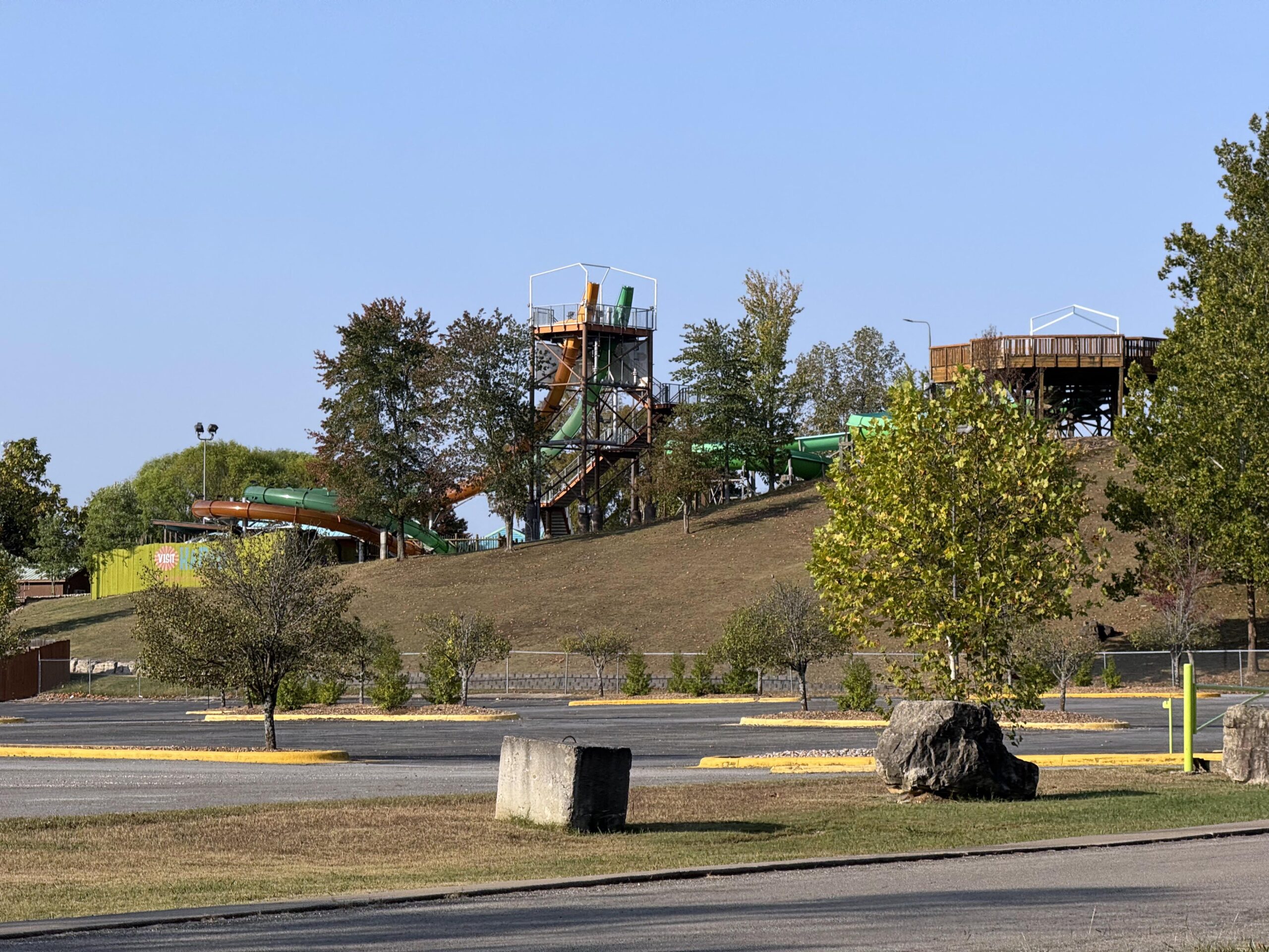
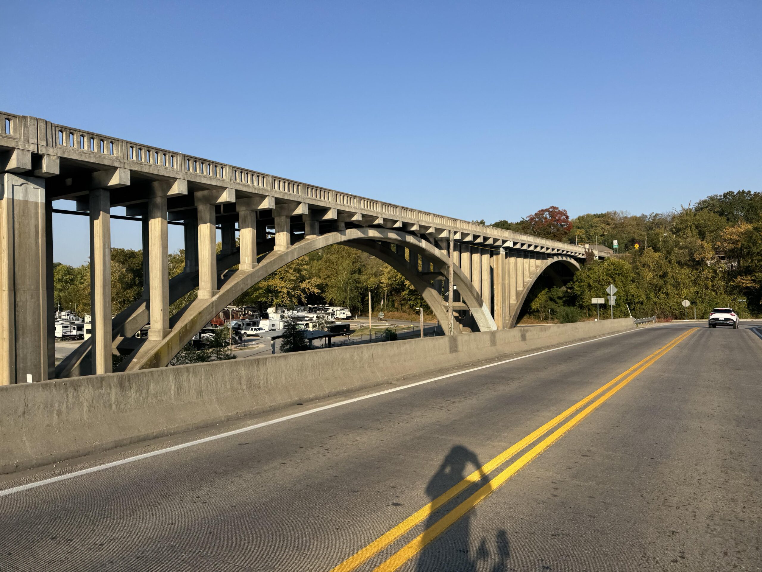
It was 630am on a Sunday morning, so I wasn’t too worried about traffic … but I should have been. Cars were nice, but it was a steady stream of fast cars from the river all the way to Branson, Missouri which I made it to at about 7:30am. Branson is still in the Ozarks and quite hilly with the White River and tributaries carving deep canyons. By 8:30am when I made it to “Branson West”, traffic was awful. Nearly constant groups of cars on a two lane state highway with a weird shoulder that was sometimes perfect with no rumble strip and sometimes had a wide rumble strip taking up the shoulder or there would be no shoulder at all and the rumble strip would extend to the inside of the white line making me ride over farther into traffic, which was patiently waiting to pass. Still, there were short gaps in the groups of cars so it wasn’t one long line of cars behind me until I made it to some road construction where a second highway had been detoured onto the one I was on. So two highways worth of traffic on one sometimes narrow road, which eventually joined the main highway from Branson to Springfield, MO. Finally, I turned to head west whereas most (but not all) of the traffic continued north towards Springfield. It felt like an eternity but this stretch of bad traffic was only about 10 miles long taking about 40 minutes with me having to stop and wait for traffic backing up quite far from some of the lights. And given how cars were having to wait for me at times and nobody honked or passed angrily (close, fast, and/or loud), there was NO WAY I was going to pass them back at the light as I cannot imagine how irrationally angry that would have made a non-zero number of people.
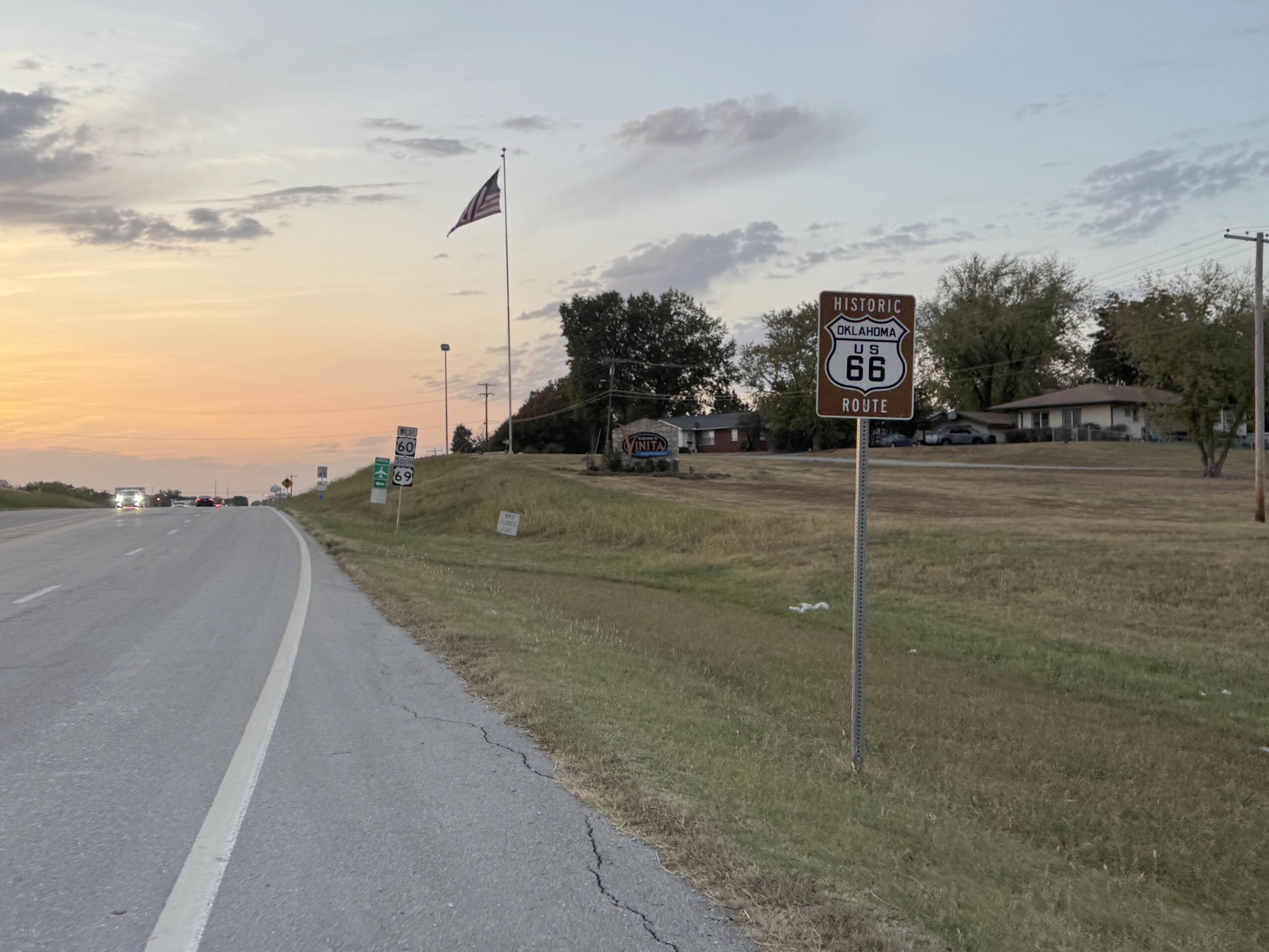
Eventually, things did settle down. It seemed like I would never make it to Oklahoma, as I had been fighting a heavy cross-wind turned headwind any time my route veered north as I started to lose the forests of the Ozarks into more wide open farmland and smaller hills. As I approached sunset I found myself riding straight into the sun for several stretches, but thankfully as I crossed into Oklahoma the roads had nice wide, rideable shoulders all the way to my hotel in Vinita, Oklahoma.

Long and short end to a long day
After what I thought would be a quick stop at Subway (since I was the only one there) but turned into 15 minutes as the only worker there made several sandwiches very slowly for a phone order, I finally got my sandwich and made it to the hotel just down the street. Thankfully, I asked and he let me get my drink and eat some chips while he was working on the sandwiches for the phone customer. Also, I had experimented with the online check-in for the hotel and it worked wonderfully, I only had to show my ID and sign one piece of paper rather than the normal, “type”, “type”, “type” on the computer and the coding of the key for the room. Instead she handed me my key and the entire check-in took about a minute. When you are tired and hungry … 1 minute vs 3-4 minutes is a big deal (or at least it feels like it!).
Exhausted, I made it to the room and was showered and asleep within 30 minutes. But before that I ran into a problem with the charging setup I had brought … I had brought a four port charger that had two USB-A and two USB-C ports. I had brought four cables, but only one of them was USB-C. So I could only charge three things at once.
I needed to charge the following things: Garmin Edge GPS, Garmin Montana GPS (Satellite tracker), Front headlight, Rear tailight, iPhone, and my Wahoo heartrate monitor. If you are counting that is six devices with the ability to charge only three at once. So I set my alarm for 2 hours later to wake up and swap out the charging cables. One trick to wake up after 2 hours of sleep after not having slept at all the night before is to leave all the lights on. I don’t think I’ve ever turned lights off while sleeping on any of these trips. A dark room would lead to a hard sleep (which can be great) but there is no waking up from that until your mind/body is ready. If your sleep isn’t that great, your mind/body (or at least mine) makes do with it and the waking up isn’t nearly so bad. In this case, after two hours, I swapped out the devices charging and slept for 2 more hours before my alarm went off again. I had anticipated leaving by about 3am, but I decided that I needed a bit more sleep, and especially since this was my “vacation”, I wanted the hotel breakfast included with the room.
Heading back to Arkansas
Up by 5am, ready to go by 5:30am I wandered down to the lobby where they had everything setup already for breakfast. Out the door by 5:45am with a couple wrapped bagels to go and with all my cold weather clothes on given the temp in the 40s still dropping with the approaching sunrise. My hotel was on the outskirts of Vinita and my route immediately took me south and east of the city on what I thought would be a narrow, rural, possibly dirt road. I got passed by a school bus within a few minutes, which I thought was odd. After another few minutes, I could see the school bus stopped ahead in the road. Apparently, he was early and didn’t have his flashing red lights on (just the flashing yellow). I kept riding and started to see kids waiting at their driveways. This was at least 10-15 miles outside of town and 6:30 in the morning … long bus ride for these kids as I am sure the school they were heading to was back in Vinita. About 10 minutes later, here comes the school bus finally catching up to me a few more miles down the road just before I made my turn (after missing it because the school bus was passing me).
By this point the road had deteriorated a bit with potholes starting to appear randomly in the otherwise smooth pavement. In the low light of my headlight I started to pay special attention to the ground immediately in front of me not wanting to hit any of these potholes and flat or double-flat. Sunrise started to fill the sky and the road was getting hillier. Still, short small hills, but not the flatter roads I had been on for many miles leaving Vinita. All the while I kept heading South instead of East.
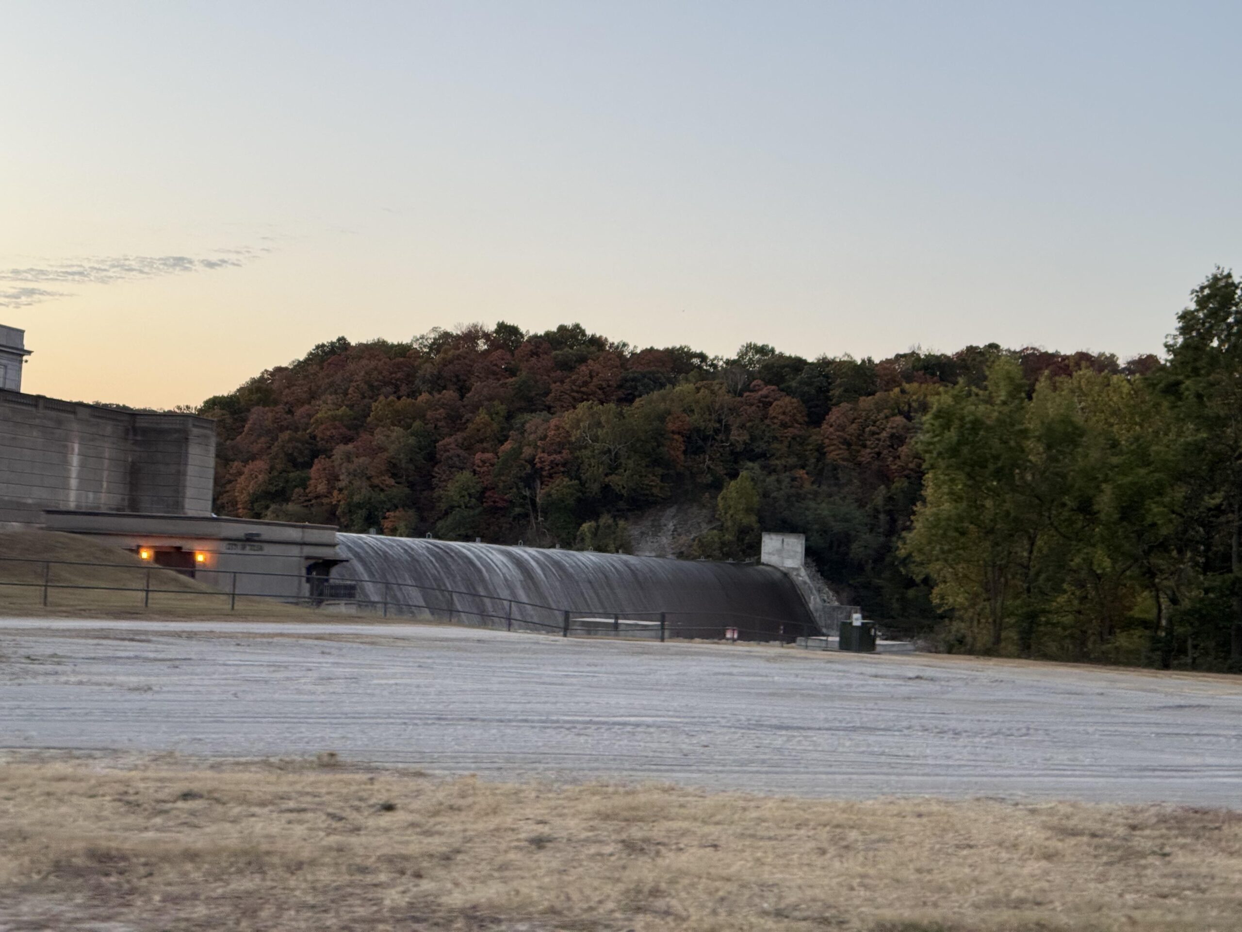
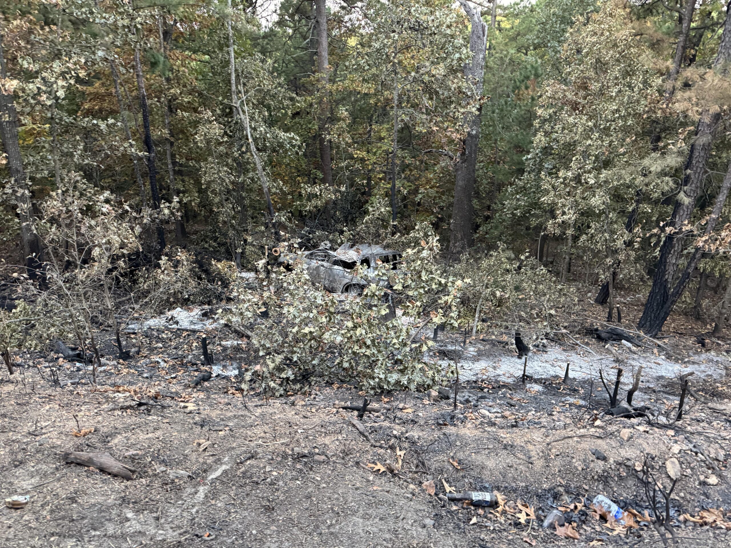
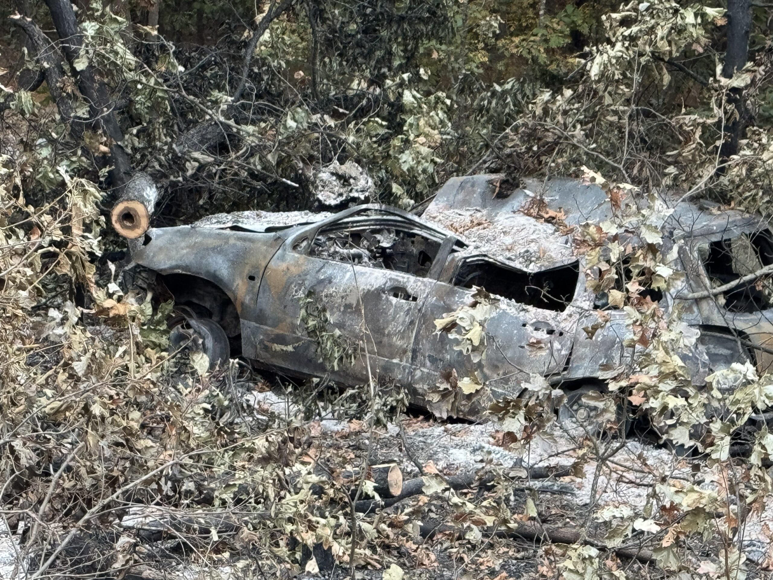
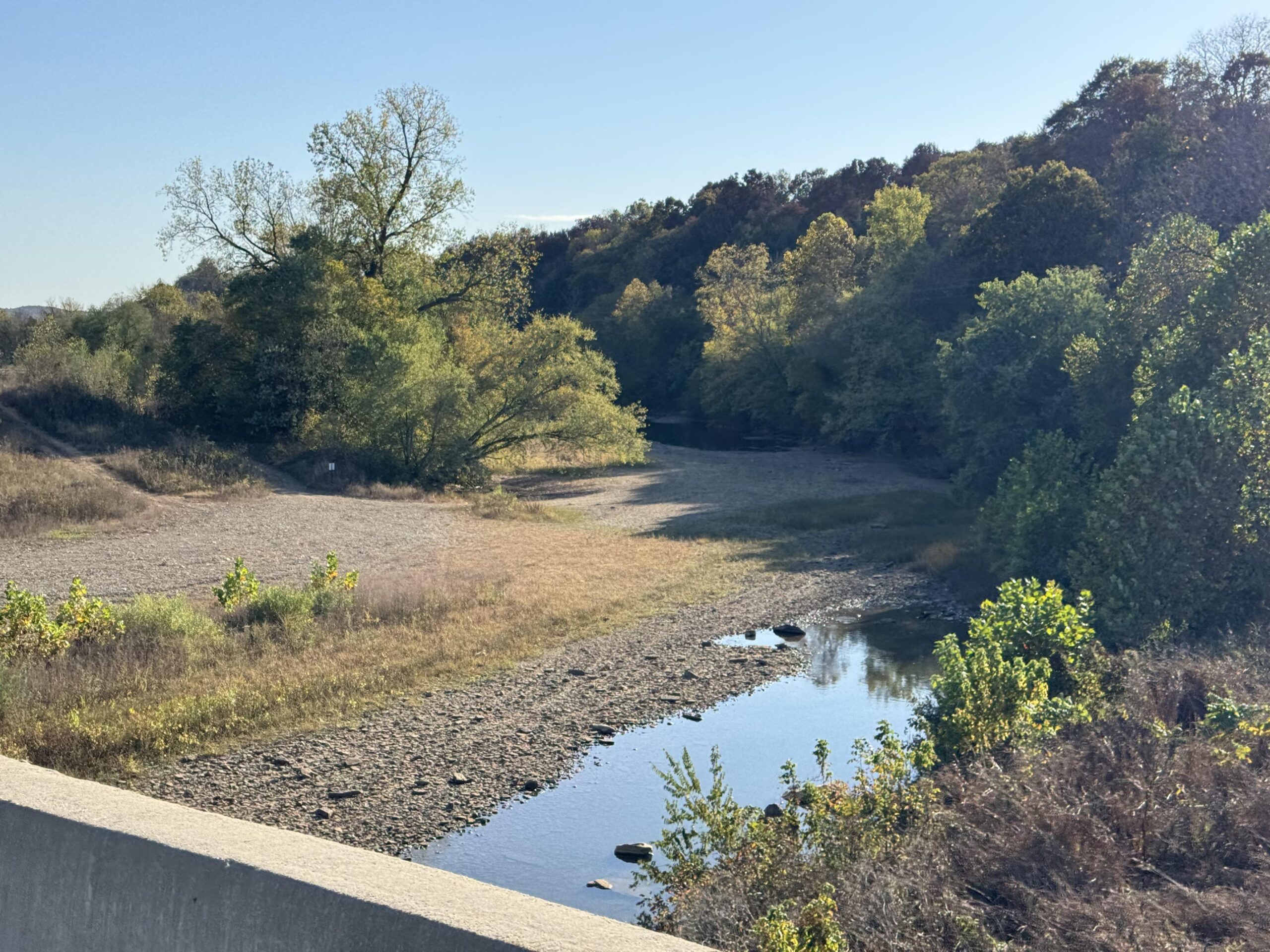
I passed through Spavinaw below the dam holding back a large lake that looked cool with a dry spillway for outflow. Immediately, I tackled a large climb making it up above 1100 feet for the first day. On one of the twisted parts of the road I came across a burned out station wagon which had caught the surrounding forest on fire, too. It looked like it was a few months old as the charcoal still looked fresh enough to be sometime this year with no new growth. Strange that they left the car there, but it was down a really steep hill and the fire had climbed the hill all the way up to the road.
Having my encounters with the school bus over an hour earlier, it was still 7:30am and I started to run into more school busses … these were heading towards me and I made it in front of one after several driveways in a row of kids. This freed up the road behind me as cars needed to wait (I made it before the bus had even turned on his yellow flashing lights, let alone the red stop lights). I enjoyed a good solid five minutes of traffic free riding before a small group of cars passed me. I passed by the Salina high school first and then about 15-20 minutes later, the Locust Grove school.
All this time, I kept heading south and even turning west several times. I kept wondering when I would turn back east to head back to Arkansas. It’s challenging to zoom out on the Garmin while riding when it has a large route loaded, the pages take a while to load and it’s difficult to pan around and figure out distances and where I am. It’s possible to do this, but it’s just not dead simple and I don’t want to be run over by a car while trying to figure out something on my Garmin. So I spend an inordinate amount of time knowing exactly where I am (road, street, lat/lng, elevation) and simultaneously not having a clue where I am (in the big picture).
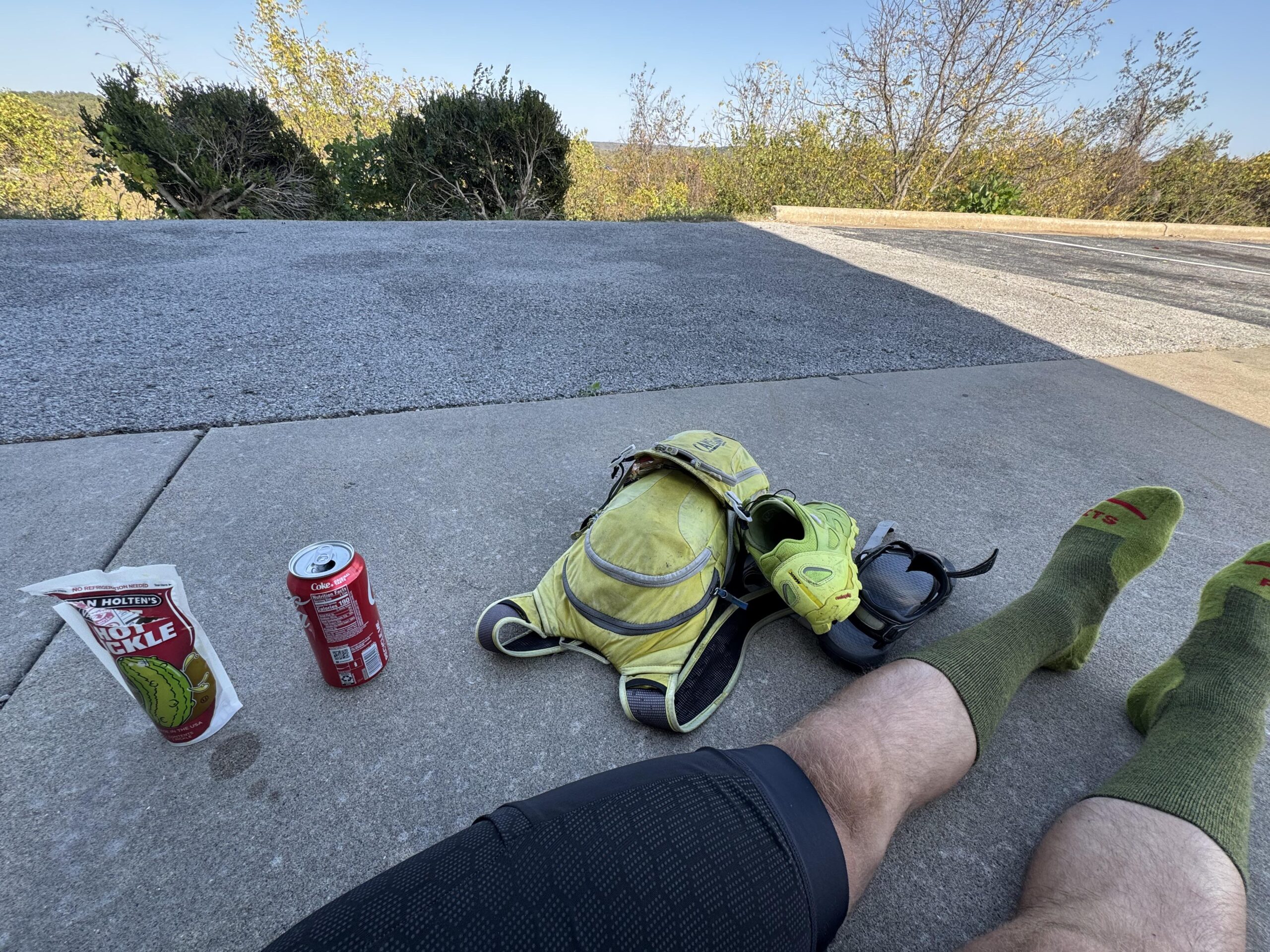
After making it through the next town (Locust Grove), I made it to my first stop of the day having only eaten one of the bagels I had brought with me from the hotel. I was on a highway heading to Tulsa (so many memories) but knew that I was definitely going to be turning soon. As it turns out, it was shortly after this stop where I decided to only fill up on water. I ended up making it 130 miles total before I needed to purchase anything at a gas station back across the border in Arkansas. I got my money’s worth out of that hotel! I will take that given how many times I have paid for a full night’s stay at a hotel to only be there for 3 or 4 hours and miss out on the free breakfast.
OK-10
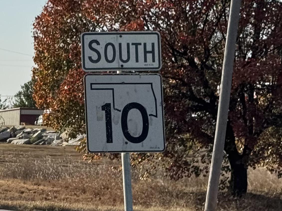
My first highway I was on the day before after crossing into Oklahoma was highway 10. Nearly 75 miles into the day, I found myself back on a section of OK-10 much farther south than the section I had ridden on the day before. The reason why I mention this at all is because the section of OK-10 I rode on Day 2 spent a lot of time down in a canyon alongside the Illinois River. One section had a temporary stoplight setup (but not turned on yet) with lots of road construction. As it turns out, the road construction was to build a temporary one lane road literally through the middle of the river parallel to the road for maybe a quarter mile while they worked on the main highway b/c of some dangerous looking overhangs that I think needed work.
The highway was deserted as it was about mid-morning by this point. After a few miles I turned right and crossed the Illinois River passing a long-haired presumably Native American man walking across the bridge as I was riding through a reservation on a much more rural chip-seal road. After a few more miles, I lost the pavement altogether and ended up riding a few more miles on dirt both before and after the Arkansas border.
I say “more miles” because as I write this up I am remembering an earlier descent down into a valley between highways that was a very rough dirt/gravel descent that I had to use my brakes nearly the whole way down what seemed like a ridiculous 10-15% gradient for a dirt road. I don’t think it would have been driveable without a 4×4 truck in the rain given how steep the descent was. Thankfully after crossing that smaller creek, the climb out of the valley was much more gentle before eventually making it to Oklahoma highway 10 after a few miles of dirt and rough gravel. These two gravel sections were the only dirt/gravel of the entire trip and they were both within 10 miles of each other in the Oklahoma / Arkansas border area south of Shiloam Springs.
Columbus Day / Indigenous People’s Day?
At some point, I was wondering about the school busses I had seen earlier in the day because back home in Alabama schools were going to be out on Monday for Columbus Day. Some states celebrate Indigenous People’s Day. I thought it was interesting that all the schools in Oklahoma appeared to be in session, especially as I was riding through Native American reservations in eastern Oklahoma including some of the Cherokee Reservation marking the end of the Trail of Tears which starts near the Silver Comet area of Georgia.
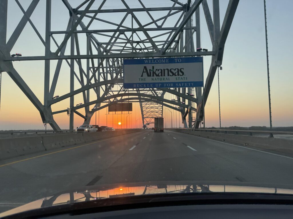
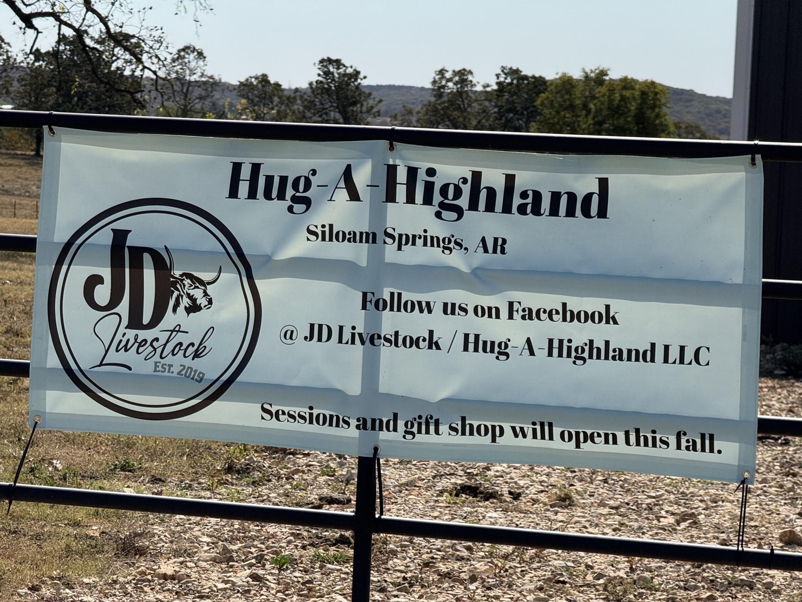
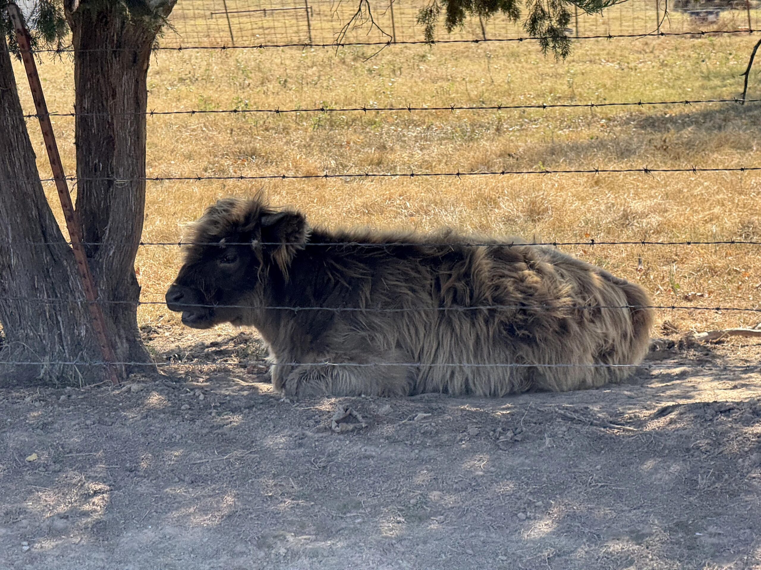
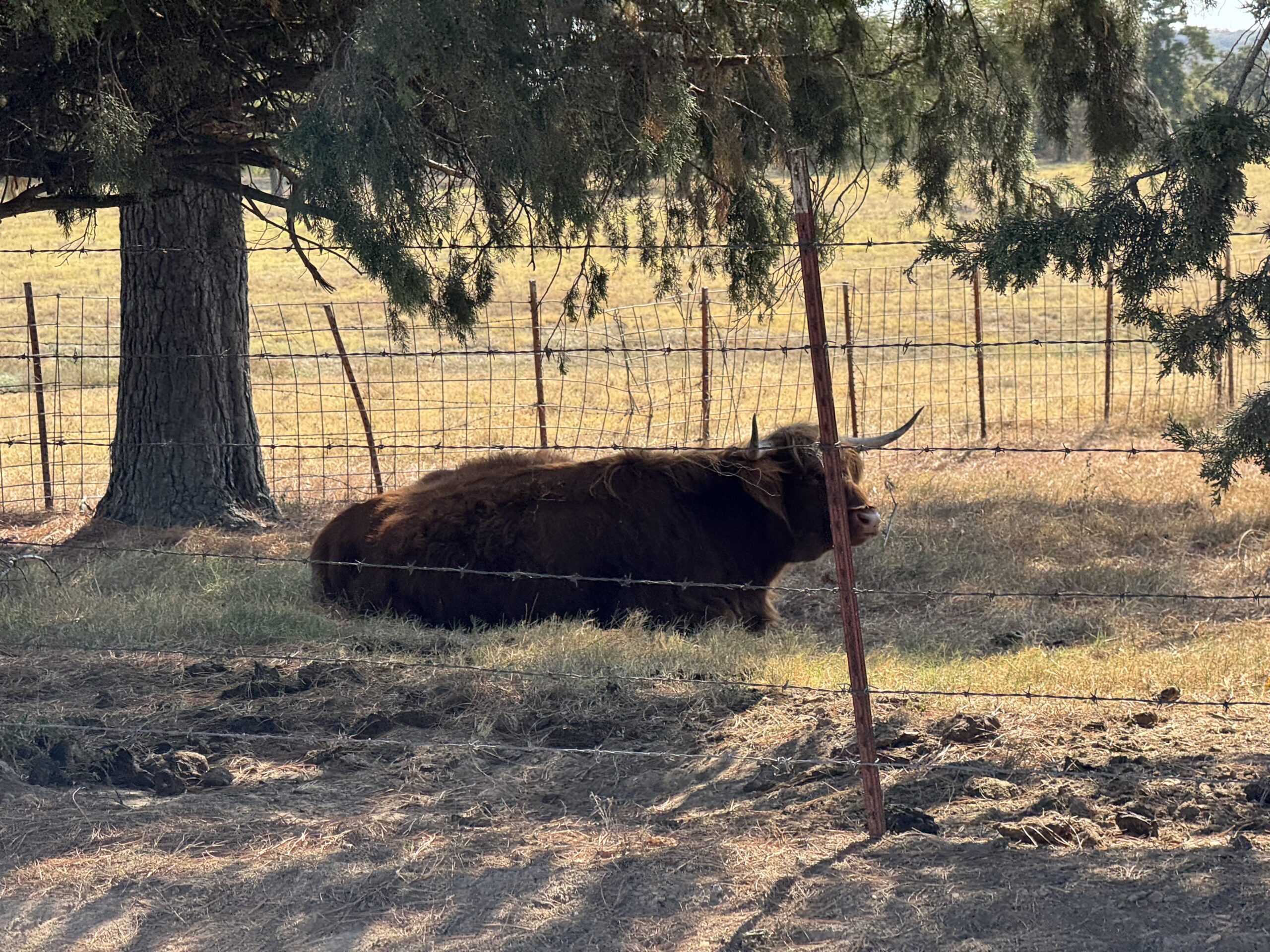
I’m not sure how they decided on the vertical border separating the eastern part of Oklahoma and the western part of Arkansas, but the roads got immediately steeper and higher after crossing into Arkansas. Within a few miles I passed by the Hug-A-Highland (cow) farm with the highland cows right there next to the road. It was very tempting to lean over and hug the nearest one but I wasn’t going to try it.
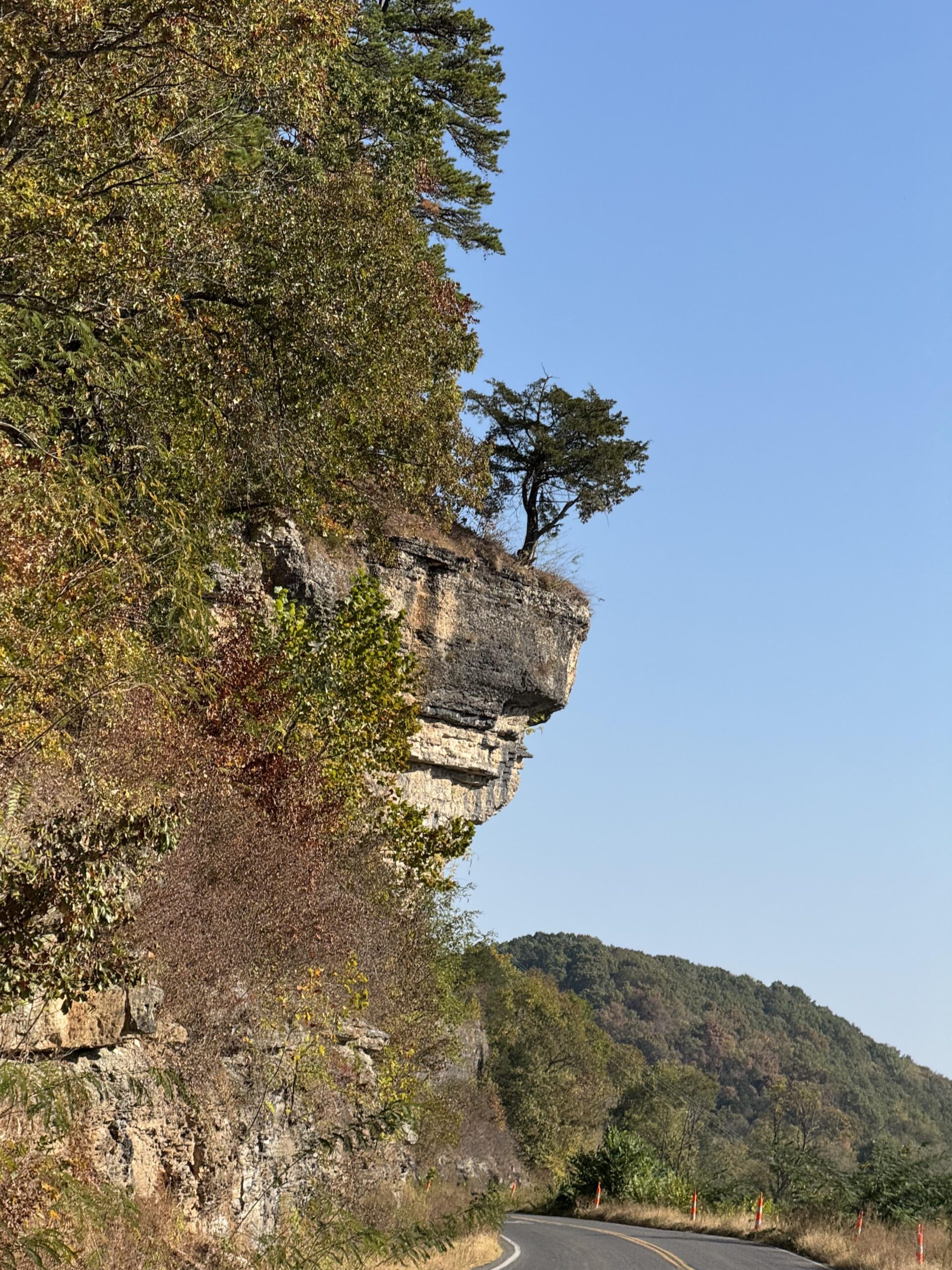
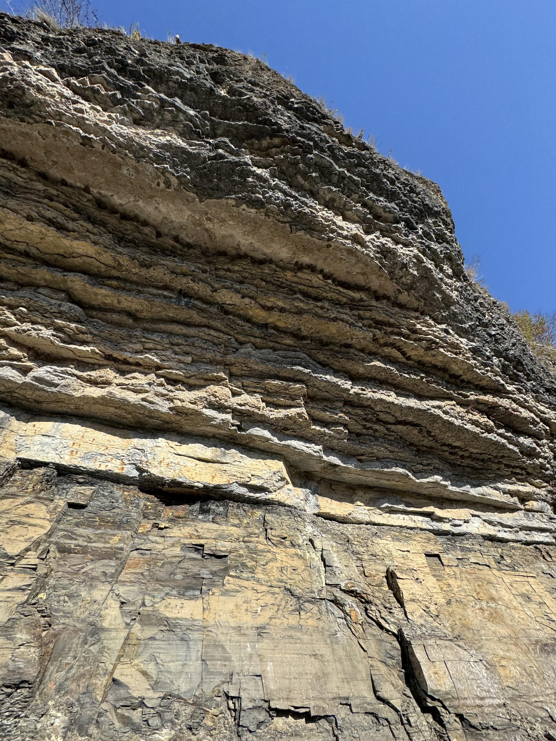
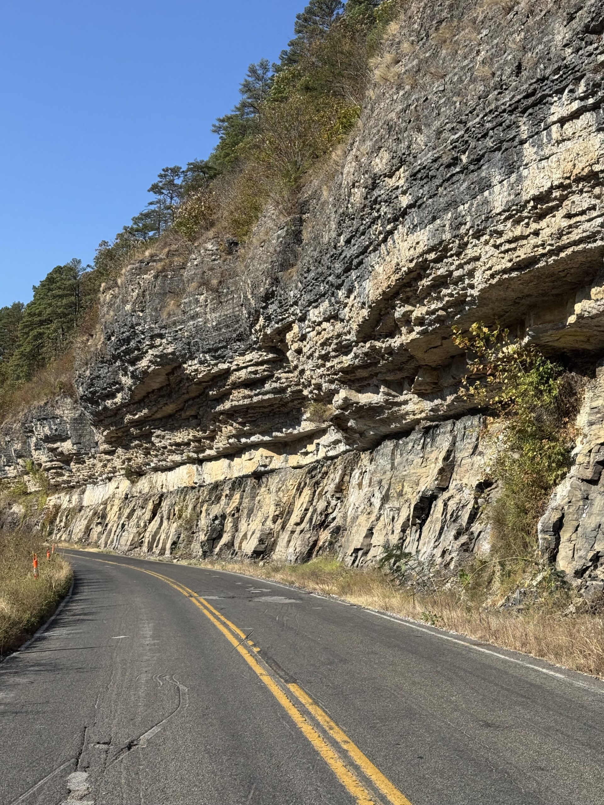
Shortly after the farm, the road I was on was going to intersect with the road I had taken in August into Fayetteville. I wanted to try something new, so instead of riding on that same exact road, I turned right at the intersection and climbed up over 1500′ of elevation onto a high mesa like ridge before dropping down, turning, and then hitting the main state highway into Farmington first and then Fayetteville. Whew, that was a BUSY highway. It was four lanes with a turn lane in the middle, too, and a huge mostly debris-free shoulder until I hit the city limits at which point they give you a narrow elevated sidewalk and no shoulder. Those sidewalks are terrible for riding a road bike on at speed with constant rocks, glass, driveways, business entrances, etc…
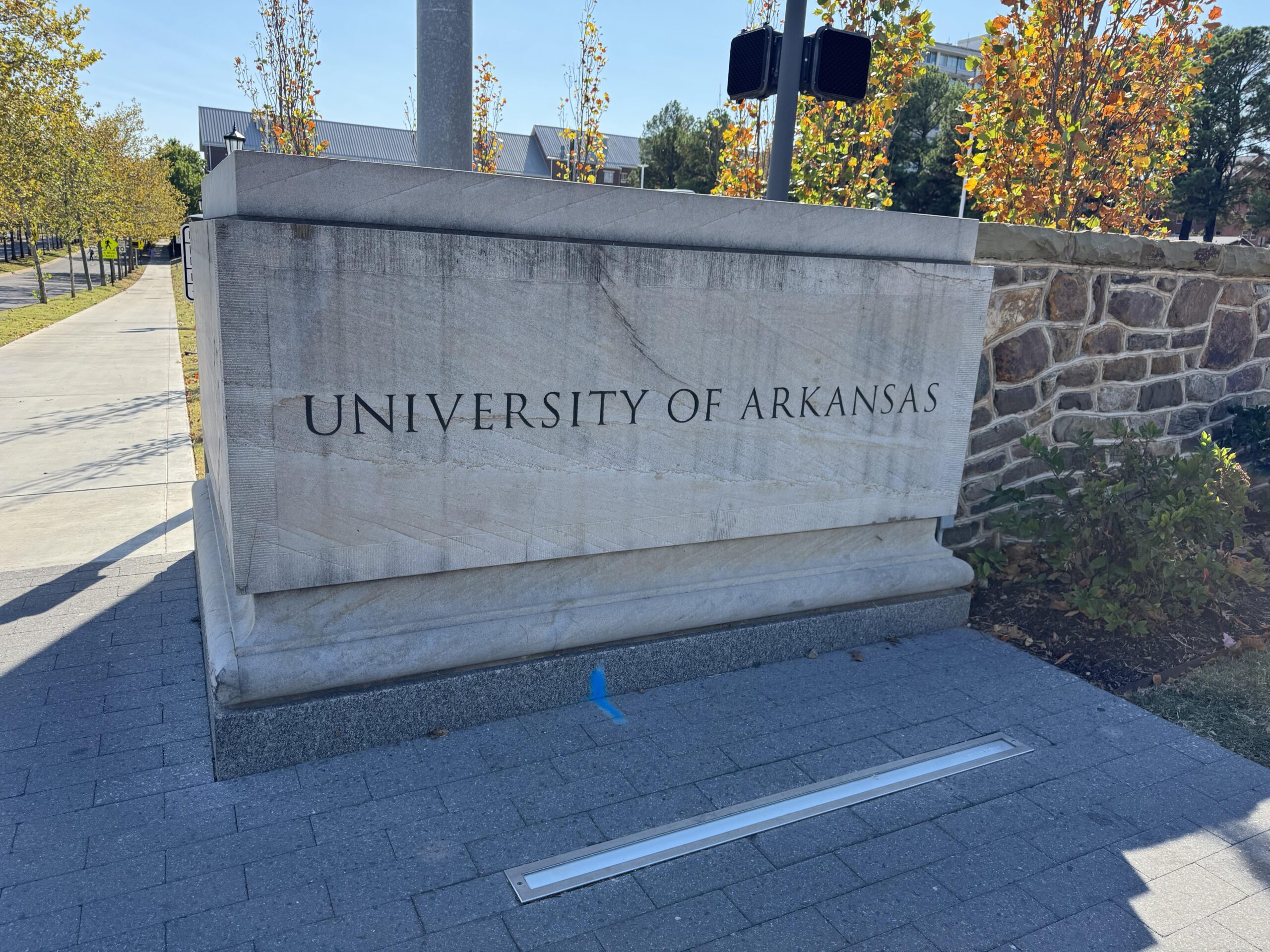
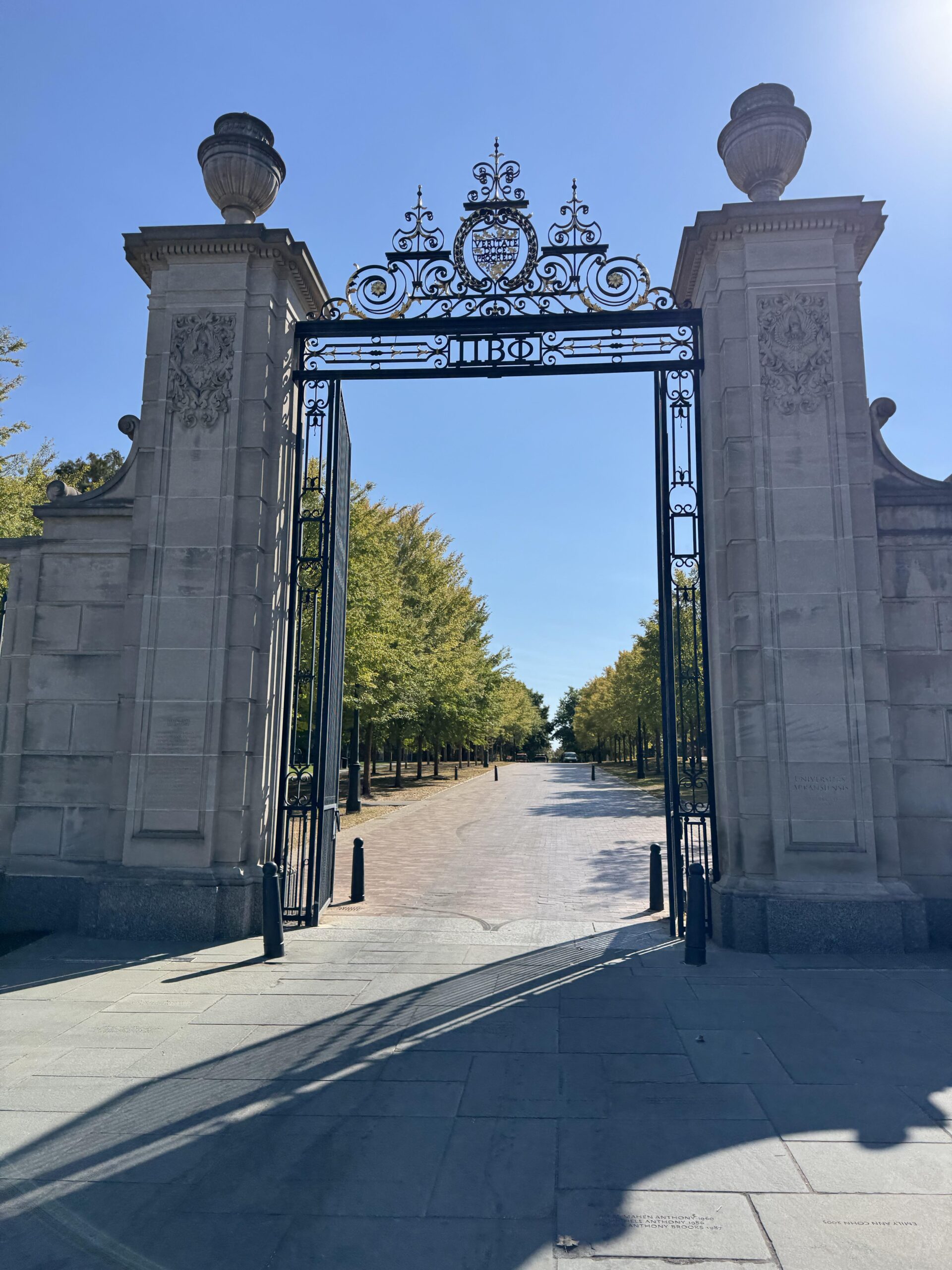
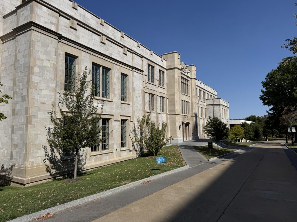
Go Big Red (U. of Arkansas)
It was still four lanes with a turn lane though, so traffic was mostly able to get around me. Still, I was thankful to make the left turn off that main highway onto a side street and then a bike path taking me pretty much all the way to the University of Arkansas campus. I had routed myself right through campus, and it was deserted so they must have been on Fall Break like I was.
I enjoyed some bike paths afterwards as well, which eventually ended leaving me on the main highway heading east with a beautiful bike lane which eventually turned into a nice shoulder which eventually turned into nothing as I got closer to Huntsville. I made it all the way through Fayetteville by 3:30pm and had a bit of school traffic, but the “work day” 5pm traffic didn’t find me until the far side of Huntsville where presumably it was mostly people leaving Huntsville (not Fayetteville) to get back to their homes and farms. It was very hilly by this point, constant hills and turns, but thankfully most of the drivers were great.
Temps had barely made it into the lower 70s in the main part of Fayetteville and it was quickly down into the 60s as I left town. I still had a good 6 hours to ride as it approached sunset with first a Freeze Warning and then a Frost Advisory popping up on my Garmin as I crossed into different weather zones. This made me a bit concerned that the arm warmers, leg warmers, cotton gloves I had brought wouldn’t be enough to keep me warm by the end of the ride.
A broken screen, a sunset, and a comet
But first, there was a lot happening pretty much back-to-back-to-back. I dropped down into Kingston hoping that the store would still be open as I was about out of water. As I crossed a rough bridge through the small downtown area, my phone bounced off the mount on my handlebars. I was worried at first that it would have fallen down into the creek, but as I turned around I could see the phone at the edge of the bridge face up. Unfortunately, even though it ended face up, it must have landed hard on the screen as it was cracked badly, and the screen itself was glitching to weird neon colors.
I was worried that the screen would give out completely, so I quickly re-enabled Siri (I keep it off to keep it from constantly listening and draining the battery) so that I could at least interact with the phone via voice control. By the time I had refilled at the store, the screen seemed to have stabilized itself and would only glitch whenever I plugged it in to charge it.
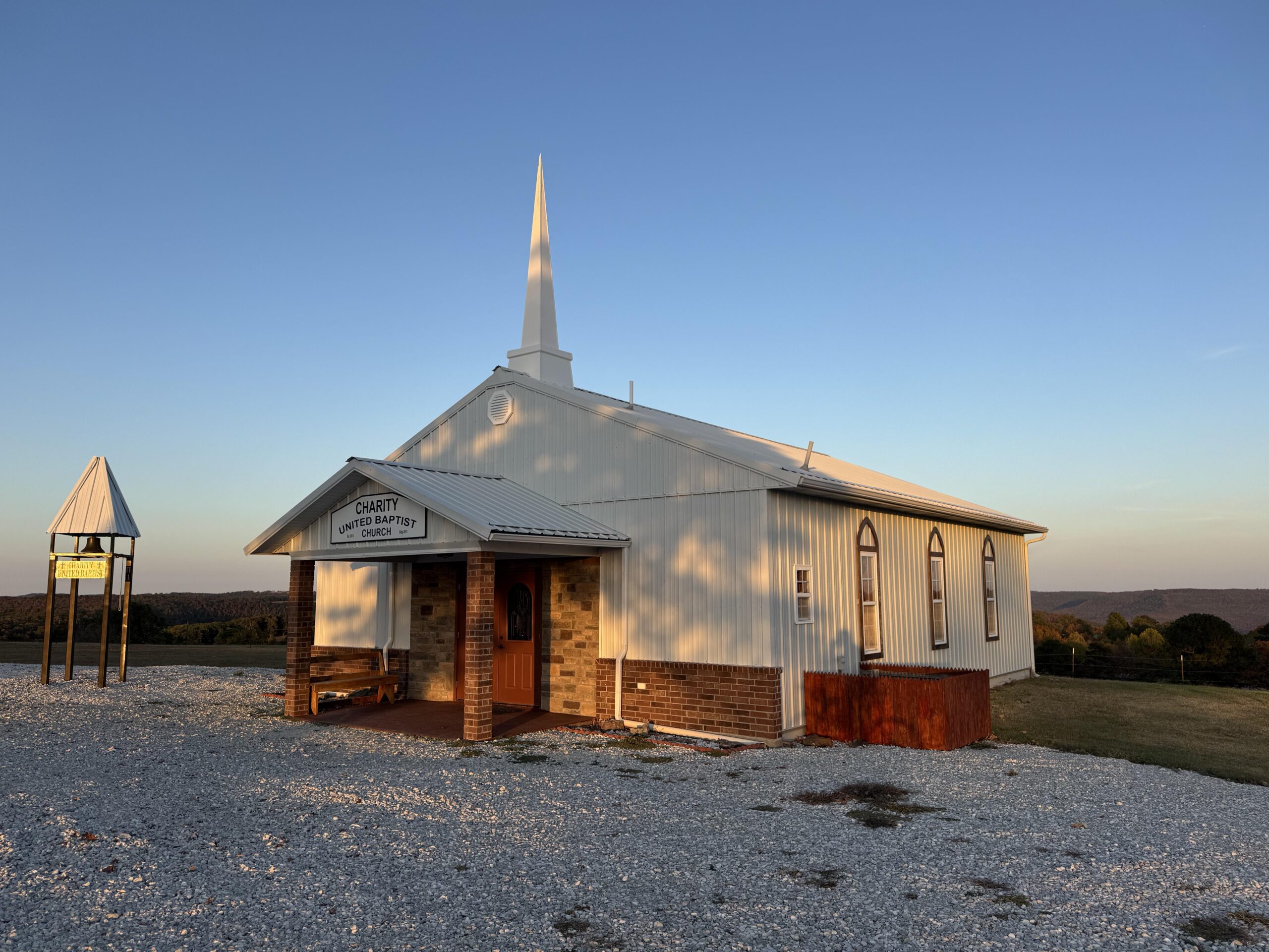
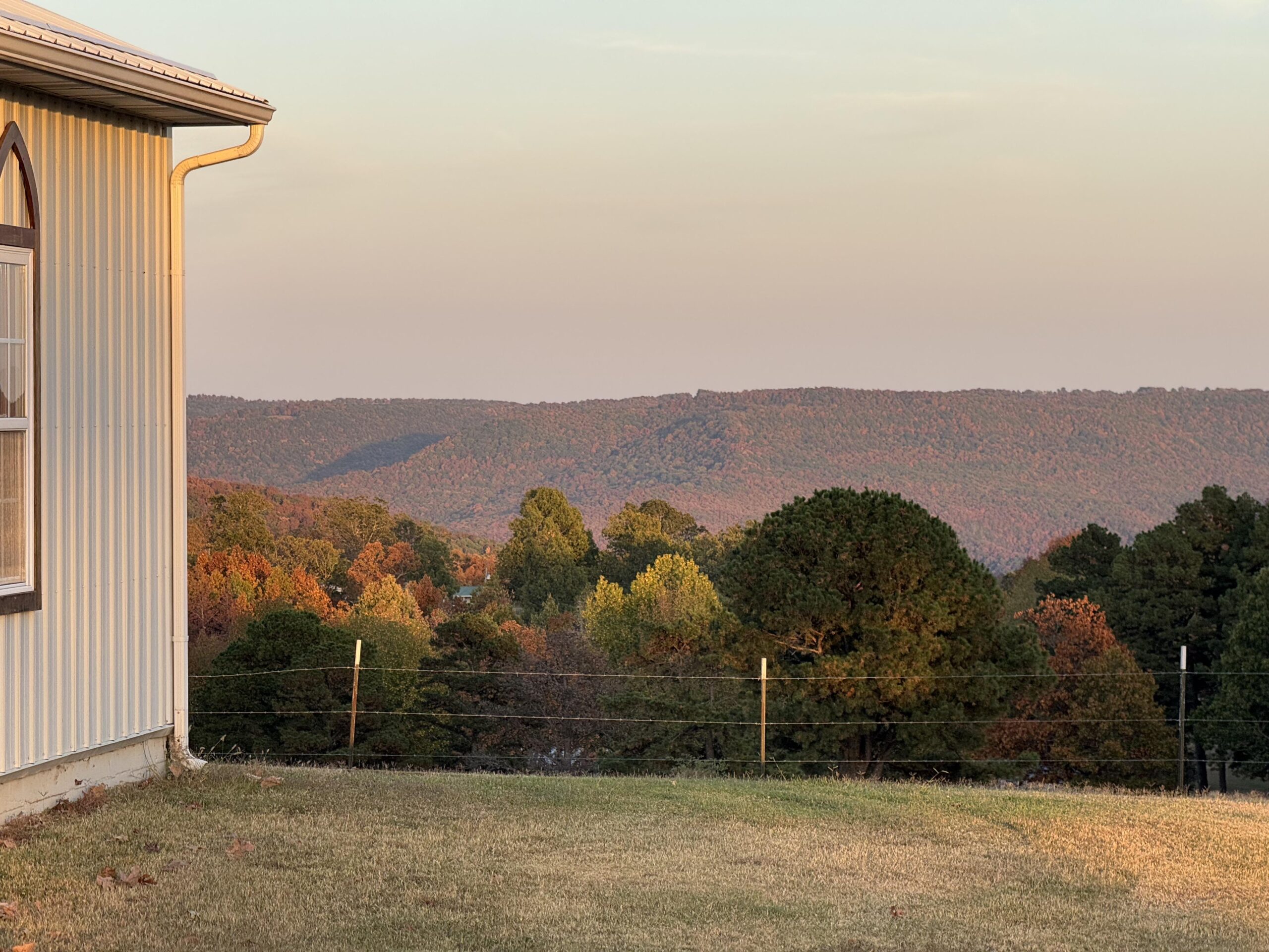
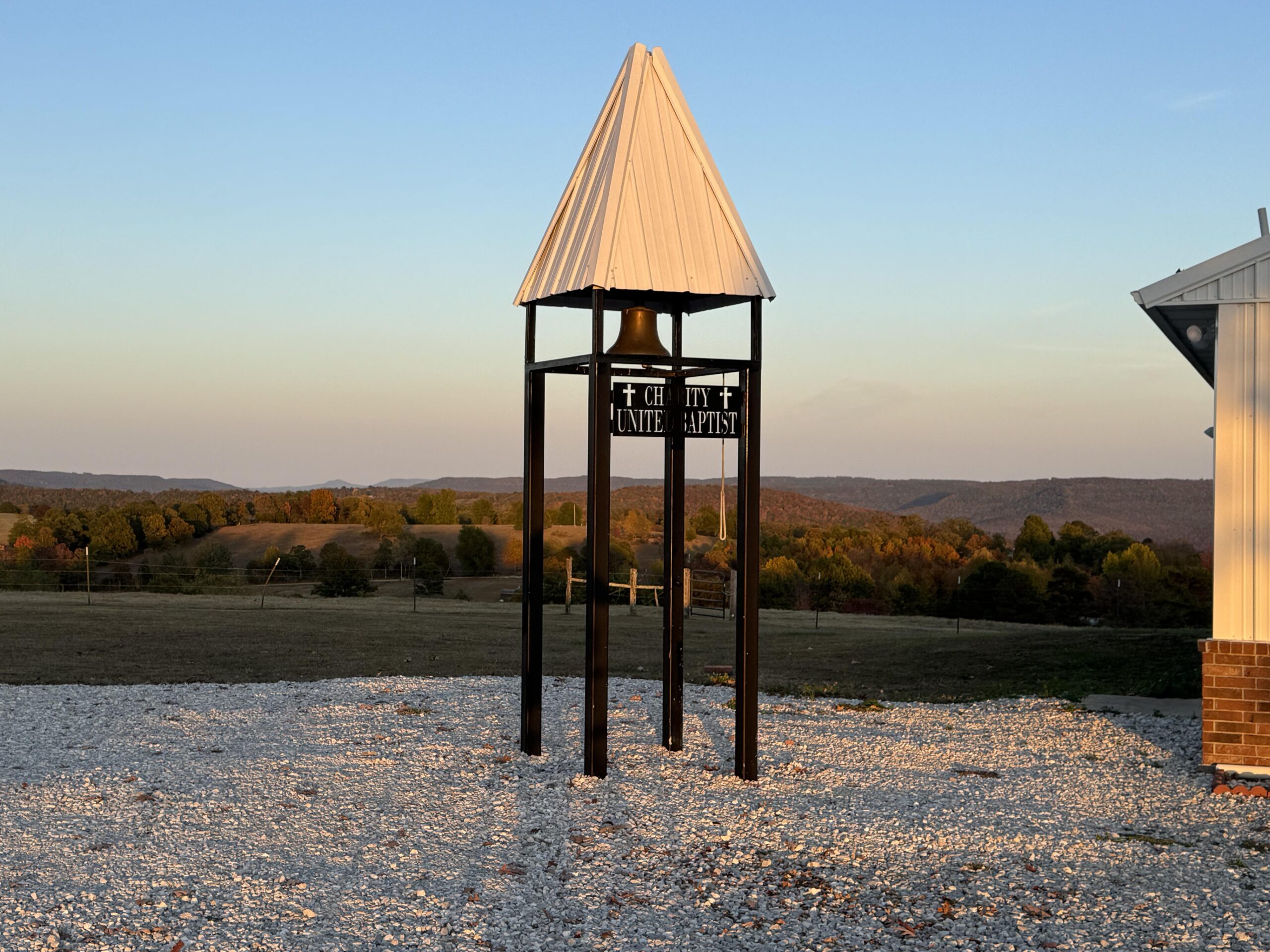
As I left the gas station, I realized that I had ridden this road before! In my failed attempt at the end of August I had ended up re-routing myself on-the-fly through the Ozarks and apparently I had taken the highway through Kingston but coming from the north instead of the south. But at this point, my current route merged with that one. So I knew that I had a very steep climb ahead of me. I was still warm, though, and just happy to be riding in such a beautiful area with the sun setting. By the very top of the climb, I made it to the tiny church with a view of all the fall colors in the trees aglow with the alpine glow from the setting sun.

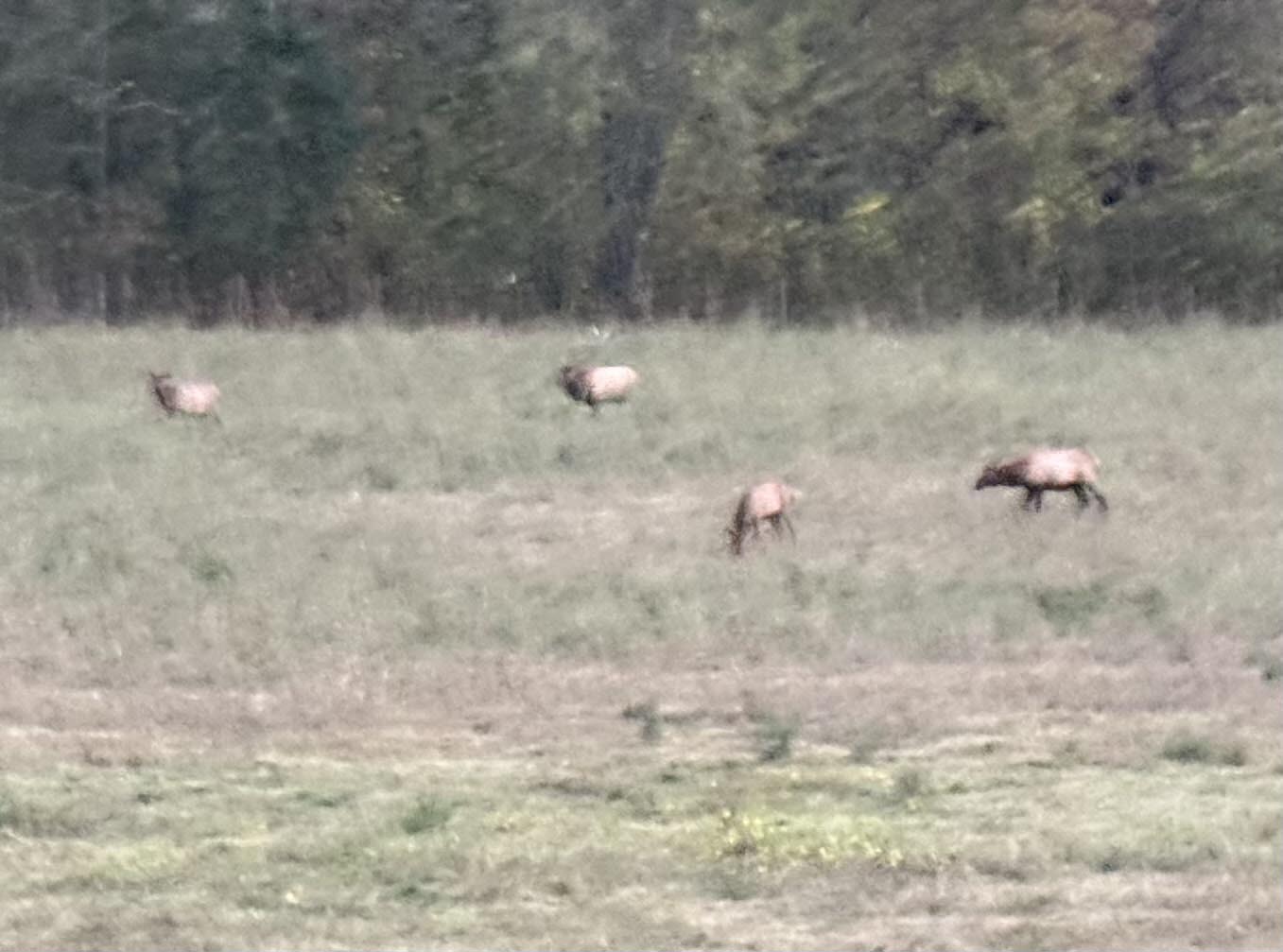
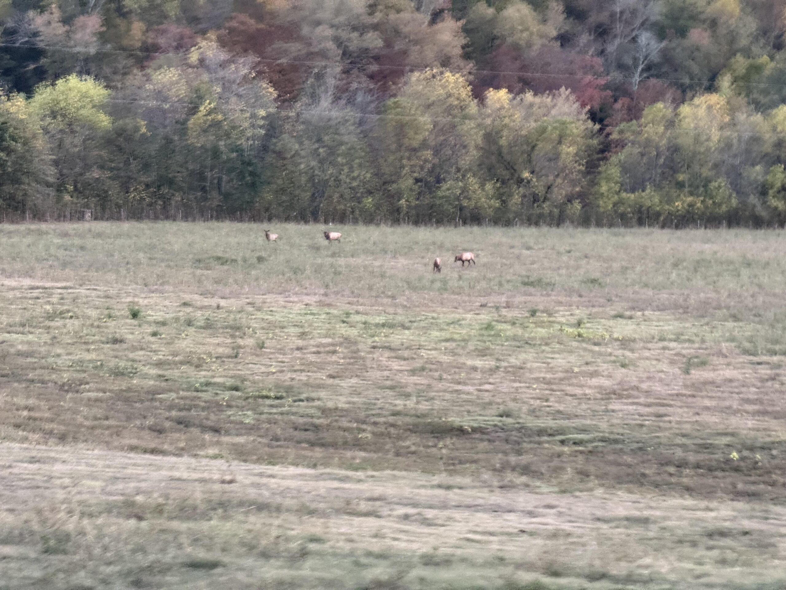
After a steep descent down to the Buffalo National Scenic River valley, the sun had disappeared behind the mountain I had just come down. It was still light enough to see without a light and as I rode up through the valley, I saw a bunch of cars ahead and several people out with professional-looking cameras. I wondered what they were looking at, and there was a herd of elk grazing on the far side of the valley from the road.
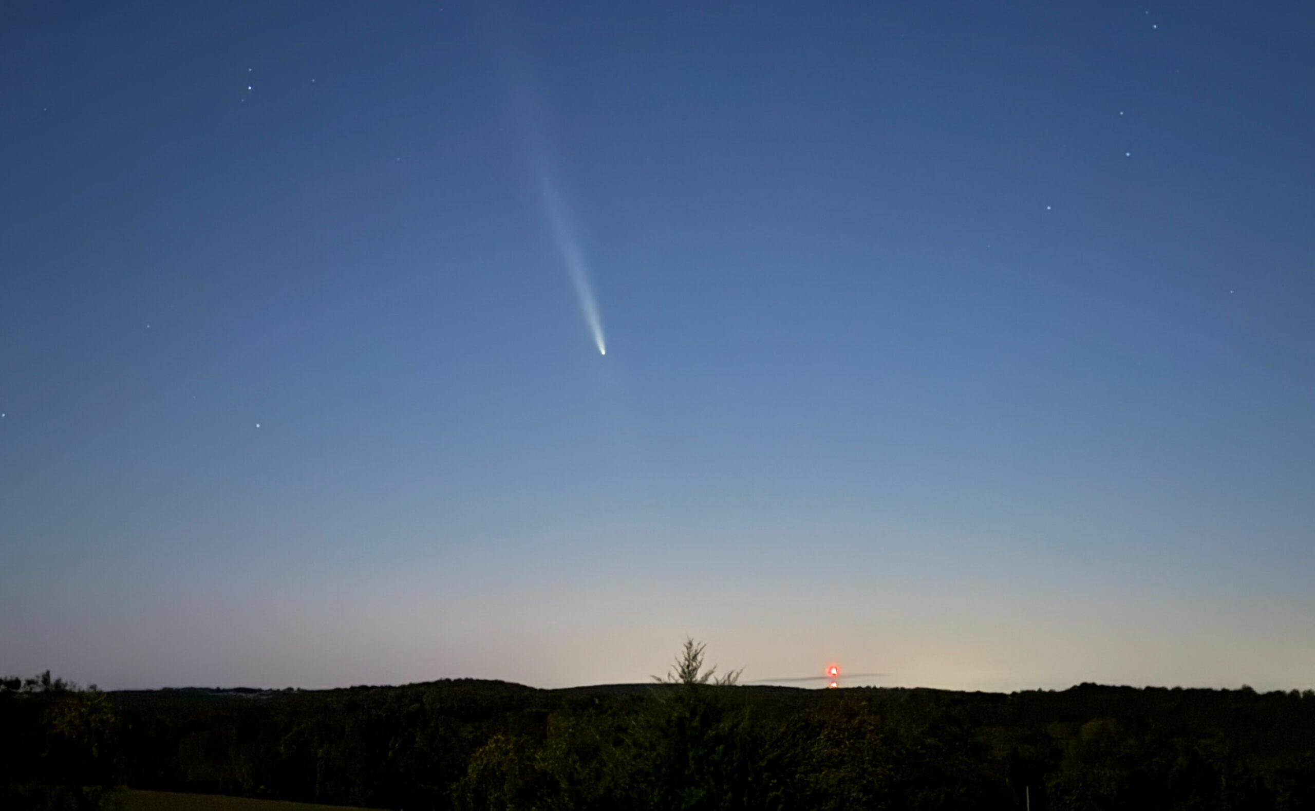
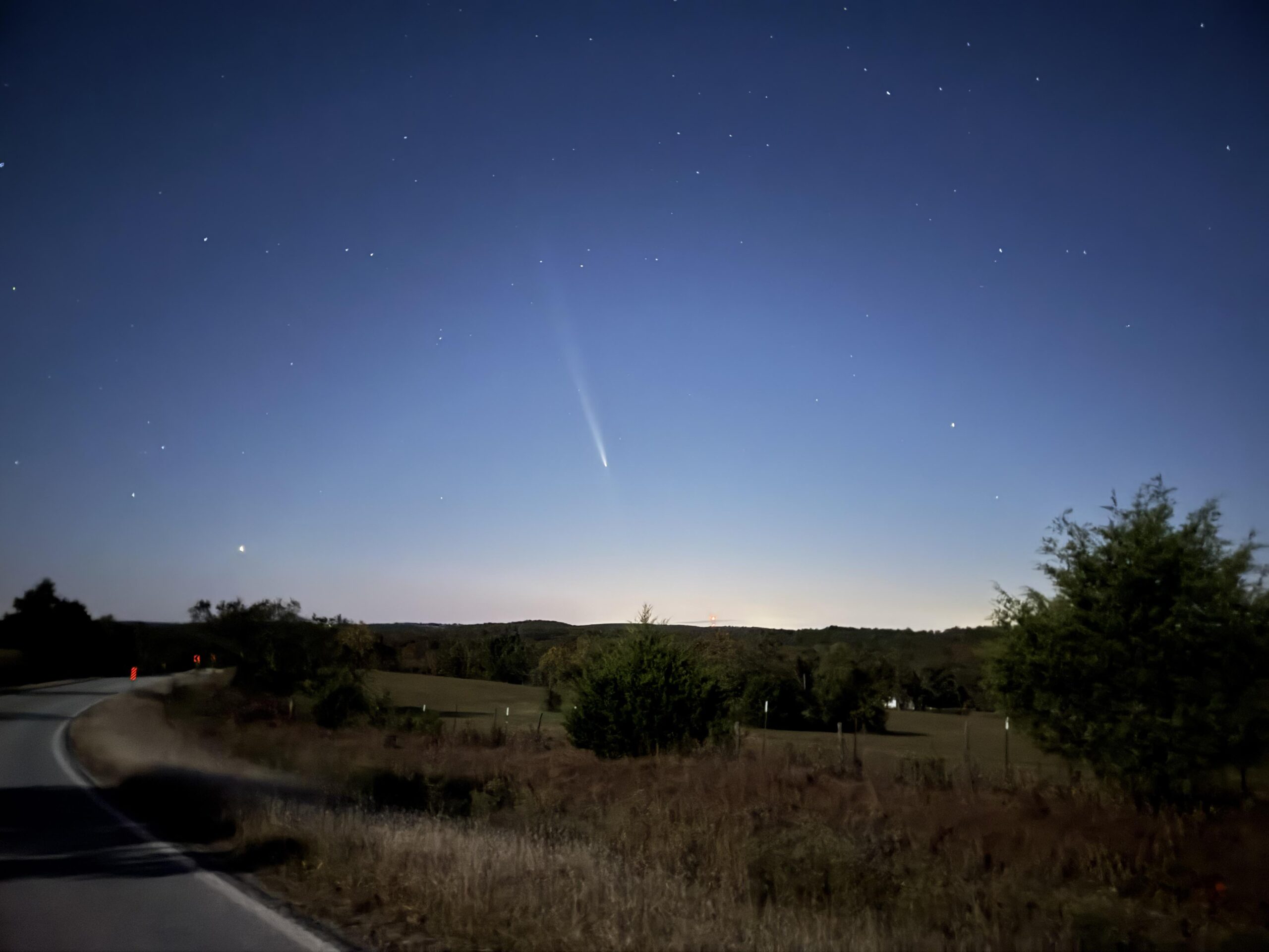
The sun had completely set by this point so I started looking for Comet A3. I found Venus and even Arcturus, the first bright start to the right of Venus, with the comet supposedly about halfway between them. No signs of the comet and as the sky got darker and I finally made it up the long Cat 2 climb out of the valley, my route turned almost due east away from the comet in the west/southwest.
I climbed up through a small town and thought about putting on warmer clothes, but I didn’t want to sweat with a long descent down into a presumably very cold valley for the last part of my ride. After I made it through that town, I happened to look back and lo and behold there was the comet very easily visible (and BRIGHT) behind me. I stopped in the middle of the road (it was deserted) and took a few pics and sent them off to the family as we all had been trying to find the comet.
After getting some good pics of the comment, I continued across the top of the long ridge/mesa waiting as long as possible to put on my arm warmers and leg warmers for the descent. Right before the drop-off was a small driveway where I could set my bike and get my clothes out of my backpack. After a quick stop, I had everything I had brought with me on. And I needed it, temps were way down in the low 40s as I bombed down the fast descent into the town of Harrison.
I had never heard of Harrison, but it was pretty big on the map. There was a large river going through town and I saw (and ignored) some detour signs and continued following my route. Well, the bridge I was supposed to take was under construction and spans of it were just gone. So I had to turn around and find another crossing of river.
A few minutes later I was back on course on US Highway 65 which is the road I started on. I knew that I wasn’t going to stay on it the entire 35 miles back to Marshall because I was going to veer north to cross over into my final county of Arkansas. I was starting to get a bit sleepy as time crept towards midnight.
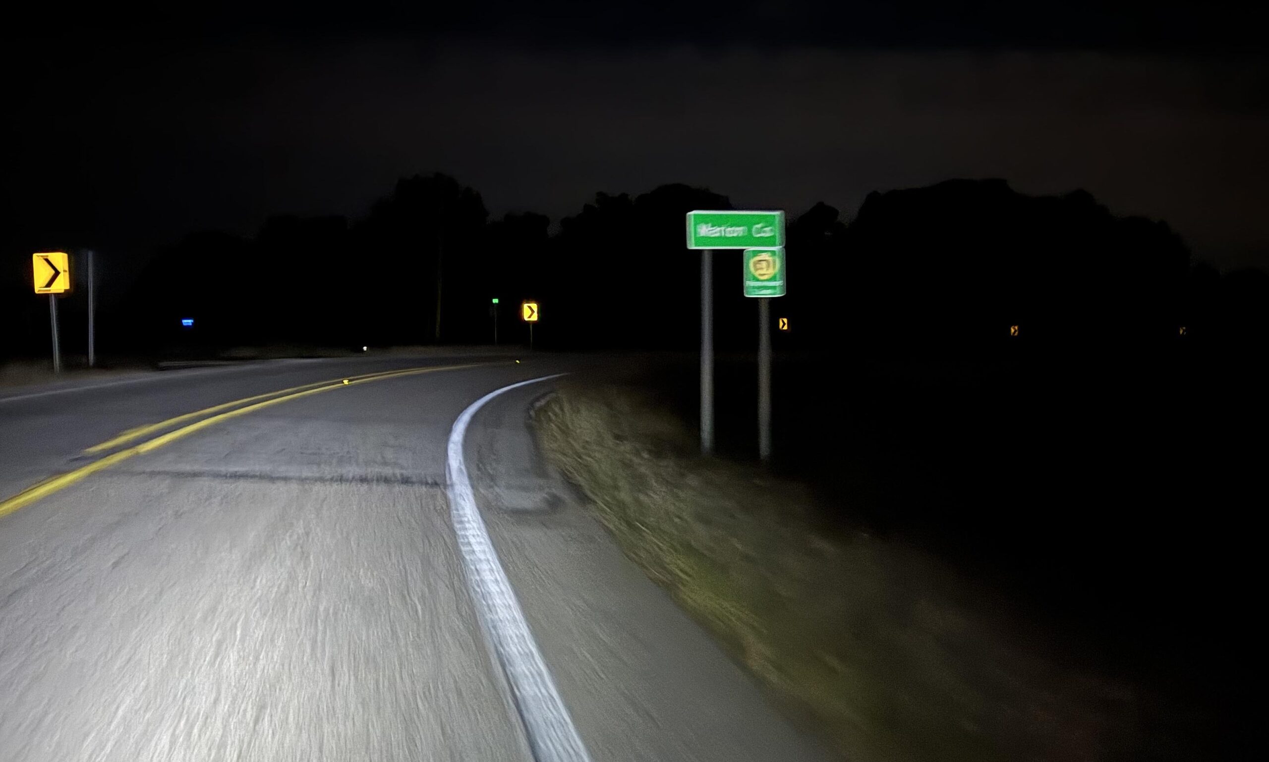
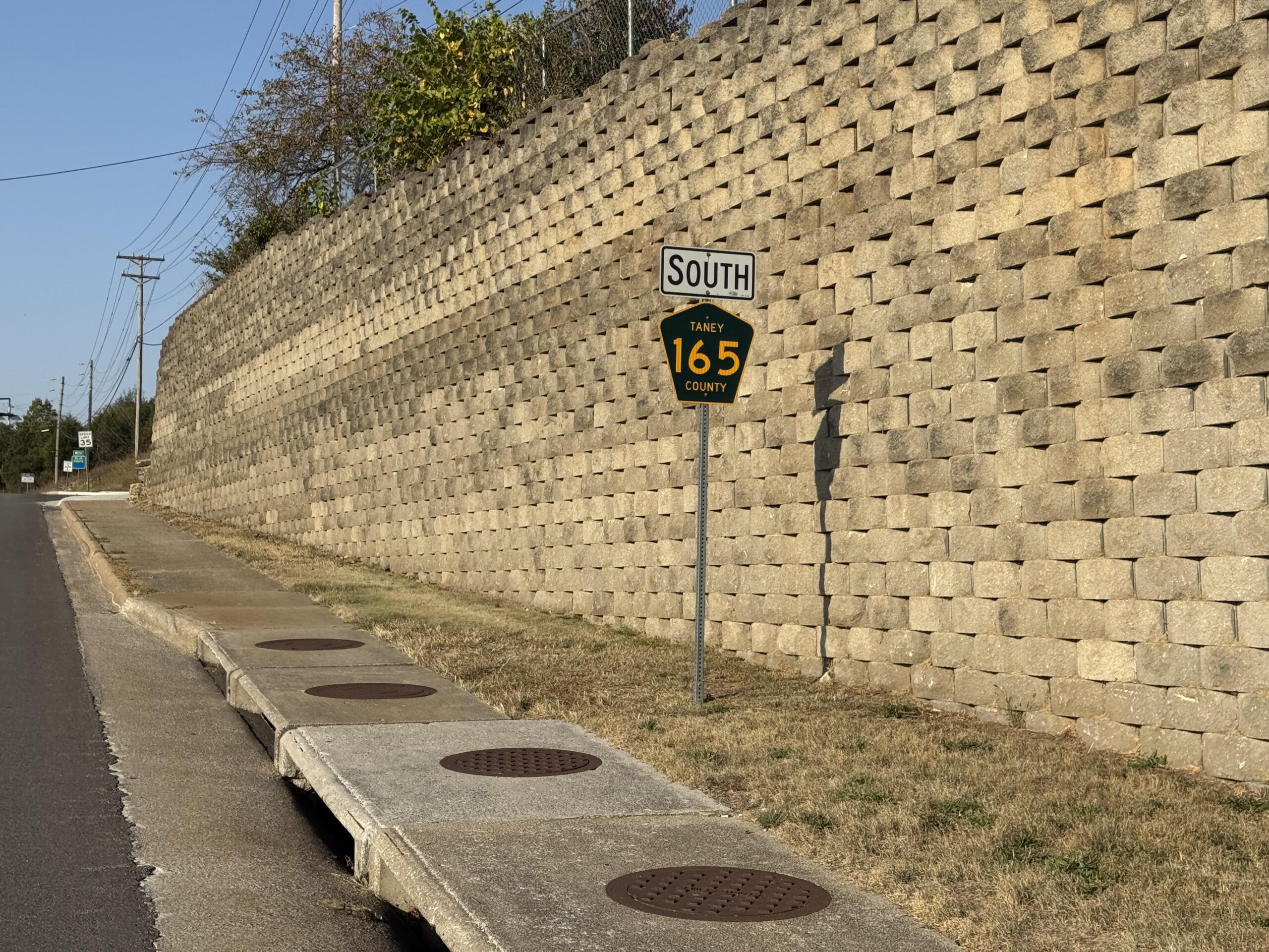
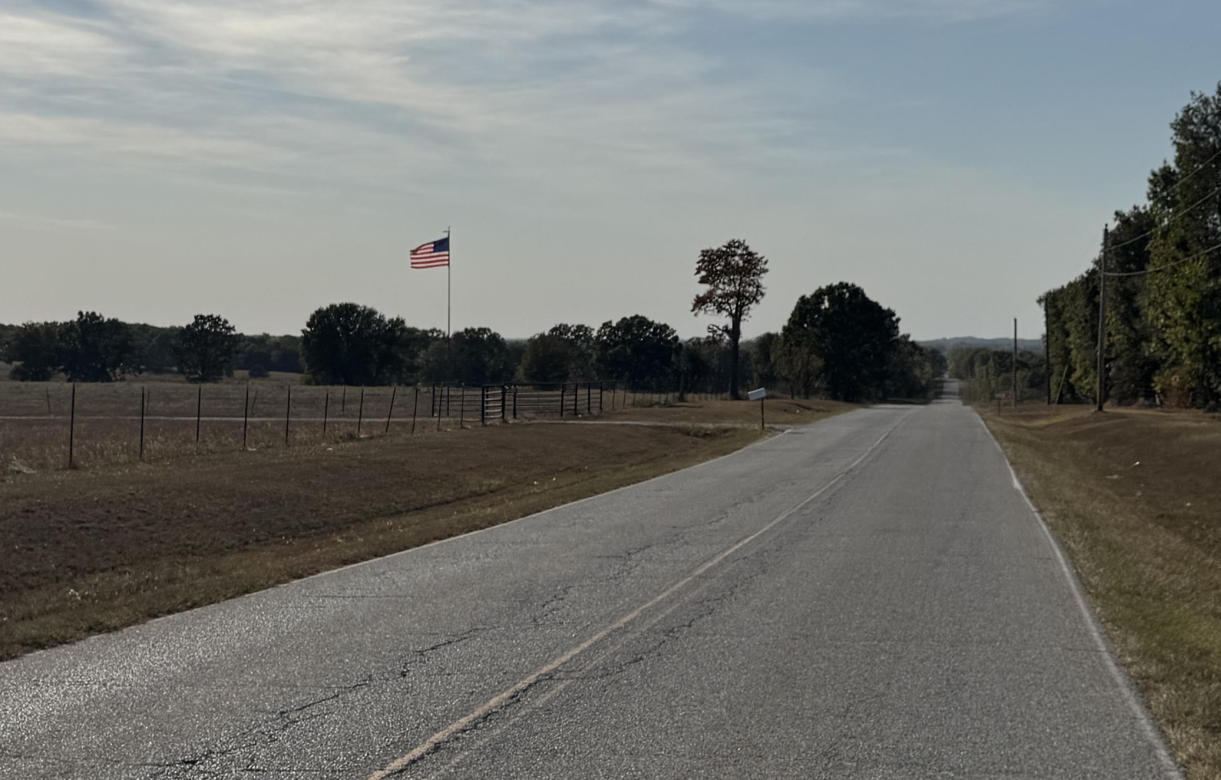
I did snap this pic of the Marion County border as I crossed back into Searcy County a few miles before making it back down to US Hwy 65 where my car awaited for me about 20 miles farther along US Hwy 65 in Marshall. Traffic was very light but as this was the main highway to get back down to Little Rock, I had 18 wheeler trucks passing me every 20 minutes or so. The shoulder was great and rideable so I would swing over into the shoulder to let the truck pass before swinging back out into the road.
It was about 15 minutes past midnight by the time I made it back to the car. I had started at 11:45PM just over 48 hours earlier … so I arrived back to a deserted small town and my car all alone in the parking lot of the grocery store just as it had been 2 days and 560 miles earlier.
Leave a Reply