Buckle in folks. This one is going to be long. Some quick background first: Kim Murrell is a well respected mastermind behind a number of bikepacking routes all over the southeast. She coordinates the grand depart for the Three Rivers Way bikepacking race each May. A lot of times this conflicts with the Cheaha Challenge, but this year she bumped up the starting time to Thursday at 6:30am. With the Cheaha Challenge not starting until Sunday at 7:30am, I calculated I could do both!
The Cheaha Challenge is a steadfast pillar of cycling in Alabama. Brooke Nelson and her husband Tom do a phenomenal job putting on this event every year. As long as I’m physically able to ride a bike, I will be doing the Cheaha Challenge. This year, since it was going to be on the back-end of a long bikepacking trip, I didn’t have any high expectations for the race other than to finish. Instead, I felt amazing and ended up in 10th place in the ultra!
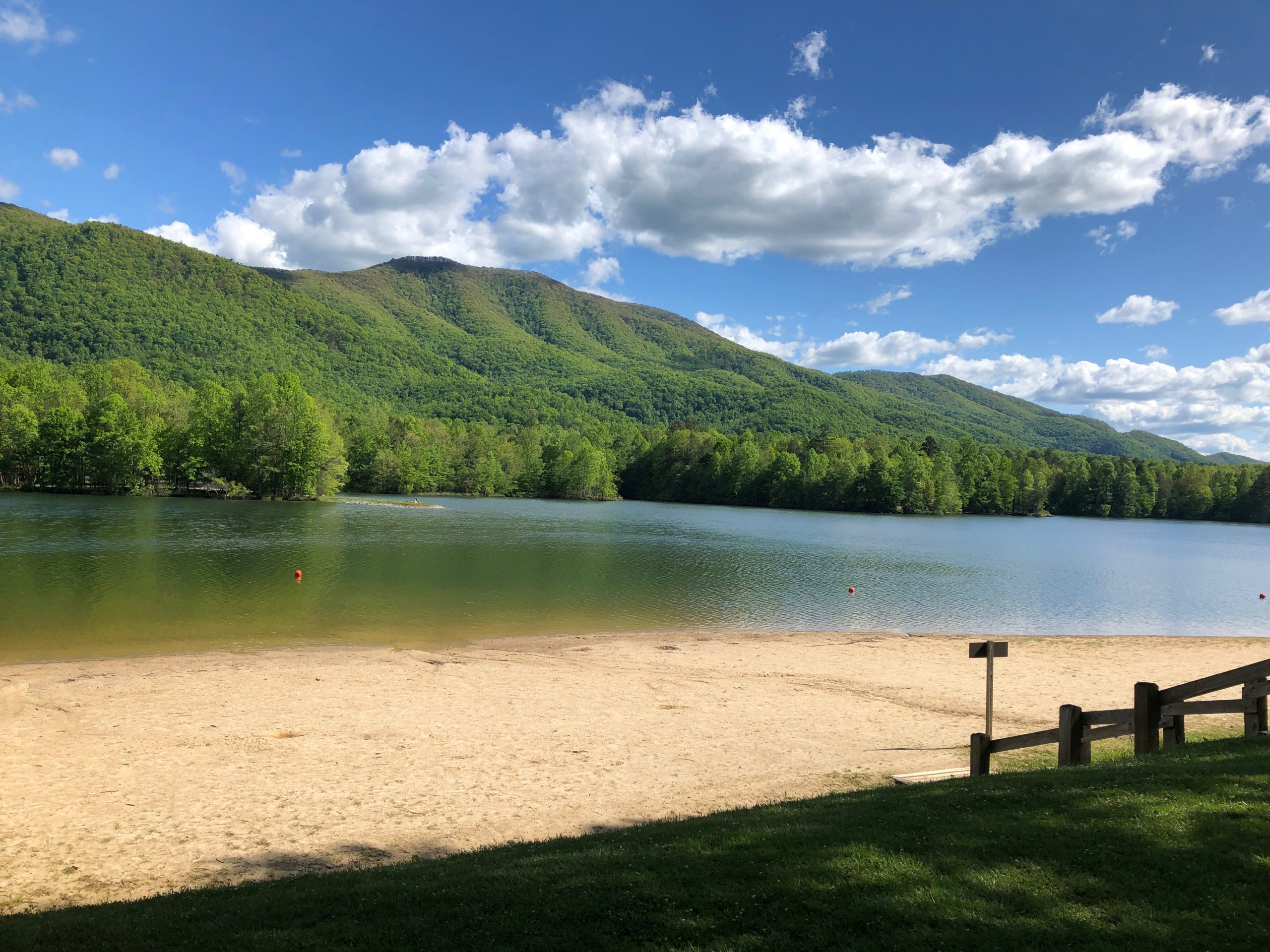
Here is the map of my 928 mile route with 85,000 feet of climbing!
- Day 1 – GREEN – Tuesday @ 9:42pm – Wednesday @ 7:30pm
Hoover, AL to Delano, TN (Fireside Outpost) – 225 miles - Days 2 and 3 – YELLOW – Thursday @ 6:30am – Friday @ 7:00pm
Three Rivers Way – Vista 320 – 1st place, Fastest Known Time (FKT) 36:30, 325 miles - Day 4 – ORANGE – Saturday @ 7:30am – Saturday @ 8:00pm
Delano, TN to Jacksonville, AL – 168 miles - Day 5 – RED – Sunday @ 7:30am – Sunday @ 9:45pm
Jacksonville, AL to Hoover, AL via the Cheaha Challenge Ultra (10th place!) 208 miles

DAY 1 – GREEN – I FOUGHT THE RAIN AND THE RAIN WON
I had planned to leave Wednesday morning around midnight after a good 4-6 hours of sleep early Tuesday evening. BUT, it was absolutely beautiful weather Tuesday evening with the radar showing a veritable wall of rain approaching from Mississippi. It just seemed dumb to me to sleep through beautiful weather to wake up and ride in the rain. Still, with nearly 1000 miles ahead of me, I thought I should probably not start the whole thing on zero sleep. So I slept for an hour, woke up, and enjoyed a good solid 3 hours of riding until the rain hit. And it was a wall of rain. It wasn’t very hard, but it was the dense small sized rain drops that just completely soaks you. I rode in this for 2 hours as the temperature also plummeted down into the lower 50s.
I stopped outside of Gadsden for coffee and to try to purchase some sort of clothing at a truck stop. But the stuff they had was very expensive and settled on a $3 bandana to add an extra layer to my head under my helmet. I was also going to slowly sip hot coffee to try to warm up on the inside before heading back out into the rain. But when I went to leave I noticed there was a booth I could sit in to enjoy my coffee. And as I sipped, I looked at the radar and noticed the trailing edge of the storm was already halfway through Alabama … moving slowly … but still not very far away. So I decided to just sleep/doze/rest in the booth and wait it out.
This went pretty well, and sure enough, right around sunrise the rain stopped. I left and headed through very wet streets through Gadsden and on northeast towards Weiss Lake. Unfortunately, up ahead I could see another wall of rain. I’m still not sure whether that was me catching back up to the original storm (they were very slow moving) or if it was a different part of the system that still hadn’t made it across yet. In any case, it rained even harder with temps even colder (despite it being well past sunrise). On top of that, the wind had picked up and I was riding straight into a stiff northeast wind. Even though the rain would stop finally after a couple more very cold hours, the wind never stopped and while it got sunny and beautiful, the ride was hard all 225 miles to Delano, TN.
I had chosen to wear my short non-riding shorts b/c I knew they would dry very fast in case I needed them again later … rather than getting a pair of bibs soaking wet that I would have to deal with and would be more likely to cause saddle sores. It eventually got quite sunny and I got quite the sunburn on my legs as I would find out the next morning before the start of the Vista 300 race. The irony of being so cold and getting so sunburnt, lol, on the same ride.
Also I was quite heavily loaded with tent and sleeping bag and sleeping pad and clothes for 5 days. See my loaded setup when I stopped at Sonic in Benton for dinner shortly before finishing up the 16 hour ride to Delano.

Arriving at the Fireside Outpost, I found Kim and was glad to finally meet her. She helped me find the perfect spot to setup my tent and get connected to electric to charge up all my devices (see equipment list at end). Kim needed to run into two to get supplies and offered to take me with her so I could restock on food for the race. This was super awesome chance to chat about races and courses as Kim has ridden all over the country on awesome bikepacking courses including large chunks of the Tour Divide, the entire Florida Divide and it was great to hear her insight and experience. After showering and saying hi to racers gathered around the main campfire I was heading back to my tent to get all rested up for the race, when all of a sudden I recognized someone – Michael Rasch who was nearing the end of his race with him starting it as an ITT earlier in the week.
He came running over full of excitement as I believe he had just made it to the outpost – deciding since the timing was right he’d rather just say hi to all the racers and get a good night’s sleep and then head out to finish his race in the morning. He gave me some great tips for the race – be prepared for cold on the cherohala descent, but gravel in good condition can really bomb it, don’t let your speed get away from you, describing the water crossings and how to best get across them. I thanked him and congratulated him too on making it to the final leg of the race and then headed back to my tent for sleep.
DAYS 2 and 3 – YELLOW – THE VISTA 300 FKT
After a great night’s sleep where I didn’t wake up at all until my alarm went off at 5am, I started to get ready for the race. I ran into a few other racers getting ready when I went over to use the restroom, but for the most part it was very quiet. I headed back to my tent to start getting my bike ready for the race. I made the mistake of waiting until the morning to do this, as it ended up taking me way too long and almost making me miss the start. I sorted all my food and clothes and got everything loaded up and this took quite a while.
(Almost) Late to the start
Kim had sent someone back to check on me since I was missing from the start line as I ran into them right as I was pulling out. With the start less than a quarter of a mile away, I made it over with 2 or 3 minutes to spare as the park ranger gave us some final instructions and wished us luck on our effort.
While the ranger was talking, I was doing some last minute clothing rearrangement – stuffing my head gaiter and fleece vest back into my backpack and swapping my long finger cotton gloves for my normal short finger riding gloves – knowing that we would be climbing immediately and getting hot immediately. I left my long sleeves on because it was pretty cold, but within a mile I would be taking them off too.
The other thing I was doing in the last minute was getting my navigation ready – pulling up the route on the Garmin. I opened the course and press ride and nothing happened. I pressed it again and still nothing … waited a few seconds and then went back out to the main screen and saw that the route was loaded but it didn’t look right. It was a long straight line from the start. I thought (hoped) maybe it was just the very beginning of the route to get to the trail was a straight line.
At this point, I’m last to leave the start line and the front racers are disappearing into the woods. I could tell by this point that something was wrong with the ride file I had loaded onto the Garmin as it went off to the side of the trail in a long straight line before connecting to the next point. My first thought was, “well, I’d better follow them while I get this sorted out”.
So I immediately took off after them while opening ridewithgps on my phone. Thankfully, I had downloaded the route ahead of time so that I could use my phone for navigation even while in airplane mode. The route loaded quickly, but by this point as I’m trying to click Navigate and start recording a ride on the phone we were hitting the trail and as I would soon find out – this first trail definitely required two hands.
Thinking about abandoning the race before the end of the first climb
I had the route up and navigating so I could switch attention to navigating the trail and passing all the racers to get back up to the front to keep an eye on the faster riders. This was not easy because the trail was full of loose baby-head rocks (rocks the size of baby heads). Eventually I made it to the very front and then proceeded to come to a fork in the trail at about 2.5 miles into the race. I couldn’t tell which way to go (even on the phone – and definitely not on the Garmin) so I waited for the next racer (Hank McCullough) to catch back up to me. And we talked about it for a few seconds and agreed we should go right (this was correct), thankfully – because the other way was a nasty muddy steep trail.
As it turns out we still had 7.5 miles to reach the top, but at much more gentle rolling incline with one final steep section. I had a pretty good gap (I think) by the top – but it all disappeared on the descent. The descent was steep and only about half as long, but it was just as rough. I had to take it super slow and even walked/scooted one particularly steep section. During this time, Joe Wharton had passed Hank and then caught up and passed me flying by on the section I ended up scooting down. Hank caught me near the very end of the trail as we popped out onto a a nice road.
Before this, even while leading the race, I was coming up with strategies for abandoning the race. The corrupt Garmin file (I thought) was the main problem. Sure, I could navigate with the phone using ridewithgps, but I had doubts I could keep my phone alive for 36 hours. This was the main thing … but on top of that I was not prepared at all for how rough and muddy and hard those first 10 miles of the race were going to be. I knew that there was no way I could survive 316 miles of that. So here is how my thought process transitioned as I continued to climb:
- Turn around now, ride back to the start, pack up the tent and ride home
- Finish the opening climb, hit some gravel, make up a route to get me back to the start a different way, perhaps adding on enough miles to take up a good chunk of the day so I could still hang out and spend the night before riding to Jacksonville (instead of home)
- Ride all the way to Cherohala (100 miles in) and get to experience the Cherohala gravel descent and decide at that point if I wanted to keep on going
So I was pretty fully committed to #3 when Hank McCullough (Greenville, SC) caught up to me. This was also right as we hit a nice gravel road to finish out the descent. Still very hot from the initial climb, we finished the long gravel and eventually paved descent. By the bottom it was very cold so separately we each stopped to put on clothes.
We ended up chatting a bit, and I commented that I was thinking of abandoning the race. And he mentioned that he saw a lot of people on drop bar gravel bikes and said he suspected there was no way the entire race could be like that or everybody would be riding hard tail or full suspension mountain bikes.
This was super encouraging to me, and I switched all my focus to my original focus of trying to push the pace hard enough to make it to the Indian Boundary general store before they closed at 5pm. This would require an average speed of 9mph. In fact, this was my only specific racing strategy for the entire race … make it to Indian Boundary before 5pm. Well, and also, try to maintain a 9mph average speed which would put me well within the record of what I thought was 36 hours.
Hank and I went back and forth for a while with me climbing faster on the gravel bike and him descending faster on his mountain bike. I had opened up enough of a gap, though, by the time I hit the creek crossings of Witt Rd, I hadn’t seen him behind me in a while. I also had completely lost site of Joe Wharton who was somewhere up ahead.
I knew from talking with Michael and Kim not to try to ride through them as they were quite deep. They also mentioned that the first one had some shallower rocks that were tempting to walk on, but quite slippery. It would have been faster to follow their advice and walk through the deeper water to the left of the rocks, but I have quite a bit of experience on that exact rock from crossing the Cahaba River and I wanted to minimize carrying the heavy bike as much as possible. So I took off my shoes and socks, put my shoes back on without my socks and started across – wedging my feet between the rocks and pushing my bike across the top of the taller ones.
Made it across just fine, and hopped back on my bike still without socks, knowing that there were two more crossings. Neither of the next ones was as rocky as the first one. But both were a bit deeper. The narrowest one was the deepest with the water coming up above my knees. It was a huge relief to make it past the three water crossings that I had heard about, but I continued to ride barefoot for a long time wanting to “air-dry” my shoes as much as possible.
The road continued on paved roads and good gravel roads always up or down for a long time and I was able to bring my average speed up over 10.0mph. I was debating about skipping a stop in Tellico Plains since it was looking very good that I would make it to Indian Boundary in plenty of time. But a couple of things happened right at the spot where I had to make a decision – 1) a nasty dog came running out to chase me and it was easier to make the left turn off course towards the Exxon I could see 2) I was tired and hadn’t stopped at all and wanted some caffeine (red bull or starbucks or anything).
So I spontaneously turned left off course to the gas station, had a pretty quick stop, 7 minutes, which was enough time to buy and drink a starbucks canned drink plus two gatorades, refill bottles and load up on some more food (way too much food … I technically had plenty left even by the time I made it to Indian Boundary that if they had been closed I would have been fine).
Indian Boundary and the Cherohala Skyway
After my short stop at the Exon, I headed out alongside the Tellico River on the bottom portion of the Cherohala Skyway. The Tellico River was the first of three major mountain rivers (Three Rivers Way) that we spent a few miles alongside. The Ocoee River would come many hours later in the middle of the night, and the third major river (the Hiwassee River) would come at the end (spectacularly). Instead of turning and following the skyway when it really started to climb, our route went straight on my favorite road of the race “River Rd” which climbed very slowly alongside the river amongst many rapids and caves and rock formations that were just inspiring. There was a “curvy road” sign with 18 miles underneath it, and I was desperately hoping that we would be riding on it for 18 miles as I was cruising at a good solid 14-15mph through here on the pavement. But alas, after just 4 miles, the route left the river on a very steep climb towards the Cherohala which had already started climbing much earlier. Fairly quickly, the route climbs all the way up to the Cherohala, but then keeps going right underneath it. For some reason, I thought this was so cool and it really inspired me. By this point, of course, I was fully committed to finishing the race and back on track to break the FKT … with the only problem being Joe Wharton being who knows how many miles ahead of me might break it first!
As it turns out, I wasn’t far behind Joe at all. When I made it to the Indian Boundary store about 30 minutes before they closed (woohoo!), he was loaded up and pulling out. So that meant the time gap would be exactly however long I stopped. I needed a good stop here. I had been riding with wet socks for a while (I had put them on as dry socks after taking them off before wading through the water … but once I put them back on, they began to soak up the water from my shoes) . Plus, the store had rocking chairs. So race-be-damned, I was going to sit in that rocking chair with my shoes and socks off for however long it took to eat a bag of chips and drink some gatorade. I switched socks, putting on nice wool dry socks, and tying my wet socks very tightly to the reflective band hanging down from my backpack. I would finish the race with those socks still tied tightly on (and completely dry!) about 225 miles later.

I took off, not necessarily in pursuit of Joe, but just enjoying the amazing scenery, the easy to ride singletrack, the super narrow bridge across the lake dam, and in the back of my mind focusing mainly on that 9mph average speed but also hoping that I would catch him eventually.
I noticed before leaving the store how cold it had gotten in the shade. I knew I had a big 10 mile climb coming so I didn’t put on any extra clothes, but it solidified my plan to put on every piece of clothing I had before starting the descent. I crawled up the climb, passed by a bunch of motorcycles, and saw a side road just before the highest point. I went down that road and when I went to put on my warm clothes, I noticed that my bibs were actually quite wet from sweat so I went ahead and changed them. But I knew I still had a little bit left to climb and didn’t want to get the dry bibs wet with sweat so I took off again knowing that I would need to stop again once I was on the descent proper.
This worked perfectly, and the amazing microfleece vest my wife had found for me earlier in the year was so perfect to keep my core warm. Long sleeves from a rain vest, long finger gloves, my gas station bandana under a gaiter, plus knee warmers and the microfleece vest over everything and I was quite toasty even on the long descent. My hands were cold by the bottom, but other than that it was perfect.
I figured it would be cold enough to keep riding like this for a while, but with it still an hour or so before sunset and the temperature was a bit warmer 3000′ lower down along the Tellico River again. So I was looking for a good place to stop when I noticed a store (closed) with a vending machine out front. I thought that would be a great place to get some water since I had drunk a full bottle of gatorade on the cherohala climb after leaving the Indian Boundary store.
As I pulled in, somebody pulled in behind me – it was Joe! He had stopped at the bottom of the descent at the ranger station and was just now catching up. They didn’t have bottled water, but they did have a monster energy drink. I thought this would be perfect to take with me and have as ammunition against sleepiness later. I also opened the coke that the Indian Boundary store had left out for the racers. Unfortunately it spewed everywhere b/c I forgot to do it slowly. Thankfully it was mainly on the ground and didn’t get me or Joe wet other than my glove. I was hoping for an outdoor spicket so I could wash off my glove to keep it from getting sticky, but the outdoor spicket I eventually found was locked!
I took off my vest and gaiter and bandana but left my long sleeves on b/c it was still quite cool outside. As we left, I told Joe that I thought we would be playing the “put on / take off” game for a while. I tried to win this game by lasting as long as I could with minimal clothing on the descents hoping that I would reach the bottom and start the next climb again to warm up. And vice-versa, if I had put back on warm clothes I tried to see how long I could climb with them without sweating too much. It worked out well as the focused effort led to some uncomfortable cold descents but still fewer stops than if I was just normally riding and trying to stay comfortable.
Even though we started out together, I put some distance into him when I think he had to stop to take off more clothes early on the climb. This climb ended up being 700′ over 3 miles followed by a similar descent. This was one of the cold descents leading to an even steeper climb where I did have to take off my long sleeves. The descent off that one was right into a beautiful sunset and since it looked like it was a long gradual descent, I put everything back on except the fleece and rode with that for many miles – all the way through Copper Hill to the 24 hour gas station where it was now so cold (down into the 30s) that I needed to stop for coffee as well as drink refill.
There was a nice couple working the gas station and they pulled out a chair to let me sit inside next to the coffee machine and sip on my coffee and eat something (I forget what it was now). I asked if they had hand warmers and would have bought some, but they didn’t have any. I wasn’t too worried, though, because I knew the Ocoee River singletrack from the Cohutta 100 race was coming up just a few miles after the gas station. Those miles were a cold descent down to the Ocoee River before hitting the singletrack and doubletrack.
I knew there were some wet sections to these trails so I took my time and had fun. The wet sections weren’t as bad as I thought they would be, and I even made it across one of the particularly rooty sections before walking the last creek crossing on the rocks to keep my socks dry. After the Centennial Olympics bridge over the Ocoee, I knew there was a big climb, but I didn’t remember how tricky it was to ride … or at least it was especially tricky to ride at night. I think with the steep slope, the tricky sections were always just above view until it was too late to see the best approach to tackle bigger root or rock climbs or drops and I ended up unclipping to get over a number of them.
All of this warmed me right up all the way to the top where our route hit the Thunder Rock Express descent. This was a tricky rocky descent that was most definitely meant for a full suspension mountain bike – not a rigid fork gravel bike. So I had to take my time and use a lot of brakes to make it down to the bottom where we immediately climbed back up to the top of the mountain on a dirt road this time right about sunrise. At the top, you hit a multi-use horse/motorcycle/biking trail taking you back down until you eventually hit a dirt road which you aren’t on for long because you have to turn onto the dreaded Sylco horse trail.
Slyco Trail to Chilohowee
The dreaded Slyco trail was the next obstacle. I totally missed the entrance and had to turn around a couple times to find it. That being said, with Michael Rash having ridden through there just a day earlier and with all the trail work that Kim and members of a local horse riding club had done to the trail, made the trail quite tame to ride. Yes, there were some overgrown sections and a few trees still down, but it was all rideable or you could take a bypass trail around. The one thing about it that was a little deceiving is that it looked like I was coming to the end at one point, but that was only the halfway point. So the second half seemed to drag on forever because I was wanting to hit paved roads again and make some time to get my speed back up to close to 9mph. It had dropped deep into the 8s by this point with all the slow singletrack climbing and descending.
But it did eventually end, and I was back on gravel and then paved roads all the way through Benton. I didn’t need to stop because I still had plenty of food and water. I kept right on going, eventually crossing a cool wooden bridge on a road that had lots of “bridge out” / road closed signs. I was thinking that I might end up needing to ford a creek, but it was actually a still in-tact bridge across a railroad that was closed to cars (but still easy to dismount and get across on a bike)
Before the abandoned bridge was Kim! She had ridden her dirt bike down to the other side of the bridge and then crossed over to see me come through there. I didn’t stop at all and told her I thought I still had a shot at the record, but needed to average 9mph from there to the end.
I scraped my leg pretty good on the bridge – enough to make me worry a little bit about tetanus since it drew blood – but other than that started to fly through the Mennonite farms seeings lots of people out and about on horse drawn buggies or just out working the farms or talking with each other. The riding was quite fast along paved relatively flat roads, but that would end on the approach to Chilohowee. I knew it was going to be a big climb, but I thought it would also be a long one … nope! The climb was 1400′ over just 3 miles with some really steep 15+% sections on gravel. Whew.
Garmin Resurrection, Chilohowee and Smith Mountain to the End
During the steep climb to the top of Chilohowee, I had been messing with my Garmin to try to pan the map over to see what was coming up and where I was and it was so slow to respond that I decided I would stop the route and then restart the route. And guess what?!? It loaded perfectly this time, which meant I could stop relying on the phone ridewithgps dings to figure out if I was off course and have to turnaround! This also meant that my Garmin showed me the upcoming terrain – more on that in a bit.
Immediately at the top, the route went straight onto the Chilohowee singletrack trail system. I was super motivated to be finished and to break the record, so I went hard on the trails trying to keep a 9+ mph average over everything. This meant I rode lots of things that I might normally have walked. And it was fun. Let’s call it “snake light” … in other words a tamer more manageable version of some of the technical parts of the snake trails from TNGA. There was some good elevation too as you started out above a waterfall, rode a trail way down alongside it to a spot where the creek was shallow enough to ride across and then immediately climbed all the way back up the other side of the waterfall. It was a mix of steep sections and rolling fun. I loved it!
I was a bit concerned though that as hard as I was trying, my overall average speed wouldn’t budge from 8.7mph, which is not fast enough to break what I thought was the 36 hour fastest known time for the race. I knew I had a big descent coming up after one more long climb so I thought that would help. I mistakenly thought it was relatively flat to the end of the race, but then as I approached the descent, I was close enough to the next major obstacle – Smith Mountain – that it showed up on my terrain view on the Garmin. And it was black, which means the steepest gradient possible. After a quick stop at the gas station at the bottom of the descent where the high school kids working the counter were impressed with us coming through there having ridden 300 miles (technically only 285 at this point), I headed out towards the climb.
I’m not sure why the Garmin showed the mountain with black gradient because it wasn’t steep at all. It was a beautiful gravel climb on good gravel. I got into a great rhythm and ended up averaging 6.3mph over the nearly 9 mile climb. Again, though the race was long enough by this point that it didn’t dent my 8.7mph average speed, but it also meant I would need to go even faster on the descent – so I was hoping that it would be the same good gravel type road … or better yet – pavement! – but alas, it was a long motorcycle trail. These are very interesting very straight trails at a designated gradient. They are also quite narrow and because they are edging down the side of a mountain, there is a lot of exposure in places with a long drop down if you fall. There was nothing sheer but if you fell to the right you wouldn’t even hit the ground for about 4-6 feet and then as long as you land on something soft you’d be fine, but if you happened to land on a rock you are most likely breaking something.
All of that is to say – starting with me not even finding the entrance the first try – I knew that it was becoming extremely unlikely that I would be able to pull the average speed up closer to 9mph to break what I thought was the 36 hour record. Still, it was going to be close so I didn’t give up. It is probably good that I knew it was unlikely because that meant I didn’t take any crazy risks on the descent. If it was a bit closer, maybe I would have ridden everything at full speed instead of unclipping and stepping over some of the sideways roots (there wasn’t very many … but if you get it wrong … 4 to 6 feet with possibility of rolling much farther down … possibly in poison oak … ouch … not worth it)
When I finally popped out on a good gravel road, I initially turned the wrong way, climbed a bit, realized my mistake and turned around and climbed the other way (lol). This quickly brought me to the Hiwassee River bridge which I had never even seen before – let alone crossed. It is a cool narrow (barely wider than handlebars) pedestrian bridge across the Hiwassee taking you to the side of the river that is quite popular for rafting (kayaking, duckies, etc…). Josiah and I had rented duckies with friends and put in at the exact spot, so I got to ride alongside some of the sections of the river that we had so much fun kayaking on two summers ago.
I also knew from the shuttle up to the put-in spot that there was quite a steep hill … but at least it was all pavement at this point, and you could crush the descent. Unfortunately, even though I’ve ridden the last stretch before I couldn’t figure out which road was the correct road taking you down to spring creek. The train that was there before seemed like it was gone, so that didn’t help, or I was just delirious. It was super ironic though because my ridewithgps route had only one single cue on it that showed up the entire time on the phone “turn on spring creek rd 3.1” and then I missed the turn after 320 miles!!!
I was already past 36 hours at this point, but I didn’t know exactly what the record was. So when I saw the missile of a dog heading straight towards me, I didn’t let it bother me and blew right past it … although it was quite scary … and straight onto the double track taking you down to the creek. When I hit the creek, I had intended to take my socks off, but with the potential of a FKT on the line, I practically ran into the creek with my shoes and socks still on. It was pretty deep and wide, but I made it across with the water coming up to the bottom of my bibs at its deepest point.
From here you hop on the gravel road leading to the state park, which was longer than I remember. But eventually you make it to the state park where Josiah and I camped with friends before our ducky adventure on the Hiwassee. We also rode the singletrack on our bikes back then so I was familiar with the trail. I rode it pretty slowly and had fun since I was approaching 36.5 hours and figured the record was long out of reach.
But when I made it to the end – there was Kim waiting at the state park HQ / ranger station and she was excited to see me and hand me the belt buckle because I actually had set the new FKT. Jon Livengood who had the previous FKT at 41 hours had just commented that he thought you could do it at under 36 hours, which I thought that meant he had the record at 36 hours!
I agree, sub 36 is definitely doable, I’d think a really skilled bikepacker might be able to do it in closer to 32-34 hours … not sure even the best of the best could drop it down much farther than that, though. I could easily chop another 30 minutes off just with the experience of having done it once. Also, if I didn’t have the navigation issues from the Garmin, I think I would have been at least 30 minutes faster with all the missed turns where I had to stop, check the phone, and double back.
Wrapping it up now, the Vista 300 was amazing and I can’t wait to come back and try my hand at the Vista 420 … might have to drive up there next time so I have time to make it down to the start of Cheaha if it’s the same weekend again!

DAY 4 – ORANGE – COMMUTING TO THE CHEAHA CHALLENGE
I had left my tent setup so I could crash in it as soon as I got back, but Kim very graciously offered me one of the cabins that hadn’t been rented for the night. So I was able to shower and sleep in an actual bed! But first I biked down to Jessica’s Place, a great family restaurant about a mile away next to the main highway. It was quite busy even at 8:45pm, which was funny because I was wondering if they would even be open. It was great as they had breakfast-all-day so I went ahead and ordered a to go breakfast in addition one of their big burgers and cheese fries … yum, yum!
I probably should have set my alarm, but I fell asleep before I was even completely ready for bed. Thankfully I had plugged everything in, but I woke up at 6:30am the next morning somewhat surprised I had fallen asleep. I knew I was going to be riding slow, and it was going to be tough to make it to Jacksonville at a reasonable hour. So I immediately sprung into “load up the bike and get out the door” mode, which still took about an hour to get everything loaded back onto the bike.
I was out the door by 7:38am with my first stop the cool back-to-back bridges I had raced through the day before wanting to get a few good pics of the bridge. Then it was onto new roads (for wandrer.earth) taking me down through an area I have ridden through a lot on some epic adventures and races … the Fort Mountain … Dalton … Rome corridor. So it was a bit tricky to find new roads, but I found a good one that went as much as possible in a southwesterly direction towards Jacksonville.
It was slow going with the heavily loaded bike, but there wasn’t a ton of climbing with only one big climb taking me over the Snake ridge at John’s Mountain on pavement. On the backside of John’s Mountain, there was a really cool road with lots of people fishing and camping alongside John’s Creek.
Also, this route was close to the TNGA course and even followed the paved portion of the TNGA course for a little bit, so I recognized a lot of things. And it was awesome to be thinking of that race and the adventures in it and yet super thankful to be on much, much easier roads even as heavily loaded as I was!
One other exciting thing was losing my phone at Berry College. I was about a mile south of the college when I realized my phone was no longer mounted on the stem! This would create numerous logistical problems for the rest of my trip, so I turned around panic and rode the same exact way I had come thinking it had come off on the curb hop I had to do to get around the unofficial exit gate. It wasn’t there, though, so my panic level was rising a bit as I took off backwards on campus. Thankfully it wasn’t too far and I found it laying in the street shortly after a speed bump. Also, thankfully, campus was deserted so nobody had run it over or picked it up. With phone back on, I headed back off campus again. No big deal, but an extra two miles of riding when trying to get a heavily loaded bike a long distance in a short amount of time … isn’t great.
Eventually, I made it to Cedartown and the Silver Comet, but still had to keep pushing the pace to try to make it to Jacksonville before the early packet pickup ended and to meet my ride, Chris Winslett, who was picking me up to let me stay with them down in DeArmanville. Super helpful because this also meant I could convert my bike back to its non-heavily loaded form and send my extra stuff (tent / sleeping bag / clothes) home with him so that I could ride the Cheaha Challenge Ultra on a good setup and enjoy the ride home instead of having to lug all the stuff.
The one sad thing about this ride is the picture below of a newly installed ghost bike at the Essom Hill trail intersection. I did some research and David Perkins was actually killed there back in 2014, but there hadn’t been a ghost bike at the intersection until this one was installed recently. Either that, or it was moved, as it struck me as new. I’m pretty sure it was new. But I’m getting old and tired.

Day 5 – RED – CHEAHA CHALLENGE ULTRA AND COMMUTE HOME
What an amazing turnout for the 2021 Cheaha Challenge. Sooooo many people. Soooo many friendly faces all out there suffering together taking on the super steep hills of the challenge.
It was awesome to have Frankie Andreu announcing and sending us off at the start. He sent off the first three waves of challenge riders and then called us ultra riders up to the start line mentioning we were taking on the crazy challenge of the steep bonus climbs. True that, but I was also arriving at the start line 768 miles into my ride.
I left Tuesday night at 9:10pm to beat the rain (the rain won) and rode 225 miles up to Delano, TN to race the Vista 300 (325 miles – bonus miles!) setting the fastest known time of 36 hours, 30 minutes with no sleep finishing at 7:00pm on Friday night.
After a good night’s sleep I biked 168 miles from Delano, TN back down to Jacksonville, AL arriving just as the early packet pickup was ending at 8pm. My friend Chris Winslett was there to meet me and pick up my packet in case I didn’t quite make it by 8. I was spending the night with him at his family’s home near DeArmanville near Oxford.
After another good night’s sleep, I drove with Chris back up to the start where I then raced the Ultra before riding all the way back home to Birmingham completing a 928 mile trip in just 5 days with a race in the middle and one near the end!
Since I was already 768 miles into my ride, I was expecting dead legs … especially after struggling into a headwind on the way back down to Jacksonville the day before. I was riding “hard” but not really because my heartrate was still below 100. It’s just that everything hurt so much and I was carrying so much weight on my bike that it felt “hard” even though my legs were probably getting a bit of rest.
So when we arrived at the start and I saw all the people there and lined up. I got excited to race my bike again … and also I had a bad case of summit fever where the closer I get to the finish, the more excited and determined I get. With all the excitement and being so close to the finish of my adventure (even with 200+ miles still left to ride), I took off at the start with a ton of adrenaline – combine that with delirium from just being tired – and I was able to keep up with one of the groups towards the front of the ultra.
I expected I’d go a lot slower than most on the climbs, but since I wasn’t spinning out and since aerodynamics wasn’t quite as important, I started to pass everyone. I’d get passed again on the descents b/c my gravel bike with water bottles mounted to the fork was nowhere near as aero as road bikes. But I put enough of a gap on the climb up Cheaha that I was able to stay away for good from the group that I had been with.
On the descent down Cheaha towards Adam’s Gap, Ashley Folkes caught up to me and we stayed together all the way to the Chinnabee rest stop before our second longer climb up Cheaha. I expected he would catch back up again on Hwy 281, but instead, Mark Miller caught up to me at the very end of 281. We both stopped at the rest stop and took off almost together so that when we ran into a couple century riders who were moving fast, we had a nice group of 4 to tackle the long flat stretch of Hwy 9.
Even with a tailwind, it helps so much to be in a group through here so I was thankful for a very strong group – powered by Mark who was clearly the strongest by how long and hard he was able to pull. At the turn towards Bains, the century riders went straight and Mark and I started to approach the Bains climbs into a stiff headwind.
We both have cramped on that climb before so we took it quite conservative, although Mark still dropped me towards the top of the first climb up Bains. I super-bombed the descent on the other side to try to catch up but didn’t end up catching up until the rest stop where a number of ultra riders were pulling away as we were arriving.
We took our time b/c it was very hot by this point and a couple extra minutes in the shade was very helpful with cold water soaked towels. But fueled up for the rest of the race with just 23 miles left, we took off and headed back up Bains.
We caught one rider who was having to walk. Looking at the results, I think it was David Hester because he almost caught back up to us, so I’m guessing he recovered from his cramps? Mark and I made it over the top together this time and rode together to Cotaquilla until towards the top when we were catching my friend Scott Trousdale who I knew was trying to break 7.5 hours for the ultra.
Mark was starting to struggle and I was feeling amazing again so I rode on up to Scott to try to encourage him, but he was at his limit and I thought we still had a ways to go on the climb. Instead, we crested shortly after I passed him so after bombing the descent I waited for him to pull him up to the bottom of the climb. During that time, Mark made his way back up to us. So it was the three of us making the righthand turn to head up Chimney.
I started out at a good steady pace that was a bit faster than they wanted to go so I moved on ahead thinking that Mark would catch me at the steep part since I was struggling to keep up with him on Bain’s. But I think he was pretty exhausted by this point. As it turns out, so were two more people in front of me!
I didn’t see anyone the whole way up the climb until I made the last turn and right there in front of me were two more ultra riders struggling up the climb. Summit fever for the end of the race on top of summit fever for the end of my super long trip meant that I flew up that last section too. I caught and passed Ashley right at the grafitti turn out where he ended up getting off the bike to walk.
The next person I caught was Alberto Blanco, a fellow RAAM finisher! He was still struggling up the last 20% grade when I went past, but he is a bit bigger than me so I wanted to push that descent as fast as possible since I couldn’t go much more than about 25-27 mph once it flattened out (instead of 30+ on a road bike). So 52mph later, I made it to the bottom and spun a very high cadence almost catching recent high school / NICA grad Caleb Jarrard finishing up his race! He saw me coming though and stepped it up a bit to make it in ahead of me.
I was super happy to finish and having passed a few people at the end meant I moved all the way up to 10th place. Alberto came in just a few seconds behind me to finish in 11th with Mark shortly behind in 12th. I got to chat with Alberto for a few minutes before heading over to the amazing post-ride bbq buffet where I joined Mike Flowers for a fun post-ride recap in the shade under the tent before setting out to tackle the 80 miles back to home sweet home, where I arrived at the same door from which I left 928 miles earlier.

Leave a Reply