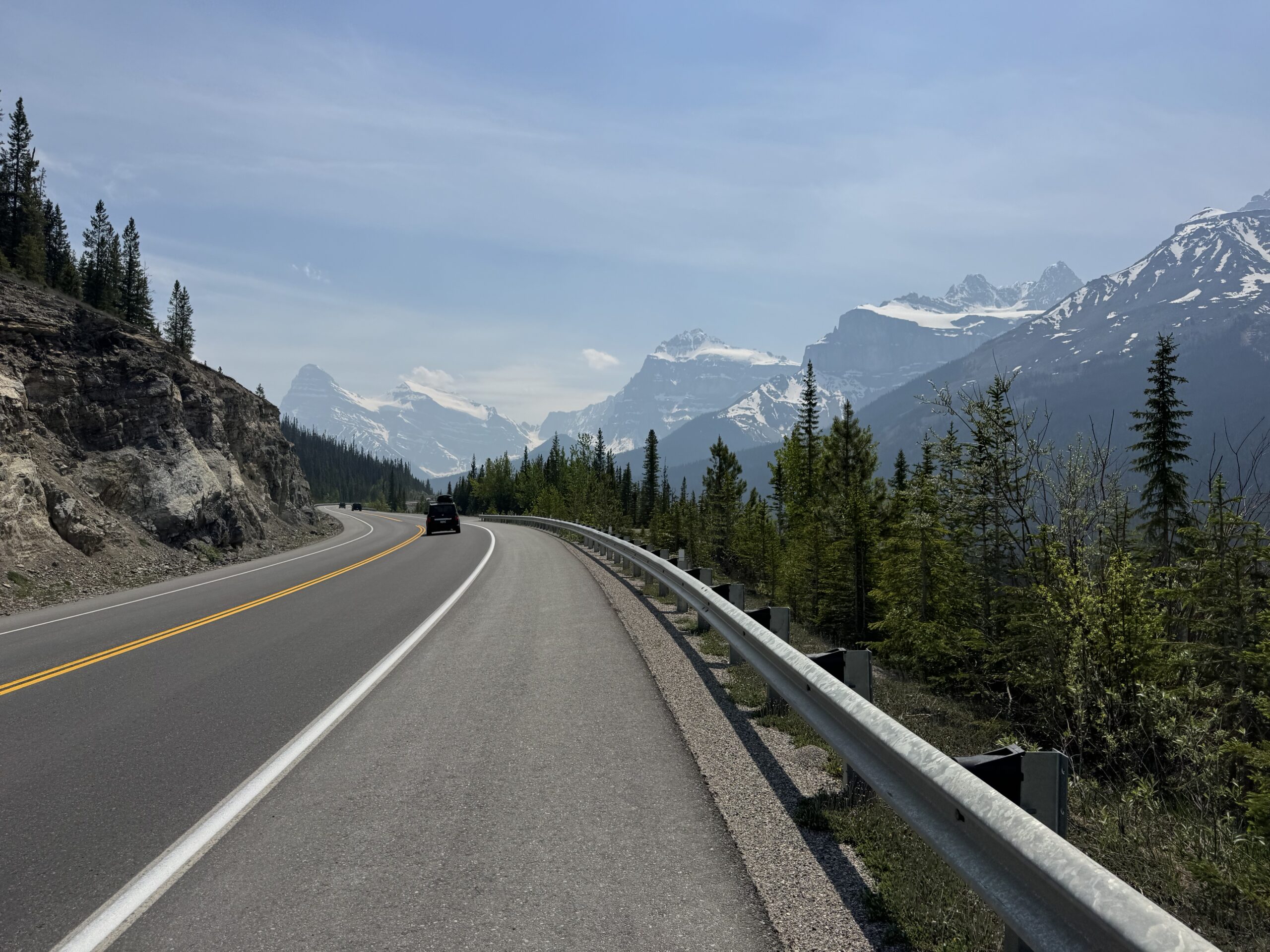
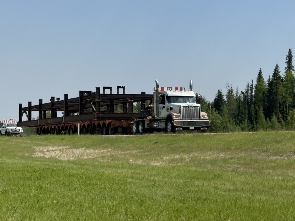
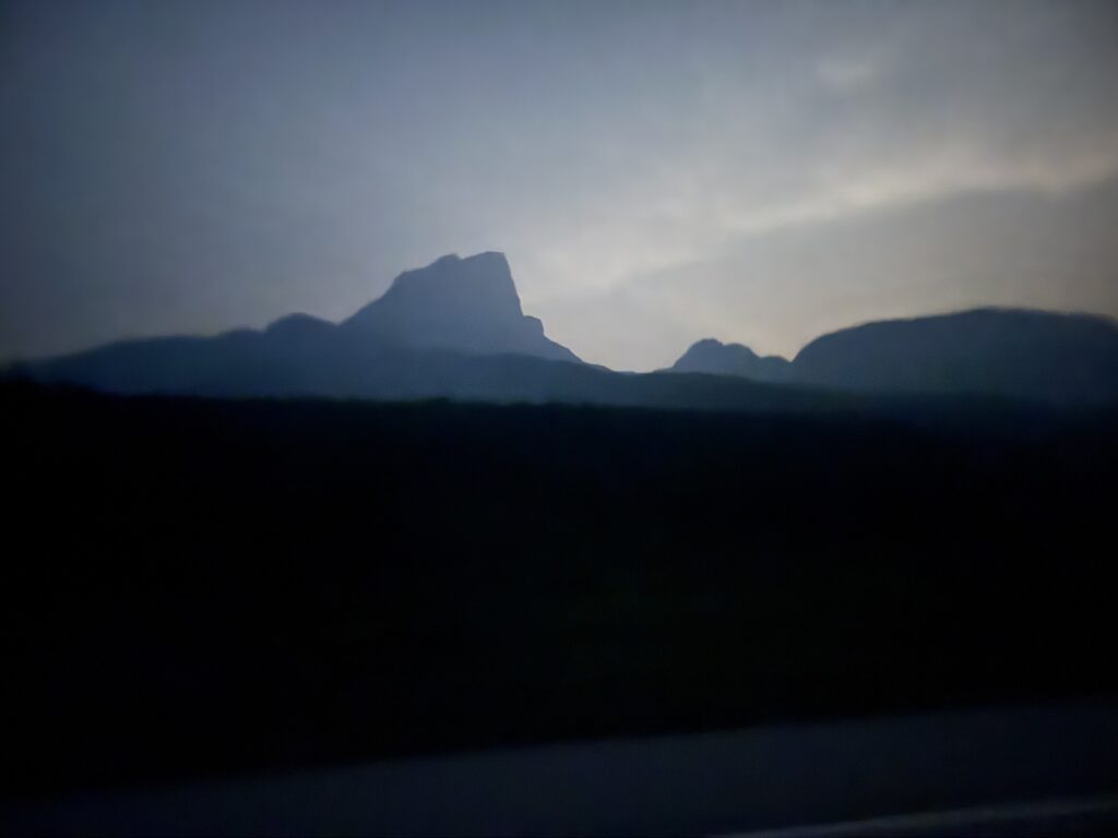
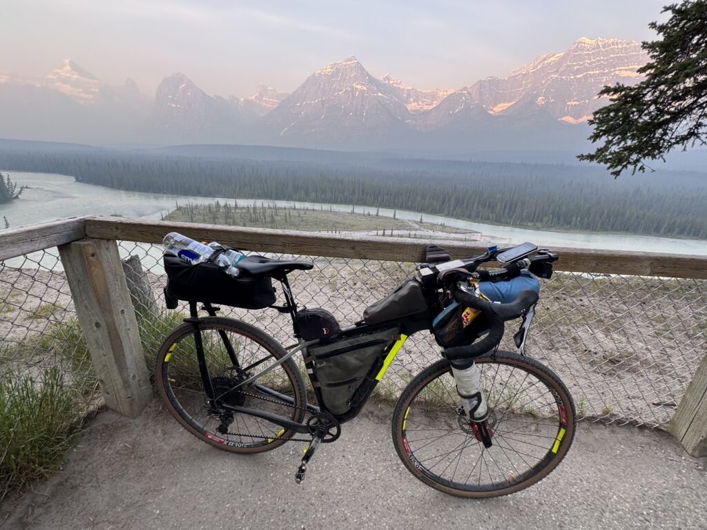
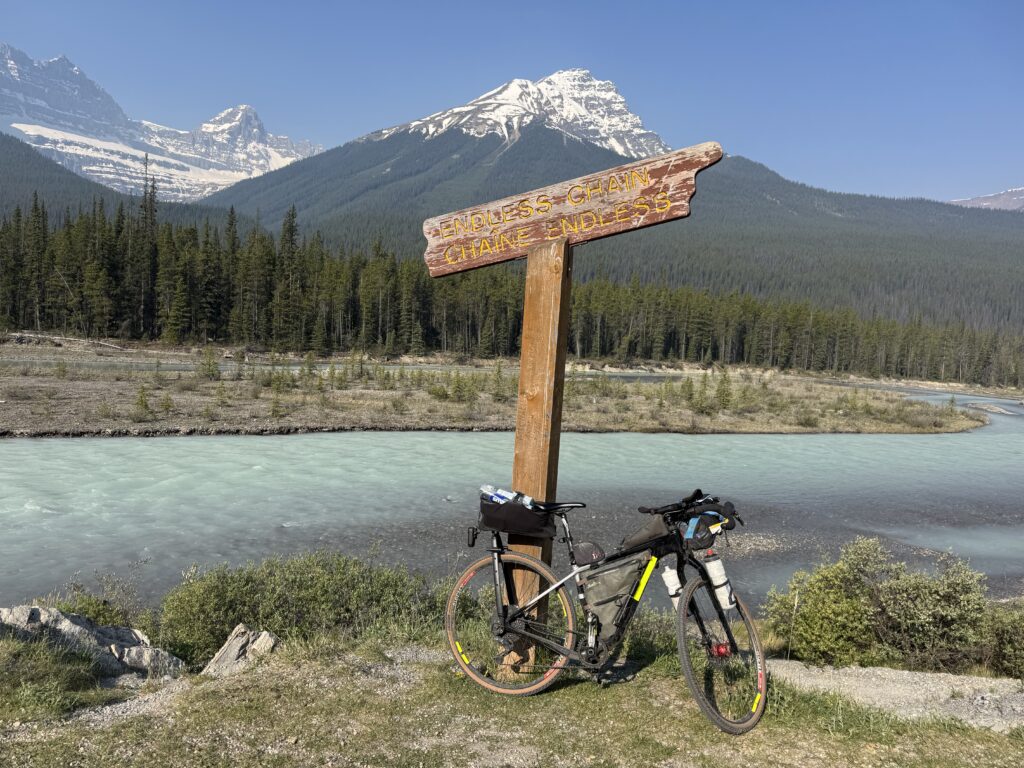
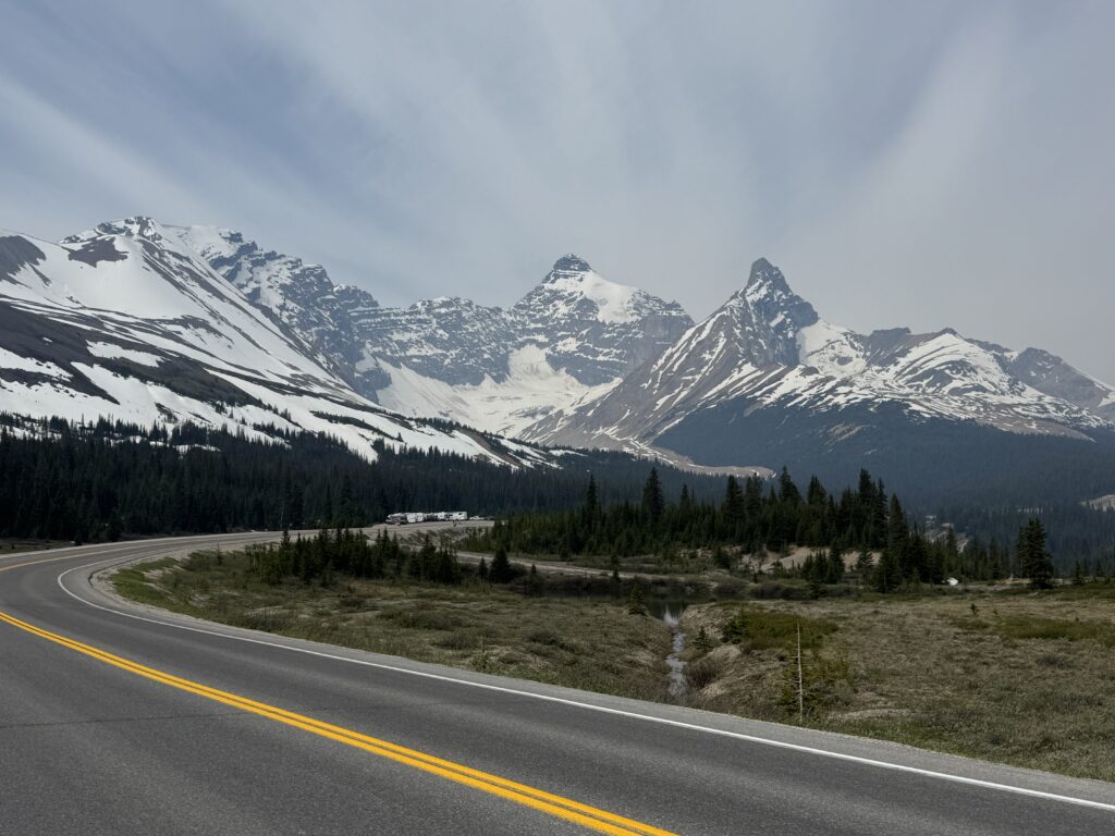
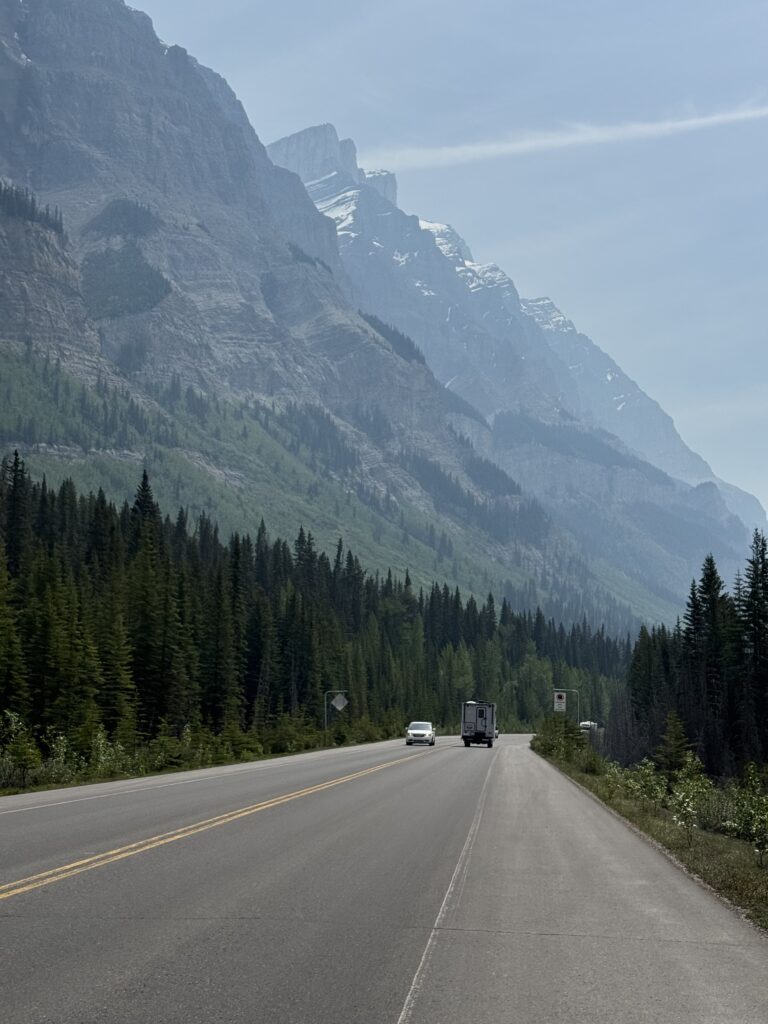
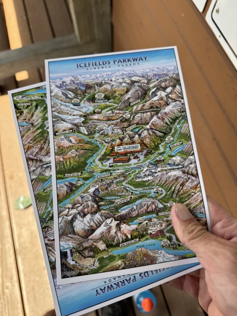
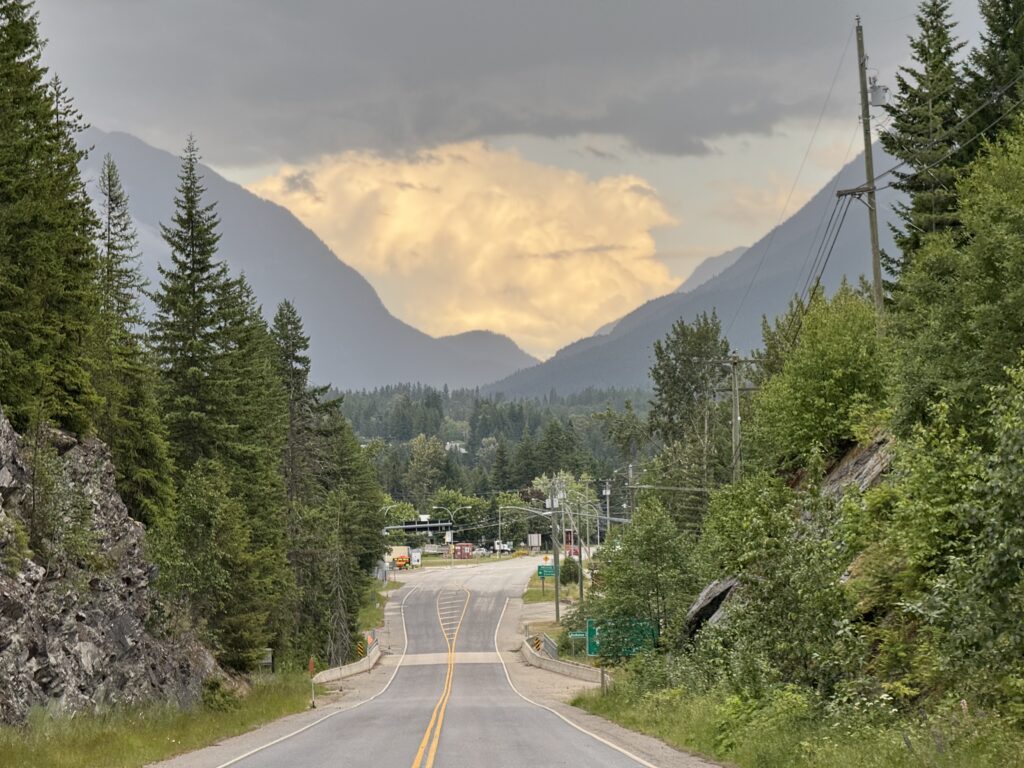
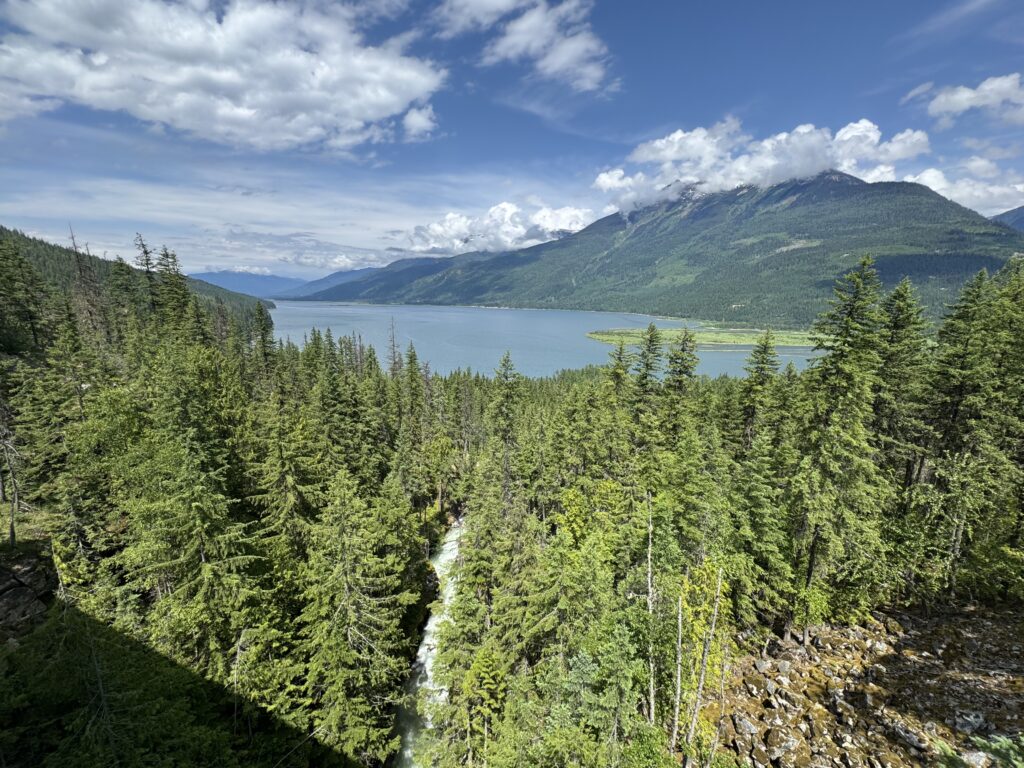
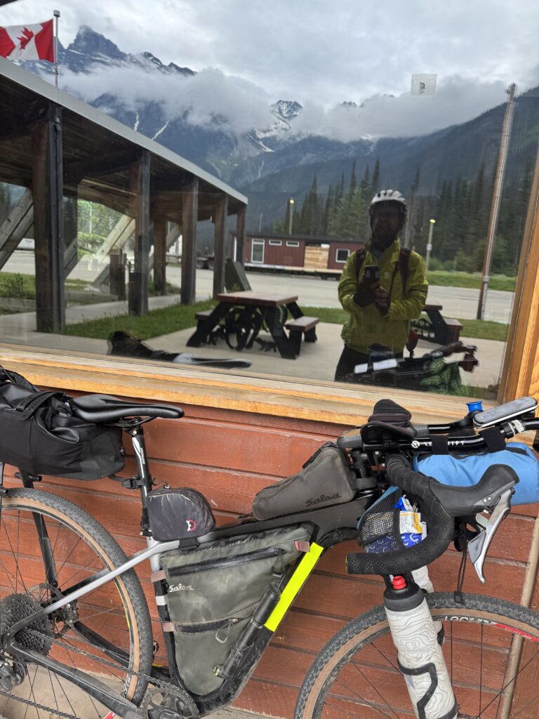
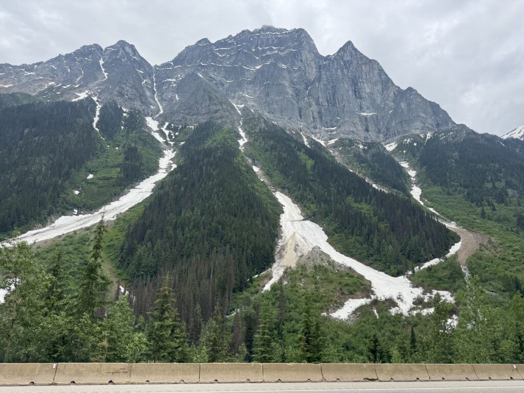
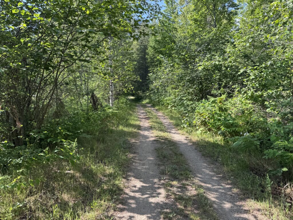
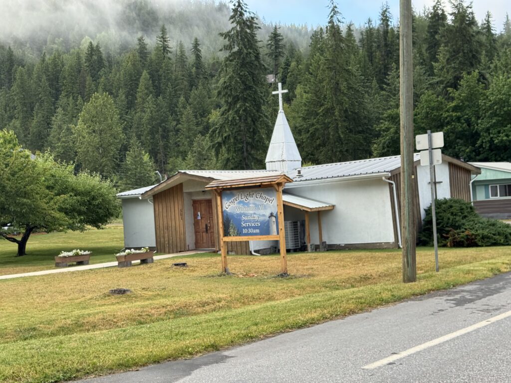
To avoid the risk of never getting around to writing up about my 3757 mile data adventure ride from Edmonton, Canada to Hoover, Alabama, I’m going to go ahead and post this with a stream of consciousness recap and split this up into a few different posts. This one is the Canadian summary, which was by far the highlight of the trip. The picture at the top of this post is taken from the Icefields Parkway, about 40 miles north of Lake Louise. The Icefields Parkway was easily the most spectacular part of the entire trip with so many snow covered mountains appearing around each bend in the road. This isn’t necessarily the best photo from that section, but it really captures all the parts … lots of mountains, lots of tourist vehicles, and good wide completely rumblestrip free shoulder for riding nearly 150 miles between Jasper and Lake Louise.
TLDR
3757 miles with 129,193 feet of climbing over 21.5 days
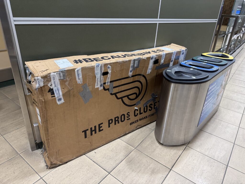
I flew on a one-way ticket from Birmingham, Alabama to Edmonton, Canada with my bike packed into a well-used cardboard shipping box. Upon landing at 10:30pm (still in daylight!), I assembled my bike in the airport and rode 3757 miles home to Hoover, Alabama finishing up the ride on my daily commute route home from work.
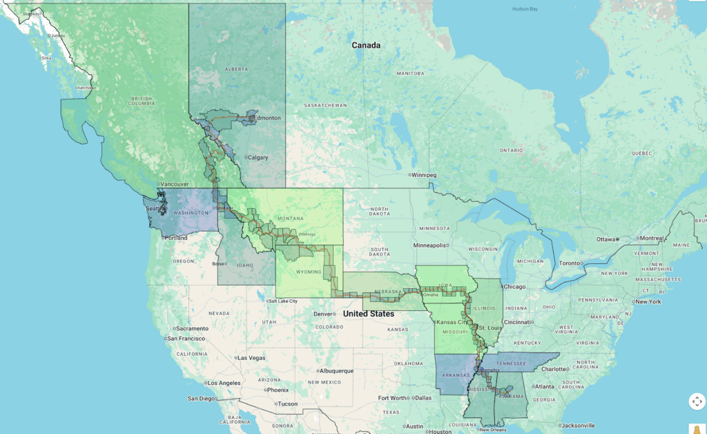
Absolutely amazing scenery with glacier covered mountain after glacier covered mountain and lots of rain in Canada eventually giving way to the “heat dome” that was affecting the east coast and central part of the USA and causing a very strong south wind which prevented me from making my way down through Eastern Colorado where I would have been battling a 20-30mph sustained headwind. Instead I opted to veer in a northeasterly direction so that I enjoyed a tailwind and cross-tailwind for a day before turning more eastward and a nasty battle with a crosswind. The map below shows my intended route (red) vs the actual route (little clock icons from my satellite tracker): https://pickuta.com/album/323

The wind never stopped blowing up from the South, but it did quiet down to a 5-10mph manageable but annoying headwind as I followed the Mississippi River south to reconnect with my original route in southern Missouri and Arkansas crossing the Mississippi River one final time in Memphis. It did get quite hot and I tried to switch to night riding but ended up pushing it a bit too far on the day I was going to transition and had a full leg lockup in a Dollar General at 1pm with 40 miles still left to ride into the outskirts of St Louis. I had to ride so slowly that I ended up riding completely through rush hour traffic before finally making it to my hotel. I recovered with a very short 100 mile day the next day so that I could be done by noon.
The last stretch through Mississippi involved daily afternoon thunderstorms I tried to finish ahead of or wait out or ride through. This at least kept the heat to more manageable levels. On the final long day I had planned, the afternoon thunderstorms never stopped so I got a hotel in Tuscaloosa rather than trying to ride through the rain all night long, which would have been dangerous and miserable way to finish the ride.
Instead, I got up the next morning to beautiful weather and promptly broke my rear shifter cable just outside of Tuscaloosa in a small town called Coaling that my friends who have ridden to/from Tuscaloosa with me many times will recognize as the little town with the water park and good water faucet. After about an hour of tinkering I was able to get my replacement cable (which I still had in my frame bag from the 2022 Tour Divide) installed to make it all the way home and not have to muscle up all the hills in my hardest gear.
I climbed the final hill to our house with my wife and son videoing and our good British friend Jane visiting us from Nicaragua cheering me on.
Daily TLDR
Click the image to jump to specific day and read all the details. I picked the best picture from each day.
Day 1: Edmonton to East Jasper
229.6mi, 7188 ft climbing, 16h 31m
Flight from Birmingham to Edmonton immediately followed by 230mi ride from Edmonton to Jasper with no sleep
Day 2: East Jasper to Golden, Canada
228.8mi, 10935 ft climbing, 17h 38m
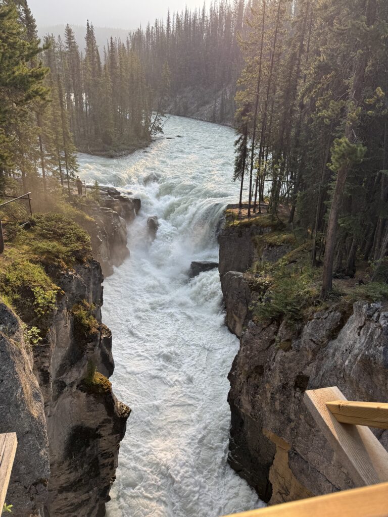
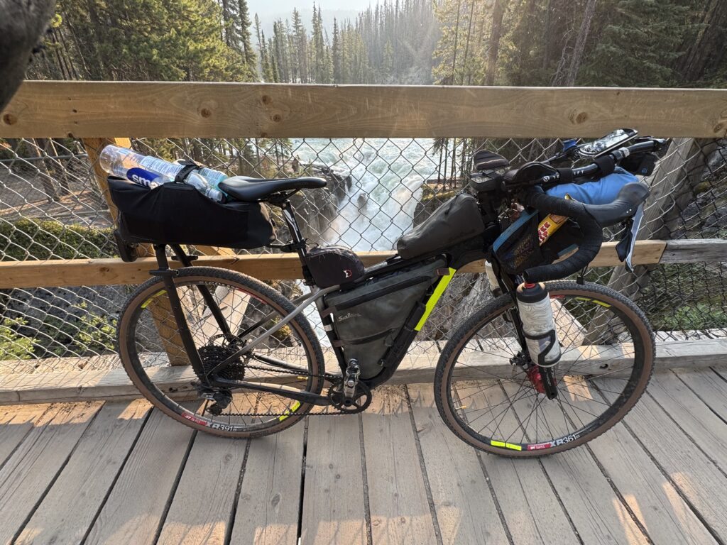
Most amazing 150 mile stretch of Icefields Parkway you can imagine. Even in the dark the views in Jasper National Park were amazing.
Day 3: Golden to New Denver, Canada
176.94mi, 9934ft climbing, 13h 23m
Lots of traffic and construction on Trans Canada Hwy 1 leading to broken spoke, fixed in Revelstroke, lots of thunderstorms before and after ferries.
Day 4: New Denver, Canada to Couer d’Alene, USA
219.72 mi, 9826ft climbing, 16h 35m
Made it back home to the USA after one more fantastic day in the Nelson lakes area.
Day 1 – leaving on a jet plane and a bicycle
229.6mi, 7188ft climbing, 16h 31m – https://www.strava.com/activities/14761153928
1736 cars, 8.16 cars/mi, 1.9 cars/min, 62mph (avg passing), 106mph (max) – https://www.mybiketraffic.com/rides/view/391048
Timelapse videos (1/2 second frame interval = 15x realtime)
Night time (Edmonton) – https://youtu.be/kMYbpGcZRc8
Day time (Trans Canada Hwy 16) – https://youtu.be/APApfL1WsPc
Late afternoon (Hinton – East Jasper Hostel) – https://youtu.be/mkpmTKvMzfM
(These timelapse videos are 15x actual speed. This means if I slow down to 2mph at a stoplight or stopsign, it will look in the video as if I’m traveling through at 30mph! Despite what it may look like occasionally, I always slowed down to make 100% sure nobody is coming before rolling through and waited until it was clear before proceeding if there was traffic.)
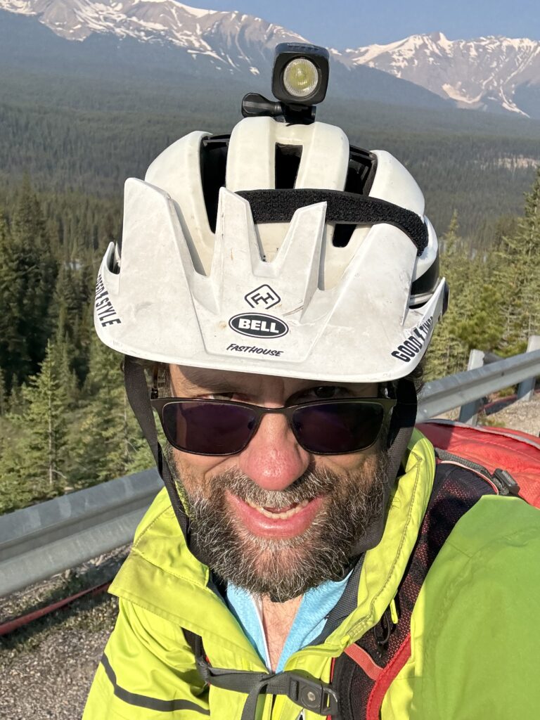
My flight from Birmingham wasn’t even until 3pm, but after a quick layover in Denver, I was on the ground in Edmonton before sunset at 10:15pm and riding my bike by 11:30pm. Bike assembly went well with one exception, I had taken a picture of the seatpost so I could return it to exact same position, but the reference position was a strap that had come off. And in the dark, I couldn’t see a wear line either. So it took about 15 minutes of starting/stopping until I finally got the seat height close enough to get started. About 15 minutes later, I pulled over into a parking lot to make one final adjustment and after that never thought about the seat height again (so it must have been pretty close).
By this point it was after midnight about 20 miles south of Edmonton proper as the airport is quite a ways out of town. I continued on my northward trek into town and actually ran into several people riding or walking next to their bikes at 1 in the morning. These were definitely “bikes for transportation” people so I instantly connected with them. I love riding a bike both for fun and for transportation. This adventure really stretched both parts. Edmonton itself is pretty flat, but there was tons of construction making it tricky to ride. The one exception is the major river that cuts through downtown. It was several switchbacks to get down and then a circular climbing bike path bridge across the river before a steeper climb to get back up out of the river valley. I had started out with my rain pants on and just short sleeves, but the temp had dropped down into the mid 40s by this point so I stopped and pulled out my fingerless gloves with pullover mittens that I had bought during the early part of the Tour Divide in Seeley Lake, Montana in 2022. Those gloves have been the absolute best for both the “in between” weather as well as bitter cold weather.
I had tried to scope out 24 hour gas stations ahead of time using Google Maps and there weren’t very many. I had one “hop” that was going to end up being close to 75 miles long before the next 24 hour gas station so I definitely needed to stop and fill up at the one marked on my map on the west side of Edmonton. But it looked closed! Thankfully, it was open, but the way it worked is the gas station clerk does your shopping for you. You just tell them what you want, they go get it, and bring it back, and then you pay through the window. I got two big gatorades and hoped it would be enough to make it the distance (it was … especially given that the temp bottomed out at 38 degF that first night).
Once you get out of Edmonton proper, it gets rural very quickly. The roads are long and perfectly straight even though the terrain has already started to get quite a bit hillier by the time you get an hour or two west of town. Instead of random spread out houses, you ended up with random spread out neighborhoods where there would be zero or sometimes one house along a 5 mile stretch of road and at the next intersection there would be a small village of maybe 50 houses!

As far as traffic goes, you can see in the image above my journey up from the airport. Each green circle represents a car passing at normal speeds. Each teal colored circle represents a vehicle (most likely a truck) going more than 50mph faster than my current speed. You can see how relatively deserted my route northwest of Edmonton was from 1am – 3am, but how dramatically busy Trans Canada Highway 16 was starting from 4:50AM when I first joined it.
Thankfully, there was a huge shoulder. Here is a video of a truck passing and circled in red on the map above at the spot where I first joined the Canadian version of an interstate.
Sorry that the speeds are in metric, but I always forget to change it back to imperial whenever the Garmin radar decides to completely reset its settings.
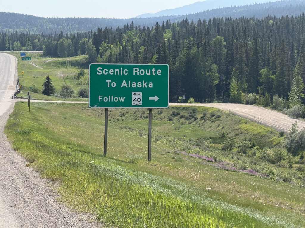
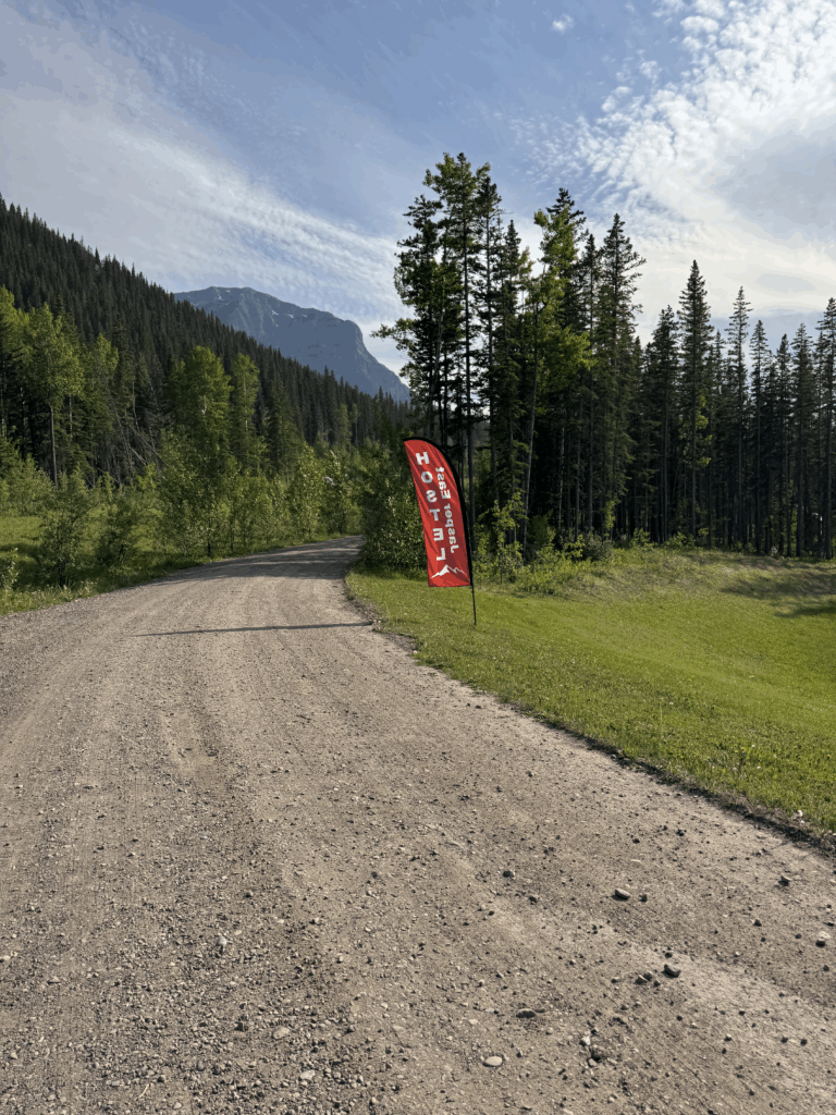
I got so sunburned on that first day because I made a miscalculation about the strength of the sun since I was so far north. But the sunrise started from about 3:30am and didn’t set until well after 10pm. I figured the angle of the sun would be lower, but it was actually higher in the sky and lasted longer. By the time I made it to Hinton, the last big town before Jasper national park I was pretty tired, but I got food for dinner from the McDonalds next to the sporting goods store where I could also buy some bear spray and sunscreen. An hour or so later after passing a sign directing me on a scenic route towards Alaska (no thanks, maybe another year), I made it to the hostel, got checked in, showered, and hit the bed for an early departure to make it through all the mountains the next day before dark.
Day 2 – Forest fires and the Icefields Parkway
228.8mi, 10935 ft climbing, 17h 38m – https://www.strava.com/activities/14772605640
1532 cars, 6.7 cars/mi, 1.4 cars/min, 51.6 mph (avg passing), 83.1mph (max) – https://www.mybiketraffic.com/rides/view/392204
Timelapse videos (1/2 second frame interval = 15x realtime)
Night time (Jasper national park to Jasper) – https://youtu.be/xdG2NGrXzlY
Day time (Jasper fire damage, alpenglow mountains, and Icefields Parkway) – https://youtu.be/yl619b1Sm_Q
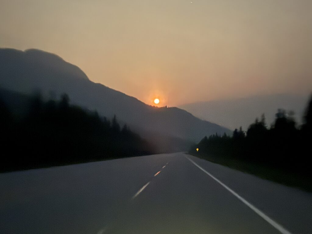
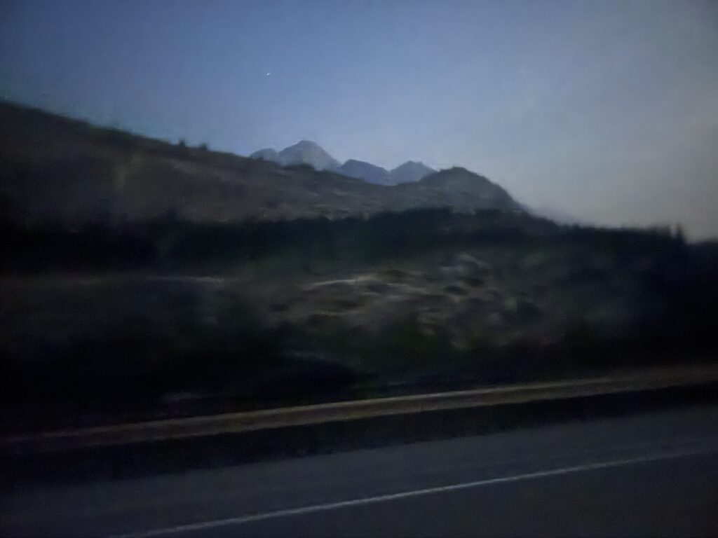
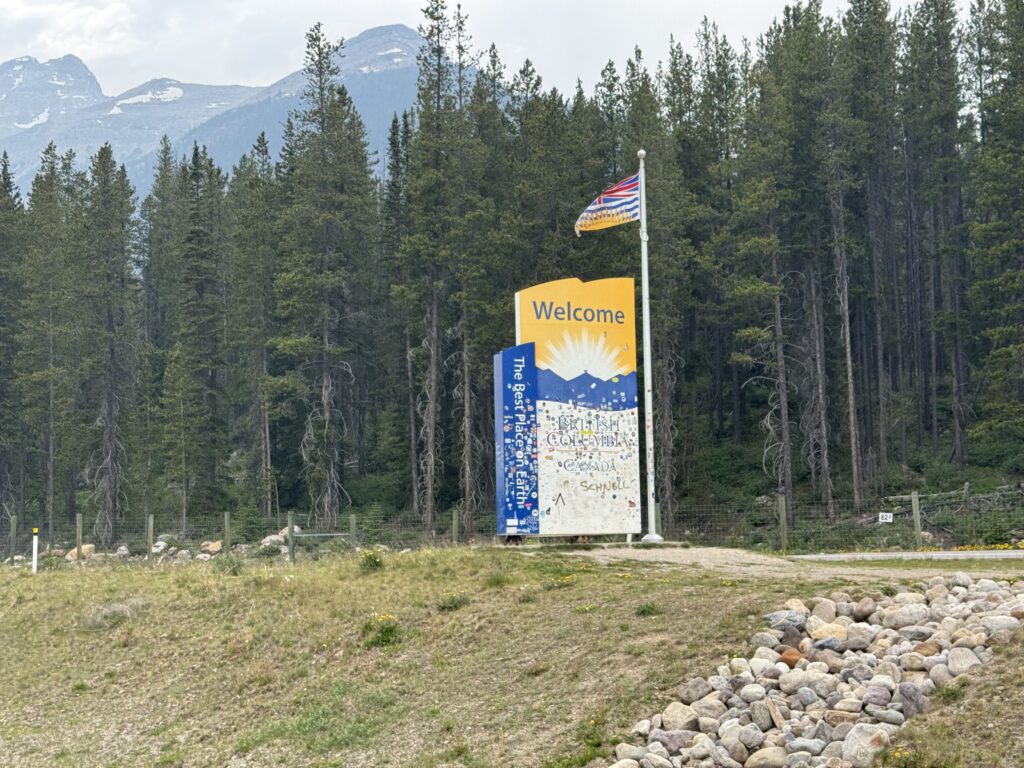
Early morning 1:45AM departure beautiful mountain shadows in full moon sky followed by amazing mountains and scenery and wildlife all day along the Icefields parkway before crossing over into British Columbia and spending the night at a hostel in Golden.
The very nice lady running the East Jasper Hostel tried to convince me to take my time and sleep in, but I knew that I wanted to finish the long 225+ mile ride to Golden at a reasonable hour. I was in bed before 8pm, so I was still able to get a nice 5 hours of sleep and still out the door before 2am the next morning.
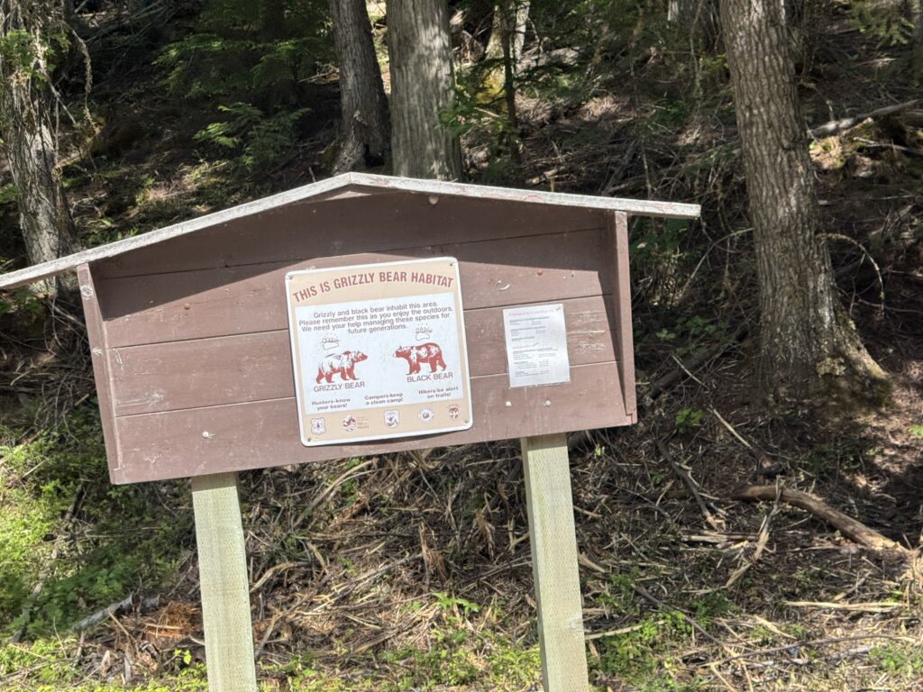
I was worried about bears on this stretch, even just leaving the hostel, because they had been visiting the hostel almost daily for the past week. But I didn’t see any as I left and made my way on to the highway through the national park. I was concerned that I would miss everything in the dark, but with a full moon (even one that was so low in the sky) and being far enough north that the nightime sky was not nearly as dark as normal, I could see all the mountains and lakes. I probably missed a bunch of distant waterfalls cascading off the mountains, but there was still so much to see.
The highway was quieter, but still relatively busy for the time I was riding it 2am – 4am. Most of the traffic was trucks with occasional cars. I have the exact data, but my ballpark estimate was about 1 vehicle every few minutes. This gave me time to turn my light to its lowest setting between cars and let my eyes adjust to see the amazing Milky Way as well as all the scenery around me.
Eventually, I made my way into the outskirts of Jasper and into the one 24 hour gas station I had marked on my map. It was almost 5am by this point, and I was able to go in and do my own shopping. I thought that there was potential for no resupply at all for the 150 mile stretch of the Icefields Parkway between Jasper and Lake Louise, so I stocked up with a lot of food and water. As it turns out, my scouting was correct that there were no gas stations, but there were three touristy stores/hotels that each had typical convenience store selection of food and drinks.
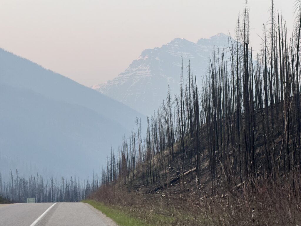
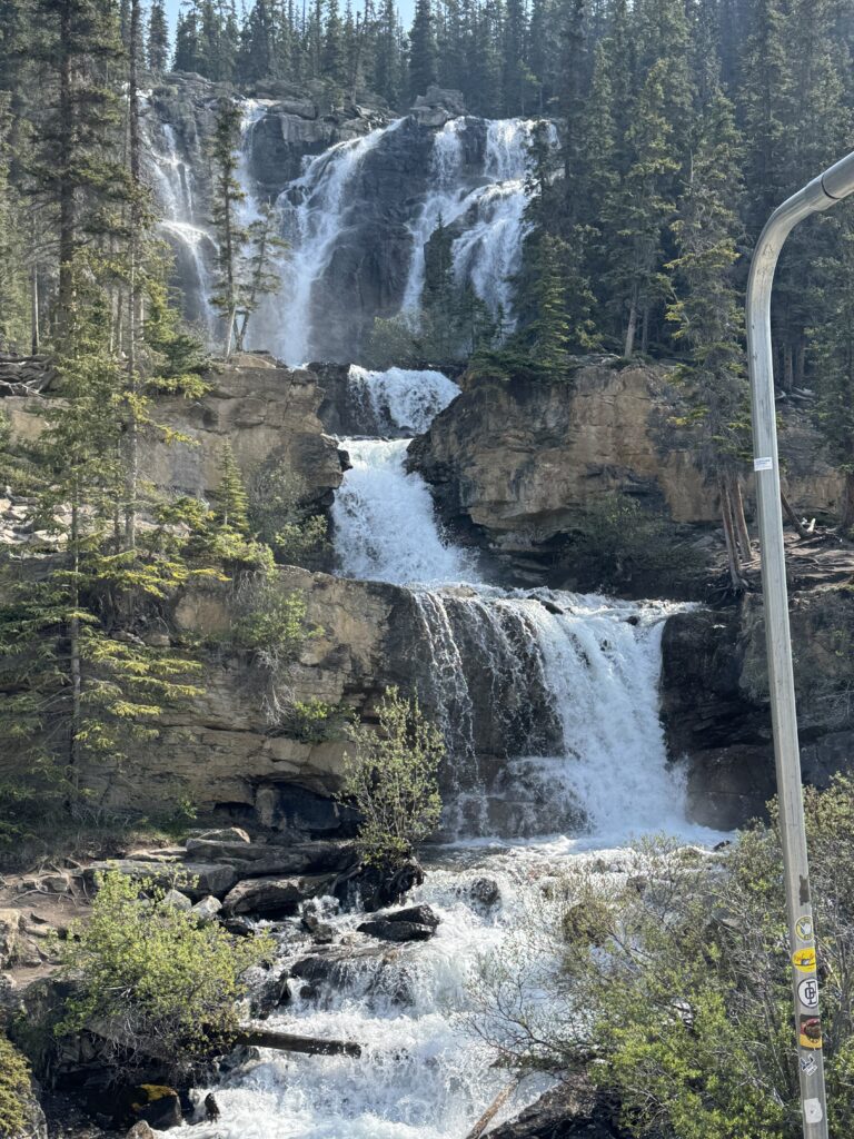
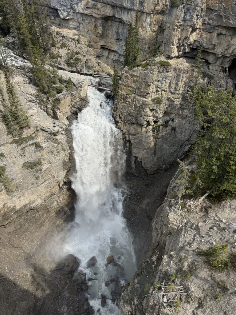
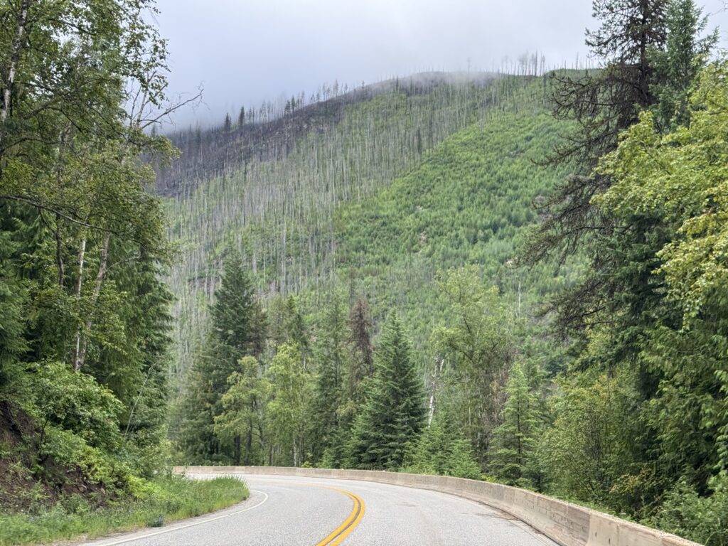
Forest Fire Damage
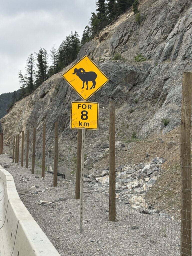
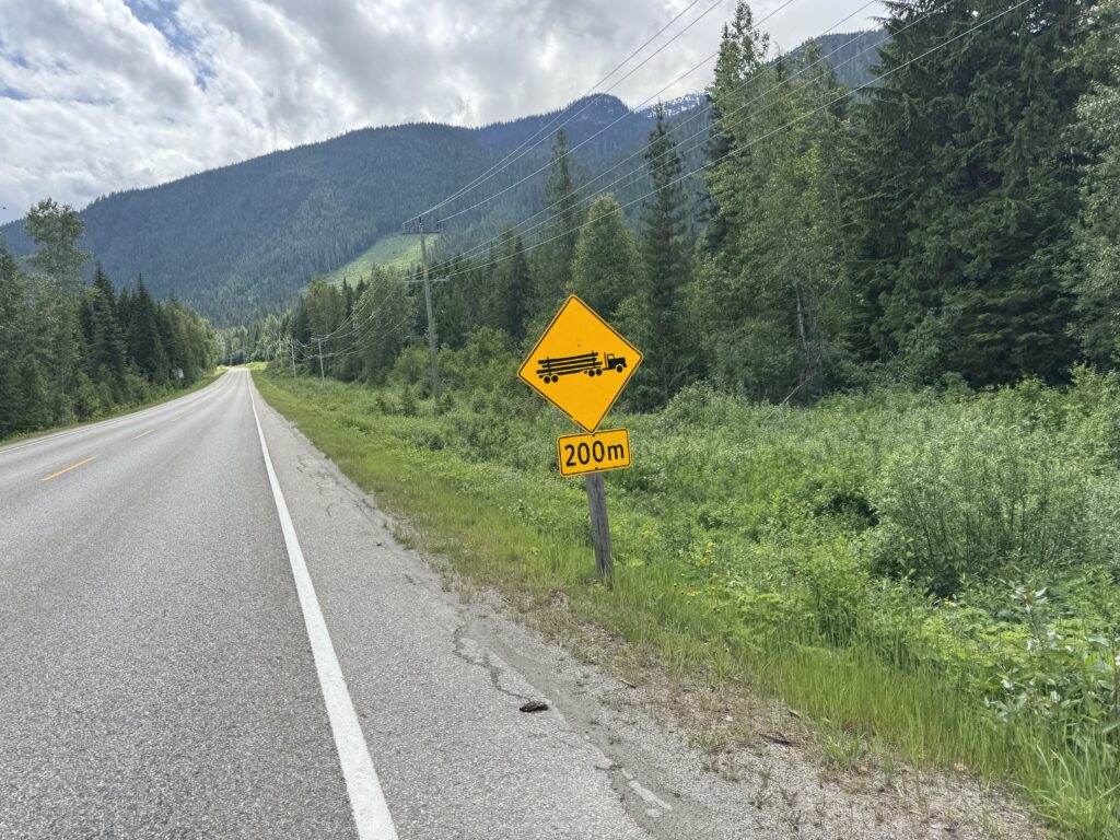
In July 2024, there was a massive forest fire that hit both the town of Jasper as well as huge chunk of the national park. By the time I left the gas station, it was light enough for me to start to see the remains of the fire a year later. The thing that struck the most is how many HOURS it took for me to completely ride through all of it. Every time I thought I was making it to the end, I would see a new wave of burnt pine trees on one or both sides of the road. As I left Jasper, I saw a sign confirming that there would be no gas for the next 200km.
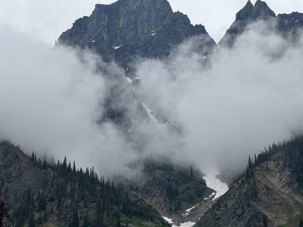
During this time, it kept getting brighter with the alpenglow lighting up the huge snow covered mountains. It was past sunrise, but with so many large mountains blocking the sun the alpenglow lasted well past sunrise. And it kept getting more and more spectacular. The temperature had stayed relatively mild during the night, but it dropped during this time, so that there were several descents where I was quite chilly. Towards the top of one of those descents, I saw a huge elk with massive rack of antlers grazing around a garbage can at a scenic rest area. I made a quick u-turn and snapped a couple pics before continuing on the descent.
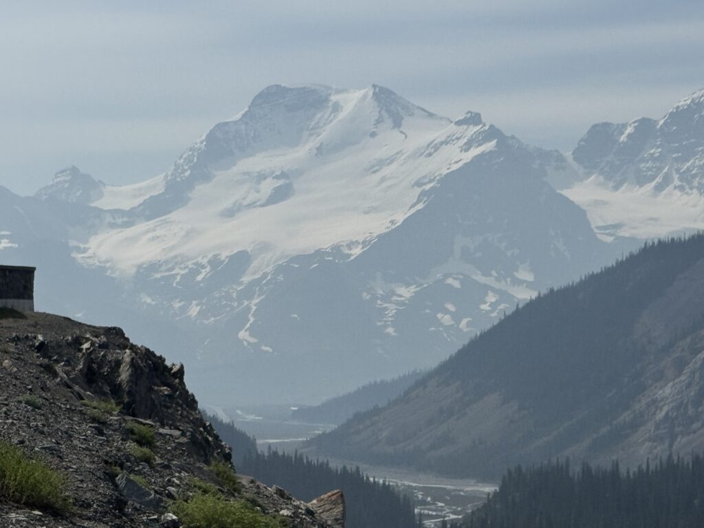
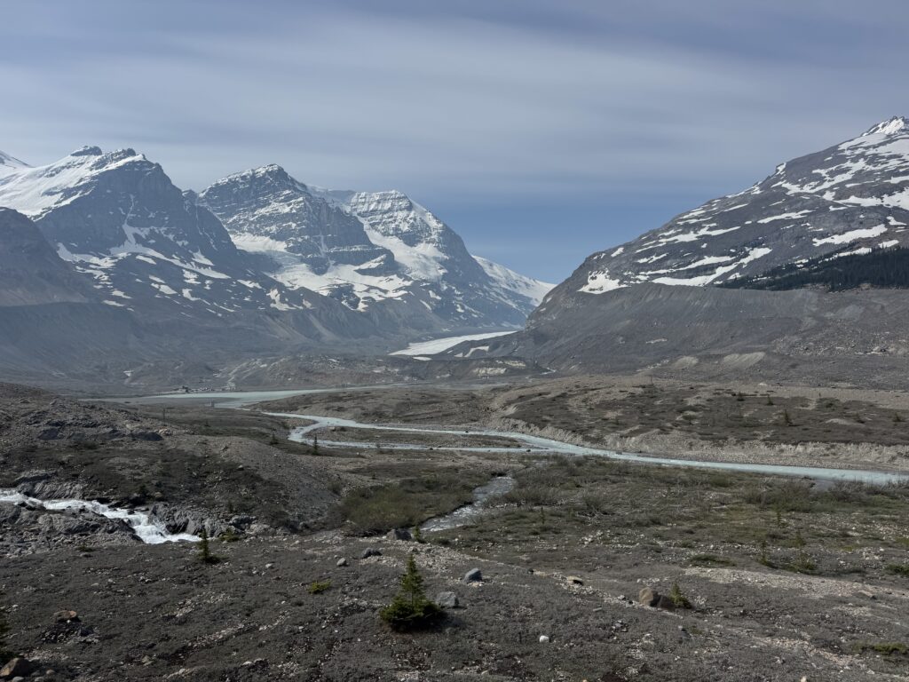
Icefields Parkway
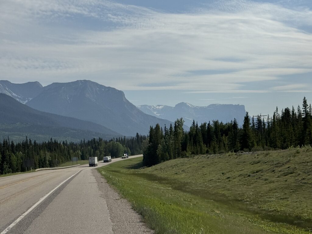
My favorite part of the entire trip was the next several hours of riding the Icefields Parkway. This stretch of highway was about 150 miles long starting out very quiet but eventually getting busy with tourists. Thankfully, the shoulder was wide and clean for most of the parkway so I never felt in danger from any of the cars or busses. No more commercial trucks as they all continued on the main Trans Canada highway instead of the parkway.
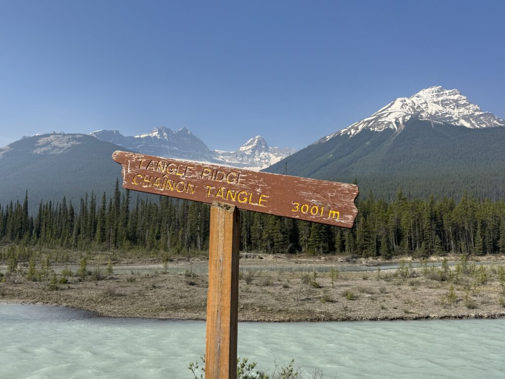
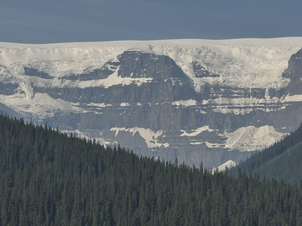
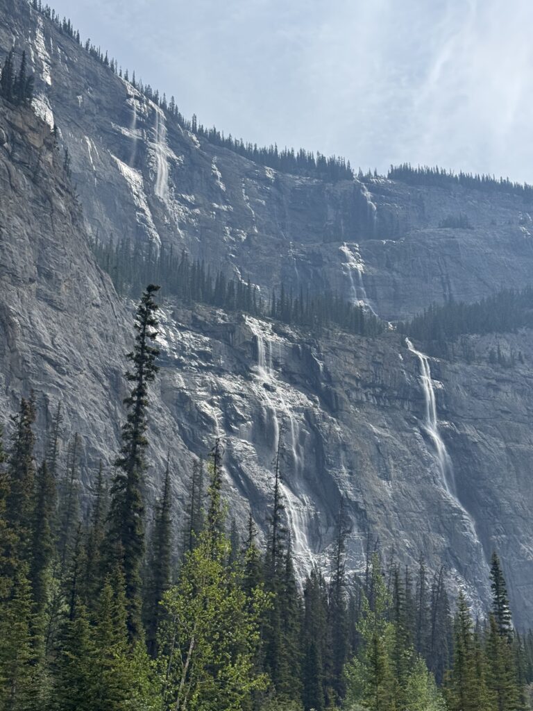
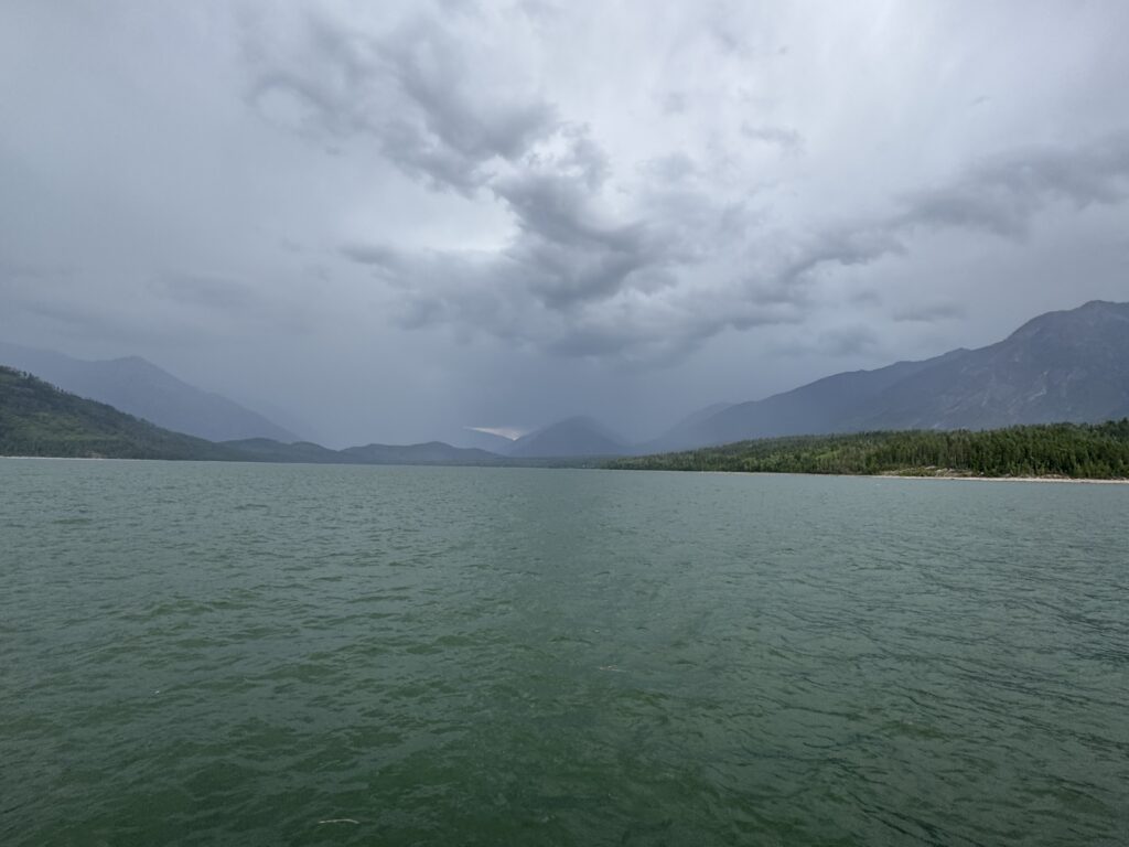
The scenery was spectacular. I was in awe from the alpenglow in the morning (see video above) until late afternoon when I finally made the turn onto Trans Canada Highway 1 to head to Golden. What strikes me the most about the Canadian Rockies is that they are more accessible and manageable than the Colorado Rockies. The mountains are sharp, jagged, snow covered with glaciers, waterfalls everywhere, but they also aren’t so big that it takes an entire day to ride by a single mountain (i.e., Colorado). Instead, it’s peak after peak appearing in the distance first, then 20 miles later you are riding right by it while other peaks have appeared. So many different peaks, each with their own unique glaciers, waterfall, shadows, and shape. The picture at the very top of this long post is from this section. I’ve linked to the youtube video below but it’s so good I’m embedding it here, too, to make sure anyone reading this far has seen it.
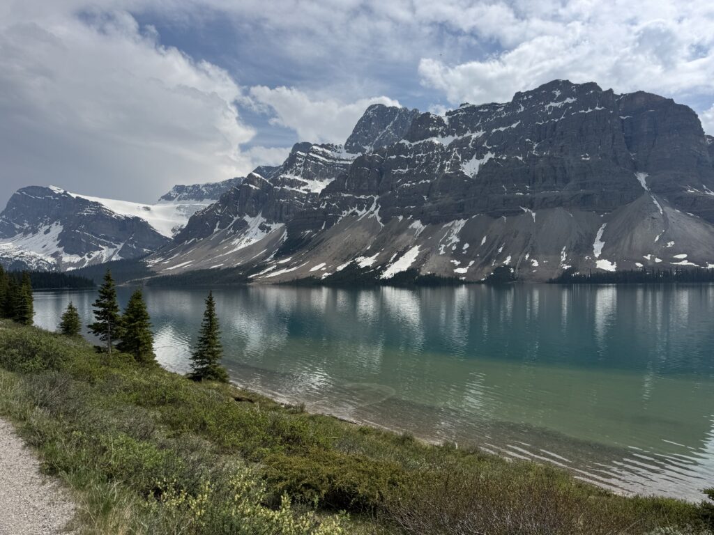
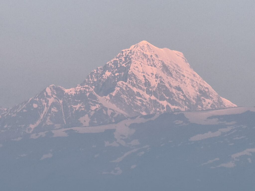
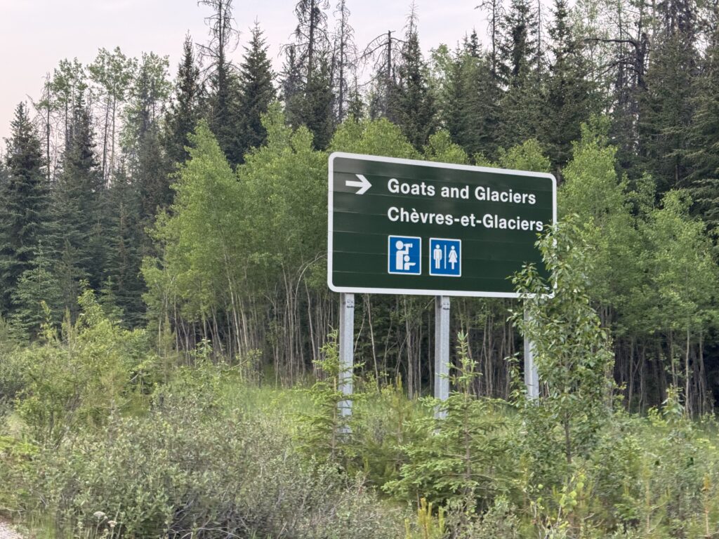
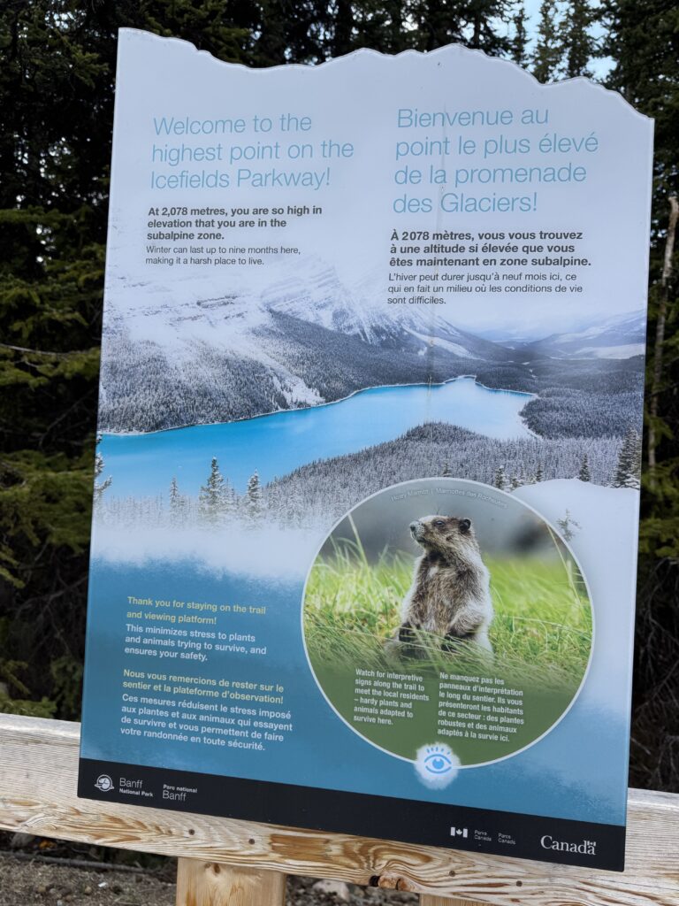
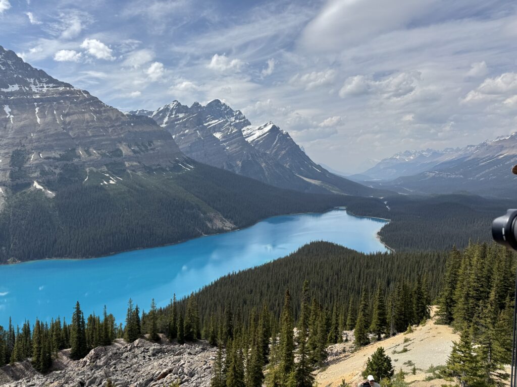
One of the highlights of this stretch was climbing up to 7000′ to see the Peyto Lake overlook. It’s a bright blue lake very similar to Lake Louise nestled behind the Columbia Icefields and glaciers. It was the was a big 2000+ foot climb after gradually climbing all day and the highest elevation for me in Canada. I had no idea what I was going to find, but there were throngs of tourists hiking to get to the overlook. It was indeed amazing and worth it! See youtube video below.
After this climb and overlook was a very long descent down towards Lake Louise. I made it to my turn onto Trans Canada Highway 1 with enough food/water to make it either to the end (which is what happened) or to a convenient gas station on Highway 1. I never found a gas station, so I was running on “fumes” so to speak by the time I made it to my hostel in Golden, Canada.
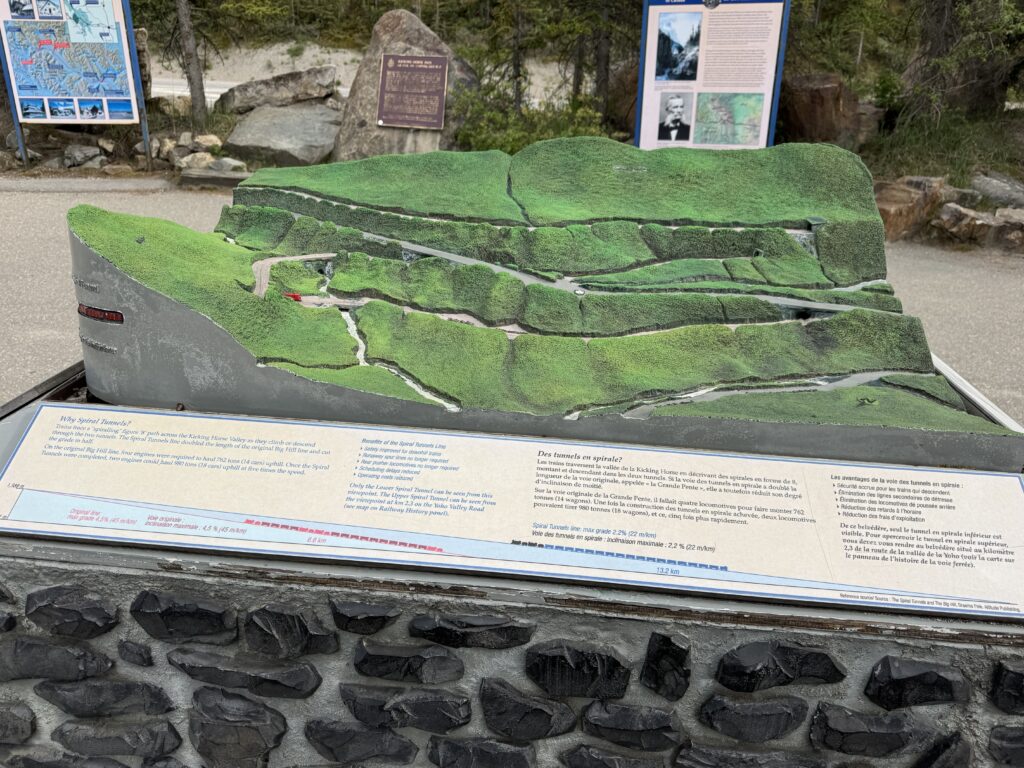
This is the national highway of Canada and was extremely busy. It was also quite hilly. I hit some very high speeds (45mph on a heavily loaded gravel bike) which may have contributed to breaking a spoke the next day. Amazingly, there were a lot of railroad tracks climbing the mountain I was descending. There was an exhibit with a 3d model of the 360 degree loop climbing tunnels to help the trains make the climb (and descent) at more manageable gradients. I was on the descent long enough to see several trains!
Amazing Golden hostel
The weather was turning, and it started to rain briefly a couple times. Then it really started to pick up right as I made it into Golden. Thankfully, it was only a few final minutes before I made it to the hostel.
The hostel was jam packed with people (no vacancy), but I had a single room reservation I had made a few weeks ago. Ann, the very kind manager, took me around and showed me everything and we figured out what to do with my bike. I had a lock with me, but he said I could keep it inside. The problem was that I would be leaving around 4:30AM the next morning. He said, “no problem”, and set his alarm to get up at that time to get the bike out of the storage closet.
Sure enough, bright and early, after I had already packed everything up from my room, I came down the stairs and Ann was there already with my bike! Still super thankful for this, Ann! But before all that, the night before, there were probably 20-30 people in the common area including the kitchen making dinner (it was 10pm). I had also seen a bunch of people I am sure were staying at the hostel at the grocery store which I had walked to in order to resupply for next day and pick up something I could microwave for dinner.
If you are looking for a good, cheap, and social place to stay, check out the Dreamcatcher Hostel in Golden, Canada.
Day 3 – broken spoke, ferries, and thunderstorms
176.94mi, 9934ft climbing, 13h 23m –
https://www.strava.com/activities/14782989096
728 cars, 4.2 cars/mi, 0.9 cars/min, 52.4 mph (avg passing), 89.7mph (max) – https://www.mybiketraffic.com/rides/view/393206
Timelapse videos (1/2 second frame interval = 15x realtime)
Day time (construction and traffic on Trans Canada 1 plus snowsheds) – https://youtu.be/hnt75fCH5Kk
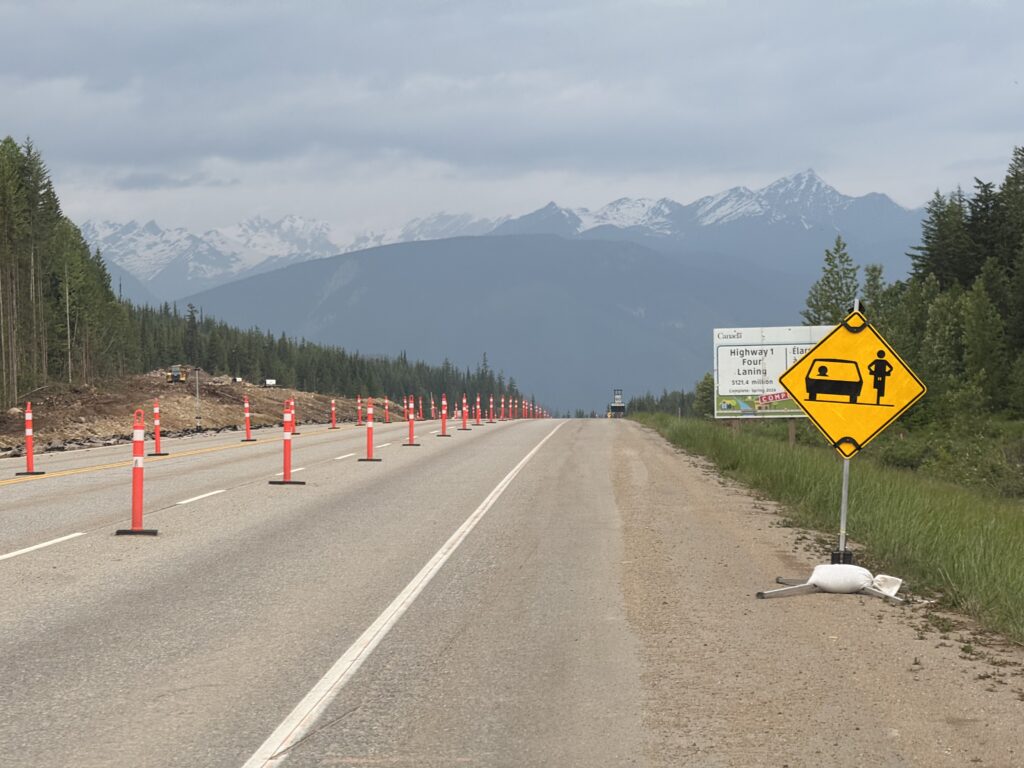
Leaving the hostel by 4:45am, the sun was already up and traffic on Trans Canada Highway 1 was pretty busy. Golden is down in a river valley, so the first several miles of my ride was a long slow climb out of the valley. This started out as a four lane, but eventually made it to a section where they were working on converting the two lane into a four lane. This was a messy, tricky construction zone with lots of trucks.
Thankfully, the trucks were all crawling up the long climb I had done and blocking traffic behind them. So I could time the tricky sections with long gaps before the next “herd” of cars and trucks. Eventually I made it through the construction zone to an older section of two lane highway that had a decent (but not great) shoulder. It was through here that I noticed my wheel had gotten very wobbly, and it turns out I had broken a spoke. I did a quick search for bike shops and the closest was in Revelstroke about 45 miles on my route. As it turns out, I still had about 20 miles of climbing before 50 MILES of descending from 5000′ down to about 1000′ in the Columbia River gorge.
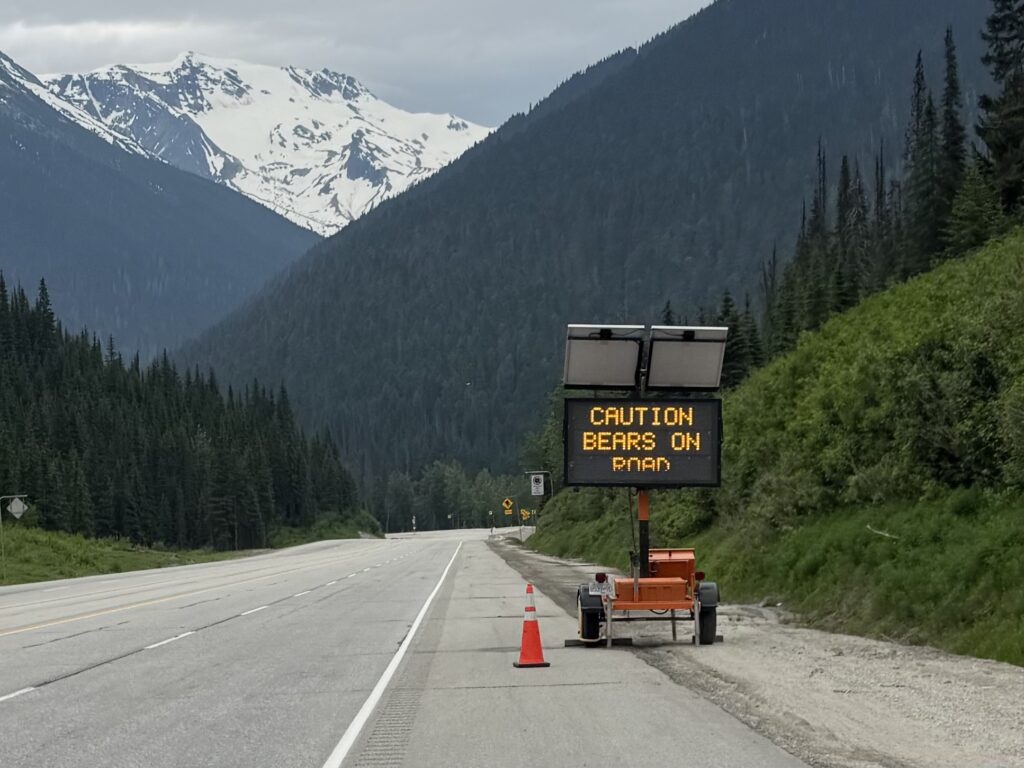
The length of the descent meant that it was pretty gradual, which I was thankful for, not wanting to have to use my brakes and also not wanting to go too fast with a broken rear spoke and wobbly wheel. There were storms in the area, but it stayed dry until a few miles into the descent after the flashing warning sign “Warning: bears on road”. I pulled over making sure to have my bear spray handy as I quickly pulled out my rain jacket and rain pants right as one of the storms started to pour.
About 10 miles later, I see a van with a bike trailer setting up a tent with supplies. I asked if they had a spoke wrench so I could try to adjust the wheel to remove some of the wobble, but that was with the mechanics in the follow vehicle. Follow vehicle? Sure enough, about 10 minutes after I left and continued on the descent, here comes a group of about 20 cyclists in the pouring down rain climbing slowly up the other way … on a Thursday. They all waved and even cheered I think? It continued to rain for another hour or so, but eventually stopped, got sunny and hot … STILL ON THE DESCENT.
It was dry and sunny in Revelstroke and had not even rained as I made my way straight to the bike shop, where a mechanic from New Zealand investigated and told me he could get me all fixed up. He pointed me towards a cafe a couple blocks away and before I had even finished my food, he called to tell me the wheel was ready. It was great chatting with him about New Zealand (Kristine and I vacationed there in 2018) and about my current adventure to Alabama.
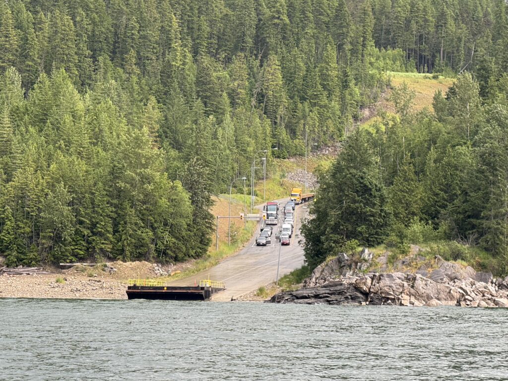
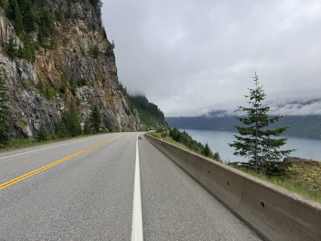
Water ferry and more storms
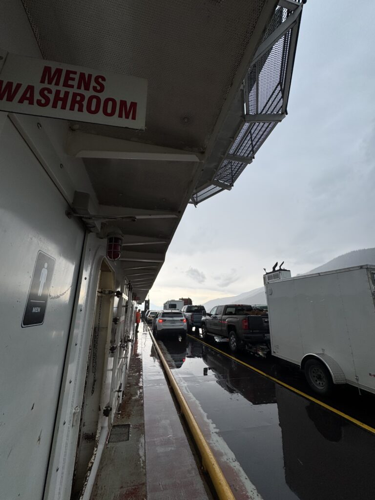
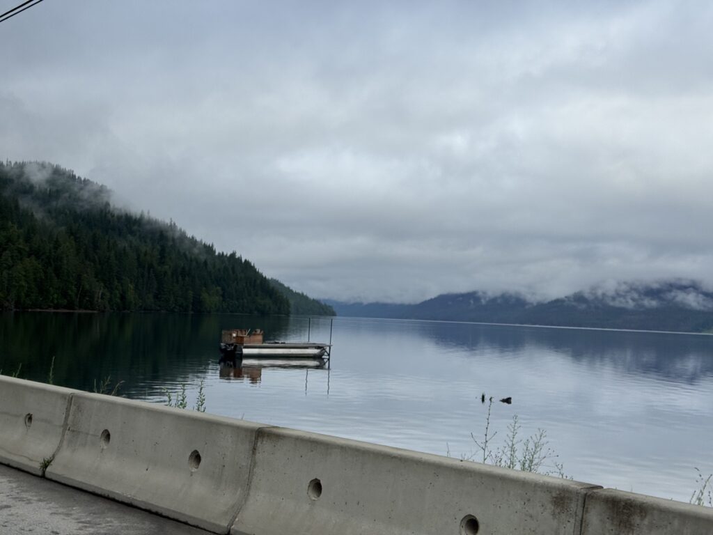
As I left Revelstroke, I made my way out of town and across a huge span of the Columbia River on a one-lane bridge! Unbelievable. It stayed hot and dry as I climbed well over 1000 feet out of the river valley to the highway heading down to the ferry. The gorge itself was too steep for them to build a road, so they built the road quite high up on the side of the mountain. Roughly I climbed about half of the 30 mile route parallel to the river and then descended the other half. I had exactly 3 hours to get there and made it with about 20 minutes to spare (given all the climbing).
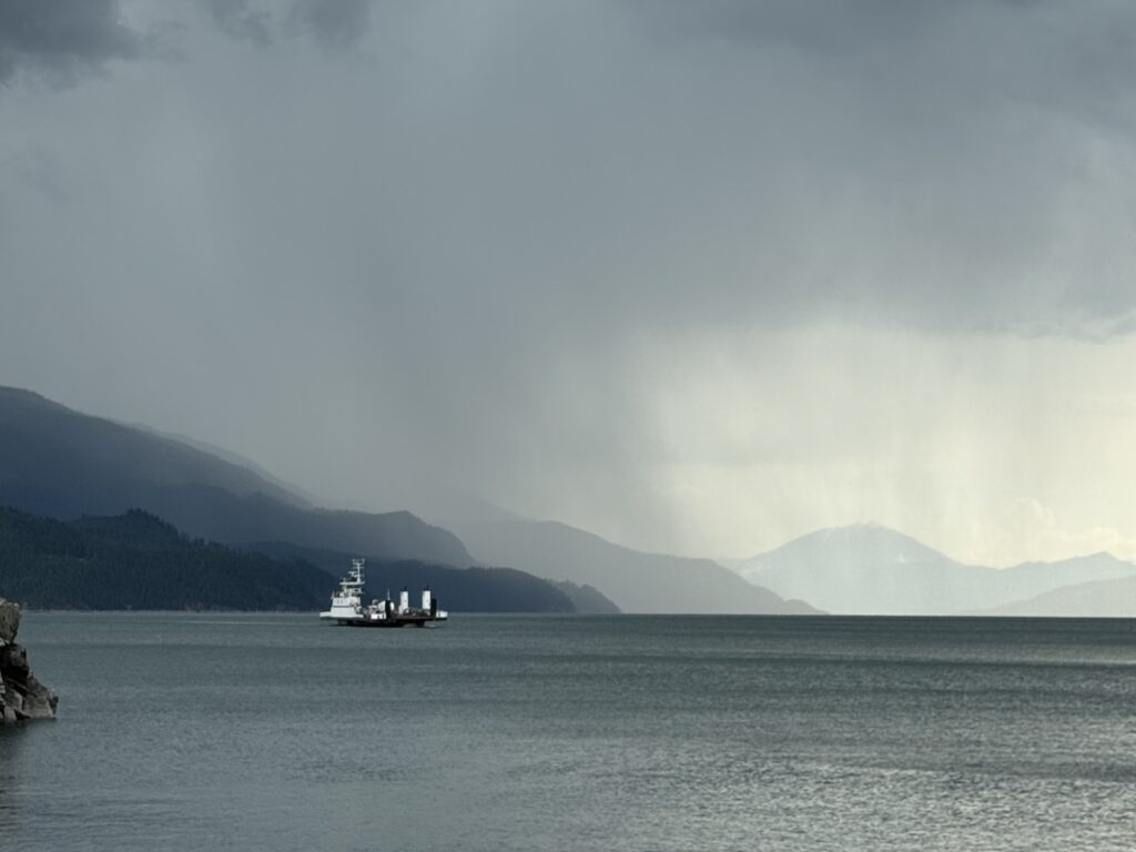
I chatted with a couple in a jeep in front of me who were going to be camping out but uncertain because of the storms. While we were chatting, one of the attendants came up and told me I could wait down at the dock instead of in line with the cars. There, all the deckhands were waiting for the incoming ferry, which came in shortly just ahead of a wall of rain and lightning. I had put on all my rain gear while I was waiting, and then signaled I could go ahead up onto the ferry before all the cars.
Because the ferry was only about 20 minutes long, there was only an indoor bathroom and no other indoor area at all for passengers. It didn’t matter, though, because the rain stopped about halfway across the river, and I wanted to get pictures and videos.
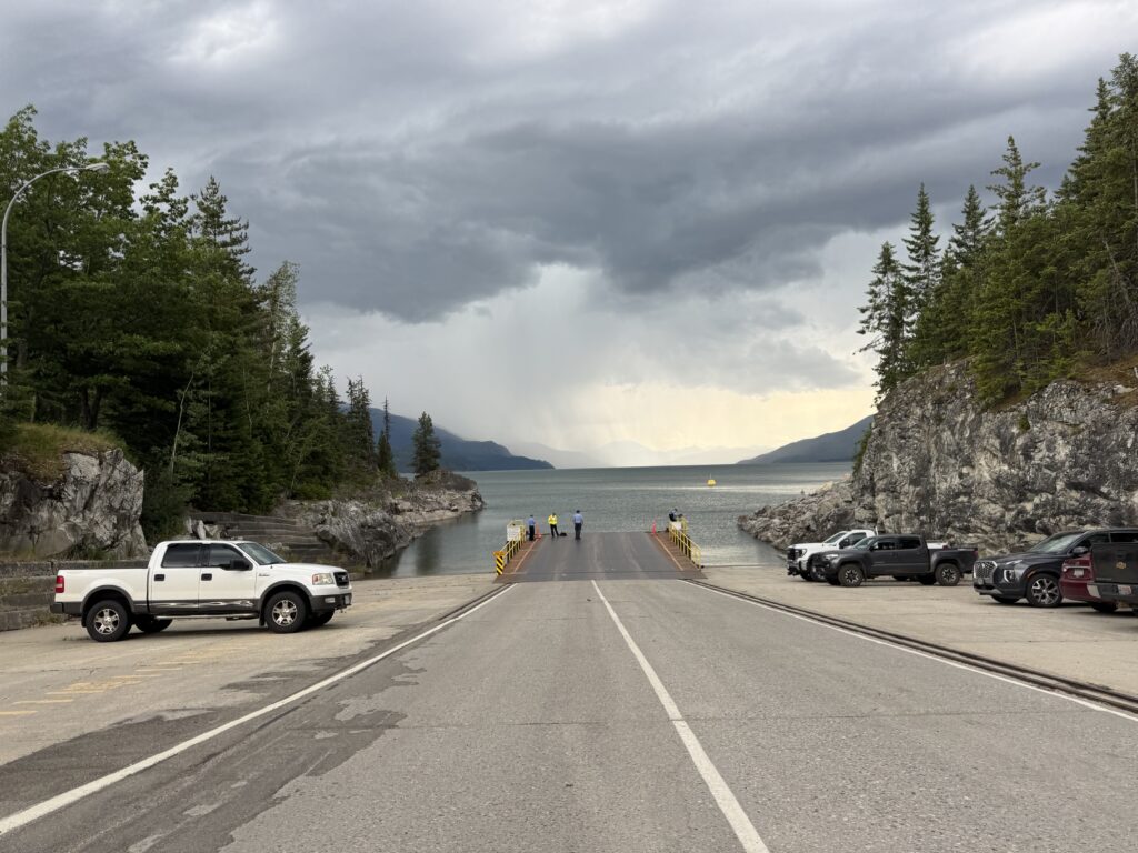
Landing on the other side was hilarious because the dock is on a 10% gradient hill. People in cars were cheering for me as I rode slowly past them waiting to board. What I didn’t realize is that the climb would go on for MILES not just past the dock. It ended up being a 3 mile 1,000 foot climb from the river up to presumably the best place they could build a road along the far side of the river as it was mostly just gently rolling after that.
Land ferry and more storms
Speaking of building a road, there was a big caution sign that said “Road Construction Expect 30 Minute Delays”. There was not a single car in sight once I made it out of the ferry terminal. I’m thinking “what could cause a 30 minute delay”. Well, as it turns out in about an hour I would finally make it to the construction zone where the road was being repaved.
There was a 10km stretch with only one lane open, and I was not allowed to ride through it. I found this out from the nice friendly young worker holding the Stop sign. We chatted for a bit and I found out he and the rest of the crew except for the person I would end up riding with were all from Vancouver Island (Victoria) and working the summer on construction crews in British Columbia.
When the lead car from traffic coming the other way (it was maybe 5 cars) turned around, the driver got out and she helped me get my bike into the back of hte pick-up truck. We had a great time chatting for about 15 minutes (max speed was maybe 30mph over the 10km stretch). She was the only one not from the island, and she was from much farther north in British Columbia. She was helping to pay for college with the construction work.
Just as we started to drive, it started to rain again, but by the time we made it to the dropoff point on the other side, it had stopped! So she saved me from riding through about 10km of rain. I still had about 30 miles to get to the next town and then another 30 miles from there to get to the Valhalla Inn, where I had already made a reservation for the night and called to confirm it would be OK if I got there late.
Wet soggy bears
I made it to the gas station just as a big thunderstorm rolled through. So I got a couple cups of hot coffee, lots of food and drink, and waited it out for a bit. Eventually, once the lightning had quieted down and it looked like a bit of a break, I put my rain gear on and took off in the rain … climbing, of course, always climbing.
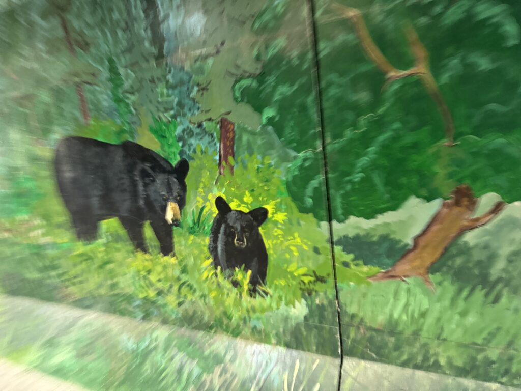
Leaving the town of Nakusp which was back down closer to river level, I climbed again for another 10 miles but only gaining 1000 feet so not nearly as steep. The best part was coming across the top and then a few miles into the gradual descent, I came across FOUR bears. It was a mama bear and three cubs. The cub that saw me first took off away from the road. The mama and other two just looked up from where they were rooting in the grass and stared at me. I was very close to them and had not noticed them because it was raining pretty hard. Probably no more than 25 feet away from me, I could see how soaked they were from all the rain I had been riding in.
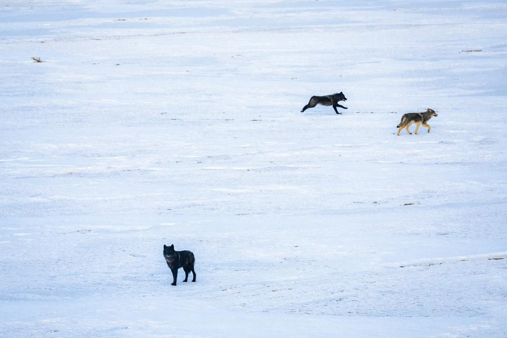
Speaking of wildlife, early in the morning at the start of the day, I might have seen a wolf wander across the road in front of me. It wasn’t a domesticated dog, but it looked a little on the small side for a wolf. Conversely, it seemed far too large for a wild coyote. So I’m not 100% sure, but it may have been a gray wolf as it very much had the same colors as the gray and tan wolf in the photo below.
I just kept on pedaling/coasting (it was downhill) and the last few miles into town were a much steeper descent all the way down to river level where I made it to the hotel before 8pm (much earlier than anticipated).
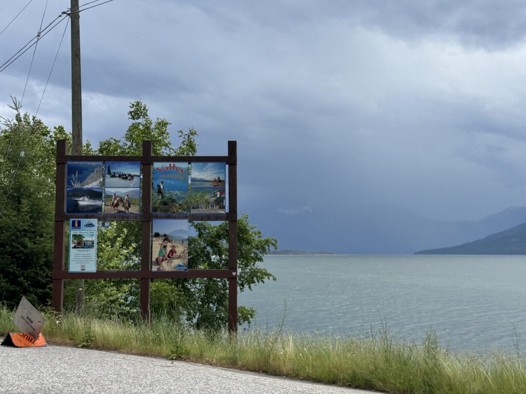
The workers there were very nice and said they kept the restaurant open for me, where I enjoyed excellent fish and chips which I ordered before heading back to my room for a quick shower and was ready when I made it back down to the restaurant. That place was so awesome. The climb that I did put me into a different river valley, so I was no longer in the Columbia River valley, but instead I was on the Slocan Lake in the Slocan River valley. If you are looking for a place to stay there (or even eat dinner), check out the Valhalla Inn in New Denver, British Columbia.
I am just now noticing that I spent Day 2 in Golden, Canada and then Day 3 in New Denver, Canada … you’d think I was in Colorado!

Day 4 – bike paths, traffic, and a rural crossing back into the USA
219.72 mi, 9826ft climbing, 16h 35m – https://www.strava.com/activities/14793462692
775 cars, 3.5 cars/mi, 0.8 cars/min, 46.0 mph (avg passing), 105.7mph (max) – https://www.mybiketraffic.com/rides/view/394214
Timelapse videos (1/2 second frame interval = 15x realtime)
Daytime (Canada) – https://youtu.be/dgLDKr78C6k
Late afternoon (USA) – https://youtu.be/T9iedF8GOE8
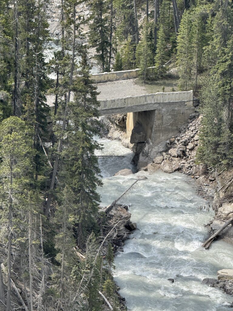
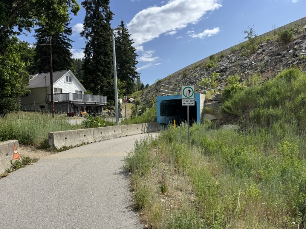
A slightly wet, foggy morning gave way to beautiful sunny skies. I stumbled upon a bike path alongside the road I was riding and found a rogue cut-in to get up to it. It was nice to be away from cars and alongside the river, but the gravel was deep and slow … not great when you’ve got 3,000+ miles to go!
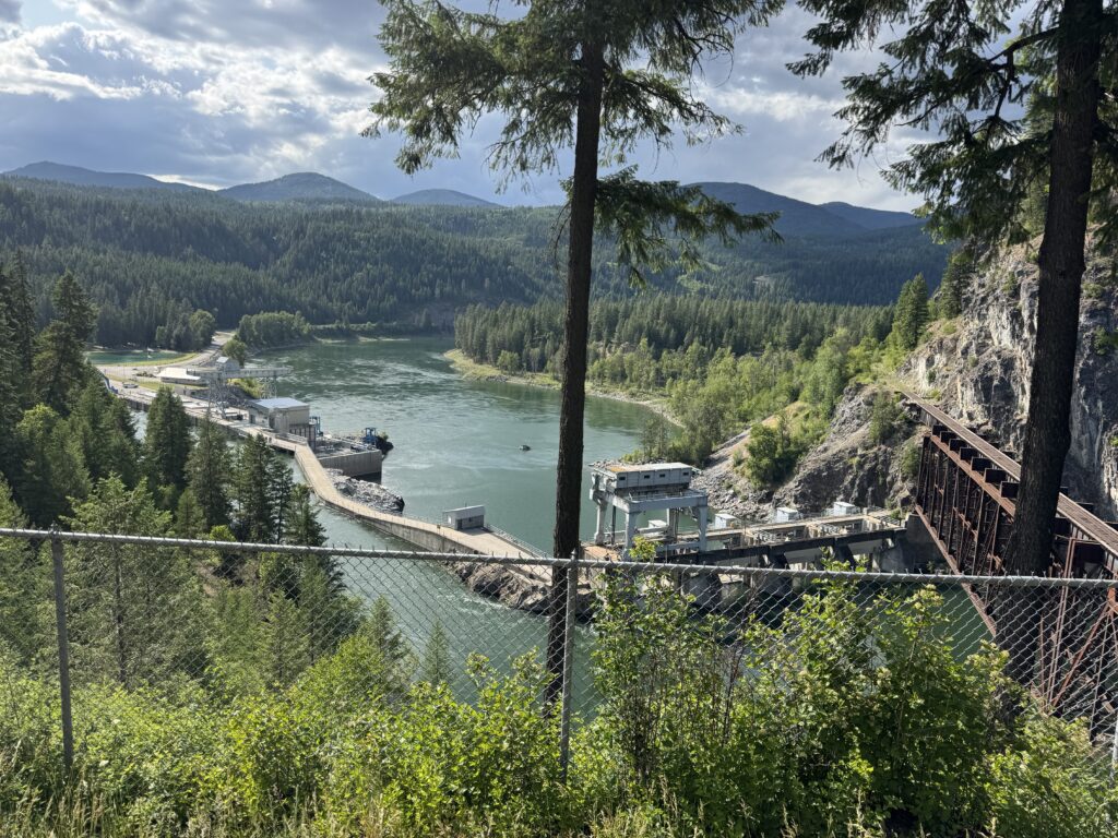
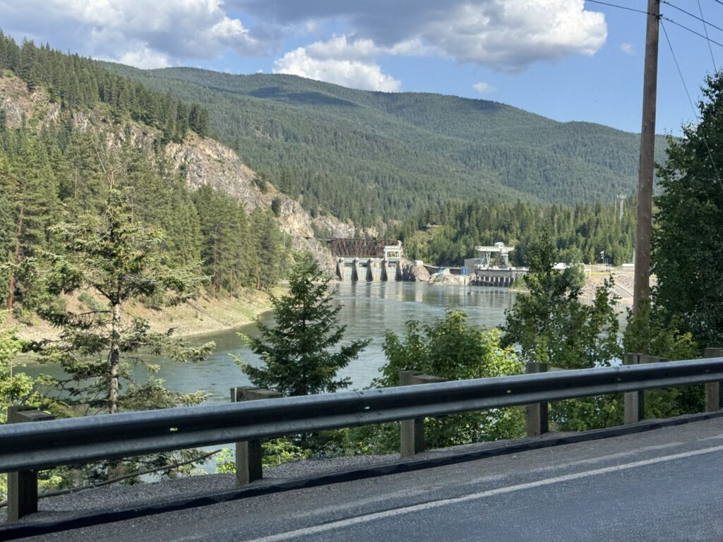
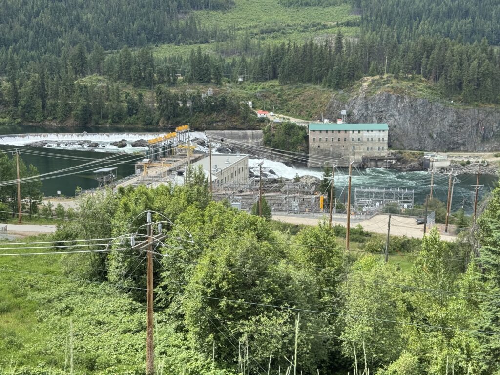
So I hopped back over onto the road at the next crossing and road it until I saw the bike path again where it had switched to being a paved bike path. I was able to take this a good chunk of the way to Nelson, but not all the way as it ended alongside Trans Canada Hwy 3 where it got narrow at all the hydroelectric dams. This stretch had quite a bit more traffic and was a sketchy section to ride, but it still had a rideable shoulder (in most places).
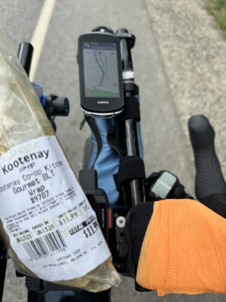
It was through here that I noticed I had lost my right time trial bars armrest in all the rain from the day before. So when I finally made it to Nelson and stumbled across a craft/garden store, I went inside to see if there was something I could use for padding. The helpful store clerk pointed me at neon colored washi tape I could wrap around thick enough to form a padded rest. It was perfect!
Nelson, itself, is built on the side of a pretty big hill. So mistakes in navigation cost me a bit of climbing and descending as I was trying to find the grocery store. Eventually, I found it, and it was worth it. It was like a mini-mall with one section devoted to groceries but then all kinds of other sections for different kinds of stuff (home goods, etc…). In any case, I ended up getting an excellent sandwich and all the stuff I’d need to make it back into the USA with the border only about 45 miles away south of Nelson.
Climbing through the rain
By the time I left the store, it had started to rain pretty hard. I put on my rain pants but not my rain jacket because it was quite warm and I knew I would be climbing for a while. So I spent the next hour or so climbing up through the rain south towards the border. Eventually I made it to the last Canadian town I would see on this trip, Salmo “home of the stone murals”. I saw one and snapped a pic before continuing on the Hwy 3 with the first sign for the US border.
Hwy 3 itself stays in Canada, but after a few miles I came to the intersection with an arrow pointing to the right saying US border. I did not know that the US border was at the top of a somewhat steep and long climb. During the 45 minutes it took me to do the climb, I was not passed by a single car. So I knew that the border would not be busy. Sure enough, I arrived at the top with nobody trying to cross the border in either direction. I followed the signs and rode right up to the lone US border patrol guard.
I gave him my passport and thought I had explained everything pretty clearly. But when he said “when is your return flight?” I started over and explained again. Pretty soon into that explanation, he got it, and said something of the lines of “oh wow, you’ve got a long ways to go”. He told me that there was a hotel in Metaline Falls, but I told him I wanted to press on to Newport, Washington on the border of Idaho.
After he handed me my passport back and wished me good luck, I rode on and quickly saw an informational sign about grizzly bears and wound my way back down the mountain to Metaline Falls.
Birthdays and alcohol
I needed to resupply at the Metaline Falls gas station where I heard somebody telling the clerk that it was his birthday. I got my stuff and when he came outside to his motorcycle, I mentioned that it was my brother’s birthday, too (I had already texted him a happy birthday from in Canada earlier in the day).
This got the man to talking, but mid-sentence he said I’ve got to go and he hopped on his motorcycle and took off saying he was going to chase down his ex-wife who had told him she was going to meet him and give him a birthday present.
While I was eating my chips and drinking my coke, I couldn’t help but overhear two ladies talking about how much better their men were when they got out of jail after not drinking for a while. Or at least that’s the gist of the conversation. This was at a gas station that had more than half the store devoted to wine and beer. And this being next to both a liquor store and a bar.
Now it could have been the weirdest of coincidences, but my first impression of the town was that some of the people of Metaline Falls may have a drinking problem.
No room at the inn
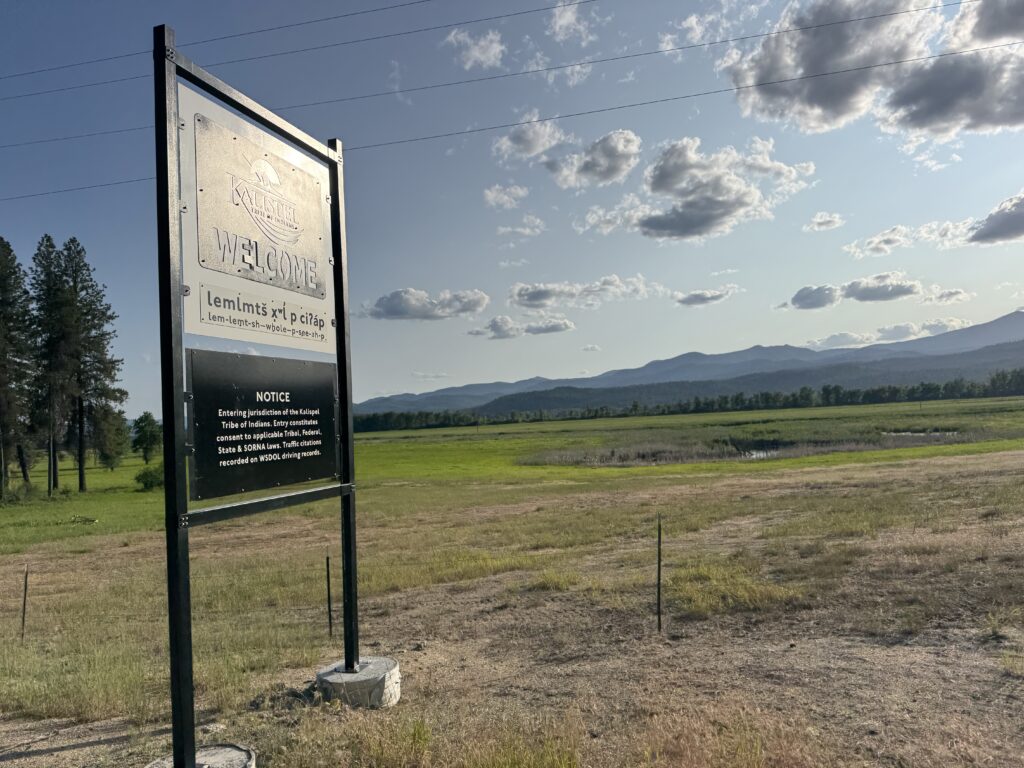
My route south to Newport took me through a large Native American reservation – the Kalispell Tribe. It was also still part of a national forest (I think) or the national forest came right up to the road I was riding as I stopped at a vault toilet with an information sign that felt like it was national forest.
In any case, when I made it to the next gas station, it was quite busy and the clerk checking me out said there was a national gathering happening the next day at the reservation. I had not booked any places to stay yet and when I checked google maps lodging, there was no availability at all in Newport. All the hotels were booked!
I resigned myself to an extra 50 miles of riding down to Coure d’Alene, but was somewhat consoled by the fact I could book a nice hotel there, do laundry for the first time, and sleep in a bit. Also that town is the easiest name to pronounce once you have heard, but I still have to look it up everytime to see how it’s spelled. I took my time and had a nice dinner at McDonald’s in Newport right after sunset at 9pm. Then I settled in and rode nearly four more hours to get to Coure d’Alene by 1am. There was a surprising amount of traffic out late on Friday night so it stayed pretty busy the whole way there. It was not a great ride.
But what made it quite a bit better, though, was my friend Stephen Peters texting me to see how I was doing. We ended up texting (voice text) back and forth for a while with him giving me updates of life back home and me telling him about the craziness of my adventure so far.
Leave a Reply