In this blog, I document the events of the surprise snowstorm that hit central Alabama on Tuesday, January 28th, 2014. I have selected several defining pictures to show full size here at the beginning to capture the chaos caused by the storm and its aftermath. Below the full-sized pictures, I have included small thumbnails of some of the videos I uploaded to youtube. Below the videos, I have organized a long pictoral gallery that covers the entire week. There are a ton of pictures, but I recommend that you click on the first one to open a full-size window and then click the arrows or click the picture to advance from photo to photo. If you do that, then when you make it to the end of the
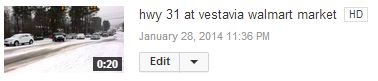
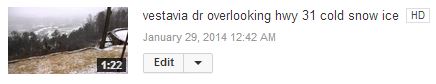
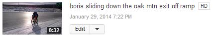
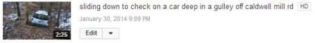
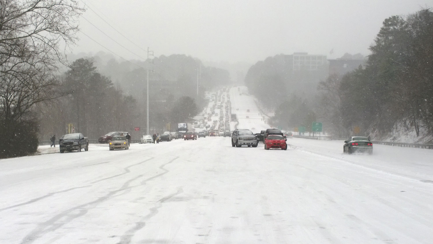
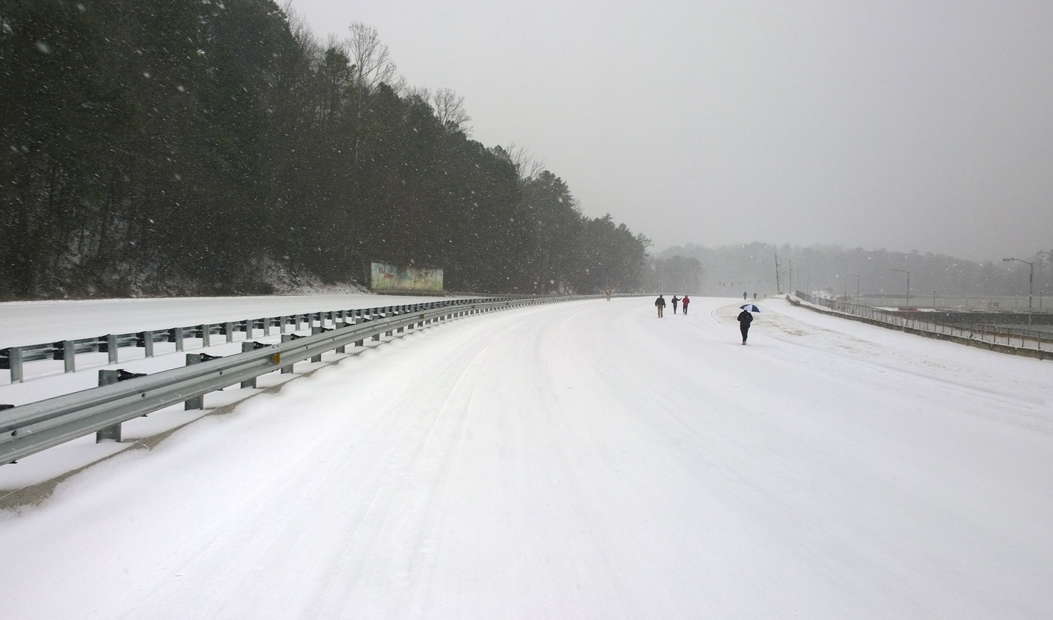
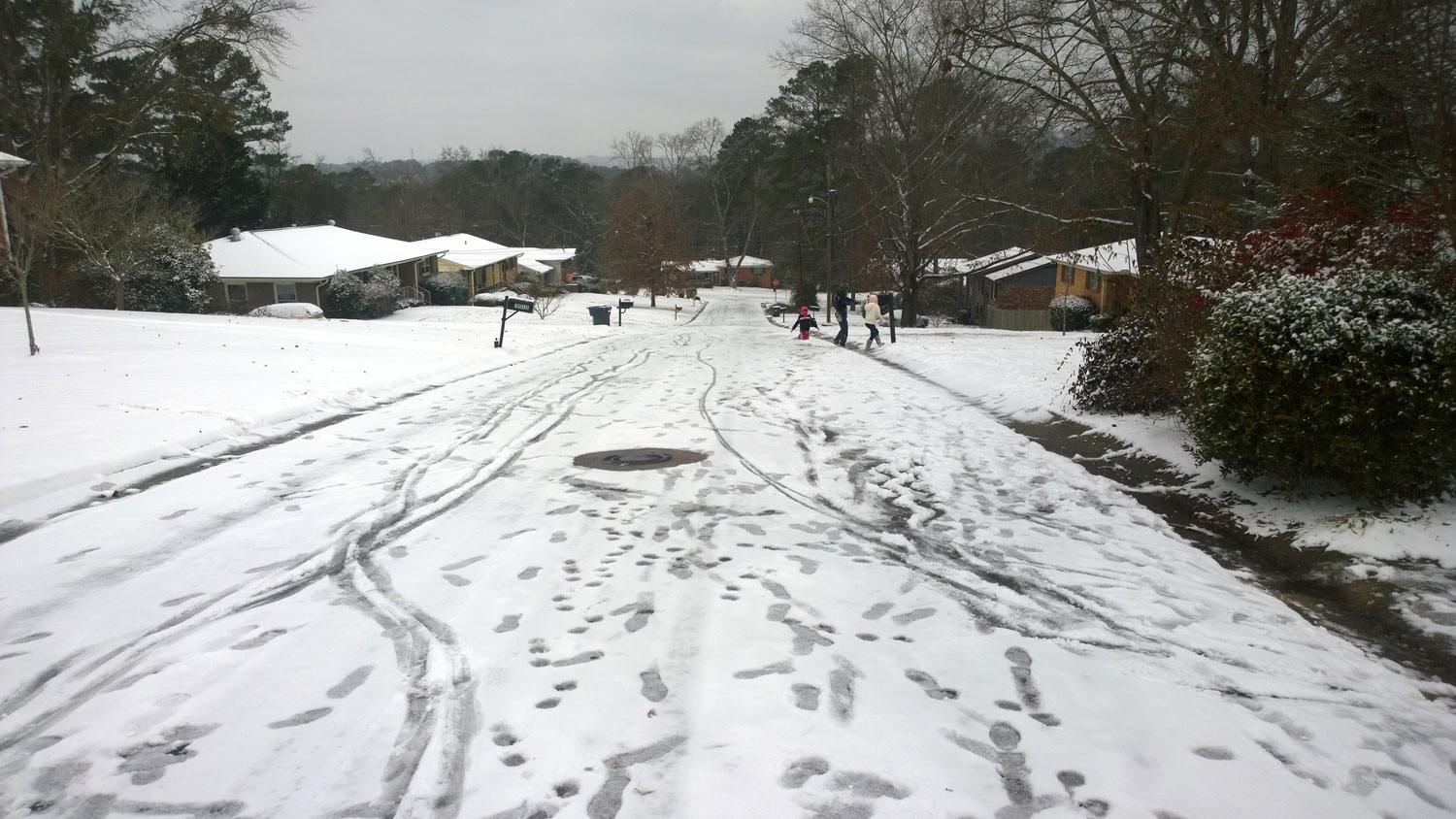
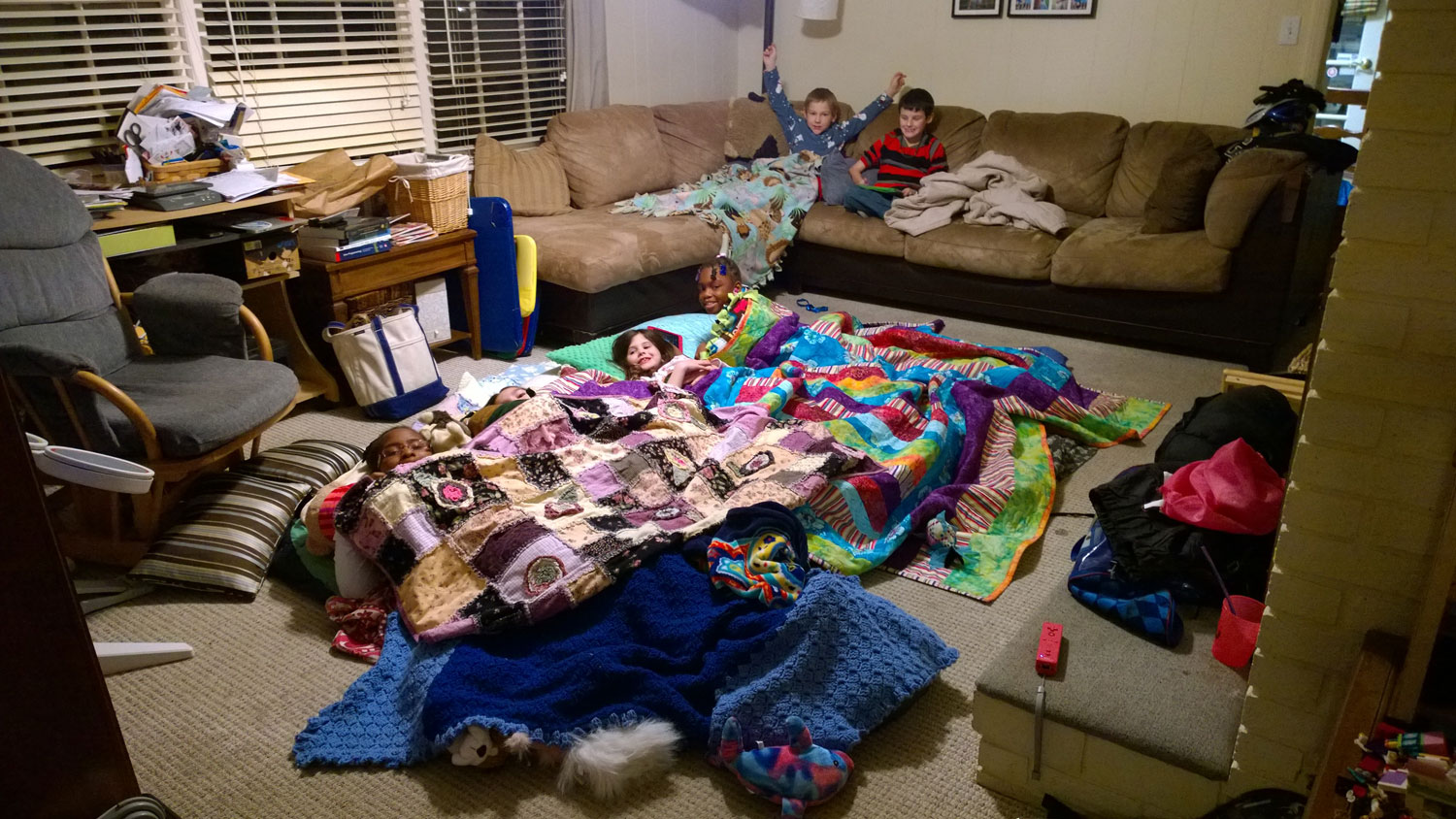
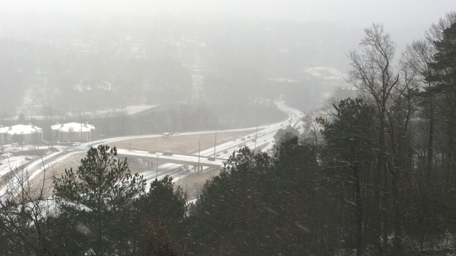
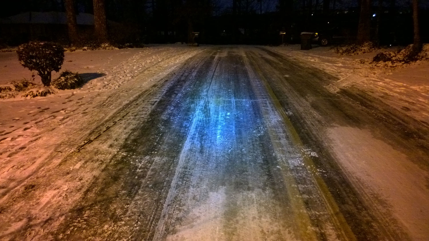
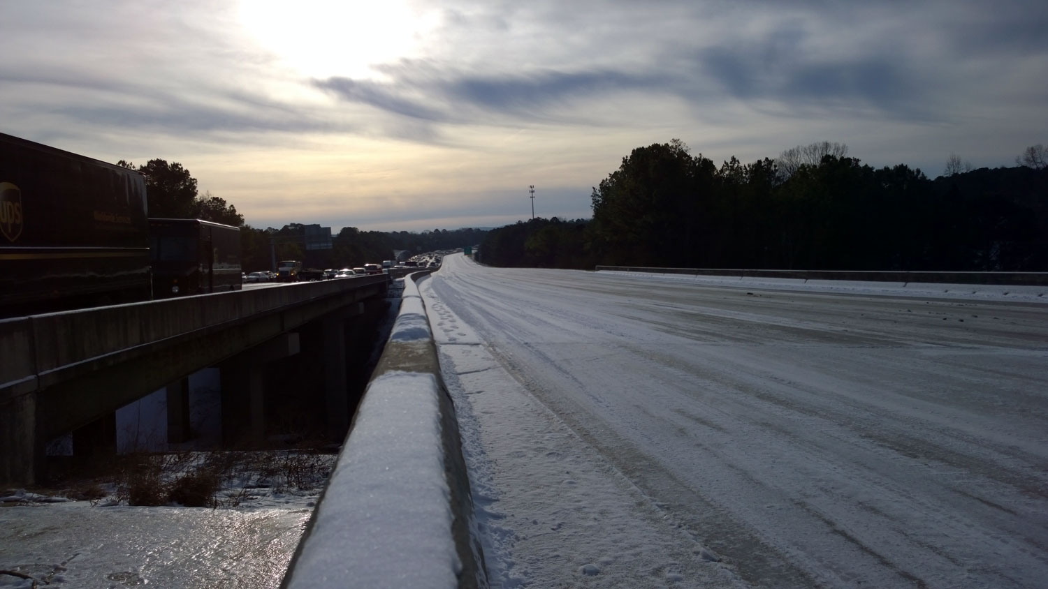
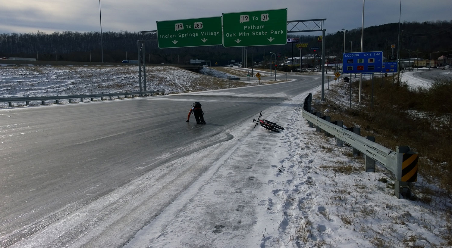
Tues, 1/28 @ 1:07PM – US Hwy 280 abandoned top of pass. People walk down a deserted six lane highway about 3 hours after it first started to snow.Tues, 1/28 @ 1:03PM – US Hwy 280 at Cherokee Rd. An ambulance spins out and struggles up the hill with a paramedic and a bystander helping to push it up the hill. People are abandoning their cars, while others try to get around. This is the spot where I started videoing my bike ride up the hill. http://youtu.be/ZlKTOy0J8WITues, 1/28 @ 1:03PM – US Hwy 280 at Lakeshore Dr. This picture is taken from the same spot as the one above, except looking back down the hill. The highway is completely blocked. There are accidents along the side, and you can see the exact spot where the cars cannot make it any farther up the hill. At this point, the line of cars probably stretches all the way back into downtown several miles away assuming that Red Mountain isn’t blocked.Tues 1/28 @ 6:08PM – icy blueberry lane. As I head out of the neighborhood, I encounter unrideable sections of Blueberry Lane coated in solid ice. To pass this section, I ride through the yard on the left where you can see all the footprints of people walking … people unable and/or unwilling to walk anywhere near the crazy slippery road. I took this picture on my return trip after making it successfully to the grocery store to get milk.Tues, 1/28 @ 9:42PM – city-wide sleepover. People sleep in their offices. Kids sleep at schools. At our house, we have a sleepover with stranded kids whose parents cannot make it to Rocky Ridge Elementary. Over 200 kids spend the night at Rocky Ridge as do 4300 other students in the entire Hoover school system.Wed, 1/29 @ 8:03AM – first flipped car. I only have to ride 1/2 mile from my house to stumble (almost literally) upon the first flipped car. Rocky Ridge Rd was so icy that I walk stretches of it. I am trying to ride down the middle of the road where there is a little bit of snow (and traction), but gravity pulls me across to the side of the road onto the shoulder where I am completely shocked to be staring at this car in front of me. This moment is recorded 7 minutes and 50 seconds into this video: http://youtu.be/31u73UqPQ4A. I park my bike alongside the sign and run down to the car just to make sure nobody is still in the car (i.e., in case it had just happened while I was biking down the other side of the hill). Nobody is inside, but the contents of the car are strewn everywhere.Wed, 1/29 @ 9:12AM – ice skating. Boris and I decide to head south on I-65 all the way down to AL-119 to buy more water and food at the gas station to hand out to drivers stuck on I-65 north. When we exit the freeway, we discover rather quickly that the ramp is unrideable and head to the shoulder. Just how slippery is it? check out this video of Boris sliding on it – http://youtu.be/KqBRt_vA2z4Wed, 1/29 @ 11:05AM – welcome to the apocalypse! By this point, the roads are starting to melt and the middle two travel lanes are moving very, very slowly (0-1mph). But the melting ice makes what is left even more slippery. Instead of solid ice, you now have a thin layer of water on top of solid ice. Boris and I both pick are way very slowly between all of the abandoned cars in this picture and almost fall several times. Every car on the shoulder or in the right travel lane in this picture is abandoned all the way past the hill to the Hwy 31 exit out of sight. Our ride through this is recorded here: http://youtu.be/NDT8zeDPoMkTues, 1/28 @ 1PM – US Hwy 280. http://youtu.be/ZlKTOy0J8WITues, 1/28 @ 2PM – US Hwy 31. http://youtu.be/y3BQokQ5Is0Tues, 1/28 @ 10:45AM – Hwy 31 overlook. http://youtu.be/OgWEwn_UUg0Tues, 1/28 @ 2:45PM – Josiah skiing. http://youtu.be/RJAFvI-mSZ0Wed, 1/29 @ 8AM – Mountain biking to I-65. http://youtu.be/31u73UqPQ4AWed, 1/29 @ 8:30AM – I-65 southbound. http://youtu.be/IH3tKdXRqSUWed, 1/29 @ 9:15AM – Boris ice skating on the interstate. http://youtu.be/KqBRt_vA2z4Wed, 1/29 @ 10:30AM – dollar general truck. http://youtu.be/Ufsg825mdtMWed, 1/29 @ 10:45AM – Welcome to the Apocalypse! http://youtu.be/NDT8zeDPoMkWed, 1/29 @ 10:30AM – I-65 northbound to I-459 overpass on-ramp. http://youtu.be/cxyB3h4TXzcThurs, 1/30 @ 1:30PM – Hwy 280 to Co Rd 41 – http://youtu.be/E77FVMy1VrIThurs, 1/30 @ 3:30PM – Hugh Daniel descent to Hwy 280 – http://youtu.be/8Vi_Z1DMcokThurs, 1/30 @ 4:20PM – caldwell mill gulley. http://youtu.be/3iyUGP48X90
Below I have created a pictoral timeline of events based on photo timestamps. I have combined what was originally two galleries into one large gallery. Click on the first picture in the gallery and you can advance through each picture at full-size with the captions displayed at the bottom.
Monday – Friday
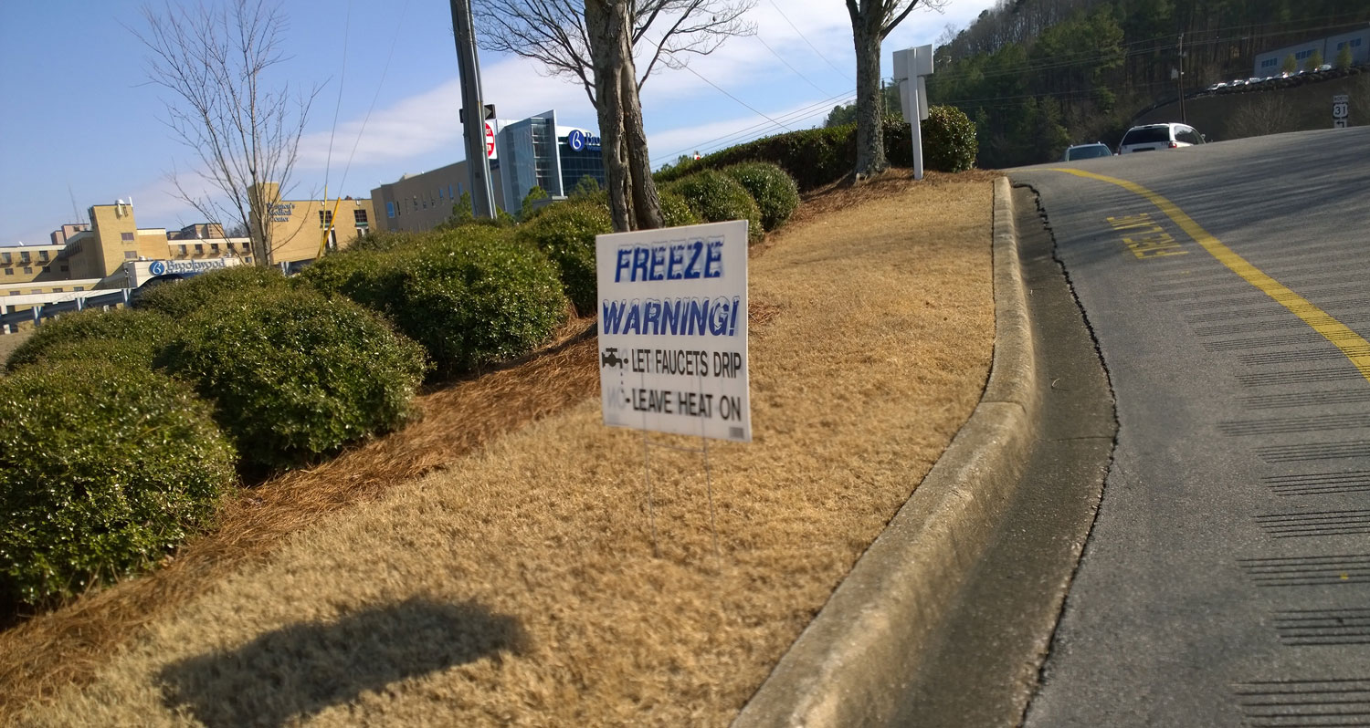
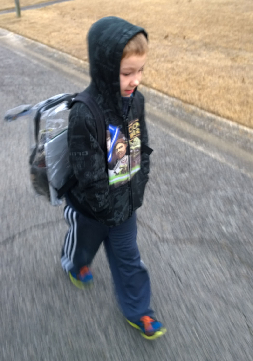
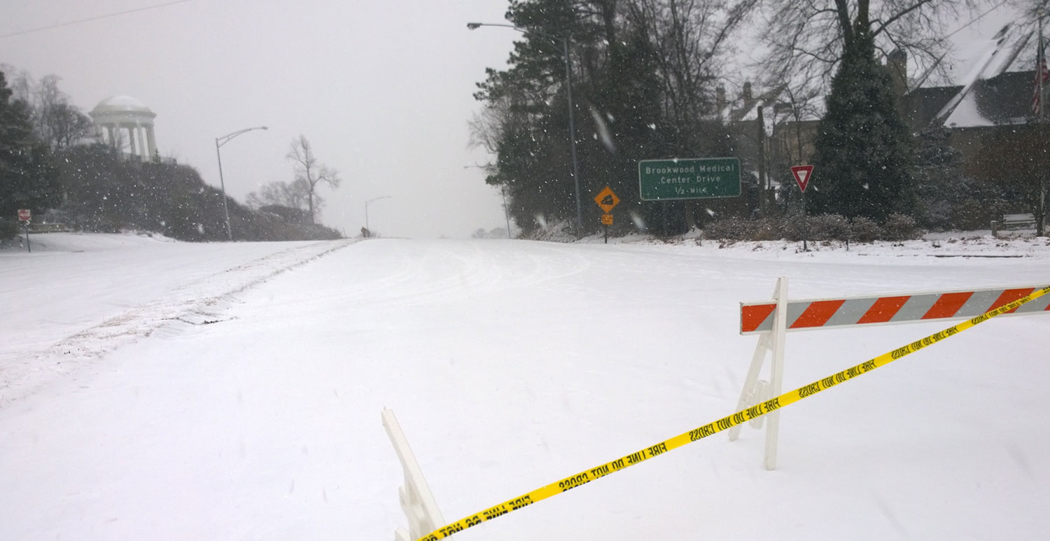
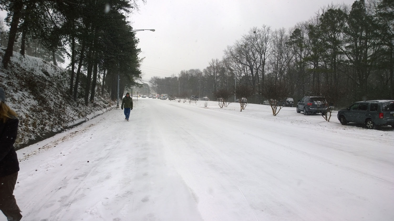
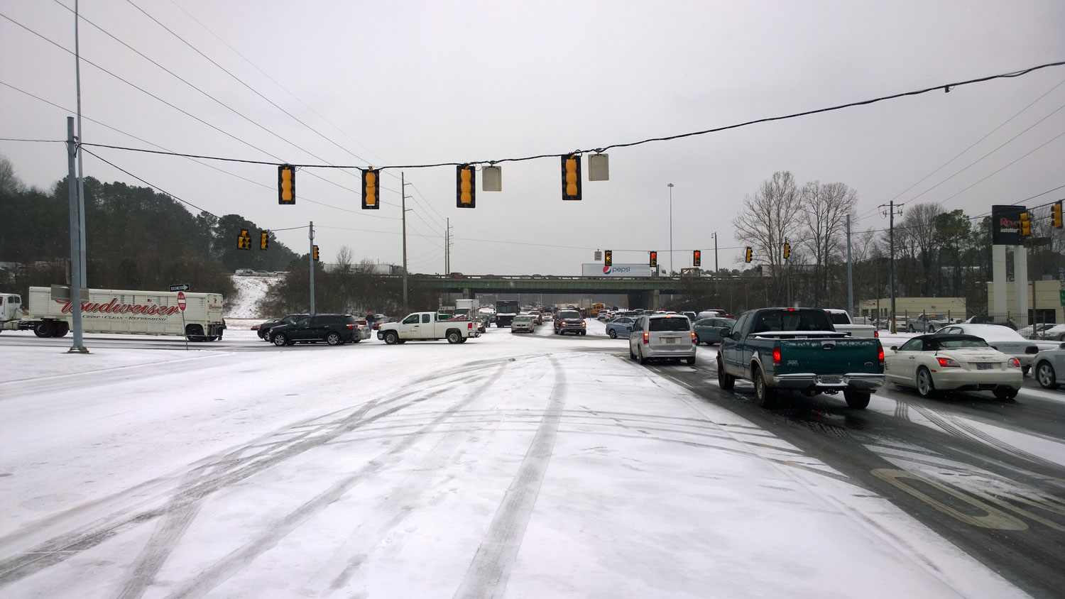
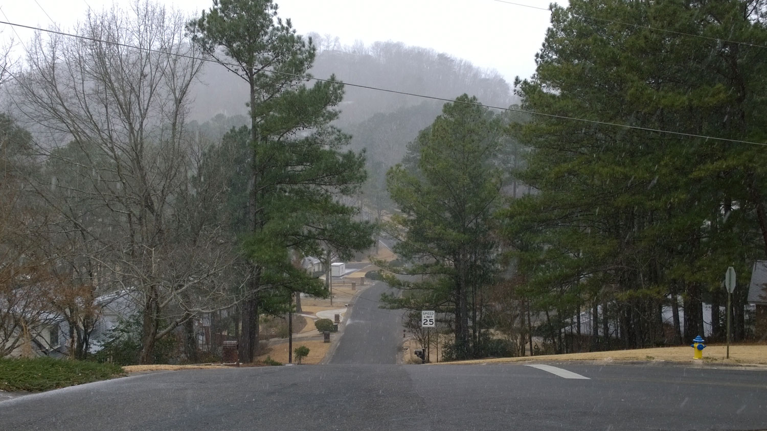
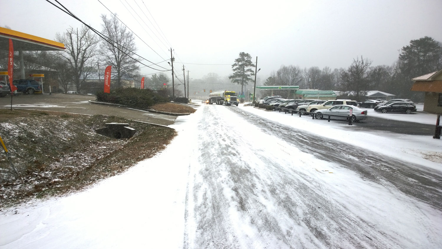
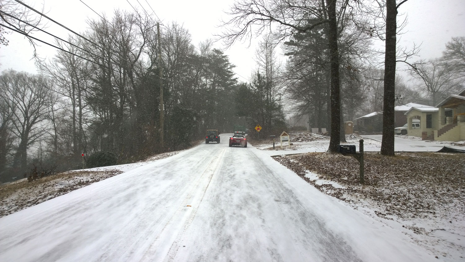
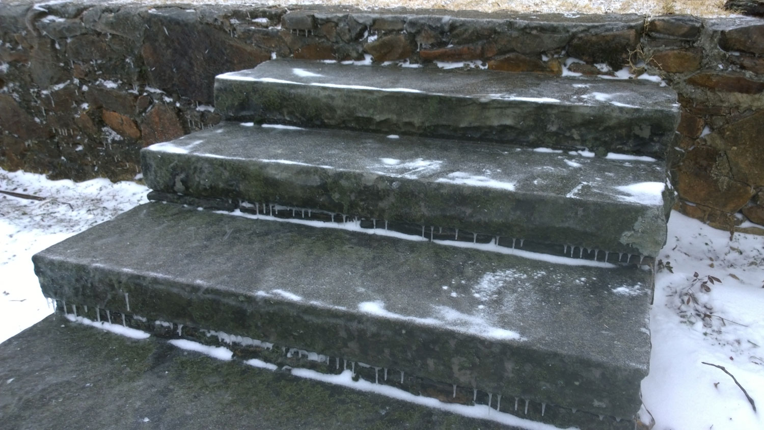
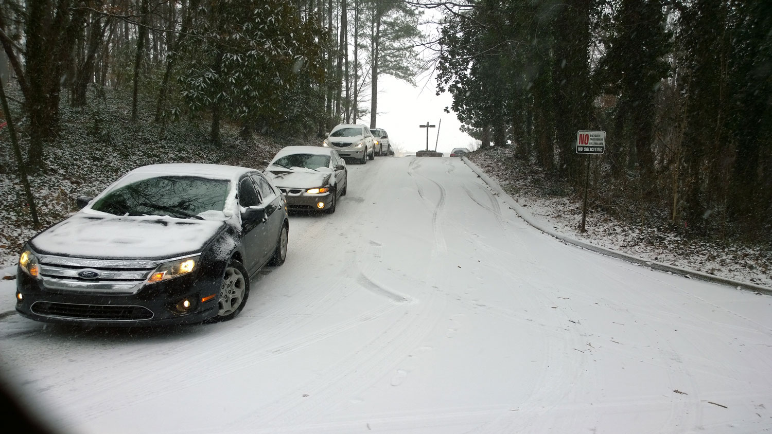
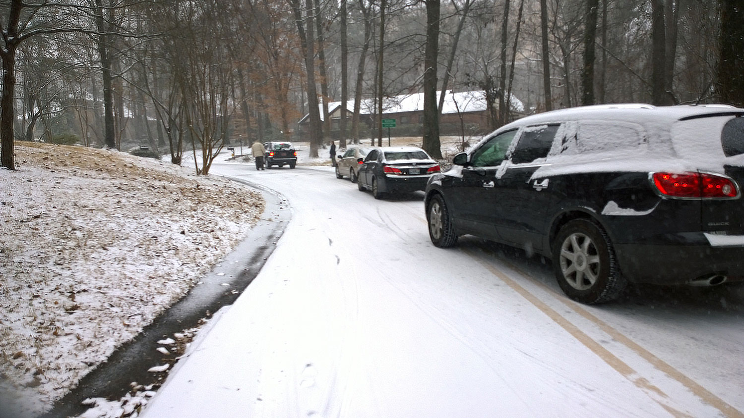
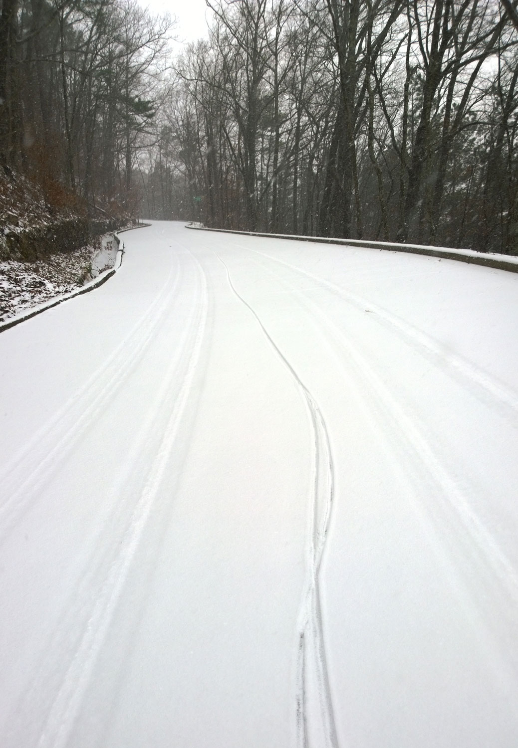
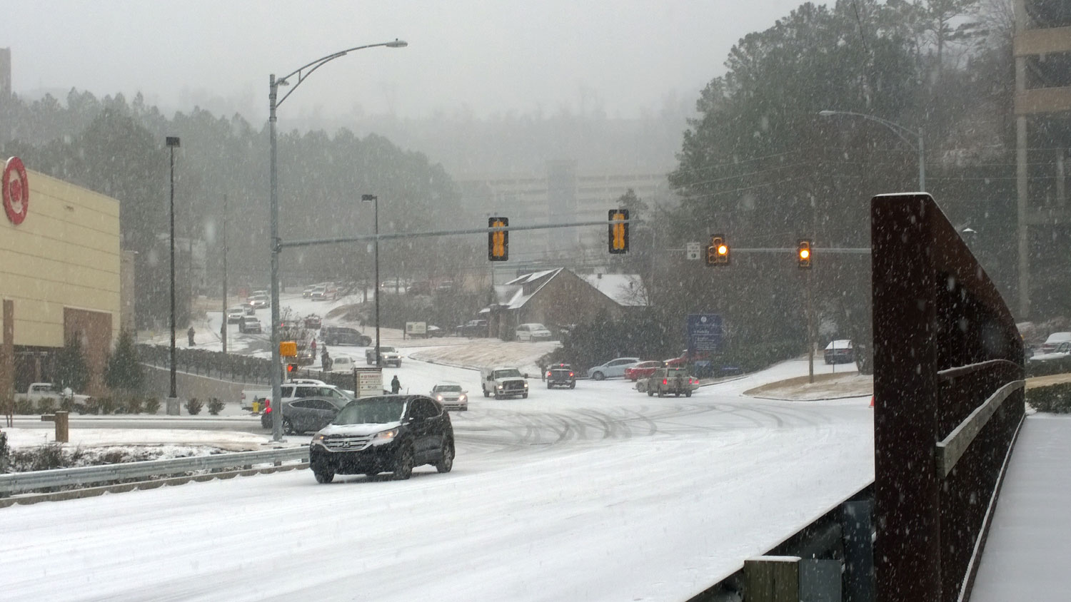
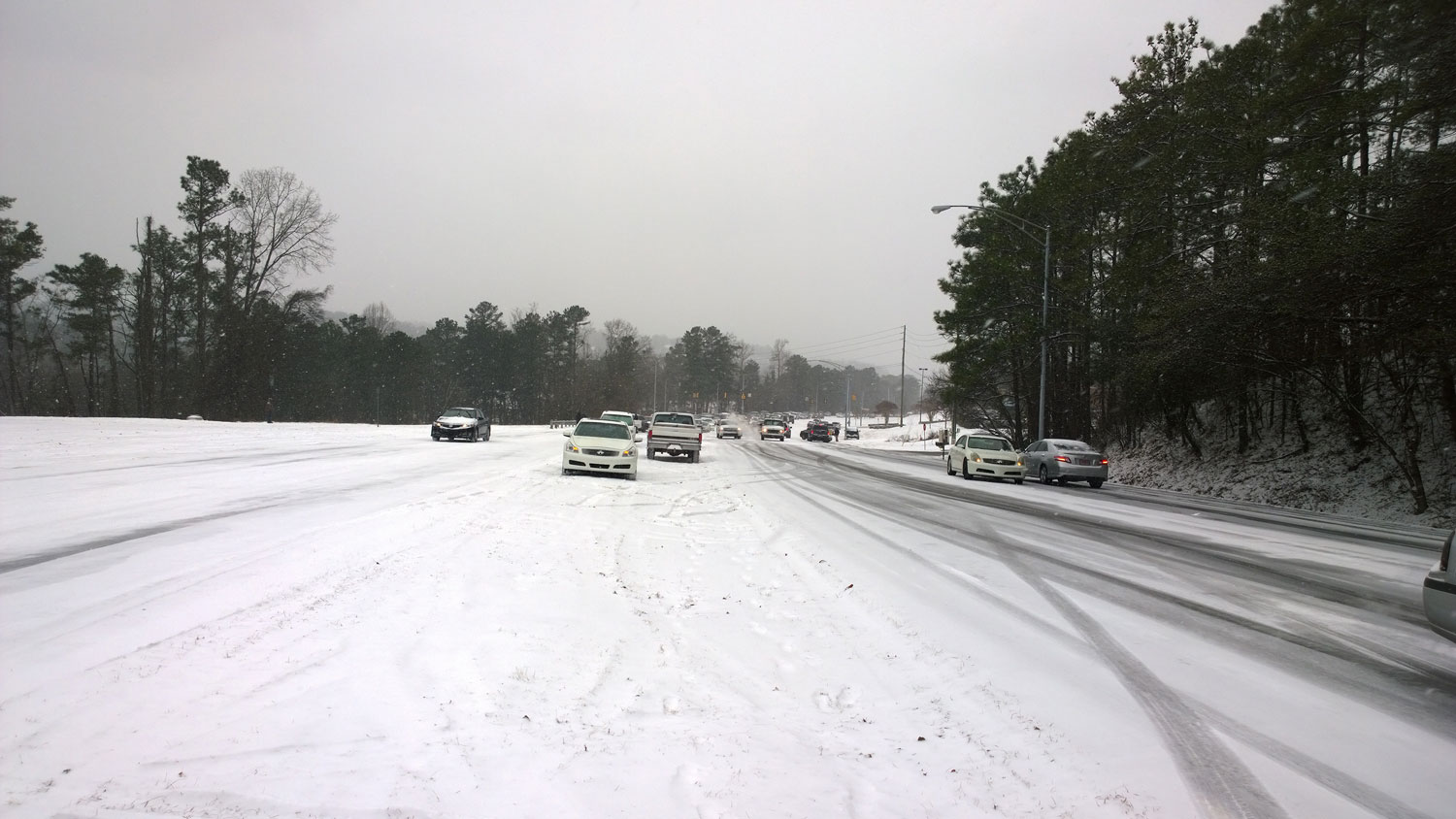
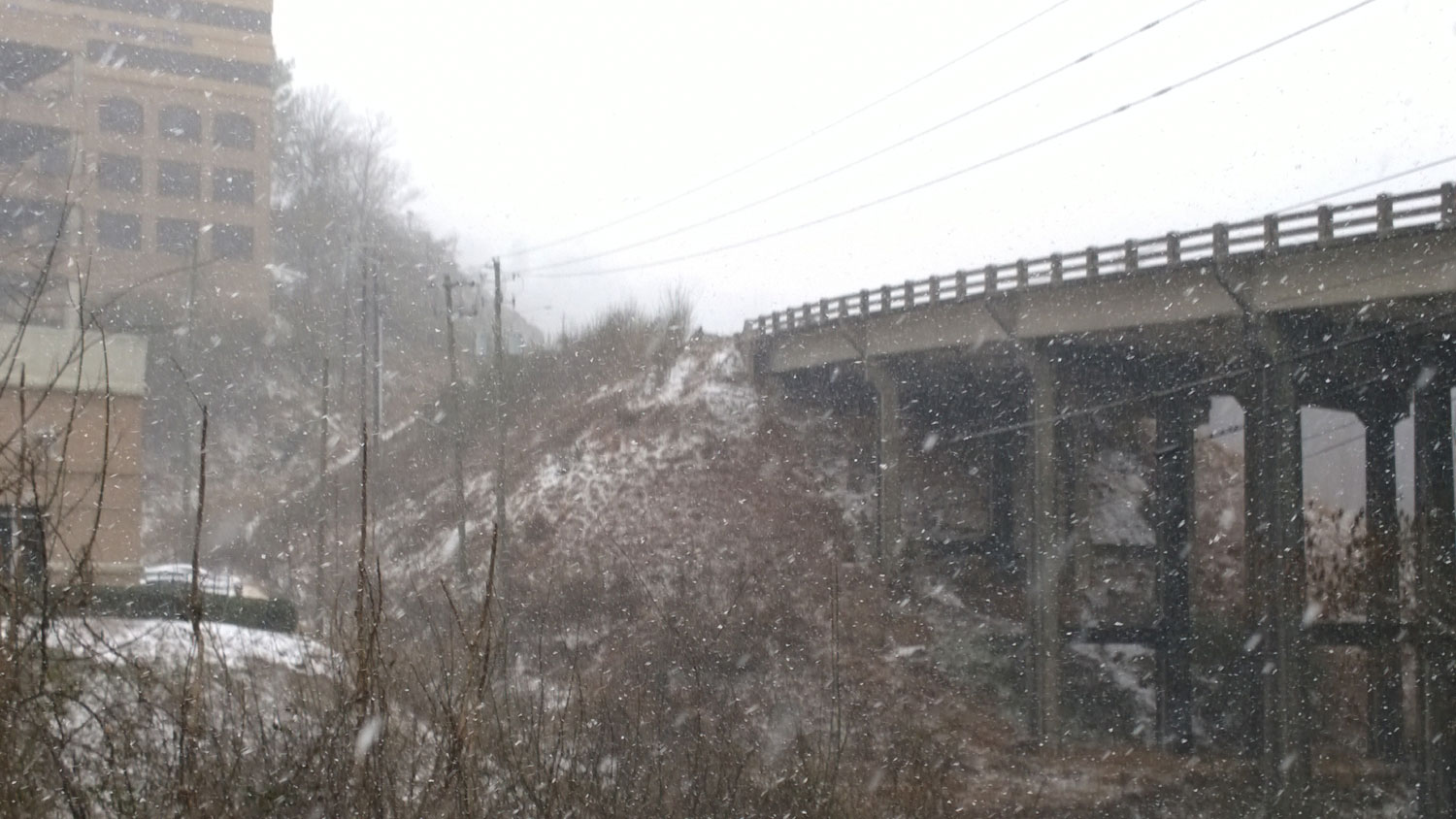
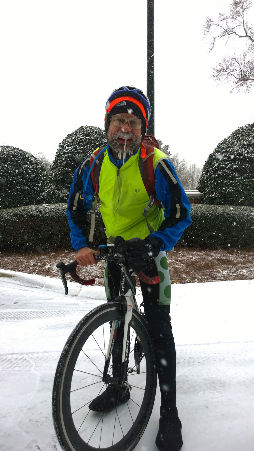
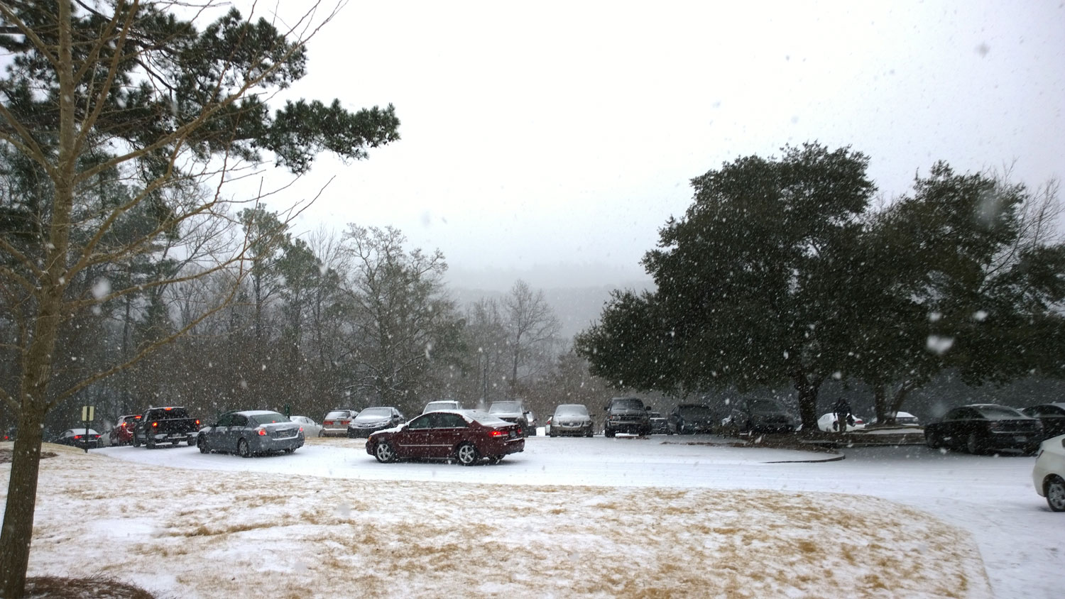
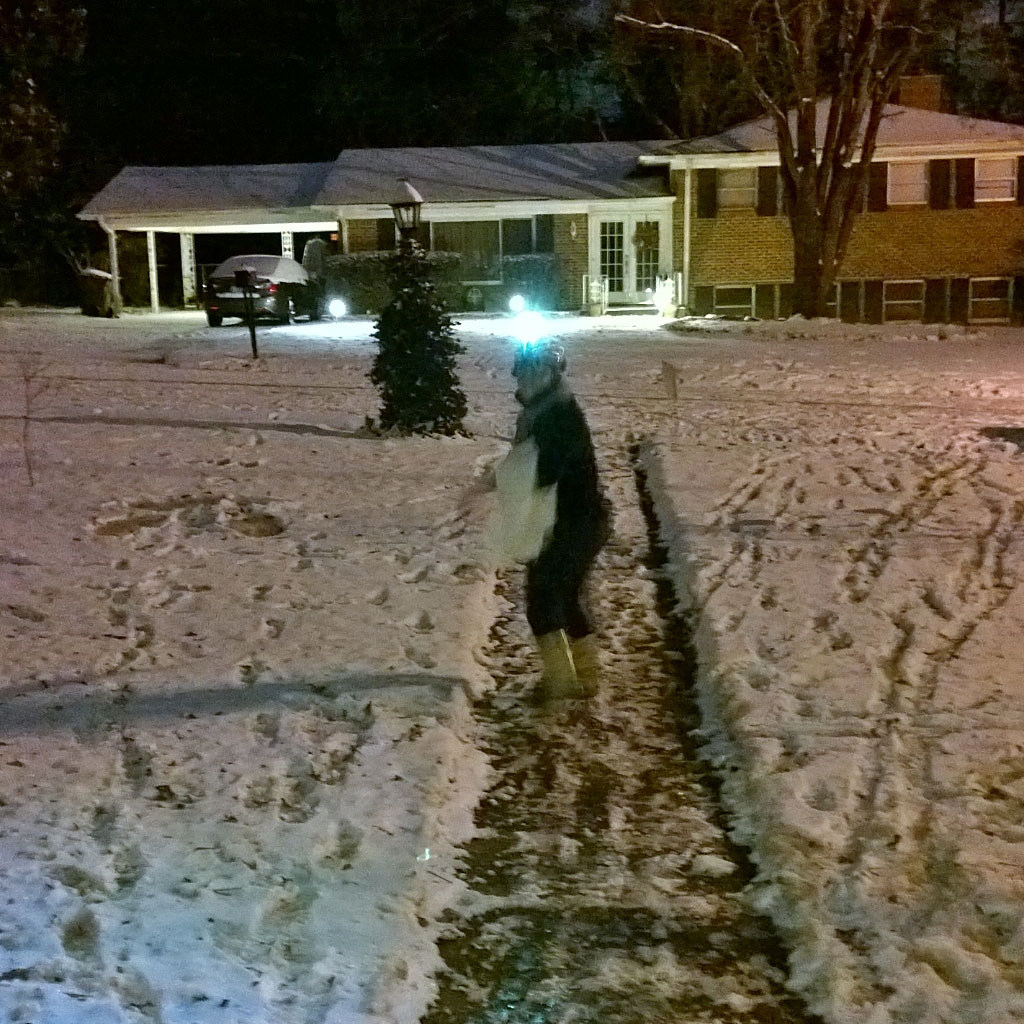
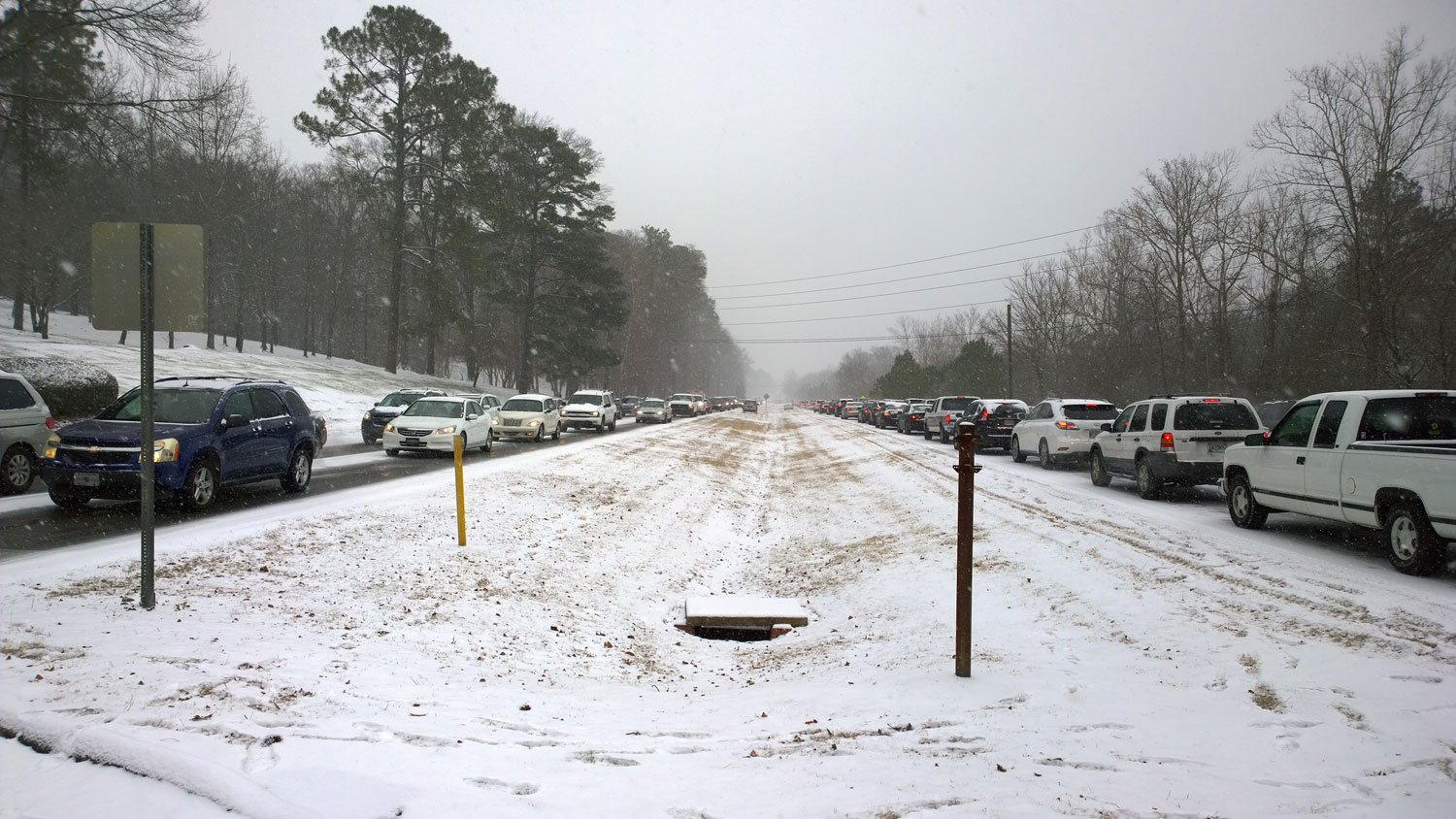
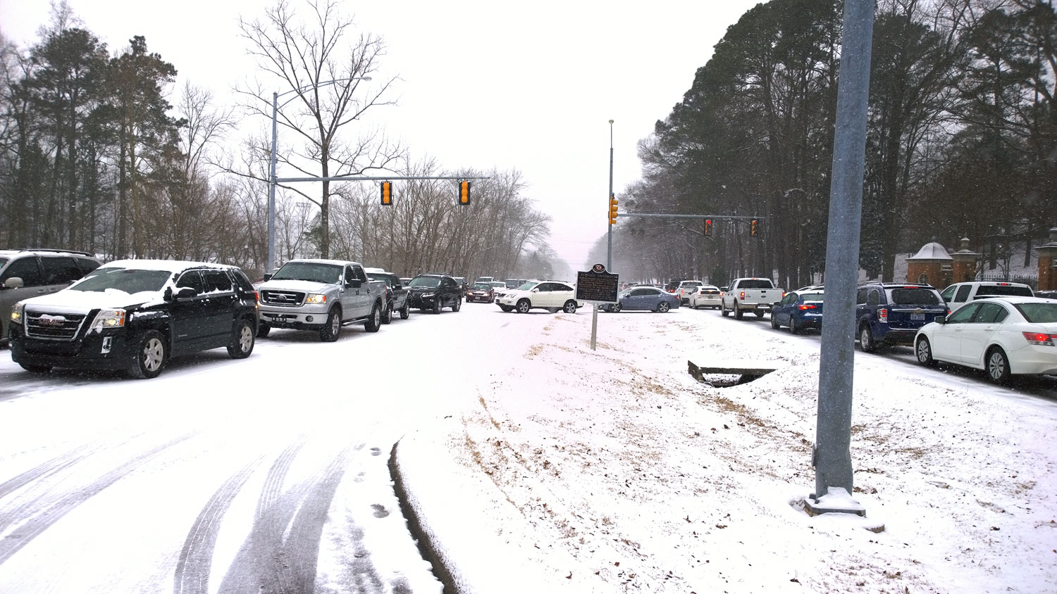
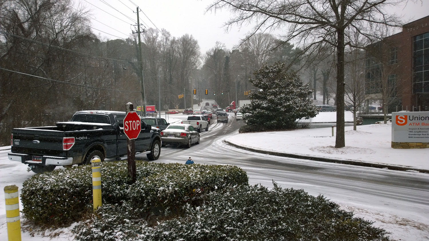
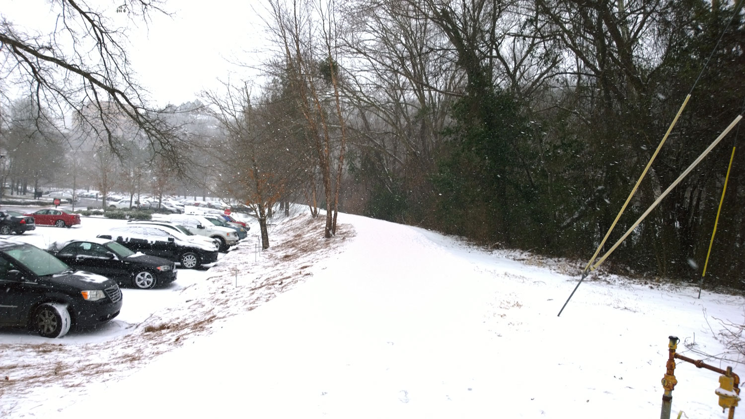
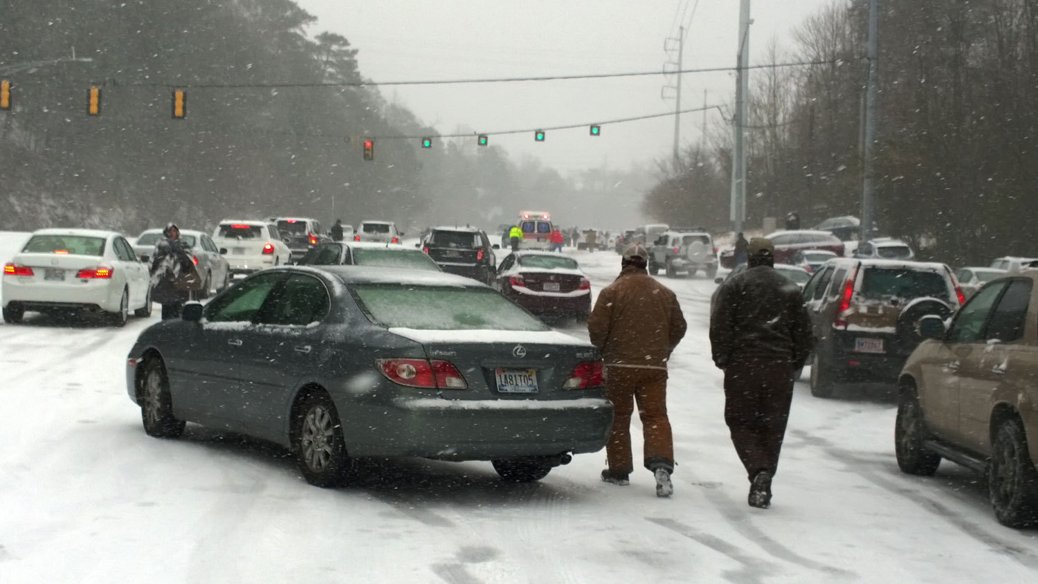
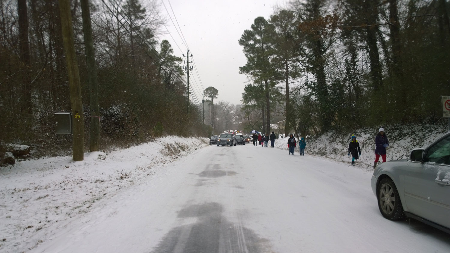
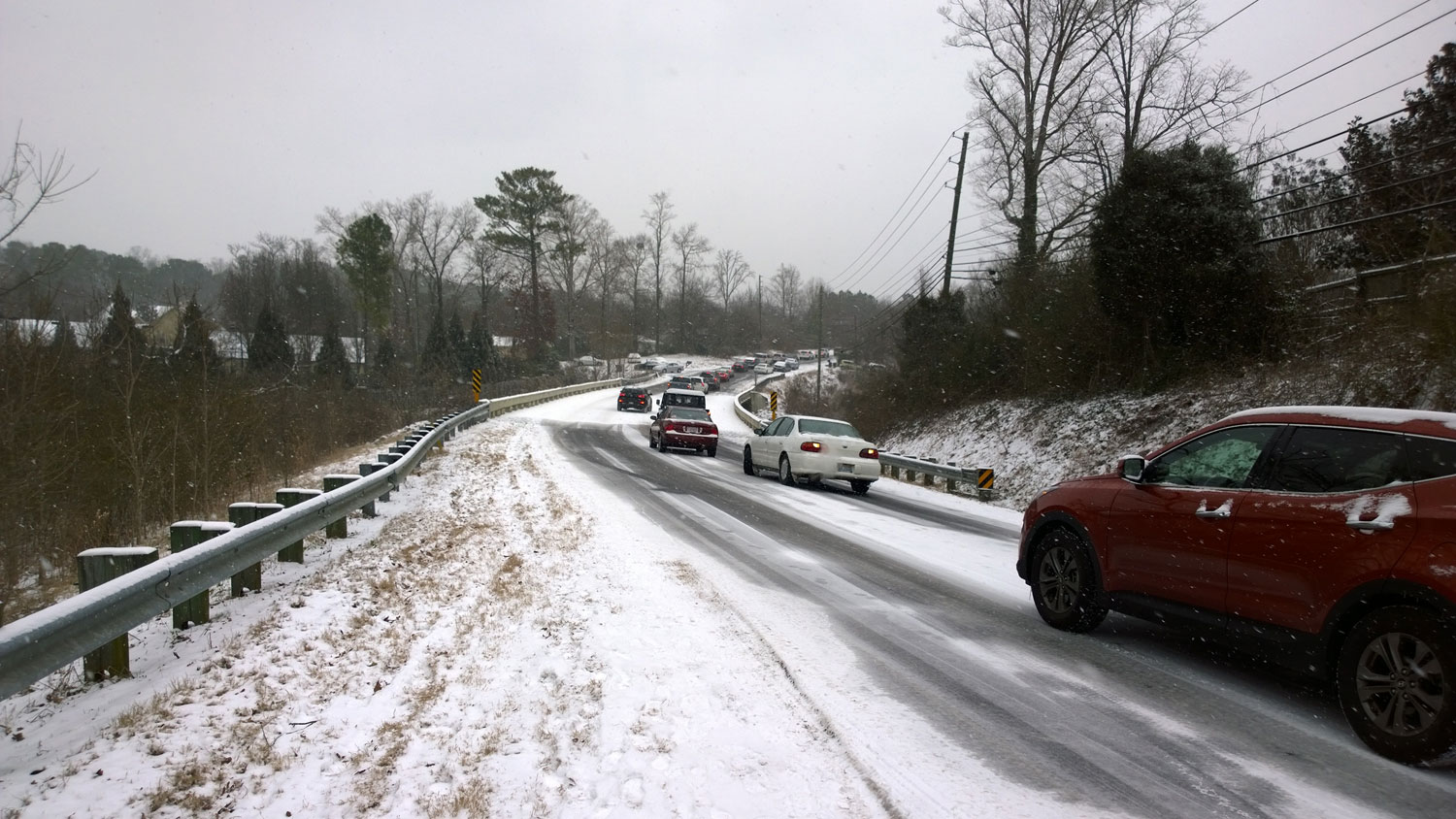
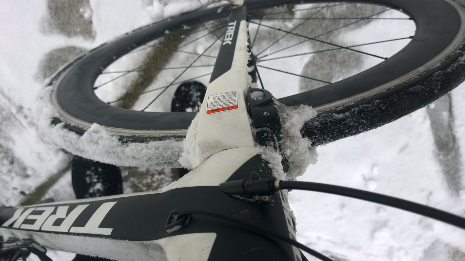
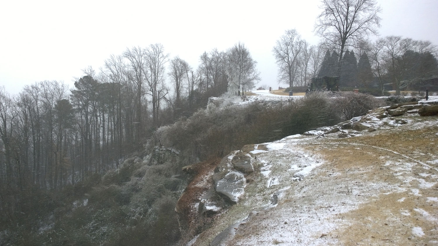
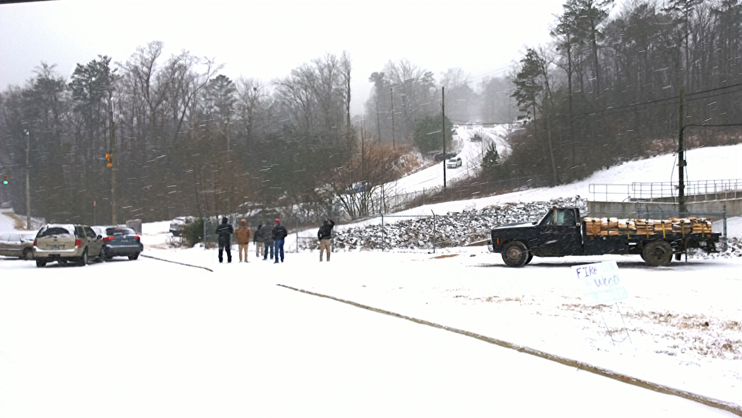
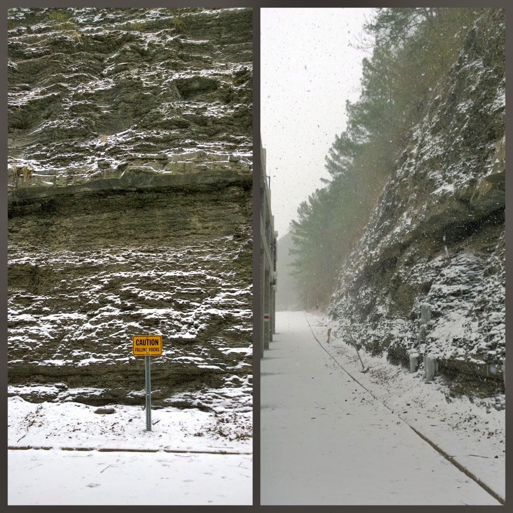
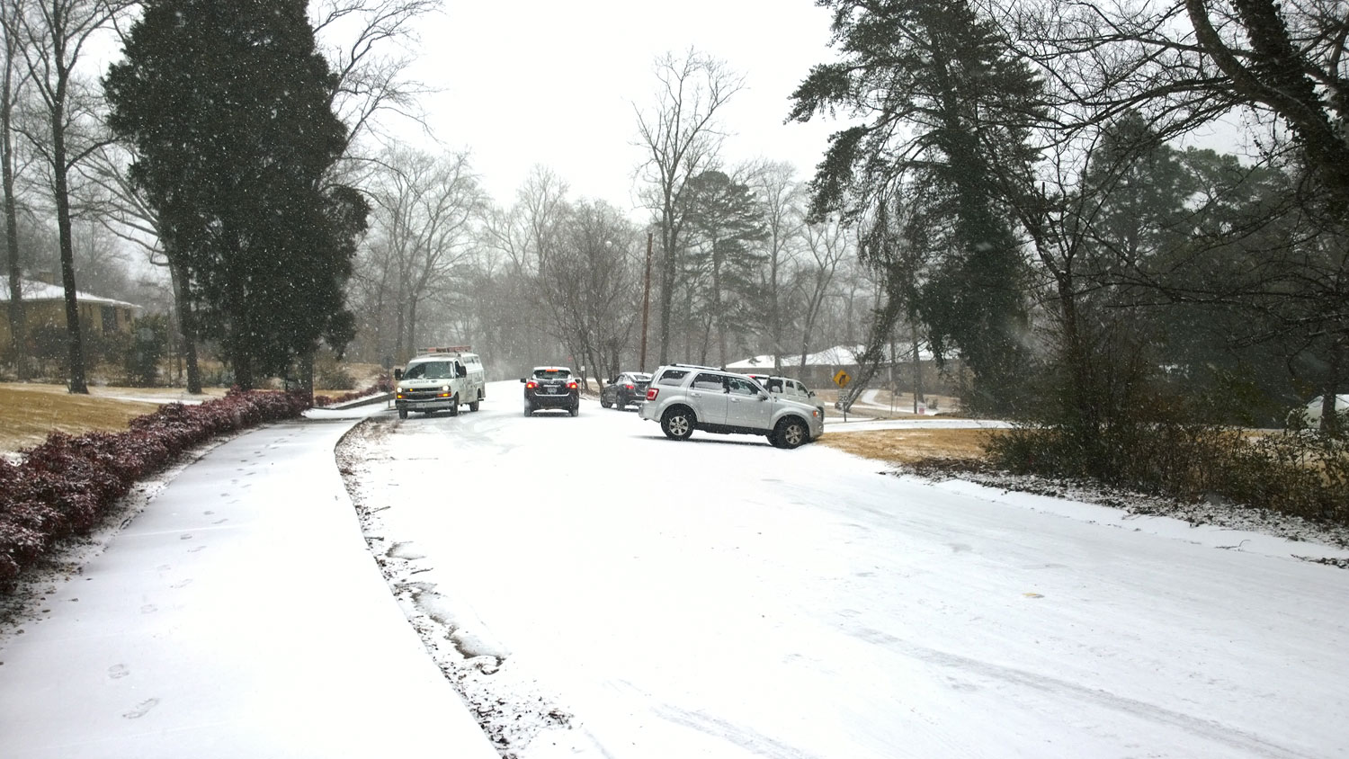
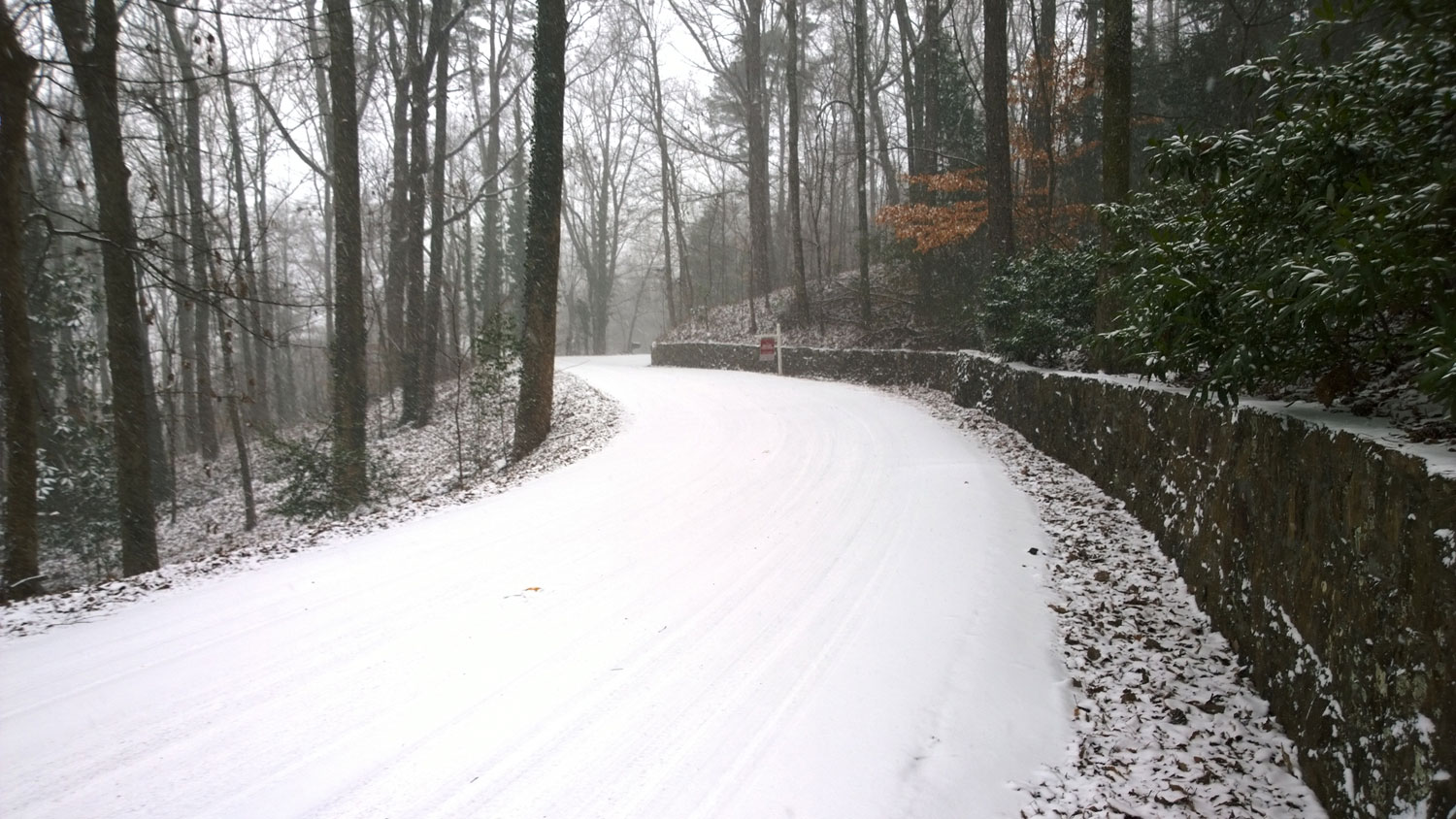
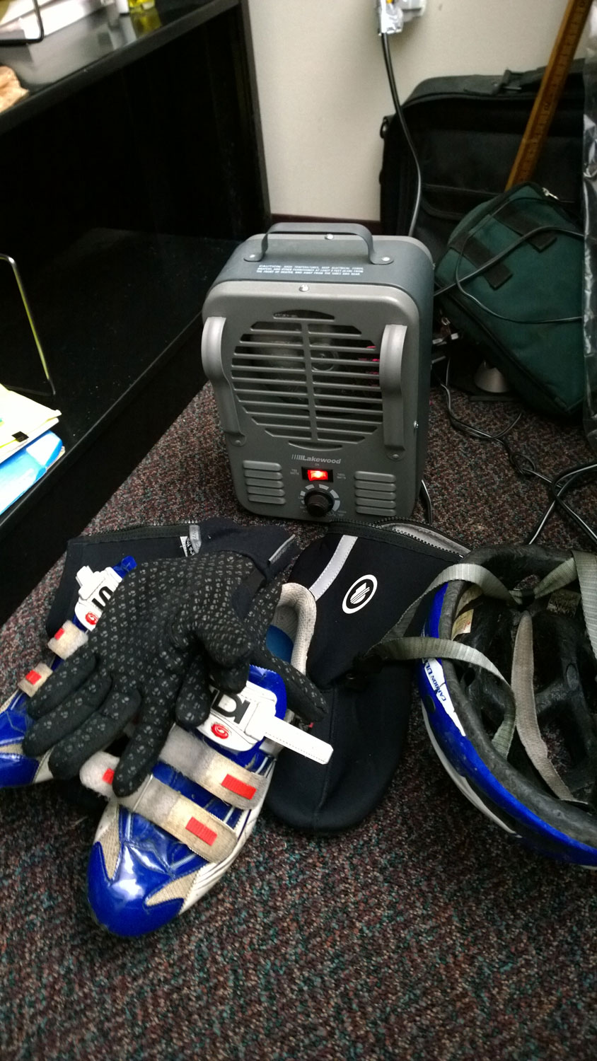
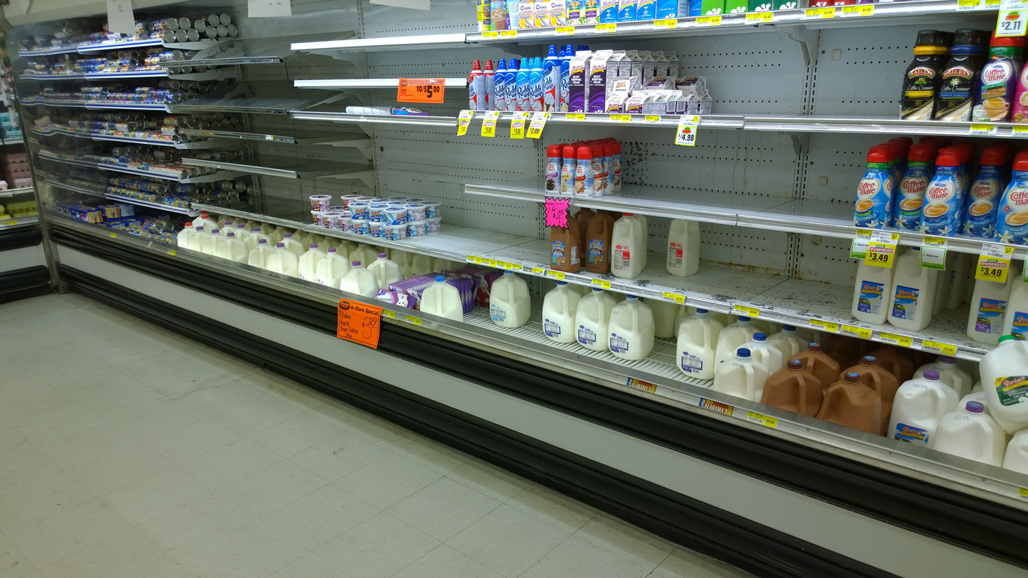
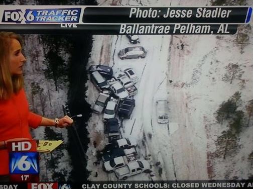
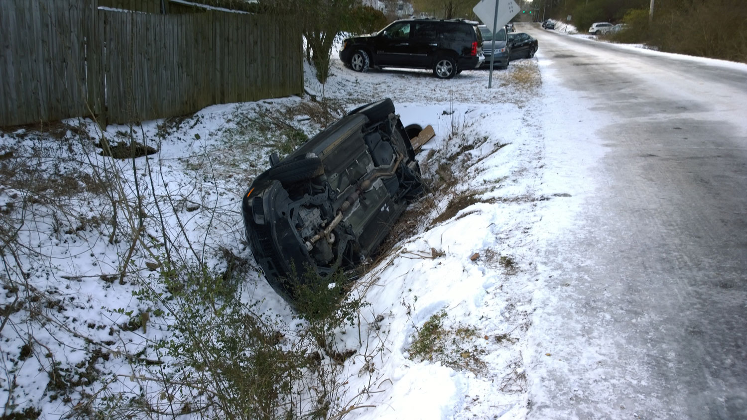
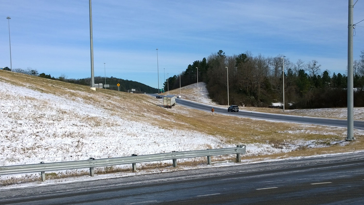
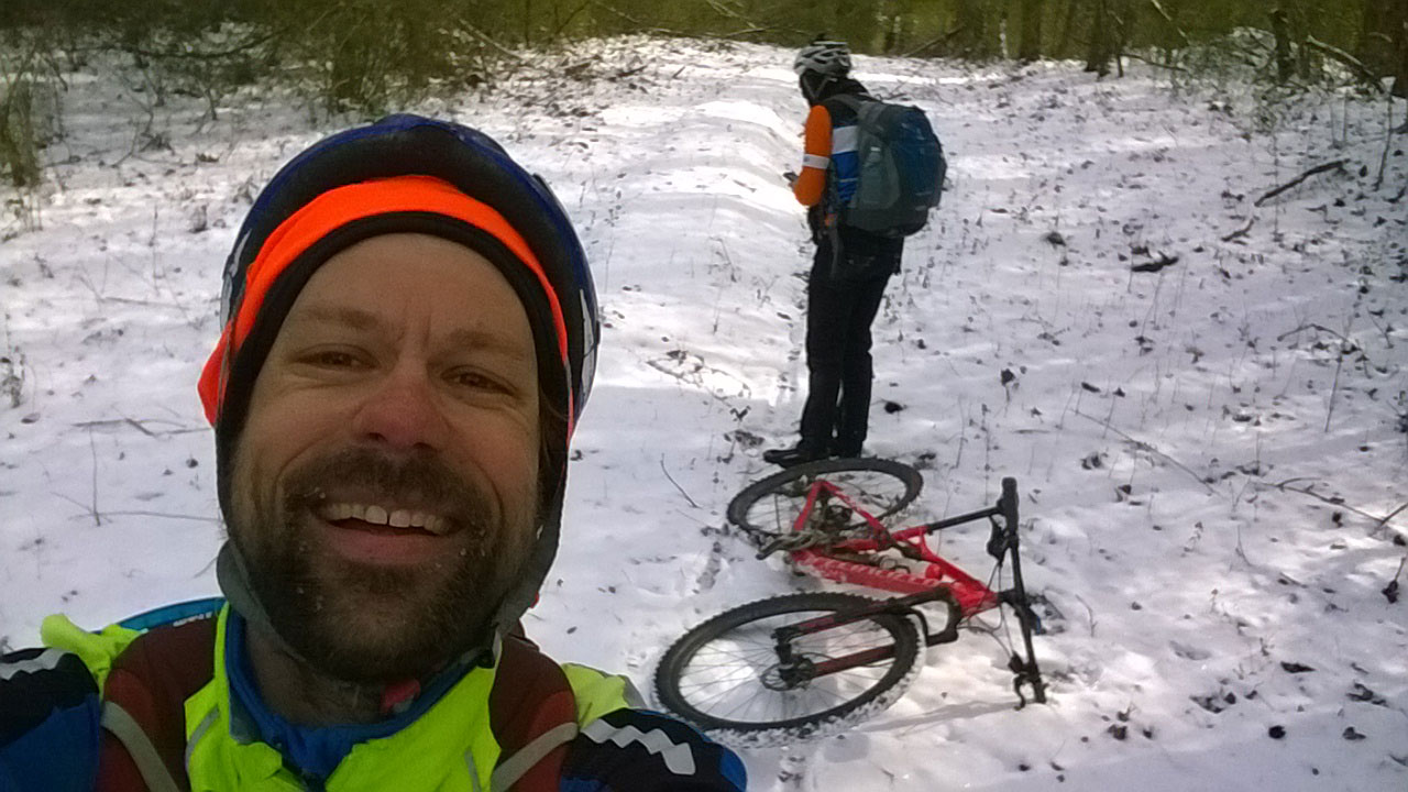
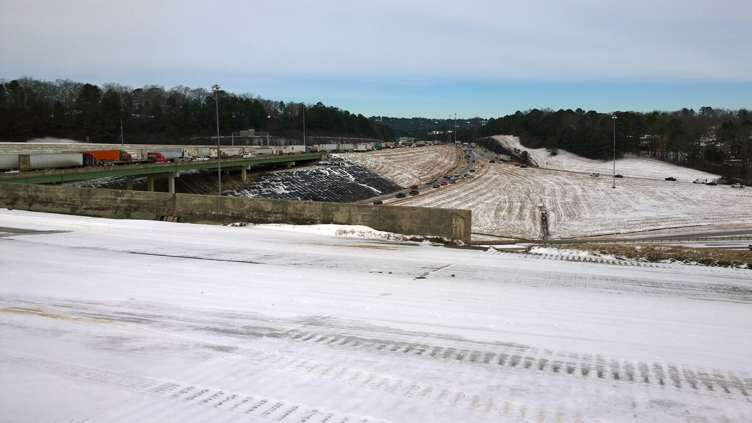
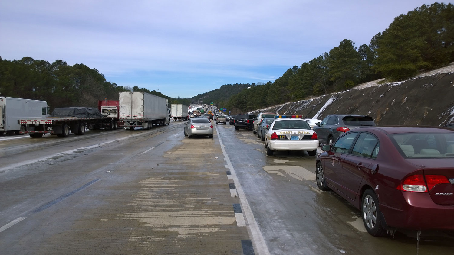
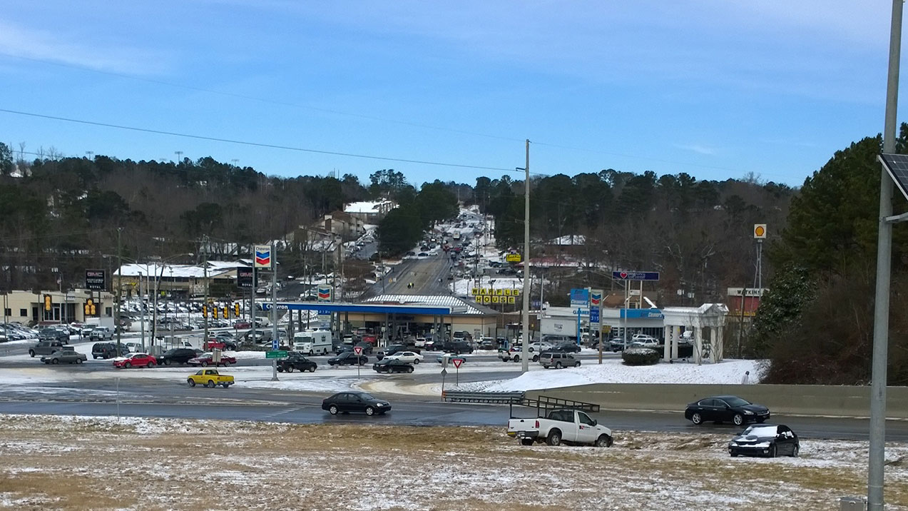
Mon, 1/27 @ 11:59AM – freeze warning. On this first day of the Spring 2014 semester at Samford, I bike into work, teach three classes, and then bike home in beautiful weather with temps around 50 degF. Everyone knows it is going to get really cold Monday night. This is the Wild Forest apartment entrance hill at Brookwood Medical Drive halfway up the Hwy 31 hill.Mon, 1/27 @ 12:40PM – winter olympics mountain goats. I bike by these mountain goat statues on most of my commutes to/from work because it is near the highest point on Shades Mountain. There are five mountain goats that the homeowners arrange around the yard doing various things throughout the year. This ski-jumping mountain setup is in honor of the winter olympics, and by the time we ride by there again on Tuesday, they have the Olympic rings and one more goat in the setup.Tues, 1/28 @ 7:23AM – cold walk to school. Analise wakes up sick and stays home with Kristine, so I walk Josiah to school. It is very cold and windy, but no flurries. Our expectations at this point are that we might see a few flurries sometime during the day.Tues, 1/28 @ 7:31AM – frozen tracks. How cold is it? After temps in the 50s the day before, my bike tracks in the mud behind the school are frozen solid with temps in the low teens.Tues, 1/28 @ 9:14AM – it’s snowing! I head out to work, but before leaving holler back up to Kristine and Analise that there are some snow flurries falling. I spend a couple minutes trying to take a picture that shows the flurries. As you can see, I was unsuccessful.Tues, 1/28 @ 9:34AM – snowflakes! After a loop around the South Cove neighborhood, the snow is really starting to pick up. I stop to try to get a picture of the flurries thinking that this is probably the heaviest snow I will see on the way into work and I’d better document it as proof. I was hilariously wrong.Tues, 1/28 @ 1:41PM – hwy 31 closed. When I make it across the top of Shades Crest, I notice that Vestavia has closed off the 1.1 mile Hwy 31 descent.Tues, 1/28 @ 1:54PM – walking south on US Hwy 31. – when I see that Hwy 31 is closed and after my experience with a deserted Hwy 280, I decide that the best way home for me is to simply take Hwy 31 south. I’m cold so I don’t stop to take many pictures on the way down, but when I stop to take this pic of all the abandoned cars I ask the lady half in the picture how far she has been walking. She tells me that she left Mountain Brook a while ago, made her way to Lakeshore, and then up Hwy 31 all the way to this spot just past the Ruby Tuesday’s. The cars climbing the hill on Hwy 31 north are all abandoned. 1:54PM, 3 hours after it first started to snow.Tues, 1/28 @ 2:13PM – I-65 intersection at US Hwy 31 and Columbiana. Having made it all the way down Hwy 31 to the I-65 intersection, I encounter another scene of gridlocked traffic. To advance from this spot to Lorna, I have to ride the cement median all the way past the bridge. You can see in this pic that some cars have tried that as well.Tues 1/28 @ 2:23PM – wisteria hill at rocky ridge rd. My outbound route from home included this intersection of Wisteria and Rocky Ridge a few hours earlier when the first snow flurries had started falling so sporadically that I could not even get a picture of them. By the time I make it back to this spot, I have ridden over 30 miles and encounter yet another scene I would never imagine seeing, especially so close to my house. It’s not really that dramatic with a small multi-vehicle pile-up and a car sliding off the road into some bushes, but nevertheless if you had asked me a couple hours earlier what an unexpected snow storm mid-morning would do to this intersection, I would not have predicted or even imagined this.Tues, 1/28 @ 9:54AM – heavy flurries. By the time I make it to the Green Valley roller coaster at the base of Bluff Park, it is snowing much harder and making the streets wet. I start to treat the ride and corners the way I would on a rainy day.Tues, 1/28 @ 9:56AM – snow line. About 200 feet up from the valley floor on the Laredo climb into Bluff Park, I see a well-defined elevation line where the snow is sticking to the roads.Tues, 1/28 @ 2:12PM – Looking south onto the I-65 ramps. I talk to the man in the foreground and find out he has just walked here from the interstate where his car had spun out and crashed into the median. We both nervously laugh at the situation and blown weather forecast, already a bit in shock at the complete chaos/gridlock. I-65 north is stopped at the foot of Shades Mountain blocking the on-ramp backing up to Hwy 31 and partially blocking it as well.Tues, 1/28 @ 10:01AM – first snow tracks. As I climb farther, the snow is getting thicker and I attempt to get a picture of my tracks in the snow. Somewhere through here I begin thinking “this is definitely more than flurries and more than a dusting”, maybe 1/2 inch of accumulation at this point.Tues, 1/28 @ 10:21AM – beard ice. By the top of Shades Crest, I can feel my beard growing icicles. As I am waiting for traffic to clear, I take a pic still thinking that the snow will stop and that my ice beard will melt by the time I make it into work. I still haven’t realized what is unfolding, partly because I’m having absolutely no problems with traction on my road bike.Tues, 1/28 @ 10:21AM – traffic trouble. At Alford Avenue, there is a LOT of traffic moving very slowly. As I approach the stop sign, there is a Hoover cop waiting to turn left, but he gives up and goes right. I am eventually able to make it out when this tanker blocks traffic to turn into the gas station. At this point, I still have amazing traction on my road bike even coming into the stop sign, making turns, etc… Not a single tire slip, so I don’t understand why there is so much traffic and why everybody is driving so slow. I was about to find out why.Tues, 1/28 @ 10:29AM – spinout. As I approach Shades Mountain Baptist Church, I notice a Vestavia Hills police officer blocking off the Canyon Rd rollercoaster. At the church, there is a huge line of people trying to pick up kids from preschool. A minute or two later as I approach the cars in this picture, they aren’t moving. The jeep then pulls around the Mercedes convertible, who is spinning his tires and going nowhere. At this point, I realize that there is a problem and things are probably going to get worse. I’m still worried about being on time to class because Samford has not cancelled classes. I take this picture and one more while riding past the Mercedes.Tues, 1/28 @ 10:41AM – icy fall. Trying to get down to a platform for a better view of the fire damage, I step down onto these steps without examining them closely. As soon as my foot hits the top step, it slips out from under me. As if in a cartoon, I slide all the way down to the bottom. These steps are coated with about 1/4 inch of solid, clear, smooth ice from the firefighting the night before and then the strong north wind all night and all morning.Tues, 1/28 @ 11:07AM – cherokee rd waiting! Decision time, I have to decide whether to cut through this office or the next one which has a fortress gate. The cars in this picture are stuck waiting and unable to leave because of the SUV unable to make it up the hill around the corner.Tues, 1/28 @ 11:07AM – cherokee rd stuck! As I approach these cars from the other direction (coming down the hill), the SUV is spinning his tires and sliding sideways trying to get up the hill. He’s got his window down so I roll up slowly and ask if I can get by real quick. He waits for me to pass before trying again. I turn around and snap this picture once I make it past the line of cars waiting to see if the SUV will make it.Tues, 1/28 @ 11:10AM – cherokee rd bike tracks. The snow past the office is mostly undisturbed. It is getting quite deep (at least an inch) by this point, and I’m surprised that I still have such good traction. As I approach the fortress gate at the bottom of the hill, I talk to one of the employees leaving to let him know about the traffic jam just up the hill at the next office lot. He kindly opens the gate for me saving me from having to negotiate the path through the woods to detour around the gate with some pretty severe gradients that would be tricky in the snow.Tues, 1/28 @ 11:07AM – cherokee rd stuck! As I approach these cars from the other direction (coming down the hill), the SUV is spinning his tires and sliding sideways trying to get up the hill. He’s got his window down so I roll up slowly and ask if I can get by real quick. He waits for me to pass before trying again. I turn around and snap this picture once I make it past the line of cars waiting to see if the SUV will make it.Tues, 1/28 @ 11:21AM – brookwood hospital trouble. Already cars are starting to have trouble on this hill leading up to the hospital.Tues, 1/28 @ 1:59PM – US Hwy 31 at walmart grocery. When I make it farther down the hill around the bend, I start to be concerned for my own safety as cars are now trying to climb the southbound side of the highway heading north at the same time as cars behind me are driving down the hill south way too fast.Tues, 1/28 @ 11:22AM – near disaster. After taking a picture of the Brookwood hill, I notice there is a car and a person at the edge of the super steep embankment leading down to Little Shades Creek from Highway 31. Looking back at this picture later, I notice that my camera’s auto-focus has picked up on the snow which is intriguing to have so many falling snow flakes in focus with the background blurry. Also, I notice that the snow has accumulated on the drainage ditch highlighting a path I’ve taken down the hill before.Tues, 1/28 @ 11:22AM – near disaster. After taking a picture of the Brookwood hill, I notice there is a car and a person at the edge of the super steep embankment leading down to Little Shades Creek from Highway 31. Looking back at this picture later, I notice that my camera’s auto-focus has picked up on the snow which is intriguing to have so many falling snow flakes in focus with the background blurry. Also, I notice that the snow has accumulated on the drainage ditch highlighting a path I’ve taken down the hill before.Tues, 1/28 @ 11:28PM – frosty professor. As I ride past the line of cars trying to leave campus (classes have just been cancelled), several of my students and a couple colleagues roll down their windows to say hi. Brian and Matt are carpooling together, and I ask Brian to take this picture of me with the longest “beardcicles” I’ve ever had in Alabama. This is usually a Wisconsin phenomenon!Tues, 1/28 @ 11:32AM – internal traffic. Lakeshore Dr is backed up so badly that traffic cannot even leave the parking lots on the Samford campus.Tues 1/28 @ 6:37PM – Back to school. Kristine heads out wearing my bike light for one more trip back to school to pick up more kids whose parents have called and are unable to make it home from work. Some of them are teachers at other schools who are spending the night with their students at school. Others are simply stuck, unable to make it home.Tues, 1/28 @ 11:32AM – large snowflakes. By the time I make it to Russell Hall on campus, large snowflakes are falling quite heavily.Tues, 1/28 @ 12:39PM – russell hall plaza snow. I set my bike outside for the Garmin to adjust to the temperature while I put my bike shoes and winter shoe covers back on. Note the amont of snow that has accumulated, maybe 1.5 inches at this point with still more to come.Tues, 1/28 @ 12:43PM – Lakeshore Dr at Samford University looking east. As I leave campus, I snap these two picture of Lakeshore Dr. This picture is facing east towards Hwy 31. Lakeshore Dr is not moving so that internally in Samford, traffic has backed up completely around the school. One of my students has already made it onto Lakeshore just out of frame on the right side of the picture. I say hi to him now and then later find out it took him two hours to make it the one mile from this spot to the next light where he parked his car to walk up the hill.Tues, 1/28 @ 12:44PM – Lakeshore Dr at Samford University looking west. I go out the entrance (instead of the exit) to make it down to this point. No need to wait for the light as nobody is moving anywhere! I ride down the embankment on the other side of the cars on the left of this picture to the Lakeshore Trail where foot traffic has started to pick up.Tues, 1/28 @ 12:49PM – Old Montgomery, Lakeshore Dr, and the Lakeshore Trail intersection. Cars unsuccessfully try to make it up the hill to the Lakeshore Foundation rehab center just past the light. I am thinking “Where are they going to go? Lakeshore is a parking lot. There is no place to go.”Tues, 1/28 @ 12:49PM – the Lakeshore Trail. The Lakeshore Trail bike path has no traffic on it except for foot traffic. Footprints are starting to make the riding a bit difficult, although in this picture it is hard to see them as my phone camera’s auto settings don’t handle snow consistently well.Tues, 1/28 @ 1:03PM – US Hwy 280 at Lakeshore Dr. I arrive at 280 from the office park on the left. I am so focused on getting up the 18% hill out of the parking lot that I don’t realize 280 is completely stopped until I make the turn and realize that nobody is able to make it up the hill. At this point, the line of cars is probably all the way back into downtown several miles away assuming that people can still make it over Red Mountain. This is the lowest spot where US 280 crosses Shades Mountain separating Homewood and Mountain Brook from Hoover, Vestavia, Chelsea, Pelham, Alabaster, etc… The gradient in this picture is about 10%. This is where I start to video holding my phone in one hand heading up the hill. http://youtu.be/ZlKTOy0J8WITues, 1/28 @ 1:03PM – US Hwy 280 at Cherokee Rd. This is another defining moment. An ambulance spins out and struggles up the hill with a paramedic and a bystander behind it pushing it up the hill. People are abandoning their cars, while others try to get around. This is the spot where I started videoing heading up the hill. http://youtu.be/ZlKTOy0J8WITues, 1/28 @ 1:07PM – US highway 280 abandoned top of pass. By the time I make it past the ambulance, the only thing left is people walking down a three lane highway with no cars visible in either direction. This is at the high point by the water treatment plant.Tues, 1/28 @ 2:23PM – rocky ridge downhill. There are no sidewalks on Rocky Ridge Rd. Nobody walks here. That alone should caption this image, but as I stop in the middle of the road to take a picture I am trying to process what is happening while simultaneously figuring out how to get through the mess to my house. Kristine has called me while I was on Hwy 31 to ask me to get home as soon as possible to watch the kids which have accumulated at our house so she can make another trip back to school to pick up more kids whose parents have called us knowing barely 4 hours after the snow first started that they will not be able to make it to school. The kids in this picture are probably from Rocky Ridge. Their parents made it to school to get them and then part of the way home before getting stuck. Now they are walking the rest of the way home.Tues, 1/28 @ 2:25PM – rocky ridge rd wisteria hill. I stop on Rocky Ridge Rd looking back up the hill. These people have given up and are walking towards home. Abandoned cars are off the road in a small ditch on the right, other cars still try to make it on the left. Cars line up behind at the top of the hill waiting to see what happens.Tues, 1/28 @ 2:26PM – little shades creek hill rocky ridge rd. Just a little bit farther down the hill, I stop again to capture the scene of cars waiting in line to try the hill climbing up from the Little Shades Creek bridge. The white car has given up and is about the make a 3 point turn in front of me. After he turns around, I ride the left shoulder across the bridge and switch into the grass to get more traction. The road is already getting quite icy at this point.Tues, 1/28 @ 2:12PM – Looking south onto the I-65 ramps. I talk to the man in the foreground and find out he has just walked here from the interstate where his car had spun out and crashed into the median. We both nervously laugh at the situation and blown weather forecast, already a bit in shock at the complete chaos/gridlock. I-65 north is stopped at the foot of Shades Mountain blocking the on-ramp backing up to Hwy 31 and partially blocking it as well.Tues, 1/28 @ 2:45PM – tracks on the hill. Looking down our hill at Josiah ski tracks, my bike tracks from riding up the hill, and kids playing in the snow.Tues, 1/28 @ 2:46PM – frozen wheels. During the time that I am playing with the kids, the slush that had accumulated on my ride home freezes both wheels in place. I have to carry my bike down the driveway into the garage as it is impossible to turn either wheel. I think to myself, “I’m glad I didn’t stop at any one spot for any length of time on the ride home or I would have been trying to figure out how to break the wheels free from the ice.”Tues, 1/28 @ 9:42PM – city-wide sleepover. People sleep in their offices. Kids sleep at schools. At our house, we have a sleepover with stranded kids whose parents cannot make it to Rocky Ridge Elementary. Over 200 kids spend the night at Rocky Ridge as do 4300 other students across the entire Hoover school system.Tues, 1/28 @ 10:41AM – army national guard and fire damage. Not a great pic and certainly not worth the fall all the way down the steps, but this is looking towards the fire. Even with some of the dramatic pics from the fire, the damage was mainly constrained to underlying brush and it looks like the trees survived OK thanks to the quick work of Homewood and Vestavia firefighters.Tues 1/28 @ 6:37PM – Back to school. Kristine heads out wearing my bike light for one more trip back to school to pick up more kids whose parents have called and are unable to make it home from work. Some of them are teachers at other schools who are spending the night with their students at school. Others are simply stuck, unable to make it home.Tues 1/28 @ 10:43AM – hwy 31 starting to stall. Even at this point only an hour or so after the snow first started to fall, cars are struggling to get up Hwy 31. You can see a pileup at the sharp bend at the bottom and a shuttle bus off the side of the steep exit ramp. Also, the second cars heading up the hill are moving (I have a sequence of pictures showing them in different positions) but the first car is turned sideways from starting to spin out.Tues, 1/28 @ 1:11PM – shades crest hill. When I turn onto Rocky Ridge, I am confused at the pile of cars on the left of the picture and in disbelief at the ATV in the upper right of the picture sliding sideways down the hill directly towards the SUV in the ditch. The white SUV is having no problems just ahead of the SUV. My hand is freezing cold, and I have just put my glove back on after videoing my ride on Hwy 280. I cannot will myself to take my glove off again to switch the camera back to video mode to capture the ATV correcting his slide to make it down the hill successfully. Note that in addition to the black SUV halfway down the hill, there are a total of four other cars that have ended up off the side of the road on the other side of the trees. Tues 1/28 @ 11:18AM – Brookwood cliffs. As I ride behind Brookwood mall next to the cliffs, I am absolutely frozen but I stop to take pics of the icicles and the snow accumulating on the cliffs.Tues 1/28 @ 10:52AM – stranded family. As I approach the fire engine blocking the road from the opposite direction, I see a mother and a very young baby walking around unsure of where to go. I stop to make sure that she gets in the fire engine and snap one picture. My tracks are visible in the sidewalk. The lady’s SUV and its tracks are visible having spun out and unable to make it any farther up the hill.Tues 1/28 @ 10:53AM – top of shades crest. Just behind the fire truck is this scene. I try to help the lady in the SUV shown here and tell her the best course is probably to drive through the yard in front of her. She wants to get permission from the owner of the house, but as she steps out of the car she slips and falls. She laughs about it and gets right back up, but that gives you an idea of how slippery the roads have gotten after less than an hour of light to moderate snow.Tues 1/28 @ 11:03AM – Smyer Rd. As I descend Smyer Rd, I decide I want to get a picture of the road covered in snow. This is one of the most beautiful roads in Birmingham – with a few switchbacks, heavily forested, lined by a very old retaining wall. In 2004, a landslide caused by Hurricane Ivan wiped out a section of road about 3/4 of the way up. This section is just past the landslide area and is a bit more picturesque.Tues, 1/28 @ 12:35PM – office warmup. By the time I make it to Samford, I am absolutely frozen having been out in temps in the mid teens for over 3 hours. I have a space heater in my office, so I put my shoes, shoe covers, and gloves in front of it to warm them up for the return trip while I instagram pics that I have taken on the way into campus.Tues, 1/28 @ 2:45PM – bike parking. I park my bike against the car in the street while playing with the kids in the snow.Tues 1/28 @ 2:47PM – ride stats. I take a picture of my ride stats for my commute – 4 hours 24 minutes (not counting the hour-long stay at Samford to warm up), 33.7 miles, with temps in the teens for most of the day barely warming up to 20 degF by the time I make it back. The max speed occurred on one of the steep downhills at the very beginning while it was still only just starting to flurry and the streets were not even wet yet. I spent a lot of time barely moving and soft pedaling, so the average power is about right, but the heartrate is a bit higher than it should be for such a low average speed and wattage. I’m pretty sure this was caused by a combination of stresses: wondering if I’m going to fall, mental effort picking out a route through the snow and ice, being surprised and shock at what I’m seeing, and battling the cold temps.Tues 1/28 @ 2:58PM – walking home from school. Kristine walks in the middle of a group of kids walking home from school. The kids are happy as clams to be playing in the snow. Another parent walks with his dog towards school to pick up their kids.Tues 1/28 @ 5:42PM – rocky ridge rd ice skating rink. Rocky Ridge Rd was ridiculously slippery by the time night begins to fall. Here a car has slid off the road. Just out of frame are several cars abandoned on the side of the road. I talk with one of the drivers leaving his car asking him what his plan is. As we are talking, a jeep wrangler comes flying by way too fast. The guy I’m talking to comments that too many people think their 4WD truck can handle it and end up in the ditch. Here is a great picture of this phenomenon a friend of mine posted to Facebook from live news coverage Tuesday afternoon: Ballantrae truck/SUV pileup. This neighborhood is so steep, though, that probably only trucks attempted the climb, which is why you don’t see any cars.Tues 1/28 @ 5:51PM – Vestavia Hills High School. The high school sits halfway up Little Valley Mountain – about half a mile from this picture of the Morgan Dr bridge over Little Shades Creek. There were at least 20 high school students milling about the store. Unable to leave the high school to get home, they had walked down the hill to get some food.Tues 1/28 @ 5:53PM – Milk! I’m not sure what I’m going to find when I make it back to the milk section, but it certainly isn’t this! This picture actually says a lot about how this storm has caught everyone by surprise. There should not be any milk visible in this picture. Of note, all the 2% milk is gone (actually, now that I look at this picture, I think the milk on the very far left with the red cap is 2% … doh!!!)Tues, 1/28 @ 5:58PM – milk and cinnamon rolls. With the extra kids at the house, our half gallon of milk isn’t going to cut it so I head out to the grocery store on my mountain bike loading up my bag with a gallon of milk and eight cinnamon rolls from the bakery.Tues 1/28 @ 6:08PM – icy blueberry lane. As I head out of the neighborhood, I encounter unrideable sections of Blueberry Lane coated in solid ice. To pass this section, I ride through the yard on the left where you can see all the footprints of people walking … people unable and/or unwilling to walk anywhere near the crazy slippery road. I took this picture on my return trip after making it successfully to the grocery store to get milk.Wed, 1/29 @ 8:03AM – first flipped car. I only have to ride 1/2 mile from my house to stumble (almost literally) upon the first flipped car. Rocky Ridge Rd was so icy that I walk stretches of it. I am trying to ride down the middle of the road where there is a little bit of snow (and traction), but graviity pulls me across to the side of the road onto the shoulder where I am completely shocked to be staring at this car in front of me. This moment is recorded 7 minutes and 50 seconds into this video: http://youtu.be/31u73UqPQ4A. I park my bike alongside the sign and run down to the car just to make sure nobody is still in the car (i.e., in case it had just happened while I was biking down the other side of the hill). Nobody is inside, but the contents of the car are strewn everywhere.Wed, 1/29 @ 8:06AM – wisteria pile-up. At the Wisteria intersection just up the hill from the flipped car, I observe that the Wisteria pileup has stayed about the same except there are a few more cars that have parked alongside and presumably walked rather than trying to drive any farther.Wed, 1/29 @ 8:15AM – first view of I-65. The bridges shown here cross Wisteria Rd. I climb onto the interstate via the cement ramp under the bridges. I am shocked by what I see – completely stopped traffic on I-65 northbound and a completely empty interstate on I-65 southbound. The moment of me taking this picture is recorded at about 19 minutes into this video: http://youtu.be/31u73UqPQ4A.Wed, 1/29 @ 9:12AM – ice skating. Boris and I decide to head south on I-65 all the way down to AL-119 to buy more water and food at the gas station to hand out to drivers stuck on I-65 north. When we exit the freeway, we discover rather quickly that the ramp is unrideable and head to the shoulder. Just how slippery is it? check out this video of Boris sliding on it – http://youtu.be/KqBRt_vA2z4Wed, 1/29 @ 9:24AM – I-65 northbound on ramp at AL-119. While Boris fields a phone call, I take a picture of the on-ramp. Several cars try to make it up and are unsuccessful while I am waiting. The black car in this picture does not make it and is either currently backing up or about to back up all the way back down. We talk to the driver and recommend he take Hwy 31 as the gradients are shallower and I-65 is parking lot just beyond the hills in this picture. One pick-up truck does makes it almost all the way up the ramp before spinning out. He then puts it in reverse and goes back down the ramp a small distance to a well-placed 3 foot diameter pile of dirt that somebody has bought, opened and dumped onto the ramp near the top. This gives the truck traction to accelerate with enough momentum to coast up the rest of the hill. We cannot figure out how the tractor-trailer ended up in this position.Wed, 1/29 @ 9:24AM – I-65 northbound on ramp at AL-119. While Boris fields a phone call, I take a picture of the on-ramp. Several cars try to make it up and are unsuccessful while I am waiting. The black car in this picture does not make it and is either currently backing up or about to back up all the way back down. We talk to the driver and recommend he take Hwy 31 as the gradients are shallower and I-65 is parking lot just beyond the hills in this picture. One pick-up truck does makes it almost all the way up the ramp before spinning out. He then puts it in reverse and goes back down the ramp a small distance to a well-placed 3 foot diameter pile of dirt that somebody has bought, opened and dumped onto the ramp near the top. This gives the truck traction to accelerate with enough momentum to coast up the rest of the hill. We cannot figure out how the tractor-trailer ended up in this position.Wed, 1/29 @ 9:50AM – snowy trail. Boris checks his phone for messages while I snap this picture. We have just followed a hidden access trail off the interstate at the Cahaba River bridge. The trail goes under the I-65 bridge and then all the way down to the Cahaba River. I cannot tell if it is leftover from construction work as it does provide a way of making a u-turn to head southbound on I-65 or if it predates the construction and widening of the interstate that was finished last year.Wed, 1/29 @ 9:52AM – bunny tracks. Following a side trail, I notice these bunny tracks heading towards the woods behind Riverchase Parkway.Wed, 1/29 @ 10:36AM – tractor trailer ice skating. None of the tractor trailers in this picture of the I-459 interchange are moving. The stuff you see on the roads is crazy slippery ice, impossible to ride or walk on. We have to navigate carefully to get to this point. This is the first picture I take after we spend nearly an hour between Old Rocky Ridge Rd and this spot handing out food, talking to people who have been in their cars and trucks for close to 24 hours, and letting them borrow our cellphones to make phone calls. A dollar general truck tries unsuccessfully to make it up the ramp here: http://youtu.be/Ufsg825mdtMWed, 1/29 @ 10:38AM – I-65 northbound at the I-459 interchange. We cross over and under I-459 here with a creative route that never actually involves touching the interstate other than the ramp in the foreground here. All the cars on the I-65 on ramp are abandoned with a couple cars completely blocking the ramp towards the middle. Here is Boris navigating part of the interchange – http://youtu.be/JrN3rvzfEcwWed, 1/29 @ 10:38AM – I-459 empty. Strangely, I-459 is mostly empty. The cars on it are driving fast with no problems. Apparently there is no easy way to access this stretch of 459 from either direction, though, or there would be more cars and trucks.Wed, 1/29 @ 11:05AM – welcome to the apocalypse! By this point, the roads are starting to melt and the middle two travel lanes are moving very, very slowly (0-1mph). But the melting ice makes what is left even more slippery. Instead of solid ice, you now have a thin layer of water on top of solid ice. Boris and I both pick are way very slowly between all of the abandoned cars in this picture and almost fall several times. Every car on the shoulder or in the right travel lane in this picture is abandoned all the way past the hill to the Hwy 31 exit out of sight. Our ride through this is recorded here: http://youtu.be/NDT8zeDPoMkWed, 1/29 @ 11:47AM – police chaining up. We take a different route to Columbiana – the I-65 climb to Alford Avenue and then across Shades Crest to this intersection with Columbiana. We arrive as a police officer puts chains onto his car. You can see the temporary barriers in place to prevent people from trying to go down the Columbiana Hill towards Lakeshore Dr.Wed, 1/29 @ 11:17AM – columbiana blockage. When we finally make it back to Hwy 31, we see an incredible view looking up Columbiana with cars turned sideways and/or parked in the middle of the road.


Leave a Reply