Seven and a half years ago today, Kristine and I got married in a beautiful little town called Shell Lake followed by our wedding reception about 45 minutes away even further north into the northwoods of rural Wisconsin at a retreat center called the Schwan Center. Today, I biked from Shell Lake 32 miles up through the snowy backroads and snowmobile trails arriving to meet Kristine, her parents, and our kids for a short mini-vacation at a cabin in the same conference center where we had our reception. Here’s a recap of today’s adventure mountain biking on snowy roads and trails in very rural parts of Wisconsin.
[youtube=http://www.youtube.com/watch?v=1RE-oGB35TA&fs=1&hl=en_US]
The basic story of the ride is that the roads got snowier and snowier as they became more rural. My Garmin worked great, but the route I had planned ahead of time didn’t upload correctly to the device so I had to stop every now and then at an intersection to figure out which way to go. I just generally had to head north though, so it was fairly easy to navigate by the setting sun. Some of the roads were really easy to ride on because the snow was hard packed, but other roads which saw a lot of snowmobile and car traffic had really loose snow that was hard to ride on. I think you can tell by the graphs below the location of the most difficult roads by the spots where my speed and heartrate are lowest.
The graphs below are all screenshots from my Garmin data: http://bit.ly/hPSb0r
 Route map – aerial view – look at all the lakes!
 Garmin speed data – note the lowest speeds on the second half of the ride
 Garmin heartrate data – low sections corresponding to low speeds

Lots of deer tracks in a field next to County Rd N

Beyond County Rd N, road getting snowier

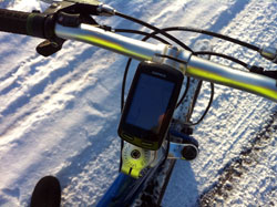
Garmin bike navigation on the mountain bike in the snow

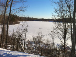
Frozen lake with beaver or river otter holes in the ice

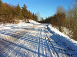
Snowy roads, some good snow, some loose snow, the trick is finding the right snow

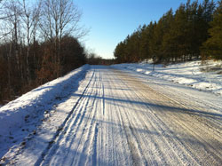
Looking the other way on the same road.

Pear lake – frozen with ice fishing house, snowmobile trails

Up close view of my mountain bike after the ride
Lastly, here is a video I took towards the end of the ride crossing the Namakogen River on State Hwy 77. If you easily get motion sickness, you may not want to watch!
[youtube=http://www.youtube.com/watch?v=NRMvdPz2VVU&fs=1&hl=en_US]
 Garmin temperature data – much warmer today than Sunday – still below freezing pretty much the entire ride!


Leave a Reply