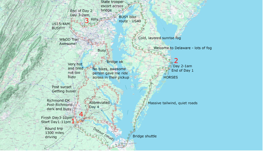
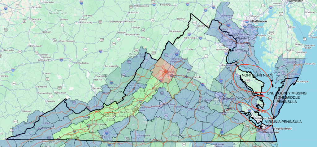
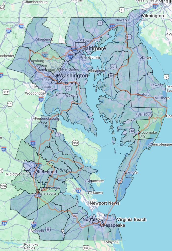
What an adventure! I had planned a three day, 780 mile loop starting in Petersburg, Virginia circumnavigating the entire Chesepeake Bay, including a traversal of the entire DELMARVA (Delaware, Maryland, Virginia) peninsula. Additionally, Day 4 would be a 275 mile inner loop starting and ending in Petersburg to explore the peninsulas on the western shore of the Chesepeake Bay. The 780 mile loop took longer than expected, so I trimmed down the “bonus day” (Day 4) to a 160 mile loop only making it out onto one of the three main peninsulas on the western side of the bay. The annotated map below shows “planned” vs “actual” along with a few of the highlights of the trip.
TLDR Summary

Day 1 – Petersburg, VA to Ocean City, MD
256mi, 3927 feet of climbing
Fri 3/7 11:12pm EST-Sat 3/8 4:41pm EDT
378 vehicles, 1.5 veh/mi, 0.4 veh/minute
Amazing adventure overnight from Petersburg across the Chesepeake Bay Bridge Tunnel via a shuttle just after sunrise. Quiet roads up the Eastern Shore crossing into Maryland and being surprised by the Assateague Island wild horses near the end.
Day 2 – Ocean City, MD to Gaithersburg, MD
256mi, 7497 feet of climbing
Sun 3/9 1:07am EDT-Sun 3/9 7:25pm EDT
2059 vehicles, 8.0 veh/mi, 2.1 veh/minute
All three of Delaware’s counties in one day along the Mason-Dixon line overnight in a thick fog that dwindled to a cool layered fog by sunrise. Lots of traffic including getting escorted across one bridge by a Maryland state trooper (thank you!). Finished at my uncle’s house in Gaithersburg.
Day 3 – Gaithersburg, MD to Petersburg, VA
267mi, 11270 feet of climbing
Mon 3/10 1:40am EDT-Mon 3/10 10:12pm EDT
1651 vehicles, 7.4 veh/mi, 1.8 veh/minute
Rode 50+ miles of bike paths in VA/DC/MD during early morning rush hour before making it onto the Western Shore of Maryland where I spent most of the day. I hitched a ride back across the Harry W Nice Memorial Bridge (closed to cyclists during the week) over the Potomac River back into Virginia with an angel. Then I rode a lot of 600-level roads to finish a 780 mile loop around Chesepeake Bay making my way directly through Richmond around 9pm and to Petersburg by 10pm.
Day 4 – Hopewell, VA to Hopewell, VA
160mi, 4767 feet of climbing
Tue 3/11 8:33am EDT-Tue 3/11 7:28pm EDT
742 vehicle, 4.7 veh/mi, 1.2 veh/min
Shortened bonus day mainly covering the Middle Peninsula of Virginia’s three main peninsulas on the west side of Chesepeake Bay. Went inside a church from the 1700s. Saw an osprey carrying its dinner stationary against the wind. Finished 950 total miles of riding, packed up and drove 650 miles back home to Alabama.
Trip Summary
939mi, 27461 feet of climbing
59 hours, 46 minutes of riding over 4 days
4830 vehicles, 5.4 veh/mi, 1.4 vehicles/min
I also collected lateral passing data for the entire trip and front/rear facing video footage, which I am currently analyzing and will make a future post about soon!
Day 1 – Petersburg, VA to Ocean City, MD
This “day” started after a 14 hour, heavy traffic 650 mile drive from Birmingham, Alabama to Petersburg, Virginia. I-20 was closed on the west side of Atlanta from an accident/fire. After waiting 30 minutes and finally making it to the exit, I observed traffic coming back up the “on ramp” to the same exit. Still not sure what happened, but it meant the surface streets were busy, too. Then, the same thing happened again on I-85 outside Charlotte. Keep in mind, this was a SATURDAY!
Getting started: Parking, Parties and Quiet Roads
I started riding as soon as I made it to Petersburg, but it was an hour and a half later due to all the traffic. That was even with a last minute decision to leave an hour and a half earlier to start my drive from Birmingham. In other words the 650 mile drive took three hours longer than I had calculated.
In Petersburg, I had difficulty finding a good place to leave my car. There is one main “mall” area that has an old mall plus a Sam’s Club, Target, Walmart … it’s HUGE. Google Streetview showed lots of “No cars for sale” signs along the Walmart parking lot, but what I missed was all the “no overnight parking” signs scattered pretty much everywhere else. Well, I needed to leave my car for not one, not two, but THREE nights. I drove around the entire complex looking for a particularly deserted area and found it to the side of Target. As a bonus, there were no “no overnight parking signs” in that small section of the parking lot. Given the amount of debris in the parking spot I parked in, nobody had parked there in a long time.
The parking lot itself was pretty deserted, but the next parking lot over was full of activity with a bunch of cars and a couple tour busses and people everywhere. I’m assuming it was some sort of loading/unloading of the tour busses. One of the challenges of my kind of multi-day riding when I’m not starting from home is figuring out where to leave the car. It’s worked out for maybe upwards of 50 of these trips so far, but there will probably come a day where the car gets towed or broken into while I’m gone. Life is short.
I finally got started after 11pm, and since I was about 1/2 mile off my route, I got turned around a couple times trying to find my way out the back of the parking lot onto a bike trail that ran along the Appomattox River. There had been heavy rain earlier in the day, and there was sand/gravel all over the trail. Thankfully, I wasn’t on it for very long and popped out on a major thoroughfare right through downtown Petersburg and the neighborhoods southwest of town. There weren’t too many cars out, but there were lots of house parties I rode by with the music loud and food on the grill. It didn’t take long, though, before the roads were completely deserted. I would go many miles without seeing a car even though I was passing by a number of neighborhoods and houses.
One of the early surprises came after midnight when I was just riding along and then out of nowhere there was a tunnel. It went under a bunch of railroad tracks at a switching yard. After this tunnel, I didn’t see a single car for the next FOUR hours. I was on classic Virginia chip seal and made a million turns from road to road, but never hit dirt until about 2 hours in. Since it had rained a lot that day, it looked quite muddy and messy so I found a nice 20 mile detour that ended up adding on only a mile or two to the route going parallel to the original route, just a mile or two farther north.
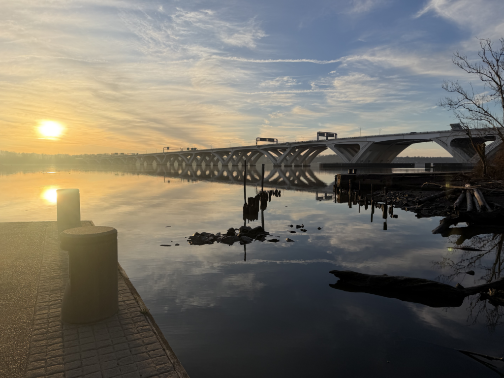
Not long before sunrise, my route dumped out onto US-58, which is pretty much an interstate, but not officially since there are a couple of level crossings. There was SO MUCH traffic. I got passed by 100 cars and trucks on a 15 minute stretch before I could make it to “Old” US-58 which paralleled the main highway the rest of the way into Chesapeake. I crossed a large, tall bridge from Chesapeake into a different populated area south of Norfolk just minutes before sunrise. I didn’t wait for the sunrise, given that I was trying to time my arrival to the Chesapeake Bay Bridge tunnel for the shuttle I had arranged at 8am and started nearly an hour and a half behind schedule. Thankfully the wind, which had been a light cross headwind most of the night, turned into a very strong tailwind from the south as I made my way north. I averaged well over 20 mph for the last 30 miles to the tunnel and was only 10 minutes late.
Chesapeake bay bridge tunnel shuttle
I had been given instructions over the phone to exit the freeway to the parking lot and walk my bike around the front where I could wait for the shuttle. It wasn’t busy and it looked like the door was locked so I walked over to the toll booth and asked the attendant where I should go. She said I could go inside the building as it was unlocked. I walked in, and immediately a police officer came out of the control room and asked if he could help me. I told him about the shuttle, and he said he would check on its location. He pointed towards a chair and a bathroom and said I could wait in here. It was a really good setup with a nice map and photos of the bridge area. Plus there was a good restroom, a water refilling station, and a chair to wait in. Also, there was a huge rack of servers that were all powered on across from the water fountain. I’m guessing those are for processing the video feeds for the constant monitoring they do over the 21 mile bridge/tunnel.
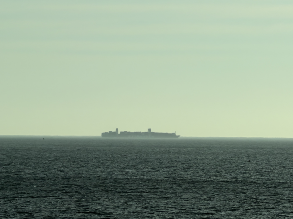
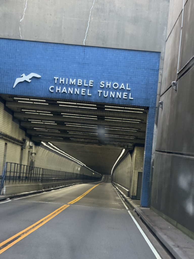
Only a few minutes after I arrived, the worker who was shuttling people across the bridge (cyclists, pedestrians, motorists who get stuck on the bridge) arrived back on my side of the bridge. She was friendly, and a co-worker and I heaved my heavy bike up into the back of the truck. After a little bit of rearranging (the bed of the truck was full of traffic cones), we were on our way. She was super friendly and we had a great convo on the 25 minute ride across the bridge. The sky was perfectly clear and bright morning sun. I took several pictures of large freighters and the sandy beach at an island we crossed. It has been several decades since the last time I crossed this bridge in a car (after a bike race in Hampton Roads). And prior to that, we had crossed it once when I was a young child visiting my grandparents outside of Charlottesville where I used to spend every summer. It seemed so much bigger and daunting as a young child. As an old man now, the bridge seemed much smaller.
Flying up the Eastern Shore
It has been decently warm overnight, and it was only an hour or two after sunrise by this point with the time change. Speaking of time change, that complicated things, too, but at least I would finally get to watch the clock tick from 1:59AM directly to 3:00AM while riding! Unfortunately, I was navigating some tricky roads at the time and even though I caught it at 1:58AM, I missed the switchover to 3:00AM by a few minutes, getting distracted by watching my lines on the road to avoid potholes and standing water, plus I was distracted by the general awesomeness of rolling under a clear sky / bright half moon.
Back to the bridge … after the worker dropped me off on the Eastern Shore, I spent a few minutes getting my radar and lateral passing camera setup for data collection. After getting ready to collect some good lateral passing data, I found myself on an amazing chip/seal deserted road where it was more than 49 minutes before the first car passed me. As I’ve frequently quipped to my wife, the best thing I can do for my own personal traffic safety is to come up with something new in my research where I need a car to pass me. This will pretty much guarantee that no cars will pass me for a long time — Murphy’s Law applied to bicycle passing research.
The road I was on was phenomenal with a massive tailwind. I easily made up the time I had lost from the slow, late start and was back on schedule. I was getting tired, though, after many hours without sleep and the roads started to get busy, too, as I crossed over into Maryland and got closer to Ocean City.
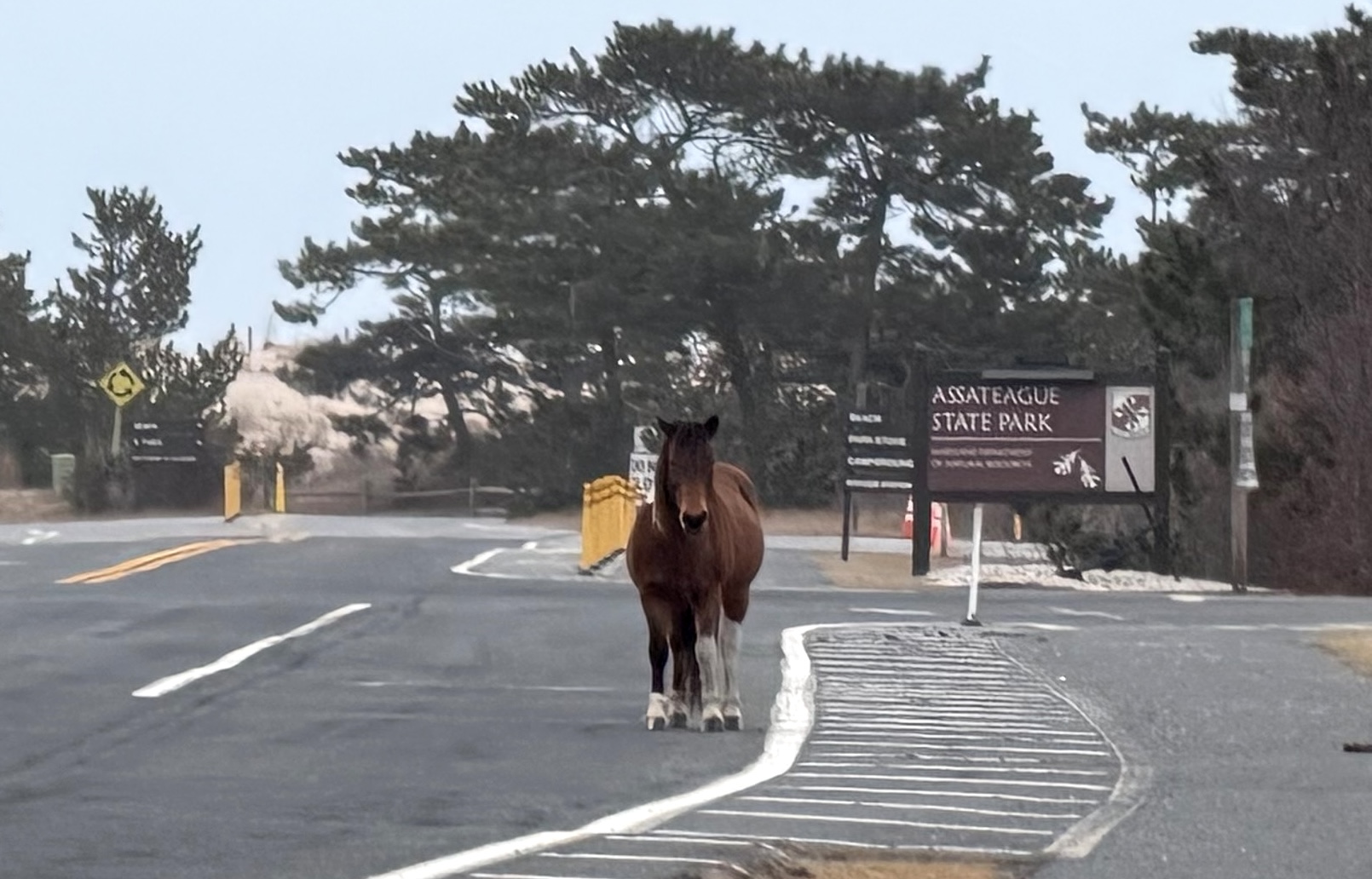
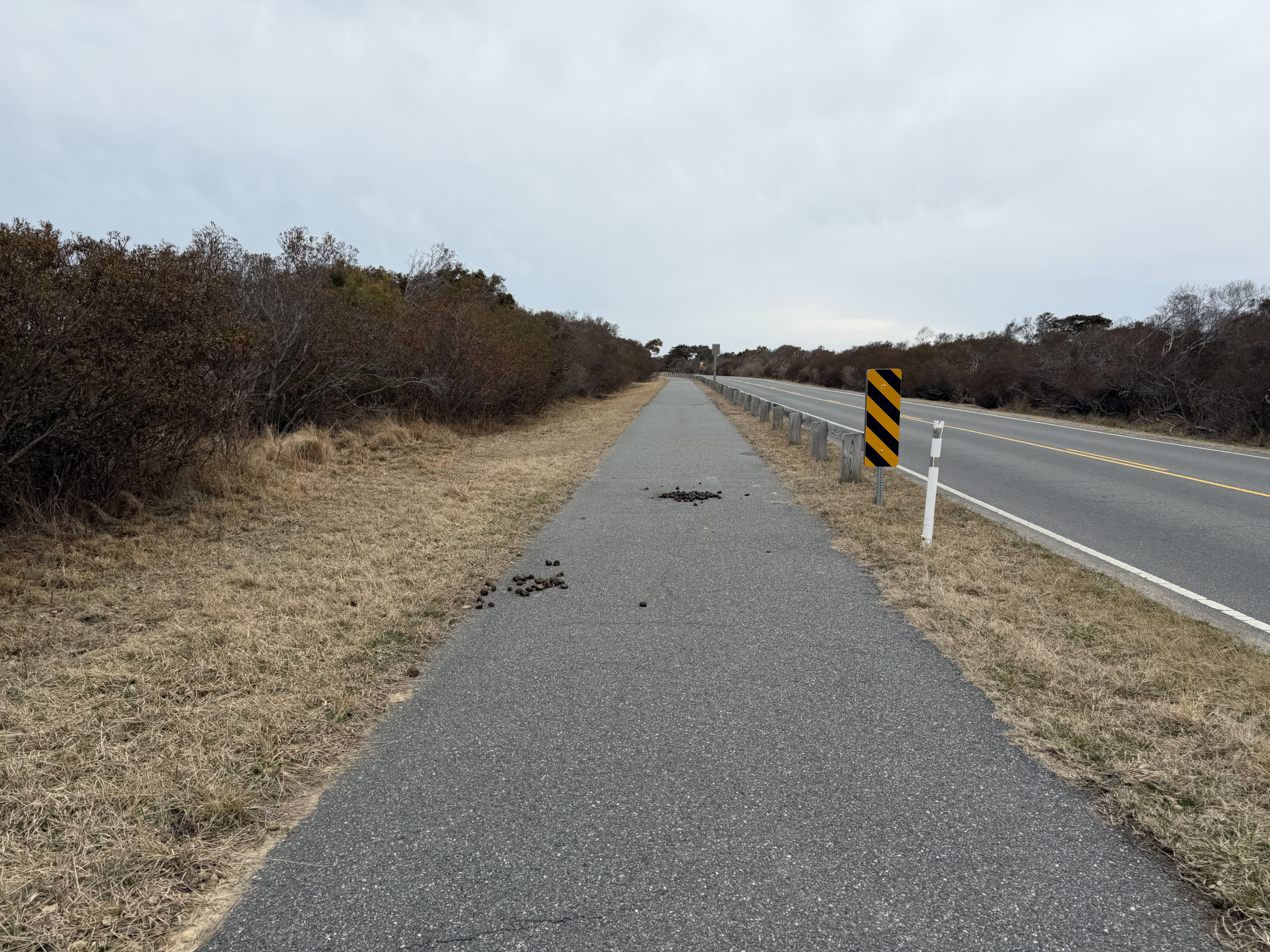
SURPRISE ENCOUNTER WITH THE ASSATEAGUE ISLAND HORSES
I had routed myself south onto Assateague Island instead of directly to Ocean City for a couple reasons: 1) I needed the extra miles for an Eddington 256 ride. 2) I was hoping to see the Assateague Island Horses. The weather had turned cold and it had started to rain as I made my way south towards the island. I thought about just turning around and calling it a day early. But I kept going anyway, especially since the family was wanting to see pictures of horses.
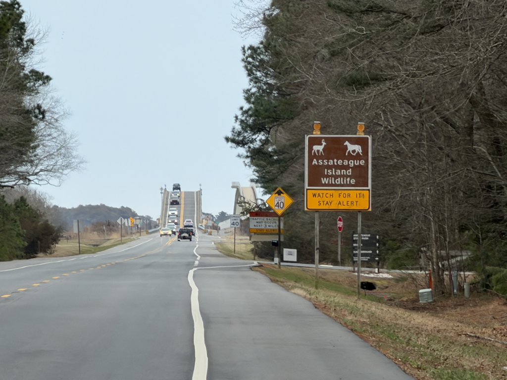
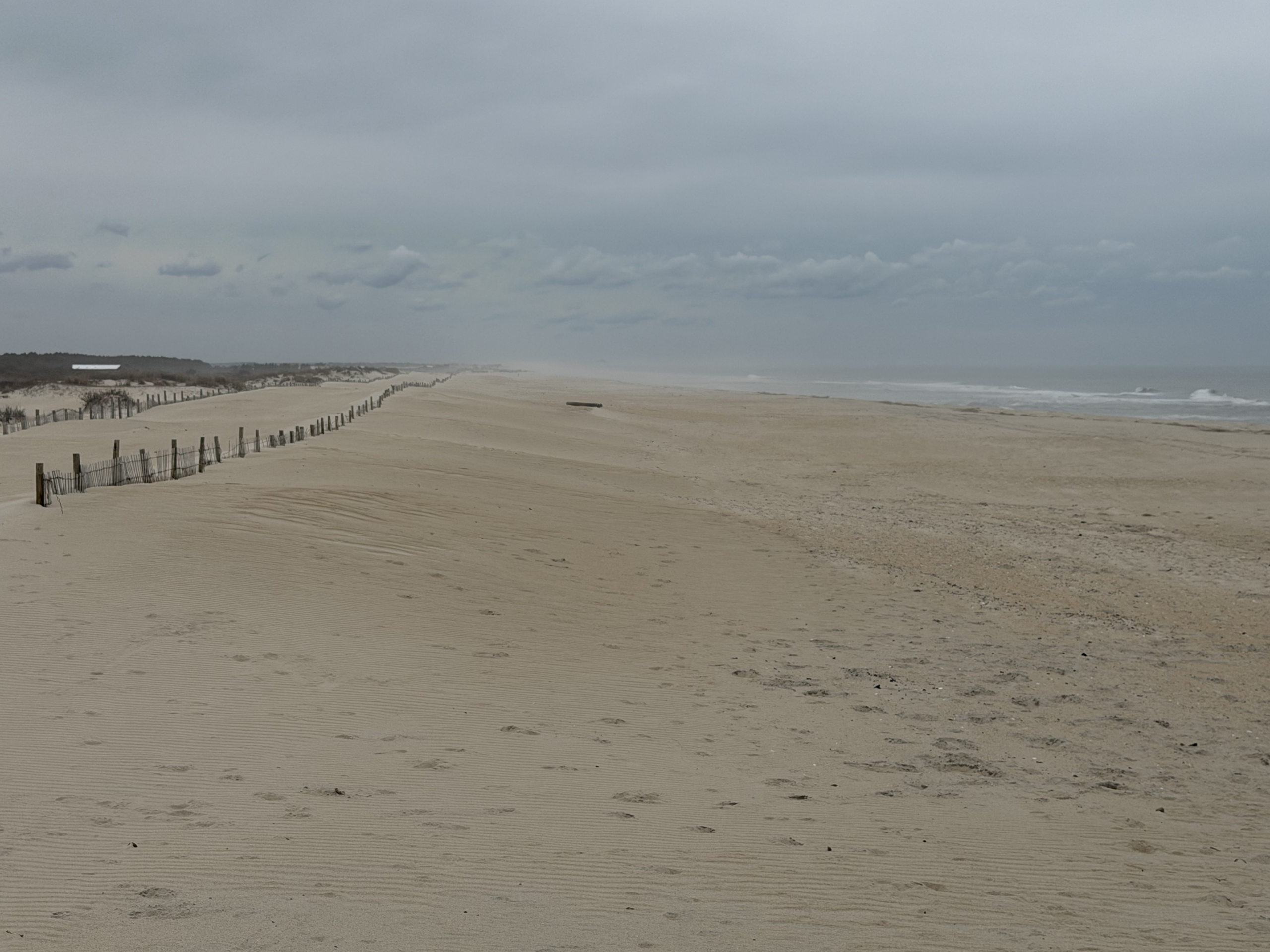
I kept seeing large piles of horse poop that looked fresh, so I kept scanning the bushes and trees on the dunes to see if there were horses hanging out underneath to get out of the cold wind and rain. But the only thing I ended up seeing was a cool looking mule deer that just stared at me as I biked by. Eventually, I made it to the main parking area and beach where we had seen the horses back in 2015 after finishing the Race Across America. It was mostly empty given the weather conditions but there were still a few people around and no horses. After checking it out, I turned around to head back north with a massive tailwind again looking forward to the end of a great first day when what do i see, but a pack of horses right there in the middle of the road crossing the road at the intersection with the state park!
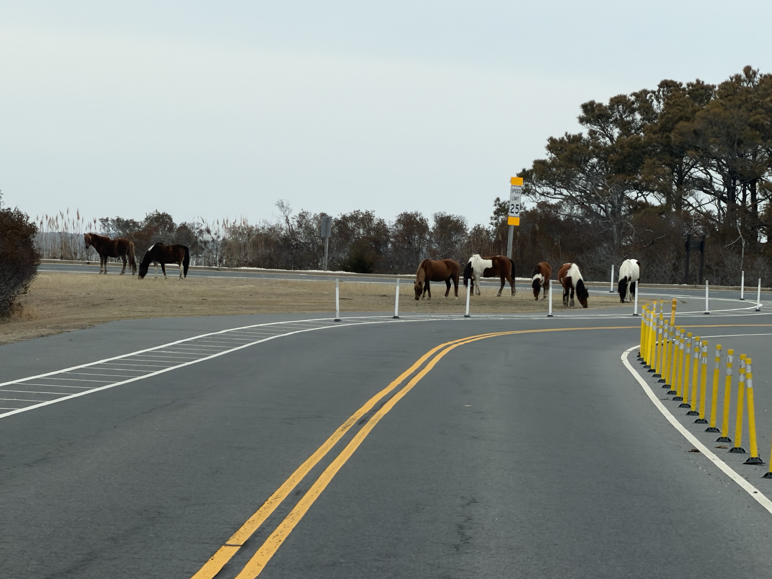
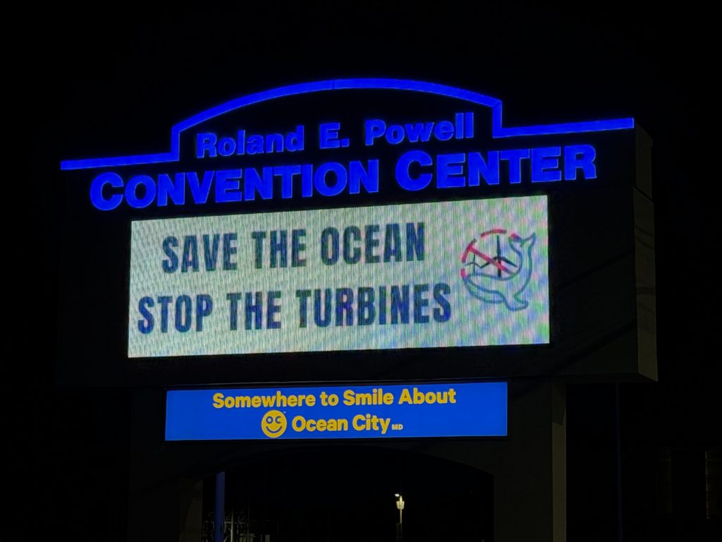
The horses were blocking the bike path so I had to ride out on the road for a bit, before crossing behind them back onto the path to cross the bridge off the island. They were pretty close to the bridge, and I was wondering if they would actually cross the bridge, but I was tired, hungry, wet, and cold so I took off ahead of them and finished the last 15 miles of the ride on a nice side road to get me off the busy highway. There was a WaWa gas station right next to my hotel (Holiday Inn Express, $51 + tax), so I was able to pick up some hot food to take back to my room. Given how long it had been since I last slept, I fell asleep while eating. I woke up with a start, switched devices that I had been charging (so many electronics to keep charged on a trip like this), and then crawled into bed for the next couple hours of sleep. I had set my alarm for 4.5 hours, which was 12:30AM, and I was out the door again for day 2 shortly after 1AM.
Day 2 – Ocean City, MD to Gaithersburg, MD via “Welcome to Delaware”
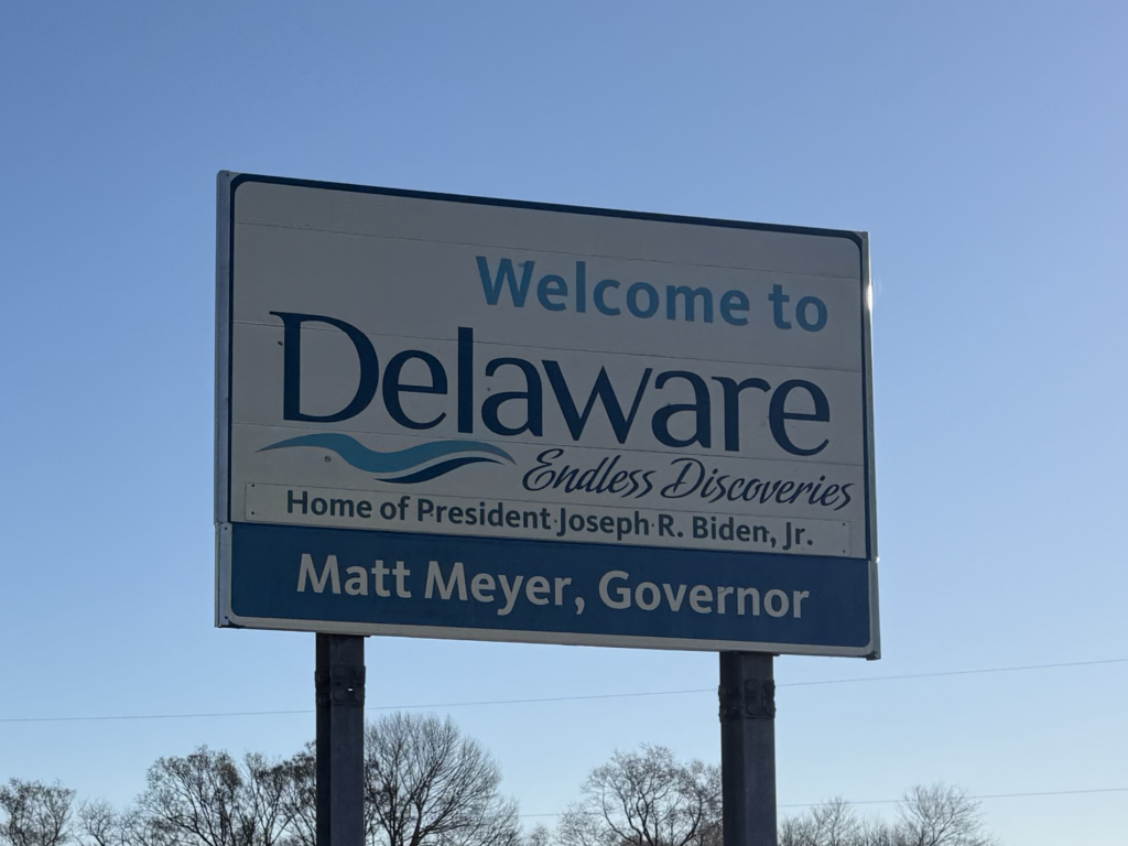
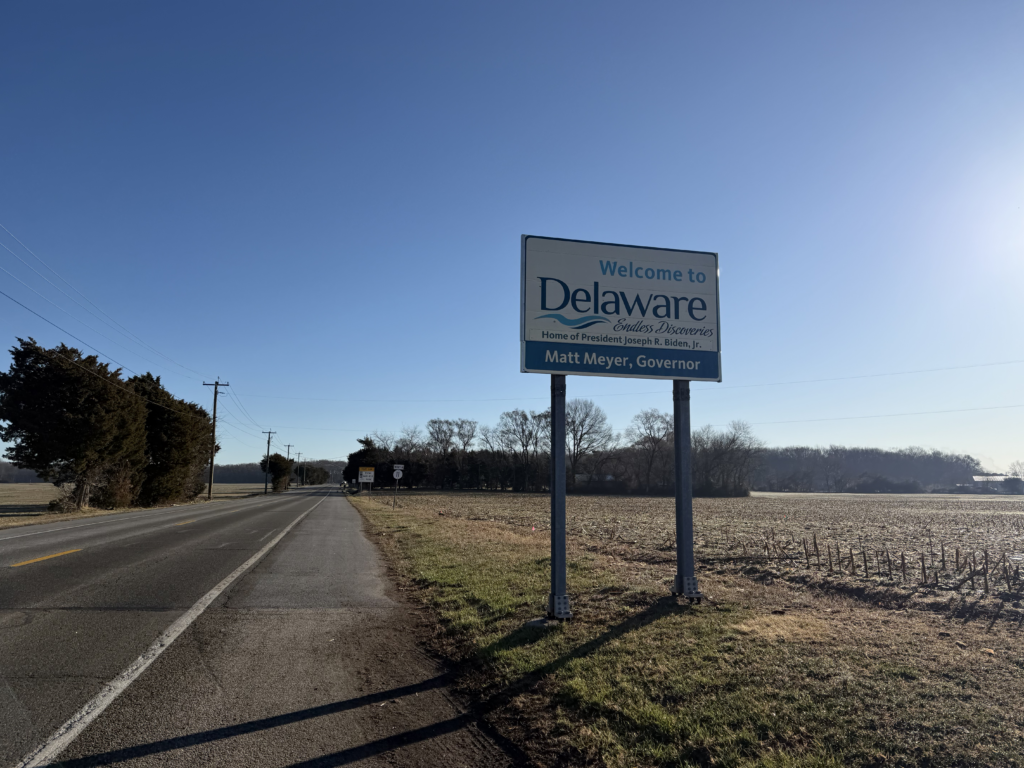
It rained a bit more while I slept, so the streets were wet as I left a very quiet Ocean City, Maryland at 1AM on a Monday morning. There were so many traffic lights that were just green for miles. I headed north, and shortly after crossing over into Delaware I made my turn west to start a zig-zag route to hit all the counties in Eastern Maryland and then cut back to cross over into each of Delaware’s three counties.

Delaware really plays into the “Welcome to Delaware” theme as every single neighborhood, community has a blue highway sign labeled “Welcome to ___” with the name of the community. It was shortly after leaving the coast I noticed the first hint of fog. The gas station clerk had commented about the weather the day before saying she was glad it wasn’t as foggy as it had been. Given how warm it had been with rain overnight and then it turning quite colder, I knew that fog was a risk for today, too.
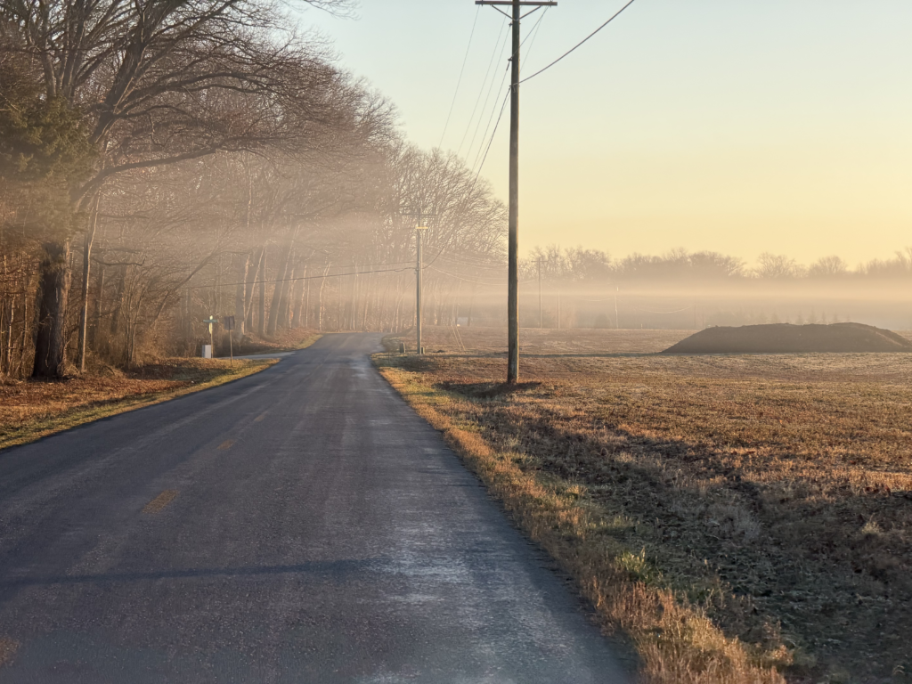
And as I headed farther inland and into wide open farmland, the fog continued to rise. At first, it was so low to the ground that just sitting upright in my seat would take my head out of the fog, which I thought in and of itself was a little unusual. Eventually, the fog rose above my head and got thicker and thicker. There would be breaks whenever the highway went through a forest or climbed a little bit. There was a couple times where the lights of an oncoming car plus my lights would lead to this weird optical scene of many layers of layer fog with clear air interspersed.

This was fairly early in the morning with not much traffic, so I was worried that as I got closer to morning rush hour that it would be dangerous with all the fog. But instead of getting thicker, the fog started to thin out a bit as it got closer to sunrise. I think there must have been drier air coming in with the cold air that offset all the moisture in the ground. I was quite wet from the fog and chilly when I stopped at my first gas station about 50 miles into the day. This is when I found out that I had mistakenly grabbed a baclava instead of one of my knee warmers. So I had a knee warmer and a baclava that I managed to turn into a knee warmer, albeit a bit on the short side just barely peaking out from under my shorts and covering my knee.
Also, the gas station had some really loud music playing out of the speakers outside the station as I filled my bottles and stuffed food into my backpack. The first song I heard was the instrumental from the Lord of the Rings, called “Concerning Hobbits”. I thought how crazy was it to randomly hear this song, which is almost a theme song for my adventures, which I frequently call “There and Back Again”, which is another Lord of the Rings reference.
This gave me a boost, especially given how early I was into this 1000 mile adventure with so much uncertainty. I left and headed back northeast into Delaware county #2. By sunrise, the fog had thinned to these whispy, scattered layers that covered the farm land. It made for some incredible sunrise scenery. This also helped rejuvenate my riding as I trekked through counties and states.
Finding the Mason-Dixon Line
One particular highlight was the town of Marydel, Maryland on the border of Delaware. Towards the middle of the first day I had ridden by the Mar-Va Theater in Pocamoke City, Maryland which I had mistakenly thought said “MaryVa Theater”, which I thought meant I was in a town called “Maryva” on the border of Maryland / Virginia. That’s the irony of these kinds of adventures with so much mapping capability I have at my disposal … half the time I have no clue where I am because I am zoomed into my Garmin just following a route I had planned out days, weeks, or months earlier and just taking it all in – the immediate surroundings, the roads, the nature, the wildlife – without even knowing what town, city, or state I am in. I rely on signs on buildings and street signs to know where I am as when you are zoomed into most maps, it never shows you the name of the city you are currently in. And it’s not as easy as it sounds to zoom out when you have a long route loaded into the Garmin, it takes forever and what are you going to miss in the meantime. Plus, how many potholes or glass debris are you going to run over, too while you are waiting for the map to load.

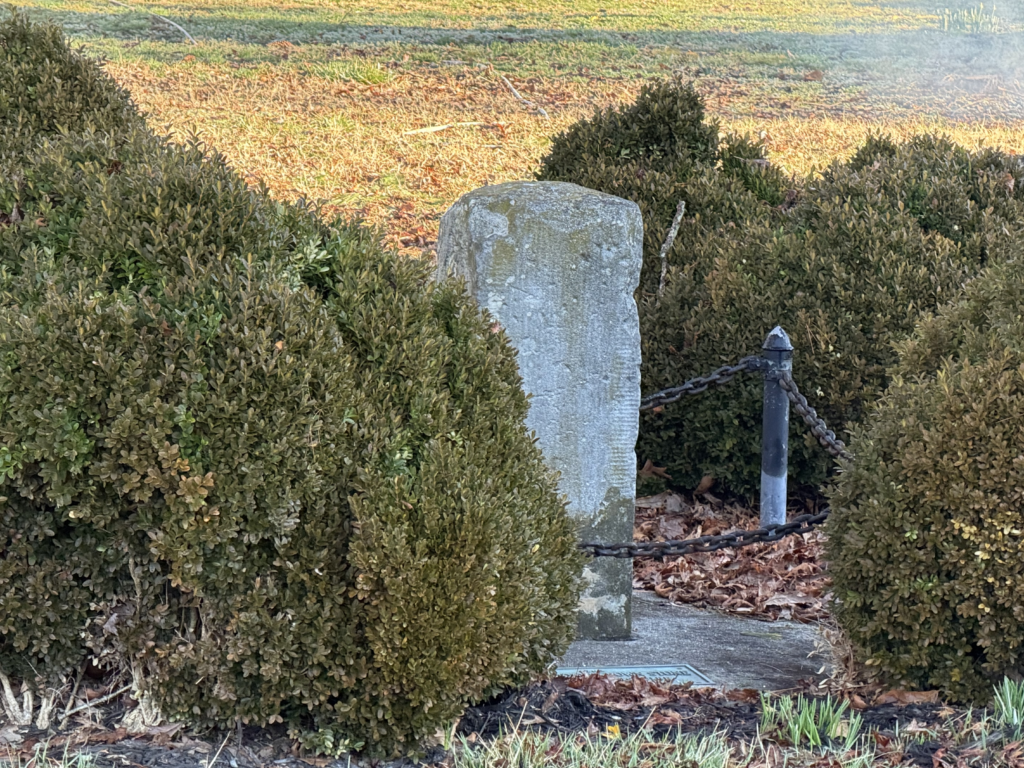
In any case, back to Marydel, Maryland — I was excited because I would be crossing over into a new county in Delaware. Also, I was enamored with the names highlighting the tri-state nature of the DELMARVA peninsula. Also, there was a cool historical sign about the Mason-Dixon line right next to one of the original Mason-Dixon crown stones still marking the line. I had listened to an audiobook on the drive up called “Pathogenesis” that referenced the Mason-Dixon line as coincidentally near the northern boundary of where a particular breed of mosquito carrying malaria can survive and how this influenced which states were for/against slavery.
Police escort across the Susquehanna River
It was getting pretty hot by this point as I made my final crossing out of Delaware back into Maryland and started my turn west towards Baltimore. Ahead of time, I had been worried about traffic in the general Baltimore area, but found myself on US Highway 40, a designated bike route. I still cannot believe it’s a bike route, but the signage is awesome, and I know where all the dangers are on a road like this, but it was pretty crazy. Also, as I found out later, only sections of it are a bike route. I was definitely right to be worried, but I was imagining I would be in a similar traffic situation without a bike lane / bike route designation or small one lane each way heavy traffic roads with no shoulders. So this “bike route” was probably about the best I could have hoped for to get me through the area quickly and relatively safely. I did have one “muscle car” intentionally make the dreaded right hook (the most common fatal bicycle crash) while squealing his brakes to drift through the turn b/c he had had to accelerate to very high speed to “make it” ahead of me instead of waiting literally one or two seconds to turn behind me. And yes, he had to have seen me the entire time, but must have misjudged how fast I was riding. Or just didn’t want to wait for some damn cyclist, no matter how short the time. Maybe I’m wrong, maybe that’s not what was going through his mind, but that is certainly what the evidence points to.
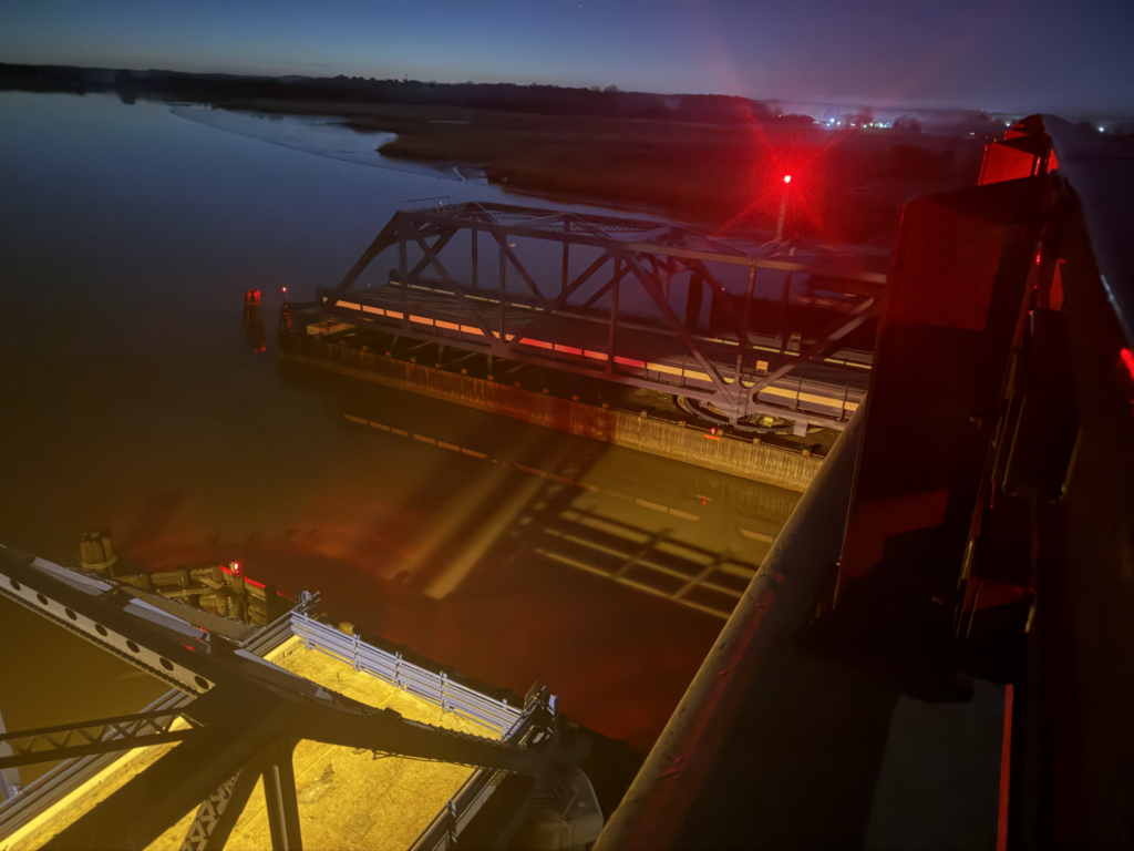
I hadn’t even considered whether all the bridges on a designated bike route would, you know, be open to cyclists. But as it turns out, the bridge over the Susquehanna River is only open to cyclists on weekends and state holidays. As you can see in the pic above, one of the lanes on the bridge was closed for construction. I thought this would give me a “weekday pass” over the river as I could just ride the closed lane up to the construction area and then wait for a gap to make it around the construction (if it wasn’t possible to walk or ride through the construction with the permission of the workers).
But as I would find out shortly after this picture when I rode straight up to the state trooper who was parked at the construction site to make sure traffic slowed, bikes were most definitely NOT allowed. Unbeknownst to me, a different state trooper (possibly going the other way?) had seen me and was chasing me down with his lights on after I was already on the bridge. I was already talking with the parked trooper who had left his car and let me know he was recording the interaction. After explaining my plan, the other trooper who had gotten out and heard said he would just block traffic behind me and let me go in front of him. He gave me a scolding that the bridge was closed to cyclists except on weekends and with the construction it wasn’t even open then. But since I was more than halfway across, it was better to just take me across. So that’s what we did. As it turns out, there was a very large gap and he only ended up blocking two cars. After we made it across the bridge, the trooper beeped his horn at me (they both were very friendly) to let me know he was leaving and then those two cars passed. It was a long, mostly downhill section of the bridge where I wouldn’t have been able to walk through the construction zone, so I was very thankful for the trooper blocking traffic for me, even if I had lucked out with a huge gap of pretty much no traffic (two cars instead of twenty cars and trucks).
The brownstones and schools of Baltimore
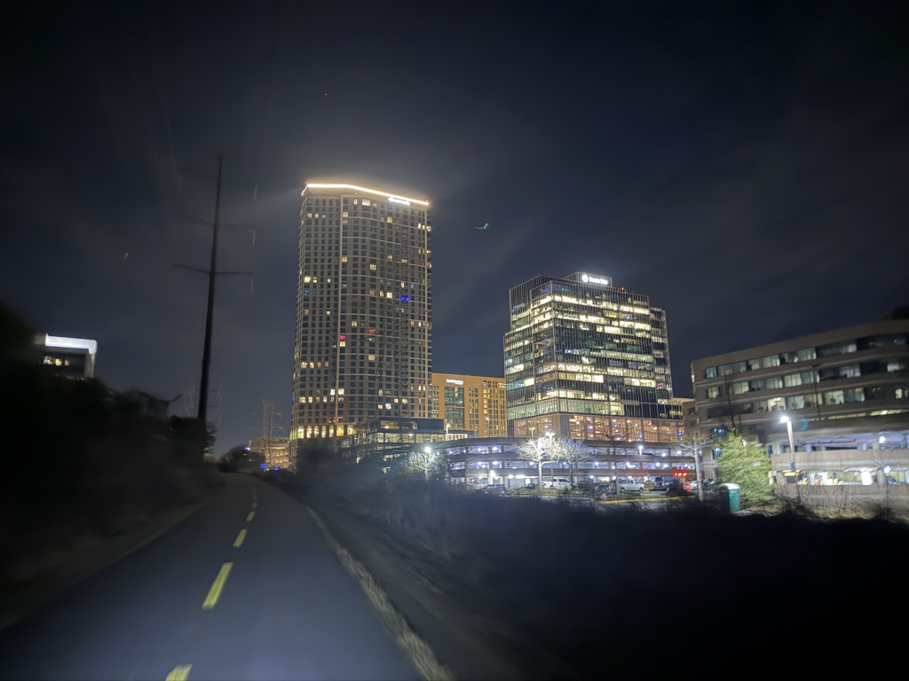
When I finally made it to Baltimore, my bicycling directions took me off Hwy 40 and onto surface streets right through the middle of downtown, where I was surprised to find so much housing mixed into the commercial businesses and high rises. These were the “brownstone” type of row houses lining the city streets similar to large sections of New York City. I made my way through traffic on several busy roads with bike lanes. I biked by several schools and saw lots of students walking home from school. It was cool to see a culture that wasn’t so completely “driven” by cars.
At one of the traffic lights, a car pulled up next to me and the passenger was asking me about all the equipment on my bike. I told him about measuring the passing distances of cars and turning into a map of which streets were safer, and he was really impressed with that. This was in the heart of downtown before I started my climb out of downtown. Basically, it felt like I was climbing forever as I made my way out of town on the west side. I followed a series of very hilly roads as the sun set. A little while after sunset, I finally made it to my uncle’s house for a short stay/sleep before heading out again a little before 2AM. It was great to catch up with him even if it was only for a couple hours.
Day 3 – Gaithersburg, MD to Petersburg, VA via DC/Northern VA bike infrastructure
I left Gaithersburg at 1:40AM for what was easily the best day of the trip. It also ended up being the longest day with the most climbing and the most traffic. Super quiet, but VERY hilly roads, heading northwest from Gaithersburg towards my eventual crossing of the Potomac River after first crossing the Monacay Aqueduct on the C&O Trail. This was a smooth crushed gravel trail that I absolutely flew on in the dark. It was like riding through a tree tunnel with the trail going right up against huge old growth trees.
heavy traffic at 4am.
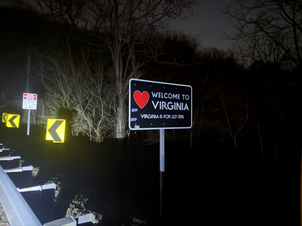
I only had a few miles of this trail before I popped out into a cool little scenic town so that I could hop on US Highway 15 and cross the Potomac River into Virginia. I would have gotten some hot coffee but nothing was open at 330am. As I spun around to take a picture of the “Virginia is for lovers” state welcome sign, there was a small pack of cars I had to avoid. After taking the picture, here came another pack of cars, this time with a big truck. I didn’t think too much of it, but I should have. I had quite a few miles on this highway to ride, and it was super busy from 3:30-4:30AM. I can only imagine how much busier it would have been if I had been an hour or two later.
I have some fun history with this highway as it basically went from my grandparents house near Palmyra all the way to Washington DC. So this is the highway we would take whenever we would drive up to Washington DC. Separately, in college, my good friend Bert Hull, and I drove up together from Clemson to stay with my grandparents and race a stage race based out of Orange, Virginia (also on US Highway 15). Shortly after heading south on US 15 on this ride, I saw a mileage sign for Culpepper and below that Orange! This immediately took me back almost 30 years!
After what seemed like an eternity, but was only 40 minutes, I turned off of 15 to head into Leesburg, Virginia hoping to find an open gas station. It was still before 5AM so all the places I biked by were closed. By this point, I was very cold and desperate for some coffee and a bathroom. So I used Google Maps to find nearby open gas stations. I was getting onto the W&OD trail in Leesburg and knew that it would be a while before the trail itself passed an open gas station. I saw that I could ride the trail for a little bit and then leave the trail to make it to a Sheetz gas station about a mile or so off the trail after riding parallel to the trail for a couple miles. This turned out to be great b/c the gas station had great coffee and good food. I broke out my “Hot Hands” hand warmers to put onto the outside of my shoes to give a little bit of warmth. I also used a couple grocery bags as socks for extra wind protection.
I climbed up and over the trail on a high bridge and then took the very steep switch backs down to the trail. Once I made it down to the trail alongside a river, I settled into a good rhythm. I was still far enough outside of DC/Northern VA towns, and it was still early enough in the morning that there wasn’t anybody running or riding … yet. It would get busy as I made my way into city after city. My first obstacle was a big “trail closed” sign with an unclimbable fence. There was no posted detour so I tried to figure something out on my own and ended up trying to cut through some sort of sports facility that the security guard let me into … without telling me that there was no way to get out the other side (another high fence!).
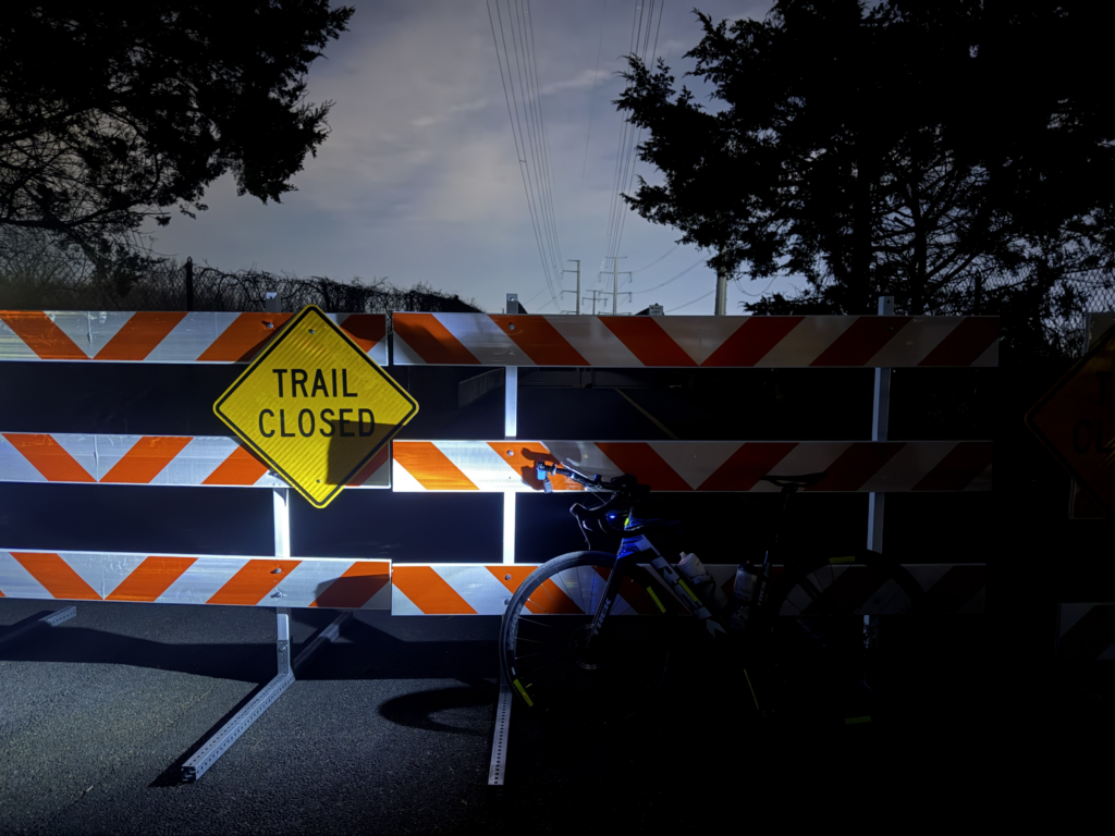

Eventually, I made my way back to the trail and happened to rejoin the trail at the opposing “trail closed” signs … by this point I was good mile or two down the trail so that was a big chunk of trail closed. I started to pick up walkers, joggers, and other cyclists by this point. They were sporadic at first, but eventually got quite a bit more frequent – especially runners. It was still a couple hours before sunrise, so thankfully most everyone had their own lights or reflective gear on. I almost hit one guy walking when another cyclist was coming the other way at the same time with a bright light. This blinded me a bit so that I didn’t see the guy walking the same direction I was going immediately in front of me. I saw him at last second and was able to quickly say “on your right” and swerve around him on the right.
Not too long after this, it started to get light enough to see and the trails got quite a bit busier. It still was nowhere near as busy as something like the Lakeshore Trail on a Saturday, but it was many, many miles of pedestrians and cyclists sharing the trail. I wasn’t going particularly fast and got passed by a ton of e-bikes. I also saw a lot of e-bikes going the other way. There were many wooden bridge crossings, and they all felt quite sketchy to me. It only took one little wheel slip for me to take them all pretty slowly. People on the e-bikes would fly over them. Those bikes do tend to have a bit wider tires, but still faster than I would go!
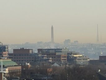
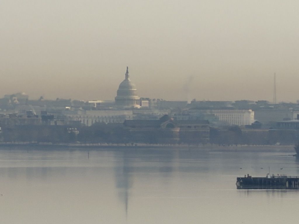
Even with the pedestrian and cycling traffic, I was still super thankful to be able to ride through such an incredibly busy area without having to contend with car traffic. I knew that it wouldn’t last forever, though. I did make it to the very end of the W&OD trail and immediately hopped on what was labeled a connector trail to take me over to the Mount Vernon trail. I followed this trail south along the Potomac River for a while but turned to cross over the river on I-495 (via a bike path alongside it). At the very corner of this was a “tri-state” marker where a tiny corner of DC comes together near the Virginia/Maryland border on the river. It doesn’t line up perfectly, though, and I ended up riding through the little section of DC and happened to snap a couple good pics of the Washington Monument and the US Capitol from about that spot on the bridge on 40x zoom.
My first major obstacle heading south through Maryland was crossing the Potomac River. After my encounter with a state trooper the day before, I decided to do some research ahead of time. Sure enough, just like the other bridge where I was escorted across, cyclists can cross this bridge but only on the weekends or state holidays. It was a Tuesday so neither applied. I also saw that there was a decent sized gas station just short of the bridge. My plan was to hitch a ride across there, and the third person I asked was an angel and they said sure, no problem … even though they weren’t even going that direction! They were fantastic and wouldn’t take any money from me either, despite having to pay a small toll both ways. Truly an angel!
After getting dropped off at the Sheetz on the Virginia side of the Potomac River, it was quite hot and I routed myself onto a state highway parallel to the main highway. But that state highway was probably just as busy with absolutely no shoulder and a rumble strip over top of the white line marking the edge of the shoulderless road. It was terrible, but it also only lasted about three miles before I was able to turn onto a quieter 600 road. Virginia has what used to be called “Rural Routes” instead of normal county roads. This is because in Virginia, the VDOT maintains nearly ALL roads in the state and doesn’t pass that duty off to counties except for a couple of exceptions. Most of the maps have been updated to call these roads State Routes, even though they aren’t state highways. To me, growing up spending the summers in rural Virginia, they will always be “Rural Routes”. In any case, the vast majority of them are numbered in the 600s with the numbers being reused in different counties. If I ever see the number 600, or especially 616, in any context, I’m immediately transported back to Fluvanna County and a one-lane wooden bridge over the Fluvanna River we would cross on the way to my grandparents house.
So it’s fun to hit those same numbered roads in other counties in Virginia and imagine some other kid visiting their grandparents and forming a similar connection between that number and their grandparents. Looking back at my map, it looks like I was on a series of them SR610, SR631, and SR697 before intersecting with US 301 as I headed south in the afternoon heat. By the time I hit 301, it was about sunset and I had a bit of a tailwind and managed to make a green left light onto a different 600 road while the oncoming traffic was waiting. I had to sprint to get there in time, and it was rejuvenating to take a corner at 25mph onto a road taking me towards the end of my long day on the bike.
I was on a series of different 600 roads before eventually merging my way back onto a long, straight, HILLY, two lane stretch of US 301 heading towards Richmond. This was the same major highway that had been four lanes across the Potomac River where I had hitched a ride several hours earlier. I thought this would be bad, but in the post rush hour timeframe almost all the traffic was leaving Richmond (heading the other way), and I would only get passed by a car every few minutes instead of the constant cars heading the other way. By the time I hit downtown Richmond, it was quite dark. My bicycling directions had taken me off US 301 before the I-295 loop and I was on a series of streets right through Richmond. They all seemed pretty good and low traffic. At this point, I can’t remember if there were bike lanes or shoulders. But I do not remember any stretches that felt dangerous or concerning.
All of this was quite hilly, which felt tortuous to me especially given how flat it was leaving Petersburg just three days earlier. I remembered, though, that it was hilly in Petersburg itself but then flattened out almost immediately. Sure enough, the entire route from Richmond to Petersburg stayed hilly. And the only last obstacle was finding the car in the massive series of parking lots. By this point, I couldn’t even remember that I had parked by Target. All I could remember was the hotel and the busses. So that’s what I was looking for when I saw that I could ride down a steep grassy embankment, which ended up popping out right at my wife’s car! It was still there and no parking tickets or boot. All good!
I had a reservation for a hotel in Hopewell, so I quickly put my bike in the car and drove the 10 miles including a crossing of the James River on the interstate (which is the main reason I wanted to stay in Hopewell, so I wouldn’t have to navigate over that on my bike).
Day 4 – Petersburg, VA loop via the Virginia “Middle Peninsula”
I knew when I finished Day 3 at close to 11pm running on “sleep fumes” (i.e., very little sleep) that I would be getting a later start on Day 4. That didn’t necessarily preclude me riding late into the night on Day 4 and completing my originally planned 275 mile ride on the Middle Peninsula and Northern Neck Peninsula. But for a number of reasons, not the least of which being I wanted to relax and not be stressed about having to complete a fourth “big day” in a row, I decided to shorten my 275 mile planned loop to a more reasonable 160 miles.
I couldn’t figure out any way to hit all three of Virginia’s mainland peninsulas: the Northern Neck, the Middle Peninsula, and the Virginia Peninsula on a ride that was less than 200 miles so I decided to cut out the Northern Neck entirely and focus on the Middle Peninsula. This was a good choice, but it leaves some pretty big hard-to-reach holes in my county map, which I will hopefully fill in on my way up to Virginia in early May for my daughter’s graduation.
After checking into the hotel and doing laundry the night before, I hadn’t gotten to sleep until almost 1am. Still, I was fueled with the hotel breakfast and out the door by 830am. This put me on the tail end of morning rush hour and mixed in with school traffic. They start schools pretty late in Virginia. I saw kids waiting for busses close to 9am!
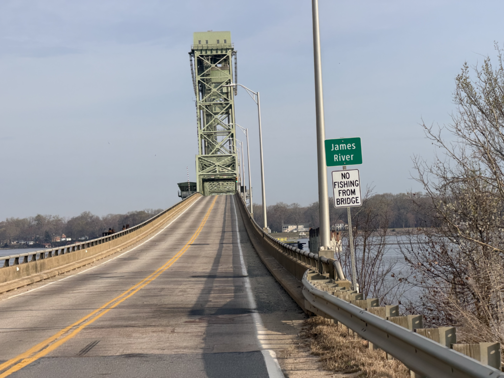
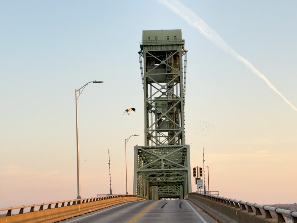
Not too long after leaving Hopewell, where I had spent the night, I crossed the James River on a large elevated bridge that also had a draw bridge in the middle. I guess this was a compromise to allow taller boats through without having to raise the draw bridge except for the largest shipping boats. The challenge with draw bridges on a bike is that frequently the part that lifts is a metal grate so that it doesn’t collect water and get too heavy to lift in a downpour. But those grates are not great for skinny road bike tires. It was dry, so I didn’t have any problems but your rear wheel does slide a bit when it hits the longitudinal raised metal. If it’s wet, this can be problematic b/c you slide even farther. And even then, that’s not that terrible of a problem. It’s just that on a busy draw bridge with very fast cars, you don’t want to be sliding around out of control with a risk of falling right in front of a car.
I made it across and shortly thereafter crossed the Virginia Capital Trail. I would be riding some of this on my way back later, but for now I was going straight across a good chunk of Virginia east of Richmond so that I could cross over onto the Middle Peninsula, proper. There wasn’t a very large river this far inland, but the highway I ended up on (US Hwy 360) was quite busy. I left it early and crossed the Mattaponi River at Walkerton. Just before crossing the river I had stumbled upon a small, cool looking old brick church. Initially, I was just going to keep on riding, but I wanted to get a closer look. And as it turns out, it was not only a historic landmark, it was also open! So I was able to go inside and read about the church and see the empty inside of it. The church was built in 1734. Most of it was redone in 1755 except for a small part of the front entrance, which was original.
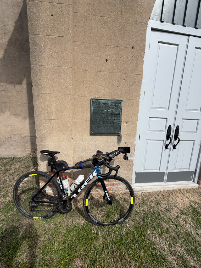
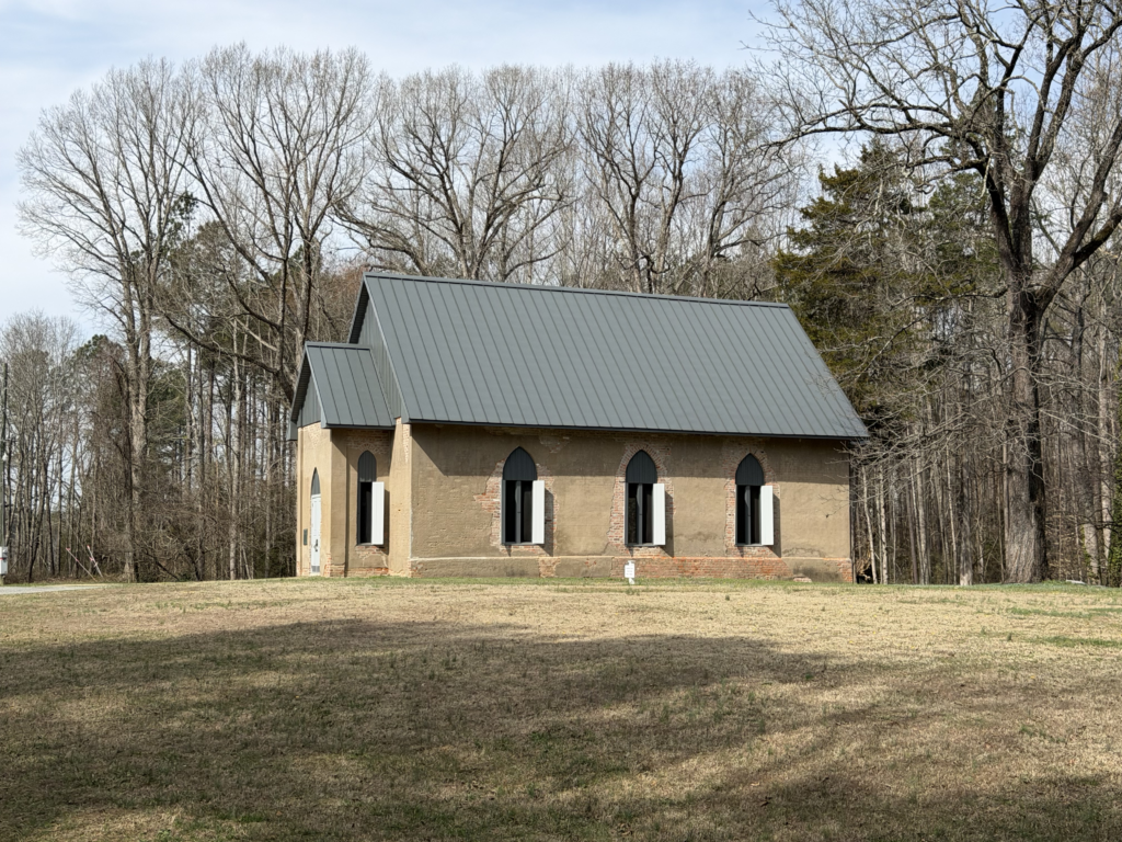
(The open shutters are what made me think the church might actually be open!)
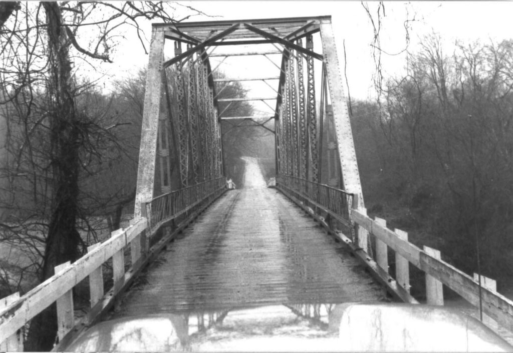
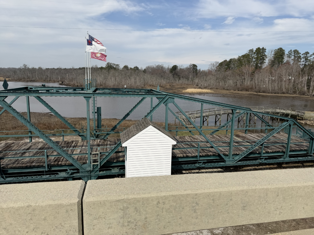
After checking out the church, I went across the river and stopped at the busy gas station in Walkerton. The bridge across the river was next to an old wooden drawbridge that was partially still standing as a fishing pier. This was my first stop for the day, but I was hungry and thirsty so I spent a little bit of time outside filling my bottles and eating a bit. During that time, all kinds of people came in/out of the store. A police officer came flying by in his car chasing a pickup truck. Somebody ran from behind the store to see what was happening. I kept on eating. After a few more minutes, I headed out cutting across the middle of the peninsula on some very nice chip/seal roads until I eventually made it to Hwy 17, the main highway through the area. I only had to ride it for about half a mile before hopping onto a road named “Old Virginia” that took me all the way into the towns of Saluda and Urbanna on the Rappahannock River not too far upstream from its mouth.
This was my turn around point, though, where I headed back west across a different part of the peninsula to West Point which marks the western edge of the Middle Peninsula. There was two back-to-back river crossings here with the town of West Point in the middle. The town is at the confluence of the Mattaponi River (Bridge #1) and the Pamunkey River (Bridge #2) where they join to form the York River. This was a super busy highway (Virginia state highway 33). It was four lanes divided with a tiny, but good, shoulder some of the time. There were a few places where the shoulder disappeared entirely, and it was littered pretty bad on the bridges. So I was thankful to finally get off that road after about 10 miles, right before it merged with Interstate 64 heading to Richmond.
It was also evening rush hour by this point, so that may have explained some of the heavy traffic, too. But that highway just felt like it would be busy all the time. Leaving the highway was great and put me on some super quiet roads that felt more like hunting roads and hunting cabins. It was hilly and scenic with beaver ponds and dense forests and then a golf course I accidentally wandered onto thinking it was a bike path alongside the main road. I turned around almost immediately because it was heading away from the main road and ended up having to add on close to a mile to get around to the state highway I was supposed to be on.
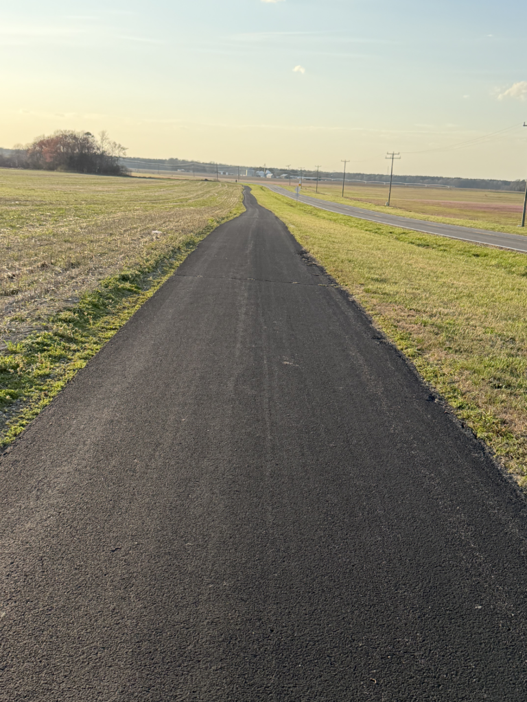
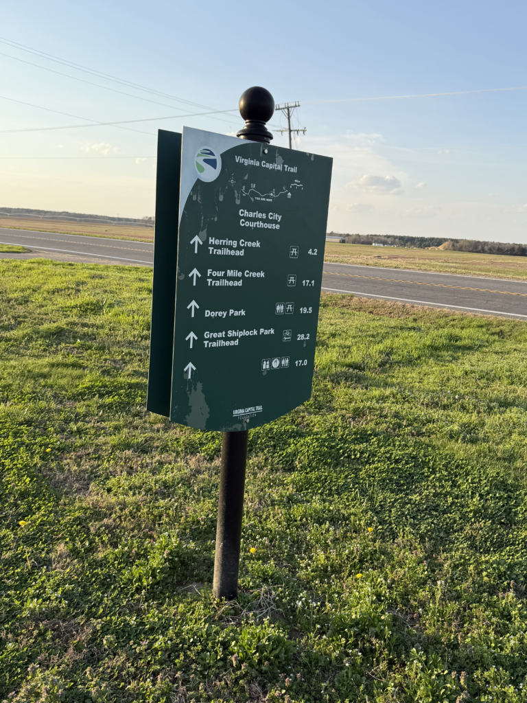
After a few miles heading south on the highway (VA-155), I intersected with another busy road (VA-5), but this time there was the Virginia Capital bike trail I could ride for several miles alongside. This was also hilly and scenic and based on the terrain was not a rails-to-trail for the section I rode. It was just a purpose built bike path next to the main road with all kinds of historical markers about every half mile or so.
Finally, I turned left at the state highway taking me back over the Benjamin Harrison drawbridge. It was very windy and there was a large osprey with its dinner in its talons struggling stationary against the wind. I snapped a bunch of pictures because the traffic was pretty light on my return trip after rush hour. By the time I made it back into Hopewell, the sun had set, and I enjoyed a relaxing ride through some neighborhood streets that popped me out at the back of my hotel where I loaded up quickly and started on my 650+ mile drive back home to Alabama!
More maps and data
Leave a Reply