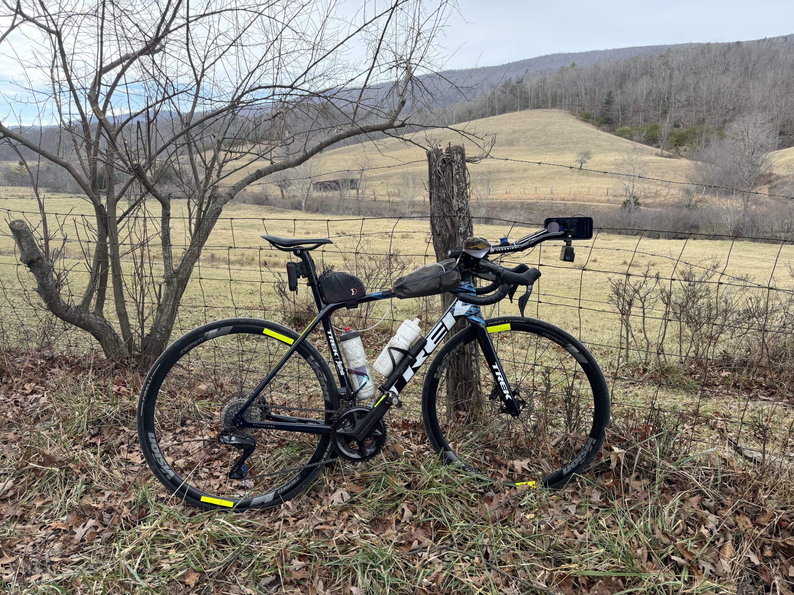
My daughter has a long 600 mile drive to get to college. I like to drive up with her to help with the drive and be there if anything happens (car trouble, deer, etc…). That puts me in Virginia without a car … no problem, I have a bike! This makes my 10th time biking to or from Virginia, and like all the others it was an adventure. The typical “straight there” route by bike is about 650 miles. I’ve never done that one because there are way more interesting routes that usually end up in the 750-800 mile range.
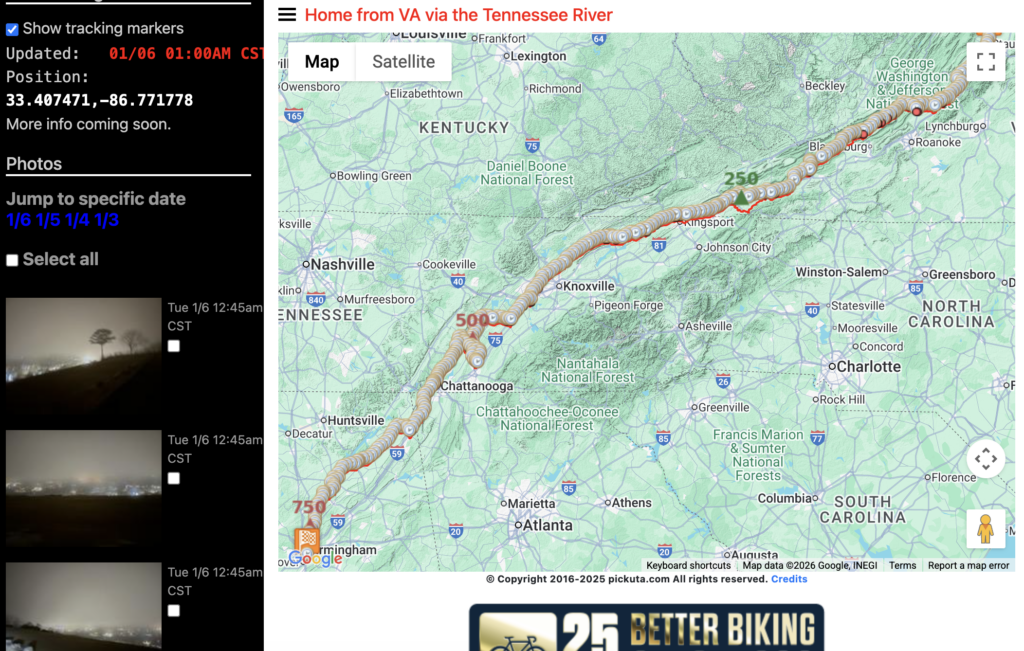
This route ended up being just shy of 775 miles and 50,000′ of climbing. It was in the general vicinity of the typical route following US Highway 11 which literally goes through both cities (Birmingham and Staunton), but with the goal of riding new-to-me roads I veered into the next valley farther north a few times and farther south a few times.
Day 1 started only a couple hours after finishing the 10 hour drive with an hour and a half of sleep before a 257 mile ride with nearly 20,000 feet of climbing covering almost the entire Virginia portion of the trip (from Staunton to Abingdon). I had wanted to ride the full Virginia Creeper Trail from Damascus to Abingdon, but with a later start than planned (so I could at least get a little bit of sleep), I skipped the southward dip of my route that would have added on about 10 miles and went straight to Abingdon. Unfortunately, that meant quite a bit of hilly intra-valley climbing … nothing too big, but just endless steep climbs followed by equally steep descents … in the dark after sunset.
It stayed overcast and I was way overdressed for temps in the mid to upper 30s. I had to stop within a couple hours to take off clothes, and it was on this really cool gravel road that was following one of the major tributaries of the James River. Deer were everywhere as I made my way south from Staunton so I was worried I would hit one on some of the fast descents and had to take them a bit easier, which of course makes the next hill a little bit harder with less momentum. Here’s the timelapse video from a few sections of Day 1.
Day 2 was quite a bit easier with less climbing and covered a good chunk of the Tennessee portion of the ride starting in Abingdon around 5AM and crossing through Kingsport in the dark but still getting a chance to enjoy the Holston River trails and views. It was quite a bit colder, too, enough that I had an ice beard by mid-morning with temps in the upper 20s for about 4 continuous hours of riding before it warmed up nicely in the afternoon into the 50s. Traffic got kinda crazy north of Knoxville as I was far enough away that all the roads where just two-lane but still close enough to the city that they were quite busy. There were a few unhappy drivers, but I did my best to stay out of their way including pulling off the road to let people pass.
The final day was my favorite of the trip, even if it felt like it would never end. It was indeed the longest, but only by a couple miles. I started at almost 7am in Cleveland, TN (which is an unheard of late start for me, although in some ways that made it quite a bit easier to ride into the night) and made my way north first following the Trail of Tears where Native Americans were marched out west (mostly Oklahoma I think) in the mid 1800s. This led to the Blythe Ferry, which was the location where the caravan of wagons, horses, and people walking were ferried across the Tennessee River. It is at the confluence of the Hiawassee River with the Tennessee River and in the early morning with light fog covering most of the water was insanely quiet and beautiful.
Part of my goal for this day was to cross the Tennessee River on as many of the bikeable bridges as made sense for my current route. After crossing there and making my way to Dayton, I took some relatively quiet roads right into the heart of Chattanooga. It caught me by surprise as I kept thinking “when is traffic going to get crazy?”. That didn’t happen until I crossed the Market Street bridge where it was only busy for a bit until I could get onto some of the smaller streets at the base of Lookout Mountain.
The plan was to take the Guild Trail all the way up to the top, which was perfect because the short section of the state highway climb up to Rock City you have to ride to get to the Guild Trail was steep and insanely busy. And given the amount of clothing and electronics I was carrying along with it being 600+ miles into my trip after back-to-back 250+ mile days, I was going quite slow. Thankfully, it was just a short section and the old rails-to-trail that is the Guild Trail was a whole lot faster even with the crushed gravel surface, given the gentle gradient.
By the time I made it up to the top of Lookout Mountain, it was late afternoon, and the long trek across the top of the mountain through Cloudland Canyon and then to Mentone took quiet a while. Eventually, I made it to the Mentone dirt road we had used during a team training camp back in 2007. It was now a very rough chip/seal for a few miles followed by perfect tarmac.
After the drop down into the US Highway 11 valley, I climbed up AL-117 and then AL-40 to make it to the top of Sand Mountain. This is a portion of Sand Mountain far enough northeast that I hadn’t ridden any of the many roads across the wide mountain. I opted for AL-75, though for nearly two hours not leaving it until Albertville, where I made it to the portion of Sand Mountain that I’ve ridden many times. I found a few new roads and traffic went from busy to very quiet. I basically split the last 150 miles into three 45-50 mile sections, one from Mentone to Albertville, another from Albertville to Cleveland, Alabama, and the final 51 mile section to my house through Birmingham on AL-79. I was struggling by this point, but it really helped to know I only ever had 45-50 miles “left” to ride. Because making it to a stop is always the goal, never think of the finish until you are well within summit fever range to the finish. For me, that was finally making it back to Cleveland/Locust Fork area where I have had so many adventures.
And with it being so late by this point, roads were getting quite deserted. I rode through downtown Birmingham well after midnight finally making it to my home around 1am.
Tons of photos on pickuta.com available here:
Leave a Reply