
Part 1 – There…
I love a good ride starting at midnight. Guess what time the Delta Epic starts … midnight! Here’s my not-so-quick-ish recap of the race before getting ready for class this morning…
I drove over to the start from Birmingham on Friday after teaching in the morning. Quick, easy drive, and I made it to the Outlet Channel public use area below the Arkabutla Lake dam. Absolutely beautiful place. So quiet, so peaceful. I backed into a parking space in the corner of the parking lot there and after riding around taking a few pics, I started last minute packing of my bike so I could pretty much just wake up and ride to the start a couple miles away before midnight.
So, that’s what I did, and it was so cold that I put on my knee warmers, arm warmers, gaiter, and a vest underneath my jersey. Interestingly, I had not planned on bringing knee warmers because I thought the low was only going to be in the mid to upper 50s … well, right before leaving the house I had typed “indianola weather” (the largest city on our route) into google and without looking too close saw that the predicted high was now only in the mid 50s with a low of 41 and a chance of rain. So I scrambled, grabbed the knee warmers, grocery bags to stuff a second set of clothes into for the race knowing that I would want to change if wet and very cold and also wondering how they could have goofed up the weather forecast so badly … as it turns out, I was looking at the weather for Indianola, Iowa!
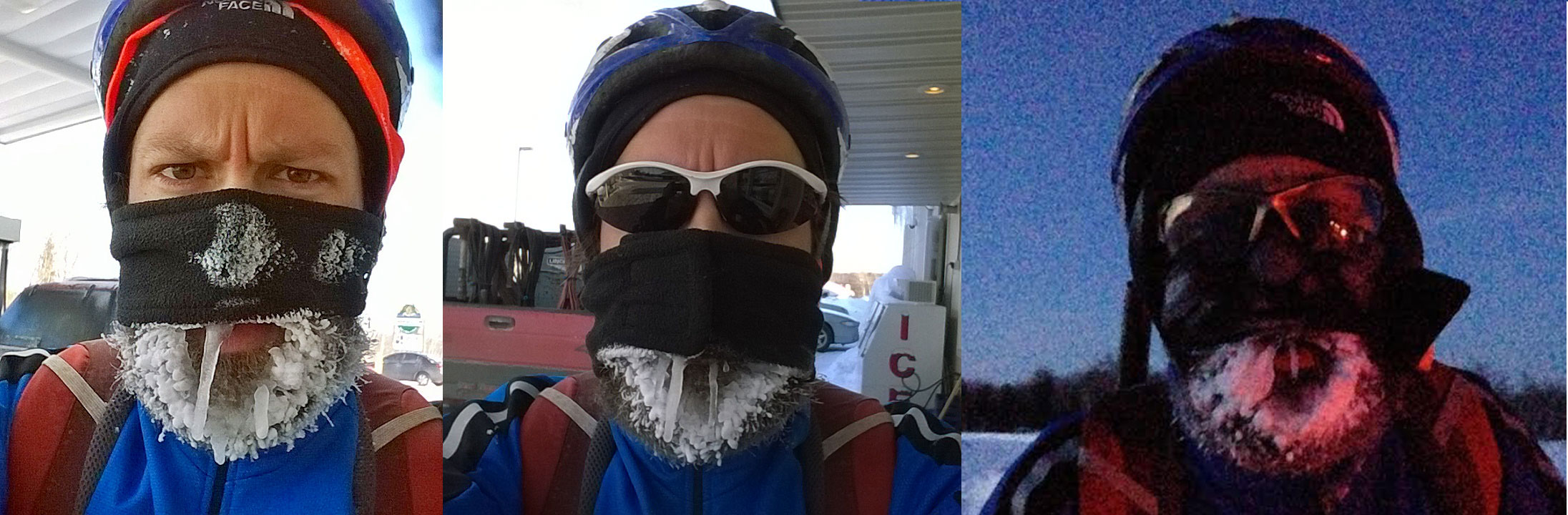
This mistake served me very, very well though as I brought more clothes than I thought I would need and ended up putting on all of it at the same time later in the night 400 miles into a 500 mile ride unable to regulate body temperature shivering in a gas station where the very nice worker unplugged and brought a space heater over to the coffee machine where I stood for about 15 minutes sipping on a coffee to get me warmed up and going again…keep in mind I’ve ridden in temps that freeze your beard nearly instantly when walking outside (22 degF below zero). But this felt more unbearable because with temps that ridiculously cold, you are so well layered up that you feel empowered to battle the cold. But with barely anything beyond normal summer clothing you feel helpless to fight the cold … and I’m sure that factors into how cold it “feels” – the mental side of it.
But back to the race. Jason and Wendi Shearer created this grassroots race with the goal of showcasing the Delta area, and it delivers. Honestly, it wasn’t until I was looking at the topo maps that it becomes clear why this area is called the Delta … table top flat as the Mississippi River has changed its course many times over the eons and washed out the entire area. This entire area was new to me as most of my riding in Mississippi has been much farther south where the Mississippi River itself separates the flat delta (in Louisiana) and the hilly Mississippi side. I never realized that there was a huge chunk of Mississippi (nearly a quarter of the state) that is table top flat. Mississippi has always in mind been a very hilly state.
And now, for real, back to the race. I was bundled up with everything I had brought and made my way over to the start, where a large crowd of solo racers and relay racers and relay race supporters were getting ready for the start along the lake at Bayou Point. I made it there with less than 10 minutes to spare, so I didn’t get a chance to talk to very many people, but I did get a chance to say hi to Jason and my good friend (and eventual winner!) Justin Lowe, and Michael Rasch whose report and tracking I was following on the race either last year or the year before is one of the reasons I was doing this race. The other main reason was Jason himself who had come to my rescue outside the delta national forest earlier this year when I double flatted in the pouring rain on a ride from Birmingham to Vicksburg. Jason mentioned that we were close to the Delta Epic course where he met me in Holly Bluff after I called him from Midnight … the town names in the Delta are epic. So I told him that I would think about coming over and doing the Delta this year as it sounded really interesting.
Fast forward almost 10 months, and I find myself rolling out in the middle of a large group at the start of the race. Jack White and one other person (Peter Reed?) were killing it off the front even before we made it out of Bayou Point. Thankfully, there were a lot of people who weren’t getting left behind so quickly so we all eventually caught back up to Jack. The front of the group missed a few turns in the dark with the high speeds so there was a number of slam on your brakes and turn around to double back to the missed turn. It was really difficult to look down at the course map while negotiating the road and a large pack in the dark.
We settled down into a rhythm and rolled fast all the way to the levee trail. It was a fast, hard pace on pavement as well as the rougher chip seal roads. I quickly had to unzip my vest and push down my arm warmers and gaiter. I was thinking I was way overdressed, despite the temps hovering in the mid to lower 40s and even dropping down to 39 for a stretch. I was also thinking that this race was going to fly by … but then we did a short climb up onto the gravel levee trail and immediately hit deep gravel. Keep in mind that our group was still probably 20-30 people at this point, although I’m sure people started falling off the group immediately, because we barely slowed down at all on the levee in the deep gravel. This pushed me to near the breaking point after spending several minutes with a zone 5 heart rate and so many miles left to ride. What kept me going was that everyone else was willing to go so hard. Also, I was holding onto the hope that the gravel would get better (less deep), which it did after about what seemed like an eternity but was less than an hour (16.75 miles in 53 minutes for average speed of 19mph). My average heart rate for that hour was 160.
We had sections that were hard, but for the most part we settled into a fast zone 3/4 pace with several breaks/regroupings down into zone 2. The first big obstacle after the photo checkpoint at the Shackup Inn in Clarksdale was a section of the route with the annotation “frequently overgrown, must dismount to cross a ditch”. There was a tall cellphone tower at the turn into this section that Jason had told us about when he went over the course during a fun Zoom video call with riders earlier in the week. When I saw the cellphone tower and made a hard turn from chip/seal immediately to double track gravel, I figured this was it. And it was … the ditch wasn’t actually the hard part of this section. Before the ditch, I was wanting to slow down but the people in front weren’t slowing down and I didn’t want a gap to open up either. And then simultaneously three people just fell immediately in front of me with no warning. Thankfully the pace had slowed enough and I had indeed opened a little bit of a gap, just barely enough to keep from running over the third person. Also, my wheel slid out from under me as I reached the spot where he fell but I had already unclipped and was almost stopped so I sorta fell into a standing position while still straddling the bike. At first I tried to remount and ride again, but it was clear that you couldn’t ride this section with the mud as slick as ice.
So people, myself included, started running with their bikes through the grassy middle part of the double track until we made it to the ditch. I was worried about getting my feet wet but in the dark the ditch looked almost completely grass covered. As it turns out there was probably about 6 inches of water at the very bottom that you could easily have stepped over but I managed to step right into it with one foot, completely soaking it and my shoe … not good. Thankfully this ditch and the overgrown icy double track before it had destroyed our group and caused large gaps to open and I was the last person… so I had to chase hard through sections of deep gravel/sand and uncertain terrain still pretty overgrown. But I gave it everything I had knowing that falling off the front group of 6 at this point would be the end of the race … even with 200 miles left to go. I say “thankfully” because the long chase I had to give (3-5 minutes again at near max effort) to latch onto the back of the group kept me from focusing on the growing cold in my feet. It also gave the wind a chance to dry out my shoes a bit and thankfully with wool socks it kept my feet just warm enough until daylight as we continued to work really hard in this smaller group of six all the way to the next photo checkpoint in Rosedale at the White Front Cafe.
I thought for sure this would be the end of my time at the front of the race as I absolutely had to stop to get food at the gas station 125 miles into the race. But I figured other people had brought enough food to keep going so I would be the only one stopping. But eventual winner Justin Lowe and Peter Reed had stopped too and we took off together after a very quick 5 minute stop that included the White Front Cafe selfie and running into the gas station to grab food and gatorade.
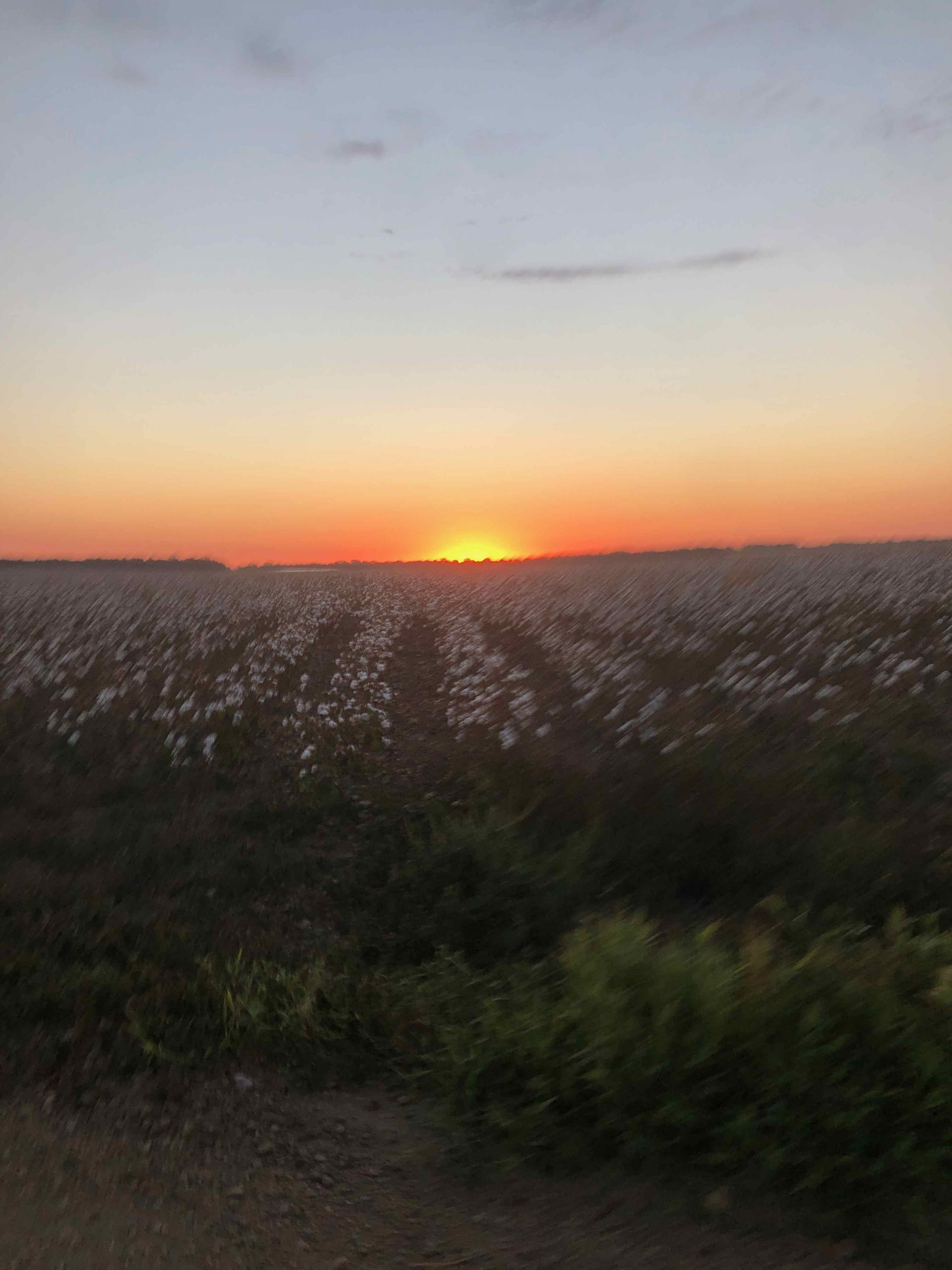
As it turns out, though, getting started again I was pretty cooked and came off nearly immediately in the next gravel section. I rallied myself to catch back up, though, in the gravel thinking that I had been gifted this opportunity to ride at the front a bit longer. I caught back up to Justin and Peter’s wheels and then promptly decided to call it when riding in their draft for a few seconds didn’t really provide any relief at all in the 15mph gravel … I just could not maintain that pace so I backed off and started riding closer to 13mph for the rest of that gravel section. I tried to hit it hard again on the next paved section, but they were just too far away at this point. Thankfully, it was sunrise right over a beautiful cotton field and since I wasn’t focusing on trying to hold a wheel, I could take a picture to remember that moment.

As it turns out, I would get this picture of the sunrise over a cotton field and then nearly 200 miles later get a picture of the sunset over a different cotton field and then after riding all the way through the night (again), I would get a picture of the sunrise the next morning … a midnight-sunrise-sunset-sunrise ride.
I rode slowly for a while into an increasingly stronger headwind. During this section, I had caught back up to Peter and rode with him for a while until eventual third place rider caught up to us at our slower pace. Peter still had a bit left in his legs whereas I knew I could not ride any faster so Peter took off with the rider whose name I can’t remember right now (Matthew?). They quickly left me far behind and I kept wondering who would catch me next. So I kept riding into a headwind, and then I rode into the headwind some more, and then for another length of time I rode into a headwind, and then it was still more headwind. After many hours of headwind, two relay transitions, and the BB King museum photo checkpoint, maybe 100+ miles, Brandon caught up to me on the heels of a relay rider shortly before the relay transition at the entrance to Delta National Forest. I hopped on and followed them into the transition about 5mph faster and significantly easier than I had been riding on my own into the headwind.
But both the relay rider and Brandon pulled off here. I was looking for the neutral water cache which I thought was just past the relay transition area but never found it. So I never stopped, didn’t get any water, and was thankful to be on my own again and putting distance into Brandon trying to hold onto fifth place.
This section of the Delta National Forest was fast and shaded and fun (other than having to ration my water at this point). But after the long opening mostly dirt road, you made a left onto Spanish Fort Road which is basically a levee road with thick gravel in wide open sun. So you got this double whammy with it all of a sudden getting very hot and very slow. I kept wondering if Brandon would catch up to me through here because I was going really slowly.
But before that happened, I could see Peter up ahead and realized I was catching back up to him. I caught him shortly after I saw a family of skunks or porcupines cross the levee right behind him after he went by. We rode together for a bit and talked about needing to stop at the Satartia grocery store, when all of a sudden Brandon comes flying up again with a relay rider. I was already starting to think about my ride home and needing to get done as soon as possible so I hopped onto the two of them and we left Peter behind.
If it had stayed paved the rest of the way, all of us may have stayed together. But the relay rider was fresh, and it went back to some pretty deep gravel roads before (and after) Satartia. Long before Satartia, Brandon and I came off the back of the relay rider and continued on our own as the relay rider continued the hard pace straight onto the deep gravel … and nearly 275 miles had taken its toll on us.
During this stretch, I completely drained the last of my camelbak after having rationed it for many miles during the Delta National Forest. I was getting a bit worried that the Satartia self service grocery store might be closed or empty … but thankfully it was not! We rolled into the small town and immediately found the grocery store. What a really cool setup. They had a few fridges and even a freezer with stuff. I got a couple small gatorades, a water, and a coke since all I had was a $10 bill to put into the payment jar. I still had lots of food left so didn’t get any food.
My thinking was that we were going to roll into Bentonia on pavement or chip/seal … but nope, as we were leaving town, you could see the road turn back into gravel and get quite steep. I commented to Brandon that we were heading towards Blockhouse Hill (from the Rouge Roubaix course). And it was pretty steep and loose (more like the Tunica Hills climb than Blockhouse Hill – for those of you that know the Rouge Roubaix course well). But nevertheless, this had the deeply recessed dirt road with trees towering above us and their roots sticking out of the ground above us and hanging out onto the road. It is something to be experienced, and we definitely don’t get roads like that in very many places in Alabama. I’ve only seen it like this in Mississippi and Louisiana and a few parts of south Alabama.
Except for where new gravel had been laid down in places, it was a really fun dirt road that rolled its way all the way into Bentonia. As we got closer, I told Brandon that he could have fourth as I definitely didn’t want to sprint for it with painful, tired legs and a long ways to go yet to get back to the start, but it would be a different story if we were fighting it out for third place or for fifth place as I would have sprinted for either of those places to try to avoid a dreaded “even number” placing … those are the worst with the exception of 10th place… which is alright.
So fifth place it was… I will take it! Super happy to have finished … even with the sun setting at this moment with 200 miles north still left to ride in what would turn out to be quite an adventure all unto itself … more on that in the next section.

Part 2 … and back again.
“It’s a dangerous business, Frodo, going out your door. You step onto the road, and if you don’t keep your feet, there’s no knowing where you might be swept off to.” Frodo in The Lord of the Rings
So, yeah, I had plotted out a route to get me back to my car and hit as many of the counties in this part of Mississippi as I could as nearly all of them were completely new to me. But I had zero knowledge of the route I had chosen, other than what I could glean from satellite imagery and streetview in the few sections it was available. And, also, it had been a couple months since I had created the route so I couldn’t remember if I had been avoiding dirt roads but vaguely had the sense that I was trying to minimize distance while still hitting the new counties … which basically means “lots-of-dirt”.
Also, I was aiming for tri-county areas and would be coming very close to the border of counties in several places and only briefly entering those counties … which means since there isn’t a county line painted on the gravel roads and surprisingly very few county line signs on the route I took, I would risk missing a county deviating from the path I had charted. See the map below.

This is important to keep in mind when I found myself lost on an abandoned road that had pretty much turned into a kudzu forest/jungle/farm. I committed to just plowing straight through the kudzu with my bike over my head. But some of it was impassable even trying to ram into it, crawl under it, or detour around it. That last bit is what led me to getting lost. I ended up doing the classic “you know you are lost” circle and stumbling upon the same log, not once, but two separate times from two different directions after coming across it for the first time while still not lost … so I tripped over the same log three times. And both the second and third time, I laughed when I realized it was the same log. And a little bit panicky too at one point as the time dragged on and I hadn’t made it any closer to home base (my car at the base of the Arkabutla Dam).
We will come back to that farm/road/kudzu jungle in a minute, but first … I took the selfie above, talked to a few people, put chain lube on my chain, and took off. I was only stopped in Bentonia for six minutes before heading east on my roundabout way back up to the start. The temperature was dropping fast, and only a few miles later, I found a gated off church I could prop my bike up against and put on all my warm clothes again. I didn’t put on my gaiter yet as I wanted to be able to regulate temp in case I got hot from any climbing and also so I would have one weapon left in my arsenal against the cold when it got really cold later.
I continued on beautiful pavement for a while with fairly minimal traffic. It was a state highway, though, and people were driving fast because it was a wide, well-paved road. I didn’t have any close calls, but it was night and day difference compared to the Delta Epic route itself (in terms of traffic). Eventually, I started my zigzagging to cross over into various counties, and the vast majority of this was on dirt and gravel roads with tons of short punchy hills. This helped keep me warm, but it also slowed my progress north quite a bit.
I stopped at a dollar general shortly before it closed and got a bag of chips and a couple “emergency” red bulls that I would carry with me to the end of the ride as I never got terribly sleepy due to the cold and constant uncertainty of the path forward. I sat down outside the dollar general to eat the chips and rest for a minute and the cement was quite unexpectedly warm from having been in the sun all day. I called Kristine to talk for a minute and told her how nice it would be to just fall asleep right there on that warm pavement for a 15 minute nap…. But at that point I wasn’t sleepy at all, so I ate a few more chips and continued on.
My next stop would be at a gas station in Holcomb, MS at 3am where a very nice worker unplugged a space heater and brought it over to the coffee machine so I could warm up while sipping on coffee. I also almost bought one of their decorative t-shirts so I could have another layer, but it was short sleeved and I felt like I had enough core layers … just needed something else on my legs and arms so I punched holes in four plastic bags and wore them like a second set of arm warmers and leg warmers. I think it helped some, but the primary benefit was the 30 minute stop itself, which had a couple of benefits – warmth and daylight! This pushed me half an hour closer to sunrise which meant half an hour less of the cold.
As it turns out, my encounter with the abandoned road/kudzu jungle/farm was only a few miles after this stop and I would end up sweating quite a bit struggling with the kudzu. Some context … much earlier in the night not too long after sunset I ran into another dead end where my route went through some clearly private land. Decisions, decisions, trespass or detour. For this one, there was a large house right there behind a gate. I was going to holler out nicely if I saw anyone to see if I could pass through, but I didn’t see anyone and it was after dark so I decided to figure out a detour … which ended up being a couple miles out of the way.
This second encounter was a bit different, because this land was not entirely clear that it was private land. There were no “no trespassing” signs. There were no signs saying “private property”. The only clue that there might be trouble ahead was an official department of transportation reflective sign that said “road closed, no thru traffic” and a gate with an opening to the side for riding/walking around. So I didn’t hesitate at all or even get off my bike, I just rode right around the sign thinking that there would be a bridge out or nasty washed out section of road.
Instead, immediately past the gate, the gravel road I was on disappeared and turned into double track with grass down the middle. No problem, fast, good dirt. But then it started to get a bit muddier and more overgrown and then it flat out disappeared into a sea of kudzu on the edge of a forest. It was clear that I was still following some sort of beat in path though that hadn’t been used in a while and whatever had beat it in wasn’t very tall because the lower you were the more cleared out was and then up higher at waste level everything was just overhanging and blocking the path ahead. I say “everything” because it was a little bit of everything – kudzu, thorns, other tall weeds or grasses, even a few smaller trees, and all of this was next to a larger forest with tall trees that sometimes had branches overhanging. My thoughts immediately went to wild boars because it just made sense that that would be what would beat in this path. The vegetation kept getting thicker and thicker and I tripped several times falling one time down into everything submerged in kudzu. My bike kept getting hung up on stuff so I tried to hold it above my head above the weeds but I would lose my balance and stumble or get my feet caught up in vines down low. So that didn’t work very well. I tried detouring wide on both sides, and unexpectedly circled back to the same exact spot instead of around it. When this happened a second time from a completely different direction, I decided to cut my losses (approaching an hour at this point) and head back the way I came which wasn’t too bad as I had cleared out stuff in all my stumbling around so I made it back to the gate a bit quicker but still spent just over an hour trying to avoid a 4 mile detour that ended up only taking about 20 minutes with part of it actually being chip-seal road instead of gravel. Here’s what an hour of blundering around in kudzu looks like:

Rejuvenated and wide awake at this point and quite hot, I continued on a four mile-ish detour eventually rejoining where my route would have been if I had made it through the kudzu. It didn’t take too long though for my internal temp to drop off as the adrenaline faded away and fatigue set in. Thankfully by this point it was starting to get light and I was back on paved roads.
One final gas station stop, and I knew I had enough to make it the remaining 5 hours back to the car … but it ended up being closer to 6.5 hours but still made it anyway with what the gatorade/food I had picked up at the gas station. Plus by this point I was going slow enough with cold temps that I wasn’t really drinking or eating anything. Summit fever hit me good when I saw the sign for the turn towards Arkabutla Dam. I “flew” those last 6.5 miles wide awake by the end… just in time to drive four hours back to Birmingham and make it back home long before sunset.
First photo checkpoint – Shackup Inn in Clarksdale, MS 
Second photo checkpoint, White Front Cafe in Rosedale, MS 
Third photo checkpoint – BB King Museum in Indianola, MS Last photo checkpoint – the Blue Front Cafe in Bentonia, MS 
Large farm machinery 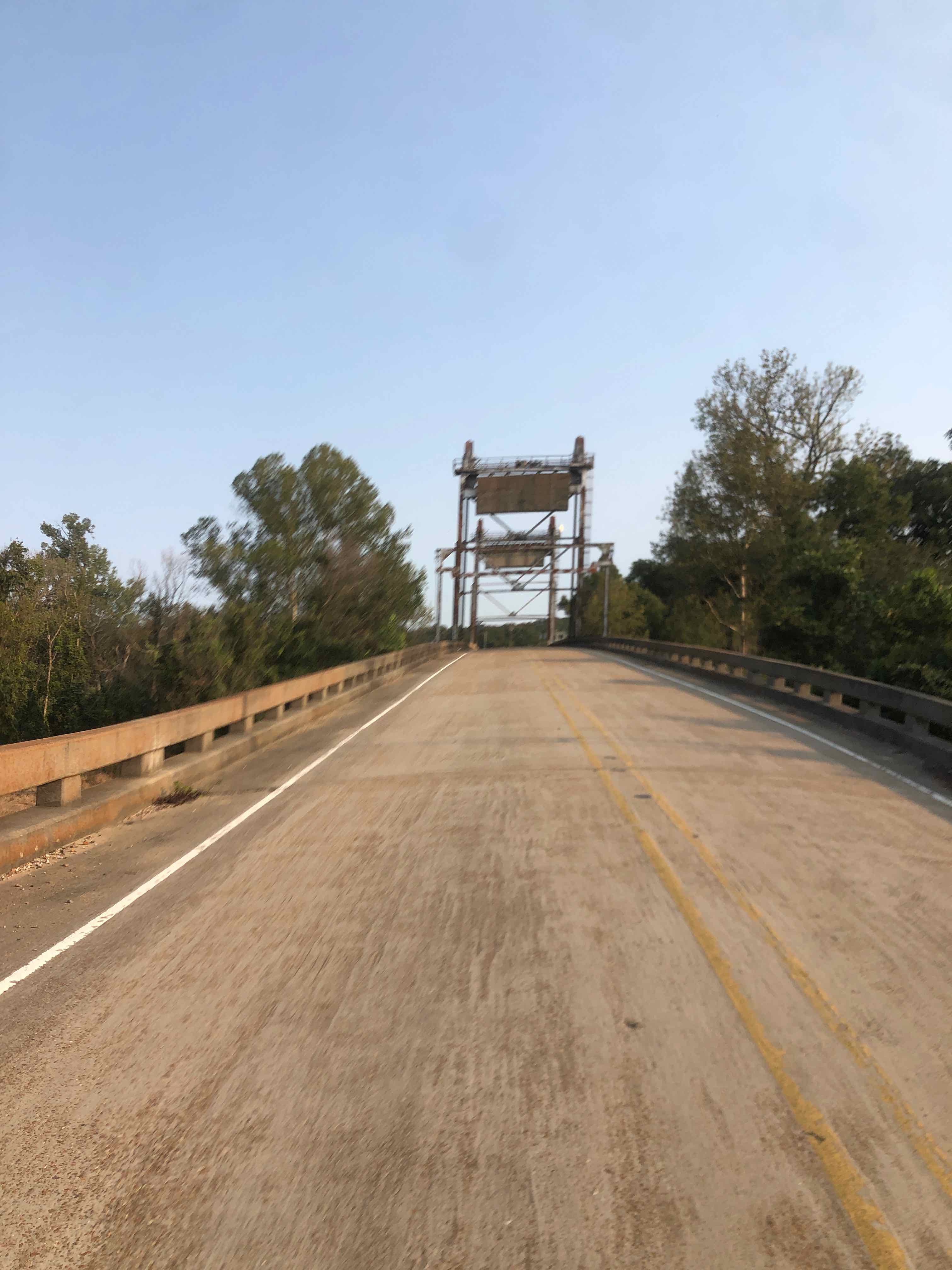
Formerly a drawbridge with giant counter weights. 
Sunset over cotton approaching Satartia 
Orange moonrise on my way back to the start. 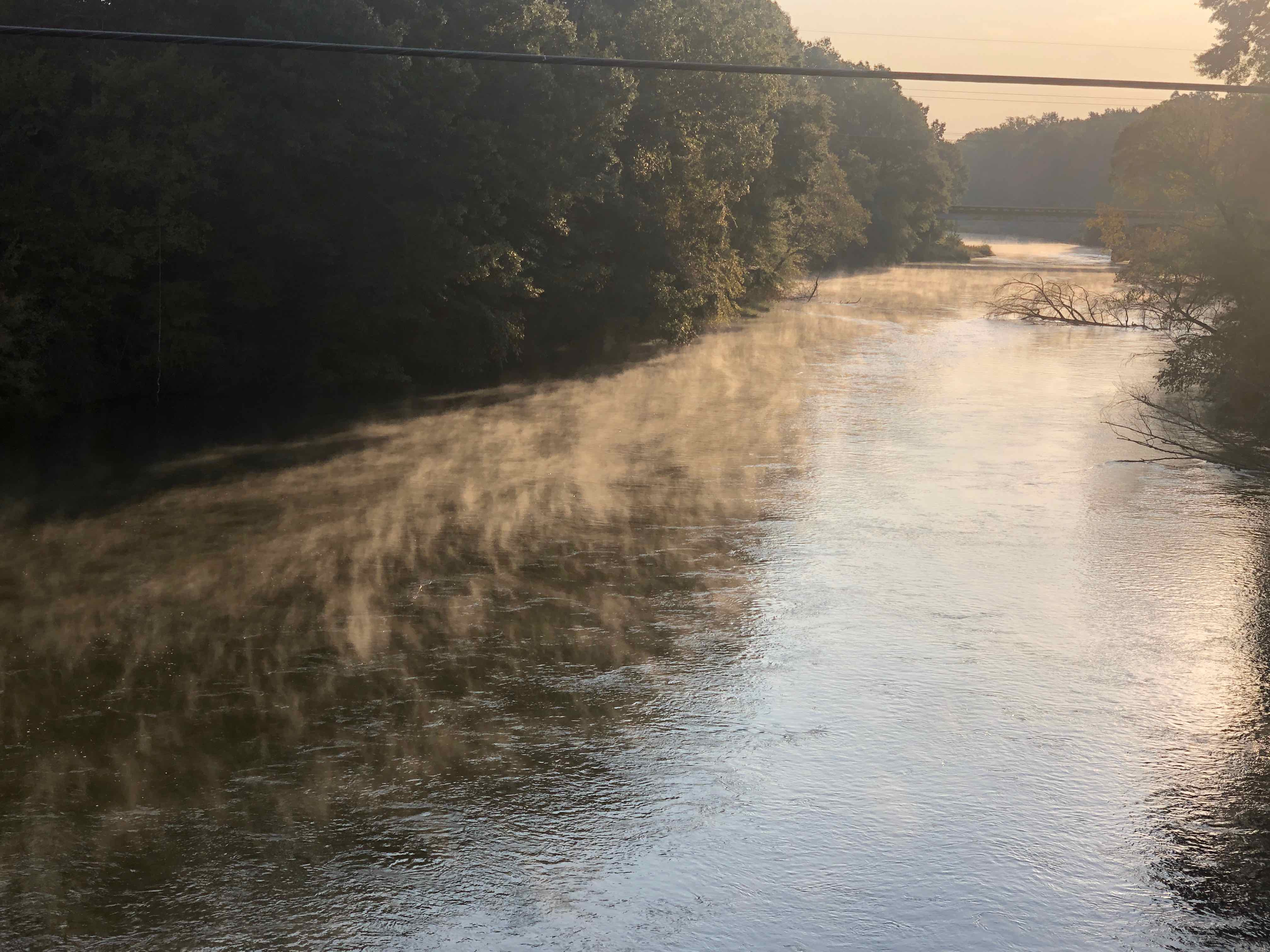
Wisps of steam rising off a river shortly after sunrise on my way back to the start. 
Shame on y’all! 
Wear it, it’s the rule. 
The outlet channel below Arkabutla Dam back at the start.
Leave a Reply